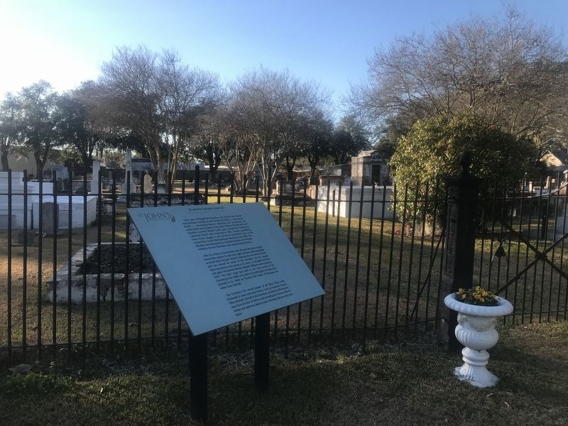
Near Jackson Street south of Seventh Street, on the right when traveling south.
Once part of Ridgefield Plantation, the land for the Church and Cemetery fronted on the Terrebonne Road - now Jackson Street - connecting Bayous Lafourche and Terrebonne. An entire block was donated in the early 1840s by George Seth and Caroline . . . — — Map (db m112696) HM
On East 1st Street (State Highway 1) 0.1 miles east of Jones Lane, on the right when traveling east.
This cemetery was established in circa 1817 on the site of the original St. Joseph Church, a mission of Assumption. The Calvary - Grotto Shrine to Our Lady of Lourdes, erected in 1883 still stands near the Menard Street entrance. Several historic . . . — — Map (db m81070) HM
Near Menard Street at St. Joseph Street, on the right when traveling west.
Dating back to 1883, the Calvary-Grotto Shrine of Our Lady of Lourdes is one of the Historic Places in Thibodaux that remain in constant use to this day.
In 1865, with the Grotto in mind, Rev. Charles Menard, Pastor of St. Joseph Catholic . . . — — Map (db m85765) HM
Near Jackson Street south of Seventh Street, on the right when traveling south.
Whitmell Martin, a native of Assumption Parish, was initially a chemist who studied and practiced law. After he served as superintendent of Lafourche Parish schools from 1894-1900, he was a District Attorney and eventually Judge for the 20th . . . — — Map (db m114135) HM
Near Jackson Street south of Seventh Street, on the right when traveling south.
William Alexander Shaffer was born in Winnsboro, South Carolina, in 1796. His father migrated to the United States from Prussia. Shaffer settled in Louisiana, on Little Bayou Black, Terrebonne Parish, in 1835. He obtained a United States land . . . — — Map (db m114084) HM
Near Walnut Creek Road at Parish Road 3, on the left when traveling north.
Organized 1846 on Old Wire Road (Lincoln Parish Road No. 232) and relocated to this site c. 1858. Present building dates from c. 1870. Church land donated by Allen Causey in 1876. Existing cemetery land purchased from J. W. Williams in 1884. — — Map (db m196866) HM
On U.S. Highway 167 at Rabb Road, on the right when traveling north on U.S. Highway 167.
The true settlement of Lincoln Parish began with the arrival from South Carolina of the Daniel Colvin family in 1809. Other branches of the Colvins came to this area during the 1850s and became the largest family of the region. — — Map (db m225352) HM
On State Highway 16, 0.3 miles north of Griffin Lane, on the left when traveling north.
Oldest in Livingston Parish. Organized in April 1837. First church was log cabin about 3 miles south of here. Frame church built at this site in 1859 on 4 acres of land. 1918 and 1955 larger churches built. Thomas M. Bond first pastor. — — Map (db m85155) HM
On Main Street (State Highway 42) 0.2 miles west of Walnut Street (Route 22), on the right when traveling west.
In memory of Sallie Martinez Martin, for the dedication of this cannon on December 16, 2006, in honor of her great-grandfather, Johann Dreystadt, and the preservation of the history of Springfield, LA. Johann was born December 23, 1831 in . . . — — Map (db m86019) HM
On U.S. 80 at Tendal North Road, on the right when traveling west on U.S. 80.
Tendal is a platform mound with sides that face the four cardinal directions. It is 6½ feet tall and 165 by 230 feet at the base. The mound was flat on top even before the house was constructed. Artifacts found here suggest the mound was built . . . — — Map (db m89040) HM
Near East Madison Avenue at Cleveland Street, on the right when traveling east.
Born 1869 near Bastrop. State Senator, 1898-1900; State District Judge, 1900-1906; State Appellate Judge, 1906-1911; Louisiana Governor, 1912-1916; Assistant Attorney General, 1918-1921. Died 1921 and buried in Bastrop cemetery. — — Map (db m109234) HM
Near State Highway 1221, 1 mile east of State Highway 120, on the right.
Here lies an unknown Confederate,
killed by Union troops, April 2, 1864,
during the Red River Campaign.
This soldier had been cut off from
his unit following a skirmish at
nearby Crump's Hill. He was shot
at this site while attempting . . . — — Map (db m175894) HM
Near Louisiana Route 484, 0.3 miles south of Parish Road (Louisiana Route 493), on the right when traveling south.
"Grandpère" Nicolas Augustin Metoyer, the oldest son of Claude Thomas Pierre Metoyer
and Marie Thérèse Coincoin, was born a twin on January 22, 1768 Grandpere, a
visionary and spiritual leader, is the Founder of St. Augustine Catholic Church and . . . — — Map (db m227367) HM
Near 2nd Street at Bossier Street, on the right when traveling north.
Established in 1737, the American Cemetery is considered one of the oldest cemeteries in the Louisiana Purchase. The many civic, religious, military, and political leaders buried here reflect the long and colorful history of Cane River National . . . — — Map (db m106111) HM
On 2nd Street north of Bossier Street, on the right when traveling north.
Originally this was the site of the relocated Fort St. Jean Baptiste and the first formal burial ground at the Natchitoches Post. Graves date from the middle eighteenth century and represent the following French, Spanish and American founders. . . . — — Map (db m106116) HM
On Adams Street at Green Street, on the right when traveling north on Adams Street.
Established in 1849 Carrollton Cemetery was part of the growing suburb of Carrollton, incorporated in 1845. The suburb of Carrollton was annexed to the city in 1874 and the management of the cemetery was handed to the city government. There are . . . — — Map (db m163656) HM
On Cohn Street at Hillary Street, on the left when traveling east on Cohn Street.
Also known as St. Mary's, Carrollton No. 2 was established about 1893. It once belonged to the Archdiocese of New Orleans, but was acquired by the City of New Orleans in 1921. The modest tombs and copings reflect the German heritage of many early . . . — — Map (db m163601) HM
On Washington Avenue south of Loyola Avenue, on the right when traveling south.
It is believed that this site started informally as a burial ground in 1850.
In 1858, the City of Lafayette, before being annexed by New Orleans, constructed 120 tombs within. In 1865 a survey and plan were drawn up of the cemetery and the . . . — — Map (db m163868) HM
To the left, along the aisle, is a row of burial crypts which also served as the wall of the cemetery on Basin Street. Because of their arched shape they were commonly known as “oven” vaults.
Constructed probably in the middle of the nineteenth . . . — — Map (db m51640) HM
These are samples of marble slabs used to adorn tombs and crypts after the opening has been sealed with brick and mortar. The tablets were gathered from areas of the cemetery where they has been put aside after falling from neglected or abandoned . . . — — Map (db m51651) HM
Near Basin Street south of St. Louis Street, on the right when traveling south.
This architectural masterpiece is the most notable of the many multi-vaulted society tombs in the cemetery. Designed by Pietro Gualdi it was fabricated in Italy and erected in 1857 at a cost of $40,000. Ownership was ceded to the cemetery in 1986 by . . . — — Map (db m86109) HM
This Greek revival tomb is reputed burial place of this notorious "Voodoo Queen". A mystic cult, Voodooism, of African origin, was brought to this city from Santo Domingo and flourished in 19th century. Marie Laveau was the most widely known of many . . . — — Map (db m13699) HM
One of the oldest burial grounds in the Mississippi Valley, St. Louis Cemetery No. 1 is still in use. From its beginning in 1789 it has been the custom to make multiple burials in the tombs and vaults when space in a tomb is re-used the remains of . . . — — Map (db m51653) HM
Within this burial memorial rest some of the gallant defenders of New Orleans, members of the battalion which fought in honor on the plains of Chalmette on January 8 1815 against the British invaders.
Date of construction is unknown. Restored in . . . — — Map (db m51866) HM
The oldest extant cemetery in New Orleans. Established by Royal Spanish land grant August 14, 1789. Originally outside city limits and double its present size this sacred ground reflects the early culture and history of the Crescent City. A small . . . — — Map (db m13501) HM
On North Rampart Street at Conti Street, in the median on North Rampart Street.
Built in 1826 as a burial church for victims of yellow fever, the chapel is the oldest surviving church in the city. Now Our Lady of Guadalupe, the chapel is the official chapel of the New Orleans Police and Fire Departments. — — Map (db m21456) HM
Established in 1833 by the City of Lafayette
The square was acquired from Cornelius Hurst and the cemetery laid out by Benjamin Buisson, city surveyor.
This was part of the Livaudais Plantation which had been subdivided into city squares in . . . — — Map (db m51493) HM
Near North Claiborne Avenue, on the right when traveling north.
Albert G. Blanchard
1810 - 1891
Graduate U.A. Military
Academy; Merchant; Director
of New Orleans Public
Schools 1843-1845; Fought in
Mexican War; Brigadier
General in Confederate Army;
After Civil War became Civil
Engineer in New . . . — — Map (db m191528) WM
Bernard de Marigny de Mandeville (1785-1868) a wealthy land-owner, served in the U.S. Army, participated in framing the first and second constitutions of Louisiana, and served in the Louisiana Territorial Legislature. He also was elected President . . . — — Map (db m51643) HM
Louisiana provided the largest number of black Union troops during the Civil War. Many lie buried here. The most notable, Capt. Andre Cailloux, fell while courageously leading a charge of the Louisiana Native Guards in 1863 at Port Hudson, La. . . . — — Map (db m161738) HM
Burial place (right) of second wife of Governor W.C.C. Claiborne, Clarisse Duralde, who died in 1809 at the age of 21.
Myra Clark Gaines (left) was the daughter of Daniel Clark (1769-1813), American consul when Spain ruled city and later . . . — — Map (db m51650) HM
First wife of Wm.C.C. Claiborne, first American governor of Louisiana. Also memorialized here are her son and her brother, Micajah Green Lewis, who died in a duel defending the honor of his brother-in-law, Benjamin Latrobe, noted architect, designed . . . — — Map (db m51648) HM
Near North Claiborne Avenue, on the right when traveling north.
Francois Xavier Martin
1762 - 1846
Louisiana Jurist and author of the First History Of The State
Designed and erected by Newton Richards in 1847
Restored in 1978
New Orleans Archdiocesan Cemeteries — — Map (db m191529) HM
On June 7, 1892, Homer Adolph Plessy defied a Louisiana law that segregated railroad trains on the basis of race. He was arrested and became the defendant in the May 18, 1896 United States Supreme Court decision of Plessy v. Ferguson, which condoned . . . — — Map (db m13036) HM
In the Protestant Section of this cemetery were interred
Benjamin Henry Boneval Latrobe
Born – Fulneck, England, May 1, 1764
Died – New Orleans, September 3, 1820
Founder of the architectural profession in America
Architect of the United . . . — — Map (db m207970) HM
Near North Claiborne Avenue just north of Iberville Street, on the right when traveling north.
"My name is Marie Justine Cirnaire. I was born in Guinea.
When I was
perhaps seven years of age I was carried to St. Dominique. I am as a result
not aware of the name of my father nor of my mother, nor do I know my age.
I was . . . — — Map (db m161741) HM
Near North Claiborne Avenue, on the right when traveling north.
Mayor of New Orleans
1900 - 1904. Served as state
auditor 1904 1922. President
of City Park Board member
sewerage and water board
interred Aug 8, 1922. — — Map (db m191531) HM
In 1805 an area at the rear of the cemetery was assigned to Christ Church (Episcopal) for the burial of non-Catholics. More extensive originally, all that remains of the Protestant section is the area between these wall vaults, the brick walls to . . . — — Map (db m51644) HM
Among burials in this area are William P. Canby, U.S.N. and other Americans who died in the defense of the city in the Battle of New Orleans and the defeat of the British Army, January 8, 1815 — — Map (db m51649) HM
Near Pontchartrain Boulevard, 0.2 miles north of Metarie Road (Louisiana Highway 611-9), on the left when traveling north.
Dedicated for cemetery purposes
July 2, 1872
Recognized as one of the world's
most unique and beautiful cemeteries
Approximately 150 acres
Formerly the Metairie Race Course
Scene of the famous match races
between LeCompte and . . . — — Map (db m87275) HM
On Pontchartrain Boulevard, 0.3 miles north of Metairie Road, on the right.
In Memory of William Charles Cole Claiborne Born in Virginia Member of the Convention that framed the first Constitution of Tennessee Judge of the Supreme Court of that State at 21, And Representative in Congress at 23. Governor of Mississippi . . . — — Map (db m109517) HM
On Canal Street, 0.1 miles south of City Park Avenue, on the right when traveling south.
Front
This cemetery was purchased by Charity Hospital in 1848 and was originally known as Potter's Field. It has historically been used to bury the unclaimed victims from throughout the city including victims of several yellow fever . . . — — Map (db m87256) HM
Near Canal Street south of City Park Avenue, on the right when traveling south.
Side 1
The New Orleans Katrina Memorial
On August 29, 2005 Hurricane Katrina made landfall upon the Louisiana and Mississippi Gulf Coast. Bringing devastation to many communities. In New Orleans, storm surge and the failure of the . . . — — Map (db m85824) HM
On Buddy Bolden Place west of City Park Avenue, on the right when traveling west.
Originally a cemetery for the city's indigent population, Holt Cemetery was first mentioned in city records in 1879, most likely named for Joseph Holt, a physician from Charity Hospital. The original 400' by 600' plot was increased in 1909 with an . . . — — Map (db m163537) HM
Near Buddy Bolden Place north of City Park Avenue, on the right when traveling west.
Holt Cemetery was officially founded in 1879 as a replacement to the dangerously overfilled Locust Grove Cemeteries on Freret Street in Uptown New Orleans. It is assumed to be named after Dr. Joseph Holt, an official with the city's Board of Health . . . — — Map (db m163915) HM
On Buddy Bolden Place north of City Park Avenue when traveling north.
While Holt Cemetery was never formally designated as racially segregated, legal restrictions on racial mixing - in life and death - became more rigorously enforced in New Orleans after the 1896 Plessy v. Ferguson Supreme Court decision. In the . . . — — Map (db m163959) HM
Near Buddy Bolden Place north of City Park Avenue, on the right when traveling west.
Unlike most New Orleans cemeteries, all of the interments at Holt are below ground. Many graves here have a distinctive appearance,
but none have been photographed or remarked upon as often as the ones "dressed” by local artist Arthur Raymond . . . — — Map (db m164143) HM
Near Buddy Bolden Place north of City Park Avenue.
For some artists and scholars, Holt is representative of spiritual traditions
with a long history in the African-American community. The spreading of
broken crockery over graves was noted in South Carolina as early as the
1890s. Art historian . . . — — Map (db m164205) HM
Near Buddy Bolden Place near City Park Avenue when traveling north.
Holt has been filled to capacity many times in its long history. In fact, grave plots have often been re-used after their upkeep is abandoned. This is not
uncommon in urban cemeteries, where space is always a problem. Still, the density of . . . — — Map (db m166883) HM
One striking pattern visible in the burial records for Holt is the high number of
stillbirths and infants interred here. In 1902, for example, 262 of the 761 burials
at Holt were under the age of one at death. Such high numbers for infant . . . — — Map (db m166892) HM
On St. Claude Avenue south of Governor Nicholls Street, on the left when traveling east.
In 1841, this parish was established for the inhabitants of Faubourg Tremé. The joint beneficence of Bishop Antoine Blanc and the Ursuline nuns made possible acquisition of property and erection of the church. Until 1925, the buildings of the . . . — — Map (db m35056) HM
On Valence Street north of Danneel Street, on the left when traveling north.
The Jefferson City Cemetery, later called Valence St. Cemetery, became a city cemetery in 1870 when Jefferson City was annexed by the City of New Orleans. The cemetery has a number of old society tombs such as the St. Anthony of Padua Italian . . . — — Map (db m163688) HM
On Chenal Road (State Highway 414) 0.1 miles north of Neubig Drive, on the left when traveling north.
This monument stands near the site of the altar portion of the original Immaculate Conception church structure. The original structure was built in 1859 and was enlarged three times to its final dimension of 35 ft. wide X 100 ft. deep. Immaculate . . . — — Map (db m87904) HM
On New Roads Street (State Highway 1) east of 5th Street, on the right when traveling east.
On April 8, 1764 the first cemetery in Pointe Coupée was
solemnly blessed. It surrounded the old St. Francis Church
built on the banks of the Mississippi river near Waterloo.
In 1865 Father Joseph Philibert Gutton, first pastor of St.
Mary of . . . — — Map (db m238107) HM
On Mississippi River Trail (Louisiana Route 418) 0.2 miles north of Highway 971, on the left when traveling north.
Began as St. James Mission in 1848. Reorganized as a parish in 1855 named after the first martyr at the suggestion of Bishop Leonidas Polk, the "Fighting Bishop" of the Confederacy. The Church and Cemetery were consecrated by Bishop Polk in 1859. . . . — — Map (db m85157) HM
On Eighth Street south of Eighth Avenue, on the left when traveling south.
Glenmora Cemetery ("Old Cemetery")
is
located in Glenmora, Rapides Parish,
Louisiana. It is owned and maintained by
Glenmora Cemetery Association, Inc.,
chartered in February 1950. Land was
donated to the cemetery in August 1950 by
Mrs. . . . — — Map (db m124021) HM
On East Shamrock Street (State Road 1250) west of Sanders Street, on the right when traveling west.
The Alexandria National Cemetery, Pineville, was authorized by an Act of Congress on February 22, 1867, and the United States, through the Secretary of War, took possession April 1871 of this property from the Succession of Franco Poussan. The . . . — — Map (db m110587) HM
Near East Shamrock Street (Business U.S. 165) near Main Street, on the left when traveling south.
Civil War AlexandriaAlexandria, Louisiana, served briefly
of the Confederate Department of the Trans-Mississippi,
as the headquarters a vast area encompassing states and territories west of the
Mississippi River.In spring 1863, the . . . — — Map (db m136134) HM
On Cedar Lane Road at Scenic Drive, on the left when traveling west on Cedar Lane Road.
Authorized by Act 92 of the 1902 Louisiana Legislature, cemetery and morgue sites were selected in January 1906. There are 2,356 persons who are interred in the cemetery, the last occurring in June 1985. Individual graves for persons who are . . . — — Map (db m116347) HM
On Main Street (Business U.S. 165) south of Ball Street, on the right when traveling south.
The cemetery was purchased in 1858 by St. James Episcopal Church, Alexandria. It is the second oldest cemetery in Rapides Parish and has always served as a community burial ground. The earliest marker is 1824.
Mount Olivet Chapel was established . . . — — Map (db m110590) HM
As settlers moved into central Louisiana in the mid-1700s, the
colonial Spanish government established a post named El Rapido, also
called Poste du Rapide by local French settlers.
During the same period, this site was selected as a . . . — — Map (db m208874) HM
On Main Street (U.S. 165) north of Hardtner Street, on the left when traveling north.
The earliest known Jewish settler in the Alexandria-Pineville area was Henry Michael Hyams, whose name appears in the 1830 census. The earliest grave marker identifiable on this site tells that Augusta Bernstein, daughter of Samuel Bernstein, was . . . — — Map (db m38329) HM
On Chalmette National Park Scenic Road (Tour Loop Rd), 0.6 miles east of Battlefield Road, on the right when traveling north.
Chalmette National Cemetery was established in 1864 as a burial place for Union soldiers who died in the gulf area during the Civil War. It also served as the site for reburials of soldiers from battlefield cemeteries in the region. This plot of . . . — — Map (db m97175) HM
On Chalmette National Cemetery Road south of West St Bernard Highway (State Route 46), on the right when traveling south.
President Abraham Lincoln
approved legislation on July
17, 1862, that established
national cemeteries for
American forces. Two years
later near the end of the Civil
War, Chalmette National
Cemetery was established
to receive Union troops . . . — — Map (db m191261) HM
The United States Congress established this site as a National Cemetery in 1864 for the re-interment of Union soldiers who died in Civil War hospitals and were buried in various nearby locations.
Over 15,000 veterans of American wars and their . . . — — Map (db m161730) HM
Established in 1864 for
Union soldiers who died in
Louisiana during the Civil
War, Chalmette National
Cemetery is the final resting
place for troops who served
in peacetime and in conflicts
from the War of 1812 to the
Vietnam War.
Park . . . — — Map (db m161729) HM WM
On Bayou Road (State Highway 300) west of Billiot Drive, on the right when traveling east.
Canary Islanders (Isleños) settled Terre-aux-Boeufs (Cattle Land) after parceling in 1778 by Pierre Philippe Marigny, during regime of Governor Bernardo de Gálvez after whom St. Bernard Church and Civil Parish were named. First burial, June 6, 1787: . . . — — Map (db m99445) HM
On State Highway 644, 0.2 miles north of Highway 643, on the right when traveling north.
Mission chapel and cemetery served by St. James Catholic Church from 1854. Became separate parish in 1864. Our Lady of Peace parish church completed 1900 and consecrated May 12, 1902. — — Map (db m81080) HM
Near State Highway 18 at East 3rd Street, on the right when traveling east.
As Madame Beauregard lay dying in New Orleans, she yearned to see her husband once more, but his duties in the Confederate Army made his return impossible. She knew her husband could not be spared as a soldier of the South, and she resigned herself . . . — — Map (db m85143) HM
On River Road (State Highway 18) at East 4th Street, on the right when traveling east on River Road.
From which civil parish was named. First church on second German Coast when Louisiana was a colony of Spain. Served west and east banks of river until 1864. Old cemetery contains wife of Gen. P.G.T. Beauregard and John Slidell family tomb. — — Map (db m85324) HM
Near Ronald Reagan Highway (U.S. 190) 0.3 miles west of Wallior Street, on the right when traveling west.
Myrtle Grove Cemetery was once known as the "Protestant Cemetery."
In April 1837, the City of Opelousas named a two man-committee to locate four arpents (an old French unit of
land measurement) of property for a public burial ground. A sexton . . . — — Map (db m145718) HM
On North Union Street at Church Street, on the right when traveling north on North Union Street.
Side 1Established circa 1798; Opelousas oldest cemetery. Located on land donated by Michel Prudhomme in 1796. It is the final resting place of numerous New York Orphan Train Riders and many veterans of wars dating back to the American . . . — — Map (db m114225) HM
On North Main Street (State Highway 182) north of East Church Street, on the right when traveling north.
The second largest Catholic Church in the south was established in 1776 and was named after the Bishop of Paris in 1650. Two former pastors are buried beneath its floor. Jim Bowie, hero of the Alamo was baptized and married here in 1814.
In the . . . — — Map (db m86742) HM
On Napoleon Avenue (State Highway 182) at State Highway 754, on the left when traveling west on Napoleon Avenue.
"While Texas will mourn the loss of her brave sons, she will treasure the memory as the glorious martyrs of our common country's independence." The above words echo from the report of Colonel O. M. Roberts regarding men of the 11th, 15th & 18th Tx. . . . — — Map (db m20025) HM
Near South Main Street (State Highway 31) near East Bridge Street (State Highway 96).
On this site lie buried officers of The Attakapas Militia serving under General Bernardo Galvez In the march to and capture of Baton Rouge and Manchac September 1779. Commandant Alexandre-Chevalier de Clouet Major Louis Du Crest Corporal Jean . . . — — Map (db m104468) HM WM
On State Highway 59/36 at Main Street, on the right when traveling south on State Highway 59/36.
Old Choctaw village which derived name from nearby medicinal springs. Last Choctaw burial and execution grounds, used until about 1880, located nearby. — — Map (db m98938) HM
On East Boston Street (State Highway 21) east of Lee Lane, on the right when traveling west.
Covington resident, where he wrote, among others, Lancelot, The Second Coming, Love in the Ruins, The Thanatos Syndrome, The Last Gentleman, and The Moviegoer, which won the National Book Award for fiction, co-founder Fellowship of . . . — — Map (db m98852) HM
Resting place of pre-Louisiana Purchase colonial settlers, veterans of the War of 1812 and the Civil War, and many men and women of great importance to local and national history. — — Map (db m103702) HM
Near Main Street north of St. John Street, on the right when traveling north.
These six men of the 2nd Division 13th Regiment Louisiana Militia fought at the Battle of New Orleans during the War of 1812 and are buried in unmarked graves Auguste Badeaux Samuel Ott William Cooper Charles Parent, Jr. . . . — — Map (db m99727) WM
Near Highway 1052 north of Camp Moore Road, on the left when traveling north.
Established May 15, 1861. Dedicated on Confederate Decoration Day June 3, 1905.
Marked by Louisiana Society Colonial Dames XVII Century February 6, 2020 — — Map (db m196989) HM WM
Near Camp Moore Road (State Highway 1052) east of U.S. 51, on the right when traveling north.
The cemetery was reclaimed from the elements in 1903 by the veterans themselves and the women who became members of Camp Moore Chapter #562, UDC. The land was bought from logging interests and the fence installed by 1905. The cemetery, fence and . . . — — Map (db m92333) HM
On Camp Moore Road (State Highway 1052) 0.7 miles north of Jackson Street, on the right when traveling north.
Site of Camp Moore, 1861-1865, where Confederate soldiers from several states were trained, the largest camp of the Confederacy. A minor engagement was fought nearby, Oct 5-9, 1864. The men buried here died of disease while in the service of their . . . — — Map (db m85943) HM
Near Camp Moore Road (State Highway 1052) east of U.S. 51, on the right when traveling north.
Sacred to the memory of
The Confederate
Soldiers who died
at Camp Moore.
Buried 1861-1865
Cemetery was dedicated
to the State of Louisiana
June 3rd, 1905
"Twine a garland, drop a tear,
O'er Louisiana's unnamed dead . . . — — Map (db m87896) WM
On Little Caillou Road (State Highway 56) 2 miles north of Bayou Sale Road (State Highway 57), on the left when traveling north.
This Indian mound was constructed around AD 1000. It is 7 feet tall with a square~shaped base. It was once part of a larger complex made up of up to five mounds. The oak tree on the northwest corner is thought to mark the grave of Houma Courteau . . . — — Map (db m85298) HM
On West Main Street (State Highway 24) 0.1 miles south of Merlin Street, on the right when traveling south.
Born Albany, New York, 1769. Died at his plantation near
this place, 1827. "Father of Terrebone Parish" and Acting-Governor of Louisiana, 1824. — — Map (db m92136) HM
On West Main Street (State Highway 182) east of Gabasse Street, on the right when traveling east.
Magnolia Cemetery was originally founded as a resting place for members of the Protestant faith. The land chosen was along Bayou Terrebonne. The original board of directors consisted of Peter Berger, John Hubbard, Lucius Suthon, John Winder, William . . . — — Map (db m85057) HM
On North Washington Street south of West St. Victor Street, on the right when traveling south.
English Translation On July 25, 1843 Père Antoine Désiré Mégret purchased 160 arpents from Joseph LeBlanc for a church, rectory and cemetery. Joseph LeBlanc was buried here in 1854. The oldest marked grave is of Eufemie Broussard 1852. . . . — — Map (db m106277) HM
On South Main Street north of Railroad Avenue, on the right when traveling north.
On this site was the first of our city's three Masonic cemeteries & served Masons and Protestants alike. It has been virtually unused since 1905, although the latest tombstone reads 1954. The earliest recorded death was 1868. A.G. Maxwell donated . . . — — Map (db m104915) HM
On Victor Martin Road, 3 miles north of Louisiana Highway 112, on the right when traveling north.
Center Panel Unexplained Tradition Connected to Unique Local Culture
Gravehouses are unusual historical structures built to protect the graves of the deceased. Though rare, they can be found in older
cemeteries across . . . — — Map (db m225689) HM
On Victor Martin Road, 0.7 miles north of J Thibodeaux Loop, on the right when traveling north.
Established by members of the Talbert and Pierson families, pioneers who first settled in the area in the 1860's. Thirteen graves are covered with unique grave houses. The origins of grave houses are uncertain-some tracing the beginnings to European . . . — — Map (db m86790) HM
On Gladney Street, 0.1 miles north of Homer Road (U.S. 79), on the right when traveling north.
In memory of our pioneer settlers who built near here the first church, schoolhouse, seat of government, post office and cemetery. Here the first white child born in this Minden area is buried. — — Map (db m227934) HM
Near South Kirkland Drive (State Highway 988) south of Bourgeois Street, on the right when traveling south.
(side 1)
West Baton Rouge conveyance records reveal that on June 28, 1833, Jean Baptiste Hebert donated land for use as a cemetery for the congregation of St. John the Baptist Catholic Church. With Hebert’s permission, the tract had already . . . — — Map (db m85121) HM
On Louisiana Route 577 at Louisiana Route 134, on the right when traveling north on State Route 577.
The Poverty Point earthworks,
located 1.1 miles north, date to
1700-1100 B.C. Built by Native
Americans who hunted, fished,
and gathered wild foods. The 5
mounds, 6 ridges, and 43-acre
plaza present a design unique
in the world. A 6th mound . . . — — Map (db m109222) HM
On U.S. 61 at Afton Villa Road, on the right when traveling south on U.S. 61.
19th Century Gardens, site of famed ante-bellum mansion built in 1849 by David Barrow, once wealthiest planter in W. Feliciana; destroyed by fire in 1963. Tomb of Alexander Barrow, U.S. Senator from La. in 1840's, in family cemetery. — — Map (db m94326) HM
On U.S. 61 north of Jackson Road (State Highway 10), on the left when traveling north.
In nearby Grace Church Cemetery is the tomb of Lieut. Commander John E. Hart, U.S. Gunboat Albatross, buried at Episcopal service & with Naval & Masonic honors by Brother Masons of Feliciana Lodge No. 31 F. & A.M., June 11, 1863.
Lower . . . — — Map (db m93717) HM
On Ferdinand Street west of Johnson Street, on the right when traveling west.
Established by 18th Century Capuchin Friars.
Second plaque mounted on cemetery gate
Mount Carmel Catholic Cemetery For All Faiths and Garden Memorial St. Francisville, Louisiana Established January, 1970. — — Map (db m128904) HM
200 entries matched your criteria. Entries 101 through 200 are listed above. ⊲ Previous 100