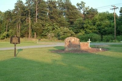
On Bellemont-Alamance Road, on the left when traveling east.
On Colonial Trading Path
Travelers used nearby spring
Preaching point 1759
Originally called "Graves Church"
Church founded circa 1770
Burials from early period in
rock enclosed cemetery
Recorded burials from 1790
Called "the Chappel" . . . — — Map (db m222798) HM
On Hanford Hills Road at Monticello Court, on the left when traveling south on Hanford Hills Road.
An early pioneer, leader and landowner, Michael Holt II was the son of Michael Holt I who had moved to this area in he 1750s. He is buried nearby with his two wives, “Peggy” O'Neal and Jean Lockhart. He had ten children who became the ancestors of . . . — — Map (db m223106) HM
On North Main Street, on the right when traveling north.
Side A Providence was a gathering spot for pioneers in the Haw River basin. Many families and denominations during the eighteenth century used this cemetery. Many early settlers including members of the Turrentine, Sellars, Holt, Harden, . . . — — Map (db m28277) HM
A memorial to British troops who died in the Old Meeting House during Cornwallis encampment here on his retreat from Guilford Courthouse March 1781.
Erected by Troop 46 B.S.A. Henry Overman Leader Who Died Before Completing It. — — Map (db m30558) HM
On these grounds, Revolutionaries and Loyalists were buried together in mass graves by people of this neighborhood, who also cared for the wounded in their homes. Additional burials are at Spring Meeting House. — — Map (db m30695) HM
At this site, Patriot militia commanded by Brigadier General John Butler ambushed loyalist militia commanded by Colonel David Fanning in an effort to free prisoners, whom the Loyalist had captured at Hillsborough the previous day.
Although losses . . . — — Map (db m30696) HM
Near East Greensboro Chapel Hill Road at Stockard Road, on the left when traveling east.
In Memory of the Whig and Tory Soldiers who died in the Battle of Lindley's Mill 14th D. 11 Mo. 1781 and were buried here and on the battlefield
Erected 7th Day 10 Mo. 1979 — — Map (db m223104) HM
On Main Street (U.S. 52) at Cemetery Street, on the right when traveling south on Main Street.
Free black served as a Baptist pastor at Rocky River Church until law in 1831 barred blacks from public preaching. Buried 500 yards west. — — Map (db m77358) HM
On U.S. 52 at Old Sneedsboro Road (North Carolina Highway 1829), on the right when traveling south on U.S. 52.
Laid out 1795. Promoted as inland port town on Pee Dee River by Archibald D. Murphey. Only graveyard remains, five miles southeast. — — Map (db m42309) HM
On North Carolina Route 33 west of Taylor Road, on the left when traveling west.
(side 1)
This cemetery is the burial ground for the Episcopal congregation of Trinity Church Chocowinity.
The Rev. Nathaniel Blount of Chocowinity, a missionary of the Society for the Propagation of the Gospel, established Trinity . . . — — Map (db m226573) HM
On North Bonner Street at East Main Street, on the right when traveling north on North Bonner Street.
Washington's original "free" church, open to all denominations, was constructed on lot 50 of the town's plat, created by Col. James Bonner, the founder of Washington, circa 1776. Bonner and two other Revolutionary War soldiers are buried here. . . . — — Map (db m226315) HM
On North Market Street (County Route 1516) at East 15th Street, on the right when traveling north on North Market Street.
After the Civil War, women’s associations throughout the South sought to gather the Confederate dead from battlefield burial sites and reinter the remains in proper cemeteries, while Confederate monuments were erected in courthouse squares and other . . . — — Map (db m76917) HM
Near West Water Street (U.S. 17) near Sutton Drive, on the left when traveling west.
These graves were discovered during site preparation for Roanoke/Cashie River Center.
They were overgrown with vines and shrubs, and had not been tended in many years.
One grave dates to 1884. No date is found on the other headstone. . . . — — Map (db m60733) HM
On State Highway 87 at Lisbon Road, on the left when traveling north on State Highway 87.
Mount Horeb
Presbyterian Church
and Cemetery
circa 1845
have been placed on the
National Register
of Historic Places
by the United States
Department of the Interior — — Map (db m215473) HM
On Rhett Street north of Monroe Street, on the right when traveling north.
“Nor even this hour shall want its charm / For side-by-side still fondly we’ll keep / And calmly in each others arms / Together linked go down the deep.” —From the marker for Emeline L. Taylor and Major George Taylor who were . . . — — Map (db m6229) HM
On River Road (State Highway 133) at Plantation Road, on the left when traveling south on River Road.
Anglican, built under act of 1751. Graves of Governors Arthur Dobbs and Benjamin Smith and U.S. Justice Alfred Moore. Ruins 2 mi. S.E. — — Map (db m6467) HM
On E Chestnut St at Merrimon Ave. on E Chestnut St.
United States Senator, 1895-1903. Republican leader, newspaperman, federal judge. His home is 3/10 mile east; grave is 1.3 mi. west. — — Map (db m12708) HM
On Overlook Road south of Springside Road (County Route 3506), on the left when traveling south.
Early in 1861, Buncombe County farmer William Riley Powers joined the Rough and Ready Guards (Co. F, 14th North Carolina Infantry). The regiment was assigned to southeastern Virginia. There, Confederate Gen. Benjamin Huger discharged Pvts. Powers . . . — — Map (db m75532) HM
Near North Pack Square (Alternate U.S. 74) at South Market Street, on the right when traveling east.
W.O. Wolfe's tombstone shop, fondly recalled by his son, Thomas in Look Homeward Angel, once stood on this corner. During the boom of the 1920s, real estate developer L.B. Jackson purchased the property from Julia Westall Wolfe and built . . . — — Map (db m97548) HM
Near Patton Avenue (Alternate U.S. 74) at Church Street.
William Sydney Porter, whose pen name was O. Henry, rented an office nearby in 1909-1910. Popular for his short stories, especially "The Gift of the Magi," he was inspired to write "Let Me Feel Your Pulse" by a visit to an Asheville physician. . . . — — Map (db m97533) HM
Near Dalton Street, 0.3 miles north of Wyoming Road, on the right when traveling north.
George Avery, a 19-year-old enslaved blacksmith, joined Co. D, 40th United States Colored Troops, in Greeneville, Tennessee, in 1865. According to local tradition, his master, Confederate Maj. William W. McDowell, sent Avery to enlist for a post-war . . . — — Map (db m75527) HM
Near Birch Street west of Pearson Drive when traveling west.
Two notable Buncombe County brothers are buried here. Zebulon B. Vance (1830-1894) was North Carolina's Civil War governor and served as a U.S. senator from 1879 to 1894. His elder brother, Robert B. Vince (1828-1899), led the 29th North Carolina . . . — — Map (db m209950) HM
On Broadway Street at Ocala Street, on the left when traveling north on Broadway Street.
Graves of Thomas Wolfe & "O. Henry," authors; Zebulon B. Vance, governor; Thomas L. Clingman and Robert R. Reynolds, U.S. senators. One-half mile W. — — Map (db m97532) HM
Near Branstrom Drive, 0.2 miles north of Sam Wall Avenue when traveling north.
In gratitude for the valor
of these Revolutionary War patriots
whose fight for independence secured our liberty
General Charles McDowell • Major Joseph McDowell • Margaret O'Neal McDowell • Grace Greenlee McDowell • Colonel Alexander Erwin . . . — — Map (db m240438) WM
Near McConnaughey Lane, 5 miles south of Swan Pond Drive (County Road 1297), on the left when traveling south.
Col. Waightstill Avery
1741-1821
Revolutionary War
Patriot
Col. Waightstill Avery
First Attorney General
for the
State of North Carolina
1778-1779 — — Map (db m210351) HM WM
On St Johns Church Road at Mt Olive Road, on the right when traveling north on St Johns Church Road.
side 1
Adolph Nussmann
1739-1794
Pioneer minister and founder of the Lutheran Church in North Carolina
side 2
Born in German; educated in the University of Gottingen; called through commissioners Christopher . . . — — Map (db m77377) HM
On Concord Parkway North (U.S. 29) at Church Street North, on the right when traveling north on Concord Parkway North.
Cannon Mills president, 1921-1962; advanced the marketing of textiles. Civic leader and health care benefactor. Grave is one mile south. — — Map (db m42696) HM
On St Johns Church Road at Mt Olive Road (County Route 2416), on the right when traveling north on St Johns Church Road.
During the Civil War, about two hundred members of St. John’s Lutheran Church served in at least eight Confederate army units. The units included companies in the 8th, 20th, 33rd, 52nd, and 57th North Carolina Infantry regiments, as well as a . . . — — Map (db m77374) HM
On State Highway 268, on the right when traveling west.
On the 28th of May 1866, Laura Foster, a beautiful but frail girl, was decoyed from her fathers house at German Hill in Caldwell County to a place in Wilkes County and was murdered. Tom Dula (Tom Dooley) was later hanged for her murder. She was . . . — — Map (db m57259) HM
On State Highway 343 at NC Highway 34 North (U.S. 158), on the left on State Highway 343.
Member of provincial congresses, 1775–1776; lieutenant colonel of militia in Revolution; Congressman, 1795–99. Grave is 7 miles S.E. — — Map (db m2768) HM
On Highway 158 just east of Havenwood Drive (County Road 1257), on the right when traveling west.
Author of "Blackbeard, a Comedy," 1824, an early drama on North Carolina, & other works. Member of Congress. Grave 160 yds. N.W. — — Map (db m165205) HM
On Turner Street north of Middle Lane, on the right when traveling north.
Before the outbreak of the Civil War in 1861, local citizens formed the Beaufort Harbor Guards. These Confederate sympathizers, led by Capt. Josiah Pender, occupied Fort Mason when the sole guard, U.S. Army Ordnance Sgt. William Alexander, quietly . . . — — Map (db m77029) HM
On Ann Street west of Craven Street, on the right when traveling west.
Deeded to town, 1731, by Nathanael Taylor. Capt. Otway Burns of the War of 1812, Revolutionary and Civil War soldiers are buried here. — — Map (db m77031) HM
On Broad Street (Highway 62) 0.1 miles west of Academy Street (State Highway 62), on the left when traveling west.
Cedars Cemetery monuments dating prior to 1826 are observed while strolling through these hallowed grounds. Civil War soldiers of the "Milton Blues" are buried in a common grave. Maintained by the Woman's Club of Milton, who gave it the name "Cedars . . . — — Map (db m171801) HM
On U.S. 158 at Bethesda Church Road (County Road 1153), on the left when traveling west on U.S. 158.
Presbyterian. Began as "Hart's Chapel," about 1765. Mother of many churches. The present building erected 1944, stands 3/4 mile south. — — Map (db m216377) HM
On State Highway 119 at State Highway 57, on the right when traveling north on State Highway 119.
Presbyterian. Founded about middle of 18th century. Hugh McAden, its noted pastor, was buried in the churchyard, 1781. One mile S. — — Map (db m216379) HM
Near Greenway Avenue north of Windy Holly Lane when traveling north.
Researchers estimate between 180 and 300 total interments in
Haas Cemetery. Of the identified individuals buried here,
45% passed away before the age of 18
21% lived to be age 70 or older
34 was the average age upon passing
. . . — — Map (db m240757) HM
Near Greenway Avenue north of Windy Holly Lane when traveling north.
Although the son of a Tory he chose the cause of
American independence. In 1776 he was hanged
by a band of Tories from a nearby tree. The
body was prepared for burial by Simon Haas and
interred here – the beginning of this cemetery.
Three years . . . — — Map (db m240770) HM
Near Greenway Avenue north of Windy Holly Lane when traveling north.
During the early stages of the American Revolution divided
loyalties often erupted in violence. In 1776, neighbors
supporting the British monarchy hanged 15-year-old Patriot
Isaac Wise not far from where you stand today. Fellow Patriot
Simon . . . — — Map (db m240754) HM
On Hillsboro Street (U.S. 15/501) at Hanks Street, on the right when traveling south on Hillsboro Street.
Congressman; Minister to Portugal; Governor of the Territory of New Mexico, 1857 - 1861; poet and essayist. Buried two blocks West. — — Map (db m33362) HM
Governor, 1827~28; U.S. Senator; and legislator.
Compiler of revisal of N.C. laws. His home two blocks south; grave at Hayes one mile S.E. — — Map (db m34851) HM
On S. Main Street, on the right when traveling north.
Erected during the centennial
year by Gardner -Webb
University in Honored Memory
of the School's Founders,
Supporters, and Early Educators
buried in the Boiling Springs
Baptist Church Cemetery — — Map (db m159836) HM
Near National Avenue at Court Street, on the right when traveling south.
Civil War Dead
An estimated 700,000 Union and Confederate soldiers died in the Civil War between April 1861 an April 1865. As the death toll rose, the U.S. government struggled with the urgent but unplanned need to bury fallen Union . . . — — Map (db m76959) HM
Near Queen Street at Johnson Street, on the right when traveling west.
Those who died during the yellow fever epidemic in 1798-99 completely filled the Christ Episcopal churchyard cemetery. By 1800, the church had purchased five lots in the Dryborough area fronting on Queen Street.
What was originally called the . . . — — Map (db m76965) HM
On Cypress Street at Smith Street, on the right when traveling west on Cypress Street.
Greenwood Cemetery, established in 1882 on the grounds of an earlier cemetery, is New Bern’s second-oldest public cemetery and the first city-owned cemetery for African Americans. Thirteen grave markers are dated between 1816 and 1859. At least . . . — — Map (db m76972) HM
On National Avenue at Court Street, on the right when traveling south on National Avenue.
On March 14, 1862, Union Gen. Ambrose E. Burnside captured New Bern after seizing Roanoke Island in February and moving his army inland. After the battle for the town, the Federals established hospitals in the New Bern Academy, the Masonic Lodge, . . . — — Map (db m76946) HM
In memory of the
Confederate Dead
On Fames eternal camping ground
Their silent Tents are spread.
Rest on embalmed & sainted dead
Dear as the blood ye gave.
Nor shall your glory be forgot
While Fame her record keeps
Or honor . . . — — Map (db m30896) WM
On Cool Spring Street, on the left when traveling south.
This is the oldest public cemetery in Fayetteville, begun in 1785. Mrs. Anne K. Kyle, who served as a nurse in the hospital here during the Civil War, established the Confederate Burial Ground soon after Union Gen. William T. Sherman and his army . . . — — Map (db m30940) HM
On South MacPherson Church Road near Raeford Road (Business U.S. 401), on the left when traveling south.
Presbyterian. Founded by early Scottish settlers. Graves of Alexander MacPherson and T. H. Holmes, a Confederate general, 1½ miles N. — — Map (db m121984) HM
On Lighthouse Road, on the right when traveling south.
"The losses by submarines off our Atlantic seaboard and in the Caribbean now threaten our entire war effort." Chief of Staff George C. Marshall, 19 June, 1942
During the first six months of 1942, these beaches revealed crude oil, twisted metal, . . . — — Map (db m32129) HM
Near Visitors Center Circle near Virginia Dare Memorial Bridge (Bypass U.S. 64), on the left when traveling west.
This marker recognizes the final resting place of Spencer Bowser, the patriarch of a prominent African American family in North Carolina. Also buried here are several other members of the Bowser family, including J.P. Bowser, Lloyd B. Bowser, Q.B. . . . — — Map (db m57026) HM
On Browntown Lane at Abbotts Creek Church Road, on the left when traveling south on Browntown Lane.
This 1756 church contains unique and artistic
North Carolina soft soapstone & pierced
tombstones, carved. by Anglo-German cabinet
and furniture makers, many attributed to the
Swicegood School, using the same tools as
used in furniture. They . . . — — Map (db m239122) HM
Near Pilgrim Church Road, 0.2 miles west of City Lake Road, on the right when traveling west.
Dedicated to the memory of
these Revolutionary War
soldiers buried in unmarked
graves in Pilgrim Cemetery
John George Clodfelter 1757-1833
Peter Everhart 1754-1836
George Fritts 1753-1845
Michael Leonard 1750-1827
Philip Leonard . . . — — Map (db m239081) WM
On U.S. 70, 0.3 miles south of Shuler Road, on the right when traveling north. Reported missing.
First head of Oxford Orphanage (1873-1884) and Thomasville Baptist Orphanage (Mills Home), president Oxford Female College. Grave 100 yds. S. — — Map (db m222593) HM
BORN 1751, MARYLAND
WIFE: Margaret Watkins
Migrated to Rowan County (Now Davie) in 1781
CHILDREN: Ellen (Nellie) b. 1769; Walter b. 1772; Nicholas b. 1773; Basil, Jr. b. 1774; Gassaway b. 1780; Nathan b. 1788; Betsey b. 1790
CAPTAIN: . . . — — Map (db m181937) HM
On Main Street at Court Square, on the left when traveling south on Main Street.
Daniel Boone
Hunter, Explorer Backwoodsman, Soldir Surveyor Roadbuilder Legislator, Magistrate
He lived and learned woodcraft in Davie County 1750-65
Squire and Sarah Boone
Parents of Daniel Boone
Pioneers of the Yadkin whose remains . . . — — Map (db m53211) HM
In 1827 Joannah Smith bequeathed $600 so her Church could have a pastor. The unparalleled generosity of dedicated Presbyterians Joannah and husband James Smith, enabled Joppa Presbyterian Church, then located at this site, to call the Rev. William . . . — — Map (db m181940) HM
On 04 October 1750, Squire Boone received a Land Warrant and Survey for a 640-acre tract "lying...upon Grant's Creek, alias Lickon (Licking) Creek" in present Davie County. He received a grant for this 640 acres on the present Elisha and Dutchman . . . — — Map (db m53219) HM
On North Roxboro Street (U.S. 501) at Bahama Road, on the right when traveling north on North Roxboro Street.
Historian, bibliographer, collector of North Carolina books and manuscripts, professor
at Trinity College, 1891-93. Grave 6 mi. N.E. — — Map (db m218165) HM
On Dubose Home Lane, 0.7 miles east of Meadowmont Lane, on the right when traveling east.
Contains about 120 graves on hilltop known as "Barbee Mountain", site of Barbee family plantation; engraved headstones for William Barbee, son of "Old Kit", and wife, Gaskey. William was a member of the House of Commons in 1819, and a merchant. . . . — — Map (db m171942) HM
Near Dubose Home Lane, 0.8 miles east of Meadowmont Lane, on the right when traveling east.
The "South Garden" was created in 1933 by Mr. & Mrs. David St. Pierre Dubose. They are buried in the family cemetery below the garden. — — Map (db m171944) HM
On University Drive at Hope Valley Road (North Carolina Highway 751), on the right when traveling east on University Drive.
Negro educational and religious leader. Founder of a college (1910), now N.C. Central University, its president to 1947. Grave 1½ miles S.E. — — Map (db m219796) HM
On East St. James Street at St. David Street, on the right when traveling east on East St. James Street.
Civil War soldiers and veterans are buried in Calvary Episcopal Churchyard and Old Town Cemetery. Among the
fifty Confederates interred in the churchyard are Gen. William Dorsey Pender and Lt. Col. John L. Bridges. In May 1863,
Pender . . . — — Map (db m45432) HM
On West St. James Street near Main Street (Business U.S. 64).
Editor "Colonial Records of North Carolina," Confederate colonel, N.C. Secretary of State, 1879-91. His grave is four blocks east. — — Map (db m46603) HM
On South Church Street just north of Race Street, on the right when traveling north.
Archaeologists have located 28 of the graves in the original Parish Graveyard. Rebecca Hill was the last person buried in the Parish Graveyard, prior to the racial segregation of Salem cemeteries in 1816. Rebecca was born on January 23, 1772 and . . . — — Map (db m172104) HM
On Race Street at Church Street South, on the left when traveling west on Race Street.
When George and Mary Catherine Hege move to the house at Lot 101 in 1851, they brought with them at least two enslaved African Americans, including Lewis, who had been born in 1840 at the Hege grist and saw mill outside of Salem. Lewis likely . . . — — Map (db m172101) HM
On Shorefair Drive NW, on the left when traveling south.
The Odd Fellows Cemetery is believed to have started in 1911 by the Twin City Lodge and the Winston Star Lodge, both African-American fraternal organizations. The Odd Fellows Cemetery is one of Winston-Salem's oldest African-American graveyards . . . — — Map (db m52623) HM
On East Salem Avenue, 0.1 miles south of Cemetery Street, on the right when traveling south.
Salem Cemetery Co. was chartered as a
nondenominational corporation by some of Winston
and Salem's most prominent citizens in 1857. E.A.
Vogler's picturesque design for the cemetery – part
of the Old Salem Historic District National . . . — — Map (db m239160) HM
The Moravian Graveyard is still known fondly by the old Germanic name of "God’s Acre" (Gottesacker). This burial ground is characterized by its simplicity and uniformity. As the name implies, this is a field where the bodies are "sown as perishable . . . — — Map (db m54684) HM
On Holiday Street, 0.1 miles north of Carolina Circle, on the left when traveling north.
Silver Hill, a small, L-shaped 1880s African-American neighborhood of modest houses built by tobacco workers and domestic servants, predated the white subdivision of Buena Vista that developed around it. The community housed approximately 12 . . . — — Map (db m135918) HM
265 entries matched your criteria. The first 100 are listed above. Next 100 ⊳