To reach Oregon, Union Pacific Railroad organized the Oregon Short Line Railway Co. in 1881 and built from Wyoming westward across Idaho in the same year. Oregon Railway & Navigation Co. was building eastward from Portland. Tracks of the two . . . — — Map (db m107282) HM
Welcome to the historic world of Sumpter Valley Dredge State Heritage Area! Here you will find one of the largest gold dredges in the United States.
There are many ways to learn about the dredge and the people who worked it, from tours to . . . — — Map (db m106794) HM
The bustling boom town of Sumpter stretched from here westward to Powder River at the peak of the mining boom.
The mining camp was named for Fort Sumter, South Carolina, by five ex-Confederate soldiers who discovered gold near here in 1862. . . . — — Map (db m112914) HM
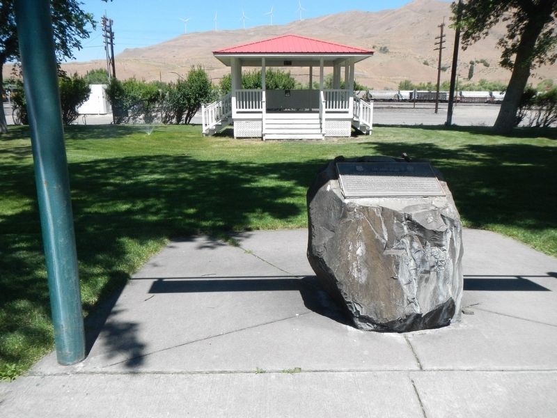
The banks of the Willamette River were the focus of early town development. The town plat for Marysville was files on February on February 25, 1851, by Joseph C. Avery, using a portion of his land claim of 1845. The town included property from the . . . — — Map (db m117488) HM
Commerce came quickly to the area as pioneers cleared land and became established. Pasture and grazing was common but presented transportation problems before refrigeration and good roads or bridges. The Clear Creek Creamery co-op was formed to . . . — — Map (db m114236) HM
George Abernethy who arrived at Willamette Falls in 1840 by ship, took a land claim that stretched from the Willamette River to Holcomb Hill. The neck of land that followed Abernethy Creek acrosss Green Point became known as Abernethy Green. Oregon . . . — — Map (db m114032) HM
In the shadow of the tall trees, a stream of travelers crossed ash flows, talus slopes and boggy wetlands along this last stretch of the trail. Some emigrants were forced to abandon their wagons with the death of livestock and walk, carrying their . . . — — Map (db m112341) HM
Built at the turn of the 20th Century, the Norris Young Machine Shop served the farming community. Young, an accomplished machinist and inventor, repaired farm machinery and logging equipment.
Young was an enterprising businessman who along . . . — — Map (db m127204) HM
The Oregon Electric Railway was completed during the first decade of the 1900s, coming initially from Portland to Wilsonville, then on to Salem and Eugene after construction of a mile-long trestle across the Willamette River was completed in 1907. . . . — — Map (db m127219) HM
Built in January 1946 by Great Northern Railway in St. Cloud, Minn., this steel-frame, wooden-sided caboose was put into service by the Spokane, Portland and Seattle railroad.
Originally painted red, caboose No. 853 operated on the . . . — — Map (db m113665) HM
This cupola-style, 54,000-pound steel caboose was built in December 1942 and sold to Southern Pacific for use on runs between Coos Bay, Eugene and Klamath Falls. Painted "all mineral" brown with daylight orange ends, it was among the last cupola . . . — — Map (db m113660) HM
The Coos Bay Lumber Co. purchased this 73-ton, 2-8-2 Mikado-type steam locomotive in 1922 from Baldwin Locomotive Works in Philadelphia, Penn.
Engine No. 104 pulled log trains – sometimes as many as 100 cars – from the Powers and . . . — — Map (db m113669) HM
In 1872, the Coos Bay Wagon Road was completed.
The road, which connected Coos Bay Roseburg, was 58 miles long. A stagecoach could make the trip in about 28 hours in good weather.
Another route to the interior was the stage . . . — — Map (db m114150) HM
To supply the lumber mills with logs, entire mobile towns were created in the woods to house the men and their families who cut down the trees. The towns were movable camps conveyed by railroad cars. From 1916, these temporary towns, or logging . . . — — Map (db m113935) HM
Huge trees were felled in the woods and the logs were transported by railroad to town. They were then dropped into the Deschutes River to await their turn in the mill. The river was a perfect storage place for the logs. The natural flow of the . . . — — Map (db m113936) HM
Placed on the National Register of Historic Places 1985
The Mill-Pine neighborhood grew out of a need for housing close to the railroad. The Oregon-California railroad line was completed from Portland to Roseburg in 1872 and on to Ashland in . . . — — Map (db m99323) HM
Few Oregon communities have had a more colorful history than Scottsburg. It was named for Levi Scott, a pioneer of 1844, who homesteaded here and founded the town in 1850. There was a lower town at the head of tidewater on the Umpqua River which . . . — — Map (db m113510) HM
Imagine the American Indians first creating trails through these mountains hundreds of years ago. Later, in 1825 and 1826, Hudson Bay Fur Company trappers, led by Peter Skeene Ogden, crossed this very pass. In 1862 more people made this difficult . . . — — Map (db m107101) HM
For the longest time life here in Bear Valley as quiet and change was slow.
Native American seasonal camps gave way to small ranching operations of the first Europeans. In good weather the stagecoach ran through the valley. And in 1895, . . . — — Map (db m108734) HM
After spending a day skidding logs, laying track or building Seneca's first homes, the workers needed a place to call home; temporarily at least.
In 1928 "Camp One" was established southwest of here, and with boxcars for homes, . . . — — Map (db m108735) HM
Back in the early 1920's you may have left the dirt streets and wooden sidewalks of the town of Burns, to walk in these woods, where untouched ponderosa stood tall.
But in a few short years, one of the biggest ever timber sales in the . . . — — Map (db m108836) HM
When the railroad was being built the forest here was a busy place with trees being felled to make ties, and rock being blasted for ballast. In February 1927, forest ranger G. C. Blake reported:
"Yesterday I made the trip from . . . — — Map (db m108872) HM
Thousands of Oregon Trail emigrant passed this way toward new lives in a place Abigail Scot, emigrant of 1852, called the "Garden of the World" The Willamette Valley was nearly 2,000 miles from Missouri, and by the time emigrants reached this . . . — — Map (db m158539) HM
"The first locomotive ever run over the first railroad ever built in the state of Oregon"
Early travel on the Oregon Trail was extremely dangerous. The last 100 miles of the journey westward from The Dalles to the Willamette . . . — — Map (db m158538) HM
Gale-force winds bedeviled explorers and emigrants alike in the Columbia River Gorge.
Journals from the 1800s depict travel as treacherous through this singular passage in the Cascade Range where 60 mile-per-hour gusts are common.
By . . . — — Map (db m113939) HM
Constructed in 1911, the OWR & N Co. Railroad Depot served Hood River's thriving fruit, timber, and tourist industries. The Craftsman style building which was larger than most other stations replaced the original 1882 Queen Anne style depot on the . . . — — Map (db m112302) HM
At this location on December 17, 1887 at 5:04PM the Golden Spike was symbolically driven by Charles Crocker of the Southern Pacific Railroad. This final connection completed freight and passenger service around the nation.
Mileage 428.8 . . . — — Map (db m160778) HM
On December 17, 1887, Charles Crocker Drove The Golden Spike In The Rail Yard Just South Of This Point; Connecting The Oregon & California Tracks From The North With Those Of The California & Oregon, Now The Southern Pacific, From the South. This . . . — — Map (db m145727) HM
Side 1
Used for centuries by Shasta and other Native people, this low gap between the Rogue and Klamath watershed was crossed by Peter Skene Ogden, led by Shasta Guides, on February 9, 1827. With Ogden was a mounted group of Hudson’s Bay . . . — — Map (db m134504) HM
Gold discovered on hill across Rogue River in 1860. Land for Gold Hill donated by Thomas & Rose Chavner in 1884. Railroad built in 1887. Town Inc. Feb. 12, 1895. First school in Methodist Church in 1889. Electricity came from Gold Rey Dam in 1904. . . . — — Map (db m99286) HM
Both horses and horsepower figure prominently in this site's past. In the 1860s, William J. Plymale (1837-1904) opened a livery stable at Oregon and "D" streets. He sold feed and kept horses and buggies on hand.
Steam Driven Horsepower . . . — — Map (db m112896) HM
Imagine this site in the 1890’s. A small but serviceable locomotive, belching steam and smoke, rumbles up to the little depot on the corner. Commuters step from a single passenger car and quickly disperse. Further down the track, in the train yard . . . — — Map (db m113390) HM
This is the site of the depot of the Rogue River Valley Railroad which ran from Medford to Jacksonville
Siskiyou Pioneer Sites Foundation
Medford, Oregon — — Map (db m91772) HM
On October 27, 1883, C. Mingus, c.w. Broback, I.J. Phipps and C.C. Beekman, deeded in excess of two hundred acres for a townsite plus twenty acres for a railroad depot to the Oregon and California railroad company.
Charles Howard and his father, . . . — — Map (db m113405) HM
The Oregon Trunk Railway Bridge, constructed in 1911, was the first structure to cross this spectacular gorge. Prior to construction the only crossing of the Crooked River in this region was located about a mile upstream, where the canyon's sheer . . . — — Map (db m80490) HM
First known as Cook’s Logging Camp. "Old Blue",
Klamath County’s first railroad engine brought
here by horses from Klam[a]thon, 1893. — — Map (db m152414) HM
Before the railroad came to Klamath County, sawmills were built to provide milled lumber to be used locally. Due to the lack of roads and transportation equipment, most mills were built near water so logs could be floated to the mills.
The . . . — — Map (db m157457) HM
"To know the Oregon, California & Eastern Railway, one must imagine conditions in Oregon in the early 1900's." David F. Myrick, "Oregon, California & Eastern"
A century ago, the Klamath Basin held an inventory of nearly 35 billion . . . — — Map (db m112892) HM
Locomotive #2579 is a typical example of over 350 small steam locomotives called “Consolidations” that were used by the Southern Pacific Railroad from the early 1900s well into the 1950s. During their time she and her sisters were . . . — — Map (db m99216) HM
Erected in 1913 by the Nevada, California & Oregon Railroad running from Reno, Nevada to Lakeview, Oregon. Used as a passenger & freight station. Purchased by the Southern Pacific Railroad in the 1920's. Served as a residence and freight station. . . . — — Map (db m161948) HM
Once described as "Eugene's pioneer colored citizen", and "one of the most industrious colored men in Eugene", Wiley Griffon was well known on the streets of Eugene. A tram operator, he drove the city's "horse" drawn trolleys. These trolleys . . . — — Map (db m112881) HM
Constructed in 1912, this Southern Pacific Railroad Depot served Mapleton, a community 15 miles east of Florence. With the widening of Highway 126 in 1976, it was saved from demolition by local contractor, Mike Johnson, and rebuilt on the present . . . — — Map (db m113262) HM
Born of a vision that was not to be fully realized, Junction City was platted in 1870 by Ben Holladay, the West Coast railroad promoter. Holladay was building the Oregon & California Railroad south from Portland, laying track on both the east and . . . — — Map (db m119466) HM
Of this type of railway locomotive, only Engine 418 and a sister, Engine 293, remain. Engine 293 is on permanent display at a Leningrad museum in Russia.
Engine 418 was built in Tampere, Finland, in 1904. In 1939-40 it saw services during the . . . — — Map (db m119461) HM
Just across the reservoir, Lowell took root in the 1850s at Amos D. Hyland's homestead. First called Cannon, then later dubbed Lowell, the town grew up around Hyland's general store and large hop-processing yard. Hyland also operated a ferry that . . . — — Map (db m112930) HM
Founded in 1865, Newport has become the largest town on the central Oregon coast.
Its railroad, maritime and highway connections have nurtured its development.
Newport Harbor
Today, Newport's harbor serves mostly . . . — — Map (db m112412) HM
(right column)
Local Stories to Share
The Alsea River and Alsea Bay take their name from the native word Alsi (meaning peace). The Native Americans who once lived here were removed by order of the US Government in the . . . — — Map (db m177061) HM
The US Department of Agriculture describes cedar as possessing a natural resistance to rot…
It is well recognized for its longevity and strength above other wood products.
Oneonta Bluff presented an obstacle to engineer Samuel C. . . . — — Map (db m112251) HM
The city of Wheeler with a commanding view of
The Nehalem Bay
has some of the most interesting pre-Oregon history beginning with Frances Drake repairing his ship in the summer of 1579 and the wreck of a 1700's Spanish galleon.
Some . . . — — Map (db m113628) HM
(Six panels dealing with the Emigrant Springs portion of the Oregon Trail are found beneath this kiosk)
Lost Livestock
Water is scarce in the steep, forested slopes of the Blue Mountains and is often found only at . . . — — Map (db m111537) HM
The existing Depot building was built in 1909 by the Oregon Railway and Navigation Company. The depot building is primarily styled after architecture of the Mediterranean, as seen in the tiled hip roof, decorative roof support brackets and brick . . . — — Map (db m111599) HM
Nestled bewteen the rainy Cascades and the eastern Oregon deserts, Mosier's unique climate enables hillsides to bloom in a pallet of color.
In the spring, wildflower enthusiasts flock to Mosier for the spectacular array – “the . . . — — Map (db m112254) HM