After filtering for Oregon, 59 entries match your criteria.
Railroads & Streetcars Topic
By Barry Swackhamer, June 28, 2017
The Last Spike Marker
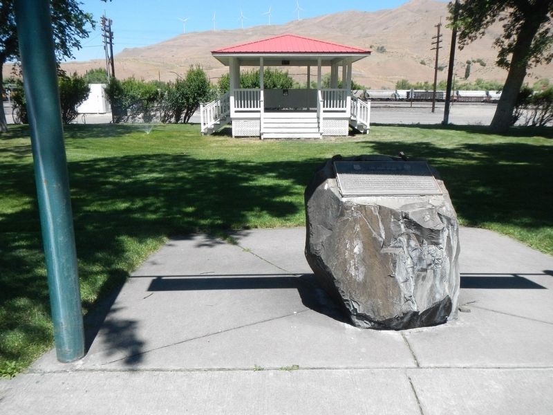
| 1 ► Oregon, Baker County, Huntington — The Last Spike — |
| On Washinton Street East (Business U.S. 30) near 1st Street East, on the right when traveling west. | |||
| 2 ► Oregon, Baker County, Sumpter — A Golden History — Sumpter Valley Dredge — |
| On Austin Street, 0.1 miles west of Mill Street, on the right when traveling west. | |||
| 3 ► Oregon, Baker County, Sumpter — Sumpter, Oregon — |
| On Mill Street at Sumpter Highway (Oregon Route 410), on the right when traveling north on Mill Street. | |||
| 4 ► Oregon, Benton County, Corvallis — Early Town Development — The Corvallis Riverfront — |
| On SW 1st Street north of SW Jefferson Avenue, on the right when traveling north. | |||
| 5 ► Oregon, Clackamas County, Oregon City — Area Commerce — |
| Near South Gronlund Road near Carver Road, on the right when traveling west. | |||
| 6 ► Oregon, Clackamas County, Oregon City — George Abernethy's Historical Significance — You are currently standing on Abernethy Green! — |
| Near Washington Street near Abernethy Road, on the right when traveling north. | |||
| 7 ► Oregon, Clackamas County, Welches — Emigrant's Final Steps — The Barlow Road — Oregon Trail Mile 1891 — |
| On Mt. Hood Highway (U.S. 26) at Main Park Road, on the left when traveling west on Mt. Hood Highway. | |||
| 8 ► Oregon, Clackamas County, Wilsonville — Norris Young Machine Shop — |
| On SW Boones Ferry Rd at SW 5th St, on the left when traveling south on SW Boones Ferry Rd. | |||
| 9 ► Oregon, Clackamas County, Wilsonville — Site of the Train Depot — |
| On SW Boones Ferry Rd, on the right when traveling south. | |||
| 10 ► Oregon, Coos County, Coos Bay — Caboose No. 11269 — |
| On Oregon Coast Highway (U.S. 101) north of Hall Avenue, on the right when traveling north. | |||
| 11 ► Oregon, Coos County, Coos Bay — Caboose No. 1134 — |
| On Oregon Coast Highway (U.S. 101) north of Hall Avenue, on the right when traveling north. | |||
| 12 ► Oregon, Coos County, Coos Bay — Coos Bay Waters to Coquille Waters Trail — 1850-1874 — |
| On Oregon Route 42 north of Confusion Hill Road, on the right when traveling north. | |||
| 13 ► Oregon, Coos County, Coos Bay — Steam Engine No. 104 — |
| On Oregon Coast Highway (U.S. 101) north of Hall Avenue, on the right when traveling north. | |||
| 14 ► Oregon, Coos County, Coos Bay — Transportation — (right panel) — |
| On Oregon Coast Highway (U.S. 101) north of Anderson Avenue, on the right when traveling north. | |||
| 15 ► Oregon, Deschutes County, Bend — Journey of the Log to Lumber — It All Began in the Woods — |
| Near SW Powerhouse Drive north of SW Columbia Street when traveling west. | |||
| 16 ► Oregon, Deschutes County, Bend — Thank Goodness for Water and Gravity — The Railroad and the River Moved the Logs to the Mill — |
| Near SW Powerhouse Drive north of SW Columbia Street when traveling west. | |||
| 17 ► Oregon, Douglas County, Roseburg — The Mill-Pine Historic Neighborhood District — |
| On SE Pine Street south of SE Woodward Avenue, on the left when traveling south. | |||
| 18 ► Oregon, Douglas County, Scottsburg — Scottsburg — Oregon History — |
| On Umpqua Highway (Oregon Route 38) at Main Street, on the left when traveling west on Umpqua Highway. | |||
| 19 ► Oregon, Grant County, Prairie City — Sumpter Valley Railroad Hiking Trail — Dixie Pass interpretive site — |
| On John Day Highway (U.S. 26), on the right when traveling east. | |||
| 20 ► Oregon, Grant County, Seneca — Changing Times in Bear Valley — |
| On 4th Street at Barnes Street (U.S. 395), on the left when traveling west on 4th Street. | |||
| 21 ► Oregon, Grant County, Seneca — From Logging Camp to a Town — |
| On Barnes Avenue (U.S. 395), on the right when traveling south. | |||
| 22 ► Oregon, Grant County, Seneca — Railroad to a Brighter Future — |
| On U.S. 395, on the right when traveling south. | |||
| 23 ► Oregon, Grant County, Seneca — Rocks, Rails and Railroad Ties — |
| On U.S. 395, on the right when traveling south. | |||
| 24 ► Oregon, Hood River County, Cascade Locks — Cascade Falls Portage — |
| Near Southwest Cascade Avenue near Wa Na Pa Street. | |||
| 25 ► Oregon, Hood River County, Cascade Locks — the Oregon Pony — |
| Near Southwest Portage Road near Wa Na Pa Street. | |||
| 26 ► Oregon, Hood River County, Hood River — Hood River — From Steamboats to Sailboards — |
| On East Port Marina Drive north of Interstate 84 when traveling north. | |||
| 27 ► Oregon, Hood River County, Hood River — OWR & N Company Railroad Depot — 1911 — City of Hood River Downtown Historic District — |
| On Cascade Avenue near 1st Street, on the left when traveling east. | |||
| 28 ► Oregon, Jackson County, Ashland — Ashland, OR — California & Oregon Linked At Last — |
| Near 9th Street Alley. | |||
| 29 ► Oregon, Jackson County, Ashland — Ashland’s Golden Spike — |
| On A Street at 5th Street, on the right when traveling east on A Street. | |||
| 30 ► Oregon, Jackson County, Ashland — Siskiyou Pass — |
| On Mt Ashland Ski Rd, on the right when traveling north. | |||
| 31 ► Oregon, Jackson County, Gold Hill — City of Gold Hill — |
| On 2nd Avenue west of Dardanelles Street, on the right when traveling west. | |||
| 32 ► Oregon, Jackson County, Jacksonville — History Right Here - Horse Powers — |
| On West C Street at N Oregon St, on the right when traveling west on West C Street. | |||
| 33 ► Oregon, Jackson County, Jacksonville — Jacksonville’s Rogue River Valley Railway 1891-1925 — |
| On W C St west of North Oregon Street, on the right when traveling west. | |||
| 34 ► Oregon, Jackson County, Jacksonville — Rogue River Valley Railroad Depot — 1891 • 1925 — |
| On West C Street at North Oregon Street on West C Street. | |||
| 35 ► Oregon, Jackson County, Medford — Medford Townsite — |
| Near S Ivy St at W 8th St. | |||
| 36 ► Oregon, Jefferson County, Metolius — Metolius Depot — End of the Line — |
| On Washington Ave at SW 6th St, on the right when traveling south on Washington Ave. | |||
| 37 ► Oregon, Jefferson County, Terrebonne — The Oregon Trunk Railroad Bridge — |
| Near Dalles-California Highway (U.S. 97 at milepost 114), 0.7 miles south of SW Culver Highway, on the right when traveling south. | |||
| 38 ► Oregon, Klamath County, Keno — Algoma Sawmill — 1908–1911 — |
| 39 ► Oregon, Klamath County, Keno — Horn's Camp 1895 - 1898 — |
| 40 ► Oregon, Klamath County, Keno — New Pokegama - 1903-1909 — |
| 41 ► Oregon, Klamath County, Keno — Old Pokegama — 1897 - 1903 — |
| 42 ► Oregon, Klamath County, Keno — Snow — 1892–1903 — |
| 43 ► Oregon, Klamath County, Kirk — Steam, Iron, and Strong Backs — The Moveable Railroad — |
| On Silver Lake Road (County Route 676) near U.S. 97, on the right when traveling east. | |||
| 44 ► Oregon, Klamath County, Klamath Falls — Beginning of a Trail — The OC&E Line — |
| On Oc&E Woods Line State Trail. | |||
| 45 ► Oregon, Klamath County, Klamath Falls — Locomotive 2579 — |
| On Klamath Avenue at Main Street on Klamath Avenue. | |||
| 46 ► Oregon, Klamath County, Klamath Falls — Swede’s Cut — |
| 47 ► Oregon, Lake County, Lakeview — N.C.O. Depot — |
| On Center Street south of North 2nd Street, on the left when traveling south. | |||
| 48 ► Oregon, Lane County, Eugene — Wiley Griffon — 1867 - 6/26/1913 — |
| Near East 25th Avenue. | |||
| 49 ► Oregon, Lane County, Florence — Mapleton Depot — |
| On Bay Street east of Oregon Coast Highway (U.S. 101), on the right when traveling east. | |||
| 50 ► Oregon, Lane County, Junction City — Junction City — A Brief History — |
| On W 5th Avenue at Holly Street, on the right when traveling west on W 5th Avenue. | |||
| 51 ► Oregon, Lane County, Junction City — Locomotive 418 — Finnish National Railways — In Service 1904 - 1958 — |
| On Holly Street at W 5th Avenue, on the right when traveling north on Holly Street. | |||
| 52 ► Oregon, Lane County, Lowell — Lowell Prospers — Logging Brings Growth — |
| Near S Pioneer St. | |||
| 53 ► Oregon, Lincoln County, Newport — South to Newport — |
| Near Northwest Lighthouse Drive west of Oregon Coast Highway (U.S. 101). | |||
| 54 ► Oregon, Lincoln County, Waldport — Waldport — |
| On SW Maple Street north of U.S. 101, on the right when traveling south. | |||
| 55 ► Oregon, Multnomah County, Cascade Locks — Oneonta Tunnel — Revisit the Past — |
| On Historic Columbia River Highway (U.S. 30) 1.8 miles west of Interstate 84, on the left when traveling west. | |||
| 56 ► Oregon, Tillamook County, Wheeler — Wheeler — |
| On Oregon Coast Highway (U.S. 101) at Rector Street, on the left when traveling north on Oregon Coast Highway. | |||
| 57 ► Oregon, Umatilla County, Meacham — Emigrant Springs Oregon Trail Kiosk — |
| Near Old Oregon Trail near Interstate 84, on the left when traveling north. | |||
| 58 ► Oregon, Umatilla County, Pendleton — Union Pacific Depot — |
| On Southwest Frazer Avenue near Southwest 1st Street, on the left when traveling west. | |||
| 59 ► Oregon, Wasco County, Mosier — Mosier — |
| On Historic Columbia River Highway (U.S. 30) east of Main Street, on the right when traveling east. | |||