On N. 4th Street south of E. Birchwood Avenue, on the right when traveling south.
The Lake Ice bear which many years ago spent summers in Sawdy Pond has returned!
Tomahawk's bear was originally a Hamm's beer advertising display. It sat on the beer cooler at Leon and Florence Weizenicker's Lake Ice business. When George . . . — — Map (db m237472) HM
On E. Washington Avenue east of N. 4th Street, on the left when traveling east.
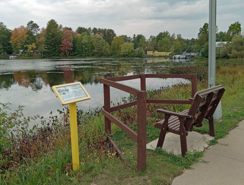
The Kwahamot Water Ski Club had its beginning during the city's 1960's "Aqua Days" celebration. The idea of waterskiing for the public arose when the Jaycees, coordinators of the event hired professional skiers to perform. Local resident, Rod . . . — — Map (db m244292) HM
Near County Highway R, 0.5 miles north of Schley Road.
In 1847 New York millwright and speculator Pliney Pierce built this mill adjacent to the rapidly falling waters of Devils River. First constructed as a sawmill, Rock Mill was quickly converted to a gristmill after the area's available timber was . . . — — Map (db m223213) HM
Near Interstate 43 at milepost 168,, 4.1 miles north of County Highway Z, on the right when traveling north.
Since about 1840, the lakeshore area from Manitowoc to Sturgeon Bay has been a center for shipping, fishing, and shipbuilding on the upper Great Lakes. Early shipping was characterized by sail and steam vessels docking at small private piers . . . — — Map (db m22452) HM
The U.S.S. Cobia was towed to Manitowoc on August 17, 1970 and was moored 400 yards upriver from here. There she remained until May 28, 1986 when she made her "Last Run" to this site. This most recent relocation of the U.S.S. Cobia and the . . . — — Map (db m98760) HM
Near Lakeview Drive (U.S. 10), on the left when traveling east.
(Side A)
Manitowoc and the Car Ferries. In the first five decades of the 20th century, Lake Michigan railroad car ferry service aided national defense and the regional economy by providing a key transportation alternative to the railroad . . . — — Map (db m11835) HM
Near Maritime Drive at North 7th Street, on the right when traveling east.
At the outbreak of World War II in 1939, President Franklin D. Roosevelt called upon America to rearm. Increasing the number of submarines became a goal. Because existing shipbuilders could not meet production schedules, the U.S. Navy approached . . . — — Map (db m12075) HM
On South 8th Street (U.S. 10) north of Quay Street, on the right when traveling north.
In 1847 Captain Joseph Edwards built the schooner Citizen here, beginning an era of maritime tradition in Manitowoc which has still not ended. The Challenge, believed one of the first clipper ships produced on the Great Lakes, was . . . — — Map (db m12073) HM
U.S.S. Cobia
has been designated a
National
Historic Landmark
This site possesses national significance
in commemorating the history of the
United States of America
1986
National Park Service
United States . . . — — Map (db m39489) HM
Keel Laid 27 January 1943
Launched 1 August 1943
Commissioned 30 November 1943
On 18 March 1944 the U.S.S. Golet departed Pearl Harbor to begin her first patrol. A severe combination of fog, rain, and ice prohibited her from sinking . . . — — Map (db m98710) HM WM
Keel Laid 3 March 1943
Launched 29 August 1943
Commissioned 23 December 1943
On 6 April 1944 the U.S.S. Guavina departed Pearl Harbor to begin her first patrol off the Bonin Islands. By the end of the war the Guavina completed 6 . . . — — Map (db m98715) HM WM
Keel Laid 7 April 1943
Launched 26 September 1943
Commissioned 26 January 1944
On 7 May 1944 the U.S.S. Guitarro departed Pearl Harbor to begin her first patrol. The Guitarro sank 2 vessels during her first patrol and 4 during her . . . — — Map (db m98757) HM WM
Keel Laid 5 May 1943
Launched 24 October 1943
Commissioned 1 March 1944
On 6 June 1944 the U.S.S. Hammerhead departed Pearl Harbor to begin her first patrol. The Hammerhead sank 5 vessels totalling 25,178 tons during her second . . . — — Map (db m98759) HM WM
Keel Laid 7 July 1943
Launched 12 December 1943
Commissioned 18 April 1944
On 27 July 1944 the U.S.S. Hardhead departed Pearl Harbor to begin her first patrol. On 23 June 1945 she sank 3 warships, including 2 submarine chasers. During . . . — — Map (db m98764) HM WM
Keel Laid 7 August 1943
Launched 9 January 1944
Commissioned 17 May 1944
On 23 August 1944 the U.S.S. Hawkbill left Pearl Harbor to begin her first patrol. She sank a destroyer during her second patrol, and on her third patrol sank 2 . . . — — Map (db m98774) HM WM
Keel Laid 4 September 1943
Launched 20 February 1944
Commissioned 10 June 1944
On 9 September 1944 the U.S.S. Icefish departed Pearl Harbor to begin her first patrol. The Icelfish was credited with sinking 2 vessels totalling . . . — — Map (db m98775) HM WM
Keel Laid 29 September 1943
Launched 12 March 1944
Commissioned 8 July 1944
On 9 October 1944 the U.S.S. Jallao departed Pearl Harbor to begin her first patrol. During this patrol she, with assistance from Navy aircraft, sank a light . . . — — Map (db m98788) HM WM
Keel Laid 25 October 1943
Launched 9 April 1944
Commissioned 31 July 1944
On 31 October 1944 the U.S.S. Kete departed Pearl Harbor to begin her first patrol. On 10 March 1945, during her second patrol, she sank 3 vessels totalling . . . — — Map (db m98801) HM WM
Keel Laid 14 December 1943
Launched 30 April 1944
Commissioned 8 September 1944
On 12 December 1944 the U.S.S. Kraken departed Pearl Harbor to begin her first patrol, during which she rescued a downed American airman. She earned 1 . . . — — Map (db m98807) HM WM
Keel Laid 11 January 1944
Launched 28 May 1944
Commissioned 14 October 1944
On 24 January 1945 the U.S.S. Lagarto departed Pearl Harbor to begin her first patrol. During this patrol she sank 2 vessels totalling 1,845 tons. One of . . . — — Map (db m98808) HM WM
Keel Laid 22 February 1944
Launched 18 June 1944
Commissioned 17 November 1944
On 17 February 1945 the U.S.S. Lamprey departed Pearl Harbor to begin her first patrol off the coast of Luzon in the Philippines. The Lamprey's second . . . — — Map (db m98815) HM WM
Keel Laid 14 March 1944
Launched 16 July 1944
Commissioned 30 December 1944
On 9 April 1945 the U.S.S. Lizardfish departed Pearl Harbor to begin her first Patrol. The Lizardfish was credited with sinking one vessel, a submarine . . . — — Map (db m98818) HM WM
Keel Laid 1 April 1944
Launched 13 August 1944
Commissioned 9 February 1945
On 15 May 1945 the U.S.S. Loggerhead left Pearl Harbor to begin her first patrol. The Loggerhead conducted 2 patrols and was not credited with any . . . — — Map (db m98819) HM WM
Keel Laid 1 May 1944
Launched 19 September 1944
Commissioned 29 March 1945
On 9 July 1945 the U.S.S. Macabi departed Pearl Harbor to begin her first patrol. The Macabi conducted 2 patrols and was not credited with any sinkings. . . . — — Map (db m98834) HM WM
Keel Laid 30 May 1944
Launched 9 November 1944
Commissioned 30 April 1945
On 4 August 1945 the U.S.S. Mapiro departed Pearl Harbor to begin her first patrol. She arrived at Saipan, Mariana Islands, on 15 August 1945, the day the . . . — — Map (db m98835) HM WM
Keel Laid 21 June 1944
Launched 20 December 1944
Commissioned 22 June 1945
The U.S.S. Menhaden was not destined to see action because the war ended while she was in Panama. Fleet Admiral Chester W. Nimitz, Commander in Chief of the . . . — — Map (db m98837) HM
Keel Laid 22 July 1944
Launched 17 January 1945
Commissioned 17 August 1945
On 19 November 1945 the U.S.S. Mero departed Manitowoc. The Mero was the last of 28 submarines built at the Manitowoc Shipbuilding Company. She was not . . . — — Map (db m98838) HM WM
Keel Laid 18 June 1941
Launched 30 April 1942
Commissioned 21 November 1942
The U.S.S. Peto was the first submarine built by the Manitowoc Shipbuilding Company. On 2 April 1943 she left Brisbane, Australia, to begin her first patrol. . . . — — Map (db m98384) HM WM
Keel Laid 15 September 1941
Launched 23 June 1942
Commissioned 10 January 1943
On 15 April 1943 the U.S.S. Pogy departed Pearl Harbor to begin her first patrol. The Pogy sank 3 vessels, including a 5,000 ton transport loaded with . . . — — Map (db m98394) HM WM
Keel Laid 26 November 1941
Launched 15 August 1942
Commissioned 17 March 1943
On 10 July 1943 the U.S.S. Pompon left Brisbane, Australia, to begin her first patrol. She sank a 5,871 ton transport during this patrol. On her sixth and . . . — — Map (db m98641) HM
Keel Laid 16 February 1942
Launched 22 November 1942
Commissioned 27 April 1943
On 7 September 1943 the U.S.S. Puffer departed Darwin, Australia, to begin her first patrol. She sank 3 vessels, including a submarine tender and a 5,113 . . . — — Map (db m98649) HM WM
Keel Laid 4 May 1942
Launched 20 December 1942
Commissioned 8 June 1943
On 3 October 1943 the U.S.S. Rasher departed Darwin, Australia, to begin her first patrol. By the end of the war she completed 8 patrols. She was credited with . . . — — Map (db m98650) HM WM
Keel Laid 29 May 1942
Launched 24 January 1943
Commissioned 13 July 1943
On 16 October 1943 the U.S.S. Raton departed Brisbane, Australia, to begin her first patrol. She sank 3 vessels totalling 18,801 tons during this patrol. The . . . — — Map (db m98676) HM WM
Keel Laid 20 July 1942
Launched 28 February 1943
Commissioned 27 July 1943
On 15 August 1943 the U.S.S. Ray departed Milne Bay, New Guinea, to begin her first patrol. During her sixth patrol, she and Navy aircraft shared credit for . . . — — Map (db m98680) HM WM
Keel Laid 3 September 1942
Launched 4 April 1943
Commissioned 31 August 1943
On 26 December 1943 the U.S.S. Redfin departed New Guinea to begin her first patrol. The Redfin sank 3 vessels, including a destroyer, during her second . . . — — Map (db m98683) HM WM
Keel Laid 24 October 1942
Launched 9 May 1943
Commissioned 28 September 1943
On 8 January 1944 the U.S.S. Robalo began her first patrol west of the Philippines. During her first 2 patrols, she earned the Asiatic-Pacific Area Service . . . — — Map (db m98696) HM WM
Keel Laid 23 December 1942
Launched 20 June 1943
Commissioned 26 October 1943
On 8 February 1944 the U.S.S. Rock departed Pearl Harbor to begin her first patrol. The Rock was credited with sinking 1 vessel and damaging 42,282 tons . . . — — Map (db m98697) HM WM
Built in 1886 by a Mr. Boehmer of Manitowoc for the U.S. Lighthouse Service this lighthouse stood at the harbor entrance of Two Rivers for 89 years until it was replaced by an automated beacon. The original lamp was a 240 degree Fresnel lens lit by . . . — — Map (db m39245) HM
Near Park Road, 2.2 miles west of County Highway N, on the right when traveling west.
From the 1840's to 1920's, logging overshadowed all other industries in Wisconsin. The state's northern pine forests became "pineries," providing logs to meet the nation's increasing demand for building materials.
Timber cut from these pineries . . . — — Map (db m74237) HM
Near Scott Street (State Highway 52) near Washington Street.
If you were a French voyageur in the 1600s or arrived with George Stevens in 1838, you would have heard and seen large rapids churning and bubbling here in front of you. Without dams, the river was much shallower than it is now. It swirled and . . . — — Map (db m44343) HM
Near Bridge Street (U.S. 41) 0.1 miles north of Riverside Avenue (State Highway 180), on the left when traveling north.
This river is named after the Menominees who lived here until they moved to the Wolf River in the 1850's. The Menominee River served as the main artery of commerce until the 1850's. Indians and fur traders moved their furs downriver in canoes to a . . . — — Map (db m15956) HM
On French Street (Business U.S. 41) east of West Front Street, on the left when traveling east.
This bridge crosses the river that has been the heart of the
community since the founding of Peshtigo.
This river provides power for our commerce and daily lives.
This river also protected some of our citizens who sought
refuge in . . . — — Map (db m120500) HM
On West Beloit Road, 0.5 miles west of South 108th Street (Wisconsin Highway 100), on the right when traveling west.
The Root River system began forming about 20,000 years ago when Wisconsin’s glaciers began to retreat. Starting in eastern New Berlin, it flows through southwest Milwaukee County before entering Lake Michigan at the city of Racine (French for . . . — — Map (db m81350) HM
On West Wisconsin Avenue west of North 20th Street, on the right when traveling west.
Of German birth, Pabst became a ship's captain in the 1850s and moved to Milwaukee in the 1860s. He later joined his father-in-law's brewery (founded 1844), which was renamed the Pabst Brewery in 1889. By the 1890s it was the world's largest lager . . . — — Map (db m8306) HM
On E Michigan, 0.1 miles east of E Michigan, N Lincoln Memorial Dr.
Near here, at the foot of Huron (now Clybourn) Street, the first cargo pier in Milwaukee harbor was built by Horatio Stevens, Richard Owens, Amos Tufts and J.G. Kendall during the winter of 1842-43. The first vessel to dock at North Pier was the . . . — — Map (db m31137) HM
Early in the 20th century, architect Alfred C. Clas imagined the riverfront as a European-style destination for recreation and a source of beauty at the heart of downtown.
In 1914, Clas, a proponent of the "City Beautiful" movement to improve . . . — — Map (db m38863) HM
On Wisconsin Avenue at the east bank of the Milwaukee River, on the right when traveling east on Wisconsin Avenue.
Indian villagers are credited with giving Milwaukee its name, which may have derived from Mahnawauk, Meolaki or Milwacky. Those words may be references to the Milwaukee River or a medicinal plant, but the most common translation is "good land." . . . — — Map (db m38882) HM
From pioneer days well into the 20th century, the River was a year-round playground for the generations, used for boating, swimming, fishing, curling, horse-drawn sleigh rides, tobogganing and ice skating. Swimming schools, boat rental facilities . . . — — Map (db m136106) HM
The Lake Michigan Water Trail Project in Wisconsin is designated a keystone conservation and outdoor recreation project under President Obama's America's Great Outdoors program. Here, we celebrate the partnerships and collaboration that resulted in . . . — — Map (db m204432)
Milwaukee's three rivers and surrounding wetlands first attracted Native Americans to the area. The water provided game, waterfowl, fish and wild rice. These waterways also provided transportation routes for their canoes and dugouts that carried . . . — — Map (db m147639) HM
On North Water Street at East Erie Street, on the right when traveling north on North Water Street.
The loss of the sidewheel steamship Lady Elgin was one of Lake Michigan’s most tragic maritime disasters. On September 8th, 1860, the ship, returning to Milwaukee from Chicago, sank following a collision nine miles off Winnetka, Illinois. . . . — — Map (db m37263) HM
Four miles long and a half-mile wide, the Menomonee River Valley was formed by melting glaciers more than 10,000 years ago. A vast marsh extended from Lake Michigan to where you are now standing. Steep wooded bluffs rose 100 feet above both sides of . . . — — Map (db m226146) HM
Near North Wahl Avenue at North Terrace Avenue, on the right when traveling north.
The North Point Light Station has a long history of guiding mariners to Milwaukee. Its location was chosen to mark the north point of Milwaukee Bay. Erected in 1887 and first lit in 1888, the 39-foot octagonal cast-iron tower replaced an 1855 . . . — — Map (db m48408) HM
Near North Lake Drive, 0.2 miles south of Kenwood Boulevard. Reported permanently removed.
Milwaukee’s first lighthouse was erected in 1837 on a 56 foot bluff at the east end of Wisconsin Ave. It was replaced in 1855 by a 28 foot tower 100 feet east of the present location. Erosion forced the rebuilding in the 1870’s and relocation . . . — — Map (db m34766) HM
On South 6th Street, 0.1 miles south of West Canal Street, on the right when traveling south.
The Menomonee River Valley helped make Milwaukee a center for shipping and trade. From 1870 to 1890, the river was straightened and canals were dredged to aid commerce. Factories built right up to the banks make it easy to load and unload cargo . . . — — Map (db m84983) HM
On West Michigan Street at North 4th Street, on the right when traveling east on West Michigan Street.
Milwaukee born and educated, lawyer Carl F. Zeidler became Milwaukee’s 33rd mayor in April, 1940, when he defeated Daniel W. Hoan, Socialist mayor since 1916. In April, 1942, Zeidler left office to enter service as a U.S. Navy Lieutenant (j.g.). On . . . — — Map (db m37268) HM
On North 4th Street, on the right when traveling south.
Born January 26, 1930 in Elkhorn, WI, Harry "Buddy" Melges, Jr. is recognized as one of the most successful competitive sailors in history with dozens of National and International Championships in many different classes. Melges won an Olympic Gold . . . — — Map (db m98670) HM
Near Interstate 90 at milepost 21,, 3 miles west of Black River Street (State Highway 27), on the right when traveling west.
From the hills all around, rugged valleys collect for rivers that feed the mighty Mississippi. The early French called such a valley a coulee. These many valleys, large and small, still are known as coulees, a regional name for a regional landscape. . . . — — Map (db m8921) HM
Near Y north of A, on the right when traveling north.
In 1854, Samuel Thomas and his sons Samuel H. and Cyrus purchased the land and established a commercial fishing settlement between Smith's Creek and Wittkopf’s Slough. On October 8, 1871, the Peshtigo Fire destroyed the settlement. — — Map (db m230798) HM
On Park Street north of Superior Street (U.S. 45), on the left when traveling north.
The Eagle River-Three Lakes Chain of 28 Lakes is the largest inland Chain of Lakes in the World. The 28-Lake Chain has over 174 miles of shoreline. It spans from 5 miles southeast of the Town of Three Lakes to 1.5 miles west of the City of Eagle . . . — — Map (db m36093) HM
On Main Street (State Highway 15) east of Nash Street, on the right when traveling east.
Horton was born in Connecticut. In 1848, he purchased land in this heavily forested area and built a dam across Black Otter Creek to power a sawmill. Water collecting behind Horton's dam formed Black Otter Lake.
Hortonville, named after its . . . — — Map (db m20657) HM
Her Saloon is superbly fitted and furnished and the accommodations for steerage passengers on the main deck are unsurpassed.
Milwaukee Sentinel
May 20, 1846
Between 1844-1857, “palace steamers” ruled Great Lakes . . . — — Map (db m47081) HM
Only fragments remain of a pier that once extended from this point more than 700 feet into Lake Michigan. Rail cars, loaded with limestone from a hopper at the crusher house, ran along the top of the pier about 50 feet above the water. Workers first . . . — — Map (db m119286) HM
On Hamilton Road, 0.1 miles north of Green Bay Road, on the left when traveling north.
In our ancient past, Wisconsin was crossed by a system of trails first forged by deer and elk as they migrated in search of good weather, food and salt. Native Americans used the Paths as they hunted, traded, and made war in troubled times. Some . . . — — Map (db m66620) HM
History of the Lime Kiln Dam
Sources: Great Lakes Archaeological Research Center and Ozaukee County Staff
The Milwaukee Falls Lime Company was established in 1892 with the opening of a limestone quarry in the Village of Grafton. The . . . — — Map (db m95157) HM
Fish Passage Program
Between 2006-2013, the Ozaukee County Planning and Parks Department was awarded over $8.5 million in federal, state, local, and private funding to develop, refine, and implement a comprehensive "Ozaukee Fish Passage . . . — — Map (db m149146)
Enhancing the River and improving water quality. The Milwaukee River watershed is part of the Milwaukee Basin encompassing roughly 860 square miles of land in Southeast Wisconsin. The Basin discharges into Lake Michigan, the source of drinking water . . . — — Map (db m131510) HM
1835: Port Washington is founded. No natural harbor exists.
Circa 1844: A private pier is built at the end of "Pier" Street.
1849: The first lighthouse and keeper's dwelling is built on the north bluff (St. Mary's Hill).
1860: New . . . — — Map (db m88894) HM
A cistern is an enclosure usually constructed of brick, cut stone or cement that is used to collect rainwater, which runs off the roof via large rain gutters and downspouts. Its purpose is to supply water for bathing and other household uses. This . . . — — Map (db m183491) HM
Near South Wisconsin Street north of South Milwaukee Street, on the right when traveling north.
Lake Michigan and its feeder tributaries have been continually fished for centuries, first by Indigenous populations and much later by European and American settlers. This peninsula of land, where Sauk Creek empties into Lake Michigan, was the . . . — — Map (db m223749) HM
On March 10, 2012 twenty four year old Peter Dougherty lost his life while kayaking off the shores of South Beach. Six months later on September 2, 2012, Tyler Buczek lost his life while swimming with friends off the shores of North Beach. This . . . — — Map (db m88547) HM
In the afternoon of October 22, 1929, the steam-powered, steel hull, rail car ferry S.S. Milwaukee set off for the return trip to Michigan heading into a northeaster gale filled with 28 train cars, a full load, packed with lumber, food, . . . — — Map (db m244531) HM
On Johnson Street west of East Van Buren Street, on the right when traveling west. Reported permanently removed.
The schooner Northerner was built in 1850 at Clayton, N.Y. and sold to Nicholas Ronk and Andreas Ryerson in 1865. While loading cordwood at the village of Amsterdam, 12 miles north of Port Washington, she struck bottom and was damaged. The . . . — — Map (db m244522) HM
The unwritten code of the lakes dictates that seamen come to the aid of anyone in peril. In this regard the fishermen of Port Washington time and again showed their mettle.
At the time of the September equinox, 1895 a furious gale was . . . — — Map (db m88885) HM
On Johnson Street at East Van Buren Street, on the right when traveling east on Johnson Street.
This property has been listed in the
National Register of Historic Places
by the United States Department of the Interior
Port Washington Light Station
1860 — — Map (db m46949) HM
This 13'8" propeller, weighing 7 tons, is from the S.S. BADGER, which was built by the Christy Corporation of Sturgeon Bay, Wisconsin and launched in 1952. The SPARTAN, a twin of the BADGER was built at the same time. The two carferries bear the . . . — — Map (db m95174) HM
Work to revitalize Sauk Creek and improve habitat for resident and migratory fish began in the summer of 1994. The project called for cleanup of the creek, creation of deeper and narrower channels, stabilization of stream banks and creation of fish . . . — — Map (db m118466) HM
Spears and Clubs
The Indians used handmade spears and clubs, from shore or in primitive boats, to catch the many species of fish native to the shallow waters of Lake Michigan.
The Seine
The seine net was anchored at one end, to . . . — — Map (db m88805) HM
On East Van Buren Street at Johnson Street, on the right when traveling north on East Van Buren Street.
HistoryThe first settlers arrived in Port Washington in 1835. General Wooster Harrison became the town's first settler, laying out 16 acres of the gently sloping land at the mouth of Sauk Creek. In 1848, following years of petitioning Congress, . . . — — Map (db m183580) HM
Built in 1850 by John Oades of Clayton, NY, the Northerner began as a lakeshoring vessel on Lake Ontario, transporting general merchandise to and from American and Canadian ports for Henry T. Bacon. Around 1863 the Northerner began its career on . . . — — Map (db m129368) HM
On Johnson Street, on the left when traveling east.
Final Voyage - 11/29/1868. The schooner Northerner pounded heavily upon the bottom while loading at the pier at Amsterdam, 12 miles north of Port Washington. Later that day after getting out into the lake, it was discovered she was leaking . . . — — Map (db m244523) HM
The lure of the lake is magnetic and hypnotizing to a true commercial fisherman. It draws him into its embrace from the time he is born to the day he is laid to rest. The lake mesmerizes him with its beauty, strength and sometimes terror. It . . . — — Map (db m88895) HM
The Indians who spent their summers where Sauk Creek and Lake Michigan meet were Port Washington's first fishermen. They used rocks or clubs to kill fish in shallow water. Later, spears were used. Then, crude hooks were fashioned out of bone. With . . . — — Map (db m88898) HM
Andrew Lodde was working on fish tugs by the time he was sixteen in 1888. He started with the Van Ells in Port Washington, then off of Jones Island and back to Port when the fish company relocated here. In 1913 Andrew formed a partnership with the . . . — — Map (db m88899) HM
The Toledo was a steamship that was built for the freight and passenger trade in the upper lakes area. It was commissioned by Charles H. Lee and Associates in 1854 and taken over by the American Transportation Company in 1855. The Toledo was part of . . . — — Map (db m135855) HM
Near East Van Buren Street at Johnson Street, on the right when traveling south.
This is the site of the original well for the 1849 and 1860 light station. It was only 32 feet deep and the water was not potable. The well pulley is from the steamer Toledo, which was battered to pieces in a storm off Port Washington in 1856 . . . — — Map (db m183753) HM
On The Great River Road (State Highway 35) north of Washington Street, on the right when traveling north.
A steamboat which was run on the Chippewa River for many years during the last half of the 19th century.
Captain Scheckel was perhaps the best known pilot that ever put his hand to a wheel of a Chippewa River steamboat. — — Map (db m10077) HM
On The Great River Road (State Highway 35) 1.9 miles south of County Highway D, on the right when traveling south.
This beautiful lake is twenty-two miles long, varies in width from one to two and a half miles, and covers about thirty-eight square miles. It was caused by the delta of the Chippewa spreading across the gorge of the Mississippi at the southeastern . . . — — Map (db m10026) HM
On North Cascade Street (State Highway 35) north of Osceola Road (State Highway 243), on the left when traveling north.
On May 14, 1884, William Kent and 12 companions stopped on their journey from St. Croix Falls to explore a creek that rippled through the glen and emptied into the St. Croix River. A beautiful 25-foot waterfall burst upon their vision and they . . . — — Map (db m17546) HM
Near North Cascade Street (State Highway 35) north of Osceola Road (State Highway 243), on the left when traveling north.
By 1845, the first sawmill was erected in Osceola. It stood two stories high and was capable of cutting 10,000 board feet every 24 hours. Approximately 35 million board feet were cut during its existence. It was located on Osceola Creek near the . . . — — Map (db m17554) HM
Near East Massachusetts Street west of North Washington Street (Wisconsin Highway 87), on the left when traveling west.
Gaylord Anton Nelson (1916–2005), known worldwide as the founder of Earth Day, was the son of a country doctor and a nurse. Born the third of four children on June 4, 1916, at Clear Lake, Wisconsin, 28 miles from here, Nelson canoed the . . . — — Map (db m14796) HM