By Bill Kirchner, July 22, 2011
Rear of Alameda Marker
| On 4th Street NW at 2nd Street NW (State Road 47), on the right when traveling south on 4th Street NW. |
| On 4th Street NW at Marble Avenue NW, on the right when traveling north on 4th Street NW. |
| Near South Plaza Street NW. |
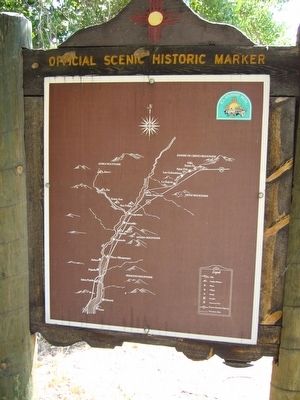
| Near Mountain Road NW at Old Town Road NW. |
| On Mountain Road NW at 19th Street NW, on the right when traveling east on Mountain Road NW. |
| On U.S. 285 at West 11th Street, on the right when traveling south on U.S. 285. |
| On State Road 53 at milepost 83.1,, 2.5 miles south of Interstate 40, on the right when traveling north. |
| On El Morro National Monument Road, 0.6 miles south of Ice Caves Road (State Highway 53), on the right when traveling south. |
| On El Morro National Monument Road, 0.1 miles south of Ice Caves Road (State Highway 53), on the right when traveling south. |
| On Therma Way (U.S. 64) at State Road 38, on the left when traveling east on Therma Way. |
| On U.S. 60 at milepost 357, on the right when traveling west. |
| Near northbound I-10 (Interstate 10) when traveling north. |
| On Interstate 25 at milepost 22.8, on the right when traveling south. |
| On Interstate 25 at milepost 22.8, on the right when traveling south. |
| On U.S. 285 at milepost 67, on the right when traveling north. |
| On U.S. 285 at County Road 719, on the right when traveling north on U.S. 285. |
| On State Road 152 at milepost 32, on the left when traveling west. |
| On Scenic State Road 152, 1.1 miles east of State Highway 356, on the right when traveling east. |
| Near North Hudson Street (New Mexico Route 90) at East Yankie Street, on the left when traveling north. |
| On Coronado Avenue (U.S. 84) 0.1 miles east of Interstate 40, on the right when traveling east. |
| On Coronado Avenue at River Road, on the right when traveling east on Coronado Avenue. |
| On Route 66, 0.3 miles west of Will Rogers Drive, on the right when traveling west. |
| On Interstate 40 at milepost 252, on the right when traveling west. |
| On Geronimo Trail, 1.5 miles east of Arizona / New Mexico State line, on the right when traveling west. |
| On U.S. 62, 0.3 miles west of NW County Road, on the right when traveling west. |
| On Billy the Kid Trail (U.S. 380 at milepost 97.8), on the right when traveling west. |
| Near Interstate 10 at milepost 61. |
| On East Main St (U.S. 54), on the right when traveling east. |
| On Highway 84 (U.S. 84 at milepost 211.5) near Local Road 187, on the left when traveling south. |
| On State Highway 17 at U.S. 64, on the right when traveling south on State Highway 17. |
| On Chama Highway (U.S. 84 at milepost 191.1), close to Española, on the right when traveling north. |
| On North Martinez Lane north of West Martinez Lane, on the left when traveling north. |
| On Bridge Street at Valencia Street, on the right when traveling west on Bridge Street. |
| On North Grand Avenue (U.S. 85) at Legion Drive, on the right when traveling north on North Grand Avenue. |
| On U.S. 550 at milepost 4.2,, 0.2 miles east of Santa Fe Hills Boulevard, on the right when traveling east. |
| On Rio Rancho Drive (State Road 528 at milepost 13), 0.2 miles south of Idalia Road NE, on the right when traveling west. |
| On U.S. 550, 1.6 miles west of Zia Boulevard, on the right when traveling west. |
| On County Road 59, on the right when traveling south. |
| On State Road 41, on the right when traveling south. |
| Near Paseo de Peralta near Otero Street. |
| Near Paseo de Peralta near Otero Street. |
| On East Palace Avenue east of Cathedral Place, on the right when traveling east. |
| On East Palace Avenue at Old Santa Fe Trail, on the left when traveling west on East Palace Avenue. |
| On South Guadalupe Street north of West De Vargas Street, on the right when traveling north. |
| On Cerrillos Road (State Road 14) west of Camino Carlos Rey, on the right when traveling north. |
| On State Highway 51 west of County Route A013, on the left when traveling west. |
| On South Broadway Street, 0.7 miles east of Interstate 25, on the right when traveling east. |
| On North Date Street, on the left when traveling north. |
| On Interstate 25 at milepost 166.4, on the right when traveling north. |
| On Calle de Lemitar at Interstate 25, on the right when traveling east on Calle de Lemitar. |
| Near CanAm Highway (Interstate 25 at milepost 113), 1.2 miles south of State Road 107, on the right when traveling south. |
| On U.S. 380 at milepost 0.4, on the right when traveling east. |
| On Interstate 25 at milepost 114, on the right when traveling north. |
| On Terry Avenue at School of Mines Road, on the right when traveling east on Terry Avenue. |
| On Interstate 25 at milepost 114, on the right when traveling north. |
| On Interstate 25 at milepost 114, on the right when traveling north. |
| On Kit Carson Road west of Dragoon Lane, on the right when traveling west. |
| On U.S. 64 at milepost 258.3,, 1.3 miles east of Paseo Del Canon East (State Road 585), on the right when traveling east. |
| On Kit Carson Road west of Dragoon Lane, on the right. |
| Near Twining-Blue Lake Back Pack Trail south of County Road 79. |
| On New Mexico Route 314, 0 miles north of Tribal Road 106 (Route 106), on the right when traveling north. |