After filtering for Arizona, 86 entries match your criteria.
Forts and Castles Topic
By Bill Kirchner, September 19, 2010
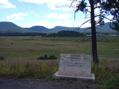
The Old Bushvalley Fort Marker
| 1 ► Arizona, Apache County, Alpine — The Old Bushvalley Fort — |
| On U.S. 180 at milepost 427.7, on the left when traveling west. | |||
| 2 ► Arizona, Cochise County, Bowie — Apache Pass - A Corridor Through Time — Fort Bowie National Historic Site — |
| On Apache Pass Road, 13 miles south of Business Interstate 10, on the left when traveling west. | |||
| 3 ► Arizona, Cochise County, Bowie — Apache Spring — |
| Near Fort Bowie Trail, 1.2 miles south of Apache Pass Road. | |||
| 4 ► Arizona, Cochise County, Bowie — Cavalry Barracks — |
| Near Fort Bowie Trail, 1.5 miles south of Apache Pass Road. | |||
| 5 ► Arizona, Cochise County, Bowie — Cavalry Mess Hall and Kitchen — |
| Near Fort Bowie Trail, 1.5 miles Apache Pass Road. | |||
| 6 ► Arizona, Cochise County, Bowie — Commanding Officer's Quarters — |
| Near Fort Bowie Trail, 1.5 miles south of Apache Pass Road. | |||
| 7 ► Arizona, Cochise County, Bowie — First Fort Bowie — |
| On Apache Pass Road. | |||
| 8 ► Arizona, Cochise County, Bowie — Infantry Barracks — |
| Near Fort Bowie Trail, 1.5 miles south of Apache Pass Road. | |||
| 9 ► Arizona, Cochise County, Bowie — Mining Cabin — |
| Near Fort Bowie Trail, 0.1 miles south of Apache Pass Road. | |||
| 10 ► Arizona, Cochise County, Bowie — 086-352 — Old Fort Bowie — Guardian of Apache Pass — |
| On I-10 Extension (Interstate 10), on the left when traveling east. | |||
| 11 ► Arizona, Cochise County, Bowie — Post Cemetery — |
| Near Apache Pass Road, 2.3 miles south of Bear Springs Road. | |||
| 12 ► Arizona, Cochise County, Bowie — Post Trader — (Sutler's Store) — |
| Near Fort Bowie Trail, 1.5 miles south of Apache Pass Road. | |||
| 13 ► Arizona, Cochise County, Bowie — Quartermaster Storehouse — |
| Near Fort Bowie Trail, 1.5 miles Apache Pass Road. | |||
| 14 ► Arizona, Cochise County, Bowie — Second Fort Bowie — |
| Near Fort Bowie Trail, 1.5 miles south of Apache Pass Road. | |||
| 15 ► Arizona, Cochise County, Elfrida — Camp John A. Rucker A Military Outpost — Stood on This Site 1878 - 1880 — |
| Near North Tex Canyon Road, 0.2 miles east of East Rucker Canyon Road, on the left when traveling east. | |||
| 16 ► Arizona, Cochise County, Elfrida — Camp Rucker and the Indian Scouts — |
| On North Tex Canyon Road near East Rucker Canyon Road. | |||
| 17 ► Arizona, Cochise County, Elfrida — Camp Rucker Bakery and Commissary — |
| Near North Tex Canyon Road, 0.8 miles east of East Rucker Canyon Road. | |||
| 18 ► Arizona, Cochise County, Elfrida — Camp Rucker Timeline — |
| Near North Tex Canyon Road near East Rucker Canyon Road. | |||
| 19 ► Arizona, Cochise County, Elfrida — How Camp Rucker received its Name — |
| Near North Tex Canyon Road, 0.8 miles east of East Rucker Canyon Road. | |||
| 20 ► Arizona, Cochise County, Huachuca City — Fort Huachuca — (1877) — |
| On Arizona Route 90 at milepost 314, on the right when traveling south. | |||
| 21 ► Arizona, Cochise County, Sierra Vista — Fort Huachuca — |
| On Grierson Avenue at Boyd Avenue, on the right when traveling south on Grierson Avenue. | |||
| 22 ► Arizona, Coconino County, Fredonia — 29 — Pipe Springs National Monument — |
| On U.S. 89A at milepost 609, on the left when traveling north. | |||
| 23 ► Arizona, Coconino County, Happy Jack — General Crook Trail — |
| On Rim Road (Forest Road 300), 1.2 miles east of Arizona Route 87, on the left when traveling east. | |||
| 24 ► Arizona, Coconino County, Happy Jack — General Crook Trail — |
| On Rim Road (Forest Road 300), 8.4 miles east of Arizona Route 87, on the left when traveling east. | |||
| 25 ► Arizona, Maricopa County, Fort McDowell — Camp Reno — |
| On Beeline Highway (Arizona Route 87 at milepost 190) near North Fort McDowell Road, on the right when traveling north. | |||
| 26 ► Arizona, Maricopa County, Fort McDowell — Fort McDowell — |
| On Beeline Highway (Arizona Route 87) near North Fort McDowell Road, on the right when traveling north. | |||
| 27 ► Arizona, Maricopa County, Mesa — Site of Old Fort Utah — |
| On North Horne at East Lehi Road, on the right when traveling north on North Horne. | |||
| 28 ► Arizona, Mohave County, Bullhead City — Old Fort Mohave — |
| Near State Highway 68. | |||
| 29 ► Arizona, Mohave County, Fredonia — 995 Miles of Wire — Pipe Spring National Monument — |
| Near North Pipe Spring Road, 0.3 miles north of Arizona Route 389, on the left when traveling north. | |||
| 30 ► Arizona, Mohave County, Fredonia — Boulders to Building Blocks — Pipe Spring National Monument — |
| Near North Pipe Spring Road, 0.3 miles north of Arizona Route 389, on the left when traveling north. | |||
| 31 ► Arizona, Mohave County, Kaibab — 5 — Pipe Springs National Monument — |
| Near North Pipe Springs Road. | |||
| 32 ► Arizona, Mohave County, Kingman — Camp Beale Springs Arizona — |
| On Fort Beale Road at Wagon Trail Road, on the left when traveling north on Fort Beale Road. | |||
| 33 ► Arizona, Navajo County, Fort Apache — Adjutant's Office (117) — |
| On General Crook Street, on the right when traveling east. | |||
| 34 ► Arizona, Navajo County, Fort Apache — B.I.A. Club House (105) — |
| On General Crook Street, on the left when traveling east. | |||
| 35 ► Arizona, Navajo County, Fort Apache — Barracks (115) — |
| Near Barracks Row, on the left when traveling west. | |||
| 36 ► Arizona, Navajo County, Fort Apache — Barracks Row — |
| On Scout Street, on the left when traveling north. | |||
| 37 ► Arizona, Navajo County, Fort Apache — Boys' Dormitory (116) — |
| On Barracks Row, on the right when traveling west. | |||
| 38 ► Arizona, Navajo County, Fort Apache — Captain's Quarters (102 and 103) — |
| On General Crook Street, on the left when traveling east. | |||
| 39 ► Arizona, Navajo County, Fort Apache — Commanding Officers' Quarters (104) — |
| On General Crook Street, on the left when traveling east. | |||
| 40 ► Arizona, Navajo County, Fort Apache — Commissary Storehouse (113) — |
| On Kinney Road, on the left when traveling south. | |||
| 41 ► Arizona, Navajo County, Fort Apache — First Commanding Officer's Quarters (101) — |
| On General Crook Street at Scout Street, on the left when traveling east on General Crook Street. | |||
| 42 ► Arizona, Navajo County, Fort Apache — Guard House (114) — |
| On Kinney Road, on the left when traveling south. | |||
| 43 ► Arizona, Navajo County, Fort Apache — Non-Commissioned Officers' Quarters (110 & 111) — |
| On General Crook Street, on the left when traveling east. | |||
| 44 ► Arizona, Navajo County, Fort Apache — Officer's Quarters (106) — |
| On General Crook Street, on the left when traveling east. | |||
| 45 ► Arizona, Navajo County, Fort Apache — Officers' Quarters (107, 108, 109) — |
| On General Crook Street, on the left when traveling east. | |||
| 46 ► Arizona, Navajo County, Fort Apache — Old Guard House (115A) — |
| Near Fort Apache Road, on the right when traveling west. | |||
| 47 ► Arizona, Navajo County, Fort Apache — Parade Ground — |
| On General Crook Street, on the right when traveling east. | |||
| 48 ► Arizona, Navajo County, Fort Apache — T.R. School Teachers' Quarters (112) — |
| On General Crook Street, on the left when traveling east. | |||
| 49 ► Arizona, Pima County, Tucson, Armory Park — Camp Lowell 1866-1873 — |
| On South 6th Avenue, on the right when traveling north. | |||
| 50 ► Arizona, Pima County, Tucson, Downtown — S. E. Corner Adobe Wall of Spanish Presidio of Tucson — |
| Near North Church Avenue. | |||
| 51 ► Arizona, Pima County, Tucson, Downtown — Southwest Corner of the Presidio — |
| Near West Pennington Street. | |||
| 52 ► Arizona, Pima County, Tucson, El Presidio — Main Gate — |
| Near North Main Avenue at West Alameda Street. | |||
| 53 ► Arizona, Pima County, Tucson, El Presidio — Presidio San Agustín del Tucson — |
| On North Main Avenue at West Paseo Redondo, on the right when traveling south on North Main Avenue. | |||
| 54 ► Arizona, Pima County, Tucson, El Presidio — Presidio Wall — |
| On North Main Avenue at West Washington Street, on the right when traveling north on North Main Avenue. | |||
| 55 ► Arizona, Pima County, Tucson, El Presidio — Tucson Old Walled City — |
| On West Alameda Street near North Main Avenue, on the right when traveling east. | |||
| 56 ► Arizona, Pima County, Tucson, Old Fort Lowell — Cavalry Barracks and Band Barracks — |
| Near North Craycroft Road. | |||
| 57 ► Arizona, Pima County, Tucson, Old Fort Lowell — Cottonwood Lane — |
| Near Cottonwood Lane near North Craycroft Road. | |||
| 58 ► Arizona, Pima County, Tucson, Old Fort Lowell — Fort Lowell — |
| Near North Craycroft Road near East Glenn Street. | |||
| 59 ► Arizona, Pima County, Tucson, Old Fort Lowell — Fort Lowell — |
| On Craycroft Road, on the right when traveling north. | |||
| 60 ► Arizona, Pima County, Tucson, Old Fort Lowell — Fort Lowell — 1873 – 1891 — |
| Near North Craycroft Road. | |||
| 61 ► Arizona, Pima County, Tucson, Old Fort Lowell — Fort Lowell 1873-1891 / Post Hospital — |
| Near North Craycroft Road. | |||
| 62 ► Arizona, Pima County, Tucson, Old Fort Lowell — Headquarter's Buildings — |
| On North Craycroft Road, on the right when traveling north. | |||
| 63 ► Arizona, Pima County, Tucson, Old Fort Lowell — Infantry Barracks / Laundresses' Quarters — |
| Near North Craycroft Road. | |||
| 64 ► Arizona, Pima County, Tucson, Old Fort Lowell — Officers' Quarters — |
| On North Craycroft Road, on the right when traveling north. | |||
| 65 ► Arizona, Pima County, Tucson, Old Fort Lowell — Post Hospital — |
| Near North Craycroft Road. | |||
| 66 ► Arizona, Pima County, Tucson, Old Fort Lowell — Quartermaster Depot and Post Trader — |
| On North Craycroft Road, on the right when traveling north. | |||
| 67 ► Arizona, Pima County, Tucson, Old Fort Lowell — The Chief Trumpeter — Sculptor/Artist: Dan Bates — |
| On North Craycroft Road, on the right when traveling north. | |||
| 68 ► Arizona, Pima County, Tucson, Old Fort Lowell — The Fort Lowell Flagstaff — |
| Near North Craycroft Road. | |||
| 69 ► Arizona, Pima County, Tucson, Old Fort Lowell — Veterans Memorial — Fort Lowell Park — |
| Near North Craycroft Road. | |||
| 70 ► Arizona, Santa Cruz County, Nogales — Camp Stephen D. Little — |
| On North Grand Avenue, on the right when traveling south. | |||
| 71 ► Arizona, Santa Cruz County, Tubac — Presidio of Tubac — |
| Near Tubac Road near Cll Iglesia Road. | |||
| 72 ► Arizona, Santa Cruz County, Tubac — Tubac — |
| 73 ► Arizona, Santa Cruz County, Tubac — Tubac Presidio — |
| 74 ► Arizona, Yavapai County, Camp Verde — Camp Verde — |
| On General Crook Trail (South Access Road), 0.2 miles east of Interstate 17 Exit 285, on the right when traveling east. | |||
| 75 ► Arizona, Yavapai County, Camp Verde — Flagpole & Administration Building — Fort Verde, Arizona Territory — |
| Near E Hollamon Street when traveling north. | |||
| 76 ► Arizona, Yavapai County, Camp Verde — Fort Verde State Historic Park — The West As It Really Was! — |
| On Hollamon Street, on the right when traveling east. | |||
| 77 ► Arizona, Yavapai County, Camp Verde — Officers’ Row — Fort Verde, Arizona Territory — |
| On E Hollamon Street, on the right when traveling east. | |||
| 78 ► Arizona, Yavapai County, Camp Verde — Site of Married Officers' Quarters — Fort Verde, Arizona Territory — |
| Near E Hollamon Street when traveling north. | |||
| 79 ► Arizona, Yavapai County, Camp Verde — Site of Married Officers’ Quarters — Fort Verde, Arizona Territory — |
| Near E Hollamon St when traveling north. | |||
| 80 ► Arizona, Yavapai County, Camp Verde — Surgeon’s Quarters — |
| Near E Hollamon Street when traveling north. | |||
| 81 ► Arizona, Yavapai County, Montezuma Castle National Monument — The Community — |
| 82 ► Arizona, Yavapai County, Montezuma Castle National Monument — The People Next Door — |
| 83 ► Arizona, Yavapai County, Prescott, Bob Stump VA Medical Center — Fort Whipple — |
| Near Route 89 south of Cultural Center Road, on the left when traveling south. | |||
| 84 ► Arizona, Yuma County, Yuma — Commanding Officer's Quarters & Kitchen — |
| Near North 4th Avenue. | |||
| 85 ► Arizona, Yuma County, Yuma — Office of the U. S. Army Depot Quartermaster — |
| Near North 4th Avenue north of West 1st Street. | |||
| 86 ► Arizona, Yuma County, Yuma — Quartermaster Depot Water Reservoir — |
| Near North 4th Avenue north of West 1st Street. | |||