After filtering for Wyoming, 147 entries match your criteria. The first 100 are listed. ⊳
Forts and Castles Topic
By Duane Hall, July 6, 2013
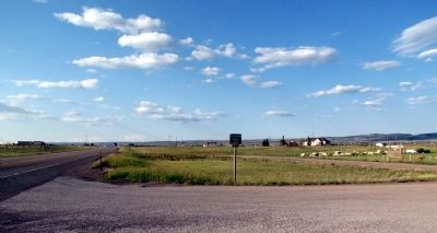
View to north along US 287
| 1 ► Wyoming, Albany County, Laramie — Ft. Sanders — 1866-1882 — |
| On U.S. 287 at Cavalryman Ranch Road, on the right when traveling north on U.S. 287. | |||
| 2 ► Wyoming, Albany County, Laramie — Site of Fort Sanders — |
| On S. Kiowa Street, 0.1 miles east of Fort Sanders Road, on the right when traveling east. | |||
| 3 ► Wyoming, Carbon County, Elk Mountain — Fort Halleck — |
| On Rattlesnake Pass Road near Interstate 80. | |||
| 4 ► Wyoming, Carbon County, Sinclair — Early Construction — |
| Near County Route 347 near Interstate 80, on the left when traveling north. | |||
| 5 ► Wyoming, Carbon County, Sinclair — Enlisted Men's Barracks — |
| Near County Route 347 near Interstate 80, on the right when traveling west. | |||
| 6 ► Wyoming, Carbon County, Sinclair — Fort Fred Steele — Historical Overview — |
| Near Old Highway, 0.1 miles east of County Road 347, on the left when traveling east. | |||
| 7 ► Wyoming, Carbon County, Sinclair — Fort Fred Steele — |
| Near County Road 347, 1.7 miles north of Old Highway. | |||
| 8 ► Wyoming, Carbon County, Sinclair — Fort Fred Steele after 1886 — |
| On County Route 347 near Interstate 80, on the right when traveling west. | |||
| 9 ► Wyoming, Carbon County, Sinclair — Fort Fred Steele State Historic Site — |
| Near County Route 347 near Interstate 80, on the left when traveling north. | |||
| 10 ► Wyoming, Carbon County, Sinclair — Officer's Quarters — |
| Near County Route 347 near Interstate 80, on the right when traveling west. | |||
| 11 ► Wyoming, Carbon County, Sinclair — Officers Who Commanded Fort Fred Steele — |
| Near State Highway 347 near Interstate 80, on the right when traveling west. | |||
| 12 ► Wyoming, Carbon County, Sinclair — Powder Magazine — |
| On County Route 347 near Interstate 80, on the right when traveling north. | |||
| 13 ► Wyoming, Carbon County, Sinclair — Railroad and River — Fort Fred Steele's Lifelines — |
| On State Highway 374 near Interstate 80, on the right when traveling north. | |||
| 14 ► Wyoming, Carbon County, Sinclair — This January 1880 plan of Fort Fred Steele... — |
| On County Route 347 near Interstate 80. | |||
| 15 ► Wyoming, Carbon County, Sinclair — Viewing the Fort Grounds — |
| Near County Road 347, 1.7 miles north of Old Highway. | |||
| 16 ► Wyoming, Converse County, Douglas — Bozeman Trail — |
| On State Highway 93, on the right when traveling north. | |||
| 17 ► Wyoming, Converse County, Douglas — Fort Fetterman — (1867-1882) — |
| On State Highway 93. | |||
| 18 ► Wyoming, Converse County, Douglas — Water Supply — |
| On State Highway 93, on the right when traveling north. | |||
| 19 ► Wyoming, Fremont County, Atlantic City — Fort Stambaugh, 1870-1878 — |
| On South Pass Road (Dickinson Avenue) near Atlantic City Road, on the left when traveling south. | |||
| 20 ► Wyoming, Fremont County, Fort Washakie — Block House — |
| Near Old Wind River Highway near Trout Creek Road, on the right when traveling south. | |||
| 21 ► Wyoming, Fremont County, Lander — Lander Valley Historical Sites — |
| On East Main Street (U.S. 287) near North 1st Street, on the right when traveling west. | |||
| 22 ► Wyoming, Fremont County, Lander — Site of Fort Augur — 1869 - 70 — |
| On Main Street (U.S. 287) near South 4th Street, on the left when traveling west. | |||
| 23 ► Wyoming, Fremont County, Lander — Site of Fort McGraw — |
| On State Highway 789 near Beebee Road, on the right when traveling west. | |||
| 24 ► Wyoming, Fremont County, Lander — Site of Fort Thompson or Camp Magraw — |
| On State Highway 789 near Chittim Road, on the left when traveling north. | |||
| 25 ► Wyoming, Goshen County, Fort Laramie — ‘Where’s the Wall?’ — Fort Laramie National Historic Site — |
| Near State Highway 160, on the left when traveling west. | |||
| 26 ► Wyoming, Goshen County, Fort Laramie — “Officers Row” — |
| Near State Highway 160, on the left when traveling west. | |||
| 27 ► Wyoming, Goshen County, Fort Laramie — Administration Building — |
| Near State Highway 160, on the left when traveling west. | |||
| 28 ► Wyoming, Goshen County, Fort Laramie — C.O.’s Chicken Coop — (Built in 1881) — |
| Near State Highway 160, on the left when traveling west. | |||
| 29 ► Wyoming, Goshen County, Fort Laramie — Captain’s Quarters — |
| Near State Highway 160, on the left when traveling west. | |||
| 30 ► Wyoming, Goshen County, Fort Laramie — Cavalry Barracks — Fort Laramie National Historic Site — |
| On County Route 53. | |||
| 31 ► Wyoming, Goshen County, Fort Laramie — Commissary Storehouse — Fort Laramie National Historic Site — Visitor Center — |
| On 53. | |||
| 32 ► Wyoming, Goshen County, Fort Laramie — Crossroads of a Nation Moving West — Fort Laramie National Historic Site — |
| Near State Highway 160, on the left when traveling west. | |||
| 33 ► Wyoming, Goshen County, Fort Laramie — Embassy on the Northern Plains — Fort Laramie National Historic Site — |
| Near 160, on the left when traveling west. | |||
| 34 ► Wyoming, Goshen County, Fort Laramie — Fort John – The ‘Second Fort Laramie’ — Fort Laramie National Historic Site — |
| Near State Highway 160, on the left when traveling west. | |||
| 35 ► Wyoming, Goshen County, Fort Laramie — Fort Laramie — Fort Laramie National Historic Site — |
| On State Highway 160. | |||
| 36 ► Wyoming, Goshen County, Fort Laramie — Fort Laramie National Historic Site — Crossroads of a Nation Moving West — |
| On County Route 53. | |||
| 37 ► Wyoming, Goshen County, Fort Laramie — Fort Laramie National Historic Site — |
| On U.S. 26 near Otis Street, on the left when traveling north. | |||
| 38 ► Wyoming, Goshen County, Fort Laramie — Fort Platte — |
| On State Highway 160 near State Highway 59, on the right when traveling west. | |||
| 39 ► Wyoming, Goshen County, Fort Laramie — Fort William and the Fur Trade — Fort Laramie National Historic Site — |
| Near State Highway 160, on the left when traveling west. | |||
| 40 ► Wyoming, Goshen County, Fort Laramie — General Sink (Latrine) — |
| Near State Highway 160, on the left when traveling west. | |||
| 41 ► Wyoming, Goshen County, Fort Laramie — Guardhouse — 1850 – 1868 — |
| Near State Highway 160, on the left when traveling west. | |||
| 42 ► Wyoming, Goshen County, Fort Laramie — Infantry Barracks — |
| Near State Highway 160, on the left when traveling west. | |||
| 43 ► Wyoming, Goshen County, Fort Laramie — Magazine — (Built in 1849) — |
| Near State Highway 160, on the left when traveling west. | |||
| 44 ► Wyoming, Goshen County, Fort Laramie — Military Justice: Punishment Harsh and Certain — Fort Laramie National Historic Site — |
| Near State Highway 160, on the left when traveling west. | |||
| 45 ► Wyoming, Goshen County, Fort Laramie — 49 — Mormon Pioneers at Fort Laramie — |
| On East Merriam Street (U.S. 26) at Lawton Avernue on East Merriam Street. | |||
| 46 ► Wyoming, Goshen County, Fort Laramie — Noncommissioned Officers’ Quarters — Fort Laramie National Historic Site — |
| Near State Highway 160, on the left when traveling west. | |||
| 47 ► Wyoming, Goshen County, Fort Laramie — Officers Quarters — |
| Near State Highway 160, on the left when traveling west. | |||
| 48 ► Wyoming, Goshen County, Fort Laramie — Old Bedlam — |
| Near Gray Rocks Road near Wyoming Highway 160. | |||
| 49 ► Wyoming, Goshen County, Fort Laramie — Parade Ground — |
| Near State Highway 160, on the left when traveling west. | |||
| 50 ► Wyoming, Goshen County, Fort Laramie — Post Quartermaster’s Area — Fort Laramie National Historic Site — |
| Near State Highway 160, on the left when traveling west. | |||
| 51 ► Wyoming, Goshen County, Fort Laramie — Reading, ‘Riting, and ‘Rithmetic — Fort Laramie National Historic Site — |
| Near State Highway 160, on the left when traveling west. | |||
| 52 ► Wyoming, Goshen County, Fort Laramie — Refinement at Fort Laramie — |
| Near State Highway 160, on the left when traveling west. | |||
| 53 ► Wyoming, Goshen County, Fort Laramie — Sawmill — |
| Near State Highway 160, on the left when traveling west. | |||
| 54 ► Wyoming, Goshen County, Fort Laramie — Spanning a Century: End of an Era — |
| On State Highway 160 near County Route 59, on the left when traveling west. | |||
| 55 ► Wyoming, Goshen County, Fort Laramie — The “Government Workhouse” — Fort Laramie National Historic Site — |
| On State Highway 160, on the left when traveling west. | |||
| 56 ► Wyoming, Goshen County, Fort Laramie — The “New” Guardhouse and Adjacent Barracks — |
| Near State Highway 160, on the left when traveling west. | |||
| 57 ► Wyoming, Goshen County, Fort Laramie — The Cavalry Stables — Fort Laramie National Historic Site — |
| Near State Highway 160, on the left when traveling west. | |||
| 58 ► Wyoming, Goshen County, Fort Laramie — The Pony Express — 1860-1861 — 1960-1961 — |
| Near County Road 53. | |||
| 59 ► Wyoming, Goshen County, Fort Laramie — The Pony Express — 1860-1861 — 1960-1961 — |
| On County Road 53. | |||
| 60 ► Wyoming, Goshen County, Fort Laramie — The Post Bakeries — |
| Near State Highway 160, on the left when traveling west. | |||
| 61 ► Wyoming, Goshen County, Fort Laramie — The Post Hospital — Fort Laramie National Historic Site — |
| Near State Highway 160, on the left. | |||
| 62 ► Wyoming, Goshen County, Fort Laramie — The Queens of Soap Suds Row — Fort Laramie National Historic Site — |
| Near State Highway 160, on the left when traveling west. | |||
| 63 ► Wyoming, Goshen County, Fort Laramie — The Rustic Hotel — Fort Laramie National Historic Site — |
| On County Route 53. | |||
| 64 ► Wyoming, Goshen County, Fort Laramie — The Sutler’s House — |
| Near State Highway 160, on the left when traveling west. | |||
| 65 ► Wyoming, Goshen County, Fort Laramie — The Sutler’s Store — |
| Near State Highway 160, on the left when traveling west. | |||
| 66 ► Wyoming, Johnson County, Buffalo — Fort McKinney — |
| On U.S. 16 at milepost 90 near Veterans Lane, on the left when traveling west. | |||
| 67 ► Wyoming, Johnson County, Kaycee — “We live like the prairie dogs that surround us…” — |
| On Lower Sussex Road near Sussex Road (County Route 192), on the right when traveling north. | |||
| 68 ► Wyoming, Johnson County, Kaycee — Cantonment Reno Supplied the 1876 Indian Campaign. — |
| On Lower Sussex Road near Sussex Road (County Route 192), on the right when traveling north. | |||
| 69 ► Wyoming, Johnson County, Kaycee — Taming the Powder River: The First Bridge — |
| On Lower Sussex Road near Sussex Road (County Route 192), on the right when traveling north. | |||
| 70 ► Wyoming, Laramie County, Cheyenne — Camp Carlin — |
| On Happy Jack Road (State Highway 210) near Carlin Avenue, on the right when traveling west. | |||
| 71 ► Wyoming, Laramie County, Cheyenne — The Military 1867-1890 — Cheyenne Depot - Camp Carlin — |
| On Randall Avenue at McComb Avenue, on the right when traveling east on Randall Avenue. | |||
| 72 ► Wyoming, Laramie County, Cheyenne — The Military 1867-1949 — Fort David A. Russell - Fort Francis E. Warren — |
| On Randall Avenue at McComb Avenue, on the right when traveling east on Randall Avenue. | |||
| 73 ► Wyoming, Laramie County, Cheyenne — The Military 1949-Present — Francis E. Warren Air Force Base — |
| On Randall Avenue at McComb Avenue, on the right when traveling east on Randall Avenue. | |||
| 74 ► Wyoming, Natrona County, Casper — Old Fort Caspar — |
| On Fort Caspar Road, 0.1 miles west of Wyoming Route 258, on the right when traveling west. | |||
| 75 ► Wyoming, Natrona County, Casper — Reconstructed Fort Caspar — |
| Near Fort Caspar Road near South West Wyoming Boulevard (Wyoming Highway 258), on the left when traveling west. | |||
| 76 ► Wyoming, Natrona County, Casper — Richard Bridge and Military Complex — |
| Near Fort Caspar Road, 0.1 miles west of Wyoming Route 258, on the right when traveling west. | |||
| 77 ► Wyoming, Natrona County, Casper — Site of Fort Casper — |
| On Fort Caspar Road west of South West Wyoming Boulevard (Wyoming Highway 258), on the right when traveling west. | |||
| 78 ► Wyoming, Niobrara County, Lusk — Hat Creek Stage Station — |
| On Stage Road near Hat Creek Road, on the right when traveling south. | |||
| 79 ► Wyoming, Park County, Mammoth Hot Springs, Mammoth — A Good Duty Station |
| On Unnamed Road, 0.1 miles south of North Entrance Road and upper Grand Loop Road, on the left when traveling south. Reported permanently removed. | |||
| 80 ► Wyoming, Park County, Mammoth Hot Springs, Mammoth — A Soldier's Life |
| On Officer's Row, 0.1 miles Mammoth Street, on the left when traveling south. Reported permanently removed. | |||
| 81 ► Wyoming, Park County, Mammoth Hot Springs, Mammoth — At Guard |
| On Unnamed Road, 0.2 miles south of North Entrance Road and upper Grand Loop Road, on the left when traveling south. Reported permanently removed. | |||
| 82 ► Wyoming, Park County, Mammoth Hot Springs, Mammoth — Welcome to Historic Fort Yellowstone |
| On North Entrance Road at Grand Loop Road - upper loop, on the left when traveling south on North Entrance Road. Reported permanently removed. | |||
| 83 ► Wyoming, Park County, Yellowstone National Park, Mammoth — A Sense of Community — |
| On Grand Loop Road, on the left when traveling south. | |||
| 84 ► Wyoming, Park County, Yellowstone National Park, Mammoth — A Soldier’s Life — |
| On Officers Row, on the left when traveling south. | |||
| 85 ► Wyoming, Park County, Yellowstone National Park, Mammoth — Crime in Wonderland — |
| On Officers Row, on the right when traveling north. | |||
| 86 ► Wyoming, Park County, Yellowstone National Park, Mammoth — Fort Yellowstone — |
| On North Entrance Road (U.S. 89) at Grand Loop Road (U.S. 89), on the left when traveling south on North Entrance Road. | |||
| 87 ► Wyoming, Park County, Yellowstone National Park, Mammoth — Fort Yellowstone National Historic Landmark — |
| On N Entrance Road, on the left when traveling south. | |||
| 88 ► Wyoming, Park County, Yellowstone National Park, Mammoth — From Soldier to Ranger — |
| On Officers Row, on the left when traveling south. | |||
| 89 ► Wyoming, Park County, Yellowstone National Park, Mammoth — Guard Duty — |
| On Grand Loop Road, on the left when traveling south. | |||
| 90 ► Wyoming, Park County, Yellowstone National Park, Mammoth — Life in the Fort — |
| On N Entrance Road (U.S. 89), on the right when traveling north. | |||
| 91 ► Wyoming, Park County, Yellowstone National Park, Mammoth — The Post Exchange — |
| On Officers Row, on the left when traveling south. | |||
| 92 ► Wyoming, Platte County, Guernsey — Fort Laramie — |
| On S Wyoming Avenue, on the left when traveling south. | |||
| 93 ► Wyoming, Platte County, Guernsey — Forts, Stations, and Camps — |
| Near Lucinda Rollins Road near South Guernsey Road, on the left when traveling west. | |||
| 94 ► Wyoming, Platte County, Guernsey — The United States Army and the Oregon Trail — |
| Near Lucinda Rollins Road near South Guernsey Road, on the left when traveling west. | |||
| 95 ► Wyoming, Platte County, Guernsey — The US Army’s Role in Protecting the Oregon Trail is Best Described by the Soldiers — |
| Near Lucinda Rollins Road near South Guernsey Road, on the left when traveling west. | |||
| 96 ► Wyoming, Sheridan County, Banner — Cemetery Site — |
| On Wagon Box Road, on the left when traveling west. | |||
| 97 ► Wyoming, Sheridan County, Banner — Fort Phil Kearny — |
| On Wagon Box Road, on the left when traveling west. | |||
| 98 ► Wyoming, Sheridan County, Banner — Fort Phil Kearny — Registered National Historic Landmark — |
| Near Wagon Box Road, 0.4 miles west of Kearny Lane. | |||
| 99 ► Wyoming, Sheridan County, Banner — Laundress Row: — No Hog Ranch Here — |
| Near Wagon Box Road, on the left when traveling west. | |||
| 100 ► Wyoming, Sheridan County, Banner — Lesson Learned — Archaeology at Fort Phil Kearny — |
| Near Wagon Box Road, on the left when traveling west. | |||
147 entries matched your criteria. The first 100 are listed above. The final 47 ⊳