The emigrant trails across Wyoming were a vital link in the transcontinental migration of an estimated 250,000 Americans in the 19th century, and opened the area to settlers. The Indians resented this intrusion and threatened these . . . — — Map (db m67994) HM
This Monument
Marks the Site of
Fort Sanders
Established September 5, 1866
Abandoned May 18, 1882
Named in Honor of
Brigadier General
William P. Sanders
Erected by the
State of Wyoming
and
Jacques Laramie Chapter . . . — — Map (db m67995) HM
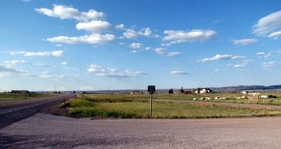
Established July 20, 1862. Located west of the Medicine Bow River at the north base of Elk Mountain. The site was selected by and the post built under the command of Major John O'Ferrall, 11th Ohio Cavalry. It was established to protect the . . . — — Map (db m95377) HM
The Post Trader's House was "T" shaped in three sections. The stem of the "T" was built first and over time other rooms were added to the house. The small fireplace was actually designed to burn coal. Many houses of this time period included coal . . . — — Map (db m90004) HM
Two stone foundations and chimneys remain of the five enlisted men's barracks once at Fort Fred Steele. The walls were constructed of logs and boards and battens while a shingled roof protected pine floor boards. Tar paper covered interior walls. . . . — — Map (db m89949) HM
The south central portion of Wyoming has long been a travel corridor for prehistoric and historic people. Native American tribes from the Great Basin region to the west crossed this area to hunt buffalo on the eastern plains.
From 1810 . . . — — Map (db m67988) HM
Officially abandoned in 1886, the fort came under the jurisdiction of the Department of the Interior in 1887. In 1892 and 1893 most of the buildings were sold a public auction. In 1897 the land, opened to homesteading, was patented by the Union . . . — — Map (db m89913) HM
Fort Fred Steele was established in 1868 to protect the North Platte River railroad crossing and the crews builting the Transcontinental Railroad. Named after Civil War hero Major Frederick Steele, the Fort and its soldiers provided vital services . . . — — Map (db m89997) HM
The collapsed sand stone building west of the sign is all that remains of the once imposing eight room, one and one-half story Commanding Officers quarters. Residences for staff officers were four, wood-framed double quarters with a captain in . . . — — Map (db m89946) HM
U.S. Army Officers Who Commanded Fort Fred Steele from it's Inception (1868) until its Abandonment (1886)
Baker, Eugene M. (Maj, 2 Cav) • Bartlett, Charles G. (Capt, 4 Inf) 1869 • Bascom, Gustavus, M. (1/Lt, 13 In) 1872 • Bisbee, . . . — — Map (db m89947) HM
The powder magazine housed the fort's munitions and therefore was located away from the main military complex. Ironically, it is one of the few fort structures remaining. It replaced the original magazine, a dugout constructed when the post was . . . — — Map (db m89994) HM
The Union Pacific Railroad and the North Platte River are important parts of the story of Fort Fred Steele. Located where these two great resources met, the fort and the local industries surrounding it would depend upon the rails and water for . . . — — Map (db m89759) HM
depicts a bustling military community astride the continental Union Pacific Railroad and flanked on the north and east by the Platte River.
Although the variety flora is limited, bitter cottonwood trees grown profusely with a smattering of pine . . . — — Map (db m89926) HM
Fort Fred Steele was established in 1868 as one of a group of military posts placed along the route of the Trans-Continental Railroad to protect and support the railroad construction. Today, except for the Powder Magazine (south of the Railroad . . . — — Map (db m71623) HM
From this point, the Bozeman Trail wound a long, twisting northwesterly route to the Montana goldfields. This view points out a portion of that difficult and dangerous road. The map shows the locations of forts, rivers and mountains along the trail. . . . — — Map (db m80089) HM
This plateau above LaPrele Creek and the North Platte River was chosen as an Army post by Major Dye who described it as “…being neither so low as to be seriously affected by the rains or snow; nor so high and unprotected as to suffer from the . . . — — Map (db m80092) HM
From this location, where the water reservoir once stood, one can see several interesting points. The sighting device points out the location of the pump used during the later years to supply the fort with water. Prior to installation of the pump . . . — — Map (db m80091) HM
was established to protect from Indians the gold mining camps of South Pass City, Atlantic City, Miners’ Delight, and others. It was named for 1st Lt. Charles B. Stambaugh, 2nd Cavalry, U.S.A. who was shot from his horse by Indians when defending a . . . — — Map (db m80145) HM
Scouts and Trappers visited this area by 1811 and rendezvous were held in 1829, in 1830, and in 1836.
Camp Magraw, 1857, site 2.1 miles north.
Fort Thompson, 1857-1858, was located 4.4 miles north of here.
Camp Augur, 1869-1870, . . . — — Map (db m95785) HM
In 1856 the United States Congress appropriated money to build the central division of the Fort Kearney-South Pass-Honey Lake Wagon Road from Nebraska to California. W.M.F. Magraw was appointed superintendent by the Secretary of the Interior. He was . . . — — Map (db m96164) HM
It is one of the most commonly asked questions here – and with good reason. Those who grew up watching western movies expect to see a fort with a large wooden stockade. Like many other aspects of Hollywood westerns, the walled military fort . . . — — Map (db m87076) HM
This 1889 winter scene shows buildings along the west side of the Parade Ground which housed Fort Laramie’s officer complement – hence, “Officers Row”. RIGHT TO LEFT, the “Burt” House, the “Surgeon’s” . . . — — Map (db m87031) HM
The large structure built on this site in 1885 – pictured shortly after completion – was put to many uses. The section on the far right was used as a schoolroom for officers’ children. The central portion housed the Headquarters . . . — — Map (db m87005) HM
High ranking officers commonly kept chickens for their own use. The consumption of chickens and eggs provided a welcome change from meals of wild game and tough army beef. Individual soldiers and cooks utilizing company funds could purchase . . . — — Map (db m87024) HM
Originally intended as housing for the commanding officer, this building was divided into a duplex when the C.O. chose to remain in another new dwelling. As such, the quarters was completed in 1870 at which time high-ranking officers and . . . — — Map (db m87009) HM
The building before you is the only surviving enlisted men's barracks at Fort Laramie. The building proper was completed in late 1874 and was designed to provide quarters and other needed support facilities for two companies of soldiers, The . . . — — Map (db m71018) HM WM
This building was completed in 1884. It was built as a commissary storage facility. As such it would have been primarily divided into two large storerooms: one for meat and one for flour, rice, and beans. Three or four smaller rooms would have been . . . — — Map (db m71017) WM
Crossed the Laramie ford this morning and passed through the fort registering our names and found that . . . 16,913 men, Women 235, Children 242, Wagons 4,672, Horses 14,974, Mules, 4,641, Oxen 7,427, Cows 465, passed, besides nearly as many . . . — — Map (db m86975) HM
As the main outpost of the U.S. Government on the Northern Plains, Fort Laramie served as an official meeting ground between the United States of America and the sovereign tribes of the Northern Plains. The first great treaty negotiation, the . . . — — Map (db m86984) HM
. . . the articles of trade consist, on the one side, almost entirely of buffalo robes; and, on the other, of blankets, calicoes, guns, powder, and lead, [and] . . . cheap ornaments such as glass beads, looking-glasses, rings, vermillion for . . . — — Map (db m86968) HM
A military post on the Oregon Trail June 16, 1849-March 2, 1890. This monument is erected by the State of Wyoming and a few interested residents — — Map (db m100065) HM
Fort Laramie was perhaps the single most important location in America’s expansion into the west. Founded in 1834 as a trading post, it became a military fort in 1849. Until it closed in 1890, Fort Laramie influenced major events in the history of . . . — — Map (db m71016) HM
The epic story of America’s western expansion played out on a grand scale at Fort Laramie, where the North Platte and Laramie Rivers meet.
Fort Laramie was first established in 1834 as a private fur trading post. By the 1840’s, it served as an . . . — — Map (db m79778) HM
In 1834, Robert Campbell and William Sublette established the first fort at the confluence of the North Platte and Laramie Rivers. Christened Fort William, the post was rectangular, measuring only 100 by 80 feet. Hewn cottonwood logs 15 feet high . . . — — Map (db m86958) HM
In the 1880’s the Surgeon General determined that the privy vault - - “That most objectionable and dangerous nuisance” - - was a threat to the soldier’s health. His concern had been prompted by the accumulated reports from disgusted . . . — — Map (db m86996) HM
The remains of the first guardhouse constructed in 1850, at Fort Laramie were discovered by workmen in 1960 during restoration of the “new” guardhouse. This site is a good example of the structural changes that occurred during the forts . . . — — Map (db m87001) HM
In answer to the perpetual need for housing, construction of an enlisted men’s barracks commenced at the opposite end of these foundation ruins. The barracks were extended in this direction as more men were assigned. Kitchens, mess halls, . . . — — Map (db m87030) HM
Restored here to the 1850-1862 period, the magazine is among the oldest surviving structures at Fort Laramie. It was during this early period that George Balch, 1st Lieutenant, Ordnance Corps, sent the following report to the Assistant Adjutant . . . — — Map (db m168269) HM
As long as you behaved yourself and performed your duty as a soldier, you got along alright.Sergeant Perley S. Eaton, 3rd Cavalry Few soldiers completed their enlistments without experiencing the military justice system. Minor . . . — — Map (db m87003) HM
Between the years 1847 and 1868, most of the approximate 80,000 Mormon Pioneers passed through Fort Laramie. This was the first stop for the vanguard company after leaving Winter Quarters, (near Omaha) Nebraska.
In June, 1847, after following a . . . — — Map (db m79776) HM
Before you stand the remains of a six-unit apartment building constructed in 1884. Built for the fort’s senior noncommissioned officers and their families, this new structure provided the best housing available for married enlisted men on post. . . . — — Map (db m168233) HM
This 1885 photograph shows the buildings constructed on this site in 1881. Previous adobe structures, built in 1855, were left standing as rear wings. On the far left was the Commanding Officer’s residence. Between 1881 and 1890 it was successively . . . — — Map (db m87026) HM
This graceful old structure, built in 1849, is the oldest standing building in Wyoming. It was nicknamed “Old Bedlam” because of boisterous sounds supposedly heard while it was occupied by bachelor officiers.
Shown in an 1889 . . . — — Map (db m79774) HM
The parade ground was the center around which a variety of utilitarian buildings were constructed between 1849 and 1885. Though intended as a center of activities for the post with its parades and drills, Fort Laramie’s parade ground was not in . . . — — Map (db m87002) HM
The job of building, maintaining, and supplying military posts belonged to the Quartermaster’s Department. The QMD was responsible for quarters, barracks, construction, infrastructure, transportation of personnel and supplies, and the procurement . . . — — Map (db m87105) HM
I knew little about reading, spelling and arithmetic, while I was well versed in lightning, thunder, vapor and geography. Guy V. Henry Jr. on growing up at frontier military posts Wyoming’s first public school opened at Fort . . . — — Map (db m168463) HM
Fort Laramie began as a dusty, drab frontier outpost as pictured above in the 1868 photograph. However, by the 1880’s, the Army had embarked upon a major cleanup and improvement campaign. The delightful results are evident in the 1887 view – . . . — — Map (db m87020) HM
Through a succession of accidental fires, Fort Laramie’s sawmills gained a reputation of being oll-fated. The lime-grout building erected upon this site in 1887 was the last of several such structures that sheltered stream engines used for sawing . . . — — Map (db m87044) HM
Once broad and turbulent, the North Platte River posed a formidable obstacle to 19th century travelers. High water made it nearly impossible to cross the river for several months each year. The crossing became less dangerous by 1850 when ferry . . . — — Map (db m79743) HM
“I am beginning to think the soldiers … know better how to handle pick and shovel than they do a gun …”Private George W. McAnulty, Fort Laramie, W.T., 1878 “ … nothing worries a soldier more than doing the dirty [work] . . . — — Map (db m87018) HM
The “new” guardhouse, built in 1876 and shown in this 1887 view, was the last and most comfortable of three such structures at Fort Laramie. It was constructed upon the ruins of the original guardhouse, built in 1849-1850. The . . . — — Map (db m86998) HM
Most of the four generations of cavalry stables constructed at Fort Laramie were located here, just below the rise you are standing on. Measuring as large as 310 by 28 feet, the stables were made of log or board and batten construction. Typically . . . — — Map (db m87051) HM
From April, 1860, to October, 1861, Fort Laramie was a major post on the Pony Express route between St. Joseph, Missouri and Sacramento, California. — — Map (db m49117) HM
120 celebrated riders rode 650,000 miles with only one rider killed by Indians, one schedule not completed and one mail lost.
Russell • Majors • Waddell
Founders • Owners • Operators — — Map (db m49118) HM
Four different bakeries operated successively at Fort Laramie. The remains of two bakeries stand before you. The nearer, built in 1876, was used until 1884, when it was converted into a school. A bakery built upon the far site operated from 1884 . . . — — Map (db m87100) HM
A succession of three hospitals served Fort Laramie from 1849 to 1890. The first hospital was located in the old adobe trading post (Fort John) at the south end of the parade ground. Suffering from structural failure and a serious vermin . . . — — Map (db m87085) HM
With reddened knuckles and rolled up sleeves, an obscure corps served the 19th century army. Beginning in 1802, the army enlisted women aged 13 and older to wash soldiers’ laundry. Laundresses received a wage, quarters, fuel, rations, and medical . . . — — Map (db m86993) HM
The Rustic Hotel opened in 1876. During that year it probably provided the best accommodations for travelers between Cheyenne and the Black Hills. It also served as a station for the Cheyenne-Black Hills Stage and Express Line. By 1883, when this . . . — — Map (db m71020) HM
The Victorian-style cottage, built in 1863 and shown in this 1868 photograph, must have been a strange sight on the untamed Northern Plains. Sometime between 1875 and 1882, the cottage was replaced by a much larger lime-grout structure, used by . . . — — Map (db m87046) HM
Parts of this building date from the earliest periods at Fort Laramie. The adobe portion on the left, built in 1849, housed the Post Sutler’s Store. In 1852, the right section was added and used at various times as the Sutler’s office, the . . . — — Map (db m87035) HM
First known as Cantonment Reno, For McKinney was established in 1876 on the Powder River near present-day Jaycee. In 1877, the Fort was renamed for Lieutenant John McKinney, who died during the Dull Knife Battle in 1876.
The Fort's presence . . . — — Map (db m91498) HM
This could have been said by a member of the Cantonment Reno garrison. Cantonment means temporary, and this definitely described the conditions here. Construction began in the fall of 1876, and because of the approaching winter, dugouts and cabins . . . — — Map (db m97940) HM
The year was 1876. Armies marched from every direction of the compass to confront Native Americans in the Powder River Country. One command under General George Crook marched three times that year from Fort Fetterman to the Powder River and points . . . — — Map (db m97942) HM
A raging wall of water in the spring and a mud wallow in the fall, the Powder River could halt a wagon train for days. The first attempt to temper the river was made by the post trader who construction a wood toll bridge. This was quickly washed out . . . — — Map (db m97941) HM
Camp Carlin or Cheyenne Depot, 1867-1890, was 2nd largest quartermaster depot in the United States. In Wyoming it supplied Forts Russell, Sanders, Steele, Bridger, Washakie, Fetterman, Laramie, McKinney and Phil Kearny; in Nebraska, Forts Sidney, . . . — — Map (db m92156) HM
The second of the original military facilities to be located in Cheyenne was officially established in August 1867 and was named Cheyenne Depot; however, it later took the name of its first Quartermaster Commander, Brevet Lieutenant Colonel Elias B. . . . — — Map (db m95175) HM
The United States Army came to Cheyenne in 1867 on the heels of the Union Pacific Railroad's westward expansion and established two separated military operations: Camp Carlin just west of Cheyenne and Fort D.A. Russell adjacent to Camp Carlin and . . . — — Map (db m95171) HM
In 1949, more than eighty years after it was founded, Fort Warren and the City of Cheyenne joined forces shortly after the new year to battle the "Blizzard of 49." Personnel and equipment from the 3450th Technical Training Wing cleared the City's . . . — — Map (db m95177) HM
Originally known to trappers and explorers (1830-1847) as Upper Crossing of the North Platte River, it became the Mormon Ferry in 1847. Guinard built a bridge here in 1858, and troops from Platte Bridge Station guarded the telegraph line and . . . — — Map (db m164496) HM
These fort buildings were reconstructed on the original site in 1936 by the Works Progress Administration. The WPA was a government program created during the Great Depression to provide jobs for the unemployed.
Prior to his death on July 26, . . . — — Map (db m91702) HM
The military camps and Richard Bridge were located in the bend of the North Platte River about one-half mile north of Evansville, Wyoming. Locally known as Reshaw’s Bridge, the area is marked by a historical sign.
John Richard (Reshaw) . . . — — Map (db m164518) HM
U.S. Military Post
On the Oregon
Trail
Established 1858
Rebuilt 1865
Enlarged 1866
Troops Withdrawn 1867
Burned by Indians 1867
Restored by City of Casper
1936 — — Map (db m164498) HM
1876 - 1887
In memory of the pioneers who operated the stage line and those who traveled the old Cheyenne-Deadwood Trail
Erected on the site of Old Fort Hat Creek by... — — Map (db m170565) HM
The lifespan of most Western military posts was measured in months, or several years. Accordingly, their structures were temporary, and many have long since vanished from the landscape. Fort Yellowstone was unusual because of its permanence and the . . . — — Map (db m123155) HM
A soldier lived with the rest of his company in the Troop Barracks (structure in front of you).
A typical day began at 5:30 am, at the stable, just behind the barracks where the horses were fed. From that time until almost noon, soldiers . . . — — Map (db m123148) HM
Protecting Yellowstone's wildlife and natural wonders was the primary function of the Army. An important part of this duty was managing the growing visitation to the park and watching for "shady characters."
Park roads were once aligned so that . . . — — Map (db m123152) HM
From 1886 until the creation of the National Park Service in 1916 the United States Army was responsible for the administration and management of Yellowstone National Park.
The row of buildings ahead of you is part of Historic Fort Yellowstone. . . . — — Map (db m123151) HM
The last of the structures built by the army (completed in 1913), the chapel added a finishing touch to the fort and was considered by far its most beautiful structure. The community held religious services in the troop mess hall, the post . . . — — Map (db m87140) HM
Here in Fort Yellowstone, a soldier lived with the rest of his company in the Troop Barracks (structure in front of you). A typical day began at 5:30 a.m. at the stable where the horses were fed and groomed. Activities could also include guard . . . — — Map (db m87142) HM
From poachers to stagecoach robbers, soldiers were kept busy enforcing the law in Yellowstone. There were five stagecoach robberies in Yellowstone, with the last occurring on 1914. What is often considered the greatest stagecoach robbery of . . . — — Map (db m123146) HM
“This is the only point in the park where an extensive transformation of natural conditions by the work of man has been permitted. Yet, it was unavoidable here, and in yielding to this necessity, the effort has been made to provide a . . . — — Map (db m87127) HM
The National Park Service Act was signed on August 25, 1916. About one month later on September 30th, twenty-three soldiers were discharged from the army to be hired by the civilian agency as the first rangers in Yellowstone. Included with the . . . — — Map (db m87144) HM
Protecting Yellowstone’s wildlife and natural wonders was the primary aim of the army. An important part of this duty was managing the growing visitation to the park and watching for “shady characters.” Park roads were once aligned so . . . — — Map (db m87139) HM
During the season (June, July, August, September), life at the post was always busy with fire patrol, guarding the thermal features, flirting with the maids of the hotels and camps, and going to dances. There were sports as well. Baseball was . . . — — Map (db m87138) HM
At the Post Exchange, a soldier with free time could spend it in the gymnasium or bowling alley, or could play cards and drink beer. There may also have been a billiards table, and movies were shown once a week. The building was informally known . . . — — Map (db m87143) HM
This sighting device points to the crest of a ridge separating the North Platte and Laramie Rivers. Directly down the opposite slope, on the banks of the Laramie about a mile above the confluence of the streams, stands Fort Laramie. It is about . . . — — Map (db m86933) HM
Two plaque, under the same name, described military forts and stations on the Wyoming's Platte River section of the Oregon Trail.
Panel 1:
There were four forts, numerous stations, and camps along the Oregon-California-Mormon . . . — — Map (db m85769) HM
The U.S. Army's Role in Protecting the Oregon Trail in Wyoming 1842 to 1870
Lieutenant John C. Fremont led an expedition west in 1842 to map a route to Oregon Territory. The scout, Kit Carson, guided the expedition. Lieutenant . . . — — Map (db m85771) HM
Three plaques, under the same title, describe how the U.S. Army protected immigrants on the Oregon Trail.
Panel 1:
“If it is in contemplation to keep open communications with Oregon Territory, a show of military force in this . . . — — Map (db m85766) HM
Because of a healthy climate plus a short existence, Phil Kearny’s cemetery might have remained an almost vacant place. But warfare prevented that idea. Here rested eighty-one victims of Fetterman’s impetuosity; three heros of the masterful Wagon . . . — — Map (db m87703) HM
has been designated a Registered National Historic Landmark Under the provisions of the Historic Sites Act of August 21, 1935 this site possesses exceptional value in commemorating and illustrating the history of the United States. U.S. Department . . . — — Map (db m87402) HM
The Land
The land under view where the Great Plains meets the Rocky Mountains was once the Red Man's land of milk and honey, then as now teaming with wildlife. It was a most productive--thus favorite--hunting ground. But it was also a . . . — — Map (db m153150) HM
All military posts had laundresses, with some having poor reputations as ladies-of-the-night, or for conducting shady activities. This may not have been the case at Fort Phil Kearny. There were four to five laundresses at this fort, each assigned . . . — — Map (db m87657) HM
Documented archaeology began at Fort Phil Kearny in 1961 and reoccurred in 1970, 1991-92, 1999 and 2000. The initial work was done by Gene Galloway who salvaged artifacts during the county road construction. In 1970-71 George Frison studied the . . . — — Map (db m87667) HM
147 entries matched your criteria. The first 100 are listed above. The final 47 ⊳