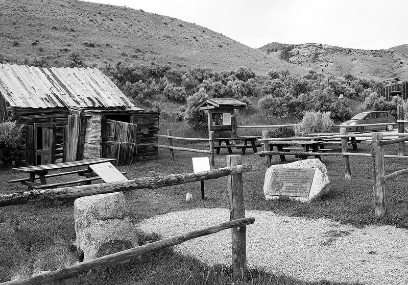
Lewis and Clark Trail 1806. First Important Gold Camp 1862. Scene of Vigilante Activities 1863. First Capital Territory of Montana 1864-1865. First County Seat of Beaverhead County 1864-1881. In grateful memory of the early pioneers who founded our . . . — — Map (db m145711) HM
Built in 1902, this building was the second location of the Dillon Implement Company, a company that was founded in August of 1886. The first location was north of the Union Pacific Depot on Montana St. The second building was constructed from stone . . . — — Map (db m180752) HM
The Andrus Hotel was built to be a first-class establishment to serve the City of Dillon and to accommodate train travelers in the ares. Jesse M. Warren, a well known Butte Architect, designed the building for construction. Dar Hardware of Dillon . . . — — Map (db m209430) HM
Building contractor Ernest Adler constructed these attached, flat roofed storefronts between 1914 and 1920. A German immigrant, Adler was one of Hardin’s most prolific builders. Situated on the edge of the business district, the one-story brick . . . — — Map (db m189252) HM
Long before fur trappers entered the Bighorn Valley, Crows, Sioux, and Cheyennes vied for the area’s abundant game. In 1876, Sioux and Cheyenne warriors defeated the U.S. Army at the Battle of the Little Bighorn; the following year, the Army . . . — — Map (db m189333) HM
German immigrant Anton Becker had great faith in Hardin’s future. Becker bought this lot on May 30, 1907, the day town lots went on sale. He soon constructed a two-story brick building, in front of which he installed Hardin’s first cement sidewalk. . . . — — Map (db m189367) HM
The elaborate corbelling on the front façade and the parapet above the transom evoke the glory days of this building, which long provided recreation for Hardin residents. German immigrant Anton Becker, owner of the hotel next door, constructed the . . . — — Map (db m189365) HM
Montana created twenty-six counties during its 1910 county-splitting craze. Among them was Big Horn County, carved from portions of Yellowstone and Rosebud Counties in 1913. Private entrepreneurs constructed the new county’s first courthouses. In . . . — — Map (db m189332) HM
Charles and Rushann Schneider built this two-story brick business block in 1910. Anticipating the arrival of electricity by four years, the Schneiders had their building wired during its construction. The exterior’s relative simplicity reflects the . . . — — Map (db m189363) HM
On May 4, 1917, Hardin celebrated the “formal opening of the Gay block . . . with a grand ball in the south store room of this magnificent structure.” The storage area’s hardwood floor was perfect for dancing, and construction of the two-story brick . . . — — Map (db m189361) HM
Once upon a time, railroads ruled Montana's transportation landscape. When the first railroad reached Montana in 1881, it began a process where, by 1916, over 5,200 miles of steel track criss-crossed the state. The railroad transformed some . . . — — Map (db m189446) HM
Its Beginning
Significant production of gold-rich pyrite ores in the Radersburg District of the Elkhorn Mountains during the 1870s eventually lento the construction of the Toston Smelter in 1885. The Toston Smelter Company - incorporated in . . . — — Map (db m188778) HM
J. P. Kearns came to Townsend from Benton, Wisconsin, in 1899. Business-educated and experienced, Kearns astutely recognized the town’s need for a new financial institution and founded the State Bank of Townsend only three months later. The bank was . . . — — Map (db m141732) HM
A coal-mining town established in 1905, Bearcreek developed quickly, and after just one year the town boasted telephones, city water, and electric streetlights. Bert Vaill, a cashier with the Carbon County Bank of Red Lodge, purchased this lot from . . . — — Map (db m190148) HM
About sixty million years ago, this area was part of a vast subtropical coastal plain with major rivers flowing eastward into an inland seaway. Between these major river systems great thicknesses of plant material accumulated that was converted to . . . — — Map (db m190146) HM
known as the Pillsbury House
Built 1907
has been placed on the
National Register
Of Historic Places
by the United States
Department of the Interior — — Map (db m167009) HM
Norwegian-born immigrant John Gibson arrived in the Clarks Fork Valley at the turn of the twentieth century and soon opened brickyards in Fromberg and nearby Belfry. Gibson became one of the area’s most prominent contractors, constructing Fromberg’s . . . — — Map (db m166882) HM
Jewish merchant Samuel Greenblatt moved to Fromberg from Gebo in 1900. An immigrant from Russia, Greenblatt built the town’s first commercial building. Two years later he married Jennie Hetch of Chicago at Temple Emanu-El in Helena. Greenblatt built . . . — — Map (db m166929) HM
The Bank of Joliet opened in 1904 and began planning construction of this stately one-story building soon after. By the time the $8,000 building was completed in 1907, the bank had new owners and a new name. Built on Joliet’s most visible corner, . . . — — Map (db m190745) HM
Local physician Dr. Samuel Souders owned this commercial lot in 1909 when Dan Davis, an advocate for the construction of a fancy opera house, proposed it for the construction of his vision. The newspapers reported weekly for several months on Davis’ . . . — — Map (db m45384) HM
A combination moving picture theater and boarding house were the original tenants of this two-story masonry building, completed in 1908. Several directors managed the rather short-lived Alcazar, including Steve Roman, whose family long monopolized . . . — — Map (db m45387) HM
Forty-five guests enjoyed a sumptuous dinner and housewarming at the home of John and Alphia Chapman on November 12, 1903. Begun in 1902, completion of the residence was delayed when contractor Walter S. Smith suffered a serious fall from the porch . . . — — Map (db m190278) HM
This two-story building was under construction in 1907, and for a short time housed part-owner Charles Antilla’s dry goods store. In 1912, new owners Ed Ricketts and C. V. Lucas located their Okay Meat Market, later the Red Lodge Meat Market, on the . . . — — Map (db m45388) HM
A natural springs and pond provided ice and water for a brewery established here in the early 1890s. In 1894, arson destroyed the ice house and brewery buildings, but a small, one-room log residence escaped the blaze. Dan Davis purchased the . . . — — Map (db m190562) HM
Photographer Mark E. Hawkes and his son Charley built a photography studio at this location where much of Red Lodge’s history was documented in pictures. Charley later struck out for Great Falls, and son Harry joined Mark. Hawkes & Son sold the . . . — — Map (db m45405) HM
In the 1920s Italian shoemaker Ludovico Iarussi (later changed to Jarussi) owned this property containing his shop and several frame commercial buildings. In 1929 Iarussi razed the older shops and constructed the present building. Financially . . . — — Map (db m45409) HM
Early Red Lodge businessmen James Blackburn and Dominic Marino jointly built this fine two-story commercial building circa 1905 to house a mercantile business. A series of saloons later occupied the ground floor. An upstairs boarding house, first . . . — — Map (db m190220) HM
These two turn-of-the-twentieth-century wood-frame commercial buildings with a tiny shop sandwiched in between today share one façade. In 1900, Biagio Sconfienza opened a bakery in the one-story building. In 1903, as the business prospered, Biagio . . . — — Map (db m190225) HM
German-born Victor and Otto Neithammer first established their meat market on North Broadway in 1912, raising their own livestock to supply this and other local family-run stores. Because the Neithammers' employees represented many ethnic groups, . . . — — Map (db m45415) HM
One of nine remaining homes on Nutting Row, this foursquare cottage features a hip-roofed main block with ornate dormers with shingles in an imbricate pattern. The design and plan of this 1907 home reflects William B. Nutting’s role in the . . . — — Map (db m190448) HM
Designed by Red Lodge carpenter and amateur architect Frank A. Sell and built by W. T. Pernham in 1902, this impressive brick commercial building was home to the Red Lodge Picket and, after 1918, the Picket-Journal, the primary news . . . — — Map (db m45416) HM
High transom windows that provide interior light for a mezzanine commercial display area are an interesting design feature of this well-constructed commercial building. The simple chain-patterned ornamentation of buff brick across the tall parapet . . . — — Map (db m45419) HM
Coal was discovered in the Rock Creek Valley nearly two decades before Red Lodge was established as a mail stop on the Meeteese Trail in 1884. In 1887, the Rocky Fork Coal Company opened the first large-scale mine at Red Lodge sparking the . . . — — Map (db m45250) HM
Pure Rock Creek water and a ready market of thirsty coal miners struck Bozeman beer baron Julius Lehrkind as a recipe for success. With nephews Fred and Paul, Julius incorporated the Red Lodge Brewing Company in 1910, hiring the prominent . . . — — Map (db m190564) HM
Rapid growth of the young town of Red Lodge coincided with the arrival of the Northern Pacific Railroad’s branch line in 1889. The area became Montana’s leading coal mining region. Town lots were platted by the secretary of the Rocky Fork Town and . . . — — Map (db m45386) HM
Real estate speculation abounded after the Northern Pacific Railroad constructed a branch line to Red Lodge to take advantage of the area's rich coal deposits. In 1891 Nathan Smethurst purchased this lot for $36, selling it for a profit the same . . . — — Map (db m190249) HM
Originally intended as a meeting hall with storefront space, tenants Byton Down and Robert Pryde redesigned the building’s ground floor before its completion for use as a theater. When the Iris opened in 1925, residents viewed it as welcome . . . — — Map (db m45410) HM
A keen sense of the town’s future prompted businessman William Talmage to move his hardware business away from the busy commercial center a few blocks south to this building in 1894. When other businesses began to move to the newly platted main . . . — — Map (db m45420) HM
This fine example of masonry architecture, with its unusually preserved storefront and recessed entry, appears almost as it did in 1900 when Walter Hall opened his first-floor grocery. Sandstone banding, corbelled arches, and original stained glass . . . — — Map (db m190221) HM
In 1934, at the height of the Great Depression, fire destroyed four Main Street buildings, including the First National Bank. When the economy recovered, local contractor V. E. Figg designed and constructed this 1940 commercial structure. With . . . — — Map (db m164217) HM
Pennsylvania native John Castner discovered rich coal deposits along Belt Creek in 1870. Within just a few years, he and Fort Benton trader T.C. Power opened a commercial coal mine near here. The partners sold coal for use by the Great Northern . . . — — Map (db m143650) HM
Great Falls’ premier residential street, Fourth Avenue North, gained 24 new homes between 1900 and 1910. Among them was this substantial residence, constructed in 1904 for bookkeeper Edgar Newlon and his wife Anna. The home is a classic American . . . — — Map (db m143823) HM
Pictured in 1909 in the Great Falls Tribune under the headline “A Great Falls Residence,” this Queen Anne style house was hardly typical of its day. An imposing two-and-one-half-story structure, the elegant home was built in 1901 for . . . — — Map (db m143815) HM
A dramatic living room fireplace, crystal chandelier, and boxed-beam dining room ceiling are among the original fixtures continuing to decorate the interior of the Abe and Carrie Kaufman residence. Neoclassical, Craftsman, and Victorian detailing . . . — — Map (db m143816) HM
The Boston and Montana Consolidated Copper and Silver Mining Company, later acquired by the Anaconda Company, chose a treeless bluff overlooking the river to locate its smelter and refinery in 1892. Among the seventeen managers’ houses built at . . . — — Map (db m143828) HM
During the busy 1890s, Great Falls’ business district swarmed with activity. City boosters such as pioneer rancher Robert Vaughn expressed confidence in the town’s future by investing in commercial real estate. Vaughn commissioned an unknown . . . — — Map (db m143679) HM
By 1910, the Queen Anne style had lost much of its allure. Once admired, its artistic jumble of angles, textures, and colors had become reviled as cluttered and artificial. This rejection of complexity was gradual, and many houses—like this . . . — — Map (db m143856) HM
Charles E. Davis, “expert watchmaker and jeweler,” arrived in Great Falls with his wife, Grace, in 1900. With Charles’ two brothers, the couple opened a store on bustling Central Avenue, selling jewelry, watches, cut glass, gifts, and . . . — — Map (db m143805) HM
A shortage of steel and limited purchases of nonessential goods during World War II caused the automobile industry to skyrocket after the war ended. As the troops came home and the economy recovered, Montana experienced this boom as well. By the . . . — — Map (db m143772) HM
A close look at the Woolworth Building’s upper floors makes evident that it was originally two separate, but closely related edifices. Connecting arches over second-story windows, a decorative metal cornice, and a crowning brick parapet distinguish . . . — — Map (db m143769) HM
An eclectic cultural landscape has long characterized the West Bank. Separated from downtown Great Falls by the broad Missouri River, the larger neighborhood has hosted a varied mix of industrial, residential, and commercial development since the . . . — — Map (db m143758) HM
An eclectic cultural landscape has long characterized the West Bank. Separated from downtown Great Falls by the broad Missouri River, the larger neighborhood has hosted a varied mix of industrial, residential, and commercial development since the . . . — — Map (db m143676) HM
Beneath the façade of this solid-looking building stands a much older wooden boarding house. In 1891, only seven years after the founding of Great Falls, a two-story dwelling stood on this lot. Mrs. S. H. Lemon ran the boarding house in 1896 and . . . — — Map (db m143770) HM
Thirty-six hundred people watched Nomads of the North at the grand opening of the Liberty Theatre in August 1921. A musical score, played on a $47,000 Wurlitzer organ, accompanied the silent film. An overflow crowd of two thousand toured the . . . — — Map (db m143756) HM
Carroll B. McCulloh and his wife Ella constructed this elegant two-story brick home in 1911, raising their two children here. Its two-and-one-half stories, simple box shape, low-hipped roof, large central dormer, wide overhanging eaves, and offset . . . — — Map (db m143855) HM
In the 1880s Murphy, Maclay and Co. sold everything from flour and fine teas to window glass and blasting powder. Edgar Maclay and John Murphy established the firm with stores in Helena and Fort Benton in 1882. Two years later they sent Worden Wren . . . — — Map (db m143754) HM
Town founders Paris Gibson and Herbert Chowen built the original Park Hotel in 1892 to serve travelers disembarking at the nearby Great Northern Depot. When the hundred-room hotel burned in a 1913 fire, Park Hotel owners hired prominent Great Falls . . . — — Map (db m143753) HM
By 1908, Montana’s agricultural boom was in full swing, and real estate agents like John Quigley, whose firm offered farms “on 20 years payments,” seemed poised to make a fortune. That year forty-eight-year-old Quigley built this large . . . — — Map (db m143807) HM
Thirty-six hundred people watched Nomads of the North at the grand opening of the Liberty Theatre in August 1921. A musical score, played on a $47,000 Wurlitzer organ, accompanied the silent film. An overflow crowd of two thousand toured the . . . — — Map (db m143757) HM
Apartment buildings were good investments in rapidly expanding communities like Great Falls, which grew from 17,000 to 26,000 between 1910 and 1920. Owners reported waiting lists for units, which ranged from rooms in old-fashioned “apartment . . . — — Map (db m143824) HM
The front canted bay window hints at the modest one-story Queen Anne style residence that lies at the core of this elegant home. In 1891, the house was one of only two on the block. A small back addition had been added by 1900, when Mandeville . . . — — Map (db m143822) HM
A grand home on a large corner lot, this Colonial Revival residence bespeaks the prominence of its first owners. Banker, rancher, and state senator William Floweree and his wife, Norma, built this brick two-and-one-half-story home in 1916. Its . . . — — Map (db m143806) HM
William and Isabel Shea built this cozy one-story brick home in 1929. With its distinctive low profile, clipped-gable shingle roof, stucco siding, exposed rafter tails, and multi-pane windows, the inviting residence is a classic Craftsman style . . . — — Map (db m143670) HM
Rich veins of silver were mined in the Historic Neihart Mining District for a fifty-year period beginning in July 1881. Remnants of the first claim, the Queen of the Hills mine, are located just a few hundred yards north of where you are standing. . . . — — Map (db m128300) HM
The ore-extraction process also carries the legacy of pollution. In particular, tailings are leftovers from crushing and chemically treating ore to extract valuable metals such as silver. This fine-grained material, which has been found in isolated . . . — — Map (db m128351) HM
According to legend, the town and the creek got their name from the muleskinner "Big Sandy" Lane. The creek was flooded during one of his long treks from Cow Island to Fort Benton. When "Big Sandy" fluently bewailed his bad luck in superlatives . . . — — Map (db m142531) HM
The bank was established June 1, 1880, by T. E. Collins, Charles Duer and L. H. Hershfield and Brother. It was first located in the Benton Record Building, then moved to this location in October 1881. The bank remained here until the large two-story . . . — — Map (db m142100) HM
This is a replica of the buffalo robe press that was used at Old Fort Benton. It was big and awkward, but robes were so bulky and heavy that it took equipment like this to handle them. Robes were pressed hair-side out after the four sides were . . . — — Map (db m142212) HM
I.G. Baker and T. C. Power built the original Thwing House in 1868. Under the watchful eye of Mrs. Thwing, this “downtown” hotel competed with the Overland. The hotel closed in 1870 and was rented as military officers’ quarters. It . . . — — Map (db m142134) HM
Solomon's Medicine Lodge Saloon was remodeled in 1875 and became the Centennial Hotel. This frame building was moved to the back of the lot by Robert S. and Lydian Smith Culbertson for living quarters, while a new two-story brick hotel was built . . . — — Map (db m142303) HM
Originally this site was occupied by a wooden frame building that housed Mose Solomon’s Medicine Lodge. This legendary saloon was open twenty-four hours a day from spring thaw to first snow. When the building burned, prominent lawyer, customs . . . — — Map (db m161662) HM
Fort Benton’s building boom of 1887-1884 saw the construction of many commercial buildings made of locally produced soft brick. This fine example was built in 1881 as a saddlery by Davidson and Moffitt of Helena. The River Press Company, publisher . . . — — Map (db m142064) HM
Founded in 1846 as a fur post, Fort Benton is the oldest continuously inhabited settlement in Montana. From its palisaded walls grew the most important transportation center in the Northwest. Trails led to all points of the compass, carrying goods . . . — — Map (db m141987) HM
The Fort Benton to Fort MacLeod or "Whoop-up" Trail into Canada was the main artery of commerce in the 1869-1883 era. Twenty yoke of oxen was a team and each team hauled three of the heavy freight wagons loaded with trade goods, calico and whiskey. . . . — — Map (db m142216) HM
The Fort Benton Engine House, built in 1883, and the Grand Union Hotel are two of only a few structures remaining to remind us of the rapid expansion here during the flourishing steamboat days. When Fort Benton incorporated in 1883, a volunteer fire . . . — — Map (db m142417) HM
Founded in 1846 as the fur trade transitioned fro furs to buffalo robes, Fort Benton was both a trading post and a center for distribution of Indian annuities. In the early 1860s, Montana's gold rush and the initiation of steamboat traffic made the . . . — — Map (db m142173) HM
On June 14, 1869 nine sternwheelers moored along this bank, unloading whiskey, gold pans, salt, bacon, boot and miners. Ox teams hauled the freight to faraway points. Wells Fargo coaches took miners to Helena for $25, fights with the Blackfoot were . . . — — Map (db m142060) HM
Joseph LaBarge docked the Emilie on June 17, 1862, three days ahead of the American Fur Company boats. His Emilie was the first side-wheeler at Fort Benton. LaBarge unloaded six hundred tons of freight with is partner James Harkness. . . . — — Map (db m161587) HM
As you look across the Missouri, on the third bottom were two fur posts within several hundred yards of one another. Fort Cotton, built in 8142 by the Union Fur Company, existed only two years before it was abandoned. Fort Lewis was built by . . . — — Map (db m142017) HM
Opened to the public Nov. 1, 1882 the Grand Union Hotel was Fort Benton's pride, a haven of relaxation in a boisterous frontier town at the head of navigation on the Missouri. Total cost of the finest hostelry between Seattle and the Twin Cities . . . — — Map (db m142061) HM
This grandiose, three-story Italianate style hotel welcomed weary river travelers to the Gateway of the Northwest, offering guests a luxurious refuge before setting out for less civilized destinations. Its opening in 1882 came at the end of the . . . — — Map (db m142062) HM
This structure opened in 1882 during Fort Benton’s "glory days" as Montana’s largest hardware store. T. C. Power and Hans Wackerlin operated the business. Wackerlin, a tinsmith, had come to Fort Benton in 1867 aboard the steam boat Richmond, which . . . — — Map (db m142136) HM
Stores, warehouses and homes belonging to Montana's greatest trading company were along this side street. Founded in 1866, I.G. Baker Co.'s freight wagons cut deep trails into western history. From northern Canada along routes in all directions, the . . . — — Map (db m142292) HM
From the 1850s to 1887, Fort Benton was the trade center for this region of the American and Canadian West. Like others who chose to stay when the fur trade declined, I.G. Baker (last American Fur Company factor at the fort) turned to new endeavors. . . . — — Map (db m142133) HM
The original portion of this house, one of the oldest in Montana, was built for I.G. Baker in 1867. Early-day Fort Benton merchant Baker wanted a home, rather than the old fort for the birth of his expected child.
Constructed of rough-sawn . . . — — Map (db m142290) HM
Members of Masonic Lodge #25 built this brick structure in 1882, housing their temple on the second floor. Grocer W. H. Burgess rented first floor space. Economic decline in the late 1880s caused the Masons to lose title, and Burgess, too, went . . . — — Map (db m142103) HM
Originally built to house the Stockmen’s National Bank, this solid structure represents typical pre-1900s commercial architecture. Its 1890 construction is significant as one of the few buildings erected after Fort Benton’s heyday and before . . . — — Map (db m142102) HM
Logs were floated downstream from Fort Lewis in May of 1847 and erected on foundations built the year before. The fort was called Fort Lewis or Fort Clay before officially named for Senator Thomas Hart Benton of Missouri upon completion of the . . . — — Map (db m142210) HM
In 1864, Mills and Douglas operated a restaurant and hotel on this corner. Mills and Robert S. Culbertson went into partnership in 1877, opening a new establishment called the Centennial Hotel in celebration of the United States' 100th birthday. . . . — — Map (db m142104) HM
Stages operated from Fort Benton in many directions well into the 20th century. The first routes connected the gold camps of Helena and Virginia City with the river port. In 1866 C.C. Huntley established the route, but was soon bought out by Wells . . . — — Map (db m161659) HM
Originally built to house the Stockmen’s National Bank, this solid structure represents typical pre-1900s commercial architecture. Its 1890 construction is significant as one of the few buildings erected after Fort Benton’s heyday and before . . . — — Map (db m142101) HM
Across the street stood the first two stores of the T.C. Power Company, the third became the Pioneer Lodge. T.C. Power stepped off the Yorktown about this spot on June 14, 1867 with a tiny stock of merchandise bought "on jawbone," but with . . . — — Map (db m142248) HM
In 1867, merchant T. C. Power, destined to become one of the state’s wealthiest and most influential men, brought his first wagonload of goods to Fort Benton, where he set up shop in a borrowed tent. Still in business in 1916, Power constructed a . . . — — Map (db m142137) HM
T. C. Power and Bro. was founded in 1868 at approximately this location. Initially housed in a wooden building, the store was moved in 1879 to a large brick structure across the street. When the firm expanded, a hardware store was built next door . . . — — Map (db m142135) HM
Originally a pretentious two-story frame hotel familiar to all rivermen, the Choteau House was built in the spring of 1868. T.C. Power and I.G. Baker constructed the building between their businesses to rival Overland up the street.
At . . . — — Map (db m142289) HM
Back from the levee that was cluttered with their freight and warehouses stood the uptown merchant's establishments. Carroll and Steell founded the first mercantile in 1864. Murphy, Neil and Co., Kleinschmidt Bros. and W.S. Wetzel built here as well . . . — — Map (db m161658) HM
The Lewis and Clark Expedition camped at the mouth of the river just east of here June 3, 1805. The Piegan people called it "The River that Scolds at all Others," but Lewis named it Maria's River in honor of his cousin, Miss Maria Wood (over time . . . — — Map (db m142488) HM
The railroad grade you see before you was the St. Paul, Minneapolis and Manitoba Railroad, the precursor of the Great Northern Railway. In 1887, nearly 9,000 men constructed 550 miles of track across Montana's northern Great Plains between Minot and . . . — — Map (db m142486) HM
Homesteaders, travelers, and railroad crews helped the tiny town of Virgelle thrive during the 1910s. Town founder Virgil Blankenbaker chartered the Virgelle State Bank in 1917 where he, his brother-in-law John G. Chancellor, C. J. McNamara, and . . . — — Map (db m161664) HM
583 entries matched your criteria. The first 100 are listed above. Next 100 ⊳