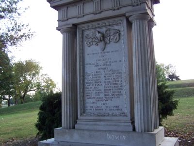
The residents of the Twenty First Ward as a lasting expression of their gratitude and affection have placed this tablet as a testimonial to the young men of this community, who in a spirit of unselfish patriotism answered their country’s call in the . . . — — Map (db m41354) HM
This land was part of a 2,568-acre tract named Georgia Plantation, that Charles Carroll purchased in 1732. By 1760, his son Charles Carroll, a lawyer, had constructed a Georgian summer home, Mount Clare. the Carroll family lived here until . . . — — Map (db m2537) HM
Baltimore’s Park Commission purchased portions of the Mount Clare estate between 1890 and 1907 to provide a large landscaped park for the city’s southwestern neighborhoods. The Olmsted Brothers firm helped the city develop plans to protect the . . . — — Map (db m41430) HM
Native Americans once traversed this stream where nearby at Gwynns Run in 1669, Richard Gwinn, the stream’s namesake, established a trading post. Next to the trail today is the nine-hole executive Carroll Park Golf Course, one of the five operated . . . — — Map (db m41426) HM
For more than one hundred years Carroll Park has served the historic Washington Village/Pigtown neighborhood, whose rowhouses once provided lodging for workers employed at the B&O Railroad, streetcar maintenance barns across the street (now used . . . — — Map (db m220061) HM
Carroll Park Golf Course, a city-owned course, was purchased in 1923 for White golfers only. A group of avid African American golfers challenged the city for access through several legal actions. After much persistence, these golfers gained full . . . — — Map (db m220066) HM
The trees of Carroll Park are a treasured legacy. In 1888 The Baltimore Park Commission purchased the first 20 acres surrounding Mount Claire Mansion for Carroll Park and began planting trees "in great numbers." By 1900 the park was 64 acres and . . . — — Map (db m220063) HM
This outstanding Georgian mansion, built between 1754 and 1768, was the home of Charles Carroll, Barrister and framer of Maryland’s first Constitution and Declaration of Rights. Carroll and his wife Margaret Tilghman made Mount Clare a center of . . . — — Map (db m3152) HM
1754–1914.
This oldest colonial structure of Baltimore was built in 1754 upon the estate known as “Georgia Plantation”
by
Charles Carroll, Barrister
1723–1783
One of the foremost patriots of . . . — — Map (db m41351) HM
In the late 1760’s, the Mount Clare mansion was built by Charles Carroll, Barrister and his wife, Margaret Tilghman, as their summer home. The mansion was located on the grounds of the original plantation, Georgia, and included an orangery, . . . — — Map (db m2533) HM
The Susquehannock and Algonquian Indians had long traveled through this area when Captain John Smith explored and mapped the Chesapeake Bay region in 1608. As the Susquehannocks went from Pennsylvania to the bay, they crossed the Gwynns Falls . . . — — Map (db m6390) HM
After centuries of abuse, the Gwynns Falls is being restored as a healthy stream. Government, civic groups, and scientists monitor water quality here and work together to implement restoration projects. Volunteers pick up trash, plant trees and . . . — — Map (db m6389) HM
Metropolitan Baltimore is a human-dominated ecological system. The Baltimore Ecosystem Study (BES), part of the National Science Foundation's Long-Term Ecological Research Network, conducts research to understand how this system changes over . . . — — Map (db m220064)
The Gwynns Falls Trail at Middle Branch Park is a splendid place to do some birdwatching, learn to row, try your luck fishing, and relax while enjoying views of the city’s skyline and harbor activities. To the north, under I-95, the Gwynns Falls . . . — — Map (db m65304) HM
1001 Light St Baltimore played a significant role in the abolitionist movement, particularly during the mid-19th century. The building, which was located in the heart of downtown Baltimore, became a hub for anti-slavery activism, as well as a key . . . — — Map (db m240364) HM
This property is listed on the National Register [of Historic Places]
as part of
Federal Hill
National Historic District
and is registered with the
Preservation Society
c. 1800 — — Map (db m189931) HM
This property is listed on the National Register [of Historic Places]
as part of
Federal Hill
National Historic District
and is registered with the
Preservation Society
c. 1840-41 — — Map (db m189930) HM
This property is listed on the National Register [of Historic Places]
as part of
Federal Hill
National Historic District
and is registered with the
Preservation Society
1840 — — Map (db m189929) HM
This property is listed on the National Register [of Historic Places]
as part of
Federal Hill
National Historic District
and is registered with the
Preservation Society
1896 — — Map (db m189932) HM
This property is listed on the National Register [of Historic Places]
as part of
Federal Hill
National Historic District
and is registered with the
Preservation Society
c. 1845 — — Map (db m189927) HM
This property is listed on the National Register [of Historic Places]
as part of
Federal Hill
National Historic District
and is registered with the
Preservation Society
1855 — — Map (db m189926) HM
This property is listed on the National Register [of Historic Places]
as part of
Federal Hill
National Historic District
and is registered with the
Preservation Society
c. 1870 — — Map (db m189877) HM
This property is listed on the National Register [of Historic Places]
as part of
Federal Hill
National Historic District
and is registered with the
Preservation Society
1825 — — Map (db m189933) HM
This property is listed on the National Register [of Historic Places]
as part of
Federal Hill
National Historic District
and is registered with the
Preservation Society
1796 — — Map (db m189934) HM
This property is listed on the National Register [of Historic Places]
as part of
Federal Hill
National Historic District
and is registered with the
Preservation Society
1850 — — Map (db m189874) HM
This property is listed on the National Register [of Historic Places]
as part of
Federal Hill
National Historic District
and is registered with the
Preservation Society
c. 1820 — — Map (db m189936) HM
This property is listed on the National Register [of Historic Places]
as part of
Federal Hill
National Historic District
and is registered with the
Preservation Society
c. 1860 — — Map (db m189869) HM
This property is listed on the National Register [of Historic Places]
as part of
Federal Hill
National Historic District
and is registered with the
Preservation Society
c. 1860 — — Map (db m189867) HM
This property is listed on the National Register [of Historic Places]
as part of
Federal Hill
National Historic District
and is registered with the
Preservation Society
1872 — — Map (db m189935) HM
This property is listed on the National Register [of Historic Places]
as part of
Federal Hill
National Historic District
and is registered with the
Preservation Society
1850 — — Map (db m145576) HM
This property is listed on the National Register [of Historic Places]
as part of
Federal Hill
National Historic District
and is registered with the
Preservation Society
c. 1850 — — Map (db m192387) HM
This property is listed on the National Register [of Historic Places]
as part of
Federal Hill
National Historic District
and is registered with the
Preservation Society
c. 1850 — — Map (db m189925) HM
This property is listed on the National Register [of Historic Places]
as part of
Federal Hill
National Historic District
and is registered with the
Preservation Society
1857 — — Map (db m189937) HM
This property is listed on the National Register [of Historic Places]
as part of
Federal Hill
National Historic District
and is registered with the
Preservation Society
circa 1840 — — Map (db m189870) HM
This property is listed on the National Register [of Historic Places]
as part of
Federal Hill
National Historic District
and is registered with the
Preservation Society — — Map (db m240365) HM
This property is listed on the National Register [of Historic Places]
as part of
Federal Hill
National Historic District
and is registered with the
Preservation Society — — Map (db m189872) HM
This monument is erected in honor of the gallant defender of Fort McHenry near this city during its bombardment by the British Fleet on the 13th and 14th September 1814. He died universally esteemed and regretted on the 25th of April 1818 in the . . . — — Map (db m80930) HM
This church is part of the African Methodist Episcopal congregation, the oldest independent black institution in the country. The origins of the A.M.E. church date back to the late 18th century, when blacks withdrew from the parent Methodist . . . — — Map (db m128640) HM
Since the founding of Baltimore, 1729, this hill has been a popular point for viewing the city’s growth. Here 4,000 people feasted 1780, to celebrate the ratification by Maryland of the Federal Constitution and in honor of the new government gave . . . — — Map (db m2555) HM
On the evening of May 13, 1861, U.S. General Benjamin E. Butler’s troops occupied Federal Hill and brought their guns to bear on Baltimore. For the next four years the hill, garrisoned by 10 different regiments, served as a strategic Union strong . . . — — Map (db m2560) HM
In memory of the Grand Army of the Republic by the Daughters of the Union Veterans of the Civil War, 1861-1865.
Mother Sperling Tent No. 1, April 23, 1933.
[rear of marker] [Engraving of a 13-star flag] Our fathers saved.
[text on . . . — — Map (db m66592) HM
Under his command the attack of the British upon Baltimore by land and sea Sept. 12-14, 1814 was repulsed. Member of Congress forty successive years, president U.S. Senate, Secretary of the Navy, Mayor of Baltimore.
Hero of both wars for . . . — — Map (db m2557) HM
In July 1846, a battered and storm-tossed hulk, the William Penn, was moored at the pier at Light Street wharf across from what is now the McCormick building. A ship chandler, a rigger and other local merchants with interests in the . . . — — Map (db m7076) HM
The Salvation Army-“While women weep, as they do now, I’ll fight. While men go to prison, in and out, in and out, as they do now, I’ll fight. While there is a drunkard left, while there remains one dark soul, without the light of God, I’ll . . . — — Map (db m62434) HM
In joyful recognition of LeRoy E. Hoffberger's unique role as co-founder with Rebecca Hoffberger of the American Visionary Art Museum, and for his lifelong extraordinary and passionate leadership as both humanitarian and cultural philanthropist, . . . — — Map (db m202979) HM
This property is listed on the National Register [of Historic Places]
as part of
Federal Hill
National Historic District
and is registered with the
Preservation Society
c. 1840-41 — — Map (db m189875) HM
Memorials closely reflect the attitudes and ideals of the people who placed them, more than the historic events they were designed to commemorate. The original grove of Japanese Cherry Trees before you was planted in 1931, the same year "The Star . . . — — Map (db m180364) HM
In honor to the abiding memory of The father of the Argentine Navy Admiral Guillermo Brown On the banks of the Delaware where he started his maritime career. "Brave in combat, magnanimous in victory and audacious in his decisions"
Born in 1777 in . . . — — Map (db m6158) HM
Jake Owens was a sports enthusiast, who fell in love with skateboarding when he saw his first X-Games at the age of three. Since then, he was determined to learn how to skateboard and took to the streets of South Baltimore to master the sport . . . — — Map (db m234767) HM
On May 14, 1986, the Pride of Baltimore, her captain, and three members of her crew were lost at sea.
The Pride now rests at the end of a goodwill journey that covered 150,000 miles and touched 125 cities around the world. . . . — — Map (db m20484) HM
Private Armed Schooner of Baltimore Mich Moon Com. Making her Escape from an 18 Gun Brig. after Receiving the Broad Sides off Lanzorote 21th September 1812. — — Map (db m234769) HM
Pivot guns were located at the bow and stern of the ship. These versatile weapons were mounted on sliding carriages rolled on bronze track laid in the deck which allowed the guns to cover a 360° range and provide a fire across the ship's path . . . — — Map (db m219678) HM
The quarterdeck is the area of the ship around the helm. At sea, the officer-of-the-deck would have managed the sailing of the ship from this area. The quartermasters were senior enlisted sailors who were responsible for keeping the ship . . . — — Map (db m219676) HM
Victor was the first president of the Locust Point Civic Association.
Shirley initiated the Annual Locust Point Community Festival.
Together they worked for 5 years to have the final section of I-95 changed, from the proposed bridge . . . — — Map (db m145538) HM
Established as a port of entry in 1706, this peninsula was originally known as Whetstone Point. Along this road in 1814, soldiers marched to the defense of Fort McHenry, nearby. Port facilities served as a Federal supply camp in the Civil War. Later . . . — — Map (db m2561) HM
Dedicted to those men and women of the Armed Forces of the United States who, in serving their country during times of conflict have suffered the scars of battle. Donated on behalf of the entire community of South Baltimore and Locust Point by the . . . — — Map (db m34895) HM
You are standing less than a mile away from Ft. McHenry, where the citizens of Baltimore valiantly defended our freedom back in 1814, inspiring Francis Scott Key to write "The Star-Spangled Banner." To this day, that anthem is played before every . . . — — Map (db m145532) HM
While seemingly toy-like, the sculpture neither moves nor did it ever function. It was designed to integrate 90 tons of obsolete machinery from Baltimore's industries, highlighting their many interconnections. All the components were donated to . . . — — Map (db m131183) HM
Of the 60 soldiers in Captain Frederick Evans' company, U.S. Corps of Artillery, 16 soldiers occupied this room, sleeping four to a bunk. To enhance an esprit de corps, the color yellow, signifying the artillery service, was used on the . . . — — Map (db m34890) HM
British ships launched an attack on Fort McHenry early on September 13, 1814. The fort defended the water approach to the city of Baltimore. The future of the city and possibly the United States depended on the outcome. After the American defeat . . . — — Map (db m61551) HM
The Francis Scott Key Tablet above was dedicated as part of the National Star Spangled Banner Centennial celebration in 1914. Designed by Hans Schuler, the bronze shield depicts and American flag and myrtle (symbolic of love and immortality) . . . — — Map (db m244391) HM
"… if there should be an uprising in Baltimore, I shall be compelled to try to put it down; and that gun is the first that I shall fire."
Major General John Dix, U.S. Army, 1861
Two soldiers have finished guard duty and should be cleaning their weapons. Instead, they talk to a servant, enslaved to one of the militia officers. A sergeant overhears their conversation and prepares to rebuke them for talking instead of . . . — — Map (db m145543) HM
To
Col. George Armistead,
April 10, 1779 – April 25, 1818,
commander of this fort
during the bombardment
by the British Fleet,
Sept. 13-14 1814. War of 1812.
Erected Spet. 12, 1914
by the City of Baltimore,
Soc. War of 1812 . . . — — Map (db m2595) HM WM
"Not a man shrunk from conflict" -Major George Armistead, Commander Fort McHenry September 1814
The defenders who manned the heavy cannons in front of you represented a unique combination of soldiers and sailors. One unit, the U.S. Sea . . . — — Map (db m194429) HM WM
Before 1821 immigrants from the German States, England, Ireland, Northern Ireland, Scotland, France, Haiti, as well as African slave arrived in Baltimore in relatively small numbers, fewer than 1,000 per year on average.
From 1821 to . . . — — Map (db m131173) HM
This crane was a fixture on Pier 3 of Bethlehem Steel's Key Highway Shipyard facility. It was one of three identical cranes used to repair war-damaged ships during World War II. The Bethlehem Steel Corporation acquired the Baltimore Dry Dock . . . — — Map (db m131177) HM
This 100-foot-high whirley crane—so called because its cab rotated a full 360 degrees—was one of many similar machines once located at Bethlehem Steel's Fairfield shipyard near Curtis Bay. The crane helped build nearly 500 Liberty and Victory . . . — — Map (db m189940) HM
The arched chambers on either side of the sally port are identical bomb shelters for the fort's soldiers. They were built immediately after the bombardment of 1814, when it became obvious that such places were needed. Fortunately, Fort McHenry . . . — — Map (db m12246) HM
Fired by the British Naval Forces during the bombardment of this fort Sept. 13-14, 1814 when by the light of “Bombs bursting in air” the National Anthem – The Star Spangled Banner had its birth. — — Map (db m10882) HM
"This tree dedicated to Captain Francis Hancock, whose command discovered the attempt of 1200 British Marines to surprise Fort McHenry from the rear and revealed their boats to adjacent batteries by lighting fires on the opposite shore resulting in . . . — — Map (db m145565) HM WM
Fort McHenry was surrounded by water, but none of it was fit to drink. In the early years, soldiers rowed into Baltimore to fill casks with fresh well water. They also collected rainwater from the barracks' roofs in a cistern located in this . . . — — Map (db m66631) HM
Fort McHenry has had several guardhouses. This one, built in 1835 and enlarged in 1857, is one of the best preserved buildings in the star fort. Soldiers on duty in this room guarded military offenders in the adjacent cells.
During the Civil . . . — — Map (db m244388) HM
Larger cannon -- and more cannon -- came to Fort McHenry during the Civil War period. To provide safe storage for the additional gunpowder and ammunition, the Army built this magazine in 1864.
From the inside it doesn't look especially . . . — — Map (db m194437) HM
"This tree dedicated to Colonel Benjamin Fowler, who commanded the 39th Maryland Regiment at the Battle of North Point, September 12th, 1814." — — Map (db m145568) HM
"This tree dedicated to Colonel James McHenry Secretary of War under Presidents Washington and John Adams and for whom Fort McHenry was named in 1798 when it was offered to the Federal Government." — — Map (db m145548) HM
"This tree dedicated to Colonel William M. McDonald who commanded the 6th Maryland Regiment at the Battle of North Point, September 12th, 1814." — — Map (db m145573) HM WM
The rooms on the left end of this building stood as a separate structure during the 1814 period. This was the residence of Major George Armistead, commanding officer and “Hero of Fort McHenry.”
It was Armistead who directed the successful . . . — — Map (db m244393) HM
About 2:00 p.m. on September 13, 1814, gunners of the Maryland Militia under Captain J.H. Nicholson were waiting out the British bombardment behind this parapet. It was futile to return fire because their 21 pounder gun did not have the range to . . . — — Map (db m34591) HM
Two men died on this ground. During the afternoon of the bombardment the men on this bastion felt helpless. The mortars on the British bomb ships could fire their 200-pound shells two miles (half way to the modern bridge) while the fort's cannons . . . — — Map (db m145544) HM
You are standing in the most vulnerable point of Fort McHenry, and potentially the most deadly. The main entrance was the weakest part of the fort's walls. Fearing a British land attack, the defenders built the Ravelin (the structure to your . . . — — Map (db m194412) HM
After the Battle of Baltimore in 1814, Fort McHenry continued as a military post for more than a hundred years. The U.S. Army constructed buildings outside the star fort and modified existing structures to serve the needs of the time.
During . . . — — Map (db m10881) HM
Funds for developing new weapons decreased after the Civil War, forcing the Army to upgrade the cannon they already had.
These three 19-inch Rodman gun tubes were probably made during the 1870’s, but their carriages are improved versions . . . — — Map (db m2637) HM
1776
Whetstone Point shore battery
1794
Star Fort begun.
Later named for Washington’s Secretary of War
1795
Reservation partly acquired by the United States
1814
Gallant defence during British bombardment inspired the . . . — — Map (db m2569) HM
As a guardian of Baltimore’s harbor, Fort McHenry is the site of the sucessful defense of the city by American Forces during the British attack on September 13–14, 1814 which inspired Francis Scott Key to write “The Star-Spangled . . . — — Map (db m2568) HM
This tree dedicated to Francis Scott Key who was inspired to write our National Anthem — The Star Spangled Banner — by the flag which flew from Fort McHenry during its bombardment. — — Map (db m145550) HM
The successful defense of Baltimore from British attack has been remembered and commemorated every year since 1814.
The Society of the War of 1812 maintains the legacy of remembrance. This society traces its origin to Fort McHenry. On . . . — — Map (db m145540) HM
The Governor R.M. McLane was built for the Maryland State Police Oyster Navy and named after Robert Milligan McLane, Governor of Maryland from January 1884 to March 1885. The Oyster Navy was formed in 1867 in order to enforce fishery laws . . . — — Map (db m131181) HM
The bombardment has ended; the battle is over. As the rain clouds pass and the rays of the sun shine on the fort, the garrison, tired and relieved, stands upon the parade ground. All eyes stare at the large 30 x 42-foot American flag. Carefully . . . — — Map (db m194629) HM
This elegantly designed cupola sat atop the William Knabe and Company piano factory in 1869 off South Eutaw Street, near present day Oriole Park at Camden Yards. The original building and cupola is an example of 19th century decorative industrial . . . — — Map (db m131182) HM
"This tree dedicated to Lieutenant H.S. Newcomb, of Barney's Flotilla, who commanded Fort Covington, water front battery supplemental to Fort McHenry, September 12th, 13th, 14th, 1814." — — Map (db m145575) HM WM
"This tree dedicated to Lieutenant John A. Webster, of Barney's Flotilia, who commanded Fort Babcock, water front battery supplement to Fort McHenry, September 12th, 13th, 14th, 1814." — — Map (db m145564) HM WM
"This tree dedicated to Lieutenant John Frazier of Barney's Flotilla, who commanded the Lazarretto, a water front battery supplemental to Fort McHenry, September 12th, 13th, 14th, 1814." — — Map (db m145552) HM WM
"This tree dedicated to Lieutenant S. Rutter of Barney's Flotilla who commanded the barges that protected the entrance to the harbor as the left wing of the water battery of Fort McHenry." — — Map (db m145566) HM
Over 1.2 million European immigrants disembarked near this site, on piers six through nine, as part of the "Great Wave" immigration period from 1868 to 1914. The majority of these immigrants came on ships of the North German Lloyd Steamship . . . — — Map (db m131174) HM
When the British attacked in 1814, guns of this type – but larger – were fired from the ramparts and the water batteries near the riverbank. They kept the British warships from entering Baltimore Harbor, but they could not shoot far . . . — — Map (db m10885) HM
If you had been standing on this rampart with the American gunners on the morning of September 14, 1814, you would have had a close-up view of the dramatic scene Francis Scott Key described in our National Anthem.
About two miles downstream, . . . — — Map (db m244560) HM
169 entries matched your criteria. The first 100 are listed above. The final 69 ⊳