2054 entries match your criteria. The first 100 are listed. Next 100 ⊳
Ohio Historical Society / The Ohio History Connection Historical Markers
Markers of the more than 1,800 Ohio Historical Markers Program administered by the Ohio Historical Society, now called The Ohio History Connection, and formerly known as the Ohio State Archaeological and Historical Society and the Ohio Historical Marker Committee.
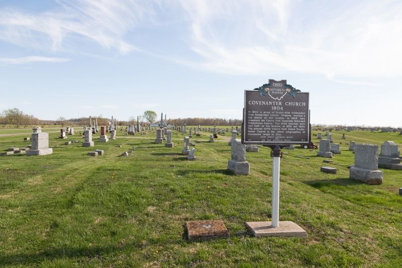
In 1804, a group of Scotch-Irish Covenanters from Rockbridge County, Virginia, erected a log church on this location. In 1805, they organized the Cherry Fork Associate Reformed Presbyterian Church. Two brick churches were also built on this . . . — — Map (db m133853) HM
Israel Donalson, member of the First Constitutional Convention of Ohio.
In May 1800, Congress passed an act building the Northwest
Territory, with the western division becoming Indiana
Territory and the eastern called the Territory of the . . . — — Map (db m136539) HM
Manchester was founded in 1791 by Nathaniel Massie as a base to
survey the land warrants of American Revolutionary War soldiers in
the Virginia Military District. This bank of the Ohio River provided
a secure site for the last civilian stockade . . . — — Map (db m136536) HM
In 1784, the state of Virginia ceded all of its Northwest Territory
to the federal government except for this tract to satisfy the
land bounties owed to its Revolutionary War soldiers. The Virginia
Military District extended from the Scioto River . . . — — Map (db m136532) HM
Massie’s Station, built in 1791, was the fourth
permanent settlement center in Ohio and the
last stockade settlement built in Ohio.
It
provided protection from the Indians
for
Manchester’s settlers until 1794.
Manchester was . . . — — Map (db m136537) HM
Platted in 1881 by Isaiah Custer on the junction of old Zane's Trace (1796-97) and the Cincinnati & Eastern Railway (1881). Incorporated 1886. Named after John G. Peebles, Portsmouth, Ohio businessman. David Nixon constructed the first house in . . . — — Map (db m223788) HM
One of North America’s most spectacular effigy mounds, Serpent Mound is a gigantic earthen sculpture representative of a snake. Built on a spur of rock overlooking Ohio Brush Creek around 1000 A.D. by the Fort Ancient culture, the earthwork was . . . — — Map (db m268239) HM
The inn was built 1800-01 by Peter Wickerham, a Revolutionary War veteran. It was used as an overnight stagecoach stop and tavern on Zane's Trace until ca. 1850. Runaway slaves were hidden here when the "Underground Railroad" was in operation. . . . — — Map (db m108129) HM
A thriving riverport in the 19th Century founded in 1835 by William Stout. Elisha Stout, son of William, born and raised here, was one of the founding fathers of Omaha, Nebraska and Denver, Colorado. Former site of Adamsville which served as the . . . — — Map (db m73138) HM
Founded 1887 by John Q. Roads on the Cincinnati & Eastern Railway (1881) and the Old West Union Road (1807). Incorporated 1911. Named after Franklin Seaman who donated land to the railroad for a station. Home of Will Rogers, "The Black King of the . . . — — Map (db m108200) HM
The Bradford Tavern, West Union’s first inn built circa 1804,
served the Maysville-Zanesville stagecoach route and such travelers as Andrew
Jackson, Henry Clay, and Santa Anna. After 1840,
it was continued as the Marlatt House and,
later, the . . . — — Map (db m135307) HM
Country music writer and recording star
Lloyd Estel Copas was born on July 15,
1913 on Moon Hollow near Blue Creek in
Adams County, Ohio. Reared by musical
parents, he learned to play the guitar
and fiddle at an early age and began
a singing . . . — — Map (db m135306) HM
side A
First Presbyterian Church
The First Presbyterian Church of West Union, built in 1810, is known as the "Church of the Governors." Although the date is uncertain, the congregation was organized circa 1800 on Thomas Kirker's land on . . . — — Map (db m122227) HM
The William Lafferty Memorial Funeral and Carriage Collection shows the development of the
funeral business since the mid-1800s through an
exhibit of caskets, funeral clothing, and hearses
collected and preserved by James William . . . — — Map (db m135347) HM
A short distance south of Zane’s Trace, West
Union was established by an act of the Ohio
Legislature on April 13, 1803, as the seat of
Adams County. West Union was surveyed in the
spring of the following year, and became
important stagecoach . . . — — Map (db m135312) HM
Members of the Associate Reformed Presbyterian
Church settled in Adams County as early as 1797.
The West Union congregation was organized in 1812,
and a lot was purchased for the construction of a
public house of worship. This brick church, . . . — — Map (db m135303) HM
Originally a vigilante group, the Anti-Horse Thief Society was formed here in March 1853 by area landowners to recover stolen horses and prosecute the thieves. Horse theft was a serious offense in the antebellum era. Trustees nominated a captain and . . . — — Map (db m214406) HM
Confederate Brigadier General John Hunt Morgan
and his raiders galloped into Winchester about 8:30 am
on July 15, 1863. The rebels immediately began searching
businesses and private residences for firearms, food, horses
and anything else that . . . — — Map (db m108236) HM
Winchester, Ohio. Founded November 8, 1815 by General Joseph
Darlinton and named for his Virginia birthplace.
Winchester was incorporated in 1864 and later
became the eastern terminus of the Cincinnati and
Eastern Railway (1877-1880). The . . . — — Map (db m133890) HM
Memorial Park hosted the famous Kansas City Monarchs during a barnstorming tour on August 4, 1961. The home team was the Lima Metro League’s Cairo Merchants. Legendary pitcher Leroy “Satchel” Paige (1906-1982) appeared on the mound for the Monarchs. . . . — — Map (db m230339) HM
Following the American Revolution, the British Crown sought to retain possession of the Ohio Country by sending chief British Indian Agent Alexander McKee and others to establish trading posts with Native Americans and resist American settlement. In . . . — — Map (db m238374) HM
In 1885, 800 feet north of this marker, Benjamin Faurot struck oil after drilling into the Trenton Rock Limestone formation at a depth of 1,251 feet. This event marked the beginning of the great Oil Boom of northwest Ohio. The ensuing rush brought . . . — — Map (db m22931) HM
One of America's largest steam locomotive builders, the Lima Locomotive Works, built 7,752 locomotives between 1879 and 1951. It rose to success building the patented Shay geared locomotive, an innovative design that became the standard for . . . — — Map (db m22935) HM
The Lima Chapter of the American Women's Voluntary Services Organization established a community-based, free canteen during World War II for troops traveling on the Pennsylvania Railroad and adjacent Baltimore & Ohio-Nickel Plate Railroads. Meeting . . . — — Map (db m22951) HM
Oil became a valuable resource in Ohio when significant quantities were discovered in Lima in 1885. The discovery brought an economic boom to Lima and northwest Ohio. News of the Lima oil field spread, attracting the attention of John D. . . . — — Map (db m22961) HM
In 1910, the Ohio Electric Railway Company opened this terminal, formerly the Interurban Building, which served interurban passengers until 1937. Along with offices, it contained space for express and baggage handling, ticket windows, a newsstand, . . . — — Map (db m22934) HM
On March 18, 1942, four U.S. Army Air Corps pilots lost their lives within a quarter mile of this marker. Three months after Japan bombed Pearl Harbor, these pilots left Wayne County Airport near Detroit flying P-39F Airacobra pursuit planes. . . . — — Map (db m156914) HM
Founding of Ashland College. The dream of establishing a college was born in the hearts of members of the German Brethren Church. In March 1877, a meeting was held at the Maple Grove Brethren Church to discuss the establishment of a college in . . . — — Map (db m269824) HM
Tensions between Native Americans and Euro-American settlers remained high on the Ohio frontier during the War of 1812. Grievances mounted rapidly following the removal of the Greentown Delawares to Piqua in the late summer of 1812. On September . . . — — Map (db m299738) HM
This building was a center of community life from the time of its construction in 1886 to the late 1930s. Once common, such combinations of governmental offices and commercial and entertainment space are today rare. The second floor opera house . . . — — Map (db m24286) HM
A pioneer in automotive innovation. Charles Franklin Kettering (1876-1958) was born three miles north of Loudonville. He attended local schools and graduated from Ohio State University in 1904. He organized the Dayton Engineering Laboratories . . . — — Map (db m157069) HM
A pioneer in automotive innovation. Charles Franklin Kettering (1877-1958) was born three miles north of Loudonville. He attended local schools and graduated from Ohio State University in 1904. He organized the Dayton Engineering Laboratories . . . — — Map (db m261968) HM
Clear Fork Gorge was formed when glacial meltwater cut through the sandstone bedrock that forms its steep walls fourteen to twenty-four thousand years ago. The gorge is one thousand feet wide and over three hundred feet deep. Its seclusion has . . . — — Map (db m24285) HM
Side A
Mifflin was founded in 1816. Originally known as Petersburg, the name was changed in 1827 in honor of the settlers that moved here from Mifflin Township, Allegheny County, Pennsylvania. The first village jailhouse and crossroad . . . — — Map (db m97113) HM
A migration of Indians throughout Ohio began due to unstable conditions created by the American Revolution. The massacre of Christian Indians at the Moravian mission of Gnadenhutten in 1782 and Colonel William Crawford’s expedition against . . . — — Map (db m168811) HM
John “Appleseed” Chapman (b. September 26, 1774—d. March 18, 1845) was the first lessee of this 160 acre tract (NW ¼, S 20, T 20, R 16), when he secured it for 99 years from the Virginia Military District School Lands on April 10, 1815. This $320 . . . — — Map (db m46337) HM
Pymatuning Wetlands The advancing and retreating mile-high glacial sheet of ice and snow shaped the countryside around this area. As the last of the ice masses melted, a great swamp developed, punctuated by towering white pines, bogs, and . . . — — Map (db m107661) HM
Side A
When the Pittsburgh, Youngstown and Ashtabula Railroad was finished in 1873, Ashtabula's harbor became a direct route to ship iron ore to the booming steel mills of Youngstown and Pittsburgh. On the west side of the Ashtabula River, . . . — — Map (db m121521) HM
Near this site, an iron truss bridge collapsed into the Ashtabula River during a blizzard, plunging a passenger train with 160 on board into the gulf below. Nearly 100 people were killed in this, one of the worst train disasters in American . . . — — Map (db m121524) HM
Side A
The Hotel Ashtabula was built in 1920 during an economic boom that lasted most of that decade. Architecturally, it represents a combination of Second Renaissance Revival and Georgian Revival styles. The H.L. Stevens and Company of . . . — — Map (db m121527) HM
At 440 feet in length, the Lakeshore Park Main Pavilion, now known as the Ashtabula Township Park Lakefront Pavilion, is thought to be the longest and oldest lakefront pavilion in continuous use on the Great Lakes. Built in 1919, the pavilion, with . . . — — Map (db m121509) HM
Built in the 1840s by William and Catharine Hubbard and known as "Mother Hubbard's Cupboard" or "The Great Emporium" by fugitive slaves, the Hubbard House was an important terminus on the fabled Underground Railroad in the years before the Civil . . . — — Map (db m121522) HM
Betsey Mix Cowles dedicated her life to fighting slavery and improving the status of women. Her desire for a formal education led her to Oberlin College, where she completed two years of study in 1840. An advocate of immediate abolition, Cowles . . . — — Map (db m121528) HM
On July 4, 1796, Moses Cleaveland and his survey party landed at the mouth of Conneaut Creek on the southern shore of Lake Erie in what is today Conneaut, Ohio. The Connecticut Land Company, a private land speculation enterprise, had hired General . . . — — Map (db m121508) HM
Side A
Ransom E. Olds was born on this property on June 3, 1864. Olds co-founded the Olds Motor Vehicle Company, forerunner of the Oldsmobile Division of General Motors in Lansing, Michigan, on August 21, 1897. The curved dash model, built . . . — — Map (db m121529) HM
Replacing an earlier bridge that was carried away in a spring flood, the Harpersfield Covered Bridge was built in 1868 and spans the Grand River, a state-designated wild, and scenic river. This bridge, which currently carries County Road #154 . . . — — Map (db m299270) HM
This building served as the law office to Joshua Reed Giddings, a Whig congressman who advocated for the abolition of slavery and an end to the domestic slave trade. Born in 1795, much of Giddings' young life was occupied by working on his . . . — — Map (db m232893) HM
Adna R. Chaffee was born in Orwell on April 14, 1842, and grew up on the family farm. He left home in 1861 to pursue a career in the military, enlisting first in the 6th U.S. Cavalry for service in the Civil War. Distinguishing himself in many . . . — — Map (db m268109) HM
Prehistoric Earthworks
Indians built a fortification across this neck of land sometime before 1650. A low wall is all that remains today of a stockade where earth had been piled at the base of posts. The stockade and the naturally steep . . . — — Map (db m224955) HM
Albany. The village of Albany was established in 1838 as a market center for the surrounding agricultural area, which saw its first white settlement in the early years of the nineteenth century. Education was always a major concern of Albany's . . . — — Map (db m52872) HM
In the years leading to Ohio statehood in 1803, Ames Township citizens decided to establish a stock-owned circulating library. Since cash was scarce during Ohio's frontier era, some citizens paid for their $2.50 shares by the sale of animal pelts, . . . — — Map (db m15540) HM
In the first years of the twentieth century. Athens’ citizens formed
a new National Guard company. The guardsmen initially held drill
at the Campbell Block on Court Street, but soon the Athens
Commercial Club began advocating for an armory from . . . — — Map (db m122452) HM
Golfing greats Arnold Palmer and Jack Nicklaus first
met on the golf course at the Athens Country Club
in Athens, Ohio. The event was a celebration for
native son Dow Finsterwald, winner of the 1958
PGA Championship. Due to the significance of . . . — — Map (db m122477) HM
Beginning as a congregation in 1872 inside a private home, the first Mount Zion Baptist Church building in Athens was on Lancaster Street in 1876. Between 1905 and 1909, a thriving community of free-born and formerly enslaved Black Americans built . . . — — Map (db m248625) HM
[Marker front]
Manasseh Cutler, Rufus Putnam, Winthrop Sargeant, and Benjamin Tupper of the Ohio Company conceived Ohio University, which was encouraged by the Ordinance of 1787 and the Northwest Territorial Legislature in 1799, . . . — — Map (db m15564) HM
Ohio University’s Peden Stadium is the oldest of the Mid-American Conference stadiums and one of the oldest of its type in the country. It was dedicated in 1929 with a victory over Miami University. The stadium served as housing for the influx of . . . — — Map (db m42162) HM
In the first quarter of the nineteenth century, when the general public
believed that the insane and paupers could be rehabilitated into productive
citizens, the Ohio Legislature gave authorization to county commissioners
to establish county . . . — — Map (db m122758) HM
Approximately 150 feet east stood the Hisylvania Coal Company Mine No. 22 tipple, in use from 1912 to 1925. The company name was derived from combining “Ohio” and “Pennsylvania,” home states of its founders. Coal came from . . . — — Map (db m15573) HM
The arrival of the Columbus and Hocking Valley Railroad in 1869 led to the decline of the Hocking Canal and assured Nelsonville's prominence as a major shipping point of coal and industrial products. The portion of the railway from Logan in . . . — — Map (db m43240) HM
Side A:
Following a wage reduction from 70 to 60 cents per ton after many Hocking Valley coal mines consolidated in 1883, the Ohio Miners' Amalgamated Association struck on June 23, 1884. The operators responded by offering an even smaller . . . — — Map (db m37019) HM
The Village of Cridersville was founded in 1856. With the discovery of oil in 1885 the village prospered and grew quickly. Its business district developed along Main Street in the first block east of the railroad. The Town Pond . . . — — Map (db m28668) HM
After Gen. William Hull's surrender at Detroit early in the War of 1812, most of Michigan Territory came under British and Indian control. To prevent a possible invasion of Ohio, Gen. William Henry Harrison, commander of the Northwestern Army, . . . — — Map (db m165760) HM
The fort was built, maintained, operated and defended by both militia and regular army companies from primarily Kentucky and Ohio. The Kentuckians, made up of members of the militia, first built and manned the fort in 1812. The Ohioans came to . . . — — Map (db m167088) HM
Along the River
Evidence suggests that General Wayne may have built a structure on
this site shortly after the Treaty of Greene Ville. A letter from Secretary
of State Thomas Pickering to the Committee of Military Establishments
in 1796 . . . — — Map (db m167041) HM
Fort Layout
Fort Amanda was enlarged again by the Ohio militia under
Captain Daniel Hosbrook. The finished fort measured 198
feet by 330 feet and covered an area of approximately
1.5 acres. The original portion included four . . . — — Map (db m167045) HM
Supply Depot
Fort Amanda was a supply depot. An inventory
of materials at the fort listed 400 barrels of flour,
20 barrels of biscuits, 45 barrels of salt, I10,000
pounds of bacon (55 tons) and 69 barrels of
whiskey (4,426 . . . — — Map (db m167046) HM
The Miami & Erie Canal and New Bremen
Begun in 1833, the Miami Extension linked the Miami Canal in Dayton to the Wabash & Erie Canal at Junction. Engineering difficulties, epidemics and the Panic of 1837 delayed completion of the Extension . . . — — Map (db m20023) HM
Side 1 The history of New Knoxville provides one of the best examples of chain migration to America. After the Shawnee were removed from what would become Auglaize County, James Knox Lytle, cousin to James Knox Polk, purchased land in . . . — — Map (db m92310) HM
Established in 1823, the pioneer settlement of St. Marys became a thriving 19th century milling center following completion of the Miami & Erie Canal in 1845. The Reservoir Mill, built by Scott, Linzee & Co. in 1847, led this period of industrial . . . — — Map (db m185830) HM
The Dayton and Michigan Railroad provided the single most important impetus to the growth and development of Wapakoneta. Although Wapakoneta had been platted in 1833, at the time of incorporation (1848), "the town was still without any material . . . — — Map (db m12406) HM
Dudley Nichols was born in Wapakoneta in 1895, the son of Dr. Grant and Mary Mean Nichols. He spent his childhood in a home on this site and graduated from Blume High School before leaving Ohio. After working as a journalist in new York City, he . . . — — Map (db m92116) HM
Stephen and Viola Armstrong moved their family, including 13-year-old Neil and his younger siblings, June and Dean, to the house at 601 West Benton Street in 1944. Here, Neil explored his fascination with flying by reading aviation magazines and . . . — — Map (db m237216) HM
Saints Peter and Paul Church, Petersburg (1835), was the mother
church for St. Joseph, Wapakoneta; St. John the Evangelist, Fryburg;
St. Lawrence, Rhine; and Our Lady of the Immaculate Conception,
Botkins. All were founded by German-Catholic . . . — — Map (db m225370) HM
Side A:
The Shannon Stock Company, also known as Shannon's Famous Players, was a traveling theatre company based in Wapakoneta from 1913 until the Great Depression. Founded by Harry Shannon, the group included his wife Adelaide, their . . . — — Map (db m29924) HM