1769 entries match your criteria. Entries 101 through 200 are listed.⊲ Previous 100 — Next 100 ⊳
Ohio Historical Society / The Ohio History Connection Historical Markers
Markers of the more than 1,800 Ohio Historical Markers Program administered by the Ohio Historical Society, now called The Ohio History Connection, and formerly known as the Ohio State Archaeological and Historical Society.
Platted in 1802 by John Zane and William Chapline along the old Wheeling Road. Morristown was named for Duncan Morrison, an early settler, innkeeper, and Justice of the Peace. Older than the state itself. Morristown prospered into the mid-1800s, . . . — — Map (db m287) HM
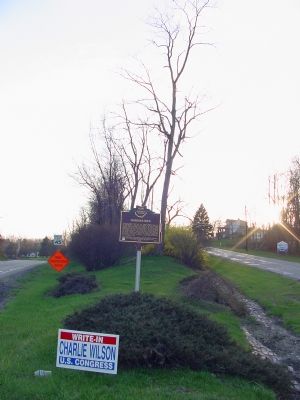
First surveyed in 1849, Powhatan Point was laid out by Franklin Knox. The "point" is the confluence of Captina Creek and the Ohio River. The small but thriving river and farming community served York Township and the rich Captina Valley as a . . . — — Map (db m78499) HM
Side 1
The Coal Industry at Powhatan Point
The Pittsburgh No. 8 coal seam, located 100 feet below river level at Powhatan Point, extends across much of eastern Ohio, western Pennsylvania, and northern West Virginia. The Cleveland and . . . — — Map (db m78501) HM
Born in Scotland. From 1787-1802, was first governor of the Northwest Territory, which included Ohio, Indiana, Illinois, Michigan, Wisconsin and part of Minnesota. St. Clair established territorial court system and Ohio’s first nine counties . . . — — Map (db m214491) HM
Belmont County. On September 7, 1801, Belmont County became the ninth county in what became the State of Ohio. On April 1, 1803, the state’s first General Assembly appointed a commission to determine if it was necessary to move the county . . . — — Map (db m214486) HM
Historic Decatur. Originally called St. Clairsville and platted in 1801, Decatur was named for early 19th century naval hero Stephen Decatur. It is among the oldest villages in Brown County, which before 1817 was a part of Adams County. Among . . . — — Map (db m121885) HM
This house originally stood at Logan’s Gap, Union Township. By tradition, it was constructed in 1783 by Indian scouts William Dixon and Cornelius Washburn who became residents of Brown County. Dixon lived in this house until 1800. — — Map (db m135937) HM
"…Hamer was one of the ablest men Ohio ever produced. I have always believed that had his life been spared, he would have been President of the United . . . — — Map (db m70909) HM WM
Through the terms of his will,
absentee British
landowner Samuel Gist
freed his 350 slaves in Virginia.
Gist (c.1723-1815)
intended
that these freed people would
remain on
the land and
receive
instruction in Christianity and that schools . . . — — Map (db m136037) HM
U.S. Grant, general-in-chief of the Armies of the United States, 18th president and first native Ohioan to be elected chief executive, lived in this house from 1824 to 1839. Jesse R. Grant, his father, built the original part fronting Water . . . — — Map (db m70910) HM WM
With news of hostilities at Fort Sumter in South Carolina, Ripley men formed one of Ohio’s first military units and established Camp Ripley on what was the 12-acre Ripley Fairgrounds. Chosen as Captain was West Point graduate Jacob Ammen. His unit . . . — — Map (db m135348) HM
Charles Young in RipleyUpon his death in 1922, Colonel Charles Young was the highest ranking African American officer in the United States Army. Born into slavery in Kentucky in 1864, Young moved to Ripley with his parents Gabriel and . . . — — Map (db m180613) HM
Ripley was incorporated as the village of Staunton in 1812. Its name
was changed in 1816 to honor General Eleazer Wheelock Ripley, a hero
of the War of 1812. In the years before railroads. Ripley was
principal Ohio River shipping center. Also . . . — — Map (db m135431) HM
A part of the Virginia Military District, Ripley was founded in 1812 by Colonel James Poage, a veteran of the Revolutionary War. Originally named Staunton, after Poage’s home town in Virginia, the village comprised 1,000 acres along the Ohio river. . . . — — Map (db m135427) HM
The American Civil War was in its second year, and Confederate forces were advancing in the east and in the west. Confederates led by General Edward Kirby Smith had defeated a Union Force at Richmond, Kentucky on August 30, 1862. Word was received . . . — — Map (db m135372) HM
First Jain Temple in Ohio
"Souls render service to one another"
The Jain Center of Cincinnati and Dayton was established on April 22, 1979 as a non-profit tax-exempt organization under the laws of the United States and the State of Ohio. . . . — — Map (db m24073) HM
Side A: Busenbark
In 1833, Robert Busenbark deeded land to the directors of School District No. 6 for Busenbark School. Twenty years later, Robert and son David granted a right-of-way on their property for a station on the Cincinnati, . . . — — Map (db m28533) HM
Elisha Morgan purchased 48.6 acres in Fairfield Township, part of the Symmes Purchase, in 1817. The Farm Mansion was built shortly after he settled the land. The house incorporates two prevalent architectural styles in southwest Ohio in the . . . — — Map (db m224980) HM
Miami Chapel Cemetery. Around 1843, local Methodists organized a new Methodist Episcopal church at Fair Play and later erected a brick chapel. The congregation was short-lived, however, and fell into decline after one of its leading members, . . . — — Map (db m158422) HM
Abraham Lincoln spoke from the rear of a Cincinnati, Hamilton & Dayton Railroad passenger train on Saturday September 17, 1859, to about 1000 people at South Fourth and Ludlow streets (about 785 feet south of here). Lincoln, elected president of the . . . — — Map (db m122279) HM
Bunker Hill The Millville, Reilly and Milton Turnpike brought prosperity to the
village now renamed Bunker Hill. School House No. 10 stood nearby
from 1849-1857. By 1860 clothing manufacturing was the major
business here. A Post Office was . . . — — Map (db m107801) HM
Side A The Civil War created orphaned and impoverished children across the nation. To establish a home for area children, a group of Hamilton women met with Reverends Thane Miller and Benjamin W. Chidlaw in January 1869. By May, the women . . . — — Map (db m137852) HM
Butler County was created on March 24, 1803, about three weeks after Ohio became a state. Hamilton won the competition for the county seat, thanks to Israel Ludlow, Hamilton's founder. Ludlow's donation of the public square secured the county . . . — — Map (db m28546) HM
The Champion Coated Paper Company began production here April 15, 1894, with nine employees under the direction of Peter G. Thomson (1851-1931), a Cincinnati businessman, who had incorporated the firm in November 1893. Thomson, previously a . . . — — Map (db m28547) HM
Author Side Raised and educated in St. Louis, author Fannie Hurst (1885-1968) was born in Hamilton at 918 Central Avenue, the home of her maternal grandparents. She was the daughter of Rose Koppel and Samuel Hurst. Already a writer as a student . . . — — Map (db m122411) HM
The Hogan Family owned and operated what was known as the Hamilton Airport for over 52 years. Airplane owner and pilot, Carl "Pop" Muhlberger and aviation enthusiast and farmer, Joe Hogan, co-founded the airport in July 1929. Muhlberger taught Joe . . . — — Map (db m225373) HM
John Stewart Black (1891-1936) was a Vaudeville performer and songwriter who penned the classic "Paper Doll." He is also remembered for "Dardanella," which he called his "gift to the musical world." "Dardanella", recorded by the Ben Selvin . . . — — Map (db m158421) HM
Side A
Clark Lane built this library in 1866 and donated it to the people of Hamilton two years later. The 1913 Great Miami River flood catastrophe damaged much of the building and many of its books and records. The refurbished library . . . — — Map (db m122413) HM
Side A:
James Elrick, a local carpenter, built the Lane-Hooven House in 1863 for Clark Lane (1823-1907), a Hamilton industrialist and philanthropist. Lane, who first came to the area at age twenty-one as a blacksmith, resided in the house for . . . — — Map (db m28775) HM
Lewis-Sample Farmstead. The farmstead shares the name of the Lewis and Sample families, two owners since European-descended settlers began moving into the Ohio County in the late 1700s. Andrew (1762-1847) and Martha Lewis (1774-1852) acquired . . . — — Map (db m157034) HM
Pilgrim Baptist Church. On January 9, 1919, a group of eight men and three women, being led by the Holy Spirit, met at a house on Wallace Street to form a new black Missionary Baptist Church in Hamilton, Ohio. The group quickly raised $150 to . . . — — Map (db m206449) HM
Rossville was settled in April 1801 shortly after the U.S. Government initiated land sales west of the Great Miami River. Its original proprietors--John Sutherland, Henry Brown, Jacob Burnet, James Smith and William Ruffin--named the town in honor . . . — — Map (db m28790) HM
Side A: Soldiers, Sailors, and Pioneers Monument
The Soldiers, Sailors, and Pioneers Monument was planned and promoted by Butler County Civil War veterans and financed by a county levy in 1899. The monument, built of Indiana Limestone, is . . . — — Map (db m30705) HM
Side A
The dimensions of the canal channel were 26 feet wide at the bottom and 40 feet wide at the top. The depth of the canal averaged four and one-half feet. The 12 locks were 80 feet long with 14-foot wide interior chambers which could . . . — — Map (db m122419) HM
Warren Gard (1873-1929), son of Samuel Z. Gard and Mary Duke, was born in Hamilton, Ohio. He established his practice in Hamilton after graduating from Cincinnati Law School and being admitted to the Ohio Bar in 1894. Gard served as Butler County . . . — — Map (db m122416) HM
Author William Dean Howells (1837-1920) spent his boyhood from 1840 to 1848 in Hamilton. Called the "Dean of American Letters," Howells wrote 35 novels, 35 plays, 34 miscellaneous books, 6 books of literary criticism, 4 books of poetry, and hundreds . . . — — Map (db m28772) HM
At Middletown, Ohio, on July 21, 1825, ground was first
broken for the Miami-Erie Canal, which eventually
linked Cincinnati and Toledo. The canal created much
change in the region, including increased population
and commercial, political, and . . . — — Map (db m134879) HM
William Holmes McGuffey, author of the Eclectic Series of Readers, was ordained a Presbyterian minister in a log meeting house on this site in 1829. The ordination was performed by Robert Bishop, President of Miami University, and other ministers . . . — — Map (db m24060) HM
The village of Miltonville, located along the banks of Elk Creek, was platted in 1816 by George Bennett, Theophilus Eaglesfield, and Richard V. V. Crane. The creek served two grist mills, one built around 1804 and operated by a free black, Bambo . . . — — Map (db m28776) HM
City of Monroe Monroe. Nathanial Sackett (1768-1854) and John H. Piatt (1781-1820) platted Monroe in 1817, naming it for President James Monroe. Monroe was a stagecoach stop between Cincinnati and Dayton and grew to be a rural village . . . — — Map (db m206448) HM
Side A:
1858 Morgan Township House
On April 20, 1857, the trustees of Morgan Township met in Okeana to obtain a lot for the township house. From a quarter mill tax levy, $850 was budgeted for a house and lot. Money expended on the project . . . — — Map (db m24000) HM
Edward Bebb, father of William Bebb and first Welshman to settle in Paddy's Run, Morgan Township, Butler County purchased this cabin in 1801. Originally the cabin stood four miles southeast of this site on the Dry Fork of the Whitewater River. It . . . — — Map (db m24001) HM
(side A)
Bunker Hill Universalist Church
The Bunker Hill Society was organized about 1845 and fellowshipped in 1854. A frame meeting house, capable of seating 300, was dedicated in 1855. Thirty people united with the church . . . — — Map (db m107789) HM
In what was called the "Freedom Summer" of 1964, more than 800 volunteers, most of them college students, gathered at the Western College for Women (now Western Campus of Miami University) to prepare for African-American voter registration in the . . . — — Map (db m107802) HM
The Indian Creek Regular Baptist Church was established in 1810 as an arm of the Little Cedar Creek Church of Brookville, Indiana. The congregation purchased three acres of land for a burial ground and church and built a log structure here in . . . — — Map (db m120291) HM
Side A: Langstroth Cottage Reverend Lorenzo Langstroth, renowned as "The Father of American Beekeeping," lived in this simple two-story, eight-room house with his wife, Anne, and their three children from 1858 to 1887. Unchanged externally, the . . . — — Map (db m24009) HM
In 1833, Samuel Eells founded Alpha Delta Phi (ΑΔΦ), the first fraternity west of the Allegheny Mountains and the first fraternity at Miami University. The formation of Miami's Alpha (founding) chapters followed in the next two . . . — — Map (db m107741) HM
Oxford Female Institute Chartered in 1849, the Institute was the first of three women's colleges established in Oxford. The original brick building was completed in 1850, and forms the core structure. The Reverend John Witherspoon Scott, a . . . — — Map (db m107675) HM
Percy Mackaye
Percy MacKaye (1875-1956) was a poet and dramatist elected to the National Institute of Arts and Letters in 1914. From 1920-1924, MacKaye held the position of writer-in-residence at Miami University, the first position of its . . . — — Map (db m140417) HM
Thomas Cowan Bell, James Parks Caldwell, Daniel William Cooper, Isaac M. Jordan, William Lewis Lockwood, Benjamin Piatt Runkle, and Franklin Howard Scobey met in a second floor room of this building to found Sigma Chi (ΣΧ) in early . . . — — Map (db m227310) HM
Stanton's "Magnificent Dwelling"
Home of Two Miami University Presidents
Built by “Old Miami” University President Robert L. Stanton, D.D. (1810-1885) as his private home and president’s office, Stanton’s 1868 Italianate house faced . . . — — Map (db m225372) HM
side A
A cemetery was established on the site in 1811 and became the final resting place for many of the area's early pioneer families. The Hanover Township Trustees obtained title to the land in 1823 from John and Anna Farnsworth, and it . . . — — Map (db m97814) HM
Front One of the few remaining covered bridges in southwestern Ohio and the only one in Butler County on its original site, this bridge was built in 1868-1869 to give access to a saw and grist mill owned by James B. Pugh on Four Mile . . . — — Map (db m86977) HM
Side A: The DeWitt Family
Zachariah Price DeWitt was born of a Dutch family in New Jersey in 1768. With brothers Jacob and Peter, he migrated to Kentucky where, in 1790, he married Elizabeth Teets, who was born in Pennsylvania in 1774. By . . . — — Map (db m24064) HM
Side A: The Doty Settlement
As Oxford Township was developing in the mid-1800s, a cluster of farmsteads near its northern border was designated the "Doty Settlement." As was the custom, the community took its name from a prominent family in . . . — — Map (db m24015) HM
Side A: The Restoration Movement
In the early years of the nineteenth century, a religious unrest known as the Second Great Awakening spread across much of the American frontier. Among the most influential of the evolving religious . . . — — Map (db m24051) HM
William Holmes McGuffey (1800-1873) was a Miami University faculty member in 1836 when he compiled the first edition of the McGuffey Eclectic Reader in this house. His Reader taught lessons in reading, spelling, and civic education by . . . — — Map (db m24012) HM
Woodside Cemetery
Established as the Oxford Township Cemetery in 1880, this public graveyard replaced the original one at the corner of College Avenue and Spring Street. That earlier burial ground was abandoned when the railroad bisected it . . . — — Map (db m227942) HM
The foundation for the first Welsh settlement in Ohio was laid on June 29, 1801, when William and Morgan Gwilym purchased land in what is now Morgan Township at the Cincinnati Land Office. The Welsh, who settled in Pennsylvania beginning in the late . . . — — Map (db m23991) HM
Side A: The Village of Trenton
Platted 1816. Incorporated as Village 1895. Became a city 1971
Trenton's founder, Michael Pearce, came to the area in 1801. The original village of 33 lots was named Bloomfield. When the post office was . . . — — Map (db m28792) HM
During the height of World War II, President Franklin Roosevelt turned to the innovative engineers of the Crosley Broadcasting Corporation to build powerful short wave radio transmitters capable of delivering broadcasts overseas. On farm fields . . . — — Map (db m23994) HM
This farm, Chrisholm (German for home farm of Christian Augspurger), was established in 1830 by Christian Augspurger (1782-1848), leader of the Amish Mennonite settlement in Butler County. The Amish selected this area because of rich, fertile . . . — — Map (db m122421) HM
This hamlet, located one mile southwest from here, was never platted, but was named after William Woods, president of the three-story brick Woodsdale paper mill constructed in 1867. Flanking the mill were the company office and store and several . . . — — Map (db m122420) HM
Major Daniel McCook of Carrollton and his 9 sons and their cousins, the 5 sons of Dr. John McCook of Steubenville, won popular acclaim for their outstanding service in the United States Army an Navy.
“TRIBE OF DAN”
Maj. Daniel: mortally . . . — — Map (db m290) HM
President Abraham Lincoln's assassination on April 14, 1865, created a national tragedy, and the nationl mourned as his body was transported by rail from Washington, D.C. back to Springfield, Illinois, where he would be buried. As the nine-car . . . — — Map (db m84946) HM
Mt. Tabor Church. The first Mt. Tabor Church, a log meetinghouse, was erected on this site in 1816. It stood on land originally selected by Griffith and Martha Evans for a graveyard at the death of their daughter circa 1812. Deeds show the . . . — — Map (db m198029) HM
Born here October 9, 1832. Attended Antioch College. Member of Mt. Olivet Masonic Lodge. Enlisted in the 2nd Ohio Volunteer Infantry Regiment and volunteered for the famous Andrews Raid. The raiders seized "The General" locomotive at Big Shanty, . . . — — Map (db m76518) HM
Side A:
Congress passed Fugitive Slave Laws in 1793 and 1850, allowing federal marshals to arrest slaves that had escaped to the North and take them back to their southern owners. They could also arrest northerners suspected of aiding . . . — — Map (db m13760) HM
Side A:
James R. Hopkins was born May 17, 1877, in Irwin and graduated from Mechanicsburg High School in 1895. As a child, he gained exposure to art through his mother, Nettie, an accomplished self-taught water colorist. Hopkins enrolled at . . . — — Map (db m13729) HM
Joseph E. Wing was one of the first persons to identify, promote, and grow alfalfa as a forage crop east of the Mississippi River. He developed his interest in alfalfa while in Utah, where he worked on a cattle ranch. When he returned, Wing began . . . — — Map (db m13761) HM
The Mechanicsburg United Methodist congregation was founded in the early nineteenth century and met first in open-air camp meetings before moving into a small log school building. In 1820 the congregation built a wood framed church on East Sandusky . . . — — Map (db m13730) HM
Side A:
This site has long served the religious, education, and public interests of the residents of Mechanicsburg. A local Methodist congregation built its first church here in 1820, and the townspeople also used the structure as its . . . — — Map (db m13731) HM
In 1897, a farm boy investigating the disappearance of water into a sinkhole in a nearby field discovered this system of subterranean passageways. Digging down a few feet, he found an opening to a cave that had begun forming perhaps several . . . — — Map (db m198028) HM
Friends Church
Among the earliest settlers to Rush Township were members of the
Religious Society of Friends or Quakers, who emigrated from the
eastern states, mostly Pennsylvania and North Carolina. At first
religious services were held in . . . — — Map (db m86266) HM
Albert B. “A. B.” Graham was born in Champaign County on March 13, 1868, the son of Joseph and Esther Graham. He was raised in a small rural home, but a fire destroyed the house in 1879, and the family moved to Lena where Graham attended . . . — — Map (db m13789) HM
President Abraham Lincoln's assassination on April 14, 1865, created a national tragedy, and the nation mourned as his body was transported by rail from Washington D.C. back to Springfield, Illinois, where he would be buried. In Champaign County, . . . — — Map (db m13790) HM
Benson Road and the North Urbana Lisbon Road (SR 54) in Champaign County was the site of the 1950 National and Ohio Plowing Matches and the National Association of Soil Conservation Districts Field Days. The three-day event drew a crowd of nearly . . . — — Map (db m86249) HM
Bailey and Barclay Halls. Urbana University was established by the Swedenborgian Church in 1850. Bailey Hall (1853), named after Francis Bailey (1735-1815), was designed by W. Russell West, architect of the Statehouse of Ohio. Bailey was an . . . — — Map (db m13808) HM
Billy “Single” Clifford
Wm. C. Shyrigh, better known as Billy Clifford, was born in this
house on January 24, 1869, to Levi and Sarah Shyrigh. Coming
from a musical family, he developed an early interest in music
and practiced with the . . . — — Map (db m90489) HM
In 1942 Cedar Bog became the first nature preserve in Ohio purchased
with state funds. Efforts to set this wetland aside began in the
1920s through the efforts of Florence Murdock and her daughter.
Efforts intensified in the mid 1930s with help . . . — — Map (db m90503)
[Marker Front]:
The Dayton, Springfield, and Urbana Electric Railway (DS&U) was an “Interurban” rail system that ran between the cities of Urbana, Springfield and Dayton. Its beginning can be traced to the franchise given to . . . — — Map (db m13811) HM
A group of Freemasons, inspired by the concepts of a new country, of Freedom with Responsibility, Brotherly Love, and Truth, formed Harmony Lodge near this site in 1809, the first Masonic lodge in western Ohio. Meetings were held in the log court . . . — — Map (db m13820) HM
The side rails on this boardwalk were
made possible by financial support
from the Cedar Bog Association and
from Ralph and Jean Ramey, who
made generous contributions in
memory of their daughter Carolyn.
Though handicapped from birth,
Carolyn . . . — — Map (db m198692) HM
Simon Kenton who is buried here. During the Revolutionary War he frequently served as scout under George Rogers Clark and later praised Clark for his role in saving the Kentucky settlements. Kenton's Indian captivity of 1778-79 acquainted him with . . . — — Map (db m34088) HM
Side A: John Anderson Ward Farmstead
John Anderson Ward had this Federal style house constructed from 1823-1825 on land inherited from his father, Urbana's founder Colonel William Ward. The Colonel's will stipulated that a local mason . . . — — Map (db m13822) HM
Side A The founders of what would become the Kings Creek Baptist Church first met on June 29, 1805 in the log home of local residents James and Ann Turner. The Baptist congregation continued to meet in people's homes until 1816 when . . . — — Map (db m84858) HM
The Mad River and Lake Erie Railroad Company was chartered by the State of Ohio in January 1832 to connect west central Ohio with northern Ohio and Lake Erie. It was the first company to be incorporated for railroad purposes in the state. . . . — — Map (db m13824) HM
Champaign County residents James [sic-Joseph] Vance (1786-1852) and John H. James (1800-1881) were among the Mad River and Lake Erie Railroad's first officers, serving as president and treasurer, respectively. Vance emerged as a leader in the War of . . . — — Map (db m13825) HM
(side A)
Construction of the Columbus, Piqua, and Indiana Central Railroad started in 1850 and was finished in 1854. Later referred to as the "Panhandle Railroad," it ran from Columbus to Bradford. During the Civil War, the line carried . . . — — Map (db m93853) HM
(Side A)
The nine-car funeral train for President Abraham
Lincoln departed Washington, D.C. on April 21, 1865.
It arrived in Urbana on April 29 at 10:40p.m.
Urbana’s citizens erected an arch of evergreens and
flowers near the station . . . — — Map (db m84960) HM
The Underground Railroad in Champaign County
The inhumanity of slavery and the Fugitive Slave Acts of 1793 and 1850 motivated anti-slavery activists to operate a covert network, the "Underground Railroad," which helped fugitive slaves . . . — — Map (db m78141) HM
War Council of 1812. To confirm that the Treaty of Greenville would be upheld, Ohio Governor Return J. Meigs called a council with Native Americans June 6-9, 1812. He sought approval to cross native land when marching to Canada and to ensure . . . — — Map (db m81636) HM
Warren G. Grimes. Raised in an Ohio orphanage, Warren G. Grimes (1898-1975) ran away after finishing the ninth grade and at age 16 went to work for the Ford Motor Company in Detroit. He later became a partner in an electrical business where . . . — — Map (db m13818) HM
Virginia native William Owen, 1769-1821, is credited with being the
first American to settle in Mad River Township, Champaign County
sometime between 1797-1799. He and his family built a cabin in the
northeast quarter of Section 15 directly west . . . — — Map (db m86157) HM
The Johnson Manufacturing Company was incorporated in 1902 by brothers James B., J. Will, Isaac T., and Charles F. Johnson, all of Quaker heritage. The company manufactured tin and galvanized iron ware for railroad lines across the United States. . . . — — Map (db m221049) HM
Baseball great Harvey Haddix was born on September 18, 1925, and grew up on a farm just south of Westville. He attended Westville School until March 1940 and played his first organized baseball at this site. Entering Major League Baseball in 1952, . . . — — Map (db m13888) HM
President Abraham Lincoln's assassination on April 14, 1865, created a national tragedy, and the nation mourned as his body was transported by rail from Washington, D.C. back to Springfield, Illinois, where he would be buried. On its way the Funeral . . . — — Map (db m84945) HM
1769 entries matched your criteria. Entries 101 through 200 are listed above. ⊲ Previous 100 — Next 100 ⊳