Near this monument, Jayhawker group of Death Valley Forty-Niners, gold seekers from middle west, who entered Death Valley in 1849 seeking short route to mines of Central California, burned their wagons, dried the meat of some oxen and, with . . . — — Map (db m89481) HM
The escape trail where Manley & Rodgers led the Bennett & Arcane families to safety from Death Valley in Feb 1850.
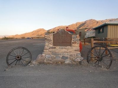
←Brier's Silent Sepulchre Fish's Gravesite, 1 mile. — — Map (db m174570) HM
Site of Livermore and Chester Store, first business establishment in Bakersfield, an adobe structure built in 1865. Purchased by H. H. Fish in 1886. Destroyed in the fire of 1889. Rebuilt in 1890. — — Map (db m55119) HM
This military post was established by the United States Army on June 24, 1854, to suppress stock rustling and for the protection of Indians in the San Joaquin Valley. As regimental headquarters of the First Dragoons, Fort Tejón was an important . . . — — Map (db m117523) HM
James Dean made his last stop at this corner on Sept. 30th, 1955. The young actor died in a car crash a short time later while enroute to Salinas for an auto race. Althouh he appeared in only 3 films, James Dean remains a legend. — — Map (db m228036) HM
America's most spectacular gusher blew in here on March 14, 1910. Initially 18,000 barrels per day, the flow later reached an uncontrolled peak of 100,000 barrels per day, completely destroying the derrick. This Union Oil Company well produced nine . . . — — Map (db m54267) HM
As Taft’s first 100 years is being celebrated in 2010, let’s look back to see from where we came. Taft got its start when the railroad laid tracks to Taft and beyond. Siding Number Two was where it all started along the tracks in the vicinity of 2nd . . . — — Map (db m54388) HM
On September 30th torrential rains flooded Tehachapi Creek, undermining the tracks under Santa Fe Engine No. 3834 which was waiting out the storm about ½ mile east of Woodford Station. The engine disappeared into the raging water below. It remained . . . — — Map (db m202039) HM
Lassen County Deputy Sheriff
Larry Griffith
was killed in the line of duty
March 2, 1995
On that date, Deputies Larry Griffith, Henry Mahan, William Freitas and Wayne Aldridge were on duty on the Madeline Plains and were . . . — — Map (db m87781) HM
About one half mile southeast of this spot, on Dominguez Hill in historic Rancho San Pedro, the first Air Meet in the United States was held during January 10-20, 1910. Subsequently, this area has evolved into one of the world's leading . . . — — Map (db m50979) HM
Montrose California - Birthplace of
National Flag Week
"It All Started In Montrose"
Montrose merchants Bill Bailey and Vito Cannella dreamed of establishing a
"It all started in Montrose" National Week of Recognition to honor the . . . — — Map (db m218223) HM
Dr. Sun Yat-Sen, founding
father of the Republic of
China, was born on November
12, 1866. One of the greatest
figures in China's long
history, he not only gave the
republic its physical being but
also provided the nation with
the Three . . . — — Map (db m219287) HM
Thomas Charles Lasorda,
Los Angeles, N.L., 1977-1996.
One of baseball's most engaging personalities
and a great ambassador for his sport. Managed
Dodgers with an impenetrable passion, claiming
to "bleed Dodger blue.” In his 47th . . . — — Map (db m186815) HM
Presented to the citizens of Los Angeles County in December 1916 by Captain Allan Hancock with a request that the scientific
features be preserved.
First historic reference to the tar pools recorded in the diary of Gaspar de Portolá on August . . . — — Map (db m126874) HM
In the beginning was the land of Armenia and the kingdom of
Pakradouni, Ani.
And Ani became Volga. And Volga became Crimea. And Crimea
became Don. And Don became the Republic of Armenia.
And the Armenian became a citizen of the . . . — — Map (db m217685) HM
May 19, 1995, 9:02 A.M.
In honor of Victims and Survivors
of the bombing of the Oklahoma City Federal Building,
April 19, 1995, 9:02 A.M. — — Map (db m163222) HM
Panel 1:
On April 19, 1989, a powder explosion occurred in Turret 2 while IOWA was conducting peace-time gunnery drills off the island of Viesques, Puerto Rico. Preparing to fire, the center gun's powder bags exploded before the breech . . . — — Map (db m70263) HM
This plaque commemorates the 1963 Crusade for Christ
with a total attendance of 920,927 highlighted by the
concluding session on Sunday, September 8th. Citizens
from every walk of life occupied every seat and spilled
onto the playing field . . . — — Map (db m238195) HM
Commemorating the first mass to be celebrated by a Pope in California,
Los Angeles Memorial Coliseum,
September 15, 1987.
His Excellency Archbishop Roger M. Mahony
and the church of Southern California
welcoming the Holy Father on his second . . . — — Map (db m233700) HM
The Studio City Neighborhood Council and CBS Studio Center, home of Republic Pictures, hosted the Republic Pictures 75th Anniversary Celebration, September 25, 2010. — — Map (db m220072) HM
The first hydroelectric installation in California for long-distance transmission of alternating current at high voltage was built in 1892 on San Antonio Creek below this spot by the San Antonio Light and Power Company organized by Dr. Cyrus . . . — — Map (db m149504) HM
The stone memorial on this site represents the only remaining portion of the second Pasadena Public Library, an impressive castle-like structure built in the Romanesque architectural style.
Designed by Pasadena architect, Harry Ridgeway, the . . . — — Map (db m71141) HM
Dedicated to the memory of Yuen Kee Laundry and the early Chinese settlers of Pasadena, who helped build the railroads, labored on the citrus and grape farms, and established successful businesses. On November 6, 1885 a mob threw stones into the . . . — — Map (db m243589) HM
On September 5, 1876, Charles Crocker, President of the Southern Pacific Company, drove a gold spike here to complete his company's San Joaquin Valley Line, the first rail connection of Los Angeles with San Francisco and Transcontinental lines. — — Map (db m122365) HM
In 1839, the Mexican Government granted to
Antonio del Valle some 48,000 acres of
The Santa Clarita Valley known as the Del Valle Rancho.
On March 9, 1842, Francisco Lopez y Arbello, the brother-in-law of Antonio del Valle, visited the . . . — — Map (db m20112) HM
In Placeritas Canyon, March 1842, Francisco Lopez y Arballo, while gathering wild onions from around an old oak, discovered gold particles clinging to the roots of the bulbs. It is estimated that $80,000 in gold was discovered as a result of this . . . — — Map (db m154258) HM
The ascent of Signal Hill (elevation 364 feet) was not just a fantasy for automobile drivers of the early 1920s. In January 1921, the Long Beach Daily Telegram advertised an upcoming effort by a Dodge touring car to climb “The . . . — — Map (db m100502) HM
Here in this grove of enduring redwoods, preserved for posterity, members of the United Nations Conference on International Organization met on May 19, 1945 to honor the memory of Franklin Delano Roosevelt, thirty-first President of the United . . . — — Map (db m144203) HM
The most famous and most popular version of the Tequila Sunrise was created at the Trident in the early 1970s by bartenders Billy Rice and Bobby Lozoff. In June 1972 the Rolling Stones attended a party at the Trident hosted by Bill Graham. Lozoff . . . — — Map (db m232278) HM
During the Cold War, Mono County was home to one of many remote facilities used by the US Military to test new weapons and weapons systems. A "secret military installation" operated by the US Navy was located along the south shoreline of Mono . . . — — Map (db m20739) HM
On February 19, 1990, a tragedy occurred at this site. Three boys from a local youth camp fell through the ice. Two counselors, David Myers and Randy Porter, U.S. Forest Service employee Clay Cutter, and Long Valley Fire Captain Vidar Anderson . . . — — Map (db m2895) HM
Commemorating the 75th Anniversary
of the placing of the pole and the raising of the flag on Centennial Bluff on July 4th 1876 by John Connell
Wood Larson and the Cole brothers.
1876 – 1951 — — Map (db m50084) HM
Honoring
Four Early Americans in California
They came to this coast as seamen and remained as settlers
Baptized in this Mission
George Mayo, of Plymouth, Mass., on 3 August, 1816
Thomas W. Doak, of Boston, Mass., on 22 November, 1816 . . . — — Map (db m63684) HM
First Marriage in California took place at this Mission between Juan Maria Ruiz of El Fuerte, Sonora, Mexico, 25 years of age, and Margarita de Cortona, 22, a Salinan woman of Mission San Antonio, on the sixteenth of May in the year of Our Lord 1773 — — Map (db m51561) HM
(Editor's note: The original marker has been replaced.)New Marker:
(English Text:)
Hippolyte Bouchard is celebrated in Argentina as a hero and patriot and founder of the Argentine Navy--the equivalent of John Paul . . . — — Map (db m66555) HM
At Monterey, June 3rd
1770
the ceremony of taking possession
of California for Spain was enacted by
Father Junipero Serra
under the shade
of this tree. — — Map (db m63259) HM
□ Look out upon these waters.
□ Their recorded history began when Juan Rodriguez Cabrillo sighted the "Bay of Pines" on Nov. 17, 1542.
□ Sebastian Viscaino was first to touch land Dec. 16, 1602. He claimed the land for . . . — — Map (db m30347) HM
(This series of 35 (36) plaques, inlayed in the brick walkway, extends from Pacific Street to the Great Seal of the State of California in front of Colton hall, at which point the line of plaques turn left.)
The Ancient Ones . . . — — Map (db m63358) HM
Site of original flagstaff
where the American flag was first raised
by
Commodore John Drake Sloat
on
July, 7th 1846
taking possession of California in the name of
the United States of America
Later ceded to America
under the Treaty . . . — — Map (db m63063) HM
Combined American forces under Captains Charles D. Burrass (or Burroughs) and Bluford K. Thompson clashed with Comandante Manuel de Jesús Castro's Californians in this vicinity on November 16, 1846. Casualties on each side consisted of several men . . . — — Map (db m26646) HM
This monument is dedicated to the 3,586 Monterey Bay Area residents of Japanese ancestry, most of whom were American citizens, temporarily confined in the Salinas Rodeo Grounds during World War II from April to July 1942. They were detained without . . . — — Map (db m165487) HM
This original brick building in continuous usage as a foundry for over 110 years. Famous Pelton Waterwheel developed and manufactured here in 1878. Ingenious double-cupped bucket designed by Lester A. Pelton of Camptonville and Nevada City. It . . . — — Map (db m12863) HM
This hotel, one of the oldest in continuous operation west of the Rockies, opened for business in August, 1856. Originally known as The “Bicknell Block”. The structure consists of three common-walled buildings of simple brick . . . — — Map (db m12891) HM
Original Marker:
North San Juan Fire Department
In Commemoration of the establishment of this fire station in 1864
George S. Murphy
First Fire Chief
Replacement Marker:
N. S. J. F. D.
To the memory of the . . . — — Map (db m39826) HM
This community of 3000 people seceeded from the Union to declare a free and independant state. Colonel E.F. Brundage was elected President. Congressional action on California statehood was pending at the time. — — Map (db m57991) HM
Established in 1849 and named in honor of General Zachary Taylor, after the Rough and Ready Company of miners from Wisconsin, this was one of the principal towns of Nevada County. In 1850, articles of secession were drawn up establishing the . . . — — Map (db m10560) HM
History
Today each August hundreds of swimmers take to the 65º water of Donner Lake and swim its 2.7 mile long length. Each swimmer has lots of company.
On August 19 (sic, 18), 1935 though, it was a different story. On that day 17 . . . — — Map (db m129739) HM
The Annual May Festival, a traditional celebration in the Orange community began in the 1880s. It was held in the Irvine Park area as a harvest festival in May of each year by Orange and surrounding communities. The festival and parade were later . . . — — Map (db m189680) HM
Two miles inland from this point, in Los Cristianitos Valley, the first Christian baptism in Alta California was performed by Padre Francisco Gómez, a member of the Portolá Expedition, in 1769. — — Map (db m145307) HM
Following the example of Gordy Ainsleigh in 1974, each year runners from around the world meet the challenge of completing on foot the rugged 100-mile distance of the historic Western States Trail from Squaw Valley to this stadium. Placer Union High . . . — — Map (db m95777) HM
Old Four Fingers, ruthless outlaw, was
killed near this spot on April 1, 1851.
Driven to a life of crime by the humiliation
and degeration, resulting from a radical
digital mutilation, preformed upon him by a
pious father. He was apprended and . . . — — Map (db m143582) HM
The first sport ski area in the western hemisphere was in the Sierra Nevada. By 1860, races were held in the Plumas-Sierra region. The mining towns of Whiskey Diggings, Poker Flat, Port Wine, Onion Valley, La Porte, Jamison City, and Johnsville . . . — — Map (db m143423) HM
Within this valley was laid part of the scene, and here resided a number of the characters portrayed in Helen Hunt Jackson's historical novel, "Ramona", which depicted life and presented the status of the Indians of many great ranchos in early . . . — — Map (db m50997) HM
On January 1, 1776, the first party of colonists to come overland to the Pacific Coast crossed the Santa Ana River south of this marker and camped between here and the river. Recruited in the presidios of Sonora, Mexico, and led by Lt. Col. Juan . . . — — Map (db m50995) HM
With the backing of Southern Pacific Railroad magnate Henry E. Huntington, Mount Rubidoux was purchased by Frank Miller of the Mission Inn in 1906. In an attempt to beautify the mountain and to sell residential lots at its base, a road was built and . . . — — Map (db m120431) HM
Three miles west of this site, on July 14, 1937, three Soviet aviators completed a transpolar flight from Moscow in 62 hours, 17 minutes, establishing a new world's nonstop distance record of 6,305 miles. The huge single-engine aircraft, an ANT-25 . . . — — Map (db m50706) HM
Near this site on July 14, 1937, three Russian aviators completed a transpolar flight from Moscow in 62 hrs, 17 min establishing a new world's nonstop distance record of 6,305 miles. The huge single-engine aircraft, an ANT-25 military reconnaissance . . . — — Map (db m50681) HM
The Folsom Veterans Memorial honors those brave individuals who serve our country and those who have fallen in service to our country. The memorial is composed of several distinct elements.
The Flag Court pays homage to all those who have served . . . — — Map (db m15619) HM
Sutter’s Fort, established by Capt. John A. Sutter in August 1839, marked the Western end of the Coloma Road. Opened in 1847, this road ran from the Fort to Sutter’s sawmill at Coloma. Used by James W. Marshall in January 1848 to bring the news of . . . — — Map (db m11897) HM
The Sacramento Wood Company’s steamer wood freight shed, between N and O streets in the Front Street right-of-way, remained at this location for approximately 30 years. The Sacramento Wood Company could trace his roots from an earlier enterprise . . . — — Map (db m16508) HM
On this site stood the store of James L. L. F. Warren, an influential center of agriculture during the Gold Rush. Here at the New England Seed Store, the camellia was first introduced into California in February, 1852.
Camellia
Official . . . — — Map (db m11193) HM
The 1890s was a pivotal decade of invention. The transmission of electricity from the Folsom Power House to Sacramento in 1895 was, by its size and purpose, a major national achievement. The hydroelectric power generated was three-phase alternating . . . — — Map (db m229904) HM
Even after the great national stock panic of 1893 disabled the labor force in America, many events such as the Spanish American War and World War I – temporarily glossed over the plight and discontent of the American working class. Then, the Great . . . — — Map (db m229969) HM
The unmarked last resting place of over three thousand pioneers, their exact place of burial, somewhere between the north border of Broadway and the north portion of the cemetery, and between 9th and 11th Streets, known but to their God.
Buried . . . — — Map (db m34290) HM
An outspoken proponent of suffrage for women, she became the first of her gender elected to a municipal office in Sacramento, being swept into office by an all male electorate before women attained the right to vote. Widow of a politician and . . . — — Map (db m15621) HM
The Mutual Hook and Ladder Company, formed on February 5, 1850, was the first fire company in the State of California. It served with distinction until disbanded October 30, 1859.
On June 23, 1858, a grateful city donated this plot of ground . . . — — Map (db m12462) HM
The above marker shows the direction of the road that connected the 21 Missions. Expeditions left here to go north to Mission Santa Clara or go south to the head-quarters at Mission San Carlos Borromeo de Carmelo.
This road was used from 1797 to . . . — — Map (db m15344) HM
Near this spot once stood the home of Isaac Williams, first American settler in this valley, about which on September 26-27 1846, was fought the first important engagement in California of the war with Mexico.
This was also the site of the Chino . . . — — Map (db m379) HM
Conflicts between Indians and white settlers over the rich lands of the San Bernardino Mountains culminated in The Battle at Chimney Rock on February 16, 1867. Although the Indians defended themselves fiercely, they were forced to retreat into the . . . — — Map (db m63982) HM
Charles M. Hatfield agreed with San Diego City Council members, after a four year draught, to “make it rain” sufficiently to fill Lake Morena Reservoir for $10,000. His “rain enhancing” tower and pans were erected south of . . . — — Map (db m49824) HM
On this site in 1900, Coronado Beach Company opened Tent City for vacationers on a budget. Until 1939, thousands of people from Southern California and beyond vacationed here between June and September, enjoying the fresh air, nightly concerts, . . . — — Map (db m123189) HM
While marching to the conquest and occupation of California during the Mexican War, a detachment of 1st U.S. Dragoons, under the command of Brig. Gen. Stephen W. Kearny, was met on this site by native California lancers under, the command of Gen. . . . — — Map (db m51095) HM
Originally built as the home of San Diego’s John Brown in 1850, the house was converted to a church by Don Jose Aguirre in 1858. Father Antonio D. Ubach , formally a missionary among the Indians, was parish priest here from 1866 to 1907. It is said . . . — — Map (db m11652) HM
No. 7
Dedicated
in commemoration
the heroic sacrifice and
history-making achievements
of the
Mormon Battalion
"whose march over 2000 miles
from Council Bluffs, Iowa to San Diego
help to win California for the Union
and open a . . . — — Map (db m51992) HM
In 1960 the state legislature authorized the California State colleges to grant honorary doctoral degrees to individuals who have made unusual contributions toward learning and civilization. On June 6, 1963 San Diego State College was the first of . . . — — Map (db m51099) HM
To commemorate the discovery of California by Juan Rodriquez Cabrillo who landed on the shores of San Diego Bay September 28, 1542. — — Map (db m126875) HM
During World War II, 600 fishing vessels were taken by the Navy, Army, and Coast Guard, including 52 “Tuna Clippers”.
On Pearl Harbor Day, the U.S. canned tuna industry was located almost exclusively in Southern California, and . . . — — Map (db m52350) HM
In honor of the men who lost their lives fighting the Inaja Forest Fire on November 25, 1956
Anderson, Albert W.
Daniels, Miles F.
Fallin, William D.
Garcia, George R.
Hamilton, Virgil L.
Lingo, Carlton R. . . . — — Map (db m34325) HM
"He took his chance"
On April 27, 1936, a guard tower stood on these concrete pylons. As officers watched, inmate Joseph Bowers burned garbage in the incinerator straight ahead. Suddenly, Bowers went for the fence, made it over the top, and . . . — — Map (db m193975) HM
The first Pony Express rider to reach San Francisco on the final relay carrying mail from St. Joseph, Missouri to California, arrived in this city Apr. 14, 1860 aboard the River Str. ‘Antelope’. Led by a band and several engine companies, a . . . — — Map (db m84866) HM
On July 9, 1846, in the early morning, in “the days when water came up to Montgomery Street,” Commander John B. Montgomery – for whom Montgomery Street was named – landed near this spot from the U.S. Sloop-of-War . . . — — Map (db m143434) HM
Near this site occurred
the incident which led to the formation of
The San Francisco
Society for the Prevention
of Cruelty to Animals
on April 8, 1868
———————————
James Sloan Hutchinson, a pioneer banker witnessing nearby an act . . . — — Map (db m33538) HM
In commemoration of the Inauguration of the California Midwinter International Exposition
On this spot the first shovelfull of earth was turned
With ceremonies on August 24th, 1893. — — Map (db m233017) HM
We will never forget the genocidal slaughter of six million Jews, including one and a half million children in the Nazi Holocaust of 1933-1945.
We will never forget the cruel apathy of a world which allowed that Holocaust and the deliberate . . . — — Map (db m56540) HM
This monument is erected to commemorate the arrival of the first Japanese naval ship Kanrin Maru in San Francisco Bay on 17 March, 1860. The Kanrin Maru crossed the Pacific at the same time as the U.S.S. Powhatan which brought the . . . — — Map (db m18266) HM
The Presidio’s Ordoñez gun was originally mounted in a Spanish coastal fort at Subic Bay in the Philippines. Undamaged during the Spanish American War, the gun was captured by Filipino nationalists, who were known as “Insurrectos” by the occupying . . . — — Map (db m12619) HM
On April 21, 1898, the United States declared war against Spain. The immediate causes were America’s support of Cuba’s ongoing struggle against Spanish rule and the mysterious explosion of the USS Maine in Havana Harbor. This was the first . . . — — Map (db m48530) HM
"The Canal means more to the West Coast of America than to any other part of this country or any other part of the world... and San Francisco probably represents the whole West Coast."
President Taft, 1911.
Imagine a beautiful . . . — — Map (db m191088) HM
2926 entries matched your criteria. Entries 201 through 300 are listed above. ⊲ Previous 100 — Next 100 ⊳