Patriot politician and future Declaration of Independence signer Samuel Chase began building this Georgian mansion in 1769, but he couldn't afford to finish the house and sold it two years later to Edward Lloyd IV. The wealthy Eastern Shore . . . — — Map (db m63497) HM
February 22, 1797: At the Presidential Mansion in Philadelphia, President George Washington formally presented Irish-born John Barry with Commission Number One in the newly formed United States Navy. With the commission, backdated to the . . . — — Map (db m114812) HM
This gun tube was removed from the British flagship, the HMS Confiance, during the Battle of Lake Champlain with was fought on September 11, 1814. Early in that battle a cannon ball fired by the American flagship Saratoga struck the . . . — — Map (db m69246) HM
Figurehead of HMS Macedonian.
The classical head represents Alexander, the Macedonian who ruled Greece and much of the known world in the 4th century BC. It was carved in wood in 1810 to decorate the bow of the British warship named . . . — — Map (db m63428) HM
In 1814 when Francis Scott Key wrote the words to the poem "The Defense of Fort McHenry," his wife's
sister and brother-in-law lived in a house on this site. The poem quickly became famous when it was
set to music and re-titled "The . . . — — Map (db m63433) HM
[Front of Monument (Bronze Relief)]:
· Capture of the Macedonian ·
· The American Frigate United States ·
Commodore Stephen Decatur, cruising between the Azores and Cape Verde Islands on October 25, 1812, was sighted by the British . . . — — Map (db m7419) HM
U.S. Navy Trophy Flag Collection
Congress in 1814 legislated that all flags captured from an enemy in war by the U.S. Navy would be preserved and sent to Washington. By order of the President this collection was relocated to the Naval Academy . . . — — Map (db m63563) HM
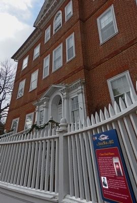
The seat of Maryland government, the State House was at the center of the state's planning for the War of 1812, both locally and in coordination with President Madison's administration in Washington, D.C. Near constant fear of invasion by the . . . — — Map (db m63499) HM
On this spot, where the inspiring strains of the Star Spangled Banner are heard each morning, formerly stood the home of Judge Joseph Hopper Nicholson, Brother-in-law of Francis Scott Key, to whom Key gave the original manuscript and who set the . . . — — Map (db m63431) HM
Erected 1808.
Transferred to the Navy Department 1845.
Demolished 1909.
In memory of men who served at Fort Severn during the War of 1812. — — Map (db m7739) HM WM
Fort Severn and Fort Madison on this stretch of the Severn River, along with a gun battery at Horn Point in Eastport, made Annapolis the best-fortified city in Maryland at the start of the War of 1812.
British ships hovered near the harbor . . . — — Map (db m79920) HM
British vessels anchored offshore several times in 1813 and 1814, giving Annapolis good reason to expect an attack. Lookouts watched enemy maneuvers from the statehouse dome. Public records were removed from the city for safekeeping. When British . . . — — Map (db m79936) HM
Founded as the Naval School Lyceum in 1845, this is among the nation's oldest museums. It contains two full floors of exhibitions. There is extensive coverage on the War of 1812 on the first floor to the left. Inside, too, is the original signal . . . — — Map (db m63851) HM
Captured on the British flagship Confiance on Lake Champlain, September 11, 1814, by Commodore Thomas MacDonough.
This gun has a dent on the muzzle from an American shot which caused the gun to recoil and kill the British commander, . . . — — Map (db m7812) HM
Fort Nonsense has been placed on the National Register of Historic Places by the U.S. Department of the Interior. It is the last remaining fortification of several constructed in the 18th and 19th centuries to defend Annapolis and its . . . — — Map (db m63588) HM
St. John's College has a long, rich history dating back to the founding of our nation. Its earliest incarnation, a grammar or preparatory school named after King William III, was founded in Annapolis in 1696, one year after Maryland's capital was . . . — — Map (db m63410) HM
This cannon of the type used in the defense of Baltimore in the War of 1812, presented to St. John's College, the alma mater of Francis Scott Key, through the Peggy Stewart Tea Party Chapter, D.A.R., and the National Star-Spangled . . . — — Map (db m5425) HM
The needs of the English settlers were similar to those of the Piscataways. As farmers they wanted good soil, so they often settled near “old fields,” areas once used by Native Americans. Look across the field to the ruins of the Java . . . — — Map (db m80873) HM
A victory off the coast of Brazil inspired John Contee to name this property “Java’s Farm.” Contee was a lieutenant on the USS Constitution when it captured and burned the British frigate HMS Java, December 29, 1812.
Contee purchased a . . . — — Map (db m80857) HM
The Curtis Creek Iron Furnace (also calle Aetna or Etna Furnace), established c. 1759, stood on the south side of Furnace Branch Creek in Glen Burnie, where Rte. 10 now crosses. The location ensured access to local iron ore deposits, wood from . . . — — Map (db m98379) HM
Built circa 1820, the Benson-Hammond House is the headquarters of the Ann Arundell County Historical Society and is open to the public.
Annapolis and Baltimore Short Line
Organized in 1880, the Annapolis and Baltimore Short Line ran its . . . — — Map (db m3161) HM
Twin Oaks - the name evokes a rural character long since lost to this part of Anne Arundel County. Built in 1857 by William Linthicum, this antebellum manor home presided over a 130-acre farm.
Twin oaks was the summer retreat of . . . — — Map (db m68392) HM
Joshua Barney’s Chesapeake Flotilla was trapped in the shallows just upriver from here. With orders to keep his boats out of enemy hands, Barney reluctantly ordered his men to destroy the flotilla when the British approached. They laid trains of . . . — — Map (db m79987) HM
Bodkin Island, having an excellent view down the Bay, was an observation station long before the war. The "Bodkin Telegraphe", a flag-signalling system based on Baltimore's Federal Hill, alerted Baltimore merchants from here as their ships . . . — — Map (db m76732) HM
What became Fort Smallwood provided an ideal vantage point for the start - and end - of the British assalut on Baltimore in 1814. On September 11, ships anchored across the river from here. More than 4,500 troops were rowed ashore at North Point . . . — — Map (db m244451) HM
This cannon stood guard over the grounds of the Rural Home Hotel for seven decades at a time when visitors flocked to Shady Side to enjoy summers on the Chesapeake.
How did this War of 1812 cannon end up here in Shady Side?
In the . . . — — Map (db m130024) HM
Enemy ships lying off Sandy Point kept Annapolis on edge in August 1813, as the city braced for attack.
It was a trying time for the British, too. A newspaper reported August 14: “Seven deserters came on shore at Sandy Point.” It was . . . — — Map (db m79916) HM
When 250-300 British troops crossed from Tilghman Island to Town Point on October 27, 1814, they easily overcame five local militiamen manning a nine-pound cannon. They burned three buildings, and a windmill.
Moving up Herring Creek, they . . . — — Map (db m79956) WM
The mouth of Harris Creek was once part of Baltimore’s thriving maritime industry. David Stodder began building ships here in the 1780s.
The first U.S. Navy frigate, Constellation, launched from Stodders Shipyard in 1797 and played an active role . . . — — Map (db m79670) HM
Canton Cove is directly in front of you. Here, schooners would wait before receiving the message to head to Fells Point to unload their cargo. The Inner Harbor, at that time, was a swamp and not navigable.
Fort McHenry is further out to the . . . — — Map (db m212896) HM
Captain Henry Thompson, Clifton Mansion’s original owner, formed the First Baltimore Horse Artillery unit in 1813. General John Stricker chose Thompson’s troop to report on enemy movements at the August 1814 Battle of Bladensburg.
Selected as . . . — — Map (db m79744) HM
The Battle Monument was America's first public war memorial and the first since antiquity to honor the common soldier. Designed by Maximilian Godefroy, its construction began in 1815, shortly after the event it commemorates: in 1814, after the . . . — — Map (db m89395) HM
After 10 harrowing days aboard ship and witnessing the British bombardment of Fort McHenry, Francis Scott Key spent his first night ashore at the Indian Queen Tavern, September 16-17, 1814. The inn operated at this site until the 1830s.
Moved by . . . — — Map (db m79849) WM
On this location, from the stage of the Holliday Street Theatre, The Star Spangled Banner, written by Francis Scott Key, was rendered for the first time publicly November 12, 1814. — — Map (db m2707) HM
Battle of North Point, 12th September, A.D. 1814, and of the Independence of the United States, the thirty-ninth
Bombardment of Fort McHenry, 15th September, A.D. 1814, and of the Independence of the United States, the thirty-ninth. . . . — — Map (db m89172) WM
This Monument
was erected by the citizens of Baltimore under the management of the Committee of Vigilance and Safety
in honor of the gallant defenders of this City and Nation who fell in the Battle of North Point
and during the . . . — — Map (db m89203) HM WM
Built 1815-1825 to commemorate those who fell in the British attack on Baltimore in September 1814, the Battle Monument stands on the site of Baltimore’s first courthouse. When Calvert Street was leveled in 1784, the courthouse was raised on an . . . — — Map (db m237126) HM
This monument is erected in honor of the gallant defender of Fort McHenry near this city during its bombardment by the British Fleet on the 13th and 14th September 1814. He died universally esteemed and regretted on the 25th of April 1818 in the . . . — — Map (db m80930) HM
Under his command the attack of the British upon Baltimore by land and sea Sept. 12-14, 1814 was repulsed. Member of Congress forty successive years, president U.S. Senate, Secretary of the Navy, Mayor of Baltimore.
Hero of both wars for . . . — — Map (db m2557) HM
Baltimore’s importance as the commercial heart of the Chesapeake region wasn’t the only reason the British wanted to capture the city in 1814. They also wanted to stifle Fell’s Point---the home port for many of the privateers that preyed on British . . . — — Map (db m79711) WM
A “nest of pirates”—that’s what the British admiralty once dubbed Baltimore’s historic Fell’s Point, then one of the most important shipbuilding centers in the nation and the home port of courageous privateers who sailed speed . . . — — Map (db m61039) HM
During the War of 1812 the young United States was embroiled in conflict with Great Britain. From 1812 to 1815 Americans fought to protect their rights and economic independence. They faced superior enemy forces on the homefront and the high . . . — — Map (db m79710) HM
Memorials closely reflect the attitudes and ideals of the people who placed them, more than the historic events they were designed to commemorate. The original grove of Japanese Cherry Trees before you was planted in 1931, the same year "The Star . . . — — Map (db m180364) HM
After crushing the Americans at Bladensburg and invading the Nation’s Capital, the British targeted Baltimore. If they could capture the city—the third largest in the United States and a commercial and shipbuilding hub—they could likely bring the . . . — — Map (db m79868) HM
The world’s only authentic sailing reproduction of an 1812-era Baltimore Clipper. Pride of Baltimore II is more than a spectacular ship---it is a living, working symbol of Baltimore’s maritime heritage. With her sharply raked masts, abundance of . . . — — Map (db m102955) HM WM
Incited by anti-war editorials in the Federal Republican, an angry mob destroyed the newspaper’s Gay Street office in June 1812. Rioters returned when editor Alexander Contee Hanson resumed publication from the Charles Street site on July 27. . . . — — Map (db m79870) HM
Private Armed Schooner of Baltimore Mich Moon Com. Making her Escape from an 18 Gun Brig. after Receiving the Broad Sides off Lanzorote 21th September 1812. — — Map (db m234769) HM
Discover Heritage Walk, a 3.2 mile walking trail through four fascinating centuries. Within a compact area, Heritage Walk connects some 20 historic sites and museums, traversing four city districts of remarkable diversity and significance. . . . — — Map (db m183367) HM
Discover Heritage Walk, a 3.2 mile walking trail through four fascinating centuries. Within a compact area, Heritage Walk connects some 20 historic sites and museums, traversing four city districts of remarkable diversity and significance. . . . — — Map (db m201646) HM
In the summer of 1813 Baltimore was preparing to defend itself against another invasion by the British, a “Second War of Independence.” Baltimore’s most prominent flag-maker at that time was a widow named Mary Young Pickersgill. In the . . . — — Map (db m114589) HM WM
The public spirited woman who made the 15 star flag that flew over Fort McHenry September 14, 1814, inspiring Francis Scott Key to write the Star Spangled Banner.
Site restored 1976 by the U.S. Daughters of 1812 and the Star Spangled Banner Flag . . . — — Map (db m89205) HM WM
In 1813, Mary Pickersgill’s flag-making business was commissioned to sew a garrison flag and a smaller storm flag for Fort McHenry, Mary’s mother, daughter, nieces, and African American servants helped complete the task in about seven weeks. . . . — — Map (db m194611) HM
• Mayor in 1812 when the city prepared for war
with the British. Known as “Baltimore's War”, Johnson headed the Committee of Vigilance and Safety and rallied Baltimore's citizens for battle.
• The mayor was nearly killed while . . . — — Map (db m97280) HM
The Flag House was the home of Mary Pickersgill and the site where she sewed the Star-Spangled Banner.
Mary Pickersgill moved into the Flag House in 1807 with her mother, Rebecca Young, and her daughter Caroline, and set up a flag making shop.
. . . — — Map (db m2723) HM
In this house was made
The Star Spangled Banner
which floated over Fort McHenry
during its bombardment by the British
September 13th and 14th 1814
and which inspired
Francis Scott Key
to write his immortal poem . . . — — Map (db m96665) HM
―――――――――★―――――――――
The flag that flew from the ramparts at Fort McHenry and inspired the famous poem by Francis Scott Key was sewn . . . — — Map (db m122314) HM
Established as a port of entry in 1706, this peninsula was originally known as Whetstone Point. Along this road in 1814, soldiers marched to the defense of Fort McHenry, nearby. Port facilities served as a Federal supply camp in the Civil War. Later . . . — — Map (db m2561) HM
You are standing less than a mile away from Ft. McHenry, where the citizens of Baltimore valiantly defended our freedom back in 1814, inspiring Francis Scott Key to write "The Star-Spangled Banner." To this day, that anthem is played before every . . . — — Map (db m145532) HM
Of the 60 soldiers in Captain Frederick Evans' company, U.S. Corps of Artillery, 16 soldiers occupied this room, sleeping four to a bunk. To enhance an esprit de corps, the color yellow, signifying the artillery service, was used on the . . . — — Map (db m34890) HM
British ships launched an attack on Fort McHenry early on September 13, 1814. The fort defended the water approach to the city of Baltimore. The future of the city and possibly the United States depended on the outcome. After the American defeat . . . — — Map (db m61551) HM
The Francis Scott Key Tablet above was dedicated as part of the National Star Spangled Banner Centennial celebration in 1914. Designed by Hans Schuler, the bronze shield depicts and American flag and myrtle (symbolic of love and immortality) . . . — — Map (db m244391) HM
"… if there should be an uprising in Baltimore, I shall be compelled to try to put it down; and that gun is the first that I shall fire."
Major General John Dix, U.S. Army, 1861
Two soldiers have finished guard duty and should be cleaning their weapons. Instead, they talk to a servant, enslaved to one of the militia officers. A sergeant overhears their conversation and prepares to rebuke them for talking instead of . . . — — Map (db m145543) HM
To
Col. George Armistead,
April 10, 1779 – April 25, 1818,
commander of this fort
during the bombardment
by the British Fleet,
Sept. 13-14 1814. War of 1812.
Erected Spet. 12, 1914
by the City of Baltimore,
Soc. War of 1812 . . . — — Map (db m2595) HM WM
"Not a man shrunk from conflict" -Major George Armistead, Commander Fort McHenry September 1814
The defenders who manned the heavy cannons in front of you represented a unique combination of soldiers and sailors. One unit, the U.S. Sea . . . — — Map (db m194429) HM WM
The arched chambers on either side of the sally port are identical bomb shelters for the fort's soldiers. They were built immediately after the bombardment of 1814, when it became obvious that such places were needed. Fortunately, Fort McHenry . . . — — Map (db m12246) HM
Fired by the British Naval Forces during the bombardment of this fort Sept. 13-14, 1814 when by the light of “Bombs bursting in air” the National Anthem – The Star Spangled Banner had its birth. — — Map (db m10882) HM
"This tree dedicated to Captain Francis Hancock, whose command discovered the attempt of 1200 British Marines to surprise Fort McHenry from the rear and revealed their boats to adjacent batteries by lighting fires on the opposite shore resulting in . . . — — Map (db m145565) HM WM
Fort McHenry was surrounded by water, but none of it was fit to drink. In the early years, soldiers rowed into Baltimore to fill casks with fresh well water. They also collected rainwater from the barracks' roofs in a cistern located in this . . . — — Map (db m66631) HM
"This tree dedicated to Colonel Benjamin Fowler, who commanded the 39th Maryland Regiment at the Battle of North Point, September 12th, 1814." — — Map (db m145568) HM
"This tree dedicated to Colonel William M. McDonald who commanded the 6th Maryland Regiment at the Battle of North Point, September 12th, 1814." — — Map (db m145573) HM WM
The rooms on the left end of this building stood as a separate structure during the 1814 period. This was the residence of Major George Armistead, commanding officer and “Hero of Fort McHenry.”
It was Armistead who directed the successful . . . — — Map (db m244393) HM
About 2:00 p.m. on September 13, 1814, gunners of the Maryland Militia under Captain J.H. Nicholson were waiting out the British bombardment behind this parapet. It was futile to return fire because their 21 pounder gun did not have the range to . . . — — Map (db m34591) HM
Two men died on this ground. During the afternoon of the bombardment the men on this bastion felt helpless. The mortars on the British bomb ships could fire their 200-pound shells two miles (half way to the modern bridge) while the fort's cannons . . . — — Map (db m145544) HM
You are standing in the most vulnerable point of Fort McHenry, and potentially the most deadly. The main entrance was the weakest part of the fort's walls. Fearing a British land attack, the defenders built the Ravelin (the structure to your . . . — — Map (db m194412) HM
After the Battle of Baltimore in 1814, Fort McHenry continued as a military post for more than a hundred years. The U.S. Army constructed buildings outside the star fort and modified existing structures to serve the needs of the time.
During . . . — — Map (db m10881) HM
1776
Whetstone Point shore battery
1794
Star Fort begun.
Later named for Washington’s Secretary of War
1795
Reservation partly acquired by the United States
1814
Gallant defence during British bombardment inspired the . . . — — Map (db m2569) HM
As a guardian of Baltimore’s harbor, Fort McHenry is the site of the sucessful defense of the city by American Forces during the British attack on September 13–14, 1814 which inspired Francis Scott Key to write “The Star-Spangled . . . — — Map (db m2568) HM
This tree dedicated to Francis Scott Key who was inspired to write our National Anthem — The Star Spangled Banner — by the flag which flew from Fort McHenry during its bombardment. — — Map (db m145550) HM
The successful defense of Baltimore from British attack has been remembered and commemorated every year since 1814.
The Society of the War of 1812 maintains the legacy of remembrance. This society traces its origin to Fort McHenry. On . . . — — Map (db m145540) HM
The bombardment has ended; the battle is over. As the rain clouds pass and the rays of the sun shine on the fort, the garrison, tired and relieved, stands upon the parade ground. All eyes stare at the large 30 x 42-foot American flag. Carefully . . . — — Map (db m194629) HM
"This tree dedicated to Lieutenant H.S. Newcomb, of Barney's Flotilla, who commanded Fort Covington, water front battery supplemental to Fort McHenry, September 12th, 13th, 14th, 1814." — — Map (db m145575) HM WM
"This tree dedicated to Lieutenant John A. Webster, of Barney's Flotilia, who commanded Fort Babcock, water front battery supplement to Fort McHenry, September 12th, 13th, 14th, 1814." — — Map (db m145564) HM WM
"This tree dedicated to Lieutenant John Frazier of Barney's Flotilla, who commanded the Lazarretto, a water front battery supplemental to Fort McHenry, September 12th, 13th, 14th, 1814." — — Map (db m145552) HM WM
"This tree dedicated to Lieutenant S. Rutter of Barney's Flotilla who commanded the barges that protected the entrance to the harbor as the left wing of the water battery of Fort McHenry." — — Map (db m145566) HM
When the British attacked in 1814, guns of this type – but larger – were fired from the ramparts and the water batteries near the riverbank. They kept the British warships from entering Baltimore Harbor, but they could not shoot far . . . — — Map (db m10885) HM
If you had been standing on this rampart with the American gunners on the morning of September 14, 1814, you would have had a close-up view of the dramatic scene Francis Scott Key described in our National Anthem.
About two miles downstream, . . . — — Map (db m244560) HM
The forts walls are called ramparts. An American flag flies over Fort McHenry twenty four hours a day by Presidential Proclamation.
The size of the flag varies. On clear days with the right amount of wind, a full-size replica of the . . . — — Map (db m61434) HM
To Francis Scott Key author of the Star Spangled Banner and to the soldiers and sailors who took part in the Battle of North Point and the defense of Fort McHenry in the War of 1812. — — Map (db m217129) HM WM
In 1916 the Fine Arts Commission sponsored a national competition for a statue to honor Francis Scott Key and the defenders who protected Baltimore during the War of 1812. It chose "Orpheus" by Charles Niehaus.
America's involvement in . . . — — Map (db m194439) HM
Magazines are structures designed to protect gunpowder and ammunition from moisture, sparks and impact.
In 1814, a much smaller magazine stood here. During the famous bombardment, a British shell crashed into the roof, but miraculously . . . — — Map (db m194446) HM
Not all of the gunpowder stored in the magazine was for artillery use; some of it was
used to make musket cartridges. On July 11, 1814, Major Armistead was ordered to prepare
320,000 rounds, and just four days later the first 20,000 had been . . . — — Map (db m244394) HM
Near the end of the Civil War, several large cannon were mounted on the ravelin above, and in the adjacent water battery. The commanding officer ordered that 1,000 rounds of ammunition be kept nearby for each gun. In 1866, this magazine and two . . . — — Map (db m145542) HM
Fort McHenry protected the water approaches to Baltimore for more than a hundred years, but was attacked only once. On September 13-14, 1814, British ships fired rockets and mortars at the fort for twenty-five hours. Fort McHenry withstood the . . . — — Map (db m10875) HM
Sailors provided the backbone of Baltimore’s defense during the War of 1812. A strong detachment of U.S. Navy seamen defended trenches on the outskirts of the city while members of the U.S. Chesapeake Flotilla served Fort McHenry’s largest . . . — — Map (db m194426) HM
By order of the President, the flag of the United States of America flies day and night here at the place where Francis Scott Key saw it when he wrote “The Star-Spangled Banner.”
Without words, the unfurled flag answers Key’s immortal . . . — — Map (db m194615) HM
454 entries matched your criteria. The first 100 are listed above. Next 100 ⊳