2029 entries match your criteria. Entries 301 through 400 are listed.⊲ Previous 100 — Next 100 ⊳
Abolition & Underground RR Topic
By Al Wolf, July 20, 2008
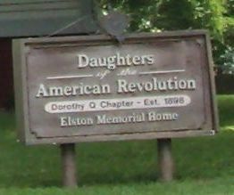
D.A.R. "Dorothy Q." Chapter - Est. 1898 - - Elston Memorial Home Marker
| 301 ► Indiana, Montgomery County, Crawfordsville — Elston Memorial Home — Col. Isaac C. Elston Home — |
| On East Wabash Avenue, on the left when traveling east. | |||
| 302 ► Indiana, Montgomery County, Crawfordsville — 54.1995.1 — Speed Cabin — |
| On North Grant Street. | |||
| 303 ► Indiana, Morgan County, Monrovia — West Union Friends Meeting — |
| On State Road 42 just west of Northwest Union Road, on the right when traveling west. | |||
| 304 ► Indiana, Ohio County, Rising Sun — 58.2018.1 — Barkshire Family — |
| On Fourth Street at North Poplar Street, on the left when traveling east on Fourth Street. | |||
| 305 ► Indiana, Parke County, Bloomingdale — Underground Railroad Station — 1850 — 1868 — Alfred & Rhoda Hadley — |
| On U.S. 41 0.1 miles County Road 500N, on the left when traveling north. | |||
| 306 ► Indiana, Randolph County, Union City — IHB 68.201 — Union Literary Institute — |
| On Stingley Rd (County Route 600 S) at South Arba Pike (County Route 850 E), on the right when traveling east on Stingley Rd. | |||
| 307 ► Indiana, Randolph County, Winchester — 68.2010.1 — Randolph County Quakers — |
| On E. Washington Street (State Road 32) at S. East Street, on the right when traveling east on E. Washington Street. | |||
| 308 ► Indiana, Randolph County, Winchester, White River Township — Organized Religion — |
| On West Franklin Street at South Main Street, on the right when traveling west on West Franklin Street. | |||
| 309 ► Indiana, Ripley County, Milhousen — 69.2004.1 — Union Church — |
| On County Road N 975W at W. Flatrock Road, on the right when traveling north on County Road N 975W. | |||
| 310 ► Indiana, Ripley County, Napoleon — Railroad House Hotel — |
| On Madison Street (U.S. 421) north of Main Street, on the left when traveling north. | |||
| 311 ► Indiana, Ripley County, Osgood — Abolitionists — |
| On East Fairground Avenue east of East Beech Street (State Road 350), on the left when traveling east. | |||
| 312 ► Indiana, Ripley County, Osgood — The Fugitive Trail — |
| On East Fairground Avenue east of East Beech Street (State Road 350), on the left when traveling east. | |||
| 313 ► Indiana, Ripley County, Versailles — 69.2004.2 — Stephen S. Harding — |
| On East Tyson Street at North Washington Street, on the left when traveling east on East Tyson Street. | |||
| 314 ► Indiana, Steuben County, Angola — Free Lecture! — Sojourner Truth — |
| On South Public Square at Wayne Street, on the right when traveling north on South Public Square. | |||
| 315 ► Indiana, Steuben County, Angola — Sojourner Truth — |
| On Wayne Street at East Maumee Street when traveling south on Wayne Street. | |||
| 316 ► Indiana, Steuben County, Fremont — The Erastus Farnham House — |
| On West Swager Drive at South Wayne Street (Indiana Road 827), on the left when traveling west on West Swager Drive. | |||
| 317 ► Indiana, Steuben County, Ray — The Unknown Potawatomi — |
| On West Cora Lane (Local Road N700E) near Local Road E750N, on the right when traveling south. | |||
| 318 ► Indiana, Switzerland County, Vevay — Historical Site - Switzerland County Courthouse — |
| On West Main Street west of Liberty Street, on the right when traveling west. | |||
| 319 ► Indiana, Switzerland County, Vevay — The Dungeon — |
| On West Main Street west of Liberty Street, on the right when traveling west. | |||
| 320 ► Indiana, Tippecanoe County, Lafayette — The Buddell Sleeper House — Underground Railroad Station — |
| On West 700 South at South 550 West, on the right when traveling east on West 700 South. | |||
| 321 ► Indiana, Tippecanoe County, Westpoint — Underground Railroad |
| On County Road W 700 S east of Road S 550 W, on the right when traveling east. Reported permanently removed. | |||
| 322 ► Indiana, Vanderburgh County, Evansville — Underground Railway Station — |
| On Carpenter Street at NW 3rd Street, on the right when traveling west on Carpenter Street. | |||
| 323 ► Indiana, Vigo County, Terre Haute — Lost Creek — AME — The Underground Railroad — |
| On North Hunt Street at Debney Road, on the right when traveling north on North Hunt Street. | |||
| 324 ► Indiana, Wayne County, Centerville — 89.2013.1 — George Washington Julian — |
| On E. Main Street (U.S. 40) at N. Third Street, on the left when traveling east on E. Main Street. | |||
| 325 ► Indiana, Wayne County, Dublin — 89.2003.1 — Indiana’s First Woman’s Rights Convention — |
| On Cumberland Street (U.S. 40) west of Davis Street, on the right when traveling west. | |||
| 326 ► Indiana, Wayne County, Fountain City — Home of Levi Coffin — |
| On Cross Street (U.S. 27) at South Water Street, on the right when traveling north on Cross Street. | |||
| 327 ► Indiana, Wayne County, Fountain City — 89.2002.1 — Levi Coffin — |
| On Cross Street (U.S. 27) at South Water Street, on the right when traveling north on Cross Street. | |||
| 328 ► Indiana, Wayne County, Richmond — 89.2018.2 — Bishop William Paul Quinn — |
| On South 6th street at South B Street, on the right when traveling south on South 6th street. | |||
| 329 ► Indiana, Wayne County, Richmond — Mendenhall-Clay Debate/Confrontation — |
| On N A Street (U.S. 40) at 7th Street, on the right when traveling west on N A Street. | |||
| 330 ► Iowa, Cass County, Lewis — Fighting Slavery – Aiding Runaways — John Brown Freedom Trail — December 20, 1858 - March 12, 1859 — |
| Near 567th Lane. | |||
| 331 ► Iowa, Cass County, Lewis — Rev. George B. Hitchcock House — |
| Near 567th Lane. | |||
| 332 ► Iowa, Dallas County, Redfield — Fighting Slavery - Aiding Runaways — John Brown Freedom Trail — December 20, 1858 - March 12, 1859 — |
| On First Street north of Omaha Street, on the right when traveling north. | |||
| 333 ► Iowa, Des Moines County, Burlington — The First Congregational Church — |
| On North 4th Street just north of Jefferson Street, on the left when traveling north. | |||
| 334 ► Iowa, Iowa County, Ladora — 41 — Historic Grinnell — |
| Near Interstate 80 at milepost 208, 3.6 miles west of County Highway V52, on the right when traveling west. | |||
| 335 ► Iowa, Lee County, Keokuk — Charlotta Gordon Pyles — |
| On Main Street at Sixth Street on Main Street. | |||
| 336 ► Iowa, Linn County, Cedar Rapids, Taylor — Riverside Park — History Happened Here! — |
| On C Street Southwest at A Street Southwest, on the right when traveling west on C Street Southwest. | |||
| 337 ► Iowa, Polk County, Mitchellville — Universalist Church — 1868 — |
| On 4th Street NW near Market Street NW, on the right when traveling west. | |||
| 338 ► Iowa, Polk County, Polk City — Josiah Hopkins' 20-Mile House — |
| On Northwest Madrid Drive at Northwest Nissen Drive, on the right when traveling south on Northwest Madrid Drive. | |||
| 339 ► Iowa, Polk County, West Des Moines — Welcome to the Jordan House — |
| Near Fuller Road west of South 19th Street, on the right when traveling west. | |||
| 340 ► Iowa, Polk County, West Des Moines, Valley Junction — Valley Junction — |
| On Railroad Place east of 5th Street, on the right when traveling east. | |||
| 341 ► Iowa, Poweshiek County, Grinnell — J. B. Grinnell — |
| On 3rd Avenue at Park Street, on the left when traveling east on 3rd Avenue. | |||
| 342 ► Iowa, Scott County, Davenport — Oakdale Cemetery Historic District — |
| On Eastern Avenue north of Wittenmyer Lane, on the right when traveling north. | |||
| 343 ► Kansas, Allen County, Humboldt — Aunt Polly Crosby's Cabin Site — |
| On Sycamore Street, on the right when traveling east. | |||
| 344 ► Kansas, Allen County, Humboldt — Colonel Orlin Thurston — |
| On 8th Street near Bridge Street, on the left when traveling north. | |||
| 345 ► Kansas, Allen County, Humboldt — Humboldt Underground Railroad — |
| On 1st Street, on the left when traveling north. | |||
| 346 ► Kansas, Atchison County, Atchison — 11 — Atchison — |
| On Skyway Highway (U.S. 59) 0.2 miles west of Rawlins Road, on the right when traveling west. | |||
| 347 ► Kansas, Bourbon County, Fort Scott — "But I Can Fire a Pistol" — |
| Near Old Fort Boulevard. | |||
| 348 ► Kansas, Bourbon County, Fort Scott — Western Hotel: Symbol of Strife — |
| Near Old Fort Boulevard. | |||
| 349 ► Kansas, Douglas County, Lawrence — 9 — Lawrence and the Old Trails — |
| On Interstate 70 at milepost 209, in the median. | |||
| 350 ► Kansas, Douglas County, Lawrence, Lawrence Cultural District — John Brown and the Siege of Lawrence, September 14-15, 1856 — |
| On Massachusetts Street south of 6th Street, on the left when traveling south. | |||
| 351 ► Kansas, Douglas County, Lawrence, Lawrence Cultural District — Liberty Hall — |
| On Massachusetts Street at 7th Street, on the left when traveling south on Massachusetts Street. | |||
| 352 ► Kansas, Douglas County, Lecompton — Sheriff Samuel J. Jones — 1827-1885 — Historic Lecompton — |
| On Elmore Street 0.1 miles south of East 3rd Street, on the right when traveling south. | |||
| 353 ► Kansas, Douglas County, Lecompton — Veterans Monument — 1861-2011 — Historic Lecompton — |
| On Elmore Street south of East 3rd Street, on the left when traveling north. | |||
| 354 ► Kansas, Elk County, Elk Falls — Prudence Crandall — |
| On U.S. 160 at Osage Street, on the right when traveling east on U.S. 160. | |||
| 355 ► Kansas, Elk County, Elk Falls — 112 — Prudence Crandall — |
| On U.S. 160 at Osage Street, on the right when traveling east on U.S. 160. | |||
| 356 ► Kansas, Jackson County, Holton — Edward D. Holton — |
| On Pennsylvania Avenue at 5th Street, on the right when traveling north on Pennsylvania Avenue. | |||
| 357 ► Kansas, Jackson County, Netawaka — 17 — Battle of the Spurs |
| On U.S. 75 at 286th Road, on the left when traveling south on U.S. 75. Reported permanently removed. | |||
| 358 ► Kansas, Jackson County, Netawaka — 17 — Battle of the Spurs — |
| On 286th Road at U.S. 75, on the right when traveling west on 286th Road. | |||
| 359 ► Kansas, Jefferson County, Valley Falls — 13 — Battle of Hickory Point — |
| On U.S. 59 at 142nd Street, on the left when traveling north on U.S. 59. | |||
| 360 ► Kansas, Leavenworth County, Leavenworth — Bleeding Kansas — Historic Wayside Tour #12 — |
| On Esplanade Street near Miami Street, on the left when traveling south. | |||
| 361 ► Kansas, Leavenworth County, Leavenworth — Leavenworth — The Oldest City in Kansas — |
| On 5th Street north of Shawnee Street, on the right when traveling north. | |||
| 362 ► Kansas, Leavenworth County, Leavenworth — Planters Hotel — National Underground Railroad Network to Freedom Site — |
| On Esplanade Street at Shawnee Street, on the right when traveling north on Esplanade Street. | |||
| 363 ► Kansas, Linn County, Mound City — Fort Montgomery — Replica built in 2000 — |
| On Main Street (State Highway 52) west of 7th Street, on the right when traveling west. | |||
| 364 ► Kansas, Linn County, Trading Post — 46 — Marais des Cygnes Massacre — |
| On U.S. 69 near Kansas Highway 52. | |||
| 365 ► Kansas, Linn County, Trading Post — Marais des Cygnes Massacre State Historic Site Trail — |
| Near North Zook Lane. | |||
| 366 ► Kansas, Linn County, Trading Post — Murder on the Marais des Cygnes — |
| Near North Zook Lane. | |||
| 367 ► Kansas, Linn County, Trading Post — Sounds from the past...hoof beats and heartbeats. — Frontier Military Historic Byway — |
| Near North 4th Street. | |||
| 368 ► Kansas, Miami County, Osawatomie — 50 — John Brown Country — |
| On 6th Street at Lincoln Avenue, on the left when traveling north on 6th Street. | |||
| 369 ► Kansas, Miami County, Osawatomie — John Brown of Kansas — |
| On 10th Street at Main Street, on the right when traveling north on 10th Street. | |||
| 370 ► Kansas, Miami County, Osawatomie — John Brown Statue — 1935 — |
| Near Main Street. | |||
| 371 ► Kansas, Miami County, Osawatomie — Old Stone Church — Ad Astra Per Aspera — [To the stars through difficulties] — |
| On 6th Street north of Parker Avenue, on the right when traveling north. | |||
| 372 ► Kansas, Miami County, Osawatomie — 6 — Old Stone Church — Osawatomie Driving Tour — |
| On 6th Street north of Parker Avenue, on the right when traveling north. | |||
| 373 ► Kansas, Miami County, Osawatomie — 9 — Soldiers Monument — Osawatomie Driving Tour — |
| On Main Street at 9th Street, on the right when traveling west on Main Street. | |||
| 374 ► Kansas, Nemaha County, Sabetha — 32 — The Lane Trail — |
| On Acorn Road (U.S. 75) 0.8 miles 280th Road (State Highway 246), on the right when traveling south. | |||
| 375 ► Kansas, Saline County, Salina — August Bondi — 1833-1907 — Jewish-American Abolitionist, Salina Resident — |
| On West Iron Avenue. | |||
| 376 ► Kansas, Shawnee County, Topeka — A Turning Point for Equality — |
| On SE Monroe Street south of SE 15th Street, on the left when traveling south. | |||
| 377 ► Kansas, Shawnee County, Topeka — 15 — Capital of Kansas |
| On 37th Street at Topeka Boulevard, on the right when traveling west on 37th Street. Reported permanently removed. | |||
| 378 ► Kansas, Shawnee County, Topeka — Constitution Hall -Topeka — 1855 - — |
| On Kansas Avenue near SW 5th Street, on the right when traveling south. | |||
| 379 ► Kansas, Shawnee County, Topeka — Ichabod Washburn — 1798-1868 — |
| Near Southwest Jewell Avenue. | |||
| 380 ► Kansas, Wyandotte County, Kansas City, Quindaro Bluffs — John Brown — |
| On 27th Street at Sewell Avenue, on the left when traveling north on 27th Street. | |||
| 381 ► Kansas, Wyandotte County, Kansas City, Quindaro Bluffs — Quindaro Ruins Archaeological Park — |
| On North 27th Street. | |||
| 382 ► Kansas, Wyandotte County, Kansas City, Quindaro Bluffs — Quindaro, Kansas — 1857 1862 — A Kansas City, Kansas Historic Site — |
| On 27th Street at Sewell Avenue, on the left when traveling north on 27th Street. | |||
| 383 ► Kentucky, Boone County, Burlington — Passage To Freedom From Slavery — Memorial to the Undergrond Railroad in Boone County, Kentucky — Another Marker in Rabbit Hash — |
| Near Lower River Road. | |||
| 384 ► Kentucky, Boyle County, Danville — 1606 — John Marshall Harlan / Kentucky's "Great Dissenter" — (1833-1911) — |
| On W Main Street. | |||
| 385 ► Kentucky, Bracken County, Germantown — 2076 — John Gregg Fee / Arnold Gragston — (1816–1901) / — |
| On Bridgeville Road (Kentucky Route 875) south of Brooksville-Germantown Road ( Route 10), on the right when traveling south. | |||
| 386 ► Kentucky, Campbell County, Bellevue — 1351 — Bellevue, Kentucky — |
| On Fairfield Avenue (Kentucky Route 8) near Patchen Avenue, on the right when traveling east. | |||
| 387 ► Kentucky, Campbell County, Newport — 121 — General James Taylor Home — |
| On East Third Street at Overton Street, on the right when traveling west on East Third Street. | |||
| 388 ► Kentucky, Daviess County, Maceo — 1241 — Uncle Tom Lived Here — |
| On U.S. 60 1.2 miles east of Kelly Cemetery Road, on the right when traveling east. | |||
| 389 ► Kentucky, Fayette County, Lexington — 2466 — Second Presbyterian Church — |
| On East Main Street (Business U.S. 25) at Ransom Avenue, on the right when traveling south on East Main Street. | |||
| 390 ► Kentucky, Fayette County, Lexington, Historic South Hill — 2 — Thriving Black Entrepreneurs — Freed Blacks Lived in this Neighborhood — Downtown African-American Heritage Trail — |
| On South Limestone north of West Maxwell Street, on the left when traveling north. | |||
| 391 ► Kentucky, Franklin County, Frankfort — 2235 — Emily Thomas Tubman House — |
| On Washington Street south of West Broadway Street, on the right when traveling south. | |||
| 392 ► Kentucky, Green County, Greensburg — 846 — Lincoln's Law Partner — |
| On S. Main Street (U.S. 68) south of W. Columbia Avenue, on the right when traveling south. | |||
| 393 ► Kentucky, Green County, Summersville — 719 — Lincoln's Mentor — |
| On Hudgins Highway (State Highway 569) at Hodgenville Road (State Highway 61), on the right when traveling west on Hudgins Highway. | |||
| 394 ► Kentucky, Jefferson County, Louisville, Butchertown — Lincoln Memorial — [Louisville, Kentucky] — |
| On East River Road at E Witherspoon Street, on the right when traveling east on East River Road. | |||
| 395 ► Kentucky, Jefferson County, Louisville, Downtown — 2072 — Kentucky Fugitives to Canada — |
| On W. Main Street (U.S. 31W) at N. 4th Street, on the right when traveling west on W. Main Street. | |||
| 396 ► Kentucky, Jefferson County, Louisville, Downtown — 1990 — Slave Trading In Louisville / Garrison Slave Pen Site — |
| On S 2nd Street at W Main Street, on the right when traveling north on S 2nd Street. | |||
| 397 ► Kentucky, Jefferson County, Louisville, University — Freedom Park: A Journey to Freedom — The Underground Railroad — |
| On South 3rd Street south of West Cardinal Boulevard, on the left when traveling south. | |||
| 398 ► Kentucky, Jefferson County, Louisville, University — The Freedom Park: A Journey to Freedom — The Free Black Community of Louisville — |
| On West Cardinal Boulevard at South 3rd Street ( Route 1020), on the right when traveling east on West Cardinal Boulevard. | |||
| 399 ► Kentucky, Jessamine County, Nicholasville — African American Enlistment — |
| Near Danville Road Loop 2 0.4 miles south of Fitch Road. | |||
| 400 ► Kentucky, Jessamine County, Nicholasville — The Thirteenth Amendment — |
| Near Danville Road Loop 2 0.4 miles south of Fitch Road. | |||
2029 entries matched your criteria. Entries 301 through 400 are listed above. ⊲ Previous 100 — Next 100 ⊳