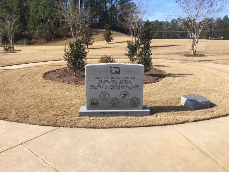
On Alabama Route 225 0.3 miles north of Upper Shay Branch Road.
In commemoration of all Sky Soldiers
whose valor and sacrifice in defense of
South Vietnam must never be forgotten
"All Gave Some – Some Gave All" — — Map (db m100946) WM
The Moon Tree was grown from seeds that journeyed to the moon and back aboard Apollo 14 during the period of January 31-February 9, 1971.
The seed was germinated by the U.S. Forest Service in Gulfport, Mississippi, and the seedling was presented to . . . — — Map (db m108374) HM
On 5th Street at Avenue B, in the median on 5th Street.
On May 3. 1941, the largest flying field in the United States, military or civilian, opened its gates as a new unit of the Southeast Air Corps Training Center, where flying cadets received advanced schooling in the handling of multi-mile-a-minute . . . — — Map (db m92359) HM
The memorial includes inscriptions on four sides.
Richard Gunter Crommelin
Lieutenant Commander U.S. Navy
January 8, 1917 - July 14, 1945
Young fighter pilot on U.S.S. Yorktown CV-5. Shot
down two Japanese Zeros in Battle of Coral . . . — — Map (db m137263) HM WM
On Alabama Route 172 north of Canyon Road, on the right when traveling north.
The Town of Hodges held a war bond auction in the month of January 1943. The proceeds amounted to about $47,000. As an award, the war department allowed Hodges to name a P-51 Mustang Fighter aircraft. She was named "The Spirit of Hodges." The plane . . . — — Map (db m83741) HM
Why was it formed?
The December 2019 National Defense Authorization Act created the Space Force as the sixth branch of the Armed Forces.
It was established to protect our interests in space, deter aggression in, from, and to space, . . . — — Map (db m268149) HM
On 19th Street North north of F L Shuttlesworth Drive, on the right when traveling north.
Birmingham's new leaders were much kinder to Rev. Shuttlesworth than their
predecessors. In 1978, officials renamed one of the city's main roads in his
honor. The city's first African-American mayor, Richard Arrington, Jr.,
requested his return . . . — — Map (db m187573) HM
(First Plaque): Navy pilots typically had their names painted on the side and just below the cockpit of one of the squadron aircraft. Most also had "Call Signs," some of which became the nickname of the pilot. On the display aircraft this . . . — — Map (db m83808) HM
On Veterans Park Drive 0.3 miles east of South Cox Creek Parkway ( Route 133), on the left when traveling east.
This Hamilton-Standard 23E50-505 hydromatic propeller is from Douglas Aircraft C-47 transport plane known as the Gooney Bird.
The C-47s operated in both the European and Pacific theaters of W.W. II as troop and cargo transports, and initiated . . . — — Map (db m69659) HM
Near South Court Street at Canal Street, on the right when traveling south.
Toward the end of the 19th Century, the U.S. government decided that Native Americans should integrate into American culture and give up tribal sovereignty.
The Dawes Allotment Act forced Native Americans to register on what became known as . . . — — Map (db m212215) HM
Named Associate Director of Marshall Space Flight Center in 2016, Jonathan Pettus was honored with the NASA Medal for Outstanding Leadership in 2005 and the Presidential Rank Award of Distinguished Executives in 2009. — — Map (db m219293) HM
On Veterans Park Drive 0.2 miles east of South Cox Creek Parkway ( Route 133), on the left when traveling east.
This F-4D Phantom is displayed in honor of Lt. Col. Edward Yeilding and all Veterans who served with the Phantom aircraft. Captain Ed Yeiding’s name is painted on the front canopy to honor his nine years flying Phantoms similar to this F-4D and . . . — — Map (db m84028) HM
Near Highttower Place south of Veterans Drive ( Route 133), on the left when traveling south.
After flying more than 90 worldwide reconnaissance missions, in 1990 Lt. Col. Ed Yeilding set a coast to coast aircraft speed record of 67 minutes 54 seconds flying an SR-71 spy plane, which is now at the Smithsonian. — — Map (db m219174) HM
Near Hightower Place south of Veterans Drive ( Route 133), on the left when traveling south.
In his 14 years in the U.S. House of Representatives (1977-1991), Ronnie Flippo held such important posts as the chairmanship of the Space Science Subcommittee during the development of the space shuttle, Columbia. — — Map (db m219170) HM
On Veterans Park Drive 0.2 miles east of South Cox Creek Parkway ( Route 133), on the left when traveling east.
The AH-1 Cobra is an anti-armor close support/attack helicopter. The Cobra is powered by a General Electric T-700-GE-401 turboshaft engine. The Cobra is 58’ long,
has a wingspan of 10’-7”, and is 14’-2” in height. The AH-1 flies at 175 . . . — — Map (db m69648) HM
On Veterans Park Drive 0.2 miles east of South Cox Creek Parkway ( Route 133), on the left when traveling east.
The Phantom
The F-4 Phantom was the U.S. Air Force’s fastest, highest-flying and longest-range fighter. It first flew May 27, 1958, and entered United States Air Force service in 1963. It was named Phantom II on July 3, 1959, during a . . . — — Map (db m69636) HM
On Sanderson Lane at WC Handy Avenue, in the median on Sanderson Lane.
(side 1)
Courtland Army Air Field (CAAF): Facilities
At its greatest strength, CAAF was home to 4600 officers, enlisted servicemen, and cadets. During the war years it was the largest population center within Lawrence County. Over . . . — — Map (db m74411) HM
On Sanderson Lane at WC Handy Avenue, in the median on Sanderson Lane.
(side 1)
Courtland Army Air Field (CAAF): Beginnings
Following the onset of WWII the Army Air Corps initiated an ambitious pilot training program. During its most active period, this program would train over 100,000 pilots per . . . — — Map (db m74409) HM
On Wheeler Dam Highway (Alabama Route 101) at County Route 412 on Wheeler Dam Highway.
Many people may not relize that NASA’s first voyage to the moon was intended to travel through the lock at TVA's Wheeler Dam. NASA planned to ship its Saturn rocket booster (which would eventually carry astrounts to the moon for the Apollo program . . . — — Map (db m229349) HM
The 224-foot Saturn IB Rocket displayed here is one of three launched vehicles in the Saturn family of rockets developed in Huntsville. The Saturn IB rocket had more power than the earlier Saturn I- enough for orbital missions with the Apollo . . . — — Map (db m207546) HM
Near Bee Line Highway (U.S. 31) 0.6 miles south of Thomas L Hammons Road, on the left when traveling south.
The Southeast Air Forces Training Center operated by Southern Aviation Training School, also known as Pryor Field, was constructed in 1941. These two aircraft hangars and beacon tower are the remaining artifacts of one of only a few World War II . . . — — Map (db m85425) HM
Alabama will continue to be key to America's future
leadership in space. NASA and its commercial and
academic partners in Alabama will manage the
development of the Space Launch System, history's
largest heavy-lift rocket, and human support . . . — — Map (db m160612) HM
On Interstate 65S, on the right when traveling south.
The Saturn I, the Saturn IB and the Saturn V were all
members of the Saturn family of rockets developed in
Huntsville. The Saturn IB, as displayed here in full scale,
had more power than the earlier Saturn I-enough for
orbital training missions . . . — — Map (db m160608) HM
The George C. Marshall Space Flight Center, located on
Huntsville's Redstone Arsenal, has provided America's
space solutions since 1960. As one of NASA's largest
engineering centers, Marshall offers its extensive expertise
and unique facilities . . . — — Map (db m160609) HM
Developed by the
Marshall Space Flight Center, Huntsville, Alabama,
and associated contractors.
Erected by the citizens of Alabama
as a tribute to the men and women who
made it possible for this nation to
explore space for peaceful purposes, . . . — — Map (db m160613) HM
While traveling through Alabama, we invite you to Visit the
U.S. Space and Rocket Center, home of U.S. Space
Camp and Aviation Challenge, The journey through the
U.S. Space and Rocket Center will lead you from the
beginning of rocketry to . . . — — Map (db m160611) HM
On Alabama 15 (U.S. 29) 3.2 miles south of Old Columbus Road, on the left when traveling south.
Established in 1939 by Tuskegee aviators Forrest Shelton, Stanley Kennedy,
and Joe Wright Wilkerson. Initially known as SKW Field, the facility
was renamed for Stanley Kennedy. The 55-acre airfield was leased by
Tuskegee Institute in February . . . — — Map (db m304219) HM
Known as the Tea Room, this small lunchroom was built during the initial expansion phase of Moton Field in 1942 and 1943, when amenities such as offices and bathrooms not built into the original hangar were added. Here, personnel stationed at . . . — — Map (db m64362) HM
Try to imagine how Moton Field looked and sounded when the cadets trained here. Compare the scene today to the photograph below, taken from your vantage point around 1944. As the pace of training accelerated during the war, Moton Field became a very . . . — — Map (db m64366) HM
During World War II a guard house stood just outside the brick entrance gates to Moton Field. The framed structure closest to you is a representation of the guard house. The historic entrance gates are just beyond. How excited the young cadets must . . . — — Map (db m99927) HM
This building was completed in 1941 as a restroom, shower, and locker room for administrative and support personnel. It had facilities for both men and women. Both black and white may have used the building. If so, it almost certainly would have . . . — — Map (db m64361) HM
A fire at an airfield, with highly flammable materials everywhere, could be catastrophic. The Bath and Locker House fire shown here highlighted the need for a dependable water supply for firefighting. A pond met that need. It also helped control . . . — — Map (db m100251) HM
The Cadet House and the Army Supply Building provided much-needed space when training operations expanded in 1942 and 1943. The Cadet House also held a cadet classroom and waiting room, a coat room, and the Flight Surgeon's Office. The Army Supply . . . — — Map (db m100252) HM
In Hangar No. 1 flying became real for the aviation cadet. The hangar housed the main activities of the airfield, including flight debriefings, flight record-keeping, aircraft maintenance, and military and civilian management. Several smaller . . . — — Map (db m64365) HM
During World War II primary training airplanes were built mostly of wood and fabric. Ground crews sealed and strengthened the fabric with several applications of a highly flammable, explosive acetate coating called "dope." This shed was used to . . . — — Map (db m100253) HM
This is the site of Hangar No. 2, completed in early 1944 in response to the tremendous increase in the number of cadets training at Moton Field. The building, nearly identical to Hangar No. 1, contained classrooms, a briefing room, a medical . . . — — Map (db m99931) HM
Moton Field was built by Tuskegee Institute, now Tuskegee University, in 1941 after the school contracted with the U.S. Army to provide primary flight training for the nation's first African American military pilots. By the end of World War II . . . — — Map (db m99940) HM
This ventilated shed provided safe and convenient storage for the large quantities and various grades of oil used at Moton Field for the maintenance of airplanes and service vehicles. It has been adapted to house the site's fire protection system. . . . — — Map (db m100254) HM
Tuskegee Airmen National Historic Site commemorates the contributions of the Tuskegee Airmen during World War II—and to American society afterward. The site preserves Moton Field, where the airmen trained before going to war. Their courageous . . . — — Map (db m99938) HM
From Moton Field’s Control Tower, controllers directed flight operations and signaled landing instructions to pilots through a system of flashing colored lights. Dispatchers called cadets for their flights. The tower overlooked the busy – . . . — — Map (db m64363) HM
Over 1,000 cadets learned to fly here at Moton Field, taking off and landing on an open, grassy field beyond the structures below. The field was used so intensely for primary flight training during World War II that the aircraft soon rutted the . . . — — Map (db m99941) HM
The first African American fighter pilots in the U.S. Army Air Corps were the public face of the Tuskegee Airmen. They made extraordinary contributions to the Allied victory in Europe during World War II. But their success was made possible by the . . . — — Map (db m99934) HM
Young African American men came to Tuskegee from all over the nation to train as military pilots. They began with primary flight training here at Tuskegee Institute's Moton Field. Tuskegee Institute also had a smaller field, Kennedy Field, where . . . — — Map (db m100255) HM
Near Chappie James Avenue 0.3 miles east of Chappie James Avenue.
The tarmac between the two hangars was a busy part of Moton Field. Cadets arriving by bus were dropped off here and went to their duties in preparation for flight training. Others boarded the buses to return to the Tuskegee Institute campus. Fuel . . . — — Map (db m99681) HM
On Campus Road east of Foster [West Outer] Drive, on the right when traveling east.
This plaza is dedicated to the memory of the Tuskegee Airmen, including General Daniel "Chappie" James, whose training at Tuskegee University and the Tuskegee Army Air Field enabled them to prove for all time the competence and bravery of Black . . . — — Map (db m20076) HM
On University Avenue at Foster Drive, on the right when traveling east on University Avenue.
This U.S. Air Force F-4C Phantom Jet Fighter was flown by General "Chappie" James, Tuskegee University graduate and first Black Four-Star General in the U.S. Armed Services, on his last combat mission--Operation Bold--over Southeast Asia. It flies . . . — — Map (db m101902) HM
Near Tranquility Base 0.5 miles west of Old Madison Pike NW, on the left when traveling west.
Neil Armstrong, Apollo 11 commander, spoke his famous words as he stepped onto the surface of the Moon.
On July 20, 1969, President John F. Kennedy's mandate that America go to the Moon was fulfilled - Apollo 11's lunar module Eagle . . . — — Map (db m85465) HM
Of the 355 individuals that flew on NASA's Space Shuttles, 306 were men and 49 were women. Over the course of the program, astronauts from 16 different countries flew Shuttle missions.
Sally Ride became the first American woman in space when . . . — — Map (db m247462) HM
Atlantis was named after the primary research vessel for the Woods Hole Oceanographic Institute in Massachusetts from 1930 to 1966.
Atlantis was the fourth operational Shuttle and made its first flight, STS-51J, on Oct. 3, 1985. This Shuttle sent . . . — — Map (db m247466) HM
The U.S. Armed Forces Avaitor Statue depicts an aviator proudly featuring from a successful mission.
It pays tribute to all U.S. Military Aviators and commemorates their courage, their sacrifice, and their commitment to duty. The U.S. Armed Forces . . . — — Map (db m268703) HM WM
Near Tranquility Base 0.5 miles west of Old Madison Pike NW, on the left when traveling west.
Commander Gene Cernan spoke these words as the last man to walk on the Moon.
Apollo 17 was the final Apollo mission and the crowning achievement of the entire Apollo program. The mission set numerous Apollo program records: the longest mission, . . . — — Map (db m85489) HM
Heavy-lift Transporter
Known as the workhorse of the U.S. Army, the Boeing Chinook is a tandem-rotor, heavy-lift transport helicopter designed to move personnel, supplies, and equipment in support of combat operations. Secondary missions . . . — — Map (db m247205) HM
Near Tranquility Base 0.5 miles west of Old Madison Pike NW, on the left when traveling west.
Command module pilot Richard Gordon assured Pete Conrad, lunar module commander, that his landing was right on target.
Apollo 12 stands out as the first of the Moon flights to achieve a pinpoint landing. Despite a rocky start caused by . . . — — Map (db m85492) HM
Alabama Astronaut Joe F. Edwards flew the seeds that formed this tree aboard the Space Shuttle Endeavor (OV-105). Launched on January 22, 1998, the seeds traveled with Edwards over 3.6 million miles. After 8 days, 19 hours, and 48 minutes of . . . — — Map (db m247204) HM
Near Tranquilty Base 0.5 miles west of Madison Pike, on the left when traveling west.
The tank exhibited at the U. S. Space & Rocket Center is real. It was delivered to NASA in 1977 it was the first ever built for the shuttle program. The tank was used in the Space Shuttle Main Engine test program at NASA’s Stennis Space Center in . . . — — Map (db m98216) HM
The Space Shuttle, officially called the Space Transportation System (STS) began its flight career on April 12, 1981, with the launch of Columbia from Launch Pad 39A at NASA's Kennedy Space Center in Florida. Atlantis flew the final . . . — — Map (db m247647) HM
On Rideout Road, on the right when traveling south.
On September 8, 1960, President Dwight Eisenhower formally dedicated the George C. Marshall Space Flight Center in Huntsville, Alabama, as a new field installation of the National Aeronautic and Space Administration (NASA) organization that had . . . — — Map (db m50147) HM
Near Tranquility Base 0.5 miles west of Old Madison Parkway NW, on the left when traveling west.
These were among the last words from Apollo 1.
On January 27, 1967, the first scheduled Apollo flight, Apollo/Saturn 204, was undergoing routine launch pad tests. Soon after the crew was sealed inside the command module, a deadly fire exploded . . . — — Map (db m85495) HM
On Airport Road SW at Memorial Parkway SW (U.S. 231), on the right when traveling east on Airport Road SW.
First American-made guided missile put on public display. First showing was May 14, 1953 at Huntsville, home of the world's largest rocket and guided missile research and development center, Redstone Arsenal. — — Map (db m34957) HM
On Tranquility Base 0.5 miles west of Old Madison Pike NW, on the left when traveling west.
Commander Jim Lovell's words initiated heroic efforts by crew and mission control to salvage a crippled spacecraft and return Apollo 13 safely to Earth.
The Apollo 13 mission is the only Apollo flight remembered primarily for the effort to . . . — — Map (db m85543) HM
Near Tranquility Base 0.4 miles west of Madison Pike, on the left when traveling west.
The Pathfinder’s three main engines are real. The two lower engines powered the first flight of Columbia in 1981. The engine located at the top was used in ground test firings.
At launch, the three Space Shuttle Main Engines (fed liquid . . . — — Map (db m98026) HM
On Westside Square, on the right when traveling south.
This plaque was placed here by
Citizens of Huntsville and
Madison County, Alabama,
In Honor Of
Major General H.N. Toftoy, USA.
Who was Commanding General
of Redstone Arsenal
from September 1, 1954, to March 31, 1958.
It was unveiled . . . — — Map (db m27906) HM
Near Tranquility Base 0.5 miles west of Old Madison Pike NW, on the left when traveling west.
"…We had to fly once more before we take the big step…" —Apollo spacecraft program manager, George Low, explained why landing on the Moon would have to wait a little longer.
Apollo missions 9 and 10 served as vital dress rehearsals. . . . — — Map (db m85544) HM
On Monte Sano Boulevard Southeast, on the right when traveling north.
From a small self-contained 1800s rural community Monte Sano ballooned with the Space Age. By 1958 there were approximately 100 families connected with the Space Program living on Monte Sano. Many were von Braun Rocket Team Members.
The school . . . — — Map (db m154275) HM
Near Tranquility Base 0.5 miles west of Madison Pike, on the left when traveling west.
Able, an American-born rhesus monkey, and Baker, a South American squirrel monkey, were launched on May 28, 1959, aboard an Army Jupiter missile. Launched in the nose cone, the two animals were carried to a 300-mile altitude, and both were recovered . . . — — Map (db m239330) HM
Near Tranquiltiy Base 0.5 miles Madison Pike, on the left when traveling west.
The Mobile Geological Laboratory (MOLAB) was built as part of the development of NASA's Lunar Roving Vehicle(LRV) program. NASA engineers and scientists studied a number of different concepts for vehicles to use on the lunar surface. This rover . . . — — Map (db m98200) HM
This vehicle was designed to land two astronauts on the moon and then launch them from its surface. It consisted of two main sections. The lower portion is the Descent Stage, with landing gear, propellant tanks, and a descent engine that could be . . . — — Map (db m247472) HM
The Saturn I was the first American launch vehicle developed solely for space exploration. Taller than a 16-story building, the Saturn I launched 10 tons (9 metric tons) of payload into Earth orbit. First static tested in Huntsville in May of 1961, . . . — — Map (db m247646) HM
Near Tranquility Base 0.5 miles west of Madison Pike, on the left when traveling west.
Skylab, the United States' first space station, was manned from May 25, 1973 to February 8, 1974 by three separate astronaut crews. Experiments were performed to enrich our knowledge of Earth, Sun, stars and cosmic space; to study the effects of . . . — — Map (db m98190) HM
Near Tranquility Base 0.4 miles west of Madison Pike, on the left when traveling west.
Pathfinder is a 75-ton simulator which was used to practice lifting and handling the real Orbiters. It was originally built at Marshall Space Flight Center in 1977 as a stand-in for Space Shuttle Enterprise to fit-check the roads and . . . — — Map (db m98021) HM
Near Tranquility Base 0.5 miles west of Madison Pike, on the left when traveling west.
Pathfinder is a test article of NASA Space Shuttle Orbiter, built by Marshall Space Flight Center (MSFC) in 1977 to practice lifting and handling the future Orbiter vehicles. Made of scrap rocket parts steel beams and wood, the mockup’s size, . . . — — Map (db m98197) HM
On Tranquility Base 0.2 miles west of Old Madison Pike.
Vanguard 1: America's First Solar-Powered Satellite
NASA began utilizing solar power to provide renewable energy to its space crafts as early as the 1950s. In 1958, the grapefruit-sized Vanguard 1 became the world's first solar-powered . . . — — Map (db m280674) HM
Near Tranquility Base 0.5 miles west of Old Madison Pike NW, on the left when traveling west.
Used during the Apollo Lunar Landing Program of the 1960's and 1970's, the Saturn V rocket remains the largest, most powerful rocket ever built.
This full scale mock up was completed in July 1999 to serve as the focal point for the 30th . . . — — Map (db m85601) HM
Near Tranquility Base 0.5 miles west of Old Madison Pike NW, on the left when traveling west.
"…A Merry Christmas and God bless all of you • All of you • On the good Earth."
With these good wishes, the crew of Apollo 8 signed off their Christmas Eve telecast from orbit around the Moon.
These successful flights came only months . . . — — Map (db m85602) HM
On Panorama Drive Southeast at Skyview Drive Southeast, on the right when traveling east on Panorama Drive Southeast.
Caroline (Cherokee) & William (Scotch-Irish) Schrimsher first of four generations to farm this 36 acres from 1880-1939. After World War II Wernher von Braun's team of scientists were brought from Germany to Ft. Bliss, Texas and then to Huntsville, . . . — — Map (db m154271) HM
Near Tranquility Base 0.5 miles west of Old Madison Pike NW, on the left when traveling west.
Lunar module pilot Jim Irwin described his ride in the first lunar rover.
The Apollo 15 mission is best remembered for introducing the electric Lunar Roving Vehicle, better known as the rover (which was developed at Huntsville's Marshall Space . . . — — Map (db m85603) HM
NASA's Space Shuttles have traveled 542,398,878 miles, making 21,152 Earth orbits. Each vehicle consisted of around 2.5 million moving parts. — — Map (db m247469) HM
Near Tranquility Base 0.5 miles west of Old Madison Pike NW, on the left when traveling west.
Alan Shepard's first words on the Moon - ten years after he made history as the first American in space.
Less than a year after the "successful failure" of Apollo 13, the mission of Apollo 14 accomplished much of what its predecessor had hoped . . . — — Map (db m85605) HM
An Unusual Hybrid
Chief among the many changes made to the Gulfstream G-11 for use as a Shuttle Training Aircraft (STA) is the highly modified cockpit in order to provide the most realistic approach and landing training possible, all the . . . — — Map (db m247645) HM
Development for use for the Space Shuttle, the Space Shuttle Main Engine or RS-25 powered 30 years of spaceflight during 135 missions. The Space Shuttle used three Main Engines, along with two Solid Rocket Boosters, for lift-off. After the solid . . . — — Map (db m247206) HM
Near Tranquilty Base 0.4 miles west of Madison Pike, on the left when traveling west.
Since the 1960s, NASA astronauts have trained for the stresses of spaceflight in the high-altitude, two-seater, supersonic T-38 Talon. Developed by Northrop Grumman, the T-38 became the world’s first supersonic jet trainer in 1961 when it entered . . . — — Map (db m98025) HM
The largest liquid-powered rocket engine ever used to launch Americans to space, the F-1 was the key to successfully "slipping the surly bonds" of Earth's gravity and sending Apollo astronauts on their first historic missions to the moon. With . . . — — Map (db m238054) HM
The first liquid-hydrogen-fueled American rocket engine, the J-2 Engine is best known for powering the second and third stages of the powerful Saturn V rocket for NASA's Apollo moon missions, supporting America's successful mission of discovery . . . — — Map (db m238053) HM
Near Tranquility Base west of Old Madison Pike when traveling west.
Most commonly referred to as the Space Shuttle, the Orbiter was the only part of the Shuttle "Stack" that made the trip into orbit.
Its Solid Rocket Boosters were jettisoned into the Atlantic Ocean, retrieved, and reused. The external tank was the . . . — — Map (db m247467) HM
Near Tranquility Base 0.5 miles west of Madison Pike, on the left when traveling west.
The ATLAS rocket was American's first Intercontinental Ballistic Missile (ICBM). It was first successfully launched in December, 1955. Originally a weapons delivery system, the Atlas D was selected by NASA to be the rocket that sent American . . . — — Map (db m98192) HM
Near Tranquiltiy Base 0.5 miles west of Madison Pike, on the left when traveling west.
First test-launched in August, 1953, the Redstone Medium-Range Ballistic Missile evolved from a five-year Army research and development program. Named for Redstone Arsenal—where it was developed—this vehicle played a crucial role . . . — — Map (db m98220) HM
Near Tranquilty Base 0.5 miles west of Madison Pike, on the left when traveling west.
America's first Intermediate-range ballistic missile (RBM), the Jupiter Rocket was an outgrowth of Redstone rocket technology. It was developed at Redstone Arsenal under the technical guidance of German rocket engineers. First test-launched . . . — — Map (db m98201) HM
Near Tranquility Base 0.5 miles west of Madison Pike, on the left when traveling west.
The Juno II was a modified Jupiter rocket with upper stages and payload sections. Its single engine-just like the Jupiter's-could be gimbaled during launch for steering control. Juno II played an important role in the history of space flight. In . . . — — Map (db m98218) HM
Near Tranquility Base 0.5 miles west of Old Madison Pike NW, on the left when traveling west.
Lunar module pilot, Charlie Duke, exclaimed.
The Apollo 16 astronauts may have qualified for the Guinness Book of World Records for pushing their lunar rover to eleven miles per hour - but that was not their most serious accomplishment. . . . — — Map (db m69754) HM
On Monroe Street Southwest south of Clinton Ave W, on the left when traveling north.
This plaque was placed here by citizens of Huntsville and Madison County, Alabama in honor of Dr. Wernher von Braun who directed research and development operations for the Army at Redstone Arsenal from 1950 to 1960, and served as Director of . . . — — Map (db m279895) HM
On Wallace Lane (County Highway 100) west of Billy D. Harbin Road, on the right when traveling west.
On this site, inventor and early aviation pioneer William Lafayette Quick and his sons designed and built the first airplane to be flown in the State of Alabama. Construction began in 1900. Awaiting an engine, it took nearly eight years to complete. . . . — — Map (db m85841) HM
On Simpson Point Road (County Route 466) at Old US Highway 431, on the right when traveling north on Simpson Point Road.
On December 29, 1954 an Air Force, C-119 "Flying Boxcar" plane
crashed near here killing nine military personnel.
The plane was en route from Stewart AFB in Smyrna, Tennessee
to Brookley-Donaldson AFB in Mobile. Severe weather, including
what, . . . — — Map (db m277920) HM
Plans for the B-52 began as early as 1945, but the first flight of a B52D was not until June 4, 1956. The operational life of the B-52 spans the period from 1957 to the present, and included the most critical phase of the war in Vietnam.
The . . . — — Map (db m50424) HM
Near Battleship Parkway at Old Spanish Trail (U.S. 98).
During the late 1940's Grumman began work on a replacement for their G-73 Mallard. The replacement needed to be larger and faster than the older aircraft. The HU-16 Albatross utilized a deep V-shaped hull to make it stable while in water. On land it . . . — — Map (db m191383) HM
On South Broad Street at Aerospace Drive, on the right when traveling east on South Broad Street.
The Mobile Aeroplex at Brookley encompasses much of the early history of aviation in Alabama, including Monroe Park where aerial experimenter John Fowler displayed his flying machine designs. The fairgrounds located adjacent to Monroe Park were . . . — — Map (db m226709) HM
Near Battleship Parkway at Old Spanish Trail (U.S. 98).
The aircraft on display here is a United States Coast Guard HH-52A amphibious helicopter named "SeaGuard." Developed to replace the HO4S-3G/HH-19G helicopters, the USCG evaluated the Sikorsky S-62A prototype N880 from 1959-60 and was impressed with . . . — — Map (db m191519) HM
On South Hansell Street at Kirkpatrick Avenue, on the left when traveling south on South Hansell Street.
The Cessna 305A (O-1A)
(L-19A) was used extensively
for Forward Air
Controller service in
Southeast Asia.
The “Bird-Dog” was made
available to Civil Air Patrol
from DOD excess sources
and is a proven vehicle in
the . . . — — Map (db m95826) HM WM
On Chennault Circle east of Twining Street, on the left when traveling east.
"Whom shall I send, and who will go for us?...
Here am I. Send me."
Isaiah 6:8
"Here dead lie we because we did not choose to live and shame the land from which we sprung. Life to be sure is nothing much to lose, but young men think it . . . — — Map (db m64566) HM WM
5580 entries matched your criteria. The first 100 are listed above. Next 100 ⊳