5621 entries match your criteria. The first 100 are listed. ⊳
Air & Space Topic
By Mark Hilton, January 14, 2017
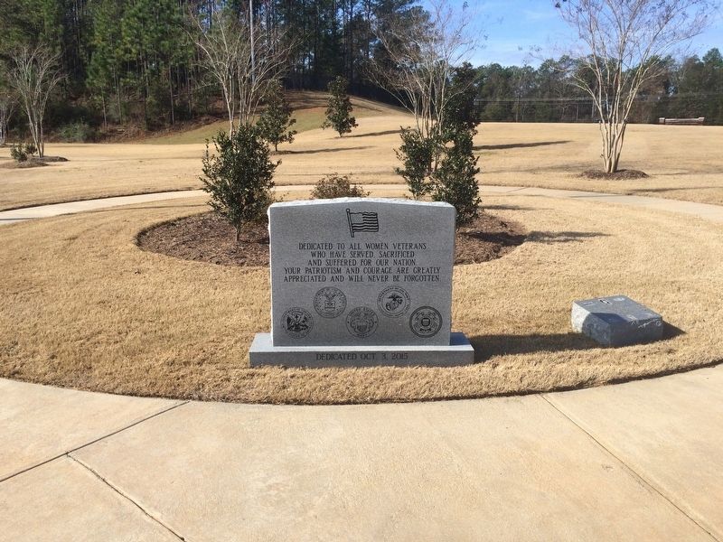
173d Airborne Brigade (Sep) Marker to right of Women's Veterans Monument
1 ► Alabama, Baldwin County, Spanish Fort — 173d Airborne Brigade (Sep) — 1963 — 1971 —  |
| On Alabama Route 225 0.3 miles north of Upper Shay Branch Road. | |||
| 2 ► Alabama, Colbert County, Tuscumbia — The Moon Tree — |
| On North Jefferson Street. | |||
| 3 ► Alabama, Dallas County, Selma — Craig Air Force Base — Advanced Flying Training School — |
| On 5th Street at Avenue B, in the median on 5th Street. | |||
| 4 ► Alabama, Dallas County, Selma — Joe T. Pilcher, Jr. — 1929 - 1987 — |
| On 5th Street at Avenue B, in the median on 5th Street. | |||
| 5 ► Alabama, Elmore County, Wetumpka — Crommelin Memorial — |
| Near Ready Street near Wharf Street. | |||
| 6 ► Alabama, Franklin County, Hodges — "Spirit of Hodges" — |
| On Alabama Route 172 north of Canyon Road, on the right when traveling north. | |||
| 7 ► Alabama, Jackson County, Scottsboro — M12 — United States Space Force — |
| On Heroes Drive west of Jefferson Dr. | |||
| 8 ► Alabama, Jefferson County, Birmingham, Druid Hills — E19 — Shuttlesworth Returns to Birmingham — March Route Towards a Purposeful Life — Birmingham Civil Rights Heritage Trail — |
| On 19th Street North north of F L Shuttlesworth Drive, on the right when traveling north. | |||
| 9 ► Alabama, Jefferson County, Birmingham, North Eastlake — CDR "Snuffy" Smith — Navy Light Attack Aircraft A-7 Corsair II — |
| On 73rd Street North. | |||
| 10 ► Alabama, Jefferson County, Birmingham, North Eastlake — History of the 117th Tactical Reconnaissance Wing — |
| Near East Lake Boulevard at 57th Street North, on the right when traveling east. | |||
| 11 ► Alabama, Lauderdale County, Florence — “Gooney Bird” Propeller — |
| On Veterans Park Drive 0.3 miles east of South Cox Creek Parkway ( Route 133), on the left when traveling east. | |||
| 12 ► Alabama, Lauderdale County, Florence — Continuity — |
| Near South Court Street at Canal Street, on the right when traveling south. | |||
| 13 ► Alabama, Lauderdale County, Florence — Jonathan Quinn Pettus — City of Florence Walk of Honor — |
| On Hightower Place near River Heritage Park. | |||
| 14 ► Alabama, Lauderdale County, Florence — Lieutenant Colonel R. Edward Yeilding — United States Air Force — |
| On Veterans Park Drive 0.2 miles east of South Cox Creek Parkway ( Route 133), on the left when traveling east. | |||
| 15 ► Alabama, Lauderdale County, Florence — Lt. Col. R. Edward Yeilding — City of Florence Walk of Honor — |
| Near Highttower Place south of Veterans Drive ( Route 133), on the left when traveling south. | |||
| 16 ► Alabama, Lauderdale County, Florence — Ronnie Gene Flippo — City of Florence Walk of Honor — |
| Near Hightower Place south of Veterans Drive ( Route 133), on the left when traveling south. | |||
| 17 ► Alabama, Lauderdale County, Florence — The Cobra Helicopter — |
| On Veterans Park Drive 0.2 miles east of South Cox Creek Parkway ( Route 133), on the left when traveling east. | |||
| 18 ► Alabama, Lauderdale County, Florence — The Phantom — |
| On Veterans Park Drive 0.2 miles east of South Cox Creek Parkway ( Route 133), on the left when traveling east. | |||
| 19 ► Alabama, Lawrence County, Courtland — Courtland Army Air Field (CAAF): Facilities/Deactivation — |
| On Sanderson Lane at WC Handy Avenue, in the median on Sanderson Lane. | |||
| 20 ► Alabama, Lawrence County, Courtland — Courtland Army Air Field / Courtland Army Air Field — Beginnings / Flight Schools — (CAAF) — |
| On Sanderson Lane at WC Handy Avenue, in the median on Sanderson Lane. | |||
| 21 ► Alabama, Lawrence County, Town Creek — From Wheeler to the moon ... — Wheeler Lock & Dam — |
| On Wheeler Dam Highway (Alabama Route 101) at County Route 412 on Wheeler Dam Highway. | |||
| 22 ► Alabama, Limestone County, Ardmore — The Saturn Legacy |
| On Hardiman Lane. Reported permanently removed. | |||
| 23 ► Alabama, Limestone County, Decatur — Southeast Air Forces Training Center — (Pryor Field) — |
| Near Bee Line Highway (U.S. 31) 0.6 miles south of Thomas L Hammons Road, on the left when traveling south. | |||
| 24 ► Alabama, Limestone County, Elkmont — Alabama's Role — |
| On I-65 S, on the right when traveling south. | |||
| 25 ► Alabama, Limestone County, Elkmont — Legacy — |
| On Interstate 65S, on the right when traveling south. | |||
| 26 ► Alabama, Limestone County, Elkmont — Perspective — |
| On I-65 S, on the right when traveling south. | |||
| 27 ► Alabama, Limestone County, Elkmont — Saturn IB Launch Vehicle — |
| On I-65 S, on the right when traveling south. | |||
| 28 ► Alabama, Limestone County, Elkmont — Visitors Center — |
| On I-65 S, on the right when traveling south. | |||
| 29 ► Alabama, Macon County, Tuskegee — Kennedy Field — |
| On Alabama 15 (U.S. 29) 3.2 miles south of Old Columbus Road, on the left when traveling south. | |||
| 30 ► Alabama, Macon County, Tuskegee Airmen National Historic Site — A Bit to Eat — Tuskegee Airmen National Historic Site — National Park Service, U.S. Department of the Interior — |
| Near Chappie James Avenue. | |||
| 31 ► Alabama, Macon County, Tuskegee Airmen National Historic Site — A Typical Day — Tuskegee Airmen National Historic Site — National Park Service, U.S. Department of the Interior — |
| Near Chappie James Avenue. | |||
| 32 ► Alabama, Macon County, Tuskegee Airmen National Historic Site — Anticipation — |
| Near Chief Anderson Drive. | |||
| 33 ► Alabama, Macon County, Tuskegee Airmen National Historic Site — Bath and Locker House — Tuskegee Airmen National Historic Site — National Park Service, U.S. Department of the Interior — |
| Near Chappie James Avenue. | |||
| 34 ► Alabama, Macon County, Tuskegee Airmen National Historic Site — Fire Suppression Pond — |
| Near Chappie James Avenue. | |||
| 35 ► Alabama, Macon County, Tuskegee Airmen National Historic Site — Ghost Structures — Tuskegee Airmen National Historic Site — |
| Near Chief Anderson Road. | |||
| 36 ► Alabama, Macon County, Tuskegee Airmen National Historic Site — Hangar No. 1 — |
| Near Chappie James Avenue. | |||
| 37 ► Alabama, Macon County, Tuskegee Airmen National Historic Site — It Was Called "Dope" — Tuskegee Airmen National Historic Site — |
| Near Chappie James Avenue. | |||
| 38 ► Alabama, Macon County, Tuskegee Airmen National Historic Site — Moton Field Expands — Tuskegee Airmen National Historic Site — |
| Near Chappie James Avenue. | |||
| 39 ► Alabama, Macon County, Tuskegee Airmen National Historic Site — New Vistas — Tuskegee Airmen National Historic Site — |
| Near Chappie James Avenue. | |||
| 40 ► Alabama, Macon County, Tuskegee Airmen National Historic Site — Oil Storage Shed — Tuskegee Airmen National Historic Site — |
| Near Chappie James Avenue. | |||
| 41 ► Alabama, Macon County, Tuskegee Airmen National Historic Site — Prepared to Fight and Die — |
| Near Gen. Benjamin O. Davis, Jr. Drive. | |||
| 42 ► Alabama, Macon County, Tuskegee Airmen National Historic Site — The Control Tower — Tuskegee Airmen National Historic Site — National Park Service, U.S. Department of the Interior — |
| Near Chappie James Avenue. | |||
| 43 ► Alabama, Macon County, Tuskegee Airmen National Historic Site — The Place Where We Learned to Fly — |
| Near Chappie James Avenue. | |||
| 44 ► Alabama, Macon County, Tuskegee Airmen National Historic Site — The Tuskegee Airmen — Tuskegee Airmen National Historic Site — |
| Near Gen. Benjamin O. Davis, Jr. Drive. | |||
| 45 ► Alabama, Macon County, Tuskegee Airmen National Historic Site — They Came to Tuskegee — Tuskegee Airmen National Historic Site — |
| Near Gen. Benjamin O. Davis, Jr. Drive. | |||
| 46 ► Alabama, Macon County, Tuskegee Airmen National Historic Site — Waiting for the Bus — Tuskegee Airmen National Historic Site — |
| Near Chappie James Avenue 0.3 miles east of Chappie James Avenue. | |||
| 47 ► Alabama, Macon County, Tuskegee Institute — The Tuskegee Airmen's Plaza — |
| On Campus Road east of Foster [West Outer] Drive, on the right when traveling east. | |||
| 48 ► Alabama, Macon County, Tuskegee Institute — Tuskegee University — F-4C Phantom — |
| On University Avenue at Foster Drive, on the right when traveling east on University Avenue. | |||
| 49 ► Alabama, Madison County, Huntsville — Armstrong • Collins • Aldrin — Launched: July 16, 1969 • Landed: July 20, 1969 • Splashdown: July 24, 1969 — "That's one small step for a man, one giant leap for mankind." — |
| Near Tranquility Base 0.5 miles west of Old Madison Pike NW, on the left when traveling west. | |||
| 50 ► Alabama, Madison County, Huntsville — Astronaut Facts — U.S. Space & Rocket Center — |
| On Tranquility Base west of Old Madison Pike. | |||
| 51 ► Alabama, Madison County, Huntsville — Atlantis, OV-104 — U.S. Space & Rocket Center — |
| On Tranquility Base west of Old Madison Pike. | |||
| 52 ► Alabama, Madison County, Huntsville — Aviator — |
| On Monroe Street Northwest. | |||
| 53 ► Alabama, Madison County, Huntsville — Cernan • Evans • Schmitt — Launched: December 7, 1972 • Landed: December 11, 1972 • Splashdown: December 19, 1972 — "...America's challenge of today has forged man's destiny of tomorrow." — |
| Near Tranquility Base 0.5 miles west of Old Madison Pike NW, on the left when traveling west. | |||
| 54 ► Alabama, Madison County, Huntsville — CH-47D Chinook Helicopter — |
| On Tranquility Base west of Old Madison Pike. | |||
| 55 ► Alabama, Madison County, Huntsville — Conrad • Gordon • Bean — Launched: November 14, 1969 • Landed: November 19, 1969 • Splashdown: November 24, 1969 — "I see the Surveyor! I see the Surveyor!" — |
| Near Tranquility Base 0.5 miles west of Old Madison Pike NW, on the left when traveling west. | |||
| 56 ► Alabama, Madison County, Huntsville — Cosmic Apple Tree — Dedication Date: October 9, 2009 — Boeing — |
| On Tranquility Base west of Old Madison Pike. | |||
| 57 ► Alabama, Madison County, Huntsville — External Tank — Liquid Propellent Supply for Space Shuttle Main Engines — |
| Near Tranquilty Base 0.5 miles west of Madison Pike, on the left when traveling west. | |||
| 58 ► Alabama, Madison County, Huntsville — Flight Span 30 Years — U.S. Space & Rocket Center — |
| On Tranquility Base west of Old Madison Pike. | |||
| 59 ► Alabama, Madison County, Huntsville — Formation of the George C. Marshall Space Flight Center — |
| On Rideout Road, on the right when traveling south. | |||
| 60 ► Alabama, Madison County, Huntsville — Grissom • White • Chaffee — Date of Incident: January 27, 1967 • Intended Launch Date: February 21, 1967 — "Fire in the Cockpit!" — |
| Near Tranquility Base 0.5 miles west of Old Madison Parkway NW, on the left when traveling west. | |||
| 61 ► Alabama, Madison County, Huntsville — Hermes Guided Missile — |
| On Airport Road SW at Memorial Parkway SW (U.S. 231), on the right when traveling east on Airport Road SW. | |||
| 62 ► Alabama, Madison County, Huntsville — Lovell • Swigert • Haise — Launched: April 11, 1970 • Splashdown: April 17, 1970 — "Okay Houston, Hey, We've got a problem here..." — |
| On Tranquility Base 0.5 miles west of Old Madison Pike NW, on the left when traveling west. | |||
| 63 ► Alabama, Madison County, Huntsville — Main Engines — Power for Lift-off and Ascent to Orbit — |
| Near Tranquility Base 0.4 miles west of Madison Pike, on the left when traveling west. | |||
| 64 ► Alabama, Madison County, Huntsville — Major General H.N. Toftoy, USA. — |
| On Westside Square, on the right when traveling south. | |||
| 65 ► Alabama, Madison County, Huntsville — McDivitt • Scott • Schweickart / Stafford • Young • Cernan — Launched:March 3, 1969 • Splashdown:March 13,1969 / Launched:May 18, 1969 • Splashdown:May 26, 1969 — “…We had to fly once more before we take the big step…” — |
| Near Tranquility Base 0.5 miles west of Old Madison Pike NW, on the left when traveling west. | |||
| 66 ► Alabama, Madison County, Huntsville — Monte Sano Elementary School — |
| On Monte Sano Boulevard Southeast, on the right when traveling north. | |||
| 67 ► Alabama, Madison County, Huntsville — Ms. Baker: Monkeynaut — |
| Near Tranquility Base 0.5 miles west of Madison Pike, on the left when traveling west. | |||
| 68 ► Alabama, Madison County, Huntsville — NASA / U.S. Geological Survey — Mobile Geological Laboratory — |
| Near Tranquiltiy Base 0.5 miles Madison Pike, on the left when traveling west. | |||
| 69 ► Alabama, Madison County, Huntsville — NASA Lunar Module (LM) — |
| On Tranquility Base west of Old Madison Pike. | |||
| 70 ► Alabama, Madison County, Huntsville — NASA Saturn I — |
| On Tranquility Base west of Old Madison Pike. | |||
| 71 ► Alabama, Madison County, Huntsville — NASA Skylab — |
| Near Tranquility Base 0.5 miles west of Madison Pike, on the left when traveling west. | |||
| 72 ► Alabama, Madison County, Huntsville — Pathfinder — Huntsville's Orbiter for NASA's Fleet — |
| Near Tranquility Base 0.4 miles west of Madison Pike, on the left when traveling west. | |||
| 73 ► Alabama, Madison County, Huntsville — Pathfinder Orbiter — Shuttle “Body Double” — |
| Near Tranquility Base 0.5 miles west of Madison Pike, on the left when traveling west. | |||
| 74 ► Alabama, Madison County, Huntsville — Project Liftoff: Solar Power in Space — |
| On Tranquility Base 0.2 miles west of Old Madison Pike. | |||
| 75 ► Alabama, Madison County, Huntsville — Saturn V — |
| Near Tranquility Base 0.5 miles west of Old Madison Pike NW, on the left when traveling west. | |||
| 76 ► Alabama, Madison County, Huntsville — Schirra • Eisele • Cunningham / Borman • Lovell • Anders — Launched: October 11, 1968 • Splashdown: October 22, 1968 — Launched: December 21, 1968 • Splashdown: December 27, 1968 — |
| Near Tranquility Base 0.5 miles west of Old Madison Pike NW, on the left when traveling west. | |||
| 77 ► Alabama, Madison County, Huntsville — Schrimsher Farm — Sunrise Terrace Subdivision — |
| On Panorama Drive Southeast at Skyview Drive Southeast, on the right when traveling east on Panorama Drive Southeast. | |||
| 78 ► Alabama, Madison County, Huntsville — Scott • Worden • Irwin — Launched: July 26, 1971 • Landed: July 30, 1971 • Splashdown: August 7, 1971 — "It's really rolling hills, up and down we go, buckin' bronco!" — |
| Near Tranquility Base 0.5 miles west of Old Madison Pike NW, on the left when traveling west. | |||
| 79 ► Alabama, Madison County, Huntsville — Seasoned Global Traveler — U.S. Space & Rocket Center — |
| On Tranquility Base west of Old Madison Pike. | |||
| 80 ► Alabama, Madison County, Huntsville — Shepard • Roosa • Mitchell — Launched: January 31, 1971 • Landed: February 5, 1971 • Splashdown: February 9, 1971 — "...It's been a long way, but we're here." — |
| Near Tranquility Base 0.5 miles west of Old Madison Pike NW, on the left when traveling west. | |||
| 81 ► Alabama, Madison County, Huntsville — Shuttle Training Aircraft — Gulfstream II C-11A, G-1159 — |
| On Tranquility Base west of Old Madison Pike. | |||
| 82 ► Alabama, Madison County, Huntsville — Space Shuttle Main Engine/RS-25 — |
| On Tranquility Base west of Old Madison Pike. | |||
| 83 ► Alabama, Madison County, Huntsville — T-38 Talon — Supersonic Jet Trainer — |
| Near Tranquilty Base 0.4 miles west of Madison Pike, on the left when traveling west. | |||
| 84 ► Alabama, Madison County, Huntsville — The F-1 Engine — Marshall's Legacy of Flight — |
| On Mercury Road at Rideout Road on Mercury Road. | |||
| 85 ► Alabama, Madison County, Huntsville — The J-2 Engine — Marshall's Legacy of Flight — |
| On Mercury Road near Rideout Road. | |||
| 86 ► Alabama, Madison County, Huntsville — The Orbiter — U.S. Space & Rocket Center — |
| Near Tranquility Base west of Old Madison Pike when traveling west. | |||
| 87 ► Alabama, Madison County, Huntsville — U.S. Air Force SM-65 Atlas-F — |
| Near Tranquility Base 0.5 miles west of Madison Pike, on the left when traveling west. | |||
| 88 ► Alabama, Madison County, Huntsville — U.S. Army PGM-11 Redstone — |
| Near Tranquiltiy Base 0.5 miles west of Madison Pike, on the left when traveling west. | |||
| 89 ► Alabama, Madison County, Huntsville — U.S. Army PGM-19 Jupiter — |
| Near Tranquilty Base 0.5 miles west of Madison Pike, on the left when traveling west. | |||
| 90 ► Alabama, Madison County, Huntsville — U.S. Army/NASA Juno II — |
| Near Tranquility Base 0.5 miles west of Madison Pike, on the left when traveling west. | |||
| 91 ► Alabama, Madison County, Huntsville — Young • Mattingly • Duke — Launched: April 16, 1972 • Landed: April 20, 1972 • Splashdown: April 27, 1972 — "Look at the size of that rock!" — |
| Near Tranquility Base 0.5 miles west of Old Madison Pike NW, on the left when traveling west. | |||
| 92 ► Alabama, Madison County, Huntsville, Quigley — Dr. Wernher von Braun — |
| On Monroe Street Southwest south of Clinton Ave W, on the left when traveling north. | |||
| 93 ► Alabama, Madison County, New Market — Site of Quick Airplane — Construction And Flight — |
| On Wallace Lane (County Highway 100) west of Billy D. Harbin Road, on the right when traveling west. | |||
| 94 ► Alabama, Marshall County, Grant — Site of 1954 Crash of Air Force Cargo Plane — |
| On Simpson Point Road (County Route 466) at Old US Highway 431, on the right when traveling north on Simpson Point Road. | |||
| 95 ► Alabama, Mobile County, Mobile — B-52D "Stratofortress" — |
| On Battleship Parkway. | |||
| 96 ► Alabama, Mobile County, Mobile — Grumman HU-16E Albatross — |
| Near Battleship Parkway at Old Spanish Trail (U.S. 98). | |||
| 97 ► Alabama, Mobile County, Mobile — Mobile Aeroplex at Brookley — |
| On South Broad Street at Aerospace Drive, on the right when traveling east on South Broad Street. | |||
| 98 ► Alabama, Mobile County, Mobile — Sikorsky Helicopter "SeaGuard" — USCG-HH-52A — |
| Near Battleship Parkway at Old Spanish Trail (U.S. 98). | |||
| 99 ► Alabama, Montgomery County, Maxwell Air Force Base — “Bird-Dog” — |
| On South Hansell Street at Kirkpatrick Avenue, on the left when traveling south on South Hansell Street. | |||
| 100 ► Alabama, Montgomery County, Maxwell Air Force Base — 1Lt Karl W. Richter — Killed in Action July 28, 1967, North Vietnam — Of The Warrior Breed — |
| On Chennault Circle east of Twining Street, on the left when traveling east. | |||
5621 entries matched your criteria. The first 100 are listed above. Next 100 ⊳