On this day the Lewis and Clark Expedition to the Pacific Ocean camped on the bank of the Missouri River at the base of a river landmark near here, now called The Tower. Clark wrote, “Capt Lewis & my Self walked up to the top which forms a Cone and . . . — — Map (db m181800) HM
Through this valley passed the Oregon Trail, highway for early explorers, fur traders, California-bound gold seekers, freighters, and brave pioneers seeking new homes in the West. Traffic was especially heavy from 1843 to 1866. At times as many as . . . — — Map (db m45521) HM
Long before early French explorers named it the Platte River, or "flat waters," this heartland oasis was a crossroads. Migratory birds, abundant wildlife and Native Americans had been in residence for centuries when the confluence of the Oregon and . . . — — Map (db m58888) HM
During their exploration of the Missouri and Columbia Rivers, Lewis and Clark held councils with Ponca, Omaha, and Sioux Indians inhabiting this region. The council with the Sioux occurred August 28-31, 1804 at Calumet Bluff now the southern . . . — — Map (db m101395) HM
On August 27, 1804, the Lewis and Clark Expedition set up its camp for four days downstream from Calumet Bluff. The explorers came across three American Indian boys who told them of a large Yankton Sioux camp nearby.
Knowing that President . . . — — Map (db m101392) HM
Much of the early history of Cedar County involves the Indian inhabitants, the Ponca, Omaha, and Sioux. Several prehistoric and historic Indian villages were located in the region. In 1804, Lewis and Clark ascended the Missouri River near here . . . — — Map (db m181311) HM
An important Omaha Indian village called Tonwantonga (Large Village) by the Omaha stood on Omaha Creek in this area. Ruled by the great chief Blackbird, an estimated 1,100 people lived in this earthlodge town about 1795 and it played an important . . . — — Map (db m206966) HM
When the Lewis and Clark Expedition to the Pacific Ocean went through this area their mood was undoubtedly gloomy. On the previous day they had buried their comrade, Sergeant Charles Floyd, who died of a ruptured appendix. Although he was the . . . — — Map (db m206919) HM
Paha Sapa is sacred land of the Lakota that the white man has named Black Hills. We never lived in this place. It is the womb of Mother Earth—the rightful home of birds and animals. We came here only for ceremonies, vision quests and burials. The . . . — — Map (db m173952) HM
From about 1837 until 1850, more than a quarter million buffalo robes bought from Indians and 27 tons of fur company trade goods were hauled over the 300 mile long Fort Pierre-Fort Laramie Trail that followed the White River through this area. First . . . — — Map (db m4530) HM
The stone monument at this location is one of Nebraska's original bench marks.
Surveyors use bench marks to determine elevations. This one was placed by the U.S. Coast & Geodetic Survey in 1902. It was part of a larger project in which a . . . — — Map (db m223449) HM
The 100th longitudinal line west of Greenwich was the major goal set by Congress in building the first transcontinental railroad.
Construction of the Union Pacific track reached the Meridian on October 5, 1866.
To celebrate this record-breaking . . . — — Map (db m123869) HM
On August, 24, 1804, the Lewis and Clark Expedition, traveling up the Missouri River, passed a bluff about 180 to 190 feet high. Clark wrote that it appeared to have been on fire and was still very hot. He also detected signs of coal and what looked . . . — — Map (db m155542) HM
When French traders and trappers explored the river in the early 1700's, the Ioway Indians occupied this area. Later explorers, such as Lewis and Clark, also traveled the Missouri. White settlement began in the late 1850's when the Omaha and Ponca, . . . — — Map (db m170764) HM
Fremont was laid out in August 1856. The town site was named for John C. Frémont, the new Republican Party's nominee for president in 1856, although Democrat James Buchanan was elected. Between 1842 and 1844 Frémont, then a U.S. Army topographical . . . — — Map (db m223447) HM
The Mormon Pioneer Trail from Nauvoo, Illinois to the Rocky Mountains passed here April 17, 1847. In this vicinity a military-type organization was formed with Brigham Young, Lieutenant General; Stephen Markham, Colonel; John Pack and Shadrach . . . — — Map (db m58566) HM
At the camp established very near here Captain Clark wrote about the "butifull Breeze from the N W. this evening which would have been verry agreeable, had the Misquiters been tolerably Pacifick, but thy were rageing all night." Clark may have . . . — — Map (db m7886) HM
Between 1804 and 1806, the Corps of Discovery traveled from St. Louis, Missouri, to the Pacific coast and back. President Jefferson instructed Meriwether Lewis to collect information on "the soil & face of the country, [its] growth & vegetable . . . — — Map (db m72050) HM
In August 1804, members of the Expedition visited villages like this one, homes to the Otoe and Missouria who lived in what is today Omaha. Planning to invite these tribes to a council, or meeting, the explorers found the villages deserted. The . . . — — Map (db m72049) HM
The tallgrass prairies of Nebraska stood in stark contrast to the forested homelands of the explorers. Dense grasses, some taller than a man, covered the land. Lewis and Clark noted beauty in the vast reaches of waist-high grarsses, a beauty . . . — — Map (db m72048) HM
Near here, the Corps of Discovery held its first council, making speeches and presenting gifts to the Otoe and Missouria. Communicating through an interpreter, members of the Expedition believed their messages were clear. But were they?
This . . . — — Map (db m72057) HM
In 1803 the Missouri River carried the hopes of the young United States in its dark and unpredictable waters. President Thomas Jefferson sought a "direct & practicable water communication across the continent, for the purposes of commerce." The . . . — — Map (db m72059) HM
On July 27, 1804, Lewis and Clark's Corps of Discovery left their “White Catfish” camp and proceeded up the Missouri River. After traveling some distance, Clark “took one man R. Field and walked on Shore with a View of Examoning . . . — — Map (db m32964) HM
The joint efforts of many individuals and groups – among them military men and scientists, a president and an enslaved man, French-speaking boatmen and American Indians, women and men – determined the fate of the Corps of Discovery. . . . — — Map (db m57978) HM
From 1867 to 1869 the first photography studio of William Henry Jackson, renowned photographer, artist, and explorer of the Old West, stood on the northwest corner of this block. His autobiography, Time Exposure, reports that in 1869 Omaha . . . — — Map (db m35193) HM
Byway 136 was designated the Heritage Highway in part because of the many historic trails that are now part of it. You are standing on the historic De Roin Trail. The De Roin Trail began at the Missouri River port town of Brownville on the eastern . . . — — Map (db m47623) HM
Ash Hollow is a focal point for understanding the geologic history of the Central Great Plains prior to the onset of the Great Ice Age. It is the type locality of the Ash Hollow Formation, named by Henry Engelmann after a visit in 1858–1859. . . . — — Map (db m2505) HM
You are near the Platte River's famous Grand Island. It is approximately forty miles in length and two miles at its widest. Providing abundant wood and water, it often served as a campsite for Pawnee Indians. Journalists for the expeditions of . . . — — Map (db m79694) HM
Above is a facsimile of an inscription carved by these men on a nearby boulder while camping here June 22, 1842. ☆ ☆ ☆ Placed by Jefferson County under the auspices of Quivera Chapter, Daughters of the American Revolution, . . . — — Map (db m177379) HM
For generations Nebraska’s Platte Valley provided a natural east-west travel route for native peoples, fur traders, explorers, emigrants, and the military. The first known passage by white men along the Great Platte River Road in the Keith County . . . — — Map (db m50782) HM
Kimball County locals, Art Henrickson and Claude Alden, discovered the Highest Point of Nebraska in October 1951 using a WW1 altimeter. • • • Dedicated to the memory of Hiram Scott, an early Nebraska Territory explorer, who was employed by the . . . — — Map (db m167112) HM
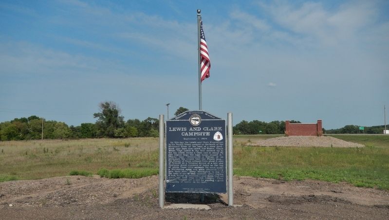
On its journey to the Pacific Ocean the Lewis and Clark Expedition camped near here on September 2, 1804. At this camp the explorers’ imagination and knowledge of military fortifications misled them into concluding that sand ridges and mounds left . . . — — Map (db m181799) HM
George Shannon was reunited with the Lewis and Clark Expedition and the group traveled onward to present-day North Dakota. Private John Newman was caught speaking in mutinous tones — an attempt to subvert the discipline and loyalty of other members . . . — — Map (db m181894) HM
George Shannon was in St. Louis in 1810 when he was authorized to travel to Pennsylvania to assist historian Nicholas Biddle in editing the Lewis and Clark journals. While working on the journals, Shannon decided he would like to study law. Shannon . . . — — Map (db m181895) HM
With the discovery of gold in the Rocky Mountains in the late 1850's , overland freighting and travel intensified. Every few miles westward along the trails, enterprising individuals established road ranches which offered lodgings and provision to . . . — — Map (db m174996) HM
Near here at a point midway between the source of the Elkhorn River and its entry into the Platte, is the town of Meadow Grove. The Elkhorn Valley has long been an important passageway for travelers and settlers. In 1739, the Mallet brothers made . . . — — Map (db m182088) HM
The Lewis & Clark Expedition Barge/Keelboat was 55 feet long and 8 feet 4 inches wide and drew 2 to 2.5 foot [sic] of water when loaded with an estimated 12 to 15 ton[s] of supplies. The preponderance of the historic evidence indicates that it . . . — — Map (db m66982) HM
One valued member of the Lewis and Clark Expedition had four legs, webbed feet and weighed 150 pounds. He was Captain Meriwether Lewis' dog Seaman, a Newfoundland.
At Lewis' command, Seaman jumped into the Ohio River to catch squirrels . . . — — Map (db m66981) HM
Today, the Missouri River is 2315 miles in length. At Nebraska City it is 1755 miles from the headwaters in Montana and 560 miles to its mouth near St. Louis, MO. where it empties into the Mississippi River. It is North America's longest river . . . — — Map (db m66978) HM
In 1492 Christopher Columbus, his crew and three ships, the Nina, Pinta and Santa Maria set sail from Spain to the New World. That voyage is depicted in the scene above as we pay tribute to the man, the voyage and the community namesake. . . . — — Map (db m59855) HM
In 1847, Brigham Young led 143 men, 2 women, and 3 children west along the Platte River, then southwest into Utah. By the 1860s, an exodus of more than 70,000 other Mormons followed this trail to their "New Zion." Today, a marked 1,624-mile auto . . . — — Map (db m53192) HM
In June 1720 a Spanish military force led by Sir Pedro de Villasur left Santa Fe, New Mexico, to gather information on French activities near the Missouri River. The force included 45 veteran soldiers, 60 Pueblo Indian allies, some Apache scouts, . . . — — Map (db m53143) HM
Commemorative of the Astorian Expedition organized June 23, 1810, by John Jacob Astor's American Fur Company This expedition discovered the Oregon Trail which spread knowledge of the Nebraska country leading to its occupancy by white people. The fur . . . — — Map (db m229275) HM
Approximately thirty feet south of here in 1865 the Union Pacific Railroad laid its original track extending from the Missouri River in Omaha, south up Mud Creek to Papillion Creek, and northwesterly along West Papillion Creek. Although Chief . . . — — Map (db m223478) HM
Pierre Didier Papin
P. D. Papin was a trusted and valued employee of the American Fur Company and its successors for over thirty years. He was born March 7, 1798, In St. Louis. The Papins were a prominent French merchant family in that . . . — — Map (db m133906) HM
Hiram Scott, employee of the Rocky Mountain Fur Company, died in the vicinity of this bluff in 1828. After being deserted by his companions near the junction of the Laramie and North Platte Rivers. — — Map (db m86783) HM
"Shade this all dark with a light sky," Lieutenant Gouverneur K. Warren wrote about the sketch below, "and you have its appearance at sunset." Warren drew this sketch of the ridge in the distance on August 16, 1857, while exploring the upper . . . — — Map (db m202253) HM
Three plaques are on this marker. Top, left plaque
First Naturalists of the American West
The Lewis and Clark Expedition was more than a geographic expedition. Lewis; and Clark became the first scientists to document the natural . . . — — Map (db m76887) HM
On August 3 Lewis and Clark held a council with the Oto and Missouria Indians at a site they named "Council Bluff," near present Fort Calhoun, Nebraska. It was the first of many councils they would hold on their journey to the Pacific Ocean. . . . — — Map (db m7794) HM
In 1804-06, Captains Meriwether Lewis and William Clark led about 40 soldiers and boatmen on an epic journey. President Thomas Jefferson commissioned this “Corps of Discovery” to find a route to the Pacific Ocean through the newly . . . — — Map (db m76886) HM
During the summer of 1804, the river below looked very different. Unlike today’s course controlled by dams and dikes, the Missouri River that Lewis and Clark knew flowed wild and erratic. Strong currents, floating branches, embedded logs, . . . — — Map (db m76885) HM
Civilization came to the west bank of the Missouri with establishment of Fort Atkinson in 1820 about a half mile southeast of here. Named after its founder, General Henry Atkinson, this western-most Fort protected the frontier's developing commerce. . . . — — Map (db m7890) HM
From 1820 to 1827, the nation's largest and most westerly military post occupied this site, the earlier scene of Lewis and Clark's Council Bluff. In late 1819, troops under Colonel Henry Atkinson established Cantonment Missouri along the river near . . . — — Map (db m223480) HM
On July 30 the explorers arrived at the bluff where Fort Atkinson would be built less than two decades later. Clark wrote, "The Situation of this place which we Call Council Bluff which is handsom ellevated a Spot well Calculated... for a . . . — — Map (db m7887) HM