6503 entries match your criteria. Entries 101 through 200 are listed.⊲ Previous 100 — Next 100 ⊳
Forts and Castles Topic
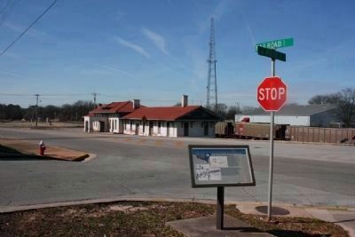
By Tim Carr, February 20, 2010
Tour Stop 4
| 101 ► Alabama, Morgan County, Decatur — 4 — “An Affair Most Important to Us” - The Federal Right, October 27-28, 1864 — “A Hard Nut To Crack” — The Battle For Decatur — |
| On Lafayette Street Northwest at Railroad Street, on the right when traveling west on Lafayette Street Northwest. | |||
| 102 ► Alabama, Russell County, Fort Mitchell — Fort Mitchell — <----- 5 miles ----- — |
| Near U.S. 165. | |||
| 103 ► Alabama, Russell County, Fort Mitchell — Fort Mitchell — |
| On Unnamed road, 0.2 miles east of Alabama Route 165, on the right when traveling east. | |||
| 104 ► Alabama, Russell County, Fort Mitchell — Fort Mitchell — Built 1813 By General John Floyd — |
| Near Old Federal Road east of Alabama Route 165, on the left when traveling east. | |||
| 105 ► Alabama, Russell County, Fort Mitchell — Fort Mitchell — National Historic Landmark — |
| On Alabama Route 165, on the right when traveling north. | |||
| 106 ► Alabama, Russell County, Fort Mitchell — Fort Mitchell Military Cemetery — |
| Near U.S. 165. | |||
| 107 ► Alabama, Russell County, Fort Mitchell — The Creek Trail of Tears — |
| Near U.S. 165. | |||
| 108 ► Alabama, Russell County, Holy Trinity — Spanish Fort, 1689-1691 — |
| On Alabama Route 165 at Terminal Road (Route 54), on the right when traveling north on State Route 165. | |||
| 109 ► Alabama, Russell County, Phenix City — Fort Jabe Brassell — Alabama Army National Guard — Russell County — |
| On South Railroad Street west of Holland Court, on the right when traveling west. | |||
| 110 ► Alabama, Russell County, Seale — Creek Settlements in Russell County — Creek Heritage Trail — |
| On Longview Street at Jackson Street, on the right when traveling north on Longview Street. | |||
| 111 ► Alabama, St. Clair County, Ohatchee — Fort Strother — |
| On State Highway 144 at Valley Drive, on the right when traveling north on State Highway 144. | |||
| 112 ► Alabama, Sumter County, Livingston — Sumter County — |
| On Lafayette Street (U.S. 11) at Franklin Street, on the right when traveling south on Lafayette Street. | |||
| 113 ► Alabama, Talladega County, Sylacauga — Fort Williams — 12 miles west — |
| On Fort Williams Street, on the right when traveling east. | |||
| 114 ► Alabama, Tallapoosa County, Jacksons' Gap — Fort Okfuskee — ←— 6 mi. west —« — |
| On U.S. Highway 280, on the right when traveling north. | |||
| 115 ► Alabama, Tuscaloosa County, Tuscaloosa — Fort W. W. Brandon Armory — |
| On Paul W Bryant Drive East, 0.1 miles west of Dr. Edward Hillard Drive, on the right when traveling west. | |||
| 116 ► Alabama, Walker County, Jasper — Revolutionary War Hero Sergeant William Jasper — |
| On 4th Avenue at 4th Street, on the right when traveling north on 4th Avenue. | |||
| 117 ► Alaska, Haines Borough, Haines — Founders of Port Chilkoot — |
| On 2nd Avenue. | |||
| 118 ► Alaska, Sitka Borough, Sitka — A Town for an Empire — |
| 119 ► Alaska, Sitka Borough, Sitka — American Sitka — |
| 120 ► Alaska, Sitka Borough, Sitka — History of Castle Hill (-1804) — |
| 121 ► Alaska, Sitka Borough, Sitka — History of Castle Hill (1804-1867) — |
| 122 ► Alaska, Sitka Borough, Sitka — Ladies of the Hill — |
| 123 ► Alaska, Sitka Borough, Sitka — Sentinel of a Divided Town — |
| Near Kaagwaantaan Street. | |||
| 124 ► Arizona, Apache County, Alpine — The Old Bushvalley Fort — |
| On U.S. 180 at milepost 427.7, on the left when traveling west. | |||
| 125 ► Arizona, Cochise County, Bowie — Apache Pass - A Corridor Through Time — Fort Bowie National Historic Site — |
| On Apache Pass Road, 13 miles south of Business Interstate 10, on the left when traveling west. | |||
| 126 ► Arizona, Cochise County, Bowie — Apache Spring — |
| Near Fort Bowie Trail, 1.2 miles south of Apache Pass Road. | |||
| 127 ► Arizona, Cochise County, Bowie — Cavalry Barracks — |
| Near Fort Bowie Trail, 1.5 miles south of Apache Pass Road. | |||
| 128 ► Arizona, Cochise County, Bowie — Cavalry Mess Hall and Kitchen — |
| Near Fort Bowie Trail, 1.5 miles Apache Pass Road. | |||
| 129 ► Arizona, Cochise County, Bowie — Commanding Officer's Quarters — |
| Near Fort Bowie Trail, 1.5 miles south of Apache Pass Road. | |||
| 130 ► Arizona, Cochise County, Bowie — First Fort Bowie — |
| On Apache Pass Road. | |||
| 131 ► Arizona, Cochise County, Bowie — Infantry Barracks — |
| Near Fort Bowie Trail, 1.5 miles south of Apache Pass Road. | |||
| 132 ► Arizona, Cochise County, Bowie — Mining Cabin — |
| Near Fort Bowie Trail, 0.1 miles south of Apache Pass Road. | |||
| 133 ► Arizona, Cochise County, Bowie — 086-352 — Old Fort Bowie — Guardian of Apache Pass — |
| On I-10 Extension (Interstate 10), on the left when traveling east. | |||
| 134 ► Arizona, Cochise County, Bowie — Post Cemetery — |
| Near Apache Pass Road, 2.3 miles south of Bear Springs Road. | |||
| 135 ► Arizona, Cochise County, Bowie — Post Trader — (Sutler's Store) — |
| Near Fort Bowie Trail, 1.5 miles south of Apache Pass Road. | |||
| 136 ► Arizona, Cochise County, Bowie — Quartermaster Storehouse — |
| Near Fort Bowie Trail, 1.5 miles Apache Pass Road. | |||
| 137 ► Arizona, Cochise County, Bowie — Second Fort Bowie — |
| Near Fort Bowie Trail, 1.5 miles south of Apache Pass Road. | |||
| 138 ► Arizona, Cochise County, Elfrida — Camp John A. Rucker A Military Outpost — Stood on This Site 1878 - 1880 — |
| Near North Tex Canyon Road, 0.2 miles east of East Rucker Canyon Road, on the left when traveling east. | |||
| 139 ► Arizona, Cochise County, Elfrida — Camp Rucker and the Indian Scouts — |
| On North Tex Canyon Road near East Rucker Canyon Road. | |||
| 140 ► Arizona, Cochise County, Elfrida — Camp Rucker Bakery and Commissary — |
| Near North Tex Canyon Road, 0.8 miles east of East Rucker Canyon Road. | |||
| 141 ► Arizona, Cochise County, Elfrida — Camp Rucker Timeline — |
| Near North Tex Canyon Road near East Rucker Canyon Road. | |||
| 142 ► Arizona, Cochise County, Elfrida — How Camp Rucker received its Name — |
| Near North Tex Canyon Road, 0.8 miles east of East Rucker Canyon Road. | |||
| 143 ► Arizona, Cochise County, Huachuca City — Fort Huachuca — (1877) — |
| On Arizona Route 90 at milepost 314, on the right when traveling south. | |||
| 144 ► Arizona, Cochise County, Sierra Vista — Fort Huachuca — |
| On Grierson Avenue at Boyd Avenue, on the right when traveling south on Grierson Avenue. | |||
| 145 ► Arizona, Coconino County, Fredonia — 29 — Pipe Springs National Monument — |
| On U.S. 89A at milepost 609, on the left when traveling north. | |||
| 146 ► Arizona, Coconino County, Happy Jack — General Crook Trail — |
| On Rim Road (Forest Road 300), 1.2 miles east of Arizona Route 87, on the left when traveling east. | |||
| 147 ► Arizona, Coconino County, Happy Jack — General Crook Trail — |
| On Rim Road (Forest Road 300), 8.4 miles east of Arizona Route 87, on the left when traveling east. | |||
| 148 ► Arizona, Maricopa County, Fort McDowell — Camp Reno — |
| On Beeline Highway (Arizona Route 87 at milepost 190) near North Fort McDowell Road, on the right when traveling north. | |||
| 149 ► Arizona, Maricopa County, Fort McDowell — Fort McDowell — |
| On Beeline Highway (Arizona Route 87) near North Fort McDowell Road, on the right when traveling north. | |||
| 150 ► Arizona, Maricopa County, Mesa — Site of Old Fort Utah — |
| On North Horne at East Lehi Road, on the right when traveling north on North Horne. | |||
| 151 ► Arizona, Mohave County, Bullhead City — Old Fort Mohave — |
| Near State Highway 68. | |||
| 152 ► Arizona, Mohave County, Fredonia — 995 Miles of Wire — Pipe Spring National Monument — |
| Near North Pipe Spring Road, 0.3 miles north of Arizona Route 389, on the left when traveling north. | |||
| 153 ► Arizona, Mohave County, Fredonia — Boulders to Building Blocks — Pipe Spring National Monument — |
| Near North Pipe Spring Road, 0.3 miles north of Arizona Route 389, on the left when traveling north. | |||
| 154 ► Arizona, Mohave County, Kaibab — 5 — Pipe Springs National Monument — |
| Near North Pipe Springs Road. | |||
| 155 ► Arizona, Mohave County, Kingman — Camp Beale Springs Arizona — |
| On Fort Beale Road at Wagon Trail Road, on the left when traveling north on Fort Beale Road. | |||
| 156 ► Arizona, Navajo County, Fort Apache — Adjutant's Office (117) — |
| On General Crook Street, on the right when traveling east. | |||
| 157 ► Arizona, Navajo County, Fort Apache — B.I.A. Club House (105) — |
| On General Crook Street, on the left when traveling east. | |||
| 158 ► Arizona, Navajo County, Fort Apache — Barracks (115) — |
| Near Barracks Row, on the left when traveling west. | |||
| 159 ► Arizona, Navajo County, Fort Apache — Barracks Row — |
| On Scout Street, on the left when traveling north. | |||
| 160 ► Arizona, Navajo County, Fort Apache — Boys' Dormitory (116) — |
| On Barracks Row, on the right when traveling west. | |||
| 161 ► Arizona, Navajo County, Fort Apache — Captain's Quarters (102 and 103) — |
| On General Crook Street, on the left when traveling east. | |||
| 162 ► Arizona, Navajo County, Fort Apache — Commanding Officers' Quarters (104) — |
| On General Crook Street, on the left when traveling east. | |||
| 163 ► Arizona, Navajo County, Fort Apache — Commissary Storehouse (113) — |
| On Kinney Road, on the left when traveling south. | |||
| 164 ► Arizona, Navajo County, Fort Apache — First Commanding Officer's Quarters (101) — |
| On General Crook Street at Scout Street, on the left when traveling east on General Crook Street. | |||
| 165 ► Arizona, Navajo County, Fort Apache — Guard House (114) — |
| On Kinney Road, on the left when traveling south. | |||
| 166 ► Arizona, Navajo County, Fort Apache — Non-Commissioned Officers' Quarters (110 & 111) — |
| On General Crook Street, on the left when traveling east. | |||
| 167 ► Arizona, Navajo County, Fort Apache — Officer's Quarters (106) — |
| On General Crook Street, on the left when traveling east. | |||
| 168 ► Arizona, Navajo County, Fort Apache — Officers' Quarters (107, 108, 109) — |
| On General Crook Street, on the left when traveling east. | |||
| 169 ► Arizona, Navajo County, Fort Apache — Old Guard House (115A) — |
| Near Fort Apache Road, on the right when traveling west. | |||
| 170 ► Arizona, Navajo County, Fort Apache — Parade Ground — |
| On General Crook Street, on the right when traveling east. | |||
| 171 ► Arizona, Navajo County, Fort Apache — T.R. School Teachers' Quarters (112) — |
| On General Crook Street, on the left when traveling east. | |||
| 172 ► Arizona, Pima County, Tucson, Armory Park — Camp Lowell 1866-1873 — |
| On South 6th Avenue, on the right when traveling north. | |||
| 173 ► Arizona, Pima County, Tucson, Downtown — S. E. Corner Adobe Wall of Spanish Presidio of Tucson — |
| Near North Church Avenue. | |||
| 174 ► Arizona, Pima County, Tucson, Downtown — Southwest Corner of the Presidio — |
| Near West Pennington Street. | |||
| 175 ► Arizona, Pima County, Tucson, El Presidio — Main Gate — |
| Near North Main Avenue at West Alameda Street. | |||
| 176 ► Arizona, Pima County, Tucson, El Presidio — Presidio San Agustín del Tucson — |
| On North Main Avenue at West Paseo Redondo, on the right when traveling south on North Main Avenue. | |||
| 177 ► Arizona, Pima County, Tucson, El Presidio — Presidio Wall — |
| On North Main Avenue at West Washington Street, on the right when traveling north on North Main Avenue. | |||
| 178 ► Arizona, Pima County, Tucson, El Presidio — Tucson Old Walled City — |
| On West Alameda Street near North Main Avenue, on the right when traveling east. | |||
| 179 ► Arizona, Pima County, Tucson, Old Fort Lowell — Cavalry Barracks and Band Barracks — |
| Near North Craycroft Road. | |||
| 180 ► Arizona, Pima County, Tucson, Old Fort Lowell — Cottonwood Lane — |
| Near Cottonwood Lane near North Craycroft Road. | |||
| 181 ► Arizona, Pima County, Tucson, Old Fort Lowell — Fort Lowell — |
| Near North Craycroft Road near East Glenn Street. | |||
| 182 ► Arizona, Pima County, Tucson, Old Fort Lowell — Fort Lowell — |
| On Craycroft Road, on the right when traveling north. | |||
| 183 ► Arizona, Pima County, Tucson, Old Fort Lowell — Fort Lowell — 1873 – 1891 — |
| Near North Craycroft Road. | |||
| 184 ► Arizona, Pima County, Tucson, Old Fort Lowell — Fort Lowell 1873-1891 / Post Hospital — |
| Near North Craycroft Road. | |||
| 185 ► Arizona, Pima County, Tucson, Old Fort Lowell — Headquarter's Buildings — |
| On North Craycroft Road, on the right when traveling north. | |||
| 186 ► Arizona, Pima County, Tucson, Old Fort Lowell — Infantry Barracks / Laundresses' Quarters — |
| Near North Craycroft Road. | |||
| 187 ► Arizona, Pima County, Tucson, Old Fort Lowell — Officers' Quarters — |
| On North Craycroft Road, on the right when traveling north. | |||
| 188 ► Arizona, Pima County, Tucson, Old Fort Lowell — Post Hospital — |
| Near North Craycroft Road. | |||
| 189 ► Arizona, Pima County, Tucson, Old Fort Lowell — Quartermaster Depot and Post Trader — |
| On North Craycroft Road, on the right when traveling north. | |||
| 190 ► Arizona, Pima County, Tucson, Old Fort Lowell — The Chief Trumpeter — Sculptor/Artist: Dan Bates — |
| On North Craycroft Road, on the right when traveling north. | |||
| 191 ► Arizona, Pima County, Tucson, Old Fort Lowell — The Fort Lowell Flagstaff — |
| Near North Craycroft Road. | |||
| 192 ► Arizona, Pima County, Tucson, Old Fort Lowell — Veterans Memorial — Fort Lowell Park — |
| Near North Craycroft Road. | |||
| 193 ► Arizona, Santa Cruz County, Nogales — Camp Stephen D. Little — |
| On North Grand Avenue, on the right when traveling south. | |||
| 194 ► Arizona, Santa Cruz County, Tubac — Presidio of Tubac — |
| Near Tubac Road near Cll Iglesia Road. | |||
| 195 ► Arizona, Santa Cruz County, Tubac — Tubac — |
| 196 ► Arizona, Santa Cruz County, Tubac — Tubac Presidio — |
| 197 ► Arizona, Yavapai County, Camp Verde — Camp Verde — |
| On General Crook Trail (South Access Road), 0.2 miles east of Interstate 17 Exit 285, on the right when traveling east. | |||
| 198 ► Arizona, Yavapai County, Camp Verde — Flagpole & Administration Building — Fort Verde, Arizona Territory — |
| Near E Hollamon Street when traveling north. | |||
| 199 ► Arizona, Yavapai County, Camp Verde — Fort Verde State Historic Park — The West As It Really Was! — |
| On Hollamon Street, on the right when traveling east. | |||
| 200 ► Arizona, Yavapai County, Camp Verde — Officers’ Row — Fort Verde, Arizona Territory — |
| On E Hollamon Street, on the right when traveling east. | |||
6503 entries matched your criteria. Entries 101 through 200 are listed above. ⊲ Previous 100 — Next 100 ⊳