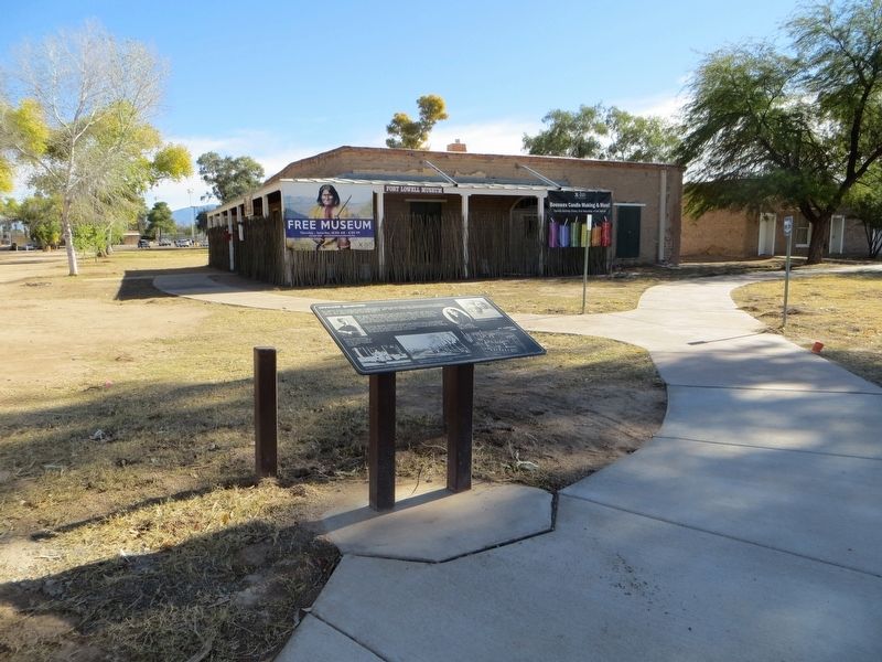
The officers of Fort Lowell and their families lived in 7 adobe homes-officers' row. During peak periods of military activity, up to three families lived in each building. After 1889, two smaller houses for married non-commissioned officers were . . . — — Map (db m100712) HM
The post surgeon was the cornerstone of army medical care. He was either a medical officer or a local civilian. At Fort Lowell, 21 men served in this capacity, assisted by enlisted hospital stewards. The surgeon maintained the health of all military . . . — — Map (db m100688) HM
Fort Lowell was a major supply depot for forts around southern Arizona Territory. The Quartermaster and Commissary Depot in on private property directly west, across Craycroft Road and north of Fort Lowell Rd. The Quartermaster Department supplied . . . — — Map (db m100692) HM
This statue was erected in February 1991 to honor the enlisted men who served in the Southwest during the Apache Wars in the 1870s and 1880s. It was cast in bronze by Desert Crucible, Inc., of Tucson. One and one-half times life-size, it stands . . . — — Map (db m100695) HM WM
The flagstaff has been the one constant feature of all military establishments since the creation of the U.S. Army in 1784.No matter what era or architectural style, the flagstaff has remained at the center of the parade ground and at the center of . . . — — Map (db m100713) HM
Dedicated to the enduring memory of the men and women who faithfully served in the military forces of the United States of America and in grateful acknowledgment of their contribution to this nation, which in time of peril, found in them its . . . — — Map (db m28932) HM
A military camp established in Nogales, Arizona, in November of 1910, was for a generation an integral part of the economic and social life of the community. The post was renamed on December 14, 1915, for Private Little, killed in action during . . . — — Map (db m296467) HM
Garrisoned by Spanish
in 1752
First Town established in
Arizona by Europeans
Here on March 3, 1859
the Weekly Arizonian was published -- Arizona's
first newspaper. — — Map (db m68027) HM
Originally an Indian village, Tubac is the oldest European settlement in Arizona. It was established as the Royal Spanish Presidio San Ignacio de Tubac in 1752, after an uprising of Pima Indians. In 1775 Captain Juan Bautista de Anza led an . . . — — Map (db m27119) HM
Here stood the original Spanish presidio or fort established as San Ignacio de Tubac after the Pima uprising of 1751. Captain Juan Bautista de Anza was in command in 1775, when he led his famous expedition to California to found San Francisco. The . . . — — Map (db m68026) HM
Ash Fork is located near the 35th Parallel where, in the 1850's the Army Corps of Topographical Engineers began surveying a future railroad route. Camels were imported and used as beasts of burden, adding to the colorful history of the region. A . . . — — Map (db m33442) HM
The bachelor officers lived a somewhat spartan lifestyle, not altogether unexpected considering the low pay, slow promotion, frequent moves, and the amount of time spent in the field. Although these quarters were designed to have three bedrooms, . . . — — Map (db m250262) HM
The oldest settlement in the Verde Valley. Site of historic Fort Verde. The first settlers came into the valley in February, 1865, followed by the military in August, 1865. Original military and historic buildings still stand. — — Map (db m40814) HM
All of the buildings at Fort Verde were built in the typical architectural style once found at nearly every 1870s military post in the United States. There are probably fewer than a dozen such buildings left west of the Mississippi River.
This . . . — — Map (db m250261) HM
Fort Verde’s flagpole was designed like a ship’s mast, just like many other military fort flagpoles that were built in the 19th century. This design supports an upper and lower timber, which allows for the use of shorter logs. Often a single tree . . . — — Map (db m159103) HM
The Mythology of a Western Fort
Fort Verde is typical of western forts built in the 1870's and 1880's but our vision of forts comes from movies. Log stockades with towers and John Wayne fearlessly firing his rifle at attacking Indians. The . . . — — Map (db m40815) HM
The Civil War has ended, the country opens up for expansion in the West, and conflicts of a different nature face the L.L.S. Military. The Indian Wars of the 1870s-1880s brought soldiers to Arizona to protect the settlers and brought challenges to . . . — — Map (db m159088) HM
There were two married officers’ quarters built at Fort Verde in 1871, both designed in the Mansard style. The style “disguises” the second floor by extending the line of the roof down. It was a popular style from the 1850s through the . . . — — Map (db m159091) HM
The foundation before you is from one of two Married Officers Quarters. This two-story building was architecturally identical to the Commanding Officers Quarters, but with a reversed floor plan.
After the U.S. Army abandoned the fort, the . . . — — Map (db m159101) HM
Each permanent military command was required to have a physician. The Post Surgeon was allowed these rather spacious accommodations because patients were treated and surgery was performed here.
The Post Hospital was located at the northeast . . . — — Map (db m159092) HM
A farming community of perhaps 200 people prospered here for more than three centuries. The Castle was home to 35 or so of these people. Archeologists suggest they may have fled what is today the Flagstaff area due to overpopulation around A.D. . . . — — Map (db m40840) HM
Here’s another “castle” – this one called “A” by the archeologists who excavated it in the 1930s.
Like neighboring Montezuma Castle, Castle A was occupied by Sinagua farmers between A.D. 1200 and 1450. However, with 45 rooms and an estimated . . . — — Map (db m40863) HM
A wooden stockade fort named for Lt. Amiel W. Whipple was established here May 18, 1864. Also known as Whipple Barracks and Prescott Barracks. The post was headquarters for the Department of Arizona. Begun in 1870, and the center for campaigns . . . — — Map (db m216628) HM
In 1859, steamboat entrepreneur George Alonzo Johnson built a riverside home for his bride, Estefana Alvarado. Now known as the Commanding Officer's Quarters, the home is believed to be Arizona's oldest Anglo-built adobe building. In the . . . — — Map (db m28999) HM
This adobe building was constructed in 1872 as an office for the Fort Yuma Quartermaster Depot. It replaced a room in a corner of the depot storehouses where, according to Captain J. G. C. Lee, Quartermaster, ". . .the noise of the arrivals and . . . — — Map (db m29000) HM
A steam pump located at the edge of the river propelled muddy Colorado River water through pipes to an elevated holding tank constructed of local rock and mortar with a wood shingle roof to decrease evaporation. Sediment fell to the bottom of the . . . — — Map (db m29001) HM
The Confederate scouts were alarmed. Looking down river to your right, one exclaimed, "One could hardly see anything in the background but smokestacks."
Union soldiers disembarked from their transports. All night, knee deep in mud, they . . . — — Map (db m108509) HM
You wouldn't have got us had it not been for your damned gunboats.
John Dunnington, colonel, chief of ordnance
Fort Hindman's cannon fired at the nine gunboats
bearing down on them. Confederate gunners had . . . — — Map (db m108072) HM
The succession of outposts here, remote from centers of New
World empire, symbolized a dream of the imperial age: to
connect the Gulf of Mexico to North America's vast interior
by the great rivers that drained it.
Following British . . . — — Map (db m108485) HM
Arkansas Post was not a single fort and trading center. From
1686 until 1863 there were no fewer than seven posts on the
Arkansas River between here and the Missişsippi. The flags
of five nations flew over them.
The 1686 post . . . — — Map (db m108464) HM
During the American Revolution, Arkansas Post
belonged to the Spanish, allies of the American
patriots. In 1783, British partisans led by James
Colbert raided the Spanish village and fort here.
It was one of the last engagements of the . . . — — Map (db m108483) HM
Standing here in January 1863, you would have seen
Confederate Fort Hindman. In what is now the water, the
fort stood atop a 25-foot high bluff The fort's cannon could
fire a mile up or down the river to protect the breadbasket
of Arkansas. The . . . — — Map (db m108511) HM
One of the oldest settlements in Columbia County. Here Colonel John Dockery had his plantation and home. Here T.P. Dockery, who became a general in the War Between the States, was born and reared. The Caddo Indian Trail from Camden on the Ouachita . . . — — Map (db m121136) HM
Ongoing warfare with other
Native American groups
led villagers to construct a
defensive ditch around their
town. The depression before
you was a formidable obstacle
to anyone trying to attack. You
will cross this ditch several
more times . . . — — Map (db m231813) HM
After Arkansas seceded from the Union in May 1861, Confederate officers began to recruit in the Wittsburg area. Companies B, D, F and K of the 5th Arkansas Infantry Regiment were organized at Wittsburg June 12-14, 1861. David Cross, for whom Cross . . . — — Map (db m116179) HM
The blockhouse is a replica of a structure that was built on this site in the late 18th century. The building was a multiple use structure, but constructed originally for defense purposes. It was used as a trading post, as a residence, and as a . . . — — Map (db m96645) HM
On Aug. 24, 1864, Confederate Gen. J.O. Shelby and his men, wearing captured Union uniforms, attacked a series of forts protecting hay-cutting operations between modern-day Carlisle and Hazen. Confederate artillery blasted the forts held by the 54th . . . — — Map (db m96453) HM
Thousands of refugee slaves came with the Union army into Helena and they continued to come. Helena became an island of freedom in a slave state.
The Union Army Recruits Freedmen
In the . . . — — Map (db m107912) HM
The Confederates Take Battery C
"Both brigades moved forward on the instant, rapidly, steadily
unflinchingly, and in perfect order under a storm of Minie balls,
grape, and canister, which poured upon them not only . . . — — Map (db m107958) HM
You are facing Battery D. One half-mile southeast of here, it was the closest of the fortifications on Crowley's Ridge to Battery C. During the Battle of Helena, Union troops at these batteries aided each other with artillery fire.
— — Map (db m107950) HM
The Union Army Takes Helena, July 1862
When General Samuel Curtis marched into Helena he was
not sure if he would remain. But the city's location on the
Mississippi River made it a valuable strategic resource . . . — — Map (db m107916) HM
Confederate General Theophilus Holmes wanted to regain control of Helena, an island of Union control in Confederate Arkansas. His attack failed. Miscommunication, lack of information, and the determined resistance of the Union troops, who vowed not . . . — — Map (db m107941) HM
You are facing Battery A, which stood on Rightor Hill, a high spot on Crowley's Ridge. Defended by the 29th and 36th Iowa and the 33rd Missouri, it anchored the north end of the Union line, approximately one and one-quarter mile northeast of here. . . . — — Map (db m107973) HM
Shortly after the capture of Helena in July 1862, the Union army took
measures to protect the city. Engineers designed a large earthen fort,
which African American laborers completed in October 1862. General
Benjamin Prentiss named the heavily . . . — — Map (db m108033) HM
When the Union army built Fort Curtis in 1862, the 34-star flag flew over the fort.
The day the Battle of Helena was fought, July 4, 1863, the 35-star flag became the official U.S. flag. The new star represented West Virginia, admitted to the . . . — — Map (db m109134) HM
The Confederates tested Fort Curtis once, during the Battle
of Helena on July 4, 1863.The battle ended in a decided
Union victory. For the rest of the war, Fort Curtis stood over
Helena, a symbol of the power of the Union army.
— — Map (db m108036) HM
The gunboat U.S.S. Tyler gave the Union defenders a decided advantage in the
Battle of Helena. Her captain could move the gunboat and its heavy artillery
where it was needed most, and that is exactly what he did.
— — Map (db m107975) HM
Confederate General Theophilus Holmes wanted to regain control of Helena, an island of Union control in Confederate Arkansas. His attack failed. Miscommunication, lack of information, and the determined resistance of the Union troops, who vowed not . . . — — Map (db m107937) HM
"such a slaughter was never greater on any battlefield west of the Mississippi" Sgt. Henry S. Carroll, 33rd Missouri
A Strong Position
Fort Curtis sat on the brow of a low ridge above Helena, . . . — — Map (db m107938) HM
The muzzles of six 24-pounders and one 32-pounder extended over the fort walls. The "pounder" designation meant that the cannon fired 24 or 32-pound balls respectively.
These large guns were usually found at coastal forts, where they provided . . . — — Map (db m109133) HM
Mr. Ronnie Nichols, then-director of the Delta Cultural Center,
first proposed building a reconstruction of Civil War Fort Curtis
in 1992. Twenty years later, his vision was realized. New Fort
Curtis was dedicated on May 11, . . . — — Map (db m108040) HM
Thousands of escaped slaves, known as Contraband, followed
the Union army to Helena in July 1862. Within weeks, the army
put hundreds of Contraband to work building Fort Curtis.
Hard Labor in Hot . . . — — Map (db m108032) HM
After occupying Little Rock Sept. 10, 1863, Union officials made plans to fortify the capital city. Construction began Nov. 9 on "a square redoubt which will command the city and all principal approaches". The resulting earthwork was named Fort . . . — — Map (db m228006) HM
The Commissary, one of the city’s most iconic landmarks, is the oldest building in Fort Smith. Its foundation was originally a raised platform from which to shoot cannons for defending the fort. The two-story building you see today was built on that . . . — — Map (db m156898) HM
Imagine spending 5 years building a home only to abandon it. That is exactly what the first Fort Smith soldiers did. They quarried rock and shaped logs to build the fort by hand. Shortly after completing it in 1824, they were reassigned to repeat . . . — — Map (db m156997) HM
If you had stood here in 1825, on your right would have been Arkansas Territory, and on your left, a vast domain traded to the Choctaw Nation for their ancestral lands in the east. Fort Smith’s location here at the edge of Indian country was a . . . — — Map (db m156900) HM
In 1817, the first Fort Smith was built at Belle Point at the junction of the Poteau and Arkansas Rivers by Major William Bradford, for the mutual protection of the pioneers and Indians. He was in command until 1822. It was named in honor of . . . — — Map (db m77874) HM
The building in front of you is very much as it appeared in the 1890s. First used as a military barracks, it was later converted for use as a courthouse and jail. Over time its appearance changed to accommodate the different needs of the people . . . — — Map (db m82354) HM WM
Fort Smith was fired on only once during the Civil War. On July 31, 1864, Confederates staged a diversionary attack from across the Poteau River, hoping to capture the city of Fort Smith. Their strategy was to pull Union troops away from other city . . . — — Map (db m156983) HM
"Ascend the Arkansas River to the point where the Osage boundary line strikes that river… and therein erect as expeditiously as circumstances will permit a Stockade…" —Orders to Major William Bradford from Brigadier General Thomas Smith . . . — — Map (db m156993) HM
Explorando Fort Smith
Hay varias áreas para explorar en el Sitio Histórico Nacional de Fort Smith. Las aceras ofrecen acceso a una variedad de características históricas. Los aspectos más destacados incluyen la horca, el comisario . . . — — Map (db m285127) HM
Traveling mostly on foot, Stephen H. Long explored over 25,000 miles of the mid-west and northern United States. His team included artists and scientists to document natural resources. In 1817, he selected the location for the first Fort Smith. When . . . — — Map (db m156996) HM
The old part of this building was the Barracks of the Fort, 1840-1871; Federal Court and Jail, 1872-1887; presided over by Judge I.C. Parker, 1875-1887. — — Map (db m57922) HM
In the spring of 1821, Osage leader Bad-Tempered-Buffalo appeared across the Arkansas River with 400 warriors in war paint. He and seven warriors crossed the river requesting gunpowder and permission to hunt on Cherokee land. Acting fort commander, . . . — — Map (db m156998) HM
This memorial built of the original stones
marks the location of the fort erected in
1838-1842 for protection against the Indians.
The wall was 12 feet high and 2 feet thick
with port holes about 4 feet apart.
The main buildings in the . . . — — Map (db m282462) HM
When army engineers originally designed the second Fort Smith in 1838, they planned for it to withstand attack. A key feature in achieving this goal was a stone wall about twelve feet high and from two to three feet thick. This wall surrounded the . . . — — Map (db m58434) HM
By 1833, a small community had developed next to the fort. Out of the six shops, five were taverns. As the fort's commanding officer, Captain Stuart's responsibilities included stopping the illegal sale of whiskey to Indians and soldiers. After two . . . — — Map (db m156901) HM
Regiment of Riflemen 1817-1822 After serving with distinction in the War of 1812, the elite Regiment of Riflemen established Fort Smith in 1817. Their mission was to promote peace between the Cherokee and Osage. The regiment merged with the 7th . . . — — Map (db m156986) HM
The “castle,” built in 1890–1894, is the most significant example of Romanesque Revival architecture in the Mother Lode. It was built to house the Preston School of Industry, established by the State Legislature as a progressive . . . — — Map (db m100594) HM
Here, at 10:18 p.m. on July 17, 1944, one of history's most powerful manmade, non-nuclear explosions obliterated two ships, damaged structures in twelve nearby towns or cities, killed 320 men, and wounded 390. It was the worst stateside disaster of . . . — — Map (db m177667) HM
For more than a half-century Port Chicago has been a major port for the shipment of munitions to U.S. forces serving overseas. The Navy created the munitions-loading complex at Port Chicago as an annex to the Mare Island Navy Yard in 1942.
This . . . — — Map (db m177665) HM
A United States military post was established here September 12, 1862 by the men of Company G, 2nd Regiment, Infantry, California Volunteers, to keep peace between the Indians and the miners and settlers of northwestern California. It was abandoned . . . — — Map (db m176820) HM
Site of Fort Terwer, United States military
post established October 12, 1857, by First
Lieutenant George Crook and men of
Company D to keep peace between the Indians
and whites. The fort was destroyed by a flood.
in December, 1861, and . . . — — Map (db m240409) HM
In the years leading up to the Gold Rush, life changed dramatically for the Nisenan who called this valley home.
Cullumah
To the Nisenan, “Cullumah” was home. For generations, they thrived in the valley and mountains, building large . . . — — Map (db m214607) HM
John Sutter and James Marshall came to California with dreams of a brighter future, but they never imagined their future would hold gold!
New Beginning
For both Sutter and Marshall, California was a land of opportunity. A persuasive . . . — — Map (db m214608) HM
Patrick Obein Murphy brought this cannon from Ft. Ross to his namesake Mt. Murphy located behind this site. It’s been said that he fired it to announce the arrival of the mail. — — Map (db m215523) HM
Because Emerald Bay reminded her of a fjord in Norway, Lora J.M. Knight purchased 200 acres here in 1928 for $250,000. She commissioned her architect nephew to design a summer home that combined the features of Scandinavian castles and churches. . . . — — Map (db m275496) HM
Approximately 2 miles north of this point, Fort Washintgon was built in the spring of 1850 by Wiley B Cassity (Cassady or Cassidy), Charls D. Gibbes, Major Lane and others. This fort, probably the first building erected in Fresno County, served as . . . — — Map (db m28013) HM
The site of Fort Miller (1851-1866) lies about one mile north and that of the pioneer town of Millerton (1851-1874) about one and one-half miles northwest on the then Visalia - Stockton Road. Both sites are now covered by the waters of Millerton . . . — — Map (db m47248) HM
Here on September 23, 1849, Lieut. Cave J. Couts, Escort Commander, International Boundary Commission, established Camp Salvation. From September till the first of December 1849, it served as a refugee center for distressed emigrants attempting to . . . — — Map (db m50586) HM
In 1774, Spain opened an overland route from Sonora to California but it was closed by Yuma Indians in 1781. In 1822, Mexico attempted to reopen this route. Lt. Romualdo Pacheco and soldiers built an adobe fort at this site in 1825-26, the only . . . — — Map (db m50589) HM
Near this spot, situated on the west bank of the Colorado River, about 45 miles north of Fort Yuma, Camp Gaston was established in 1859 by Captain Henry S. Burton, Company F 3rd Artillery. The camp served as a supply post for the Hoffman Expedition . . . — — Map (db m138177) HM
Originally called Camp Calhoun, the site was first used as a U.S. Military Post in 1849. A fire destroyed the original buildings. By 1855 the barracks had been rebuilt. Called Camp Yuma in 1852 it became Fort Yuma after reconstruction. Transferred . . . — — Map (db m149168) HM
Flash Flood Scours Grapevine Canyon
On the night of October 18, 2015, heavy rains pounded Grapevine Canyon. Floodwaters roared out of the canyon mouth — visible to the northeast — and down the valley behind the ranger station. After . . . — — Map (db m195573) HM
One hundred thirty feet west of this site, Charles Putnam built the first cabin of permanent habitation in what is now Inyo County in August 1861. The building served as a home, trading post, hospital, and “fort” for early settlers, as well as a . . . — — Map (db m2957) HM
From 1853 until 1870 Keyesville was a center of both placer and quartz gold mining. On the knoll just below the townsite may still be seen the outlines of an earth-work fort, built to meet a possible Indian attack in 1863. The original Keys Mine is . . . — — Map (db m143331) HM
Jefferson Davis, “Father of National Highways,” as Secretary of War 1853-57 sponsored the importation of 33 camels for transporting military supplies to the west coast. The camel trail survey ran from San Antonio, Texas to Fort Tejon which marks the . . . — — Map (db m32823) HM
This military post was established by the United States Army on June 24, 1854, to suppress stock rustling and for the protection of Indians in the San Joaquin Valley. As regimental headquarters of the First Dragoons, Fort Tejón was an important . . . — — Map (db m117523) HM
Although little is known about Peter Lebec, it is believed that he was killed by a grizzly bear, and buried under this tree. His epitaph was originally carved into the tree.
original 1837 marker:
“Peter Lebeck, killed by a . . . — — Map (db m11092) HM
Constructed on the basic plan of Sutter’s original fort one hundred years after its erection in Sacramento by that distinguished pioneer Captain John Augustus Sutter. The building of this replica of one of the most outstanding landmarks to the early . . . — — Map (db m130655) HM
Built of native adobe, The Fort is a replica of Sutter's Fort in Sacramento. Originally it was built to accommodate county, state, and federal offices, as well as be utilized as a town hall. The Fort was dedicated on May 22, 1940. — — Map (db m169407) HM
Built in July 1854 by Isaac N. Roop. First called Roop's House, and used as stopping place by emigrant trains. It was the locale of the "sagebrush war" fought in 1863 between Plumas County and Lassen County citizens. — — Map (db m10266) HM
If you were to spend any amount of time in our Interpretive Center, you may hear
a patron ask us a question that makes us smile - "I'm not sure if I imagined this,
but when I was a kid, I remember a huge castle that was here. Was that . . . — — Map (db m263066) HM
Built by Michael Clarke Rubel and hundreds of volunteers, 1968 to 1986, from local river rock and salvaged materials.
This property has been listed in The National Register of Historic Places by the United States Department of the Interior . . . — — Map (db m123040) HM
On this site stood Fort Moore built by the
Mormon Battalion during the War with Mexico.
This memorial honors the troops who helped to win the South West.
The Flag of the United States was raised here on July 4th 1847 by United States . . . — — Map (db m128896) HM
Pio Pico
Mexico‘s Last California Governor
The importance of Afro-Mexicans in Los Angeles is
best represented by Pío de Jesús Pico (1801-1894), who
was the last governor of California under Mexican rule.
Born at the San Gabriel . . . — — Map (db m261685) HM
Part of the chain stretched across the Hudson River in 1776 to prevent the passage of British ships, which could cut the colonies in two. Danger was imminent. The British had taken New York City, at the river's mouth. General Washington ordered the . . . — — Map (db m207317) HM
Drum Barracks, Officers’ Quarters, 1862 - 1868.
Supply Depot, Department of
the Southwest, U.S. Army.
In memory of the historic past of this
building and the importance of its
association with early American
history in California. . . . — — Map (db m52631) HM