By Patrick G. Jordan, January 8, 2011
Bull City Blues Marker and Stanford L. Warren Public Library
| On Fayetteville Street at Simmons Street, on the right when traveling north on Fayetteville Street. |
| On Concord Street at Brant Street, on the left when traveling south on Concord Street. |
| On University Drive at Hope Valley Road (North Carolina Highway 751), on the right when traveling east on University Drive. |
| On Barbee Road north of Fayetteville Road (North Carolina Road 1118), on the right when traveling east. Reported damaged. |
| On Apex Highway (North Carolina Route 55) at Riddle Road, on the right when traveling north on Apex Highway. |
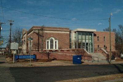
| On North Roxboro Street (Business U.S. 15) near Dowd Street, on the right when traveling north. |
| On Fayetteville Street south of Brant Street, on the right when traveling south. |
| On Roney Street south of West Corporation Street, on the right when traveling south. |
| On West Parrish Street west of West Orange Street, on the right when traveling west. |
| On West Orange Street north of West Parrish Street, on the right when traveling north. |
| On North Mangum Street (Business U.S. 501) at West Parrish Street, on the right when traveling south on North Mangum Street. |
| On North Mangum Street at West Orange Street, on the right when traveling west on North Mangum Street. |
| On West Parrish Street west of North Mangum Street, on the right when traveling west. |
| On Corcoran Street at Corcoran Street, on the right when traveling west on Corcoran Street. |
| On Formosa Avenue at Otis Street, on the left when traveling west on Formosa Avenue. |
| On Nelson Street at Fayetteville Street (North Carolina Road 1118), on the right when traveling west on Nelson Street. |
| On East Parrish Street at East Parrish Street, on the right when traveling west on East Parrish Street. |
| On Fayetteville Street (State Road 1118) at Massey Avenue, on the right when traveling north on Fayetteville Street. |
| On Fayetteville Street south of Eagle Campus Drive, on the left when traveling south. |
| On Fayetteville Street north of Formosa Avenue, on the right when traveling south. |
| On Brant Street east of Fayetteville Street, in the median. |
| On Brant Street east of Fayetteville Street, in the median. |
| On South Alston Avenue at East Lawson Street, on the left when traveling north on South Alston Avenue. |
| On Carroll Street north of Morehead Avenue, on the left when traveling north. |
| On Carroll Street north of Morehead Avenue, on the left when traveling north. |
| On Carroll Street north of Morehead Avenue, on the left when traveling north. |
| On West Chapel Hill Street at Carroll Street, on the right when traveling west on West Chapel Hill Street. |
| On State Route 33 (Business U.S. 64) at Mutual Blvd (U.S. 258), on the right when traveling north on State Route 33. |
| On Mutual Boulevard (U.S. 258) west of South Main Street (Business U.S. 64), on the right. |
| On Spruce Street at Atlantic Avenue (North Carolina Route 97), on the left when traveling east on Spruce Street. |
| On East Grand Avenue (State Highway 43) near Holly Street, on the left when traveling south. |
| On South Washington Street south of Hendricks Street, on the right when traveling south. |
| On East Thomas Street (Business U.S. 64), on the right when traveling east. |
| On East Raleigh Boulevard (Business U.S. 64) at Wake Street, on the right when traveling west on East Raleigh Boulevard. |
| On Leggett Road at Carver Place, on the left when traveling east on Leggett Road. |
| On Atlantic Avenue (State Highway 97) near Spruce Street, on the right when traveling north. |
| On Atlantic Avenue (State Highway 97) near Ivy Street, on the right when traveling south. |
| On Atlantic Avenue (North Carolina Route 97) at Spruce Street, on the right when traveling north on Atlantic Avenue. |
| On Southeast Main Street at Marigold Street, on the right when traveling north on Southeast Main Street. |
| On Northeast Main Street at East Thomas Street (Business U.S. 64), on the right when traveling north on Northeast Main Street. |
| On South Washington Street south of Hendricks Street, on the right when traveling south. |
| On Panola Street at East Chuirch Street, on the right when traveling south on Panola Street. |
| On Granville Street near Main Street (North Carolina Highway 33), on the right when traveling east. |
| On North Main Street (State Highway 33) 0.1 miles south of St. James Street, on the right when traveling north. |
| On East Granville Street near St. David Street, on the right when traveling east. |
| On Alternate U.S. 64, on the right when traveling east on U.S. 64Alternate . |
| On U.S. 301 at Bricks School Lane, on the right when traveling south on U.S. 301. |
| On Bethania Rural Hall Rd. at Turfwood Drive, on the left when traveling north on Bethania Rural Hall Rd.. |
| On Bethania Rural Hall Road at Walker Road, on the right when traveling north on Bethania Rural Hall Road. |
| On Oak Grove Road, 0.1 miles west of Bethabara Road, on the left when traveling east. |
| On Shallowford Road at Tuscany Drive, on the left when traveling north on Shallowford Road. |
| On Memorial Industrial School Road, on the left when traveling east. |
| On Lake Woussicket Road at Stafford Mill Road, on the right when traveling east on Lake Woussicket Road. |
| On Cameron Avenue, 0.1 miles north of East 12th Street, on the right when traveling north. |
| On Peters Creek Pkwy. just south of Park Circle SW, on the right when traveling north. |
| On 3rd Street East at Research Parkway, on the right when traveling east on 3rd Street East. |
| On Thurmond Street at West 14th Street, on the right when traveling south on Thurmond Street. |
| On Carver School Road at Branch Drive, on the right when traveling north on Carver School Road. |
| On Moravia Street at Burgandy Street, on the right when traveling west on Moravia Street. |
| On South Church Street south of East Bank Street, on the right when traveling north. |
| On Patterson Avenue, 0.1 miles south of Seventh Street, on the right when traveling north. |
| Near 4th Street East at North Dunleith Avenue, on the right when traveling west. |
| On North Cleveland Avenue at 7th Street, on the left when traveling north on North Cleveland Avenue. |
| Near South Church Street just north of Race Street, on the left when traveling south. |
| On North Chestnut Street just north of East 6th Street, on the right when traveling north. |
| On West 4th Street, 0.1 miles east of NW Liberty Street, on the left when traveling east. |
| On Silas Creek Parkway (State Highway 67) at Wake Forest Road on Silas Creek Parkway. |
| On Marshall Street North, 0.1 miles south of West 4th Street, on the right when traveling south. |
| On 14th Street at Cameron Avenue on 14th Street. |
| On 14th Street at Cameron Avenue, on the right when traveling east on 14th Street. |
| On Dellabrook Road, on the right when traveling east. |
| On Chestnut Street at 2nd Street, on the right when traveling north on Chestnut Street. |
| On Waughtown St. at Alder St., on the right when traveling west on Waughtown St.. |
| Near South Church Street just north of Race Street, on the left when traveling south. |
| Near South Church Street just north of Race Street, on the left when traveling south. |
| On North Cleveland Avenue at 7th Street, on the right when traveling south on North Cleveland Avenue. |
| On South Church Street just north of Race Street, on the right when traveling north. |
| On Race Street at Church Street South, on the left when traveling west on Race Street. |
| On N. Chestnut St., 0.1 miles north of E. 7th St., on the left when traveling north. |
| On Rich Avenue at East 12th Street, on the right when traveling north on Rich Avenue. |
| On Marshall Street North, 0.1 miles south of West 4th Street, on the right when traveling south. |
| On Trade Street NW north of 10th Street West. |
| On Shorefair Drive NW, on the left when traveling south. |
| On North Dr. Martin Luther King Jr. Dr. (U.S. 311) just east of Carl Russell Avenue, on the right when traveling east. |
| On 7th Street at North Chestnut Street on 7th Street. |
| On North Research Parkway at Power Plant Circle, on the left when traveling north on North Research Parkway. |
| On Race Street at Church Street South, on the left when traveling west on Race Street. |
| On Race Street just west of Church Street South, on the right when traveling east. |
| On East 8th Street at North Cameron Avenue, on the right when traveling east on East 8th Street. |
| On W. 5th St., on the left when traveling west. |
| On Liberia Street at Free Street, on the right when traveling west on Liberia Street. |
| On Holiday Street, 0.1 miles north of Carolina Circle, on the left when traveling north. |
| On S. Martin Luther King Jr. Dr. at Cromartie St., on the right when traveling south on S. Martin Luther King Jr. Dr.. |
| On Price Street at Wallace Street, on the left when traveling south on Price Street. |
| On South Church Street just north of Race Street, on the right when traveling north. |
| On South Broad Street at Wachovia Street, on the right when traveling south on South Broad Street. |
| On South Church Street just north of Race Street, on the right when traveling north. |
| On Alder Street at Mock Street, on the left when traveling south on Alder Street. |
| On Wallace Street at Price Street, on the right when traveling east on Wallace Street. |
443 entries matched your criteria. Entries 101 through 200 are listed above.
⊲ Previous 100 —
Next 100 ⊳