By Sandra Hughes, November 27, 2001
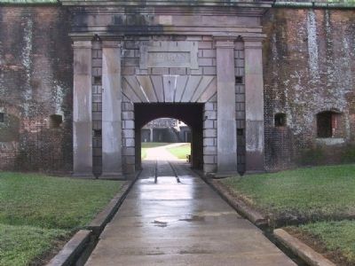
Fort Morgan
| On Dixie Graves Highway, on the right when traveling south. |
| On County Road 47, 0.4 miles east of Interstate 65, on the right when traveling east. |
| Near Spanish Fort Boulevard at Blakeley Way (County Road 72). |
| On Cotton Avenue at Highland Avenue on Cotton Avenue. |
| On Main Street (Alabama Route 51), on the right when traveling south. |
| On 6th Street South (U.S. 231) at Champion Road, on the right on 6th Street South. |
| On Old Broadway Street (U.S. 82) at Main Street, on the right when traveling west on Old Broadway Street. |
| On Ridge Road (County Road 54) at Crenshaw Road, on the right when traveling north on Ridge Road. |
| On McCullars Lane west of County Road 73, on the left when traveling west. |
| On Noble Street at East 10th Street, on the right when traveling north on Noble Street. |
| On Public Square East (State Highway 21) north of Ladiga Street Southeast, on the left when traveling north. |
| On B Street at 1st Place SW, on the right when traveling north on B Street. |
| On Alabama Route 273 at County Route 275, on the right when traveling south on State Route 273. |
| On East Main Street (Business U.S. 411) at Cedar Bluff Road, on the left when traveling east on East Main Street. |
| On County Road 63, 0.8 miles north of State Route 143, on the left when traveling north. |
| On County Road 63, 0.7 miles north of State Route 143, on the right when traveling north. |
| On County Road 63, 0.7 miles north of State Route 143, on the right when traveling north. |
| On College Avenue (Alabama Route 177) at Ocre Avenue, on the right when traveling south on College Avenue. |
| On Alabama Route 69 at Bolen Town Road, on the right when traveling south on State Route 69. |
| On Mount Zion Road at Revelation Road, on the right when traveling south on Mount Zion Road. |
| On Wilson Dam Avenue at Pickwick Street on Wilson Dam Avenue. |
| On North Dickson Street at East 3rd Street, on the right when traveling north on North Dickson Street. |
| On County Road 5, 0.7 miles south of County Road 2, on the right when traveling north. |
| On Oak Street, 0.2 miles 2nd Street North, on the left when traveling north. |
| On Capitol Avenue near Vine Street, in the median. |
| Near Capitol Avenue east of Vine Street. |
| On Gault Avenue South (U.S. 11) at 2nd Street SW, on the left when traveling north on Gault Avenue South. |
| Near Gault Avenue N (U.S. 11) at 4th Street. |
| Near Persimmon Street at St. Nicholas Avenue (Alabama Route 41). |
| On Damascus Road at Well Road (County Route 71), on the right when traveling east on Damascus Road. |
| On 6th Avenue at 4th Street NW, on the right when traveling north on 6th Avenue. |
| On Marston Ave at Coolidge Circle, on the right on Marston Ave. |
| On Forrest Avenue at South 8th Street, on the right when traveling east on Forrest Avenue. |
| On South 1st Street at Broad Street (U.S. 411), on the right when traveling north on South 1st Street. |
| On 4th Avenue SE, on the left when traveling west. |
| On U.S. 72 at Kentucky Ave. on U.S. 72. |
| Near 4th Avenue North at 18th Street North. |
| Near 3rd Avenue North near Richard Arrington Jr, Blvd North. |
| On Vulcan Road north of Richard Arrington Jr Boulevard South, on the right when traveling west. |
| On 1st Avenue North (U.S. 11), on the right when traveling north. |
| On 20th Street South at 11th Avenue South, on the right when traveling north on 20th Street South. |
| Near 5th Avenue North at 16th Street North, on the right when traveling east. |
| On Arlington Avenue at Aberdeen Road, on the right when traveling south on Arlington Avenue. |
| On 12th Street Southwest at 1st Court West, on the right when traveling north on 12th Street Southwest. |
| On Cumberland Drive east of 4th Avenue South, on the right when traveling east. |
| Near 1st Avenue North (U.S. 11) near 32nd Street North. |
| On Cumberland Drive at Balcourt Drive, on the right when traveling east on Cumberland Drive. |
| On 1st Avenue South at 28th Street S, on the right when traveling south on 1st Avenue South. |
| On 29th Avenue South at 18th Street South, on the right when traveling west on 29th Avenue South. |
| On Wisteria Drive at Monte D'Oro Drive, on the left when traveling west on Wisteria Drive. |
| On Shades Crest Road east of Mimosa Lane, on the right when traveling east. |
| On Lee Highway (U.S. 72) 0.7 miles west of County Road 583, on the left when traveling west. |
| On North Cherry Street near Hermitage Drive. |
| On South Court Street at East Tennessee Street (Alabama Route 2), on the right when traveling north on South Court Street. |
| Near Hightower Place south of Veterans Drive (Alabama Route 133), on the left when traveling south. |
| On Veterans Park Drive at South Cox Creek Parkway (Alabama Route 133), on the left when traveling south on Veterans Park Drive. |
| On North Walnut Street near East Tuscaloosa Street. |
| On Birmingham Highway (U.S. 280) at North College Street (State Route 147), on the right when traveling south on Birmingham Highway. |
| On North College Street at West Magnolia Avenue, on the right when traveling south on North College Street. Reported missing. |
| Near Chief Anderson Drive. |
| On University Avenue, 0.2 miles east of Booker T. Washington Boulevard, on the right when traveling west. |
| On University Avenue at Tuskegee Airmen Circle, on the right when traveling north on University Avenue. |
| On Gates Avenue at Franklin Street S.E. on Gates Avenue. |
| On Church Street Southwest north of Williams Avenue Southwest, on the right when traveling north. |
| On Holmes Avenue close to Lincoln St., NE. |
| Near Maple Hill Street Southeast at Eustis Ave SE. |
| On Church Street near Front Street. Reported missing. |
| On Winchester Road at Maysville Road, on the left when traveling south on Winchester Road. |
| On Winchester Road at Bell Factory Road, on the right when traveling south on Winchester Road. |
| On East Washington Street near Strawberry Avenue, on the right when traveling west. |
| On Orlando Street at National Avenue, on the left when traveling east on Orlando Street. |
| On Gunter Avenue (U.S. 431) 0.1 miles south of Taylor Street, on the right when traveling south. |
| On Gunter Avenue (U.S. 431) at Court Street, on the left when traveling south on Gunter Avenue. |
| On Florida Short Route/Gunter Avenue (U.S. 431) at Lurleen B Wallace Drive, on the right when traveling south on Florida Short Route/Gunter Avenue. |
| On Gunter Avenue, 0.1 miles south of Taylor Street, on the right when traveling south. |
| On Bienville Boulevard at Lackland Street, on the right when traveling east on Bienville Boulevard. |
| On South Bayou Street at Church Street, on the left when traveling south on South Bayou Street. |
| On Dr Martin Luther King Jr Avenue east of Ryland Street, on the right when traveling east. |
| On Chestnut Street east of Armistead Street, on the left when traveling east. |
| On Theatre Street, 0.1 miles west of South Royal Street, on the right when traveling west. |
| On South Royal Street at Government Street, on the right when traveling north on South Royal Street. |
| On Conti Street at West Claiborne Street, on the left when traveling west on Conti Street. |
| On North Dearborn Street at St Louis Street, on the right when traveling north on North Dearborn Street. |
| On Johnson Avenue east of Lower Wetumpka Road, in the median. |
| On Commerce Street at Dexter Avenue, in the median on Commerce Street. |
| Near Riverfront Park at Water Street. |
| On North Court Street at Randolph Street, on the right when traveling north on North Court Street. |
| On Goldthwaite Street at Montgomery Street, on the left when traveling south on Goldthwaite Street. |
| On AL-8 (U.S. 80), on the right. |
| On Wilson Street (U.S. 20), on the right when traveling west. |
| On Railroad St SW, 0.2 miles south of Main Street (County Road 36), on the right when traveling east. |
| On North Main Street at East Broad Street NE, on the right when traveling north on North Main Street. |
| Near Alabama Route 165, 2.3 miles south of Nuckols Road (Route 39). |
| On Highland Street south of Bloch Street, on the left when traveling north. |
| On Main Street (State Highway 119) at Middle Street, on the right on Main Street. |
| On Alabama Route 21 north of Mardisville Road (County Road 241), on the right when traveling north. |
4153 entries matched your criteria. The first 100 are listed above.
Next 100 ⊳