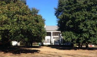
On County Road 4 0.1 miles west of Buena Vista Boulevard, on the right when traveling west.
This antebellum plantation house was completed by Capt. William Montgomery, a contemporary of Prattville's founder, Daniel Pratt.
This “Deep South” architecture reflects the Federal style with the later addition of a Colonial Revival facade . . . — — Map (db m294722) HM
On Main Steet at South Chestnut Sreet, on the right when traveling east on Main Steet.
Built circa, 1840s by A.K. McWilliams, this story and one-half Federal-style raised cottage with Greek Revival elements was the residence of Amos Smith, who named the town of Prattville.
The west front parlor was the meeting place where the . . . — — Map (db m27982) HM
On South Court Street at West 3rd Street, on the left when traveling south on South Court Street.
The county's third courthouse was used until 1906. George Littlefield Smith, an early citizen of Prattville, designed and built the Italianate-style structure. Earlier county seats were Washington, then Kingston.
Marker placed by the . . . — — Map (db m70808) HM
On Main Street at Manci Avenue, on the right when traveling south on Main Street.
The City of Daphne was incorporated July 8, 1927 with a population of 500. its history, however, dates to a much earlier period. Research and artifacts show that Tensaw, Alabama, Choctaw, Creeks, and Seminole Indians all lived in the this area prior . . . — — Map (db m100843) HM
On 24 N Section Street at Fairhope Avenue, on the right when traveling north on 24 N Section Street.
Dedicated 2008
A gift to the people of Fairhope from
The Fairhope Single Tax Corporation
& the City of Fairhope
Dedicated April 5, 2008
The Front Section of this structure was carefully restored to reflect its original
use as Fairhope's . . . — — Map (db m128887) HM
On Jenkins Farm Road 0.2 miles east of U.S. 90, on the right when traveling east.
Jenkins Farm
John Wesley Jenkins, born 1874, owned a 40 acre turpentine operation in 1915 when he married Amelia Taylor. With the decline of his turpentine resources, they began growing potatoes. At the time of John Wesley’s death in . . . — — Map (db m155369) HM
On West Louisville Avenue, on the right when traveling east.
John H. Miller built this Gothic Revival townhouse in 1859. He and his wife moved from Orangeburg, South Carolina to Barbour County in the early 1830s, settling in an area which would become known as the Tabernacle community. He later purchased a . . . — — Map (db m60755) HM
On North Midway Street, on the right when traveling north.
This unusual house was built 1859 – 1861 by Benjamin Franklin Petty, a carriage and furniture merchant, who was a native of New York and a pioneer settler of Clayton. It was patterned after a design made popular by Orson S. Fowler’s book A . . . — — Map (db m39121) HM
On North Eufaula Avenue at St James Place, on the right when traveling north on North Eufaula Avenue.
Between 1886 and 1919, businessman and philanthropist Andrew Carnegie donated more than $350 million
or 90% of his fortune to various charities and libraries around the world. He donated $40 million to build 1,689 libraries in America. Alabama . . . — — Map (db m290961) HM
On North Eufaula Avenue (U.S. 431) 0.1 miles north of Broad Street, in the median.
Built by John Hart about 1850, the Hart House is recognized as an outstanding example of pure Greek Revival architecture. Hart (c. 1805-1863) moved from New Hampshire and became a prominent merchant and farmer. When constructed, the house was on the . . . — — Map (db m48376) HM
Near State Park Road south of Furnace Road (County Route 62), on the right when traveling south.
Wilson Hayes constructed this typical farm house for his wife and six children just south of Six Mile around 1900. After he moved to Oklahoma c. 1915, his daughter Ollie and her husband Levert Rotenberry lived in the home until 1928. Between 1928 . . . — — Map (db m37136) HM
On Alabama Route 139 0.2 miles north of Cornelia Road, on the right when traveling south.
Montebrier was built in 1866–67 for John William Mallet, a renowned scientist and educator and former Superintendent of Confederate Ordnance Laboratories. He came to Brierfield to assist General Josiah Gorgas, former Confederate Ordnance Bureau . . . — — Map (db m292815) HM
On State Park Road south of Furnace Road (County Road 62), on the left when traveling south.
Originally located off Patton Chapel Road in what is today Hoover, Alabama, the Sunshine and Dorothy Morton house was moved to the Brierfield Park in March 2005 by the Morton family and restored over the next two years by restoration specialist . . . — — Map (db m37177) HM
On North Prairie Street, on the right when traveling south.
The Bullock County Courthouse Historic District in Union Springs consists of 47 structures along three blocks of Prairie Street. Focal point of the district is the 1871 courthouse which is one of the finest post-bellum courthouses in the state and . . . — — Map (db m83257) HM
On South Street east of South Perry Street, on the right when traveling east.
The First Missionary Baptist Colored Church of Greenville began under a brush arbor on the corner of South Perry and South Streets in November 1870. The church's founder, Rev Parson Stewart Adams served as the first Pastor. Early trustees, . . . — — Map (db m296397) HM
On Atlanta Avenue at West 10th Street, on the right when traveling south on Atlanta Avenue.
13 W. 10th Street
1903
has been placed on the
National Register
of Historic Places
by the United States
Department of the Interior — — Map (db m217298) HM
On Noble Street at East 12th Street, on the right when traveling north on Noble Street.
This property
has been placed on the
National Register
of Historic Places
by the United States
Department of the Interior
United States Federal Building - Courthouse
Built 1906 — — Map (db m217266) HM
On A Street Southwest near H Avenue Southwest, on the right when traveling west.
In 1905, local businessman Henry P. Ide joined with out-of-state investors and built the Ide-Profile Cotton Mill. Along with the mill, the company established the Profile Mill Village, which originally began as 40 homes for workers. The company . . . — — Map (db m195730) HM
On Ladiga Street Southeast at Church Avenue Southeast, on the right when traveling east on Ladiga Street Southeast.
John D. and Anna Maria Hoke founded the parish on June 30, 1844. Members of the Hoke, Forney, and Abernathy families joined over the years. The church design was based on Richard Upjohn's 1852 pattern book, Upjohn's Rural Architecture. Upjohn was . . . — — Map (db m199134) HM
On Pelham Road (State Highway 21) at 5th Street NE, on the right when traveling north on Pelham Road.
Prominent citizen of Jacksonville who served Alabama as Brigadier General, State Militia; member Legislature and Pres. of Senate; Circuit Court Judge; and Pres. Ala. and Tenn. Railroad
He owned extensive cotton plantations and mining interests . . . — — Map (db m29921) HM
On Main Street at Mc Kibbon Street, on the right when traveling north on Main Street.
[Top plaque]
This property has been
placed on the
National Register
of Historic Places
by the United States
Department of the Interior
[Bottom plaque]
301 Main Street
has been placed on the
Alabama Register
of . . . — — Map (db m217258) HM
On Seaboard Blvd at S Center Ave, on the right when traveling east on Seaboard Blvd.
Originally the Dixie Hotel was the Dixie House, operated by Mrs.
Martin Tyler Ledbetter from 1910-1916. Traveling salesmen were
regular guests as well as local residents who boarded the train at
the Hotel. Mrs. Ledbetter set a table with a . . . — — Map (db m285145) HM
On Hopewell Road 0.2 miles east of Ben Brown Road, on the right when traveling east.
In 1853 James E. Chambers donated 3-acres of land
on the Collins Ferry-Oakbowery Road for Hopewell
Church and Cemetery. The first building here was
crude with split log benches. It was replaced in the
1880's by one built by James B. Chambers & . . . — — Map (db m304111) HM
On State Highway 69 at Pecan Dr, on the right when traveling north on State Highway 69.
The town of Coffeeville began in 1808 as Murrell's Landing, a boat
landing and ferry crossing on the Tombigbee River. William Murrell
was a landowner and state representative for Clarke County. By
1819, the town had been renamed in honor of . . . — — Map (db m285143) HM
On West Cobb Street at South Jackson Street ( Route 295), on the right when traveling west on West Cobb Street.
This cabin was built in the 1830s by Josiah Mathews.
It is an example of a two-room log cabin. This type of cabin was commonly built by early 1800s settlers who came from the Carolinas and Georgia on the Federal Road to Clarke County. The cabin . . . — — Map (db m234676) HM
On West Cobb Street at North Jackson Street ( Route 295), on the right when traveling west on West Cobb Street.
The Alston-Cobb House (c. 1854) is an example of plantation plain-style architecture, also called an "I" house because of its narrow profile. It is characterized by a simple gable roof. Typically, as in the Alston-Cobb House, there were masonry . . . — — Map (db m234674) HM
The first of three Baptist Churches was built on
this site about 1842 as white pioneer settlers
increased. The present building was constructed
about 1895. The only surviving church book,
begun in 1898, shows sixty-eight male and
seventy-six . . . — — Map (db m288228) HM
On Putnam Street at Court Street, on the right when traveling east on Putnam Street.
James Elisha (Big Jim) Folsom, a resident of Elba,
Coffee County, served as the 45th and 47th
Governor of Alabama. Folsom lived in this home
from 1908 to 1910 when it was located near the
Folsom Mill Creek and Tabernacle communities.
The Folsom . . . — — Map (db m94160) HM
On Middle School Road north of Old Lee Highway (County Road 20), on the left when traveling north.
Cherokee High School began here in 1921 as a grammar school with two teachers in a new frame building. The building was erected by African Americans using a Julius Rosenwald Grant with additional funds from the local community. The county school . . . — — Map (db m192084) HM
On Jimmy Hughes Street at 1st Street, on the right when traveling west on Jimmy Hughes Street.
Leighton Training School, an African American school
located near the Byler Road, operated as a Type 6
Rosenwald School - a type of school funded by Sears
Roebuck President Julius Rosenwald for African
American children across the South in the . . . — — Map (db m304745) HM
On Lime Kiln Road at Houston Street, on the right when traveling north on Lime Kiln Road.
The Clyde Carter House, built in 1924,
was listed on the
National Register of
Historic Places, 2004
Criterion C in the area of Architecture
Criterion A in the area of Agriculture — — Map (db m192041) HM
Marker Front:
Muscle Shoals City was incorporated on April 24, 1923. Among the leading developers were New York realtors A.L. Howell and C.T. Graves. Their interest in Muscle Shoals was inspired by the vision of Henry Ford to use power from . . . — — Map (db m28580) HM
Built between 1828 and 1832, Belle Mont is a foremost example of Jeffersonian Palladian Architecture in the deep south and one of Alabama's first great plantation houses.
It was build for Dr. Alexander W. Mitchell, a native of Virginia, and a . . . — — Map (db m29561) HM
This home was built in 1920 for Dr. and
Mrs. A. W. Davis and is located in the Tuscumbia Historic District, which is listed in the National Register of Historic Places.
The doctor came to Tuscumbia in 1903 to serve the African
American . . . — — Map (db m216625) HM
On Forest Avenue at West 9th Street, on the right when traveling south on Forest Avenue.
In 1904, Alabama industrialist Frazier Michel
Douglass, Sr. hired a carpenter from Alexander
City, Alabama to build the Douglass House. The
house is a two-story Queen Anne Victorian and
might be the only home of this architectural type
in . . . — — Map (db m163677) HM
On East Broad Street (Alabama Route 27) 0.2 miles east of Union Street ( Route 123), on the right when traveling east.
Constructed in c. 1900 by G. P. Dowling, the Dowling-Steagall House is a Classical Revival dwelling featuring a full-height portico with Ionic columns and an elaborate door surround. A judge and prominent businessman, G. P. Dowling organized Ozark's . . . — — Map (db m36510) HM
On East Broad Street (Alabama Route 27) at Mutual Street, on the left when traveling east on East Broad Street.
The J.D. Holman House was built in 1912 for Jesse DaCosta Holman and his wife, Susan Dowling Holman, and their seven children. Architect Frank C. Galliher of Montgomery, Alabama, designed the 10,000 square foot, Greek Revival house. The gifted and . . . — — Map (db m132527) HM
Near 2nd Street North near Vine Street. Reported permanently removed.
A "row" was a 19th century shopping mall. The word was used when a building or block had several similar storefronts arranged in a straight line or row.
This cellar marks the spot where David and Nicholas Crocheron built a large 2 story brick . . . — — Map (db m83509) HM
Near 2nd Street North. Reported permanently removed.
The Crocherons were from Staten Island, New York. Richard Conner Crocheron arrived in town about 1837 to help run the family store. He traveled north for his bride in 1843 after building her this brick home. The back wall adjoined the brick store . . . — — Map (db m22870) HM
On Union Street at Furniss Avenue, on the left when traveling north on Union Street.
This Greek revival mansion was built c. 1853 for William B. King and named “Fairoaks” for the many trees found about the place. King was the nephew of Vice President William Rufus King. Ann B. Wilson, a half-sister of the builder, . . . — — Map (db m83521) HM
On Union Street at McLeod Avenue, on the left when traveling south on Union Street.
Once a gracious turn-of-the-century neighborhood, many of the homes here were close to condemnation when purchased by Circle “S” Industries, Inc. in 1980. In all, 12 Victorian cottages were renovated in the area.
Built between 1870 . . . — — Map (db m37651) HM
On Mabry Street south of Jeff Davis Avenue, on the right.
One of the finest examples of neo-classic architecture in the South; designed by Thomas Helm Lee for Edward T. Watts. Completed in 1853.
Sold 1864 to John M. Parkman,
1870 to Emile Gillman.
Purchased in 1957 through a bequest from Robert . . . — — Map (db m37649) HM
On County Road 52 at County Road 293, on the left when traveling west on County Road 52.
Lebanon Courthouse was constructed during the 1840s when Lebanon, the county seat of
DeKalb County, was a thriving community with inns, taverns, and government offices. This building, built for courthouse use, remained in use as a courthouse until . . . — — Map (db m156255) HM
On McCurdy Avenue North (State Highway 75) at Main Street (State Highway 35), on the right when traveling south on McCurdy Avenue North.
Built in 1931 by the McCurdy family, the home's interior was lined completely with cedar wood and the floor made of hand selected quarter-sawed oak. Beveled glass was in the windows and doors. Home to a delicatessen in the 1980s, plans were being . . . — — Map (db m156252) HM
On Chestnut Street at South 9th Street, on the right when traveling east on Chestnut Street.
This stately Classic Revival house, built c. 1904, was the residence of Colonel Oliver Roland Hood (1867-1951), eminent Gadsden attorney and civic leader. Colonel Hood was one of the three incorporators of Alabama Power Company in 1906 and author of . . . — — Map (db m83732) HM
On South Academy Street south of East Campbell Avenue, on the right when traveling south.
Built in 1888 by W.K. and Emma Knox Kenan, this
home is an excellent local example of Victorian
Cottage architecture. The Kenan's settled in
Geneva in 1882 and were charter members of the
Geneva Presbyterian Church established in 1884.
Despite . . . — — Map (db m167707) HM
On Erwin Street at Tuscaloosa Street, on the left when traveling west on Erwin Street.
Built in 1837 by Col. John Erwin, wealthy lawyer and planter. Architects and contractors were from Philadelphia. It has been continuously occupied by the Erwin family and is now the home of Katherine Mahood Rugg, great great-granddaughter of Col. . . . — — Map (db m203647) HM
On Alabama Route 61 south of Beech Street, on the right when traveling south.
Rev. J. Bancroft, presiding elder, and Rev. J. A. Moore, minister. called meeting of members in 1883 including the names: Hobson, Holcroft, Walker, Scott, Huggins, Moore, True, Sadler. Turpin.
Building committee consisted of Mr. Will Sadler, Mr. . . . — — Map (db m203655) HM
On Alabama Route 61 at Cemetery Street, on the right when traveling north on Alabama Route 61.
Organized November 16, 1844 under Presbytery of South Alabama by the Rev. Thomas Witherspoon and 21 charter members.
Petition to Presbytery signed by T. A. Borden, Anne Borden, Wm. Ervin, Eliza Ervin, Mrs. Rebeccah Hanna, A. & S. Hardin, Mrs. . . . — — Map (db m203657) HM
On South Scott Street at College Avenue, on the right when traveling north on South Scott Street.
College Hill Historic District, located along College Avenue between Scott and Kyle Streets, was nominated to the National Register of Historic Places in 1979. This district was Scottsboro's first subdivision. The area was part of Charlotte Scott . . . — — Map (db m167089) HM
On E Peachtree Street, on the right when traveling west.
Marker front:
Constructed in 1911-1912 and designed by architect Richard H. Hunt, the Jackson County Courthouse is a Neo-Classical, brick building situated on a town square in Scottsboro, the county seat of Jackson County. The front, . . . — — Map (db m22264) HM
Near County Road 25 south of Paradise Lane, on the right when traveling south.
The Skyline School was built as part of the Skyline Farms Project, a self-help program that the United States government conducted in 1934-1945 for unemployed farmers. Started by the Federal Emergency Relief Administration, the program loaned . . . — — Map (db m167096) HM
On City Park Road 0.2 miles south of Kentucky Avenue ( Road 117), on the right when traveling south.
This cabin was originally constructed over 100 years ago approximately 10 miles west of this site in Bennett's Cove.
It was given to the Stevenson community park by Mary and Walker Leland Jordan.
The cabin was moved to this site and restored . . . — — Map (db m197507) HM
On Eastern Valley Road (County Road 18) 0.1 miles north of Rosser Loop Drive, on the left when traveling north.
Thomas Hennington Owen,
grandson of Methodist
minister, David Owen and
Lucy McCraw, moved into
the 2 room rear wing with his
bride Malissa Rose Sadler in
1833. Second wife was Mary
Elizabeth Tarrant. The 2 story
addition in 1838 was . . . — — Map (db m215730) HM
On Arlington Avenue at 19th Street South, on the right when traveling west on Arlington Avenue.
This house was built in 1906 by architect William E. Benns for H. W. Sweet at a cost of $10,000. The house uniquely blended the Queen Anne and Neo-Classical architectural styles, featuring two identical pedimented entrance porticos supported by . . . — — Map (db m27024) HM
The Corey Land Company, a group of prominent local businessmen headed by Robert Jemison, Jr., developed Belview Heights as a neighborhood for the professional employees of U.S. Steel in the 1910's. Extending the grid system being used in Ensley over . . . — — Map (db m24351) HM
On 6th Avenue North at 20th Street North, on the left when traveling west on 6th Avenue North.
has been entered in the
National Register of
Historic Places
by the National Park Service
United States
Department of Interior
1983 — — Map (db m216137) HM
Near 20th Street North at 1st Avenue North (U.S. 11), on the right when traveling south.
At the turn of the 20th century, Birmingham was a small town of two and three story buildings with a few church steeples punctuating the skyline. During the industrial boom from 1902 to 1912 which made Birmingham the largest city in the state. Four . . . — — Map (db m27500) HM
On Richard Arrington, Jr. Blvd North at 3rd Avenue North, on the left when traveling north on Richard Arrington, Jr. Blvd North.
Designed by William C. Weston and erected in 1902, the Title Building was the second skyscraper built in Birmingham. It was the first building to supply its tenants with electric power with its own power-generating plant and the water supply was . . . — — Map (db m27501) HM
Near Valley View Drive west of Richard Arrington Jr Boulevard South.
One popular element of the park’s original design was a water feature known as the cascade. Cascading fountains were important features in formal European gardens. Their terraced pools and waterfalls animated the landscape with the sounds and . . . — — Map (db m83857) HM
When it was first proposed in 1905 that Vulcan be placed on Red Mountain, the time was not right for such a move. But by 1935 when the idea for Vulcan Park was proposed, iron ore mining had ceased here, the mineral railroad had been abandoned and . . . — — Map (db m95335) HM
On 5th Avenue North at 18th Street North, on the right when traveling east on 5th Avenue North.
Built to house the Birmingham Branch of the Federal Reserve Bank of Atlanta, the Historic Federal Reserve building was completed in 1927 out of poured concrete and white Stone Mountain, Georgia granite. The building was designed by architecture firm . . . — — Map (db m216138) HM
On 26th Street South at Hatcher Place on 26th Street South.
Built in 1937 by Gen. Louis Verdier Clark from a design by architect William T. Warren as a community playhouse for cultural activities. It was recognized as one of the best of its kind in the nation. Mrs. Vassar Allen - first president, Bernard . . . — — Map (db m27513) HM
On Highland Avenue at 29th Street South, on the right when traveling west on Highland Avenue.
Stephen E. Thompson was a native of Oberlin, Ohio who came to Birmingham in 1889 and became an active investor in real estate and land development. When he was ready to build his house on Highland Avenue, he chose an Oberlin architect, Daniel . . . — — Map (db m216071) HM
On 45th Street at Richard M Scrushy Pkwy, on the right when traveling west on 45th Street.
Carved in marble, over the front door of this post office, is a frieze depicting a train, an airplane, and a ship. These represent three primary methods of transporting the mail in 1936, the year the Fairfield post office was built. At that time, . . . — — Map (db m289886) HM
21789 entries matched your criteria. The first 100 are listed above. Next 100 ⊳