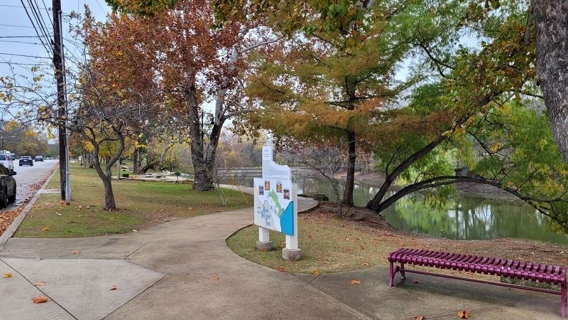
A treasure found in the magnificent Texas Hill Country, Boeme (pronounced "Bernie") originally was settled over 150 years ago by German Immigrants who first entered this land near the cool waters of Cibolo Creek. The town was plotted in 1852 by . . . — — Map (db m212520) HM
Representatives of Cibolo Nature Center, The Trust for Public Land, The Nature Conservancy in Texas, Texas Parks and Wildlife Department, and the Land Trust Alliance first met with Kendall County Commissioner's Court in the spring of 2003 to propose . . . — — Map (db m188450) HM
Constructed in 1907 for Alex Brinkmann, this building housed the Comfort State Bank until 1960. Local stonemason Richard Doebbler is credited with the hand-cut stone craftsmanship of the structure. The Comfort Public Library was located here from . . . — — Map (db m155855) HM
Ernst Karger (1861-1922), who owned and operated a saloon on the adjoining property, had this building constructed in 1913. Fritz Anderwald’s pool hall was first to occupy the building, and several other businesses have been located here over the . . . — — Map (db m304486) HM
George Wilkins Kendall, the Father of the Texas Sheep Industry and county namesake, was truly a renaissance man who was skilled in several professions and trades including animal husbandry. During the 1850's-60's Kendall, through trial and error, . . . — — Map (db m298479) HM
Civic leader and Boerne businessman Maximilian Beseler (1866-1939) had this stone Victorian cottage built for his parents, Charles and Minna Beseler, in 1903. A native of Prussia, Charles Beseler came to Texas in 1848 and served for many years as a . . . — — Map (db m212880) HM
Called "The Fighting Parson," Andrew Jackson Potter is a well-known figure in 19th century Texas history. He was born in Chariton County, Missouri on April 3, 1830, to Joshua Potter (1776-1840) and Martha (Johnson) Potter (d. 1840). His mother . . . — — Map (db m292910) HM
Ottmar von Behr had an influence on German immigration before bringing his family to Texas in 1848. Having toured America in 1846, he published an emigrant's guide, suggesting the life of a Texas farmer. Although Ottmar was a son of nobility in . . . — — Map (db m214273) HM
German native Frederick Hofheinz came to the New Braunfels area with his family in 1852. He later settled in Kendall County and wed Emilie Wilke. He served as Grand Lodge President of the Texas Sons of Hermann and ran for Texas lieutenant governor . . . — — Map (db m195549) HM
The community of Hastings was established in the late 19th century with the settlement of immigrants from England coming to farm and ranch in Texas. William George (Willy) Hughes moved from Kensington, London, to Texas in 1878 at age 19 to learn . . . — — Map (db m163344) HM
A well drilled near this site in 1894 produced hot mineral water at a depth of 3,100 feet. Hot mineral baths were popular then for treatment of various diseases, and Marlin and Mineral Wells were among Texas towns with successful bath houses. In . . . — — Map (db m208867) HM
Carl Joseph and Augusta Beseler and their two sons immigrated from Germany to Texas in 1848. They settled in Kendall County on a land grant in the 1850s. The community of Welfare was established on the Beseler Land Grant. The Beselers' son Ernst . . . — — Map (db m188513) HM
Born in Kentucky. Moved to Texas in 1833. In Texas Revolution he fought in Siege of Bexar (1835) and Battle of San Jacinto (1836). In 1842 took part in Somervell expedition against Mexico.
Resided at Washington-on-the-Brazos; present Kendall . . . — — Map (db m194072) HM
Vogt-Schoch House
Mr. J.G. O'Grady built the Kendall House as an inn and stagecoach stop in the 1850s. It was later replaced with the Vogt-Schoch House. He was a colorful character and leader in settling the area. He originally came from . . . — — Map (db m212519) HM
Abundant natural resources and a well-traveled pathway made this area one of the earliest frontier Hill Country settlements. The Pinto Trail, an ancient Native American Road between Spanish missions in San Antonio and lands north, was a conduit . . . — — Map (db m155138) HM
Panel 1
The first German settlements in Texas were Industry in Austin County, founded by Friedrich Ernst in 1831, Biegel in Fayette County, founded by Joseph Biegel in 1832, Cat Spring in Austin County, founded by the von Roeder, Kleberg, . . . — — Map (db m210312) HM
Constructed on Main Street in the late nineteenth century, this building first served as an office for the real estate, insurance, and private banking interests of Henry J. Graham (1854-1936). Born in Brazil, Graham came to Boerne in the 1870s. He . . . — — Map (db m171963) HM
Prehistoric Prehistoric people hunt and gather in the region as early as 10,000 years ago.
Native Americans Comanches, Lipan Apaches and Kiowas are the main tribes in the area by 1700.
Spanish Explorers 1689 The name . . . — — Map (db m298409) HM
Built about 1900, this was the home of Kendall County Justice of the Peace and County Judge Julius A. Phillip (1867-1935), his wife Anna (Meckel) (1867-1961) and their eight children. Originally built as a 4-room house, it was enlarged in the 1920s . . . — — Map (db m237669) HM
SAN ANTONIO - M.P. 238
The SA&AP wood frame passenger depot was located at the corner of Aransas Street, later changed to S. Alamo Street. and S. Flores Street. During its operation the ground floor provided passenger services including . . . — — Map (db m174167) HM
Jefferson (Jeff) Davis Smith, son of Henry M. and Fanny (Short) Smith, was born in Kendall County, Texas. Jeff, age 9, and his brother Clint, age 11, were kidnapped by Lipan and Comanche Indians while herding sheep near their home in 1871. Jeff . . . — — Map (db m177107) HM
Born on February 22, 1820, in Bremen, Germany, F.W. Flato immigrated to Texas in 1846 and settled in Austin County. Flato and his wife, Sophia Welhausen, moved to southwestern Fayette County by 1866 where they operated a successful mercantile . . . — — Map (db m293041) HM
A native of Kendall County, Albert Paul Kutzer (1871-1925) was the eldest son of German immigrants Reinhold and Pauline (Holzinger) Kutzer. A merchant and gin operator, he became one of Boerne's leading businessman. He also served as mayor from . . . — — Map (db m172049) HM
This pioneer home was built in 1858 by German immigrant Phillip Jacob Theis (1809-1876), an early Kendall County blacksmith and wheelwright. The original part of the Theis House is a dogtrot plan of palisade construction. Willow branches were woven . . . — — Map (db m237671) HM
Although ranching produced just a fraction of the Johnson’s income, it constituted a major portion of the President’s public identity. The Johnsons maintained two herds of cattle on the LBJ Ranch—one of them a commercial herd sold for beef, the . . . — — Map (db m91270) HM
Being the western most point of Anglo-American settlement and the closest town to San Antonio de Bexar, Gonzales was the center of the Texas revolutionary activity. In July 1826 the original settlement was abandoned after two Indian attacks but was . . . — — Map (db m290095) HM
One of the earliest explored rivers in Texas. Named for Our Lady of Guadalupe by Spaniard Alonso de León in 1689.
During, 1691-1693, Domingo Terán de los Ríos, Spanish Governor of Texas, maintained a colony on the Guadalupe. In early . . . — — Map (db m169956) HM
Veterans Plaza has been referred to by several names over the years including Public Square, Military Place, and Veterans Plaza. The original memorial monument was provided by Henry & Graham, a very active local businessman who dealt in real . . . — — Map (db m237667) HM
The first Episcopal worship service in Kendall County was held in the Old Kuhfuss Hall in Boerne in 1873. St. Helena's congregation was organized by Bishop R. W. B. Elliott in 1881, and a small wooden church structure was erected on this site. By . . . — — Map (db m128110) HM
Dan Holekamp (1851-1931) and his second wife, Franciska "Frances" (Wiedenfeld) (1862-1947), both children of founding families of Comfort, operated several businesses beginning in the 1880s. Among their interests were a mercantile and a combination . . . — — Map (db m292911) HM
The Pinta Trail (Camino Pinta) was a natural pathway through the Hill Country, utilized by Native Americans and later linking to Spanish settlements to the southeast. The path extended about 180 miles northwest from San Antonio to the 1750s . . . — — Map (db m208671) HM
This cemetery served the community of Brownsboro, which was originally settled by shinglemakers. Later, farmers and then railroad workers resided here. Thomas and Sarah Manning donated land for a burial ground and church in 1870; Levi and Sarah . . . — — Map (db m188506) HM
From 1821 to 1836, when Texas was a Mexican state, impresario land grants to Texas included territory between the Colorado River and the Guadalupe River. When Texas became a republic, Texas citizens claimed their land grants, and José Antonio de la . . . — — Map (db m188452) HM
Early settler and Confederate veteran Thomas Manning (1826-1898) deeded an acre here for a Methodist church in 1870. The measurements designated "a rock about 20 varas [55 feet] northwest of where the church stands" as the beginning of the metes and . . . — — Map (db m188507) HM
This shingle style structure was built in 1918 to attract and house bats in an effort to eradicate mosquitoes and thereby reduce the spread of malaria. It was designed for Albert Steves, Sr., a former mayor of San Antonio, by Dr. Charles A.R. . . . — — Map (db m183069) HM
Anglo pioneers in a predominantly German-settled area built the west wing of this building in 1891. Land for this first public school was given by Robert Percival Maxwell Waring, a native of Ireland for whom the town had been named in 1888, citizens . . . — — Map (db m188512) HM
USA Lest They Be Forgotten This Monument Is Erected as a Memorial by the Graham Family of Boerne Texas
In Memory of the Following Named Men From Kendall County Who Died in the Military and Naval Service of the United States During . . . — — Map (db m174123) WM
This structure has been
recorded by the
Historic American
Building Survey
by the United States Department
of the Interior for its archive
at the Library of Congress — — Map (db m235074) HM
Origin of City Park
In 1964, the city’s first developed park was the result of a growing desire among many citizens of Boerne, and the city sought the appropriate funds to make this vision a reality. On February 10, 1965, Ralph W. Yarborough, . . . — — Map (db m299006) HM
First and only courthouse in county. Erected 1869-1870, seven years after county organization. Many locally prominent men were associated with the structure.
The first county judge, Joseph Graham, was appointed U.S. Consul to Argentina. The . . . — — Map (db m111219) HM
The Trinity Aquifer
Our groundwater is stored in a complex system of aquifers, collectively known as the Trinity Aquifer. This differs from San Antonio, which has one large, fairly uniform aquifer known as the Edwards Aquifer. Depending on . . . — — Map (db m298394) HM
Thin black lines indicate changes in relevance. Between each pair of lines entries are ordered geographically but all have the same relevance.
* Inflectional forms of words are their plurals, singulars, and possessives as well as gramatical tenses and similar variations.