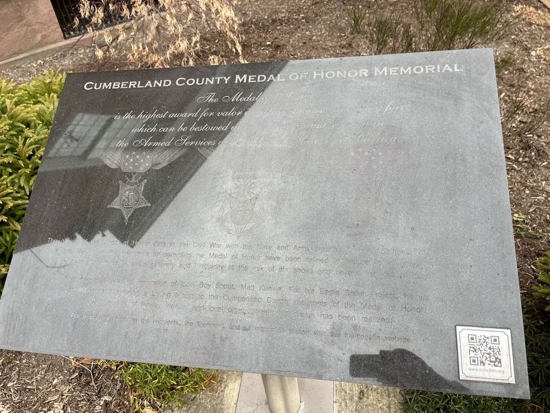
Jacob Cart, Private, U.S. Army, Company A, 7th Pennsylvania Reserve Corps, Civil War, 13 December 1862, Fredericksburg, Virginia •
William E. Miller, Captain, U.S. Army, Company H, 3d Pennsylvania Cavalry, Civil War, 3 July 1863, . . . — — Map (db m217341) WM
South Middleton Township is located on the southern side of the Cumberland Valley in the shadow of the South Mountain. The area’s natural beauty, rich farmland, abundant water resources, and historical and recreational assets have attracted . . . — — Map (db m202191) HM
This stone marks the grave of Major General John Armstrong, “First Citizen of Carlisle” and “Hero of Kittanning”.
Armstrong was born October 13, 1717 in Ireland and settled in the Cumberland Valley sometime between . . . — — Map (db m166858) HM
First Block of North Pitt Street
Carlisle, PA (You are here)
The first block of North Pitt Street has seen many changes over the years. On the northeast corner of North Pitt and West High streets sits the Hamilton . . . — — Map (db m217335) HM
During the early years of European settlement in this valley, Mary McKeechan Patton (1751-1836) operated a gunpowder mill along Powder Branch not far to the south of this spot. Mary McKeechan was born in England and her family immigrated to . . . — — Map (db m183985) HM
Carlisle At War (center panel) After Confederate forces fired on Fort Sumter, South Carolina, in April 1861, the men of Carlisle responded to the national calls to put down the southern rebellion. Four companies of Pennsylvania infantry . . . — — Map (db m135169) HM WM
Visitors are surprised and delighted to see an English looking castle standing in the heart of downtown Carlisle, but they wonder what it is and when it was built. For 130 years it was the Cumberland County Prison, and when it was constructed in . . . — — Map (db m19496) HM
Agricultural Conservation Easement (ACE) Purchase Program: Thanks to the ACE program, Pennsylvania has become a leader in the nation when it comes to the number of
farmland acres that have been permanently preserved for agricultural production. . . . — — Map (db m242592) HM
Formed on March 9, 1771 from Cumberland County, it first embraced most of western Pennsylvania. Named for its county seat (formerly Raystown) incorporated 1795. In 1758, Fort Bedford was erected here, and Forbes Road - to become a major highway . . . — — Map (db m13990) HM
(Statement):
A full transcript of the original Presbyterian Burial Ground Patent is available to all those interested from the Memorial Park Conservancy
In June, 1766, in pursuance of an order from his Honour the Governor John Penn, . . . — — Map (db m176390) HM
Formed January 27, 1750 from Lancaster County. Named for Cumberland County in England, it originally extended to Pennsylvania's western limits. Carlisle, county seat, was founded 1751. Crossed by major roads, county had a key role in westward . . . — — Map (db m15856) HM
The Old Graveyard was Carlisle's first burial ground. The earliest surviving marker is dated 1757, six years after Carlisle's founding in 1751. Title from the Penn family for the original “three acres, three quarters, and fifteen perches” for the . . . — — Map (db m19494) HM
Although Pennsylvania was a free state, where no person could be born into slavery, ownership of slaves had not been illegal, and as recently as 1840, two-dozen slaves were held in bondage in Cumberland County. At that time, more than three hundred . . . — — Map (db m30848) HM
Less than half a mile west of here, on the Lewis Whitaker farm, the only engagement of the war in Cumberland County between regular Union and Confederate troops took place on December 9, 1863. Several companies of Col. Thomas J. Jordan’s 9th . . . — — Map (db m69228) HM
Hopewell, one of the oldest Presbyterian churches in Bourbon County, has held worship services since 1785. The first congregation included Dutch settlers. It was recognized by the Transylvania Presbytery in 1787. Original church was located near . . . — — Map (db m218204) HM
Erected by the Commonwealth of Pennsylvania in grateful appreciation of the services of these soldiers of the Revolutionary War who lie buried here.
Located and verified by The Cumberland County County Chapter of the D.A.R. — — Map (db m16093) HM
1. Cumberland County, established in 1750, lost its first courthouse to fire in 1845. This Courthouse was built in 1846 and still bears the scars of a Civil War shelling on July 1, 1863.
2. Carlisle's long tradition of education began early, . . . — — Map (db m16094) HM
1. PUBLIC SQUARE - deeded by Thomas Penn for public use and laid out in 1751, has continued its function through two historic centuries as the center of Cumberland and Carlisle life.
2. CUMBERLAND CO. COURTHOUSE - SW corner of square, . . . — — Map (db m204092) HM
Formed March 22, 1820 from Cumberland County. Named for Oliver Hazard Perry, War of 1812 hero. Birthplace of two governors of Pennsylvania, one of California, and one of Minnesota. The county seat, Bloomfield (P. O. New Bloomfield) was . . . — — Map (db m308096) HM
[Header]
Walkable Warren
Walkable Warren is a local initiative intended to promote healthy lifestyles by encouraging foot traffic and bicycling as alternative modes of travel in and around the City of Warren. Warren has a wealth of . . . — — Map (db m307074) HM
John Tate, born in Ireland in 1758, came to America in 1763. He volunteered for the Pennsylvania Militia in December 1776 from Shippensburg, Cumberland County, PA. He served as a private with Captain Robert Culbertson and later, at the Battle of . . . — — Map (db m315011) HM
[column 1:]
"History of The National Road"
Settlers had been moving west since the early 1700's. By 1802, so many farms and towns had been settled in the Ohio Valley that people living in the territory were calling for . . . — — Map (db m155631) HM
The Hamilton Library Association was charterd in 1874, and this two-story brick building was erected in 1881 to house its collection. The library was made possible by a bequest of $2,000 from James Hamilton (1793-1873), a prominent Carlisle lawyer . . . — — Map (db m30830) HM
This memorial is in commemoration of the services of Revolutionary War Soldiers buried in Brown's Mill Graveyard, Antrim Township, Franklin County, Pennsylvania, and is dedicated in grateful recognition of their patriotism, valor and fidelity. . . . — — Map (db m227394) HM WM
Born in Cumberland County, Pennsylvania, January 8, 1806, John Bigler was the eldest of what was said to be “a numerous family of children.” As a young man, he was apprenticed to the printing trade and became one of the youngest editors of the . . . — — Map (db m13069) HM
In memory of their eldest son
Col. William Patterson
Born 1737 • Died 1782
Builder of the second Patterson's Fort near this spot
A brave soldier in the service of Pennsylvania during the French and Indian Wars.
A judge of the bench of . . . — — Map (db m118158) HM
Since 1825, Perry County has constructed numerous buildings for judicial and legal services. The most prominent is the County Court House, the oldest in Pennsylvania and, since 1975, on the National Register of Historic Places.
After World . . . — — Map (db m241986) HM
After disengaging from the Union cavalry in the late afternoon of June 30, Confederate Gen. J.E.B. Stuart's cavalry division, bogged down by 125 fully loaded Union supply wagons and 600 mules saddled with Union materials, left Hanover. Stuart and . . . — — Map (db m197242) HM
Monument front:
In honor of the Patriots of Cumberland Co., NJ who—on the evening of December 22, 1774—burned British tea near this site.
List of Patriots on Marker:
Tea Burners
Ebenezer Elmer
Timothy Elmer . . . — — Map (db m17692) HM
Born in 1853 in Philadelphia, Mary J. Dunlap was awarded her medical degree in 1886 from the Woman's Medical College of Pennsylvania. Dr. Dunlap was the first female Superintendent and Medical Director for the newly established Home for . . . — — Map (db m153760) HM
This bell was placed as part of the
Commonwealth of Pennsylvania's celebrations
for the 250th anniversary of the
United States in 2026.
Presented in Cumberland County
Artist: Phil George
[Images include Benjamin Rush, Molly . . . — — Map (db m304460) HM
On April 6, 1789, a group of local real estate owners - worried about the possibility of fire in the borough - organized Carlisle's first volunteer fire company. They named and modeled it after the Union Fire Company of Philadelphia, the first fire . . . — — Map (db m30832) HM
On August 19, 1837, a jubilant throng gathered in Carlisle to watch the Cumberland Valley Railroad's first train roll down High Street. Bands played, speeches were made, and the crowds cheered as the “Cumberland Valley” locomotive and . . . — — Map (db m16088) HM
The Big Spring Adamantine Guards: Soldiers from Cumberland County's leading militia cavalry unit — the Big Spring Adamantine Guards — became Company H of the Union Army's 3d Penna. Cavalry and served in the Civil War from 1861 to 1864. . . . — — Map (db m242191) HM
Erected by the Commonwealth
of Pennsylvania
in grateful appreciation of
the services of
these soldiers of the
Revolutionary War
who lie buried here
Anthony Lipsey • Samuel Mitchell • Robert Scott • John Simpson • John Means • . . . — — Map (db m152341) HM
The bridge river crossing at this spot is Harrisburg's oldest and most historic. First to be erected was the Camelback Bridge, known for its irregular and "rolling" covered bridge profile and the first bridge to ever cross the Susquehanna River that . . . — — Map (db m6376) HM
The Greatest Sacrifice
Chambersburg
The price of war is devastation. Franklin County paid the price when its county seat, Chambersburg, was burned to the ground in 1864. Invaded in 1862, 1863, and 1864 by Confederate forces, Franklin . . . — — Map (db m201757) HM
Several years in advance of other European settlers, Frederick Staring (Starns) led a small band of fellow countrymen from German Flatts in the Mohawk Valley of NY in 1741 to boldly locate themselves here in the valley of the Juniata.
“About . . . — — Map (db m238242) HM
In 1832, a Governor's commission tasked with establishing a centrally located, permanent seat for Perry County government, accepted George Barnett's donation of eight acres in what became New Bloomfield. With the construction of a courthouse in . . . — — Map (db m242035) HM
Born enslaved near Winchester, Virginia, c. 1832, John J. Butcher
migrated north through the Cumberland Valley and settled in Carlisle
following the Civil War. Butcher worked as a laborer for local
businessman George Hench. He also made and sold . . . — — Map (db m258301) HM
From 1955 to 2011 this house served as the club house for
the Civic Club of Carlisle, one of the oldest women's civic
clubs in Pennsylvania.
On June 22, 1898, Gertrude Bosler Biddle (1857-1950)
convened a meeting of 32 women to establish a . . . — — Map (db m258313) HM
Two Mile House in the 18th & 19th Century
The Cumberland County Historical Society would like to acknowledge the
peoples whose territories the land occupies: the Susquehannocks, the Lenape,
also known as Delaware, and the Haudenosaunee, . . . — — Map (db m258298) HM
Erected by the Commonwealth of Pennsylvania in grateful appreciation of the services of these soldiers of the Revolutionary War who lie buried here.
Lieut. Colonel Samuel Irvine •
Captain William Peebles •
Captain Samuel Felton • . . . — — Map (db m19563) HM
The benefits of farmers' markets: Pennsylvania has over 1,000 roadside farm and community farmers' markets.
These markets provide local residents and tourists with a convenient way to purchase top-quality produce. Fruits and vegetables can be . . . — — Map (db m242394) HM
Thin black lines indicate changes in relevance. Between each pair of lines entries are ordered geographically but all have the same relevance.
* Inflectional forms of words are their plurals, singulars, and possessives as well as gramatical tenses and similar variations.