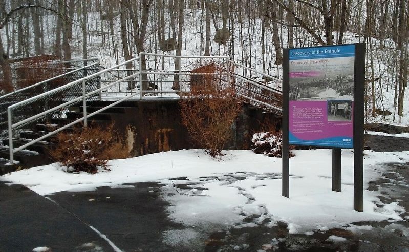
"The miner fired a blast, and when the outpouring of stones and water from the hole came rushing through, the miners...called out a cry of alarm and ran from the mine..."
Edward S. Jones, Mine Manager
They thought the earth had . . . — — Map (db m115883) HM
On Main Street at Betty Street, on the left when traveling south on Main Street.
Respected officer of the Archbald Borough Police Department, who, while in performance of his duties, was struck and killed by an automobile near this location.
Officer Paparelli's untimely, tragic death coupled with his years of public . . . — — Map (db m149531) HM
On Betty Street at Thomas Street, on the left when traveling south on Betty Street.
Founder of Eynon Drug Store in the year of 1927. Died in the year of 1972. The man who has done so much for so many people and asked so little from them in return, was responsible for the people's growth and commercial business in the town of Eynon, . . . — — Map (db m149535) HM
Coal from the Lackawanna Valley fueled America's Industrial Revolution. Millions of tons of domestic anthracite came from mines like those that ran under this park.
Today, nature's gift of anthracite and the dynamic story of the Industrial . . . — — Map (db m115890) HM
On Main Street north of Wayne Street, on the right when traveling north.
This plaque is in commemoration of the foot-bridge that connected the downtown Main Street business area with Salem Street and St. Thomas Church. The foot-bridge crossed the Lackawanna River and was located between the Gilmartin Street Bridge and . . . — — Map (db m101608) HM
On Betty Street at Thomas Street, on the left when traveling south on Betty Street.
Dedicated to
SPC. Nicholas Staback
ACO 1st Battalion
5th Regiment, 1st Brigade
25th Infantry Division
Enlisted in the US Army in March 2010,
and completed Basic Training at
Fort Benning, GA in July that same year.
SPC. Nick . . . — — Map (db m149536) WM
"It is a fine case of a well-known phenomenon called a glacial pothole."
Geologist J.C. Branner, 1884
Formation
About 20,000 years ago, a powerful, whirling mixture of frigid glacial water, sand and stones wore away solid rock, . . . — — Map (db m115887) HM
On Laurel Street at Salem Street, on the left when traveling south on Laurel Street.
In grateful tribute
to the brave men and women
of Archbald who served
their country in the
Armed Forces
World War I
[Roll of Honored Dead]
John Butero • F. Barcowski
Frank Barcosky • C. Barnosky
Francis Coughlin • N. Bellucci . . . — — Map (db m105609) WM
On Main Street at Lackawanna Avenue (Pennsylvania Route 347), on the right when traveling east on Main Street.
This anchor is preserved here as a memorial to Captain Johnston Blakely, captain of the sloop-of-war "Wasp" during the War of 1812. Captain Blakely was born in October 1781 and after a courageous naval career was lost at sea in October 1814. The . . . — — Map (db m128042) HM
On 7th Avenue west of the railroad tracks, on the right when traveling west.
In 1831, America's first underground anthracite mine opened on this very spot. A monument was placed at the site in 1901 when [illegible] celebrated its [50th?] anniversary [illegible] the West Side [illegible]. Relocation [illegible] the monument . . . — — Map (db m177582) HM
On North Main Street (Business U.S. 6) at Park Place, on the right when traveling south on North Main Street.
Erected in 1914 as the Miners and Mechanics Bank on the site of the former Harrison House, the architect was Edward Langley. Considered one of Carbondale’s most historic buildings, it was vacated upon the bank's close in 1931. In later years it . . . — — Map (db m312993) HM
Founded by the Wurts brothers, pioneers in developing anthracite resources of the region, in 1822. Here the first underground mine was opened in June, 1831, near Seventh Ave. Chartered as a city in 1851. — — Map (db m89268) HM
Founded by the Wurts brothers, pioneers in developing anthracite resources of the region, in 1822. Here the first underground mine was opened in June, 1831, near Seventh Ave. Chartered as a city in 1851. — — Map (db m89269) HM
Founded by the Wurts brothers, pioneers in developing anthracite resources of the region, in 1822. Here the first underground mine was opened in June, 1831, near Seventh Ave. Chartered as a city in 1851. — — Map (db m89293) HM
A National Register Building, Erected 1892-1894-City of Carbondale Government Offices-Carbondale Historical Society-D&H Transportation Museum — — Map (db m89296) HM
On Main Street (Business U.S. 6) at 6th Avenue, on the right when traveling south on Main Street. Reported permanently removed.
Carbondale City Hall
Carbondale City Hall is a detached masonry (brick and Pennsylvania blue stone) building, in the Romanesque Revival style, composed of a tower, a three-story wing and a two story wing. The building was designed by . . . — — Map (db m89297) HM
On Main Street (Business U.S. 6) at Park Place, on the left when traveling north on Main Street.
A detached, masonry, brick and Pennsylvania bluestone structure in the Romanesque Revival style, present-day Carbondale City Hall opened in 1894 and is listed on the National Register of Historic Places. It succeeded two earlier city halls on . . . — — Map (db m285457) HM
Here are three of the many churches in downtown Carbondale. All of which has contributed significantly to the enrichment of the quality of life in Carbondale. — — Map (db m89306) HM
Front Brevet Brigadier General D-Day Veteran July 30, 1921 Feb. 13, 2011 “When they were young, these men saved the world.”
Left side “Nothing worth having is given freely,” Liberator of Nazi Death Camp, . . . — — Map (db m89304) WM
On Main Street (Business U.S. 6) north of John Street/Lincoln Avenue, on the left when traveling north.
This structure was built in 1832 as an office for the Delaware & Hudson (D&H) Canal Company. Between 1829 and 1898, the D&H gravity railroad carried coal from mines to markets, and passengers from Carbondale to other communities. In . . . — — Map (db m122220) HM
A magnificent railroad station once rose from the foundation in front of you. Built in 1895, it was one of 19 stations on the Honesdale Branch of the Delaware & Hudson Co. The last train pulled into the station on January 4th, 1952, at . . . — — Map (db m114445) HM
On Church Street north of 6th Avenue, on the right when traveling north.
[Illustration captions, clockwise from top left, read]
First United Methodist Church · Saint Rose of Lima Catholic Church
Covenant Reformed Church · First Presbyterian Church · Berean Baptist Church
The many houses of worship in . . . — — Map (db m285441) HM
Born and raised in Carbondale, Pennsylvania 1932-1985 Graduated St. Rose High School 1949 West Point-1953 Air Command with Staff College with Distinction George Washington University-MBA-1955 Naval War College-1970 Command Pilot-flew over . . . — — Map (db m89303) WM
On Main Street (Business U.S. 6) at 6th Avenue, on the right when traveling north on Main Street.
In honor of the
men and women who gave
their lives to their country
and continue to serve.
[Armed Services Emblems]
109th Infantry
Regiment Association
SFC George A. Pugliese [photo]
SGT Eric W. Slebodnik . . . — — Map (db m153014) HM
On Canaan Street (Business U.S. 6) at Belmont Street on Canaan Street.
Between 1829 and 1898, this was the site of Plane No. 1 on the roadbed of the Delaware and Hudson Canal Company’s Gravity Railroad. The “Gravity” used a series of inclined planes and steam engines to pull carloads of coal to the top of . . . — — Map (db m89271) HM
On Canaan Street (Business U.S. 6) at Belmont Street on Canaan Street.
Gravity Park was established by the Delaware and Hudson Railroad on the site of what was formerly a portion of the roadbed of Plane No. 1. The Delaware and Hudson Canal Company’s Gravity Railroad from Carbondale to Honesdale opened on October 9, . . . — — Map (db m89274) HM
On Canaan Street (Business U.S. 6) at Belmont Street on Canaan Street.
Here began one of the first railroads in the Western Hemisphere, built 1828-1829. The line had its eastern terminus at Honesdale; its southwestern terminus was later extended to Archbald & ultimately to Valley Junction near Olyphant. Built by the . . . — — Map (db m89270) HM
On Canaan Street (Business U.S. 6) at Belmont Street on Canaan Street.
The president, managers, and company of the Delaware and Hudson Canal Company completed in 1829, the Gravity Railroad between Carbondale and Honesdale, in Pennsylvania. It was the second railroad constructed in the western hemisphere. The . . . — — Map (db m89273) HM
On Main Street (Business U.S. 6) at 8th Avenue (Business U.S. 6), on the right when traveling south on Main Street.
Carbondale's UFO
On November 9, 1974, at approximately 1900 hours,
three Carbondale teenage boys reported to Carbondale
Police that they had observed a glowing airborne object,
traveling east to west rapidly. It descend[ed] and . . . — — Map (db m135019) HM
On North Main Street (Business U.S. 6) at 6th Avenue, on the right when traveling north on North Main Street.
In the 1880’s, under the leadership of William H. Davies Post 187 of the G.A.R. Memorial Park was established on the former Carbondale militia parade ground and a monument and fountain were erected to honor the veterans of the U.S. Civil War. . . . — — Map (db m89302) HM
“The valiant never taste of death but once”-Erected by the citizens of Carbondale, PA and others in memory of Patrolman William F. McAndrew who died January 18, 1913 from bullet wounds received while making an arrest in Dickson City Jan. . . . — — Map (db m89295) HM
On 7th Avenue just west of the railroad tracks, on the right when traveling west.
[Photo showing] D&H Seventh Avenue Crossing in Carbondale, Showing D&H Mine Monument in its Original Position. Photo, circa 1961, in the collection of the Carbondale Historical Society and Museum. Photo donated to the Historical Society by Robert . . . — — Map (db m177579) HM
On 7th Avenue west of the railroad tracks, on the right when traveling west.
The first
underground anthracite mine
opened here June, 1831,
by Archbald Law,
first mining engineer.
of
The Delaware and Hudson
Canal Company
Officers of
The Delaware and Hudson Company 1901.
Robt. M. Olyphant, Pres.
F.M. . . . — — Map (db m177578) HM
On Main Street (Business U.S. 6) at 6th Avenue, on the right when traveling north on Main Street.
Erected in grateful tribute by
the Citizens of Carbondale Area
in memory of the Veterans of the
Spanish-American War 1898
World War I 1917-1918
World War II 1941-1945
[Honor Roll of Veterans] . . . — — Map (db m99135) HM
On Casey Highway (U.S. 6), on the right when traveling south.
Founded in 1823 by Maurice and William Wurts, two brothers of Swiss ancestry, the Delaware and Hudson Canal Company played a prominent role in the economic development of northeastern Pennsylvania. From its completion in 1829 until its abandonment . . . — — Map (db m104104) HM
On Casey Highway (U.S. 6), on the right when traveling south.
You are standing on the southeastern side of the Lackawanna Valley. In this area the valley is about 5 miles (8 kilometers) wide. Behind you, Moosic Mountain rises some 1,200 feet (366 meters) above the elevation of the Lackawanna River in the . . . — — Map (db m104139) HM
On Meredith Street east of Main Street (Business U.S. 6), on the right when traveling east.
Terence Powderly and National Labor Movements
Terence Powderly grew from child laborer in Carbondale to a leader in the national labor movement.
Terence Vincent Powderly
Terence Vincent Powderly was born in Carbondale on . . . — — Map (db m128155) HM
Moosic Mountain, rising over 1,200 feet above Carbondale's anthracite coal mines, was a formidable barrier to the markets of New York City. The Delaware and Hudson Canal system could be used to move coal from Honesdale to Kingston, New York, but a . . . — — Map (db m104135) HM
Rank and organizations: Second Lieutenant, U.S. Army Air Corps, 43rd Bomber Group, Place and date: Over Baku Area, Solomon Islands, 16 June 1943. Entered service at: Simpson, Pa. Born 30 January 1915, Simpson, Pa. G.O. No: 85, 17 December 1943. . . . — — Map (db m149957) HM WM
This bridge is dedicated to the memory of
Daniel T. Stark
He built this bridge and other facilities within
South Abington Recreation Park as an employee
of his father's company, Stark's Construction.
Daniel, a 1996 gradate of Abington . . . — — Map (db m211848) HM WM
On North Abington Road (Pennsylvania Route 407) at Glenburn Road, on the right when traveling north on North Abington Road.
This bell stood in
the belfry of the
Baptist church of
Clarks Green, PA
Cast in 1869 by the
Meneely Foundry
West Troy, New York.
—————————————
The . . . — — Map (db m131618) HM
On North Abington Road (Pennsylvania Route 407) at Glenburn Road, on the left when traveling north on North Abington Road.
This tablet erected to the memory of
Deacon William Clark.
Born in Rhode Island 1757
Who served his country under General Gray
at the battle of Bunker Hill.
First settler north of these mountains
Came to this place from Connecticut . . . — — Map (db m131620) HM
On State Street (U.S. 6/11) at Spring Street / Main Avenue, on the left when traveling north on State Street.
Laura Lee DeFazio Morabito, born in Clarks Summit, was educated in the Abington Heights School system. She participated in numerous school activities including Girls Softball, Basketball and the Marching Band.
Laura Lee perished in the . . . — — Map (db m99111) HM WM
On State Street (U.S. 6/11) at Clark Avenue, on the right when traveling north on State Street.
In memory of
all Abington Area
veterans and civilians
who dedicated themselves
to the principles of freedom.
Let us be forever faithful
in keeping your valor alive.
POW-MIA
Let the American youth
never forget our forefathers
and . . . — — Map (db m99465) WM
On Morgan Highway (Pennsylvania Route 307) at Grove Street, on the right when traveling north on Morgan Highway.
[front]
[Armed Forces Branch Emblems]
And I am proud to be an American where
at least I know I'm free. And I won't forget the
ones who died who gave that right to me.
[back]
This monument presented by:
Parker - Wescott Post #40 . . . — — Map (db m131624) WM
On Drinker Turnpike (Pennsylvania Route 435) at Dorantown Road, on the right when traveling north on Drinker Turnpike.
Dedicated to the men and women
of Covington Township who
served in the Armed Forces
of our country
[POW/MIA medallion]
[Armed Forces emblems] — — Map (db m237372) WM
On Dundaff Street north of Main Street, on the left when traveling north.
Bishop of Rome and Vicar of Jesus Christ,
Successor of St. Peter, Prince of the Apostles,
Supreme Pontiff of the Universal Church.
Patriarch of the West, Primate of Italy.
Archbishop and Metropolitan of the Roman Province,
Sovereign of . . . — — Map (db m194333) HM
Near Walker Street north of Jermyn Street, on the left when traveling north. Reported missing.
America250PA, in partnership with the Pennsylvania Freemasons, plants this certified Liberty Tree in commemoration of the original Liberty Trees, which were gathering places for Sons of Liberty during the American Revolutionary War. Ahead of the . . . — — Map (db m285440) HM
On Boulevard Avenue at Main Street, on the right when traveling south on Boulevard Avenue.
In grateful tribute
to the men and women
of this community who
served.
☆☆☆
In honor of those who
made the supreme sacrifice
☆☆☆
1917 World War I 1918
Zigmund Cheresko • John Mierzjewski • . . . — — Map (db m128041) WM
of East Guilford, Connecticut, located in the Lackawanna Valley A.D. 1840, and became the leading spirit in the inauguration and development of the great industries that have built up the City of Scranton. He was twice elected to Congress from . . . — — Map (db m108344) HM
G. A. R.
1878.
————
1900.
————————————
G A R Post 139
[Flag Pole] Presented by
Chas. B. Scott
Scranton, Pa.
May 30, 1916
————————————
The Bivouac of the Dead
The muffled drum's sad roll has beat
the soldier's last . . . — — Map (db m186375) WM
On Blakely Street at Cherry Street, in the median on Blakely Street.
This memorial is dedicated to those
Lackawanna County residents who gave
the supreme sacrifice, and to those
brave men and women who served
in the Korean War.
The Friends of the Forgotten Inc. N.E. Wing
wish to thank Mr. Steven Colley . . . — — Map (db m128217) WM
On Smith Street south of Center Street, on the right when traveling south.
This ramp is dedicated
in memory of
Msgr. Anthony C. Marra
He devoted his life to serving
the Lord. He built this ramp
as a result of his passion and
commitment to this service
to welcome and embrace
the Lord's flock to pray . . . — — Map (db m188132) HM
On Campus Drive, on the right when traveling west.
In 1923, Penn State began offering evening technical programs through a branch school in the city of Scranton. After WWII, the expanded programs included associate degrees. A lack of space for the increasing number of students seeking degrees . . . — — Map (db m152347) HM
On Campus Drive, on the right when traveling west.
In memory of all the veterans who have
walked these halls and served their
country to preserve our freedom.
In memory of
Gerald Walsh 76-78
John Farrell 70-72
Mark White 70-72 — — Map (db m152352) WM
On Tigue Street 0.2 miles east of East Drinker Street ( Route 435), on the left when traveling east. Reported missing.
The Pennsylvania Coal Co. gravity railroad was in operation between lower Pittston and Hawley from 1850 to 1884. It crossed the highway by overhead trestle near this point. This was plane No. 7. — — Map (db m32167) HM
On Barnard Street at Bednar Street, on the right when traveling south on Barnard Street.
Founded in 1958 by:
Joseph Dunda • Leonard DeMarco • George Kofel
Leonard Meila • Anthony Michalek • Eustachio Arduino
Vincent Metallo • Daniel Sacco • Andrew Hudak
Michael Martarano • Patrick DeMarco • Matthew Sienkiewich
Edward . . . — — Map (db m228686) HM
On Blakely Street at Cherry Street, in the median on Blakely Street.
In grateful tribute to the
brave men and women
of Dunmore
who served their country
in the Armed Forces
☆☆☆ And These Our Dead In Honored Glory Rest ☆☆☆
1917 World War I 1918
[Honored Dead]
1941 . . . — — Map (db m128203) HM
On Smith Street south of Center Street, on the right when traveling south.
In grateful memory of the men of this parish
who made the supreme sacrifice during
World War[s] I and II and the Korean War
Anthony Angerson • Joseph Angerson • Thomas Bonavoglia
Frank Cali • Salvatore Calomino • Salvatore Cantarella . . . — — Map (db m188135) WM
On Main Street north of Diane Street, on the right when traveling north.
[Honored Dead]
Anthony Wozniak • Albert Sherman • Stanley Michaloski
Vincent Misko • Samuel Ferbadussi • Alfred Pavloski • Thomas Stoback
John Melnick • Joseph Misko • Samuel Mashie • Peter Kohanski
John Niedzinsky
[Honor Roll of . . . — — Map (db m194328) WM
On Pennsylvania Route 106 at Route 247 on Pennsylvania Route 106.
U.S. Army-World War II-Recipient of the Medal of Honor for conspicuous gallantry and intrepidity involving risk of life above and beyond the call of duty in action with the enemy near Sars LaBruyere, Belgium on 4-5 September 1944. — — Map (db m89213) WM
On Jefferson Avenue south of Bacon Street, on the left when traveling south.
Calvary Bible Church
Preaching Salvation In Christ
since 1883
P.M. Church
763 Jefferson Ave.
Est. Nov. 12 1892
St. James St. George Episcopal Church
Founded 1872
St. Michael's Orthodox Church
Established 1909
1st United . . . — — Map (db m247195) HM
Why Build a Dam?
Imagine August 1955 as Hurricane Diane moves through northeastern Pennsylvania. From six to sixteen inches of rain falls, isolating the city of Scranton. More than 90 lives are lost in the region. Multiple historic floods . . . — — Map (db m172867) HM
On Business U.S. 6 at Route 107 on U.S. 6Business .
Here in 1899 Dr. Matthew J. Shields organized first aid for mine workers. From it grew the plan of Red Cross industrial first aid, which he helped establish. Dr. Shields died in Scranton January 23, 1939. — — Map (db m89266) HM
On Jefferson Avenue south of Bacon Street, on the left when traveling south.
The Memorial Garden is comprised of Circles of Life with remembrance bricks encircled by living memorial plants and trees, and engraved with historic and civic-minded sentiments for restents, former residents,
and friends of Jermyn who have . . . — — Map (db m247110) HM
On Walnut Street south of Delaware Street, on the left when traveling south.
In Memory
World War II and Korean War
Veterans
Walter Telep
John Mikridge • Michael Petrilak Jr.
Basil Keklock • John Frenchko
Alexander Krizanosky • Andrew Chup — — Map (db m177563) WM
On Delaware Street at Powder Mill Lane, on the left when traveling west on Delaware Street.
Once a thriving coal town in the middle of the Anthracite Region, Jermyn is the epitome of the picturesque and historic American small town.
Originally known as "Four Mile Town," the Village was later called Rushdale, Baconville and . . . — — Map (db m128079) HM
On Jefferson Avenue south of Bacon Street, on the left when traveling south.
Jermyn Colliery
The Hudson Coal Co.
Oct. 25, 1899
Matthew J. Shields, M.D.
Samuel Waters · David J. Jenkins · John Hogarth · Geo. Pendered, Sr.
Thos. Harvey · Wm. W. Whitley · Edward N. Stuart · Andrew Richards
Wm. Westington, Sr. · . . . — — Map (db m247194) HM
On Jefferson Avenue south of Bacon Street, on the left when traveling south.
[Armed Forces Emblems]
In Memory Of All Those Who Died
In The Armed Forces In This Area
World War I
William J. Griffiths · Carl Baker · Thomas Harvey · Richard T. Henwood
Joseph Houston · David Jones · Frank Kelly · George Morgan . . . — — Map (db m247196) WM
On Bridge Street south of Washington Avenue, on the left when traveling south.
The memorial is dedicated to the
memory of the 12 men who made the
supreme sacrifice for their country.
In 1920, 12 trees, which line the
roadway, were planted as a living
remembrance for their immortal sacrifice.
The replica rock . . . — — Map (db m128078) HM WM
On Bridge Street south of Washington Avenue, on the left when traveling south.
Memorial
to those of Jermyn
who gave their lives
in World War service
Dedicated by the
Wm. J. Griffiths Post 465
American Legion
Carl Baker • Frank Kelly
Wm. J. Griffiths • George R. Morgan
Thomas Harvey • Maurice L. Phillips . . . — — Map (db m128074) WM
On Church Street (Pennsylvania Route 247) south of Constitution Avenue ( Route 247), on the left when traveling south.
From 1892 to 1954, over 12 million immigrants entered the United States from various European countries. Thousands of those immigrants found their way to our region to work local mines, factories and fields. They brought their languages, customs, . . . — — Map (db m135058) HM
On Lane Street south of Church Street ( Route 247), on the right when traveling south.
This monument is dedicated to the
first mayor of the Borough of Jessup,
John J. Mancak
for his 24 years of service
to our community,
1966 ——— 1990 — — Map (db m157566) HM
On Hill Street at Lena Lane, on the left when traveling north on Hill Street.
Dedicated to the brave
men and women of Jessup
who served our country.
Recognizing all Veterans
of all wars and conflicts.
World War I
1917 — 1918
Jessup Borough World War II
Community Honor Roll
[Hundreds of . . . — — Map (db m135049) WM
On Church Street (Pennsylvania Route 247) south of 2nd Avenue, on the right when traveling south.
In grateful memory of the
men of Winton Borough who
made the supreme sacrifice
in defense of their country
April 6, 1917 - November 11, 1918
Michael Steiner • Fred Bisignani • Joseph Bolsar
Michael Duffy • Joseph Hotchko • George . . . — — Map (db m135052) WM
On 4th Avenue 0.1 miles south of Church Street ( Route 247), on the right when traveling south.
Donated by
the Michael Shumacher Soc.
in memory of
Michael Shumacher
Robert Hall
and All Viet Nam War Veterans
and Veterans of Foreign Wars — — Map (db m157565) WM
• In 1915 the DL&W Railroad [Delaware, Lackawanna & Western] abandoned its
old route between Clarks Summit and Hallstead.
• The Commonwealth of Pennsylvania was given
the roadbed to build a new road. The road, known
as the . . . — — Map (db m253381) HM
The Eastern Hemlock, often referred to as the Redwood of the East, is a large majestic tree that can grow 175 feet tall, 6 feet in diameter and live for hundreds of years. The oldest
recorded specimen, found in Tionesta, Pennsylvania, is at . . . — — Map (db m253353) HM
• Maple syrup is one of the few agricultural products
distinctive to North America.
• Pure maple syrup is a 100% natural food. It is full
of electrolytes, minerals, vitamins and antioxidants. It
has no fat or cholesterol, is low in . . . — — Map (db m252875) HM
The Keystone College maple sugar operation was established in 2001 to advance Keystone's commitment to responsible forest stewardship and provide distinctive hands-on educational opportunities to our students and to the community. It is funded . . . — — Map (db m252632) HM
Educator, scholar, mentor, environmentalist, leader, visionary, friend, gentleman of the highest integrity, and a man whose word you could trust.
Howard's passion for teaching and his love of nature were combined in an exceptional career that . . . — — Map (db m252932) HM
On Woodland Campus Drive, on the left when traveling south.
The construction of the Keystone College
Athletic Field and Track Complex marked a
milestone in Keystone's progressive history
by providing a state-of-the art venue for
soccer, track and field, field hockey, lacrosse,
intramurals, and . . . — — Map (db m253388) HM
It is said that a Native American woman became tired of going to the local watering hole to gather water for cooking meals. She noticed that in the late winter and early spring water was flowing from a wound in a maple tree so she began to gather . . . — — Map (db m253011) HM
Gnats
Actually Black Flies!
Are you bothered by those little bugs
flying around your face? Late spring into
early summer brings those pesky little
bugs commonly known as "gnats."
These "gnats" are actually black flies,
part . . . — — Map (db m253520) HM
The history of maple sugar production is rich in lore and legend. Written accounts date back several hundred years, but its exact origins have never been authenticated. It is most commonly believed that Native Americans were the first to discover . . . — — Map (db m253006) HM
865 entries matched your criteria. The first 100 are listed above. Next 100 ⊳