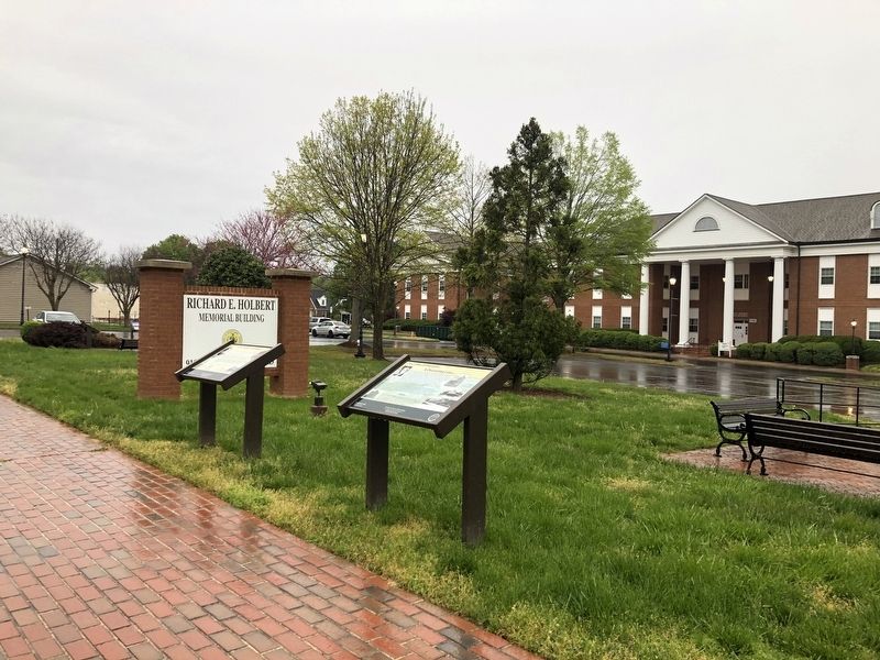
On Courthouse Road (Virginia Route 209) 0.1 miles north of Brock Road (County Road 613), on the left when traveling north.
Samuel Peter Powell was born on January 26, 1880 to James L. Powell, Jr. ad Carrie Elizabeth Jones Powell. He was the oldest of nine children. His father was a surviving Civil War veteran and served as Commonwealth Attorney in Spotsylvania. He . . . — — Map (db m148377) HM
On Courthouse Road (Virginia Route 208) at Brock Road (County Road 613) when traveling north on Courthouse Road. Reported permanently removed.
On December 31, 1855, Joseph Sanford and his wife Agnes sold the tract of land across from the Courthouse and the Spotswood Inn (also owned by Sanford) to Dr. J. Edgar Chancellor. The deed had restrictions; Sanford was to have the use and . . . — — Map (db m294069) HM
On Plank Road (Route 3), on the right when traveling east.
"May God have mercy on General Lee for I will have none." -Gen. Joseph Hooker, U.S. Army On May 1, 1863, the head of Union Gen. Joseph Hooker's Army of the Potomac arrived on these fields, apparently completing one of the most successful and . . . — — Map (db m181507) HM
On Courthouse Road (Virginia Route 208) just north of Brock Road (County Road 613), on the left when traveling north. Reported missing.
Phillip Anns, the fifth owner of the tract and building, died on August 3, 1873. He left a sum of money to his wife Lydia Anns for the care of their four children. However, Charles M. Garrett married Ann's 16-year-old daughter, Lizzie, and was . . . — — Map (db m293948) HM
On Courthouse Road (Route 208) just west of Judicial Center Lane (County Road 631), on the right when traveling west.
Most public buildings rarely survive in their original state. The County jail is no exception. By 1876, County records indicate the cells on the upper floor being used for some other purpose. The jail report stated this use cut off ventilation to . . . — — Map (db m148416) HM
On Courthouse Road (Virginia Route 208) at Courthouse Road ( Route 208), on the right when traveling west on Courthouse Road. Reported permanently removed.
After Lt. General Thomas Johnson "Stonewall" Jackson was wounded at Chancellorsville on May 2nd, 1863, he was taken to an Army hospital near Wilderness Church where his left arm was amputated. Fearing his capture, Lee ordered his move south to . . . — — Map (db m293953) HM
On Brock Road (County Route 613) at Courthouse Road ( Route 208), on the right when traveling east on Brock Road. Reported permanently removed.
In 1838, tragedy struck. The frame Courthouse on the Po River mysteriously burned. Lewis Rawlings and his wife Hannah offered the Justices of Spotsylvania County 10 acres for a new Courthouse. They quickly accepted. Lewis Rawlings was born in . . . — — Map (db m293961) HM
On Courthouse Road (Virginia Route 208) just east of Judicial Center Lane (County Road 631), on the right when traveling east. Reported permanently removed.
In 1832 the process of starting a new church began when an organization known as the Reforming Congregation of Disciples chose a group of trustees to select a site. The group chose Berea Christian Church as the new name after Berea, an ancient . . . — — Map (db m293973) HM
Near Fort Hill Road 1.1 miles west of Christanna Highway, on the right when traveling west.
Alexander Spotswood (1676-1740) was Governor of Virginia from 1710 to 1722. Born in Africa of a Scottish family, he had distinguished himself at the Battle of Bleinheim and was wounded. He was appointed to the governor’s position in Virginia in . . . — — Map (db m20200) HM
On Courthouse Road (Route 208) just west of Judicial Center Lane (County Road 631), on the right when traveling west.
"The county jail is now nearly completed, and ready for the reception of ...boarders...Persons taking quarters will be able to resist all attacks of burglars, and as far as burglars are concerned, may enjoy their slumbers in the . . . — — Map (db m148417) HM
On Courthouse Road (Virginia Route 208) 0.1 miles north of Brock Road (County Road 613), on the left when traveling north. Reported missing.
In 1924, tragedy stuck the Powell family. Peter Powell's brother, Dr. Robert Powell was shot to death by his neighbor, Charles Kendall, who was arrested and charged with with first degree murder. During the trial, it was revealed that Kendall's . . . — — Map (db m293966) HM
On Courthouse Road (Virginia Route 208) 0.1 miles north of Brock Road (County Road 613), on the left when traveling north.
On April 14, 1839, John Pulliam, local farmer, wrote in his diary......"Agnes and myself went up to Lewis Rawlings to meeting, heard an excellent sermon by Reverend J. Cook, dined at Lewis Rawlings, came home."
In 1836, Samuel . . . — — Map (db m293967) HM
On Courthouse Road (Virginia Route 208) 0.1 miles east of Judicial Center Lane (County Road 631), on the left when traveling east.
On July 20, 1841, John Pulliam, a Vestryman wrote in his diary...... "A warm day, this being the day set aside for the consecration of the church at Spotsylvania Courthouse, about nine o'clock. I started to church in the company of John . . . — — Map (db m148420) HM
On Brock Road (County Road 613) at Courthouse Road (State Route 208), on the right when traveling east on Brock Road. Reported permanently removed.
In 1864, the war returned to the village of Spotsylvania Court House. Sanford's Inn, because of its position at the crossroads, offered a point of observation for General Robert E. Lee, who surveyed the Federal lines from the upper windows facing . . . — — Map (db m293963) HM
On Courthouse Road (Virginia Route 208) north of Brock Road (County Road 613), on the right when traveling north.
Despite heavy damage from the war, the Courthouse was repaired and continued to serve the local citizens. In 1876, a belfrey and bell were added. By 1900, the Courthouse was in a serious state of disrepair. The Commissioners undertook repairs . . . — — Map (db m216695) HM
On Courthouse Road just east of Judicial Center Lane (County Road 631), on the right when traveling east. Reported permanently removed.
Berea Church was initially used as a field hospital during the battles for Spotsylvania Court House as fighting raged on the Brock Road on May 8th. On May 11th, the church became the headquarters of General Jubal Early. On May 13th, the area came . . . — — Map (db m293974) HM
On Courthouse Road (Virginia Route 208) just west of Courthouse Road ( Route 208), on the right when traveling west. Reported permanently removed.
"Was summoned as one to go with the Sheriff to take possession of the old clerk's office. The company met at the Court House, all armed and proceeded to our duty. We arrived at the office; forced the door, went in and took out all . . . — — Map (db m293971) HM
On Brock Road (County Road 613) at Courthouse Road (State Route 208), on the right when traveling east on Brock Road. Reported permanently removed.
The exact date of the building of the Ordinary on the road from Fredericksburg to Snell is a mystery. The earliest date we can attribute is 1770. It may have existed prior, but unproven by current evidence. In 1799, the property and Ordinary, . . . — — Map (db m293959) HM
On Courthouse Road (Route 208) 0.1 miles east of Judicial Center Lane (County Road 631), on the left when traveling east.
Here lies Edgar and Ann Harrison along with the daughters Ellen and Maria. Edgar was born in 1829 in King and Queen, Virginia. He married Ann Marie Smith Goodwin in Fredericksburg in 1851. Edgar was a farmer by occupation. In 1858 with the help . . . — — Map (db m148422) HM
On Courthouse Road (Virginia Route 208) north of Brock Road (County Road 613), on the right when traveling north.
Like his father before him, Samuel Powell became involved in politics. In 1906, he served as a Representative on the Republican Committee and in that same year, lost his run for chairman to R.C. Blaydes. In 1910, he lost to Blaydes again. Powell . . . — — Map (db m216694) HM
On Brock Road (County Road 613) at Courthouse Road (State Route 208), on the right when traveling east on Brock Road. Reported permanently removed.
Joseph Farmer Sanford was born in 1819, the son of Lawrence Sanford and Apphia Farmer in Stafford County, Virginia. In 1835, he married Agnes I. M. Crawford of Orange, Virginia. His early career was that of the keeper of the U.S. Hotel in . . . — — Map (db m293962) HM
On Courthouse Road (Virginia Route 208) at Courthouse Road ( Route 208), on the right when traveling north on Courthouse Road.
The famous well at Spotsylvania Courthouse was probably excavate around 1798 at the same time the Tavern and Inn located across the road was established. It dominated the intersection of the Fredericksburg Road, Brock Road and the road to . . . — — Map (db m148412) HM
On Courthouse Road (Virginia Route 208) 0.1 miles east of Judicial Center Lane (County Road 613), on the left when traveling east.
The rafters in the interior of the church still reflect the damage from the battle.
"The 11th was passed in comparative quiet, with the exception of our usual salutation from the enemy attacks. They made daily practice on . . . — — Map (db m148421) HM
On Brock Road (County Road 613) at Courthouse Road (State Route 208), on the right when traveling east on Brock Road. Reported permanently removed.
Samuel Alsop Jr., was born in 1776 in Caroline County, the son of Samuel Alsop. He was a plantation owner and planter, slave owner land speculator, and to a limited extend, slave trader. Alsop operated his growing business empire from the area . . . — — Map (db m293960) HM
On Courthouse Road (Virginia Route 208) just north of Brock Road (County Road 613), on the left when traveling north.
In March of 1909, George W. Perry acquired the corner store. George was born in Spotsylvania in 1857. He was the son of John M. Perry and Martha Virginia Chewning. In 1885, he married Martha Thompkins in Richmond. She died two years later and he . . . — — Map (db m148380) HM
On Courthouse Road (Virginia Route 208) south of Richard Samuels Lane, on the right when traveling north.
Fire destroyed the frame Courthouse near the Po River in 1838. Tavern owner Lewis Rawlings and his wife Ann offered 10 acres of land near his tavern on the road to Fredericksburg as a new site and the County quickly accepted. The Commissioners . . . — — Map (db m216698) HM
On Brock Road (County Road 613) at Courthouse Road (State Route 208), on the right when traveling east on Brock Road. Reported permanently removed.
Joseph Sanford, Sr. sold the tavern to Elijah Fisher in 1869 and left the area. A steady stream of owners followed: Jack Shelton (1872), Joseph Bittle (1887), A. B. Rawlings (1890), H. A. Carner (1897), Thomas B. Coleman (1906). A fire in 1909 . . . — — Map (db m293964) HM
On American Legion Drive (County Road 631) 0.1 miles north of Courthouse Road (State Route 208), on the left when traveling north.
The Courthouse continued to be adapted for use over the years. In the 1920's a second addition added to the back to give its current configuration. This addition housed rooms for the judge and jury. By 1927, a court annex had been added next to . . . — — Map (db m216693) HM
On Princess Anne Street 0.1 miles south of Dixon Street, on the right when traveling south.
Hazel Hill, the home of John Minor (13 May 1761 – 8 June 1816), a close friend of President James Monroe, once occupied this site. Minor served as a soldier in the American Revolution, as a colonel of the Spotsylvania County militia, and as a . . . — — Map (db m195328) HM
Near Plank Road (Virginia Route 3) east of Bullock Road, on the right when traveling east.
This is the Chancellor family cemetery. In the first half of the 19th century the Chancellors dominated this section of Spotsylvania County. Fairview was the original family seat, but branches of the family eventually lived at Chancellorsville, . . . — — Map (db m295251) HM
On Dover-Minerva Road (Kentucky Route 1235) just north of Minerva Tuckahoe Road ( Route 435).
Church constituted in 1793 by
the Rev. Lewis Craig, leader of
the “Traveling Church.” Bracken
Baptist Association also formed here
in 1799. The congregation divided
over slavery in 1805, with each
faction having own pastor. . . . — — Map (db m136342) HM
On Courthouse Road (Virginia Route 208) at Brock Road (County Route 613), on the right when traveling west on Courthouse Road.
In December 1855, Courthouse-area tavern owner Joseph Sanford sold a tract across from the courthouse to Dr. James Edgar Chancellor, a Spotsylvania County native who had studied at the University of Virginia in Charlottesville and Jefferson Medical . . . — — Map (db m294067) HM
On Courthouse Road (Virginia Route 208) at Massaponax Church Road (County Road 608), on the right when traveling south on Courthouse Road.
This cemetery is the final resting place for six Civil War veterans. Only three of the six have military-style headstones.
Charles Chewning, 9th Virginia Cavalry. Private Chewning received a sabre wound to his left thigh at Second Manassas . . . — — Map (db m216685) HM
On West First Street west of South Main Street, on the right when traveling west.
Born in Virginia, George Boxley, first settler in Adams Township, Hamilton County, came to Indiana, as a fugitive from justice. Accused of helping slaves to escape and fomenting a slave rebellion in 1816 in Spotsylvania County, Virginia, Boxley . . . — — Map (db m216521) HM
Near Courthouse Road (Virginia Route 208) south of Crestar Drive, on the right when traveling south.
Once owned by renowned builder Samuel Alsop Jr., this site is the final resting place for many of his family members, as well as members and friends of Berea Christian Church. Among those buried here are:
Samuel Alsop Jr.
March 1776 - Oct. . . . — — Map (db m294088) HM
On Sawtooth Lane near Catharpin Road ( Route 612), on the left when traveling west.
Alhough US. Colored Troops regiments fought in Civil War battles throughout much of the South, their combat presence in Virginia was thwarted, even as thousands of enslaved Virginians sought freedom by crossing into Union-held territory early in the . . . — — Map (db m297211) HM
Near Constitution Highway (State Highway 20) at Montpelier Road (County Route 693), on the right when traveling west. Reported permanently removed.
Guided by the discoveries of local relic collectors, archaeologists have found an extensive Confederate Army encampment within these woods. Excavations have uncovered the remains of huts built by the soldiers during the winter of 1863 and 1864. The . . . — — Map (db m298079) HM
On Linden Street at Heritage Lane, on the right when traveling north on Linden Street.
The 1831 Southampton Insurrection is considered the most consequential slave revolt in North American history. It was, however, preceded by many others. Slaveholders lived in fear of such uprisings as enslaved people of African descent often . . . — — Map (db m276512) HM
On Sawtooth Lane west of Catharpin Road, on the left when traveling west.
On May 4, 1864, Union Brig. Gen. Edward Ferrero, leader of the all-Black 4th Division, Ninth Army Corps, was ordered by Lt. Gen. Ulysses S. Grant to defend the supply train crossing the Rapidan River at Germanna Ford ahead of the Battle of the . . . — — Map (db m297209) HM
Near Catharpin Road (County Route 612) 0.9 miles south of Old Plank Road (County Route 610), on the right when traveling south. Reported permanently removed.
Both politicians and the public were extremely war-weary and anxious for the Civil War to end. By summer 1862, President Abraham Lincoln knew that conditions had worsened and that new tactics were necessary to thwart Confederate advances. That . . . — — Map (db m297212) HM
On Tessa Trail south of Tidewater Trail (Business U.S. 17), on the right when traveling south.
The history of Fredericksburg and Spotsylvania County surrounds you. Here are just some of the other sites you can visit while you are in the area. For visitor information or to learn more about the Civil War around you, visit: . . . — — Map (db m309467) HM
On Tessa Trail south of Tidewater Trail (Business U.S. 17), on the right when traveling south. Reported permanently removed.
The history of Fredericksburg and Spotsylvania County surrounds you. Here are just some of the other sites you can visit while you are in the area. For visitor information or to learn more about the Civil War around you, visit: . . . — — Map (db m309471) HM
On Courthouse Road (Virginia Route 208) at Brock Road ( Route 613), on the right when traveling west on Courthouse Road.
With the end of the Civil War came the immense task of rebullding a shattered Spotsylvania County. As society reorganized itself in the postwar years, many local residents, including those around Spotsylvania Courthouse, rose to prominence and . . . — — Map (db m315021) HM
On Central City Road 0.3 miles east of Marion Road (Iowa Route 13), on the right when traveling east.
Mancil "Manny" V. Root, Musician (rank equivalent to PVT) served with Company E of the 36th Wisconsin Infantry. He was the youngest veteran of the Civil War and enlisted when he was 11 years old. Mancil V. Root settled in Linn County for his last . . . — — Map (db m285995) HM
Near Fall Hill Avenue (Virginia Route 639) at Tyler Street, on the right when traveling north.
Beginning in 1829, the Rappahannock Company constructed a series of dams and canals along the river, to transport bulk cargo. Gold had been found in Spotsylvania County in 1806 and a canal could bring heavy equipment and other materials to the . . . — — Map (db m95304) HM
On College Drive (Virginia Route 375) 0.2 miles west of Germanna Highway ( Route 3), on the right when traveling west.
"Then I came to Germanna. This famous town consists of Col. Spotswood's enchanted castle on one side of the street, and a baker's dozen of ruinous tenements on the other, where so many German families had dwelt some years ago." . . . — — Map (db m171395) HM
Near Confederate Cemetery Drive south of Courthouse Road ( Route 208), on the right when traveling south.
Thousands of brave Americans were killed on the Civil War battlefields of Spotsylvania county. Seven hundred and fifty soldiers from Alabama, Arkansas, Georgia, Louisiana, Mississippi. North and South Carolina, Tennessee, Texas and Virginia were . . . — — Map (db m293981) HM
On Courthouse Road (Virginia Route 208) at Massaponax Church Road ( Route 613), on the right when traveling south on Courthouse Road.
Virginia churches suffered heavily in the Civil War, being used by contending armies as headquarters, hospitals and barracks. Zion Church was no exception. In August 1862, Union soldiers stopped briefly at the church during an expedition to . . . — — Map (db m3709) HM
On Kings Highway (Business Virginia Route 3) 0.1 miles east of Route 218, on the right when traveling west.
Fredericksburg was established in 1728 and named for Frederick Louis, Prince of Wales and eldest son of King George II. It served as the county seat of Spotsylvania County from 1732 to 1778 and was an important port during the colonial era. In his . . . — — Map (db m2206) HM
Near Perry Drive south of Shutt Court, on the right when traveling north.
Honoring the Patriotic and Military Service of
Charles Washington
1738 - 1799
Signed Leedstown Resolutions protesting the Stamp Act, 1766
Served on local Committees of Correspondence and Safety in Virginia, 1774-1775
Appointed . . . — — Map (db m249870) HM
On West 18th Street at Baynard Boulevard on West 18th Street.
African American Medal of Honor Recipients Memorial
The Medal of Honor takes its place in our country as the highest award for military valor. The honor, awarded by the President in the name of Congress, may only be accorded an . . . — — Map (db m173924) HM WM
On Lancaster Road (Kentucky Route 39) at Gilbert Creek Road ( Route 642), on the right when traveling south on Lancaster Road. Reported missing.
In search of religious freedom, the Reverend Lewis Craig led his entire congregation of 200 Baptists and 400 other settlers from Spotsylvania County Virginia and established them here on Gilbert's Creek.
This expedition, guided through the . . . — — Map (db m173233) HM
Caroline County. Area 529 Square Miles. Formed in 1727 from Essex, King and Queen, and King William. Named for Queen Caroline, wife of King George II. George Rogers Clark, conqueror of the Northwest, passed his youth in this . . . — — Map (db m22585) HM
On Fredericksburg Turnpike (State Highway 2), on the right when traveling north.
Spotsylvania County. Area 413 Square Miles. Formed in 1720 from Essex, King and Queen, and King William, and named for Alexander Spotswood, governor of Virginia, 1710-1722. The battles of Fredericksburg, Chancellorsville, the . . . — — Map (db m21586) HM
Spotsylvania County. Straddling the fall line, Spotsylvania County was formed from Essex, King William, and King and Queen Counties in 1720. It was named for Alexander Spotswood, lieutenant governor of Virginia from 1710 to 1722. The Civil War . . . — — Map (db m3319) HM
On Spotswood Trail (U.S. 33), on the right when traveling east.
Orange County. Formed from Spotsylvania County in 1734, Orange County, a pastoral Piedmont county, was probably named in honor of William IV, the Dutch prince of Orange, who married Anne, the Princess Royal, daughter of George II of England, . . . — — Map (db m24228) HM
On James Madison Highway (U.S. 15/33), on the right when traveling north.
Orange County. Formed from Spotsylvania County in 1734, Orange County, a pastoral Piedmont county, was probably named in honor of William IV, the Dutch prince of Orange, who married Anne, the Princess Royal, daughter of George II of England, . . . — — Map (db m108411) HM
On Germanna Highway (State Highway 3) 0.3 miles west of Constitution Highway (State Highway 20), on the right when traveling west.
Orange County. Formed from Spotsylvania County in 1734, Orange County, a pastoral Piedmont county, was probably named in honor of William IV, the Dutch prince of Orange, who married Anne, the Princess Royal, daughter of George II of England, . . . — — Map (db m285616) HM
On Courthouse Road (Business Virginia Route 208) at Judicial Center Lane (County Route 631), on the right when traveling north on Courthouse Road. Reported permanently removed.
A formal system of adjudication and punishment has existed in this county since the first court was seated in Germanna in ~1722. Through the years, the County seat and court building moved four times until its final location here at the . . . — — Map (db m73751) HM
On Courthouse Road (Business Virginia Route 208) north of Massaponax Church Road (County Route 608), on the left when traveling north.
The Livingston district at Spotsylvania County had the largest number of one-room schools for African American children in the county before consolidation in the 1950s. As late as the mid 1990s, two of those schools were still standing, albeit . . . — — Map (db m73750) HM
On Shepherdstown Road (West Virginia Route 45) at Files Cross Road (Local Route 45/2), on the left when traveling east on Shepherdstown Road.
1.5 miles north is Swan Pond Manor, a 2,000 acre retreat set aside in 1745 for use by Thomas, Lord Fairfax, once the proprietor of the Northern Neck of Virginia who established an estate at Greenway Court, Frederick County in 1738. So named because . . . — — Map (db m92579) HM
On Princess Anne Street, on the right when traveling west.
In Honored Memory of
Lewis Craig
John Waller, Jr.
James Chiles
of the county of Spotsylvania
Prisoners of Christ
Prophets of Spiritual Freedom
Who, undaunted by imprisonment
preached the Gospel even through
the bars of the jail . . . — — Map (db m67075) HM
Near Plank Road (Virginia Route 3) 0.8 miles west of Corter Avenue, on the right when traveling west.
The Civil War in Spotsylvania County is steeped in McGee family history. Reuben McGee, the patriarch, lived behind you on the opposite side of Lick Run. Among Reuben McGee's five sons were one ardent Confederate (Reuben McGee, Jr.), two Southern . . . — — Map (db m75954) HM
Near 7100 Confederate Cemetery Dr south of Courthouse Road, on the left when traveling south.
Erected and dedicated May 12, 1918, by the Spotsylvania Chapter United Daughters of the Confederacy, Confederated Southern Memorial Association and citizens of Spotsylvania County, to commemorate and perpetuate the valor and patriotism of the . . . — — Map (db m10436) WM
On George Street at Barton Street, in the median on George Street.
On this site, the Fredericksburg Area Veterans' Council honors the local men and women who gave their lives in wars and military actions during the twentieth and twenty-first centuries.
The extension of George Street to a new high . . . — — Map (db m217528) HM
On Courthouse Road (Virginia Route 208) at Brock Road (County Route 613), on the left when traveling south on Courthouse Road.
On the night of May 2, 1863, Confederate Lt. Gen. Thomas "Stonewall" Jackson (top right) was severely wounded by accidental friendly fire near Chancellorsville. After Jackson's left arm was amputated at an Army hospital near Wilderness Church, the . . . — — Map (db m293950) HM
On Courthouse Road (Virginia Route 208) west of Brock Road ( Route 613), on the right when traveling west.
A two story, federal style brick house known today as "Courtland" was a fixture in this spot for more than 150 years, witnessing some of Spotsylvania County's most defining moments before it burned down in 1930.
Several well-known families . . . — — Map (db m314994) HM
On Courthouse Road (Virginia Route 208) at American Legion Drive, on the right when traveling south on Courthouse Road.
In 1834, an organization known as the Reforming Congregation of Disciples built a church between the old Spotsylvania Courthouse and the Block House.
The group was part of the broader Restoration Movement, which emphasized a return to . . . — — Map (db m294154) HM
On Brock Road (County Route 613) at Courthouse Road ( Route 208), on the right when traveling south on Brock Road.
Joseph Farmer Sanford acquired the "Tavern Tract" in 1853, after the death of owner Lewis Rawlings in late 1852. He soon opened Sanford's Tavern & Inn.
Sanford had previously operated the U.S. Hotel (later renamed the Planters Hotel) in . . . — — Map (db m294083) HM
Near Catharpin Road (County Route 612) 0.9 miles Old Plank Road (County Route 610), on the right when traveling south. Reported permanently removed.
The President of the United States of America, in the name of Congress, takes pleasure in presenting the Medal of honor to Sergeant Benjamin Brown, United States Army, for extraordinary heroism on 11 May 1889, while serving with . . . — — Map (db m297210) HM
On Courthouse Road (Route 208), on the right when traveling south.
The Stubbs School is typical of African-American public schools scattered throughout the county between 1870 and 1952.
This modest one-room school opened in the early 1930s. The building lacked electricity and plumbing. Its only heat source . . . — — Map (db m3711) HM
On Gunnery Road 0.1 miles south of Ferdinand Street, on the left when traveling south.
Fredericksburg's first publicly supported high school for African American students.
Black education efforts in Fredericksburg began in 1836, when free Black people petitioned the Virginia General Assembly to start a school for free . . . — — Map (db m242251) HM
Near Old Salem Church Road near Plank Road ( Route 3).
Few communities suffered more in the face of war than did Spotsylvania County. For two years armies traversed, occupied, or fought over this ground. Most residents simply tried to stay out of the way; a few left altogether. Virtually every farm . . . — — Map (db m5621) HM
Near Confederate Cemetery Drive south of Courthouse Road ( Route 208), on the left when traveling south.
In 1905, the Ladies Memorial Association reorganized again with a new goal to erect a monument to the fallen soldiers of the Confederacy. This aspiration and determination took thirteen years to achieve. By the 1930’s nearly all the counties with . . . — — Map (db m293979) HM
Near Post Oak Road (County Route 606) 0.6 miles west of Pamunkey Road (County Route 612), on the right when traveling west.
Spotsylvania is situated almost directly in the middle of a gold-pyrite belt that runs 140 miles through 12 counties from Fairfax to Buckingham. At least six major mines operated in the county, some as early as 1804. Those mines were the Mitchell . . . — — Map (db m84592) HM
On this site, the Fredericksburg Area Veteran's Council honors the local men and women who gave their lives in wars and military actions during the twentieth and twenty-first centuries.
The extension of George Street to a new high school cut . . . — — Map (db m64223) HM
Thin black lines indicate changes in relevance. Between each pair of lines entries are ordered geographically but all have the same relevance.
* Inflectional forms of words are their plurals, singulars, and possessives as well as gramatical tenses and similar variations.