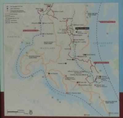
British raiding parties brought the war to Calvert County in 1814, destroying plantations and towns and carrying away the spoils. With the county’s tobacco-based economy and England as its primary market at the start of the war, Britain’s blockade . . . — — Map (db m80882) HM
On North Court Street, on the right when traveling south. Reported missing.
** Revolutionary Patriot ** Bosom Friend of Washington **** Diligent worker for independence and nominator of Washington for commander in chief of Continental Army ** Member of Council of Safety, Continental Congress and of Maryland Convention . . . — — Map (db m103773) HM
On Mears Avenue at Bayside Road (Maryland Route 261), in the median on Mears Avenue.
Built by Otto Mears of Colorado in 1897. The train track linking Washington, D.C. to Chesapeake Beach crossed here. The original depot to the east is now the Railway Museum. Excursion steamboats also brought passengers to Chesapeake Beach from . . . — — Map (db m731) HM
On Dowell Road 1.2 miles south of Solomons Island Road (Maryland Route 2/4), on the right when traveling south.
This nation's first naval amphibious training base was established here at Solomons where between 1942 and 1945 some 68,000 sailers, marines, coast guardsmen, and soldiers were trained. They formed the major components of the amphibious forces which . . . — — Map (db m3435) HM
On Southern Maryland Boulevard (Maryland Route 4) at Ferry Landing Road, on the right when traveling south on Southern Maryland Boulevard.
The brick church, dedicated in 1840, is the oldest standing Methodist church in Calvert County. The Calvert Circuit began in 1781 with services in homes. By 1789 this circuit had the largest membership in the United States. Fielder B. Smith gave . . . — — Map (db m3417) HM
On Southern Maryland Boulevard (Maryland Route 4) at Chaneyville Road, on the right when traveling south on Southern Maryland Boulevard.
Established as Patuxent County in 1654, it was given Lord Baltimore’s family name in 1658. Now the state's smallest county, it once encompassed most of Prince George’s County and parts of Anne Arundel and St. Mary’s counties. A narrow peninsula with . . . — — Map (db m3415) HM
On Lower Marlboro Road (Maryland Route 262) 4.1 miles Southern Maryland Boulevard ( Route 4), on the right when traveling west.
Originally Cox Town, named for early settlers Thomas and Henry Cox (1663). Changed to Marlborough to honor Duke for defeating French at Battle of Blenheim (1704), which reduced French and Indian attacks on the colonies. An early port of entry . . . — — Map (db m3418) HM
On Dares Beach Road (Maryland Route 402) 0.5 miles east of Solomons Island Boulevard ( Route 2/4), on the left when traveling east.
Arthur Storer (c. 1642–1686), the first astronomer in the American Colonies, came to Calvert County from Lincolnshire, England. He was among the first observers to sight and record data describing Haley's comet on its return in 1682. His . . . — — Map (db m3450) HM
On Duke Street 0.1 miles east of Solomons Island Road ( Route 2/4), on the left when traveling east.
The west wing of this library was built in 1903 on Main Street as the County’s first bank. In 1913, it was replaced, moved and became the County’s first library; 1916 County’s first Boy Scoot Troop met there; 1921 it was County’s first high school; . . . — — Map (db m3454) HM
On Solomons Island Road (Maryland Route 2) at Lore Road, on the right when traveling south on Solomons Island Road.
Established as Patuxent County in 1654, it was given Lord Baltimore’s family name in 1658. Now the state's smallest county, it once encompassed most of Prince George’s County and parts of Anne Arundel and St. Mary’s counties. A narrow peninsula with . . . — — Map (db m3416) HM
On Solomons Island Road (Maryland Route 2) 0.1 miles south of Lore Road, on the left when traveling south.
This lighthouse, installed in 1883, originally stood 125 yards offshore at the entrance of the Patuxent River to the Chesapeake Bay. The foundation on which the cottage living quarters rest consist of seven wrought iron screw piles, hand bored into . . . — — Map (db m3457) HM
On Solomons Island Road (Maryland Route 2) 0.6 miles south of Lore Road, on the left when traveling south.
Joseph C. Lore, Sr., began shipping seafood from Solomons Island in 1888 and established a packing house at this site in 1912. Three generations of Lore family packed and shipped Patuxent River oysters, crabs and fish until 1978. Present building . . . — — Map (db m3459) HM
On Solomons Island Road (Maryland Route 2) 0.7 miles south of Lore Road, on the left when traveling south.
1885 Marcellus M. Davis established his shipyard at this location, in 1913 the yard was moved to larger quarters across the harbor on Mill Creek. During the 1930’s, Davis’ yard produced many outstanding wooden yachts which brought international fame . . . — — Map (db m3460) HM
Originally called Bourne's (1680), then Somervell's Island (1740). It became known as Solomon's Island (1867) because of Isaac Solomon's oyster packing facilities here. Shipyards developed to support the island's fishing fleet. The famed "bugeye" . . . — — Map (db m8929) HM
On Parran Road at Solomons Island Road ( Route 2/4), on the right when traveling west on Parran Road.
Town of St. Leonard was originally, in 1663, at mouth of St. Leonard Creek. By 1706, when chartered by Maryland General Assembly as a port of entry, it had been moved to head of creek near here. British forces burned its wharves and warehouses July . . . — — Map (db m3464) HM
On Parran Road at Solomons Island Road ( Route 2/4), on the right when traveling west on Parran Road.
In June, 1814, Maryland's Commodore Joshua Barney commanded American flotilla of barges, gunboats and a sloop in attacks on superior British forces in Patuxent River and its tributary, St. Leonard Creek. After flotilla moved up Patuxent and was . . . — — Map (db m3463) HM
On St. Leonard Road (Maryland Route 765) 0.1 miles south of Calvert Beach Road, on the right when traveling south.
The Honorable Thomas Parran (1860-1955)
Thomas Parran, the St. Leonard citizen who played a key role in the construction of the St. Leonard Polling House, was born on February 12, 1860, on the Chestnut Hill Farm (see map) in St. Leonard . . . — — Map (db m181801) HM
On Lower Marlboro Rd. (Maryland Route 262) west of Southern Maryland Blvd. ( Route 4). Reported missing.
Before the American Revolution, Lower Marlborough (the spelling officially changed to Marlboro in the 19th century) was a thriving port town with large homes, inns, stores, warehouses, a sawmill, a tobacco inspection station, and the British . . . — — Map (db m94704) HM
Roger Brooke Taney was born in Calvert County, Maryland. After serving as attorney general of the U.S. and secretary of the Treasury, he was sworn in as chief justice of the U.S. Supreme Court on March 15, 1836. He served until his death in 1864. . . . — — Map (db m123235) HM
On Flag Ponds Parkway 1 mile east of Solomons Island Road ( Route 2/4), on the left when traveling east.
Known as the Buoy Hotel, the shanty shows the close quarters and simple lifestyle of bay watermen. Bunking together over the summer months, the men plied the waters and tended and tarred their nets, away from their homes and families. The shanty . . . — — Map (db m287745) HM
On Flag Ponds Parkway 1 mile east of Solomons Island Road ( Route 2/4), on the left when traveling east.
Flag Ponds was the site of a pound-net fishery from about 1915 to 1958. The men fished the waters each spring, some journeying from as far as the Eastern Shore to the Cliffs of Calvert. Using small boats called lighters, they would set their . . . — — Map (db m287746) HM
Near Kings Landing Court south of Kings Landing Road, on the left when traveling south.
Kings Landing Park was home of Camp Mohawk, a summer camp for African-American youth that was run by the Baltimore YMCA. The camp offered cabins, campfires, swimming, tennis, canoeing, archery and other outdoor recreation.
Of the original . . . — — Map (db m307398) HM
On Broomes Island Road (Route 264) 0.4 miles south of Solomons Island Road (Route 2 / 4), on the left when traveling south.
One of the original parishes of the Province of Maryland and Calvert County’s oldest continuously worshipping congregation, Christ Church began with a log church standing as early as 1672. Christ Church parish, 1692, included all the land south of . . . — — Map (db m3441) HM
On Solomons Island Road South south of Alexander Lane, on the right when traveling south.
Named after the first governor of the state of Maryland, the bridge was opened December 17, 1977. It links Calvert County with St. Mary's County. The channel under the center span has a depth of 123'. The fixed bridge has a horizontal . . . — — Map (db m287630) HM
On Solomons Island Road (Maryland Route 2) at Southern Maryland Boulevard ( Route 4), on the right when traveling south on Solomons Island Road.
All Saints, one of the original parishes of Maryland, included all the land north of Hunting Creek in Calvert County. The present church was started in 1774 by exchange of tobacco under the rectorship of Reverend Thomas John Clagett, later the first . . . — — Map (db m3470) HM
On Solomons Island Road (Maryland Route 2) at Pushaw Station Road, on the right when traveling north on Solomons Island Road.
During the period of racially segregated education, elementary school teacher Brown enlisted the N.A.A.C.P. and attorney Thurgood Marshall to challenge the inequity of separate salary scales for public school teachers based on race. Her case was . . . — — Map (db m5573) HM
On Lower Marlboro Road (Maryland Route 262) 0.2 miles Southern Maryland Boulevard ( Route 4), on the right when traveling east.
Authorized in 1692 by the Maryland Assembly the first All Saints (log) Church was built near this site "at the cross-roads of the Severn Ridge Path and the road leading to Coxtown" on land donated by early French Huguenot settler Thomas Hilleary . . . — — Map (db m3471) HM
On North Court Street, on the right when traveling south. Reported missing.
Chief Justice Of the United States 1836-1864 Secretary of the Treasury 1833-1834 Attorney General Of the United States 1831-1833 Attorney General Of Maryland 1827-1831 Citizen of Frederick And lawyer practicing in the Frederick County Court . . . — — Map (db m106649) HM
“Ruffian, Patriot, and Philanthropist…” John Quincy Adams. Born in Calvert County, by 1813 John Stuart Skinner was a Purser for the U.S. Navy, in charge of purchases and accounts for the United States Chesapeake Flotilla. When the British . . . — — Map (db m81064) HM
On St. Leonard Road (Maryland Route 765) 0.1 miles south of Calvert Beach Road, on the right when traveling south.
The History of the St. Leonard Garden of Remembrance (1990 - Present)
The Original Garden
The Road and Garden of Remembrance began in the spring of 1990 as a project of a committee of the St. Leonard Area Citizens Association . . . — — Map (db m181827) HM
Near Broomes Island Road (Maryland Route 264) 0.4 miles south of Solomons Island Road ( Route 2), on the left when traveling south.
Port Republic School #7 was built on this site around 1870 and remained in continuous use until it was closed in 1932. This school is from a time when free public education for all was a new concept in post-Civil War America.
This schoolhouse . . . — — Map (db m66097) HM
On The Walk of History north of Main Street ( Route 725).
The Walk of History
“We walk in the footsteps of those who went before us.”
The 300th anniversary of the founding of Prince George’s County Maryland, was celebrated on April 23rd, 1996. Three hundred years before, in . . . — — Map (db m32566) HM
On Bay Avenue at 1st Street, on the right when traveling north on Bay Avenue.
The Cliffs of Calvert dominate the shoreline for 30 miles along the coast of Calvert County. They are as impressive a sight today as they were in 1608 when Captain John Smith came upon them "Rickard Cliffs". The cliffs were formed over 15 million . . . — — Map (db m138550) HM
Near Stadium Drive south of South Market Street ( Route 355), on the right when traveling south.
For over 30 years, Thomas Johnson, Jr. committed himself to a life of public service for Maryland and the newly independent United States. Born in Calvert County in 1732, he excelled in the legal profession in Annapolis, later relocating to . . . — — Map (db m213574) HM
Wm. B. Tennison was built in 1899 by Frank Laird at Crab Island near Oriole, Maryland. Her hull is constructed in traditional Chesapeake log canoe fashion-nine large pine logs. Hollowed out and fastened together. She was built as a two-mastered . . . — — Map (db m60233) HM
On Governor Stone Parkway at Benfield Boulevard, on the right when traveling north on Governor Stone Parkway.
Born in England about 1603, he emigrated to Virginia about 1628, and he came to Maryland about 1648. He brought with him nine settlers, and many others followed. He obtained about 5,000 acres located in St. Mary’s, Charles and Calvert counties.
. . . — — Map (db m2889) HM
On Solomons Island Road South north of Charles Street, on the right when traveling south.
The name "Patuxent" is the diminutive for "Pautuckese," translated means "at the little falls" or "at the falls or rapids." In 1612, Captain John Smith named the river after one of the Werowances villages located along Battle Creek in Calvert . . . — — Map (db m287633) HM
Near Solomons Island Road South (Maryland Route 2) south of Thomas Johnson Road, on the left when traveling south.
Wm. B. Tennison was built in 1899 by Frank Laird at Crab Island near Oriole, Maryland. Her hull is constructed in traditional Chesapeake log canoe fashion — nine large pine logs, hollowed out and fastened together. She was built as a . . . — — Map (db m138608) HM
** Revolutionary Patriot **
Bosom Friend of Washington
**** Diligent worker for
independence and nominator
of Washington for commander
in chief of Continental Army
** Member of Council of Safety,
Continental Congress and of . . . — — Map (db m106718) HM
On Brooke Road 0.1 miles west of Chandlee Mill Road, on the right when traveling west.
Warrick Hill: Author and Superstar Math Teacher from Holly Grove
Warrick Hill was born in Baltimore in 1926. As a child he lived with his parents at Alloway and walked two and a half miles twice a day to and from Spencerville . . . — — Map (db m188214) HM
Near Teagues Point Road 0.1 miles south of Fairfax Court.
Discover the War of 1812 on the Star-Spangled Banner National Historic Trail—a path tracing the troop movements through historic places, inspiring landscapes, charming waterfront towns, and waterways of the Chesapeake region.
The trail . . . — — Map (db m128753) HM
On Lighthouse Boulevard east of Hemlock Drive, on the left when traveling east.
Calvert Cliffs
The Calvert Cliffs stretch more than thirty miles, from Drum Point, Calvert County, to Fairhaven, Anne Arundel County, rising in places to a height of more than 100 feet. The cliffs represent the eroded sides of the . . . — — Map (db m307391) HM
Fifth Chief Justice of
The Supreme Court of the United States
Born in Calvert County, Maryland, March 17,1777
Died in the city of Washington, October 12, 1864
Aged 87 years, 6 months and 25 days
He was a profound and able lawyer
An . . . — — Map (db m58159) HM
On Crownsville Road, on the right when traveling north.
Civil Rights, the evolution of mental health care and the push for racial equality transformed Crownsville Hospital in the 1960s and 70s. Community activism improved conditions throughout the hospital, and civil rights rulings led to the integration . . . — — Map (db m279576) HM
On Flag Ponds Parkway 1 mile east of Solomons Island Road ( Route 2/4), on the left when traveling east.
Ideal for Fishing
Flag Ponds is distinctive from the rest of Calvert County's Chesapeake shore because of the absence of high cliffs. From 1915-58, this low, flat beach and its protected harbor were an ideal camp for harvesting fishes from . . . — — Map (db m287741) HM
Near Mears Avenue 0.1 miles east of C Street, on the right when traveling east.
The Chesapeake Beach Railway ran trains to Chesapeake Beach from 1900 until the bankruptcy of the Railway in 1935. After that time the East Washington Railway operated out of the maintenance yard and roundhouse at Seat Pleasant, Maryland. Between . . . — — Map (db m162781) HM
On Bay Avenue at 3rd Street, on the right when traveling north on Bay Avenue.
The Town of North Beach, Calvert County's northernmost municipality, was originally called "North Chesapeake Beach" when it was first developed for summer cottages in 1900. Before then, this view of the beach itself had changed relatively little . . . — — Map (db m138545) HM
Near Solomons Island Road South (Maryland Route 2) just south of Thomas Johnson Road, on the left when traveling south.
"The necessity of a light at this point is very great, as all vessels bound up or down the Chesapeake put in at this place during the winter to seek protection from floating ice; and as the entrance is formed by a low sand spit, which . . . — — Map (db m138607) HM
Chief Justice
Of the United States
1836-1864
Secretary of the Treasury
1833-1834
Attorney General
Of the United States
1831-1833
Attorney General
Of Maryland
1827-1831
Citizen of Frederick
And lawyer practicing
in . . . — — Map (db m106648) HM
Near Sotterley Lane north of Sotterley Wharf Road, on the right when traveling north.
What you see at Sotterley today reflects primarily the imprint of its 20th-century owners. The property was farmed even before James Bowles built his house here in 1703, but nothing remains of the outbuildings from that era. Many of the . . . — — Map (db m297762) HM
Thin black lines indicate changes in relevance. Between each pair of lines entries are ordered geographically but all have the same relevance.
* Inflectional forms of words are their plurals, singulars, and possessives as well as gramatical tenses and similar variations.