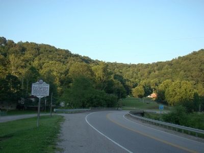
By J. J. Prats, July 14, 2008
Arnoldsburg Skirmish Marker
| On U.S. 33 at Arnoldsburg-Rocksdale Road, on the left when traveling east on U.S. 33. |
| On Arnoldsburg Road (U.S. 33/119) at County Route 33/119, on the right when traveling west on Arnoldsburg Road. |
| On U.S. 33 west of Arnoldsburg-Rocksdale Road (Local Route 18). |
| On U.S. 33 west of Arnoldsburg-Rocksdale Road (Local Route 18), on the right when traveling west. |
| On Little Kanawha Parkway (West Virginia Route 5) 1.3 miles west of the Big Bend Post Office, on the right when traveling east. |
| On Main Street (West Virginia Route 5) at Market Street ( Route 5) when traveling west on Main Street. |
| On Main Street (West Virginia Route 5) at Court Street, on the left when traveling west on Main Street. |
| On Park Place (West Virginia Route 16) at Heritage Drive, on the right when traveling east on Park Place. |
| On Main Street, on the right when traveling north. |
| On Main Street (West Virginia Route 5) at Jarvis Street, on the left when traveling north on Main Street. |
| On Calhoun Highway (West Virginia Route 16) at Milo Road (Local Route 13), on the right when traveling south on Calhoun Highway. |
| On Country Farm Road (Route 33/18) south of Ripley Road ( Route 62). |
| On West Virginia Route 2 east of Jackson Lane, on the left when traveling east. |
| On Ravenswood Road (Route 68) 0.2 miles south of County Road 4/8, on the right when traveling north. |
| On Ravenswood Road (Route 68) at Lock House Road, on the right when traveling south on Ravenswood Road. |
| On Walnut Street at Ann Street, on the right when traveling west on Walnut Street. |
| On Lock House Road, on the right when traveling north. |
| On West Virginia Route 68 0.2 miles north of U.S. 33, on the right when traveling south. |
| On West Virginia Route 68 0.2 miles east of U.S. 33, on the left when traveling north. |
| On Light House Road (West Virginia Route 68) 0.4 miles U.S. 33, on the left when traveling north. |
| On West Virginia Route 2 south of U.S. 33, on the right when traveling south. |
| On North Court Street at West Main Street, on the right when traveling south on North Court Street. |
| On Court Street North at North Street West, on the left when traveling north on Court Street North. |
| On North Church Street at West Main Street, on the right when traveling south on North Church Street. |
| On Pfost Street at FFA Drive, on the right when traveling east on Pfost Street. |
| On North Court Street just north of West Main Street (U.S. 33), on the left when traveling north. |
| Near North Court Street at Main Street (U.S. 33), on the left when traveling north. |
| On West Main Street (U.S. 33) at North Court Street, on the right when traveling west on West Main Street. |
| On Pfost Street at FFA Drive, on the right when traveling east on Pfost Street. |
| On Court Street North at West Main Street (U.S. 33), on the left when traveling north on Court Street North. |
| On North Court Street north of Main Street (U.S. 33), on the right when traveling north. |
| On North Church Street (County Road 21) at West N Street on North Church Street. |
| On Main Street (U.S. 33) at North C Street, on the right when traveling west on Main Street. |
| On North Court Street at West Main Street, on the right when traveling south on North Court Street. |
| On Court Street north of Main Street (U.S. 33), on the right when traveling north. Reported permanently removed. |
| On Court Street north of Main Street (U.S. 33), on the right when traveling north. Reported permanently removed. |
| On North Court Street just north of West Main Street (U.S. 33), on the left when traveling north. |
| On North Court Street just north of West Main Street (U.S. 33), on the left when traveling north. |
| On Pfost Street at FFA Drive, on the right when traveling east on Pfost Street. |
| On FFA Drive east of Cedar Creek Drive (County Route 25), on the left when traveling east. |
| On FFA Drive east of Cedar Creek Drive (County Route 25), on the left when traveling east. |
| On North Court Street at West Main Street, on the right when traveling south on North Court Street. |
| On Parkersburg Road at Sheriff Drive, on the right when traveling south on Parkersburg Road. |
| On Pfost Street at FFA Drive, on the right when traveling east on Pfost Street. |
| On Pfost Street at FFA Drive, on the right when traveling east on Pfost Street. |
| On West Virginia Route 68 south of Little Sandy-Median Road (County Route 8), on the left when traveling south. Reported missing. |
| On Staats Mill Road (County Route 36) east of Tug and Bear Fork, on the left when traveling east. |
| On West Virginia Route 2 south of Woodland and Graysville Road (County Route 27), on the left when traveling south. |
| On Energy Highway (West Virginia Route 2) just north of Dry Run Road, on the right when traveling north. |
| On West Virginia Route 2 south of Woodland and Graysville Road, on the left when traveling south. |
| On Huntington Road (West Virginia Route 2) south of Hereford Lane. |
| On Mason Street (West Virginia Route 62) at Columbia Street, on the left when traveling west on Mason Street. |
| On Huntington Road (West Virginia Route 2) south of Crab Creek Road (County Route 29), on the right when traveling south. |
| Near Ohio River Road (West Virginia Route 2) at Homestead Road, on the right when traveling south. |
| On Huntington Road (West Virginia Route 2) west of Old River Road (County Route 21), on the left when traveling west. |
| On Ohio River Road (West Virginia Route 62) at State Farm Road (Local Route 8), on the right when traveling west on Ohio River Road. |
| On Ohio River Road (West Virginia Route 62) at Bateman Circle, on the right when traveling south on Ohio River Road. |
| On 2nd Street at Route 833, on the right when traveling south on 2nd Street. |
| On 2nd Street at Route 833, on the right when traveling south on 2nd Street. |
| On 2nd Street at Route 833, on the right when traveling south on 2nd Street. |
| On 2nd Street at Route 833, on the right when traveling south on 2nd Street. |
| On 2nd Street at Route 833, on the right when traveling south on 2nd Street. |
| On 2nd Street at Route 833, on the right when traveling south on 2nd Street. |
| On South 2nd Street (West Virginia Route 62) at East Brown Street, on the right when traveling west on South 2nd Street. |
| On 2nd Street at Route 833, on the right when traveling south on 2nd Street. |
| On 2nd Street at Route 833, on the right when traveling south on 2nd Street. |
| On 2nd Street at Route 833, on the right when traveling south on 2nd Street. |
| On Kanawha Valley Road (U.S. 35) south of Local Road 78. |
| On 4th Street east of Main Street, in the median. |
| On 4th Street east of Main Street, in the median. |
| On Main Street just north of 10th Street, on the right when traveling north. |
| On Main Street just north of 10th Street, on the left when traveling north. |
| On Main Street just north of 10th Street, on the left when traveling north. |
| On Main Street just north of 1st Street, on the left when traveling north. |
| On 3rd Street just west of Main Street, on the right when traveling west. |
| On Main Street just south of 1st Street, on the right when traveling north. |
| On Main Street north of 2nd Street, on the right when traveling north. |
| On 6th Street (County Road 62/29) just east of Main Street, on the left when traveling east. |
| On Main Street south of 4th Street, on the left when traveling south. |
| On Main Street at 4th Street, on the left when traveling south on Main Street. |
| On Viand Street north of 5th Street, on the right when traveling north. |
| On Main Street south of 6th Street, on the right when traveling south. |
| On Main Street 0.1 miles north of 6th Street (County Road 62/29), on the left when traveling north. |
| On Viand Street north of 6th Street, on the left when traveling north. |
| On Viand Street at 7th Street, on the left when traveling north on Viand Street. |
| On Main Street 0.1 miles south of 8th Street, on the right when traveling north. |
| On Main Street just south of 8th Street, on the left when traveling north. |
| On Main Street just south of 8th Street, on the right when traveling north. |
| On Main Street just south of 8th Street, on the left when traveling north. |
| On Main Street just north of 8th Street, on the left when traveling north. |
| On Main Street just north of 9th Street, on the right when traveling north. |
| On Main Street just north of 9th Street, on the left when traveling north. |
| On Main Street just north of 9th Street, on the right when traveling north. |
| On Viand Street at 10th Street, on the left when traveling north on Viand Street. |
| On 2nd Street at Point Pleasant Biking & Walking Trail, on the left when traveling west on 2nd Street. |
| On Krodel Park Road at Route 62, on the left when traveling north on Krodel Park Road. |
411 entries matched your criteria. The first 100 are listed above.
Next 100 ⊳
