By Don Morfe, February 10, 2015
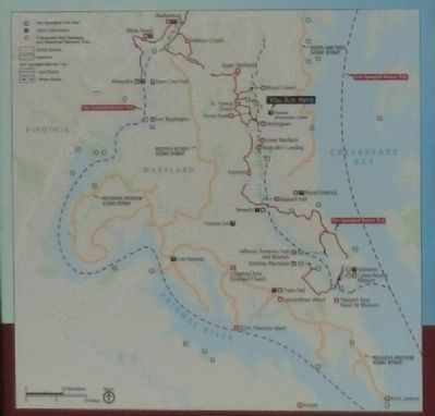
Close up of the map on the A County in Ruin Marker
RANKED BY RELEVANCE
| On Southern Maryland Blvd (SR 4). |
| On North Court Street, on the right when traveling south. Reported missing. |
| On Mears Avenue at Bayside Road (Maryland Route 261), in the median on Mears Avenue. |
| On Dowell Road 1.2 miles south of Solomons Island Road (Maryland Route 2/4), on the right when traveling south. |
| On Southern Maryland Boulevard (Maryland Route 4) at Ferry Landing Road, on the right when traveling south on Southern Maryland Boulevard. |
| On Southern Maryland Boulevard (Maryland Route 4) at Chaneyville Road, on the right when traveling south on Southern Maryland Boulevard. |
| On Lower Marlboro Road (Maryland Route 262) 4.1 miles Southern Maryland Boulevard ( Route 4), on the right when traveling west. |
| On Dares Beach Road (Maryland Route 402) 0.5 miles east of Solomons Island Boulevard ( Route 2/4), on the left when traveling east. |
| On Duke Street 0.1 miles east of Solomons Island Road ( Route 2/4), on the left when traveling east. |
| On Solomons Island Road (Maryland Route 2) at Lore Road, on the right when traveling south on Solomons Island Road. |
| On Solomons Island Road (Maryland Route 2) 0.1 miles south of Lore Road, on the left when traveling south. |
| On Solomons Island Road (Maryland Route 2) 0.6 miles south of Lore Road, on the left when traveling south. |
| On Solomons Island Road (Maryland Route 2) 0.7 miles south of Lore Road, on the left when traveling south. |
| On Solomons Island Road South. |
| On Parran Road at Solomons Island Road ( Route 2/4), on the right when traveling west on Parran Road. |
| On Parran Road at Solomons Island Road ( Route 2/4), on the right when traveling west on Parran Road. |
| On St. Leonard Road (Maryland Route 765) 0.1 miles south of Calvert Beach Road, on the right when traveling south. |
| On Lower Marlboro Rd. (Maryland Route 262) west of Southern Maryland Blvd. ( Route 4). Reported missing. |
| On State Circle. Reported permanently removed. |
| On Flag Ponds Parkway 1 mile east of Solomons Island Road ( Route 2/4), on the left when traveling east. |
| On Flag Ponds Parkway 1 mile east of Solomons Island Road ( Route 2/4), on the left when traveling east. |
| Near Kings Landing Court south of Kings Landing Road, on the left when traveling south. |
| On Broomes Island Road (Route 264) 0.4 miles south of Solomons Island Road (Route 2 / 4), on the left when traveling south. |
| On Solomons Island Road South south of Alexander Lane, on the right when traveling south. |
| On Solomons Island Road (Maryland Route 2) at Southern Maryland Boulevard ( Route 4), on the right when traveling south on Solomons Island Road. |
| On Solomons Island Road (Maryland Route 2) at Pushaw Station Road, on the right when traveling north on Solomons Island Road. |
| On Lower Marlboro Road (Maryland Route 262) 0.2 miles Southern Maryland Boulevard ( Route 4), on the right when traveling east. |
| On North Court Street, on the right when traveling south. Reported missing. |
| On Jefferson Patterson Park Road. |
| On St. Leonard Road (Maryland Route 765) 0.1 miles south of Calvert Beach Road, on the right when traveling south. |
| Near Broomes Island Road (Maryland Route 264) 0.4 miles south of Solomons Island Road ( Route 2), on the left when traveling south. |
| On The Walk of History north of Main Street ( Route 725). |
| On Bay Avenue at 1st Street, on the right when traveling north on Bay Avenue. |
| Near Stadium Drive south of South Market Street ( Route 355), on the right when traveling south. |
| On Solomons Island Road, South. |
| On Governor Stone Parkway at Benfield Boulevard, on the right when traveling north on Governor Stone Parkway. |
| On Solomons Island Road South north of Charles Street, on the right when traveling south. |
| Near Solomons Island Road South (Maryland Route 2) south of Thomas Johnson Road, on the left when traveling south. |
| Near South Market Street. |
| On Brooke Road 0.1 miles west of Chandlee Mill Road, on the right when traveling west. |
| Near Teagues Point Road 0.1 miles south of Fairfax Court. |
| On Lighthouse Boulevard east of Hemlock Drive, on the left when traveling east. |
| Near E 4th Street near N East Street. |
| On Crownsville Road, on the right when traveling north. |
| On Flag Ponds Parkway 1 mile east of Solomons Island Road ( Route 2/4), on the left when traveling east. |
| Near Mears Avenue 0.1 miles east of C Street, on the right when traveling east. |
| On Bay Avenue at 3rd Street, on the right when traveling north on Bay Avenue. |
| Near Solomons Island Road South (Maryland Route 2) just south of Thomas Johnson Road, on the left when traveling south. |
| Near South Market Street. |
| Near Sotterley Lane north of Sotterley Wharf Road, on the right when traveling north. |
Thin black lines indicate changes in relevance. Between each pair of lines entries are ordered geographically but all have the same relevance.* Inflectional forms of words are their plurals, singulars, and possessives as well as gramatical tenses and similar variations.
Nov. 13, 2026
