638 entries match your criteria. The first 100 are listed. ⊳
Works Progress Administration (WPA) projects Historical Markers
Markers related to public works built through or associated with the Works Progress Administration (later called the Works Projects Administration), or WPA, the Great Depression-era U.S. Federal government agency which provided jobs for millions of Americans.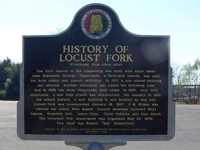
By David J Gaines, November 30, 2011
History of Locust Fork Marker, side B
1 ► Alabama, Blount County, Locust Fork — None — History of Locust Fork —  |
| On Town Hall Road, on the left when traveling east. | |||
| 2 ► Alabama, Covington County, Andalusia — History of the Library / Andalusia Post Office becomes Public Library — |
| On South 3 Notch Street at Dunson Street, on the right when traveling south on South 3 Notch Street. | |||
| 3 ► Alabama, Etowah County, Gadsden — Gadsden Amphitheater — |
| On South 1st Street south of Walnut Street, on the right when traveling north. | |||
| 4 ► Alabama, Etowah County, Gadsden — Gadsden Municipal Amphitheatre — (Legion Park Bowl) — |
| On South 1st Street, on the right when traveling north. | |||
| 5 ► Alabama, Jefferson County, Birmingham, Five Points South — Building The Park — Visiting the Park — Restoring Vulcan Park — |
| Near Valley View Drive west of Richard Arrington Jr Boulevard South. | |||
| 6 ► Alabama, Jefferson County, Birmingham, Five Points South — The Works Progress Administration |
| Near Valley View Drive west of Richard Arrington Jr Boulevard South. Reported unreadable. | |||
| 7 ► Alabama, Jefferson County, Birmingham, Redmont Park — Lane Park — |
| On Cahaba Road at Park Lane, on the right when traveling north on Cahaba Road. | |||
| 8 ► Alabama, Lee County, Opelika — Spring Villa — |
| Near Spring Villa Road (County Road 148) 1.5 miles east of State Highway 169, on the right when traveling east. | |||
| 9 ► Alabama, Montgomery County, Montgomery — Montgomery City Hall / Funeral for Hank Williams — |
| On North Perry Street at Monroe Street, on the left when traveling south on North Perry Street. | |||
| 10 ► Alabama, Morgan County, Decatur — Beauty and Hope — Restoring the Vision...Preserving The Legacy — |
| On Prospect Drive at 7th Street, on the right when traveling west on Prospect Drive. | |||
| 11 ► Alabama, Morgan County, Decatur — Carolyn Cortner Smith — Female Architect Pioneer / Designed Delano Park Structures — |
| On Gordon Drive Southeast at 8th Avenue Southeast, on the right when traveling east on Gordon Drive Southeast. | |||
| 12 ► Alabama, Shelby County, Montevallo — Montevallo High School — |
| On Oak Street, on the right when traveling north. | |||
| 13 ► Alabama, Shelby County, Montevallo — Welcome To Historic Montevallo — |
| On Main Street (State Highway 119) at Middle Street, on the right on Main Street. | |||
| 14 ► Alabama, Tuscaloosa County, Tuscaloosa — Queen City Park — |
| Near Queen City Avenue east of Jack Warner Parkway, on the right when traveling east. | |||
| 15 ► Arizona, Apache County, Springerville — 18 — White Mountain Hospital — |
| On South Mountain Avenue, on the right when traveling north. | |||
| 16 ► Arizona, Cochise County, Bisbee — The Warren Ball Park — |
| On Arizona Street at Ruppe Avenue, on the right when traveling south on Arizona Street. | |||
| 17 ► Arizona, Cochise County, Naco — Bisbee Golf Club — |
| Near W Newell Street. | |||
| 18 ► Arizona, Cochise County, Willcox — The Willcox Women's Community Center — |
| On West Stewart Street south of North Austin Boulevard, on the left when traveling west. | |||
| 19 ► Arizona, Maricopa County, Phoenix, Camelback East Village — Hunt Bass Hatchery — |
| On North Mill Avenue 0.2 miles east of North Galvin Parkway, on the right when traveling west. | |||
| 20 ► Arizona, Maricopa County, Phoenix, Camelback East Village — Papago Park's Military History — |
| Near East McDowell Road. | |||
| 21 ► Arizona, Yavapai County, Prescott — City Park and Ballfield — |
| On Gurley Street (Arizona Route 89) at Washington Street., on the right on Gurley Street. | |||
| 22 ► Arizona, Yavapai County, Prescott — Grace M. Sparkes — 1893 – 1963 — |
| Near East Gurley Street east of North Arizona Avenue. | |||
| 23 ► Arizona, Yavapai County, Prescott — Prescott National Guard Armory — |
| Near East Gurley Street east of North Arizona Avenue. | |||
| 24 ► Arkansas, Mississippi County, Osceola — WPA Post Office — |
| On West Hale Avenue, on the right when traveling west. | |||
| 25 ► Arkansas, Newton County, Jasper — C-12 — Newton County — County Seat — |
| On Church Street just east of Stone Street (State Route 7), on the left when traveling east. | |||
| 26 ► Arkansas, Pulaski County, Little Rock — A Wild Look Back — Cat House — |
| On Zoo Drive 0.1 miles west of S. Monroe Street when traveling west. | |||
| 27 ► Arkansas, Scott County, Waldron — 1900-1960 — City of Waldron Commercial Historic District — |
| On South Main Street (Business U.S. 71) just south of Danville Road, on the right when traveling south. | |||
| 28 ► Arkansas, Scott County, Waldron — Old Scott County Jail — City of Waldron Commercial Historic District — |
| On West 2nd Street just east of Huston Street, on the right when traveling east. | |||
| 29 ► California, Alameda County, Berkeley, Berkeley Hills — North Branch Berkeley Public Library — James W. Plachek, Architect, 1936 — |
| On The Alameda near Hopkins Street, on the right when traveling south. | |||
| 30 ► California, Alameda County, Berkeley, North Berkeley — Berkeley Municipal Rose Garden — City of Berkeley Landmark - Designated in 1995 — Vernon M. Dean, Landscape Architect - 1933-1937 — |
| Near Euclid Avenue near Eunice Street. | |||
| 31 ► California, Alameda County, Oakland, Grand Lake — Morcom Amphitheater of Roses — |
| On Jean Street west of Grand Avenue, on the right when traveling west. | |||
| 32 ► California, Alameda County, Oakland, Joaquin Miller Park — The Creation of a Park — |
| Near Sanborn Drive near Joaquin Miller Road, on the left when traveling north. | |||
| 33 ► California, Contra Costa County, Richmond — Alvarado Park — |
| Near McBryde Avenue at Park Avenue. | |||
| 34 ► California, Contra Costa County, Richmond — Alvarado Park — |
| On Park Avenue north of McBryde Avenue. | |||
| 35 ► California, Kern County, Bakersfield, Weedpatch — Weedpatch Camp — Sunset Labor Camp — Dust Bowl Camp — |
| On Sunset Boulevard east of Weedpatch Highway, on the right when traveling east. | |||
| 36 ► California, Kern County, Taft — The Fort — Replica of Sutter’s Fort — Erected in 1940 A.D. — |
| On 10th Street north of Irene Street, on the left when traveling north. | |||
| 37 ► California, Los Angeles County, Altadena — Farnsworth Park — Works Progress Administration — |
| Near Mount Curve Avenue East at Lake Avenue, on the left when traveling west. | |||
| 38 ► California, Los Angeles County, Beverly Hills — Beverly Hills High School — Swim Gym — 1939 — |
| On Moreno Drive 0.1 miles north of Olympic Boulevard, on the left when traveling north. | |||
| 39 ► California, Los Angeles County, Burbank — Burbank City Hall — |
| On Olive Avenue at 3rd Street, on the left when traveling east on Olive Avenue. | |||
| 40 ► California, Los Angeles County, Burbank — Burbank Post Office — |
| On Olive Avenue east of 1st Street, on the left when traveling east. | |||
| 41 ► California, Los Angeles County, Glendale, Rossmoyne — 36 — Glenoaks Blvd Bridge — Vierandeel Bridge — Glendale Historical Landmark — |
| On Glenoaks Boulevard west of Glendale Avenue, on the right when traveling west. | |||
| 42 ► California, Los Angeles County, Glendale, Verdugo Woodlands — Verdugo Wash Channel — And Road Bridges — |
| On Verdugo Road north of Oakwood Avenue, on the right when traveling north. | |||
| 43 ► California, Los Angeles County, La Crescenta-Montrose, Montrose — The Great Flood of 1934 — |
| On Rosemont Avenue at Fairway Avenue, on the right when traveling north on Rosemont Avenue. | |||
| 44 ► California, Los Angeles County, La Verne — La Verne Heights Elementary School — Red Oak Tree — |
| On Baseline Road 0.1 miles east of Wheeler Avenue, on the right when traveling east. | |||
| 45 ► California, Los Angeles County, Long Beach, Downtown Core — 17 — Recreation — |
| On 3rd Street west of Long Beach Boulevard, on the right when traveling west. | |||
| 46 ► California, Los Angeles County, Long Beach, East Village — Long Beach Post Office — |
| On Long Beach Boulevard at 3rd Street, on the right when traveling north on Long Beach Boulevard. | |||
| 47 ► California, Los Angeles County, Long Beach, Long Beach Airport — Long Beach Airport Terminal — "Daugherty Field" — Historic Landmark — |
| On Donald Douglas Drive west of Lakewood Boulevard, on the right when traveling south. | |||
| 48 ► California, Los Angeles County, Long Beach, Washington — St. Marys Long Beach Hospital — 1937 — Public Works Administration — |
| On 10th Street at Linden Avenue, on the right when traveling west on 10th Street. | |||
| 49 ► California, Los Angeles County, Los Angeles, Cahuenga Pass — Barham Blvd Bridge — Cahuenga Pass — |
| On Barham Boulevard at U.S. 101, on the right when traveling south on Barham Boulevard. | |||
| 50 ► California, Los Angeles County, Los Angeles, Canoga Park — Assembly Hall — Canoga Park High School — |
| On Topanga Canyon Boulevard at Vanowen Street, on the right when traveling north on Topanga Canyon Boulevard. | |||
| 51 ► California, Los Angeles County, Los Angeles, Canoga Park — Canoga Park Post Office — Challenger Station — |
| On Sherman Way at Jordan Avenue, on the right when traveling west on Sherman Way. | |||
| 52 ► California, Los Angeles County, Los Angeles, Chinatown — Vignes Street Grade Separation — |
| On Vignes Street 0.1 miles east of Main Street, on the right when traveling east. | |||
| 53 ► California, Los Angeles County, Los Angeles, Downtown Los Angeles — Macy Street Grade Separation — Cesar Chavez Avenue — |
| On Cesar E Chavez Avenue east of Alameda Street, on the right when traveling east. | |||
| 54 ► California, Los Angeles County, Los Angeles, Downtown Los Angeles — Temple Street Grade Separation — |
| On Temple Street at Figueroa Street, on the right when traveling west on Temple Street. | |||
| 55 ► California, Los Angeles County, Los Angeles, Downtown Los Angeles — U.S. Post Office Terminal Annex — Los Angeles — |
| On Alameda Street at Bauchet Street, on the right when traveling north on Alameda Street. | |||
| 56 ► California, Los Angeles County, Los Angeles, Echo Park — Lady of the Lake Statue — Queen of the Angels — Nuestra Reina de Los Angeles — |
| Near Park Avenue east of Glendale Boulevard, on the right when traveling east. | |||
| 57 ► California, Los Angeles County, Los Angeles, Echo Park — 972 — Naval and Marine Corps Reserve Center — Los Angeles — |
| On Stadium Way west of California Route 110, on the right when traveling west. | |||
| 58 ► California, Los Angeles County, Los Angeles, Franklin Canyon — Upper Franklin Canyon Reservoir — Exact Center of Los Angeles — |
| On Franklin Canyon Drive 0.7 miles south of Mulholland Drive. | |||
| 59 ► California, Los Angeles County, Los Angeles, Glassell Park — Washington Irving Junior High School — Irving STEAM Magnet School — |
| On Estara Avenue at Fletcher Drive, on the right when traveling south on Estara Avenue. | |||
| 60 ► California, Los Angeles County, Los Angeles, Griffith Park — 100 Years of Golf in Griffith Park — 1914-2014 — |
| Near Griffith Park Drive 1 mile north of Crystal Springs Drive, on the right when traveling north. | |||
| 61 ► California, Los Angeles County, Los Angeles, Griffith Park — Riverside Drive - Zoo Drive Bridge — |
| On Riverside Drive north of Zoo Drive, on the right when traveling north. | |||
| 62 ► California, Los Angeles County, Los Angeles, Griffith Park — 910 — Riverside Drive Bridge — |
| On Riverside Drive north of Zoo Drive, on the right when traveling north. | |||
| 63 ► California, Los Angeles County, Los Angeles, Griffith Park — 942 — Site of the Old Zoo — Griffith Park - Los Angeles — |
| Near Griffith Park Drive west of Crystal Springs Drive. | |||
| 64 ► California, Los Angeles County, Los Angeles, Hollywood Hills — Muse of Music — Hollywood Bowl — 1940 — |
| On Highland Avenue 0.8 miles north of Hollywood Boulevard, on the left when traveling north. | |||
| 65 ► California, Los Angeles County, Los Angeles, Lincoln Heights — 156 — Fire Station No. 1 — |
| On Pasadena Avenue at Avenue 23, on the right when traveling east on Pasadena Avenue. | |||
| 66 ► California, Los Angeles County, Los Angeles, Mid City — Los Angeles Center for Advanced Studies — Louis Pasteur Junior High School — |
| On 18th Street 0.1 miles west of Fairfax Avenue, on the right when traveling west. | |||
| 67 ► California, Los Angeles County, Los Angeles, Northeast Los Angeles — Florence Nightingale Junior High School — |
| On Figueroa Street just north of Cypress Avenue, on the left when traveling north. | |||
| 68 ► California, Los Angeles County, Los Angeles, San Pedro — San Pedro Post Office — |
| On Beacon Street at 9th Street, on the right when traveling south on Beacon Street. | |||
| 69 ► California, Los Angeles County, Los Angeles, Studio City — Walter Reed Middle School — North Hollywood Junior High School — 1939 — |
| Near Irvine Avenue north of Moorpark Street, on the left when traveling north. | |||
| 70 ► California, Los Angeles County, Los Angeles, Sun Valley — Roscoe Elementary School — 1939 — |
| On Strathern Street 0.1 miles west of San Fernando Road, on the right when traveling west. | |||
| 71 ► California, Los Angeles County, Los Angeles, Sunland — Sunland Park — |
| On Foothill Boulevard 0.1 miles west of Sunland Boulevard, on the right when traveling west. | |||
| 72 ► California, Los Angeles County, Los Angeles, Sylmar — Dexter Park — |
| On Dexter Park Road 0.2 miles south of Kagel Canyon Road, on the right when traveling south. | |||
| 73 ► California, Los Angeles County, Los Angeles, Tujunga — Verdugo Hills High School — |
| Near Hillrose Street at Plainview Avenue, on the right when traveling east. | |||
| 74 ► California, Los Angeles County, Los Angeles, Van Nuys — Engine Company No. 39 — Federal Emergency Administration of Public Works — |
| On Sylvan Street 0.1 miles east of Van Nuys Boulevard, on the left when traveling east. | |||
| 75 ► California, Los Angeles County, Los Angeles, Westlake — 1st Street Viaduct — Over Glendale Boulevard — |
| On Toluca Street just north of 2nd Street, on the right when traveling north. | |||
| 76 ► California, Los Angeles County, Los Angeles, Westwood — Los Angeles National Cemetery — Veterans Administration Center — |
| Near Sepulveda Boulevard 0.3 miles north of Wilshire Boulevard. | |||
| 77 ► California, Los Angeles County, Pasadena, North Central — Washington Park — Pasadena — |
| Near Washington Boulevard at El Molino Avenue, on the left when traveling west. | |||
| 78 ► California, Los Angeles County, Pomona — Millard Sheets Gallery — |
| Near McKinley Avenue 0.5 miles east of Fairplex Drive. | |||
| 79 ► California, Los Angeles County, Santa Monica — Barnum Hall — |
| Near Olympic Boulevard near 4th Street. | |||
| 80 ► California, Los Angeles County, Santa Monica — City Hall — Santa Monica Landmark — |
| On Main Street at Interstate 10, on the left when traveling south on Main Street. | |||
| 81 ► California, Los Angeles County, Santa Monica — Colorado Avenue Viaduct — Santa Monica Pier Bridge — |
| On Colorado Avenue at Ocean Avenue on Colorado Avenue. | |||
| 82 ► California, Orange County, Fullerton — 19 — Fullerton College — |
| On Chapman Avenue west of Lemon Street, on the right when traveling west. | |||
| 83 ► California, Orange County, Fullerton — 11 — Fullerton Library — |
| On Pomona Avenue at Wilshire Avenue, on the left when traveling north on Pomona Avenue. | |||
| 84 ► California, Placer County, Auburn — The Historic Cooper Amphitheater — |
| Near High Street east of College Way, on the left when traveling east. | |||
| 85 ► California, Riverside County, Riverside, Downtown Riverside — 73 — The De Anza Statue and Newman Park — 1940 — |
| On Magnolia Avenue at 14th Street on Magnolia Avenue. | |||
| 86 ► California, San Bernardino County, Barstow — Waterman Elementary School — Built 1936 — Central High School — |
| On 2nd Avenue at Hutchison Street, on the left when traveling east on 2nd Avenue. | |||
| 87 ► California, San Bernardino County, Ontario — Central School — El Morado Court Historic District — 1934 — |
| On G Street 0.2 miles east of Euclid Avenue, on the left when traveling east. | |||
| 88 ► California, San Bernardino County, Ontario — 2 — Old City Hall — 225 South Euclid Avenue — 1937 — |
| On East Transit Street at South Euclid Avenue (California Route 83), on the right when traveling east on East Transit Street. | |||
| 89 ► California, San Bernardino County, Ontario — 74 — Ontario Baseball Park — Jay Littleton Ball Park — Built 1935-1937 — |
| On Grove Avenue at 4th Street, on the right when traveling north on Grove Avenue. | |||
| 90 ► California, San Bernardino County, Ontario — 39 — United States Post Office — 123 West Holt Boulevard — 1940 — |
| On West Holt Boulevard (Business Interstate 10) at South Laurel Avenue, on the right when traveling east on West Holt Boulevard. | |||
| 91 ► California, San Bernardino County, Redlands — 42 — San Bernardino Asistencia — |
| On Barton Road east of Nevada Street, on the right when traveling west. | |||
| 92 ► California, San Diego County, San Diego, Core-Columbia — Lane Field Ballpark Site — First Home of the PCL San Diego Padres — 1936-1957 — |
| On North Harbor Drive at West Broadway, on the right when traveling north on North Harbor Drive. | |||
| 93 ► California, San Diego County, San Diego, Old Town — 49 — Adobe Chapel of The Immaculate Conception — |
| On Conde Street, on the left when traveling south. | |||
| 94 ► California, San Diego County, San Diego, Old Town — 7 — Mormon Battalion — |
| On Jackson Street. | |||
| 95 ► California, San Diego County, San Diego, Point Loma — Fort Rosecrans National Cemetery — |
| Near Cabrillo Memorial Drive, on the left when traveling south. | |||
| 96 ► California, San Francisco City and County, San Francisco, Fort Mason — Sala Burton Building — Aquatic Park Bathhouse — 1939 — |
| On Beach Street at Polk Street, on the right when traveling west on Beach Street. | |||
| 97 ► California, San Francisco City and County, San Francisco, Main Post — Sixth Army Headquarters — |
| On Keyes Avenue north of Sal Street, on the right when traveling north. | |||
| 98 ► California, Santa Barbara County, Santa Barbara — Los Baños del Mar Pool — Opened April 1939 — |
| On Shoreline Drive at Castillo Street, on the left when traveling west on Shoreline Drive. | |||
| 99 ► California, Santa Clara County, San Jose, Downtown San Jose — Main Post Office — |
| On North 1st Street near West St. John Street, on the right when traveling south. | |||
| 100 ► California, Shasta County, Redding — Veterans Memorial Hall — |
| On Yuba St, on the left when traveling west. | |||
638 entries matched your criteria. The first 100 are listed above. Next 100 ⊳