301 entries match your criteria. The first 100 are listed. ⊳
Historical Markers and War Memorials
in Central Kansas Region
By William Fischer, Jr., June 13, 2016
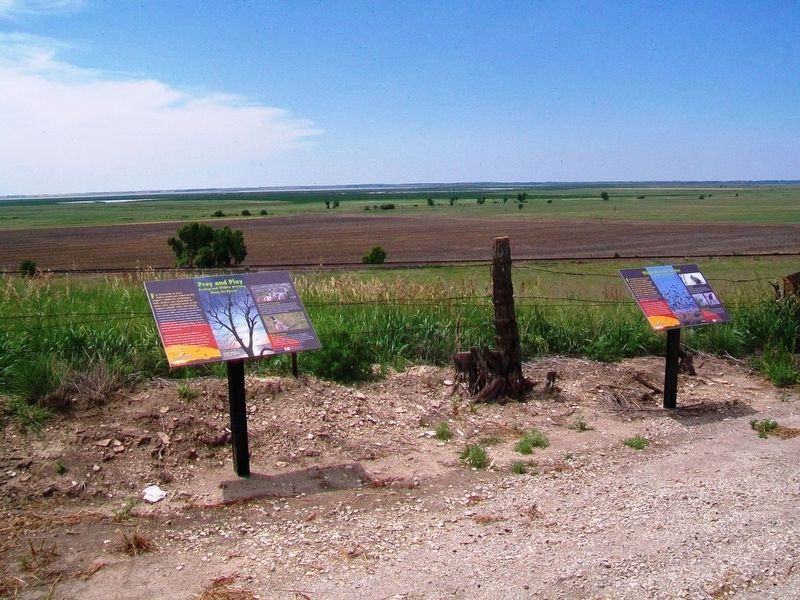
Prey and Play and Wings Over the Water Markers
1 ► Kansas, Barton County, Claflin — Prey and Play — Hunting and Wildlife Watching Along the Byway —  |
| On State Highway 4 0.2 miles east of NE 80th Avenue, on the right when traveling east. | |||
| 2 ► Kansas, Barton County, Claflin — Settling the "Great American Desert" — Zebulon Pike's Legacy — |
| On Front Street (State Highway 4) west of 4th Street, on the right when traveling west. | |||
| 3 ► Kansas, Barton County, Claflin — Wetlands & Wildlife National Scenic Byway — |
| On Front Street (State Highway 4) west of 4th Street, on the right when traveling west. | |||
| 4 ► Kansas, Barton County, Claflin — Wings Over the Water — Miracles of Migration — |
| On State Highway 4 0.2 miles east of NE 80th Avenue, on the right when traveling east. | |||
| 5 ► Kansas, Barton County, Ellinwood — Hotel Wolf — |
| On Santa Fe Boulevard (U.S. 56) at Main Street, on the left when traveling east on Santa Fe Boulevard. | |||
| 6 ► Kansas, Barton County, Great Bend — 19th Bombardment Group — 28th Squadron • 30th Squadron • 93rd Squadron — |
| On 6th Street west of Airport Road/SW 40th Avenue, on the right when traveling west. | |||
| 7 ► Kansas, Barton County, Great Bend — 40th Bomb Group — |
| On 6th Street west of Airport Road/SW 40th Avenue, on the right when traveling west. | |||
| 8 ► Kansas, Barton County, Great Bend — 73rd Bomb Wing — 20th Air Force — |
| On 6th Street west of Airport Road/SW 40th Avenue, on the right when traveling west. | |||
| 9 ► Kansas, Barton County, Great Bend — ATSF Locomotive No. 3416 — |
| On Main Street (U.S. 281) at 23rd Street, on the left when traveling north on Main Street. | |||
| 10 ► Kansas, Barton County, Great Bend — City of Bakersfield — 314th BW • 19th BG • 28th BS — |
| On 6th Street west of Airport Road/SW 40th Avenue, on the right when traveling west. | |||
| 11 ► Kansas, Barton County, Great Bend — City of Flatbush — 314th BW • 19th BG • 30th BS — |
| On 6th Street west of Airport Road/SW 40th Avenue, on the right when traveling west. | |||
| 12 ► Kansas, Barton County, Great Bend — Civil War Memorial — Lest We Forget — |
| On Broadway at Main Street (U.S. 281), on the right when traveling east on Broadway. | |||
| 13 ► Kansas, Barton County, Great Bend — Civil War Memorial — |
| Near Broadway Avenue. | |||
| 14 ► Kansas, Barton County, Great Bend — Crew 52 — 73rd Bomb Wing • 498th Bomb Group — 875th Bomb Squadron — |
| On 6th Street west of Airport Road/SW 40th Avenue, on the right when traveling west. | |||
| 15 ► Kansas, Barton County, Great Bend — Deacon's Disciples — 58th BW • 444th BG • 678th BS — |
| On 6th Street west of Airport Road/SW 40th Avenue, on the right when traveling west. | |||
| 16 ► Kansas, Barton County, Great Bend — Duke's Lead Crew — 58th Bomb Wing • 444th Bomb Group — 679th Bomb Squadron — |
| On 6th Street west of Airport Road/SW 40th Avenue, on the right when traveling west. | |||
| 17 ► Kansas, Barton County, Great Bend — Enola Gay — 509th Composite Group — |
| On 6th Street west of Airport Road/SW 40th Avenue, on the right when traveling west. | |||
| 18 ► Kansas, Barton County, Great Bend — 70 — Fort Zarah — |
| On U.S. 56, on the left when traveling east. | |||
| 19 ► Kansas, Barton County, Great Bend — Great Bend AAF Ground Training Unit — |
| On 6th Street west of Airport Road/SW 40th Avenue, on the right when traveling west. | |||
| 20 ► Kansas, Barton County, Great Bend — Honey - V☐ 42 — 73rd Bomb Wing • 499th Bomb Group — 879th Bomb Squadron — |
| On 6th Street west of Airport Road/SW 40th Avenue, on the right when traveling west. | |||
| 21 ► Kansas, Barton County, Great Bend — Jack Kilby — |
| On Main Street (U.S. 281) at Forest Avenue, on the right when traveling north on Main Street. | |||
| 22 ► Kansas, Barton County, Great Bend — Kansas Aviators in the B-29 Program — |
| On 6th Street west of Airport Road/SW 40th Avenue, on the right when traveling west. | |||
| 23 ► Kansas, Barton County, Great Bend — Kiley's Krew — |
| On 6th Street west of Airport Road/SW 40th Avenue, on the right when traveling west. | |||
| 24 ► Kansas, Barton County, Great Bend — Leslie J. Campbell Jr. — Brigadier General, USAF — Strategic Air Command — |
| On 6th Street west of Airport Road/SW 40th Avenue, on the right when traveling west. | |||
| 25 ► Kansas, Barton County, Great Bend — Lt. Zebulon Pike, 1806 — |
| On Frey Street just south of 10th Street (U.S. 56), on the left when traveling north. | |||
| 26 ► Kansas, Barton County, Great Bend — M/Sgt Robert James Aspinall — 313 Bomb Wing • 505th Bomb Group — 483 & 484 Bomb Squadrons — |
| On 6th Street west of Airport Road/SW 40th Avenue, on the right when traveling west. | |||
| 27 ► Kansas, Barton County, Great Bend — Norman Barker — |
| On 6th Street west of Airport Road/SW 40th Avenue, on the right when traveling west. | |||
| 28 ► Kansas, Barton County, Great Bend — Old-Bitch-U-Airy Bess — 58th Bomb Wing • 462nd Bomb Group — 769th Bomb Squadron — |
| On 6th Street west of Airport Road/SW 40th Avenue, on the right when traveling west. | |||
| 29 ► Kansas, Barton County, Great Bend — Original B-29 Pilots At Great Bend Army Air Field — |
| On 6th Street west of Airport Road/SW 40th Avenue, on the right when traveling west. | |||
| 30 ► Kansas, Barton County, Great Bend — Oscar Micheaux — Jan. 2, 1884 - Mar. 25, 1951 — |
| Near Broadway Avenue. | |||
| 31 ► Kansas, Barton County, Great Bend — Pacific Queen Z-35 — 73rd Bomb Wing • 500th Bomb Group — 882nd Bomb Squadron — |
| On 6th Street west of Airport Road/SW 40th Avenue, on the right when traveling west. | |||
| 32 ► Kansas, Barton County, Great Bend — People of the Plains — American Indians of Central Kansas — |
| On U.S. 281 just north of Southeast 10 Road, on the left when traveling north. | |||
| 33 ► Kansas, Barton County, Great Bend — Post Rock & Black Gold — Minerals Under the Prairie Sod — |
| On 10th Street (U.S. 56) just east of Holland Street, on the right when traveling east. | |||
| 34 ► Kansas, Barton County, Great Bend — Prey and Play — Hunting and Wildlife Watching Along the Byway — |
| On 10th Street (U.S. 56) just east of Holland Street, on the right when traveling east. | |||
| 35 ► Kansas, Barton County, Great Bend — Rover Boys Express — 21st Bomber Command • 73rd Bomb Wing — 499th Bomb Group • 878th Bomb Squadron — |
| On 6th Street west of Airport Road/SW 40th Avenue, on the right when traveling west. | |||
| 36 ► Kansas, Barton County, Great Bend — Santa Fe Trail — |
| On Main Street (U.S. 281) just north of Forest Avenue, on the right when traveling north. | |||
| 37 ► Kansas, Barton County, Great Bend — Santa Fe Trail — |
| On 10th Street (U.S. 56) just west of Frey Street, on the left when traveling west. | |||
| 38 ► Kansas, Barton County, Great Bend — Santa Fe Trail — |
| On Frey Street just south of 10th Street (U.S. 56), on the left when traveling north. | |||
| 39 ► Kansas, Barton County, Great Bend — Site of Fort Zarah — 1822 - 1872 — |
| On U.S. 56, on the left when traveling east. | |||
| 40 ► Kansas, Barton County, Great Bend — SSgt Thurman Walling — My Dear Kansas Friend — |
| On 6th Street west of Airport Road/SW 40th Avenue, on the right when traveling west. | |||
| 41 ► Kansas, Barton County, Great Bend — Streetscape — |
| On Broadway at Main Street (U.S. 281), on the right when traveling east on Broadway. | |||
| 42 ► Kansas, Barton County, Great Bend — Talie Ho — 58th BW • 444th BG • 677th BS — |
| On 6th Street west of Airport Road/SW 40th Avenue, on the right when traveling west. | |||
| 43 ► Kansas, Barton County, Great Bend — Tamerlane — 313th BW • 504th BG • 398th BS — |
| On 6th Street west of Airport Road/SW 40th Avenue, on the right when traveling west. | |||
| 44 ► Kansas, Barton County, Great Bend — The Arkansas River's Great Bend — Inch Deep, Mile Wide — |
| On U.S. 281 just north of Southeast 10 Road, on the left when traveling north. | |||
| 45 ► Kansas, Barton County, Great Bend — The B-29 Memorial — |
| On 6th Street west of Airport Road/SW 40th Avenue, on the right when traveling west. | |||
| 46 ► Kansas, Barton County, Great Bend — The Fickle Finger — 58th BW • 444th BG • 676th BS — |
| On 6th Street west of Airport Road/SW 40th Avenue, on the right when traveling west. | |||
| 47 ► Kansas, Barton County, Great Bend — This Is It — 58th BW • 444th BG • 677th BS — |
| On 6th Street west of Airport Road/SW 40th Avenue, on the right when traveling west. | |||
| 48 ► Kansas, Barton County, Great Bend — Van Wingerden's Crew — 58th Bomb Wing • 444th Bomb Group — 676th Bomb Squadron — |
| On 6th Street west of Airport Road/SW 40th Avenue, on the right when traveling west. | |||
| 49 ► Kansas, Barton County, Great Bend — Veterans of Foreign Wars Memorial — |
| Near Main Street (U.S. 281) at Forest Avenue, on the right when traveling north. | |||
| 50 ► Kansas, Barton County, Great Bend — W. M. "Bill" Colvin — In Memory Of — |
| On 6th Street west of Airport Road/SW 40th Avenue, on the right when traveling west. | |||
| 51 ► Kansas, Barton County, Great Bend — Walter R. Anderson — Washington, Kansas — |
| On 6th Street west of Airport Road/SW 40th Avenue, on the right when traveling west. | |||
| 52 ► Kansas, Barton County, Great Bend — Welch's Wolves — 58th Bomb Wing • 444th Bomb Group — 677th Bomb Squadron — |
| On 6th Street west of Airport Road/SW 40th Avenue when traveling west. | |||
| 53 ► Kansas, Barton County, Great Bend — Wichita Witch — 73rd BW • 498th BG • 874th BS — |
| On 6th Street west of Airport Road/SW 40th Avenue, on the right when traveling west. | |||
| 54 ► Kansas, Barton County, Great Bend — Wild West Superhighway — Commerce on the Santa Fe Trail — |
| On Kansas Avenue just north of Lakin Avenue, on the left when traveling north. | |||
| 55 ► Kansas, Barton County, Hoisington — Robert E. "Bob" Vohs Tribute — (January 14, 1913 - January 12, 1985) — |
| On Main Street (U.S. 183) at 2nd Street, on the left when traveling north on Main Street. | |||
| 56 ► Kansas, Barton County, Pawnee Rock — Pawnee Rock — |
| On U.S. 56 at milepost 190.8, on the left when traveling west. | |||
| 57 ► Kansas, Barton County, Pawnee Rock — 71 — Pawnee Rock — |
| On U.S. 56 at SW 70th Road / County Line Road, on the left when traveling west on U.S. 56. | |||
| 58 ► Kansas, Barton County, Pawnee Rock — Santa Fe Trail — 1822 - 1872 — |
| On U.S. 56, on the right when traveling east. | |||
| 59 ► Kansas, Barton County, Pawnee Rock — 50 — Santa Fe Trail — |
| On SW 112th Avenue/Center Street 0.4 miles north of Bismark Avenue, on the left when traveling north. | |||
| 60 ► Kansas, Barton County, Pawnee Rock, Pawnee Rock Township — "A Point of Red Rocks" — |
| Near North Centre Street. | |||
| 61 ► Kansas, Barton County, Pawnee Rock, Pawnee Rock Township — "A Rallying Point for the Indians" — |
| Near North Centre Street. | |||
| 62 ► Kansas, Barton County, Pawnee Rock, Pawnee Rock Township — "A Remarkable Rocky Point" — |
| Near North Centre Street. | |||
| 63 ► Kansas, Barton County, Pawnee Rock, Pawnee Rock Township — "Along Came the Line of Wagons" — |
| Near North Centre Street. | |||
| 64 ► Kansas, Barton County, Pawnee Rock, Pawnee Rock Township — “One of the Grandest Sights Ever Beheld” — |
| Near North Centre Street. | |||
| 65 ► Kansas, Barton County, Pawnee Rock, Pawnee Rock Township — “One of the Grandest Sights Ever Beheld” — |
| Near North Centre Street. | |||
| 66 ► Kansas, Barton County, Pawnee Rock, Pawnee Rock Township — Marking the Rock — |
| Near North Centre Street. | |||
| 67 ► Kansas, Barton County, Pawnee Rock, Pawnee Rock Township — Nehemiah Carson — 1826 - 1846 — |
| On North Centre Street. | |||
| 68 ► Kansas, Barton County, Pawnee Rock, Pawnee Rock Township — Santa Fe Trail — 1822 - 1872 — |
| Near North Centre Street, on the left when traveling north. | |||
| 69 ► Kansas, Barton County, Pawnee Rock, Pawnee Rock Township — Santa Fe Trail Monument — |
| Near North Centre Street. | |||
| 70 ► Kansas, Barton County, Pawnee Rock, Pawnee Rock Township — William Becknell — |
| On North Centre Street. | |||
| 71 ► Kansas, Harvey County, Halstead — Carnegie Library — |
| On Main Street at 3rd Street, on the left when traveling south on Main Street. | |||
| 72 ► Kansas, Harvey County, Halstead — Civil War Memorial — |
| On U.S. 50. | |||
| 73 ► Kansas, Harvey County, Halstead — Halstead Santa Fe Depot — 1917 — |
| On 1st Street east of Main Street (Kansas Highway 89), on the left when traveling east. | |||
| 74 ► Kansas, Harvey County, Halstead — Lt. Eldo "Pop" Steele — In Loving Memory — |
| On 1st Street east of Main Street (Kansas Highway 89), on the left when traveling east. | |||
| 75 ► Kansas, Harvey County, Halstead — Scout Park — |
| On Locust Street at 4th Street, on the left when traveling north on Locust Street. | |||
| 76 ► Kansas, Harvey County, Halstead — Sweezy House — |
| On Main Street at 2nd Street, on the right when traveling south on Main Street. | |||
| 77 ► Kansas, Harvey County, Halstead — The Horse and Buggy Doctor — |
| On Hertzler Road (Horse and Buggy Doctor Highway) (State Highway 89) south of U.S. 50, on the left when traveling south. | |||
| 78 ► Kansas, Harvey County, Halstead — The Old Hardware Store — |
| On Main Street south of 2nd Street, on the left when traveling south. | |||
| 79 ► Kansas, Harvey County, Halstead — War Memorial — |
| On Main Street (State Highway 89) at 1st Street, on the right when traveling north on Main Street. | |||
| 80 ► Kansas, Harvey County, Hesston — Chisholm Trail — |
| On Kansas Route 15 0.8 miles north of NE 96th Street, on the left when traveling north. | |||
| 81 ► Kansas, Harvey County, Hesston — Hesston — |
| On North Main Street at East Smith Street, on the right when traveling north on North Main Street. | |||
| 82 ► Kansas, Harvey County, Hesston — The Hesston Hardware Building — |
| On North Main Street at East Smith Street, on the right when traveling north on North Main Street. | |||
| 83 ► Kansas, Harvey County, Newton — 1871 Water Well Memorial — |
| On Main Street at 5th Street, on the right when traveling north on Main Street. | |||
| 84 ► Kansas, Harvey County, Newton — Anderson Book and Office Supply — |
| On North Main Street (State Highway 15) at West Broadway Street, on the left when traveling north on North Main Street. | |||
| 85 ► Kansas, Harvey County, Newton — Bernhard Warkentin — |
| On 1st Street near Oak Street, on the right when traveling east. | |||
| 86 ► Kansas, Harvey County, Newton — Coastal Defense Cannon — A Civil War Memorial — |
| On Oak Street at Broadway, on the right when traveling north on Oak Street. | |||
| 87 ► Kansas, Harvey County, Newton — First Presbyterian Church — |
| On North Main Street (State Highway 15) at East 7th Street, on the right when traveling north on North Main Street. | |||
| 88 ► Kansas, Harvey County, Newton — John Jacob Krehbiel Memorial Park — |
| On East 6th Street at North Oak Street, on the left when traveling east on East 6th Street. | |||
| 89 ► Kansas, Harvey County, Newton — Mennonite Settler — |
| On Athletic Park Drive 0.1 miles north of Fischer Field (football stadium), on the right when traveling west. | |||
| 90 ► Kansas, Harvey County, Newton — Midland National Bank — |
| On North Main Street (Kansas Route 15) at West 6th Street, on the left when traveling north on North Main Street. | |||
| 91 ► Kansas, Harvey County, Newton — Newton Carnegie Library — |
| On Main Street (State Highway 15) at 2nd Street, on the left when traveling north on Main Street. | |||
| 92 ► Kansas, Harvey County, Newton — Newton's Cowboy Era — |
| On Second Street West at Old Mill Road, on the left when traveling west on Second Street West. | |||
| 93 ► Kansas, Harvey County, Newton — Ragsdale Opera House — 1885-1915 — |
| On North Main Street (State Highway 15) at West Broadway Street, on the left when traveling north on North Main Street. | |||
| 94 ► Kansas, Harvey County, Newton — Railroad Savings and Loan Building — 1925 — |
| On Main Street at 5th Street, on the right when traveling north on Main Street. | |||
| 95 ► Kansas, Harvey County, Newton — Santa Fe Steam Locomotive #1880 — Pride of the Prairie • Work Horse of the Plains — Prairie (2-6-2) Type — |
| On Broadway at Oak Street, on the left when traveling east on Broadway. | |||
| 96 ► Kansas, Harvey County, Newton — The Harvey County Courthouse — |
| On North Main Street (State Highway 15) at East 8th Street, on the right when traveling north on North Main Street. | |||
| 97 ► Kansas, Harvey County, Newton — The Masonic Lodge — |
| On East Broadway Street at North Main Street (State Highway 15), on the right when traveling east on East Broadway Street. | |||
| 98 ► Kansas, Harvey County, Newton — Unknown Dead of the Civil War — |
| On Broadway at Oak Street, on the left when traveling east on Broadway. | |||
| 99 ► Kansas, Harvey County, Sedgwick — Purple Heart Trail in Kansas — "Freedom Isn't Free" — Dedicated to the Soldiers, Sailors, Airmen, and Marines Wounded or Killed in Action — |
| On Interstate 135 1 mile north of 125th Street (I-135 Exit 22) (Interstate 135), on the right when traveling north. | |||
| 100 ► Kansas, Harvey County, Walton — 61 — Turkey Red Wheat — |
| On U.S. 50, on the left when traveling east. | |||
301 entries matched your criteria. The first 100 are listed above. Next 100 ⊳