By William Fischer, Jr., October 18, 2008
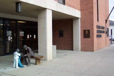
Congressional Medal of Honor Recipients Marker
RANKED BY RELEVANCE
On 2nd Street at Park Place, on the left when traveling south on 2nd Street.
On Courthouse Square at East Main and 2nd Street, on the right when traveling south on Courthouse Square.
On Main Street (Ohio Route 661) at Elm Street, on the left when traveling north on Main Street.
On Turner Road west of King Road, on the right when traveling west.
On Bryn du Drive 1.1 miles Newark Granville Road.
On East Broadway (Ohio Route 661) west of Pearl Street ( Route 661), on the left when traveling west.
On Homer Road at South Street, on the left when traveling west on Homer Road.
On South Third Street at East Canal Street, on the left when traveling south on South Third Street.
On Hudson Avenue (Ohio Route 13) at Wyoming Street, on the right when traveling south on Hudson Avenue.
On Hudson Avenue (Ohio Route 13) at Wyoming Street, on the right when traveling north on Hudson Avenue.
On East Canal Street at South Third Street, on the right when traveling east on East Canal Street.
On 6th Street, on the right when traveling south.
On Hebron Rd (Route 79) near Parkview Drive and Hopewell Drive.
On Main Street (U.S. 40) at Basin Street, on the right when traveling west on Main Street.
Paid Advertisement
On De Vilbiss Lane at Oak Island Drive on De Vilbiss Lane.
On De Vilbiss Lane at Oak Island Drive on De Vilbiss Lane.
On County Road 495 at State Route 16, on the right when traveling west on County Road 495.
On Ohio 73 (Ohio Route 73) 1 mile west of Horner Cheapel Road (Route 116), on the right when traveling north.
On Horner Chapel Road (Ohio Route 73) 0.9 miles west of Horner Chapel Road (County Road T-116), on the right when traveling west. Reported permanently removed.
Near West Main Street National Road (U.S. 40).
On East Canal Street just east of South 1st Street, on the right when traveling east.
On Flint Ridge Road (County Route 312) near Brownsville Road (Route 668).
On Flint Ridge Road (County Route 312) 0.3 miles east of Brownsville Road ( Route 668), on the right when traveling east.
On Moundbuilder's Road west of Parkview Road, on the right when traveling west. Reported permanently removed.
On Foundation Road at Downing Road, on the right when traveling west on Foundation Road.
On Hebron Road (Ohio Route 79) near Coffman Boulevard, on the right when traveling north.
On South Park Place east of South 3rd Street, on the right when traveling east.
On N 33rd Street near Parkview Road. Reported permanently removed.
Near East Canal Street west of South 2nd Street, on the right when traveling east.
On South 2nd Street at East Market Street, on the right when traveling north on South 2nd Street.
Paid Advertisement
On Canal Road (County Route 100), on the right when traveling north.
Near East Broadway (Ohio Route 661) at South Main Street ( Route 661).
Near Lancaster Road 1 mile north of Union Station Road, on the right when traveling north.
On South 2nd Street at East Market Street, on the left when traveling south on South 2nd Street.
On S. Main Street (U.S. 127), on the right when traveling north.
On Johnstown Road/Main Street (U.S. 62) 0 miles east of Route 605, on the right when traveling east.
On West Maple Street at North Williams Street, on the right when traveling west on West Maple Street.
On Court Street (Ohio Route 29/47) at Main Avenue ( Route 29/47), on the left when traveling east on Court Street.
On West Main Street west of South Isabella Street, on the left when traveling west.
On South 2nd Street at East Market Street, on the right when traveling north on South 2nd Street.
On National Road (U.S. 40) at Patterson Road, on the right when traveling east on National Road.
On Flint Ridge Road (Ohio Route 312) 0.3 miles east of Brownsville Road ( Route 668), on the right when traveling east.
On 6th Street, on the right when traveling south.
On West Main Street (Ohio Route 37) at Maple Drive (the library parking lot), on the right when traveling west on West Main Street.
On North 6th Street south of West Church Street, on the left when traveling north.
On West Illinois Avenue at Liberty Street, on the right when traveling east on West Illinois Avenue.
Paid Advertisement
On South 1st Street just south of East Canal Street, on the right when traveling north.
Near Cooper Avenue (Ohio Route 79) north of Parkview Drive and Hopewell Drive, on the right when traveling south.
On South 2nd Street at East Market Street, on the right when traveling north on South 2nd Street.
On South 2nd Street, on the right when traveling east.
On South 2nd Street, on the right when traveling east.
On South 3nd Street at West Main Street, on the right when traveling north on South 3nd Street.
︽
Thin black lines indicate changes in relevance. Between each pair of lines entries are ordered geographically but all have the same relevance. * Inflectional forms of words are their plurals, singulars, and possessives as well as gramatical tenses and similar variations.
Nov. 12, 2026