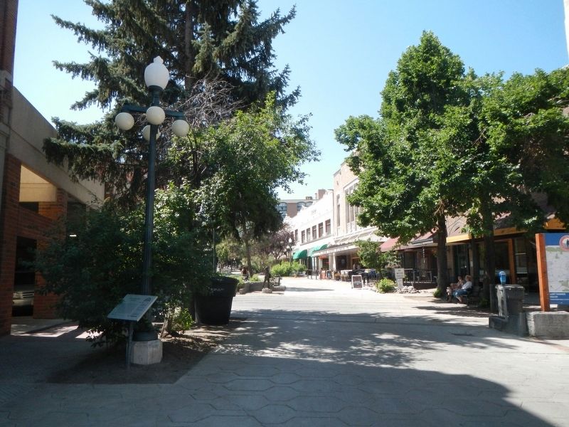
On North Last Chance Gulch at West 6th Avenue, on the left when traveling north on North Last Chance Gulch.
Two major areas comprise the Helena Historic District. The first area is roughly bounded by Hauser Boulevard, Monroe Avenue, Stuart Street, Dearborn Avenue, Flowerree Street, and Madison Avenue. The second area is roughly bounded by Neill Avenue, . . . — — Map (db m186276) HM
On Rodney Street at State Street when traveling north on Rodney Street.
This first permanent settlement of the gold camp at Last Chance Gulch offers a glimpse of early Helena from the late 1860s to the 1890s. By the 1870s, a Catholic cathedral, St. John’s Hospital, two schools, and dormitories presided over the district . . . — — Map (db m188182) HM
This first permanent settlement of the gold camp at Last Chance Gulch offers a glimpse of early Helena from the late 1860s to the 1890s. By the 1870s, a Catholic cathedral, St. John’s Hospital, two schools, and dormitories presided over the district . . . — — Map (db m188519) HM
On West Main Street near Grizzly Gulch Drive, on the right when traveling west.
The physical link between the earliest settlement of Helena and the ceaseless efforts to fully exploit the area’s mineral potential is nowhere more clearly apparent than in this narrow district, settled on mining claims. After the first local gold . . . — — Map (db m187582) HM
On North Last Chance Gulch near East Broadway Street, in the median.
By 1876 Helena was firmly established as the financial center of Montana. Nine banks were organized by 1890 and were equipped to handle "dust" which was the prime medium of exchange. Gold scales served as the cash register of the day. The gold, . . . — — Map (db m186557) HM
On North Last Chance Gulch at East Placer Avenue, on the right when traveling north on North Last Chance Gulch.
Before the coming of the automobile, horseshoers were an important part of Helena's business community. Wagons needed repairs, wheels required replacement of rims or spokes and horses must have shoes. Fall was a particularly busy time of year. . . . — — Map (db m187244) HM
On South Davis Street near North Hillsdale Street when traveling north.
Danish immigrants Henry and Matilda Blase settled on this property in the 1880s. Like other working-class Europeans who lived in the neighborhood, Blase was a man of many occupations: bartender, saloon keeper, jailer, miner, and landscape gardener. . . . — — Map (db m188113) HM
On West Main Street near Grizzly Gulch Drive, on the right when traveling west.
English immigrants Frances and Henry Hay came to Helena in the mid-1860s and were among the first to settle on West Main where Hay mined a claim. Their log cabin became the center of the present residence, built circa 1870. A switchback path leads . . . — — Map (db m187578) HM
On East Broadway Street near Rodney Street, on the left when traveling west.
Professor T. F. Campbell built a log cabin on this corner where he opened Helena’s first public school in 1865. Druggist Henry M. Parchen founded his long-time Helena apothecary that same year. Parchen acquired this property circa 1872 and . . . — — Map (db m188231) HM
On East Broadway Street near Spencer Street, on the left when traveling west.
Pioneer businessmen Anton and Martin Holter made fortunes in hardware, construction, mining investments, and real estate development. The brothers owned a number of lots in south central Helena, including three adjoining lots here on Broadway. The . . . — — Map (db m188111) HM
On Spencer Street near Pine Street, on the right when traveling north.
Contractors Anton and Martin Holter, who operated Helena’s first sawmill, built this frame residence as a rental investment in 1888. Developers like the wealthy Holter brothers built a number of south-central residences during the prosperous 1880s, . . . — — Map (db m188178) HM
Near North Last Chance Gulch near East Lawrence Street, on the right when traveling north.
Helena architects Heinlein and Matthias designed this elegant European-style hotel, formerly the Windsor House. Built in 1888, it is Montana’s only known example of a prefabricated iron façade. The locally pre-cast façade represents a building trend . . . — — Map (db m187148) HM
On North Ewing Street at East 5th Avenue, on the right when traveling north on North Ewing Street.
During his second term of office in 1903, Montana’s first governor J. K. Toole commissioned Eugene Fisk to build this magnificent home of locally quarried red porphyry and brick. Fisk, who also designed the 1880s Unitarian Church (now Grandstreet . . . — — Map (db m188461) HM
On Breckenridge Street near North Rodney Street, on the right when traveling west.
Livery stables rented and boarded horses, providing a critical service in the nineteenth century when transportation depended upon reliable mounts. Allen Livery is Helena’s best preserved reminder of this vital business and also recalls the . . . — — Map (db m188232) HM
On South Rodney Street at Miller Street, on the left when traveling north on South Rodney Street.
n May of 1890, Montana’s first governor, Helena trial lawyer and territorial statesman Joseph Kemp Toole, brought his bride, Lilly, to live in the family home on Rodney Street. The territorial brick residence had been constructed before 1880 for . . . — — Map (db m188204) HM
On East Broadway Street near North Montana Avenue, on the left when traveling west.
The western gold rushes not only lured miners but entrepreneurs seeking business opportunities. Armed with blacksmithing and wagon-making skills, adventurer Joshua Armitage and his wife Martha arrived at Alder Gulch in December 1863. They moved to . . . — — Map (db m187075) HM
The 1982 Justice Building and Montana State Library, designed by Page-Werner and Partners of Great Falls, was the last building constructed under the ambitious 1972 Capitol Campus Master Plan. Designed to house the Supreme Court, Attorney General’s . . . — — Map (db m187069) HM
On North Warren Street at East 6th Avenue, on the right when traveling north on North Warren Street.
Entrepreneur Reinhold H. Kleinschmidt built this block with five storefronts and upstairs lodging rooms circa 1892. Among his first commercial tenants was Charles Grossman, a wallpaper hanger and painter, whose business was in the corner storefront. . . . — — Map (db m188460) HM
On West Main Street near Carriage Lane, on the left when traveling north.
This rare example of European half-timber construction in the midst of a Montana mining camp beautifully illustrates how pioneer buildings often reflected the cultural traditions of their builders. After distinguished service as an infantryman in . . . — — Map (db m187484) HM
On State Street near South Davis Street when traveling west.
A small rectangular gabled dwelling built against a one-room log cabin stood on this spacious corner in the 1870s. The property had changed hands several times when Austrian immigrant Franz Koch, a bookbindery foreman, purchased it in the late . . . — — Map (db m188115) HM
On East 5th Avenue near North Davis Street, on the left when traveling west.
In 1892, a small Chinese laundry was the sole occupant of the block’s south side. Nearby, booming Rodney Street boasted a mix of businesses, tenements, boardinghouses, and single family homes. Fifth Street, however, had begun to take on a purely . . . — — Map (db m188084) HM
On South Park Avenue at South Cruse Street, on the left when traveling south on South Park Avenue.
The city of Helena started as a group of placer miners' cabins and Main Street follows the bottom of Last Chance Gulch. The gulch is formed by the convergence of Oro Fino and Grizzley Gulches and its colorful history began when gold was . . . — — Map (db m188672) HM
On West Main Street near Grizzly Gulch Drive, on the left when traveling west.
Early settlers along the gulch made use of the natural landscape by building their homes into the hillside for convenient, climate-controlled storage and maximum space. This gable-front-and-wing style home, built circa 1893, follows this practice. . . . — — Map (db m187586) HM
Near North Roberts Street near Lockey Avenue, on the left when traveling north.
During the first decade of statehood legislators met in downtown Helena where lawmakers enjoyed a variety of options for “lunch arrangements.” When lawmakers transitioned into the new Capitol in 1902, downtown Helena was a mile away. A small . . . — — Map (db m186904) HM
Much Montana history unfolded within this
magnificent landmark which served as both
territorial capitol (1887-1888) and state capitol
(1889-1902). Here in 1889 officials received
word of statehood, and three hours later J. K.
Toole was sworn in . . . — — Map (db m306347) HM
On North Ewing Street north of E Broadway Street, on the right when traveling north.
Masterful stonework of local granite in
Romanesque style creates a somber
effect in this 1890 institution. The corner
tower (which lost its battlements in the
1935 earthquake), thick stone lintels and
heavy arches recall the romantic nineteenth . . . — — Map (db m306348) HM
On East Lockey Avenue near Roberts Street, on the right when traveling north.
Concerns about communicable diseases and unsanitary slaughterhouse conditions prompted the creation of the Livestock Sanitary Board in 1907. Originally housed in the new State Capitol, its duties quickly expanded and the need for laboratory and . . . — — Map (db m186780) HM
On North Rodney Street near East 7th Avenue, on the right when traveling north.
The Lyman-Neel Residence and its many occupants reflect the ever-changing character of the North Rodney Street neighborhood. Soon after Helena’s first county courthouse opened in 1867, merchants and professionals established Helena’s first . . . — — Map (db m188375) HM
On South Rodney Street near East Broadway Street when traveling north.
The flamboyant Second Empire style is exceptionally well articulated in this grand residence, showcasing the considerable talent of its builder and original owner, Martin M. Holter. One of only a few well-preserved examples of this style in Montana, . . . — — Map (db m188208) HM
On North Roberts Street near Lockey Avenue, on the right when traveling north.
Throughout the first half of the twentieth century, state government grew to meet the increasing demands of Montana’s citizenry. In 1945—following a hiatus wrought by the Great Depression and World War II—the legislature established a Montana . . . — — Map (db m186906) HM
On West 6th Avenue near North Last Chance Gulch, on the right when traveling west.
Time stands still within the quiet confines of this nationally renowned social club, the oldest in the Northwest. A group of Helena’s elite founded the Montana Club in 1885 “for gentlemen only.” Members built a seven-story building on this site in . . . — — Map (db m187135) HM
On North Roberts Street at East 6th Avenue, on the left when traveling north on North Roberts Street.
Montana’s original Highway Department building reflects the ascendancy of the automobile in twentieth-century America. As drivers began lobbying for good roads, state government responded, forming the Montana Highway Commission in 1913. Five years . . . — — Map (db m186913) HM
Montana’s governmental landscape is an evolving political and cultural expression with deep roots. The seeds of the capital city were planted with local gold discoveries in 1864. Helena became territorial capital in 1875. Upon statehood in 1889, the . . . — — Map (db m186907) HM
On Roberts Street south of East 6th Avenue, on the left when traveling south.
The desire to memorialize the contributions of Montana pioneers and veterans and the need for a state museum converged in 1941. That year, veterans groups, the Sons and Daughters of Montana Pioneers, and the Montana Pioneers joined together to . . . — — Map (db m128478) HM WM
On South Last Chance Gulch near East Broadway Street, in the median.
Montana Territory was created by Congress on May 26, 1864. The first Legislature sat in Bannack but was moved less than a year later to booming Virginia City. Ten years later, the capital was located in Helena and despite effort of Silver Bow mining . . . — — Map (db m186560) HM
On North Roberts Street at East 6th Avenue, on the left when traveling north on North Roberts Street.
Grasshopper Creek, where gold was discovered in 1862 in what would later be named Bannack, became the first territorial capital. The territorial legislature moved the capital to Virginia City on February 7, 1865. While Virginia City enjoyed the . . . — — Map (db m187066) HM
On Reeder's Alley near South Benton Avenue, on the left when traveling west.
Historic maps show that the area above Reeder’s Alley, known as Reeder’s Gulch, was long undeveloped and virtually inaccessible. The city gave in to local pressure in the early 1890s and began construction of this bridge, first known as the Howie . . . — — Map (db m187408) HM
On East Broadway Street near South Davis Street when traveling west.
A modern brick veneer does not mask the original footprint of this early Helena home. The large bay window, the steeply pitched roof (which added space for a second story), and the cross gable, once sheltered by a full-length front porch, reflect . . . — — Map (db m188088) HM
On North Last Chance Gulch near East 6th Avenue, on the left when traveling north.
This was one of five structures rebuilt after the disastrous lightning-sparked fire of 1928. The original building and its replacement housed the thriving New York Store renamed Fligelman’s in 1929 from 1902 to 1958. This pioneer department store . . . — — Map (db m186484) HM
On North Park Avenue near West Placer Avenue, on the left when traveling north.
The Olsen House was built in stages after Amelia Derrick Olsen purchased this property in 1874. At that time, Park Street was known as Clore Street, and the original home built on these lots was a wooden, two-story building. The gable-roofed, . . . — — Map (db m187252) HM
On North Ewing Street, at East 6th Avenue when traveling north on North Ewing Street,.
Montana’s Original Governor’s Mansion was built as a private residence for the William Chessman family in 1888, and was home to the Peter Larson family and the Harfield Conrad family before the state purchased it (along with much of the Conrads’ . . . — — Map (db m188457) HM
The Montana Highway Patrol was created by an act of the State Legislature and signed into law by Governor Frank Cooney on 14 March, 1935. This building served as the original headquarters from 1935 until the early 1950s.
Governor Frank . . . — — Map (db m186966) HM
On Floweree Street at Madison Avenue when traveling west on Floweree Street.
Attention to detail distinguishes this one-story brick residence, designed in 1934 by Helena architect E. B. Benson. Benson’s plan incorporates many Tudor revival style elements: an asymmetrical facade, sloping roofline, prominent chimney, arched . . . — — Map (db m187739) HM
On South Park Avenue near Reeder's Alley, on the left when traveling north.
Wilson Butts followed the stampede to Last Chance Gulch in 1864, staked his claim here, and built a serviceable one-room cabin. The following spring his brother Jonas arrived with a wife and three young daughters. Jonas added a front room and porch . . . — — Map (db m187372) HM
On South Park Avenue near Reeder's Alley, on the left when traveling north.
Former Montana First Lady and member of the Oro Fino Chapter Daughters of the American Revolution (DAR), Grace Vance Erickson spearheaded efforts to preserve this historic cabin. In 1938, Grace rallied DAR members, including chapter officers . . . — — Map (db m187315) HM
On North Last Chance Gulch near East Broadway Street, on the right when traveling north.
Artist C. M. Russell illustrated the program for the formal ball, held April 12, 1913, inaugurating the largest hotel between the Twin Cities and the Coast. Built almost entirely with donations as a public enterprise, Helena felt real pride of . . . — — Map (db m186552) HM
On North Ewing Street near East 7th Avenue, on the right when traveling north.
The Northern Pacific finally extended its tracks to Helena in 1883, and the town became increasingly cosmopolitan. Pioneer real estate developer James Porter constructed this very stylish apartment building in 1884, the first of many multifamily . . . — — Map (db m188377) HM
On North Last Chance Gulch at North 6th Avenue, on the left when traveling north on North Last Chance Gulch.
Influential merchant and investor T. C. Power built his fortunes by controlling much of territorial Montana’s commerce and Indian trade. This outstanding granite business block housed Power’s American National Bank from 1892 through the 1920s. . . . — — Map (db m186279) HM
On South Last Chance Gulch near East Broadway Street when traveling north.
This well-preserved commercial structure illustrates Helena’s growth from mining camp to prosperous town. The quoins and arches of the original stone building, constructed circa 1865-1872, are still visible at the rear. In 1878, the building was . . . — — Map (db m186603) HM
Near South Park Avenue near Reeder's Alley, on the left when traveling north.
On July 14, 1864, four hungry miners took a "last chance", found color in their pans, and gold seekers soon moved to stake their claims. One of them built the Pioneer Cabin, Helena's oldest documented dwelling. Within the first four years, Last . . . — — Map (db m187376) HM
Pennsylvania brick mason Louis Reeder came to Helena in 1867 to practice his trade. Reeder invested in real estate and among his properties were these lots along the steep hillside of West Cutler Street. Between 1875 and 1884 Reeder constructed a . . . — — Map (db m187378) HM
On Reeder's Alley near South Benton Avenue, on the right when traveling west.
Built by Louis Reeder in the late 1860s thru 1882, Reeder's Alley stands as a memorial to the architecture of the 1870s Helena. Its importance lies not in its splendor, but its quaintness. It is one of Montana's oldest streets and one of her newest . . . — — Map (db m187407) HM
On North Rodney Street at East 7th Avenue, on the right when traveling north on North Rodney Street.
Robert E. Fisk came to Montana with the 1866 Fisk Expedition organized by his famous wagon-master brother, James. The two brothers and other partners established the Helena Herald in November 1866. Robert, who was a printer before the Civil War, . . . — — Map (db m188333) HM
On North Rodney Street at Breckenridge Street, on the left when traveling north on North Rodney Street.
Thomas K. Dane established a hotel on this corner in 1875 when Helena became the territorial capital. On a busy thoroughfare just off Courthouse Square, the establishment had become the Rodney Hotel by 1883 and the original frame building fronting . . . — — Map (db m188233) HM
On North Rodney Street at 5th Avenue on North Rodney Street.
Gambling that Helena would continue to grow, Eliza Roush purchased this lot and several others in 1869. Her bet paid off, and by 1875, Rodney Street was crowded with buildings, including a small wooden dwelling on this site. A series of wooden . . . — — Map (db m188235) HM
On East Broadway Street near South Davis Street when traveling west.
Irish immigrant James M. Ryan owned a number of local rental properties, including this appealing wood-frame apartment building constructed as a duplex between 1885 and 1888. Rapid growth during the 1880s prompted neighborhood tenants to take in . . . — — Map (db m188112) HM
On West Main Street at Carriage Lane, on the left when traveling north on West Main Street.
Small dwellings along this stretch of West Main Street housed miners and other boarders from the mid-1860s. The first plat of the Helena townsite, drawn in 1868, designated this former mining claim Block Number 1. Scottish immigrant Samuel Dempster . . . — — Map (db m187483) HM
On Madison Avenue at Stuart Street on Madison Avenue.
The history of this magnificent home, one of the earliest of the great mansions built on Helena’s west side, is finely interwoven with the history of Montana. Pioneer entrepreneur and financier Samuel T. Hauser built the twenty-nine-room residence . . . — — Map (db m187737) HM
On North Ewing Street at East 9th Avenue, on the left when traveling north on North Ewing Street.
Frontier lawyer Wilbur Fisk Sanders established his reputation in 1863 by courageously prosecuting Virginia City’s most dangerous outlaws. A member of the first territorial legislature and Montana’s first United States senator, Sanders was renowned . . . — — Map (db m188379) HM
On South Last Chance Gulch near East Broadway Street when traveling north.
Originally this was a one-story stone building erected in 1874 to accommodate the business of Morris and Julius Sands. The brothers added a second story and remodeled the façade in 1889, finishing it with alternating rows of buff sandstone and blue . . . — — Map (db m186604) HM
Gold deposits played out by the late-1870s, but the fertile land drew ranchers and farmers. William Brown and his grown children began ranching alongside seasoned ranch families like the Gehrings and Sanfords. During the 1880s, now-prominent area . . . — — Map (db m251038) HM
Near Sierra Road East, on the right when traveling east.
Silver Creek Schoolhouse
Montana Avenue was a wagon trail when the first students trekked across treeless pastures to class in 1888. The bell rang out over the valley promptly at 8:40 AM, letting children know that they had better not . . . — — Map (db m304448) HM
On East 6th Avenue near North Ewing Street, on the left when traveling west.
A pair of two-story bay windows with granite sills, decorative brickwork, corbelled cornice, and open front porch recall the prosperous Courthouse Square neighborhood during the 1880s and 1890s. This attractive brick Italianate style dwelling, . . . — — Map (db m188459) HM
On South Last Chance Gulch near East Broadway Street, on the right when traveling north.
Once connected to the old St. Louis Hotel on Jackson Street, this 1882 building in the heart of Helena’s original downtown displays the metal cornices and banded, pedimented windows typical of Italianate style architecture of the time. Pioneer . . . — — Map (db m186668) HM
On Reeder's Alley near South Benton Avenue, on the right when traveling west.
Dwellings, bunkhouses, and stables dotted the hilltop during the 1880s, forming an extension of Louis Reeder’s housing complex downslope. One prominent stone building, now the largest portion of the present building, contained four small shotgun . . . — — Map (db m187409) HM
On Floweree Street at Harrison Avenue, on the left when traveling west on Floweree Street.
Benjamin H. and Lydia Mears Tatem came west as newlyweds in 1869. They settled in Helena where Tatem managed the Unionville mining claims of Philadelphia investors and operated Helena Iron Works. Tatem profited from his interest in the Bald Butte . . . — — Map (db m187677) HM
On North Ewing Street, at East 10th Avenue, on the right when traveling north on North Ewing Street,.
Opportunity drew European Jewish immigrants to the gold camp at Last Chance where business and religion brought them together. The Jewish community contributed a firm financial foundation to the early settlement. It was the Jewish pioneers . . . — — Map (db m188378) HM
On South Last Chance Gulch near East Broadway Street, on the right when traveling north.
In the spring of 1864, John S. Cowan of Georgia, D.J. Miller of Alabama, John Crabb of Iowa, and Reginald (Bob) Stanley of Nuneaton, England, set out from Alder Creek to prospect along the Little Blackfoot River. They had no luck and moved on, . . . — — Map (db m251040) HM
Near South Last Chance Gulch near East Broadway Street.
In 1864 four miners passed through this valley on their way back from an unsuccessful prospecting trip. Discouraged they decided to take one "last chance", filling their pans a few hundred yards south of here they struck pay dirt. Another boom town . . . — — Map (db m186777) HM
On East 6th Avenue at Washington Drive, on the right when traveling east on East 6th Avenue.
American soldier and statesman; Brigadier General United States Army; raised and organized the Irish Brigade in the Army of the Potomac, and personally commanded it in the battles of Fair Oaks, Mechanicsville, Gaines’ Mill, . . . — — Map (db m128477) HM WM
On Harrison Avenue at Gilbert Street, on the left when traveling north on Harrison Avenue.
Praised for lending “an air of distinction” to “one of the handsomest residence streets in Helena,” this three-story Queen Anne style home was constructed for George and Eva Tracy. The house was completed just prior to the calamitous economic . . . — — Map (db m187671) HM
Near South Last Chance Gulch near East Broadway Street, on the right when traveling north.
(Six bronze plaques are mounted on this marker:)
U.S.S. Helena FG-9
1896-1932
The first ship named after the state capital city was the gunboat "Helena." She saw action in Cuban waters during the Spanish-American War . . . — — Map (db m186678) HM WM
On South Last Chance Gulch near East Broadway Street, on the left when traveling north.
The Montana National Bank, the first bank chartered in Montana Territory, was located on this site in 1866. A housing shortage during the 1880s prompted the construction of this three-story rooming house in 1887. The French Second Empire-inspired . . . — — Map (db m186674) HM
On East Lockey Avenue near North Roberts Street, on the left when traveling west.
Politician John G. Winant wrote in 1936 that the Great Depression made Americans aware that there were no more frontiers. Individual initiative and enterprise could no longer guarantee financial security. The government subsequently established the . . . — — Map (db m187068) HM
On Oro Fino Gulch Drive near Black Alder Gulch, on the right when traveling west.
Helena owes its existence to gold-bearing quartz lodes in the hills south of town. The gold washed out of the hills into Last Chance Gulch where the "Four Georgians" discovered it in 1864. The fabulously rich strike drew hundreds of men and women to . . . — — Map (db m188671) HM
On 5th Avenue near North Davis Street, on the left when traveling west.
Broad proportions and a horizontal emphasis combine with natural colors to make this classic bungalow a handsome ambassador of that popular style. The residence is unique to the district and an excellent example of early-twentieth-century affluence. . . . — — Map (db m188083) HM
On North Rodney Street at Breckenridge Street when traveling north on North Rodney Street.
As early as 1866, Rodney Street was Helena’s primary north-south connection and thus supported a variety of early businesses. It was also an area better protected from the fires that constantly threatened downtown commerce. This building, . . . — — Map (db m188234) HM
On North Park Avenue at Gilbert Street, on the left when traveling north on North Park Avenue.
Small in scale but highly distinctive, this colorful Modern style office building is an eye-catching anchor at one of Helena’s busiest intersections. When it opened in 1962, it was one of the nation’s most up-to-date office facilities. Western Life, . . . — — Map (db m187251) HM
On East Broadway Street near North Davis Street, on the right when traveling west.
This early gable-front-and-wing residence was constructed in 1878 by postal clerk William F. Bishop for $2,000. Mrs. Margaret Bishop ran a dressmaking business from the home and took in boarders in the late 1880s. Cottage industries and . . . — — Map (db m188110) HM
On Breckenridge Street at South Davis Street, on the left when traveling west on Breckenridge Street.
Nineteenth-century charm is well preserved in this 1883 Queen Anne style residence, built by pioneer physician William L. Steele. Its present appearance reflects additions, including a front porch and bay window, made before 1892. Stucco applied . . . — — Map (db m188087) HM
On South Rodney Street near East Broadway Street when traveling north.
Although modest compared to Helena’s imposing West Side mansions of a slightly later period, this well-preserved home was very grand for its early date. Woodman S. Paynter arrived in Helena in 1868 and entered into a business partnership with Henry . . . — — Map (db m188206) HM
On North Park Avenue at West Placer Avenue when traveling north on North Park Avenue.
Only seven years after organizing, the Helena chapter of the Young Women’s Christian Association, Independent, opened this residential building for the city’s young working women in 1918. Founded by women from most of Helena’s churches and . . . — — Map (db m187253) HM
Near Apple Grove Campground Road near State Highway 200.
For many thousands of years, travelers of every description have traversed the Blackfoot River corridor. As you drive Highway 200, alongside the boulder-strewn rapids of the fabled Blackfoot River, envision the journeys, some pleasurable, others . . . — — Map (db m219983) HM
On Apple Grove Campground Road near State Highway 200.
What makes this place, the Blackfoot River and its surrounding bioregion, so special? The Blackfoot watershed - with its headwaters near here, atop the Continental Divide at Roger's Pass - embraces 1.5 million acres. This vast area offers prime . . . — — Map (db m220015) HM
Near State Highway 200 at milepost 90 near Little Wold Creek Road, on the right when traveling east.
The weather has been unrelenting for days...
but the rugged Montana miners persevered and continued with their daily work. The 4 K's Mine near Rogers Pass, Montana was an equal effort between four men: brothers Albert and Harry Hleinschmidt, . . . — — Map (db m220107) HM
"Range life in 1900 was a grueling occupation and especially so in in the Alice
Creek area where early snows and long winters made for a very short summer
work period. When Alberta [Patterson] was twenty-one months old her
mother told of . . . — — Map (db m220035) HM
Near Main Street (State Highway 200) near First Street North, on the right when traveling east.
In 1806, Lewis and Clark followed separate Indian "roads" back across the Continental Divide. Lewis traveled up the Blackfoot River and over Lewis and Clark Pass.
This easy route led Lewis to where the vast treeless prairie rises dramatically . . . — — Map (db m219988) HM
On Apple Grove Campground Road near State Highway 200.
Wherever you are in Montana, you stand in the pathway of Lewis and Clark. Their 1804-1806 expedition was a grand adventure to investigate the people and resources of the newly acquired Louisiana Purchase and to seek a navigable passage across the . . . — — Map (db m220016) HM
Splitting Up the Corps
Captain Meriwether Lewis passed this way in the summer of 1806. Traveling east from their winter on the Pacific Ocean, co-commanders William Clark and Meriwether Lewis stopped near present-day Lolo, Montana. At a . . . — — Map (db m220034) HM
Bison! This great shaggy beast sustained the Indians of the Plains and adjacent areas for thousands of years. And in these parts we call Montana, an ancient network of trails led the Salish, Pend d'Oreille, and related Indian tribes, who . . . — — Map (db m220033) HM
On 1st Street at Grand Street, on the right when traveling west on 1st Street.
Marysville owes its existence to the nearby Drumlummon Mine developed by a
determined miner named Tommy Cruse. The British-owned Montana Mining Company
acquired the mine in 1883. Expansion of Drumlummon operations, including a large
ore . . . — — Map (db m155021) HM
On Main Street near 1st Street, on the left when traveling north.
Ann and Blibal Betor has a general store here as early as 1898. Mr. Betor was a rug peddler when he first migrated to the USA originally from Lebanon. The general store included "Dry Goods, Gent's Furnishings, Children's Ware, and Notions." . . . — — Map (db m188742) HM
On Grand Street near Attwood Street, on the left when traveling north.
Built in 1883 as a two-room structure the Marysville schoolhouse quickly became inadequate and in 1891 a second story was added to accommodate more than 200 hundred (sic) students in eleven grades. At this time instruction was provided by as many as . . . — — Map (db m188738) HM
Once the home of James and Donalda Shaffer, this house was last occupied by Frank Nyaski. The building which was donated to the Marysville Pioneer Association in 1969 by Yvette, Vinnie and Jim Shaffer, has presently been restored and used as a . . . — — Map (db m188739) HM
On 1st Street at Grand Street, on the right when traveling west on 1st Street.
In 1870 the mining town of Marysville was established and named for the first pioneer woman here, Mary Ralston, by Thomas Cruse, owner of the famous Drum Lummon Mine.
By 1900, the Marysville Mining District was reported to be the richest gold . . . — — Map (db m154440) HM
On Grand Street at 3rd Street, on the right when traveling north on Grand Street.
Marysville’s Methodist Episcopal Church was built in 1886 by its congregation on land purchased from Thomas Cruse, who founded the town in 1876 around his Drum Lummon gold and silver claims. The church’s modest clapboard-sided frame and bell tower . . . — — Map (db m188675) HM
On Main Street north of 1st Street, on the left when traveling south.
The Marysville House
In 1887 the railroad came to Silver City, Montana. The Silver City railroad
depot was erected by Montana Central Railroad as a convenient stop
between Helena and Great Falls. Montana Central Railroad and . . . — — Map (db m304446) HM