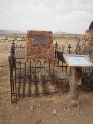
Sampson E. Stilwell, better known as "Comanche Jack," was born in Kansas in 1850 and served on the frontier during his youth as a scout and hunter. He is best known for his heroic deeds at the Battle of Beechers Island on September 6 (sic), 1868. . . . — — Map (db m91074) HM
This monument honors all war dogs and handlers: Past, Present, And Future.
K-9 teams that serve in the U.S. Military have a history of bravery and courage on thousands of unnamed foreign fields of battle. We are deeply inedited to these K-9 and . . . — — Map (db m301173) WM
Shoshone Canyon is a gorge cut through Rattlesnake Mountain by the wearing action of the Shoshone River. The mountain is a northwest trending uplift in the earth’s crust that rises 3700 feet above the surrounding terrain. Beds of sedimentary rock . . . — — Map (db m86154) HM
The Heart Mountain Division of the Shoshone Project receives irrigation water directly from Buffalo Bill Reservoir via the Shoshone Canyon Conduit, a three-mile-long tunnel drilled through Cedar Mountain located to the left. From the conduit, the . . . — — Map (db m87589) HM
At this spot in 1903 a rock dugout facing south,
near a fresh-water spring in the hillside, was established as
a stage "noon stop" where horses were changed and meals
served. The primitive accommodation was halfway between
Corbett Crossing on . . . — — Map (db m286144) HM
This monument is dedicated to honor the men women who served and sacrificed in our military services during the Second World War 1941 -1945 When called upon, they stepped forward to protect our freedom and way of life. Those who are individually . . . — — Map (db m301823) WM
On both sides of the Shoshone River there are many circles made of stones built by the Indians who frequented this area. Some of the sites are simply circles with no doorways, believed to be religious symbols associated with the circle of life or . . . — — Map (db m87575) HM
This monument, erected by the Brotherhood of the American Mountain Men, is "dedicated to all Mountain Men known and unknown for their essential part in the opening of the American West." It consists of two busts and six plaques honoring four . . . — — Map (db m91017) HM
As a band of Nez Perce Indians out (missing word(s)) and outmaneuver the U.S. Cavalry in the fall of 1877, newspapers picked up on the drama (missing word(s)) headlines read: "Comic Opera, Bungling of Pursuer, Salutes to a Most . . . — — Map (db m190092) HM
Look to your left and you will see the canyon cut by the Shoshone River. The mountain to the left of the canyon is Cedar Mountain. To the right of Shoshone Canyon you can see Rattlesnake Mountain. The red butte (to the right of Rattlesnake Mt.) is . . . — — Map (db m87565) HM
Young Buffalo Bill Cody started his famous career with the great freighting firm of Russell, Majors and Waddell as a messenger boy. He became a spectacular Pony Express rider with the same firm and road between Red Buttes and Three Crossings, along . . . — — Map (db m91008) HM
It cannot be inherited nor can it be purchased. You and no one alive can buy it for any price. It is impossible to rent, and it can not be lent. You alone and our own have earned it with your sweat, blood and lives. You own it forever. The Title, . . . — — Map (db m301085) WM
This Anchor was re-dedicated November 11, 2001 to the people who have served their country in the navy, Marine Corps, Coast Guard & Merchant Marine/ — — Map (db m300892) HM
Here on the prairie there are still visible remnants of several old wagon trails dating back to Cody City in the late 1800’s. The first buildings of Cody City were constructed on the nearby plain to the west, although the town was supposed to be . . . — — Map (db m87586) HM
Upstream Cableway Winch
This cableway winch, which was used to install and remove the ball plugs, trash racks, and the bulkhead gate for the left abutment outlet works, dates to the construction of the Shoshone Powerplant in 1922. It was . . . — — Map (db m104002) HM
William Gallagher and his friend, Blind Bill, were killed on Meeteese Creek below the old town of Arland in mid-March of 1894. Both men, about thirty, were born during the Civil War period.
Gallagher, who was somewhat of an outlaw, was tall, . . . — — Map (db m91076) HM
Jan. 4, 1913 Sept. 18, 1992 Grandson of the World-Famous Colonel William F. Cody “Buffalo Bill” Bill Cody was born at Buffalo Bill’s “Scouts Rest Ranch” in North Platte, Nebraska. He died in Cody, Wyoming. He was . . . — — Map (db m87560) HM
The 300th Armored Field Artillery Battalion was federalized from 19 August 1950 to 27 September 1954 and served, along with many other Wyoming soldiers, during the Korean War. The five batteries of the 300th were from "A" -Thermopolis; "B"- Cody; . . . — — Map (db m301183) HM WM
Fallen Comrades
Anderson, Allen G. · Barnhill, Kenneth R. · Baxter, Neil B. · Budaker, Clifford F. · Barnes, Ted U. · Budd, Malcom L. · Burt, Myron H. · Clark, Leonard W. · Clay, James E. · Cowdin, Ray R. · Davis, Courtenay C. · Dewees, . . . — — Map (db m305469) WM
This memorial is dedicated to the men and women who have served or
are serving in the Wyoming National
Guard (Air Force and Army) who
stand ready to answer the call to
active service in times of emergency,"
disaster or conflict. . . . — — Map (db m300814) WM
We the citizens of the Yellowstone gateway communities whose lives and properties were imperiled by the 1988 Yellowstone fires, hereby express our gratitude to those whose courage, skill and devotion tamed the inferno that devastated over 363,000 . . . — — Map (db m87200) HM
What's So Special About This Spot? Your feet are placed on a line that has played a key role in navigating the earth for over two thousand years! The 45th Parallel is not a visible line but a mapping tool that represents a contour halfway . . . — — Map (db m130266) HM
This travertine (calcium carbonate) mound was formed more than a century ago by a hot spring. Only small amounts of hydrothermal water and hydrogen sulfide gas currently flow from this once more prolific spring. This formation is very fragile. It . . . — — Map (db m88308) HM
The lifespan of most Western military posts was measured in months, or several years. Accordingly, their structures were temporary, and many have long since vanished from the landscape. Fort Yellowstone was unusual because of its permanence and the . . . — — Map (db m123155) HM
Before the Army arrived in Yellowstone, the park's future was in doubt. Vandals destroyed thermal features, squatters sawed down trees and poachers decimated herds of wildlife. Perhaps the Army's greatest contribution to Yellowstone's history was . . . — — Map (db m123157) HM
Fort Yellowstone was truly a community as well as a military outpost. The small village frequently assembled to welcome new residents or bid farewell to departing neighbors. The joys of births, christenings, and marriages mingles with the sorrows of . . . — — Map (db m123156) HM
A soldier lived with the rest of his company in the Troop Barracks (structure in front of you).
A typical day began at 5:30 am, at the stable, just behind the barracks where the horses were fed. From that time until almost noon, soldiers . . . — — Map (db m123148) HM
Protecting Yellowstone's wildlife and natural wonders was the primary function of the Army. An important part of this duty was managing the growing visitation to the park and watching for "shady characters."
Park roads were once aligned so that . . . — — Map (db m123152) HM
In 1912, President Taft in a special message to Congress said:
"I earnestly recommend the establishment of a bureau of National Parks. Such legislation is essential to the proper management of those wonderful manifestations of nature, so . . . — — Map (db m123149) HM
In 1878 civilian Superintendent Philetus Norris began cutting crude wagon paths to Yellowstone's major features. However, better roads were needed, and from 1883 to 1918 the U.S. Army's Corps of Engineers built and maintained Yellowstone's roads and . . . — — Map (db m123153) HM
Gathering place, site of ceremonies and parades, training ground - the drill field was the focal point of daily life at Fort Yellowstone.
Each day began with a bugler sounding Reveille. Gradually, the Fort came to life and another bugle call . . . — — Map (db m123351) HM
From 1886 until the creation of the National Park Service in 1916 the United States Army was responsible for the administration and management of Yellowstone National Park.
The row of buildings ahead of you is part of Historic Fort Yellowstone. . . . — — Map (db m123151) HM
In Memory of the World Famous Aviatrix
First Woman to Fly Across the Atlantic
June 17, 1928 and May 20, 1932
Was Building a Summer Home Near Here
When She Left to Fly Around the Earth
and Was Lost in the South Pacific
July 2, . . . — — Map (db m167162) HM
A few miles up Meeteetse Creek from here, stood one of the toughest settlements of Wyoming’s frontier history. The town was founded in the spring of 1884 by Victor Arland, a French businessman, and John Corbett, a buffalo hunter. From 1880 . . . — — Map (db m87608) HM
At this spot in 1904, brothers Charles and George Wilson, builders of the Cody-Meeteetse Road, constructed a rock dugout near Dry Creek Spring. The primitive accommodation stood halfway between Corbett Crossing on the Shoshone River to the . . . — — Map (db m87149) HM
In front of you stood the Administration Area which consisted of an H shaped Administration building, a small building to the right of the Administration building for the Block Managers Community Council offices, and a building to the south for the . . . — — Map (db m91181) HM
As you look through the site glass, you will see the only remaining root cellar of the original three. It is on private land and may not be visited. The evacuees cultivated farmland north of the living area, across the highway to the south and . . . — — Map (db m91173) HM
You are now overlooking the entire living area of the Heart Mountain Relocation Center. More than 10,000 men, women and children lived in the area bounded on your left by at the red brick home in there distance, the hill ahead of you, the hospital . . . — — Map (db m91219) HM
U.S. Senator Daniel K. Inouye (1924-2012) was a lifelong public servant. A veteran who nearly lost his life in brave service with the highly-decorated, all-Japanese American 442nd Regimental Combat Team in World War II, has been recognized for his . . . — — Map (db m91143) HM
As you look through the site glass, you see a concrete records vault, the only remnant of the high school that stood on this ground.
In early August 1942, the Heart Mountain project director hired Clifford D. Carter as superintendent and John . . . — — Map (db m91194) HM
More that 750 young men and women incarcerated during World War II at the Heart Mountain Relocation Center, despite being forced by the government to live in wooden barracks surrounded by barbed wire, left to serve their country in the U.S. Armed . . . — — Map (db m91608) HM WM
History
After the bombing of Pearl Harbor on December 7, 1941, many parts of the West Coast were declared military defense zones. The government ordered the removal of all persons of Japanese ancestry and the War Relocation Authority was . . . — — Map (db m91185) HM
September 1985
This memorial plaque is dedicated to the more than 750 internees who left Heart Mountain to serve in the U.S. Armed Forces during World War II, and to the memory of the 15 Heart Mountaineers who gave their live for our country. . . . — — Map (db m91188) HM WM
Rooted in decades of anti-Japanese and anti-Asian prejudice, the internment of 120,000 Nisei, American citizens of Japanese descent, and Issei, Japanese resident aliens, was triggered by the bombing of Pearl Harbor in Dec. 7, 1941.
Initiatives . . . — — Map (db m91169) HM
Directly in front of you was the hospital complex. The structures remaining are the boiler house and chimney, two slabs that were warehouse foundations, one building that was the kitchen and dining room, and one building that was the ambulance . . . — — Map (db m91171) HM
As you look through the site glass, to the left of the intersection of Highway 14A and Road 19 stood the Military Police complex and one of the guard towers. On the right side of Road 19 were the main gate and the train station. The Chicago, . . . — — Map (db m91172) HM
At this location, from 1942 to 1943,
Norman Y. Mineta,
Son of Kunisaku (Kay) and Kane Mineta and a U.S.
Citizen, was interned by the United States Government.
Harboring no bitterness, only an abiding love
of his country, he . . . — — Map (db m91139) HM
As you look through the site glass, you see the hill where the water reservoir stood. Across Highway 14A was the water treatment plant and adjacent to the military police complex was the sewage treatment plant. Directly across the intersection in . . . — — Map (db m91220) HM
As you look through the site glass, you see the camp swimming hole. After an internee Boy Scout drowned while swimming in the canal during the summer of 1943, the Administration ordered a large pit excavated just below the canal. The pit was lined . . . — — Map (db m91180) HM
The Shoshone National Forest provides a habitat for more Rocky Mountain bighorn sheep than any other national forest. Grazing on nutritious bunchgrasses, bighorn sheep evolved in open, high visibility habitats near steep, rocky cover, making it . . . — — Map (db m89018) HM
Stretching across 9,000 square miles, the Absaroka Volcanic Field forms one of the largest volcanic fields in the continental United States. Between thirty-five to fifty-five million years ago volcanoes in the Yellowstone region erupted, depositing . . . — — Map (db m87599) HM
The Mummy Cave rock shelter was home to Native Americans for nearly 10,000 years. The rock shelter formed when the Shoshone River undercut a vertical cliff and then migrated south. The shelter began filling with sediment and slopewash. The . . . — — Map (db m228370) HM
Red to Dead Trees live and die by natural processes. As you look across the landscape, you may see red needles or dead trees. Natural events such as drought, windthrow, and old age add stress to trees. In some places, where fire has been . . . — — Map (db m89032) HM
This valley has sustained life for thousands of years. Early Native Americans were drawn here to hunt buffalo, elk, deer, moose, sheep and bear. It has always been considered a unique place. The establishment of the nation’s first park and . . . — — Map (db m89027) HM
The Buffalo Bill Scenic Byway stretches 27.5 miles from the Shoshone National Forest boundary to Yellowstone National Park. Originally built in 1901, the byway spans the North Fork of the Shoshone River Valley and divides two vast wilderness areas: . . . — — Map (db m89038) HM
About 3,000 years ago, small groups of people camped here for a short time. In 1985, archaeologists found stone tools and thousands of bone fragments associated with two fire hearths. The excavation revealed that in winter, the people subsisted . . . — — Map (db m228459) HM
This "living room floor" of the Pagoda Creek archaeological site was perfectly preserved. More than 4,000 artifacts of chipped stone flakes, tools, and bone fragments were found where they had lain for nearly 3,000 years. The site was buried when . . . — — Map (db m228585) HM
Under proper lighting this spring shines like the blue-green gemstone, beryl. Its activity, and that of adjacent springs, was greatly altered by the 1959 earthquake. The violent agitation of the water is due to volcanic gases, mostly steam. The . . . — — Map (db m282417) HM
Other than the brief summer months spent carpeted by beautiful yellow pond lilies, this sliver of water seems rather insignificant. Looks can be deceiving!
As spring runoff empties into Isa Lake, the water swells and overflows it tiny borders. . . . — — Map (db m253768) HM
Why all the vivid colors? One word - sunlight. The brilliant blue of the water is caused by sunlight being scattered by mineral particles in the water. The spring often appears to have a blue haze hovering over it. This is caused by the steam . . . — — Map (db m253840) HM
With massive boulders up to five feet in diameter, the museum’s lower walls appear to rise out of a rocky outcrop. Other structural details – log beams, wooden shingles – relate to the surrounding forest. Wildlife exhibits featuring . . . — — Map (db m88467) HM
About 480,000 years ago, after the last caldera-forming eruption, lava flowing from the east covered this area. The lava hardened into erosion-resistant rock. Over time, superheated water rose through the hardened lava, altering and making it easier . . . — — Map (db m228140) HM
Scattered across this unusual landscape are hot springs – hot springs that are reshaping the mountain. Water, heated deep underground, rises to the surface. As it rises, the water percolates through buried limestone, dissolving calcium . . . — — Map (db m88449) HM
A Golden OpportunityWhen Yellowstone became the world’s first national park in 1872, only 300 people reached its borders.-----------------------------------------For decades, traveling to Yellowstone and other remote parks remained slow and . . . — — Map (db m88730) HM
The last of the structures built by the army (completed in 1913), the chapel added a finishing touch to the fort and was considered by far its most beautiful structure. The community held religious services in the troop mess hall, the post . . . — — Map (db m87140) HM
Here in Fort Yellowstone, a soldier lived with the rest of his company in the Troop Barracks (structure in front of you). A typical day began at 5:30 a.m. at the stable where the horses were fed and groomed. Activities could also include guard . . . — — Map (db m87142) HM
Yellowstone’s vast northern range is home to an amazing array of mammals. This wildlife community is one of the largest and most diverse of any on Earth! While visiting Yellowstone, you may see some of these animals. Remember, they are wild and . . . — — Map (db m88938) HM
West Thumb’s shoreline has suspiciously crater-like contours. Its underwater profile is dramatically deeper than the rest of Yellowstone Lake. Only a massive explosion could have formed West Thumb. Though the blowout occurred 125,000 years ago, . . . — — Map (db m88422) HM
A Photographer's Canvas
Artist Point offers a magnificent view of Lower Falls plunging 308 feet (93 meters). Framed by canyon walls, forest, and sky, the picturesque scene has been photographed countless times for more than a century. . . . — — Map (db m45265) HM
Living Color The vivid colors of Beauty Pool’s basin and runoff channels are created by microscopic lifeforms. Incredibly, these organisms survive and thrive in an environment that would be lethal to us and most other living creatures. . . . — — Map (db m88364) HM
this geyser, named for its 4-foot high cone, resembles an old fashioned beehive. Though its cone is modest by comparison to others in the Upper Geyser Basin, Beehive is one of the most powerful and impressive geysers in Yellowstone. The cone acts as . . . — — Map (db m46274) HM
This mudpot roared into existence in 1948, blowing trees out by roots and forever changing this once quiet forested hillside. A park interpreter named the new feature for its resemblance to a darkly colored “demon of the backwoods.” For . . . — — Map (db m88693) HM
Black obsidian (volcanic glass) “sand” gives this geyser basin its name. Oranges, greens, and other colors in and around the hot springs come from thermophiles (heat-loving microorganisms). While you walk the trail, watch for one of . . . — — Map (db m88865) HM
Sculpting Lower Falls
Reaching the Brink of Lower Falls overlook requires hiking a steep trail that winds down the canyon wall…a wall of hardened rhyolite lava…a wall exposed by the Yel1owstone River while excavating the canyon. . . . — — Map (db m45293) HM
Between a Rock and a Hard Place
From the Brink of Upper Falls viewpoint you can witness the power of the Yellowstone River as you watch millions of gallons (liters) of water plunging 109 feet (33 meters).
From the brink, notice the . . . — — Map (db m45291) HM
Mineral stains mark the sites of hot springs and steam vents in the canyon walls. For thousands of years,upwardly percolating fluids have altered the chemistry of the rocks, turning them yellow, red, white, and pink.
From the rim, the bright . . . — — Map (db m45266) HM
During their fighting retreat toward freedom in Canada, the non-treaty Nez Perce passed directly through Yellowstone National Park in August, 1877. Their route followed this creek. When outriders encountered a party of sightseers camped nearby, the . . . — — Map (db m39455) HM
The massive cone is a sign of old age. Eruption after eruption, probably for thousands of years, scalding water has deposited this silica mineral formation. By contrast, Old Faithful’s fledgling cone may only be a few hundred years old. Castle . . . — — Map (db m88374) HM
Across the meadow, a fire burned in the campsite of nine tourists on the night of August 23, 1877. The Cowan party had unknowingly camped near hundreds of Nez Perce men, women, and children who were under violent pursuit by the United States Army. . . . — — Map (db m86788) HM
Frothing and fuming as heat and gas rise from Yellowstone’s magma chamber, this muddy pool churns and cooks. Shaken again and again by earthquakes, the temperature beneath it rises and falls, transforming Churning Caldron. Roiling or Boiling? . . . — — Map (db m88689) HM
Hot springs create different water temperature environments for living things. Cistern Spring’s brown, orange, and green colors represent species of visible algae and bacteria, each requiring a different temperature environment. Only a . . . — — Map (db m89128) HM
Shake, then Bake Covered by dense forest until 1978, this hillside changed dramatically after a swarm of earthquakes struck the area. In spite of being jolted again and again, the trees remained standing, but met their demise soon afterward . . . — — Map (db m88682) HM
Hot springs are the most numerous type of thermal feature in Yellowstone. More than 10,000 are scattered across Yellowstone’s 2 million acres, but few are as hot and as intensely colored as Crested Pool. Water temperatures within the pool often . . . — — Map (db m88373) HM
From poachers to stagecoach robbers, soldiers were kept busy enforcing the law in Yellowstone. There were five stagecoach robberies in Yellowstone, with the last occurring on 1914. What is often considered the greatest stagecoach robbery of . . . — — Map (db m123146) HM
After the ice sheet on Yellowstone Lake breaks up in May and grinds downstream beneath Fishing Bridge, you can witness a spawning frenzy. Cutthroat trout lay millions of eggs in the riverbed gravel within sight of the bridge. Spawning season has a . . . — — Map (db m88135) HM
Daisy Geyser is part of an interconnected group of geysers and hot springs. Underground cracks and fissures allow water and heat to circulate between the various features in this group. When the activity of one feature affects the behavior of . . . — — Map (db m88380) HM
An unknown park visitor named this feature around 1912, perhaps due to the water that frequently surged from the cave like the lashing of a dragon's tongue. Until 1994, this dramatic wave-like action ofter splashed water as far as the boardwalk. The . . . — — Map (db m46269) HM
Millions of spine-shaped deposits surround Echinus Geyser. Iron, arsenic, manganese, and aluminum are all found in the acidic fountain of water that showers the landscape. With each eruption, these metals help build miniature rust-colored sinter . . . — — Map (db m89129) HM
Millions of spine-shaped deposits surround Echinus Geyser. Iron, arsenic, manganese, and aluminum are all found in the acidic fountain of water that showers the landscape. With each eruption, these metals help build miniature rust-colored sinter . . . — — Map (db m89130) HM
As the days grow short and temperatures dip, bull elk feel the nudge of autumn. Instinct and experience guide them. Ready to compete, bulls pierce the air with bugling – their distinctive mating calls. Gathering and Guarding a Harem . . . — — Map (db m88847) HM
A hot spring’s color often indicates the presence of minerals. In a clear blue pool, the water is absorbing all the colors of sunlight except one – blue, which is reflected back to our eyes. Here in Emerald Spring’s pool, another factor joins . . . — — Map (db m88440) HM
Morning Glory Pool is losing its brilliant color. Through ignorance and vandalism, people have tossed objects into the hot spring, clogging its vent and lowering the temperature. Brown, orange, and yellow algae-like bacteria thrive in the cooler . . . — — Map (db m88349) HM
Like wind, rain, and sunshine, fire is part of the Yellowstone ecosystem. Plants decompose very slowly in Yellowstone’s cool, dry environment. Fire speeds up this process. Wood and other organic material are turned into ash. Minerals and valuable . . . — — Map (db m88912) HM
A Special Place Yellowstone’s northern range is home to a large variety of plants and animals. It is unique – different from other areas in the park. What makes it different? • Elevations are 5,200 – 7,000 feet – lower than . . . — — Map (db m88954) HM
When Yellowstone was established in 1872, the fledgling park was viewed greedily by poachers, railroads, and mining interests. The nineteenth-century way of seeing wilderness as empty land on which to capitalize would need to change before these . . . — — Map (db m87112) HM
“This is the only point in the park where an extensive transformation of natural conditions by the work of man has been permitted. Yet, it was unavoidable here, and in yielding to this necessity, the effort has been made to provide a . . . — — Map (db m87127) HM
The National Park Service Act was signed on August 25, 1916. About one month later on September 30th, twenty-three soldiers were discharged from the army to be hired by the civilian agency as the first rangers in Yellowstone. Included with the . . . — — Map (db m87144) HM