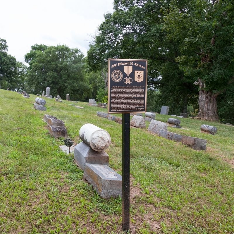
Near Alexandria Pike (U.S. 27) at the Evergreen Cemetery entrance.
Edward H. Ahrens was born on November 4, 1919 in Dayton, Kentucky
and enlisted in the United States Marine Corps on February 3, 1942.
Assigned to Company A, 1st Raider Battalion, Fleet Marine Force, Ahrens
landed with his unit—on Tulagi, . . . — — Map (db m279398) HM
Near 25 Alexandria Pike (U.S. 27) at the Evergreen Cemetery entrance, on the right when traveling south.
Richard Southgate, a lawyer, came to Newport in 1795. He was appointed Commonwealth Attorney for Campbell County in 1798,
voted State Representative in 1803, and served as State Senator from
1817-1821. The city of Southgate was named for him; at . . . — — Map (db m279754) HM
Near Alexandria Pike (U.S. 27) at the Evergreen Cemetery entrance, on the right when traveling south.
Walk down to the road behind this sign and you will find the Webster
crypt. Samuel Bigstaff, husband of Mary Alice Webster, is entombed here.
As a 17-year-old Confederate soldier, Samuel Bigstaff was taken prisoner by
the Union army and brought . . . — — Map (db m280341) HM
Near Alexandria Pike (U.S. 27) at the Evergreen Cemetery entrance, on the right when traveling south.
The Shaler Battery is a hilltop earthwork fortification
that was built in Northern Kentucky during the
American Civil War. The Battery’s purpose was to
turn back invading Confederate troops and protect
Cincinnati and the Ohio River Valley.
. . . — — Map (db m279316) HM
Near Alexandria Pike (U.S. 27) at the Evergreen Cemetery entrance, on the right when traveling south.
In 1862, the Confederate Army began marching towards Cincinnati. Union General Lew Wallace called for white volunteers from Cincinnati to build defenses but few answered the call.
On September 2, Provost Guards abducted black men from their homes . . . — — Map (db m279396) HM
On Alexandria Pike (U.S. 27) at the Evergreen Cemetery entrance, on the right when traveling south on Alexandria Pike.
One of youngest Kentuckians to receive the Medal of Honor for service during the Civil War is buried in Evergreen Cemetery. Horsfall, born in Newport, 1847, was a drummer in Company G, First Ky. Infantry (USA). Medal was awarded for saving the life . . . — — Map (db m62013) HM
Near Alexandria Pike (U.S. 27) at the Evergreen Cemetery entrance, on the right when traveling south.
William Horsfall ran away from home and became a
drummer in the Civil War. He hitched a ride on the
steamship Annie Laurie, which was docked in Newport. When he was just 15 he received the Medal of
Honor for saving the life of a high ranking . . . — — Map (db m280462) HM
Near Alexandria Pike (U.S. 27) at the Evergreen Cemetery entrance, on the right when traveling south.
This large monument at the top of the hill is the memorial to James
Taylor, Jr. He arrived in Newport in 1792 and laid out the town of
Newport. He was the executor of his friend David Leitch’s estate
and he later married Leitch’s widow, Keturah. . . . — — Map (db m279835) HM
On AA Highway (Kentucky Route 9) at Pooles Creek Road ( Route 1998), on the right when traveling east on AA Highway. Reported permanently removed.
Site of first white settlement in Campbell County. Established by Major David Leitch 1753-1794, aide-de-camp to General Lawson during the Revolutionary War. — — Map (db m279314) HM
On Highland Avenue (U.S. 42) east of Martin Road (Route 2350), on the right when traveling west.
Grave of one of founders of Port
William (now Carrollton). Craig
laid off town on 613 acres which
he and James Hawkins owned; the
legislature incorporated it in
1794. He erected the first brick
house in county, 1792. Born in
Virginia, 1751, . . . — — Map (db m136133) HM
On U.S. 42 east of Ware Avenue, on the right when traveling west.
First settled 1792, incorporated as Port William 1794. Carroll County formed and name of town changed to Carrollton by the Kentucky Legislature, 1838, both honoring "Charles Carroll of Carrollton" of Maryland, bold signer of the Declaration of . . . — — Map (db m22149) HM
Near General Butler Park Road east of 11th Street (Road 320).
Marker Front:
Col. Percival Butler was appointed Ky.'s first adjutant gen. in Gov. Isaac Shelby's first term. Born in Penn., he was with Washington at Valley Forge and Lafayette at Yorktown. Immigrated to Jessamine Co., Ky., then moved to . . . — — Map (db m22097) HM
On Highland Avenue (U.S. 42) at 2nd Street, on the right when traveling west on Highland Avenue.
In 1754 James McBride canoed down the Ohio to the mouth of this river—now Kentucky. Here, as first explorer, he carved his initials and the date on a tree, a landmark for 30 years. Cited for part in defense of Bryan Station and Battle of Blue . . . — — Map (db m136145) HM
Near General Butler Park Road east of 11th Street (aka: St. Rd. 320).
Born in Kentucky
April 19, 1791 - August 6, 1880
Transylvania University 1812
War of 1812 - Aide De Camp to Andrew Jackson
River Raisin - Pensacola - New Orleans
Mexican War - Major General of the Volunteers
Commanded 1st Volunteer . . . — — Map (db m22100) HM
On Fifth Street north of U.S. 42, on the left when traveling north.
Gen. William O. Butler, born Kentucky 1791, died here, 1880. War of 1812: River Raisin, Pensacola, and New Orleans. Gen. Andrew Jackson's staff 1816-17. Cited for heroism in Mexican War 1846-48. Practiced law here. Congressman 1839-43. Defeated as . . . — — Map (db m22131) HM
On U.S. 42 west of Fifth Street, on the right when traveling west.
In memory of the men of Carroll County
who gave their lives serving their Country and
to all people who have served their Country.
+ + + KOREA + + +
Clyde M. Carter
William A. Day
Bobby R. Schirmer
George W. Willett . . . — — Map (db m22156) WM
On Highland Avenue (U.S. 42) at 2nd Street, on the right when traveling west on Highland Avenue.
The Old Kentucky River Toll Bridge first surveyed November 1897 and incorporated Nov. 1898. J.F. Jett, M.I. Barker, John J. Orr, and Martin L. Downs were instrumental in obtaining bridge. Contract was let to Indiana Bridge Company, July 1899; bridge . . . — — Map (db m136142) HM
Blockhouse built here, 1789, by
Gen. Charles Scott for protection
of settlers against Indians who
had massacred and driven off
earlier families. Scott came
from Va., 1785. He was in the
French and Indian Wars. Organized
first company south of . . . — — Map (db m77353) HM
On U.S. 42 east of Carraco Road, on the left when traveling east.
Oldest brick house still standing in county, this was home of Richard and Sarah Masterson. Bricks laid in Flemish bond. House was center of town's activities. Mastersons, leading Methodists, opened their home for services before church erected in . . . — — Map (db m22128) HM
Center Panel:
The Price of Freedom
In honor and memory of all
Kentucky Veterans who served
our Country in times of Peace
and War, and to those who paid
the Supreme Sacrifice so that
we might enjoy freedom.
Their . . . — — Map (db m22321) HM
On U.S. 42 west of Fifth Street, on the right when traveling west.
In Memory of the Men 0f CARROLL COUNTY
who gave their lives
Serving Their Country
+ + + World War I + + +
Otis Arvin • Golden Bowie • Frank L. Grimes • Lester Williams Howard • Guy Kirkland • Walter Lewis • Joseph B. Schirmer • Chester . . . — — Map (db m22160) WM
On Main Street (U.S. 42) south of Main Cross Street ( Route 47), on the left when traveling south.
Known as McCool’s Creek Settlement
it was laid off in 1809 on land
of Samuel Sanders, whose father
was here early as 1795. Thirteen
families came from Virginia, 1800.
Traditionally, on visit here about
1816, Henry Clay a member of . . . — — Map (db m136129) HM
On Main Street (U.S. 42) at Ann Street, on the right when traveling south on Main Street.
Birthplace of poet, humorist,
columnist, raconteur, soldier.
He brought pleasure to thousands
with his dialectal stories and
banjo songs of the Blue Grass, and
his unique fictional character of
“Uncle Rambo.” For 20 years . . . — — Map (db m136132) HM
On Ghent-Eagle Station Road south of Dividing Ridge Road ( Route 2984), on the left when traveling south.
Home and family cemetery of Lewis
Sanders, 1781-1861. House built
1819, on land wife inherited from
Col. George Nicholas, key drafter
of Kentucky Constitution and the first
state Attorney General. Sanders
organized first Kentucky fair on . . . — — Map (db m136122) HM
On Kentucky Route 467 at Pike Street (Route 36), on the right when traveling east on Kentucky Route 467.
Gen. George Rogers Clark used
route through here, circa 1780s,
called Clark’s War Road,
Drennon’s Lick to Ohio River.
First called Rislerville, then
Liberty Station. In 1874, renamed
Sanders, for “Wash” Sanders, local
citizen . . . — — Map (db m136125) HM
On Hilltop Road (Route 170) 0.2 miles south of Elizaville Road ( Route 32), on the right when traveling south.
PFC Franklin Runyon Sousley USMCR. One of six of 28th Reg. 5th Marine Div. who raised flag on Suribachi 23 Feb. 1945. Immortalized in Joe Rosenthal's famed AP photograph. Sousley born Fleming County, 1925. Joined Marines, Jan. 1944. Landed on . . . — — Map (db m83494) HM
On Hilltop Road (Kentucky Route 170) at Elizaville Road ( Route 32), on the left when traveling south on Hilltop Road.
Displayed great coolness & courage under heavy enemy barrage when he went forward without hesitation to destroy enemy wire entanglements & continued this extremely hazardous work until killed on Aug. 17, 1918 near Frapelle, France. Posthumously . . . — — Map (db m83495) HM
On South Main Cross Street at Pumphrey Avenue ( Route 57), on the right when traveling north on South Main Cross Street.
Birthplace of Herman Chittison
Born in Flemingsburg, October 15, 1908, to Charles and Sarah Jane Chittison. He played hymns at Strawberry Methodist Church as a child. Attended Walden College in Nashville, 1924; later Ky. State Industrial . . . — — Map (db m83512) HM
On Court Square at North Main Cross Street ( Route 57), on the left when traveling south on Court Square.
Kentucky's 26th, formed from Mason in 1798. Named for John Fleming, Rev. War officer who came in 1776 to mark and improve land. Built Fleming's Station, among the county's earliest. Fellow pioneers were John Finley, Michael Cassidy, and George . . . — — Map (db m83507) HM
On North Main Cross Street (Kentucky Route 57) at Court Square, on the right when traveling south on North Main Cross Street.
The oldest section of this building, the ell that faces Court Square, was built in the early 1800's and used as a stage coach stop. In use as a hotel by 1833, this building was used to house victims of the cholera epidemic. The oldest section of . . . — — Map (db m83675) HM
On Court Square at East Main Street, on the right when traveling east on Court Square.
The building was purchased by the Gorman Construction Company in 1952 and served as its office and following a merger was home to the Kentucky Stone Company. The building was sold in 1974 to its current occupant, The Farmers Home Mutual Aid . . . — — Map (db m83673) HM
On North Main Cross Street (State Highway 57) at Main Street, on the right when traveling north on North Main Cross Street.
Andrews lived here 1859 - 62. In 1862 he led 22 Union soldiers into Georgia to cut the railway between Marietta & Chattanooga. Their capture of the locomotive "The General" and their pursuit by Confederates was a dramatic incident of the Civil War. — — Map (db m30016) HM
On Court Square at North Main Cross Street ( Route 57) on Court Square.
A native of Fleming County, this prize-winning journalist began his career with the Lexington Leader; later worked with Washington Bureau of Louisville Courier-Journal. Director and Vice President of CBS News, 1955-61, where he won two Emmy awards. . . . — — Map (db m83503) HM
On Elizaville Pike (Kentucky Route 32) at Cassidy Pike, on the left when traveling west on Elizaville Pike.
A fearless Indian fighter in over 30 battles, Michael Cassidy built Cassidy Station (site-one mile south) in later 1780s. A native of Ireland, he came to Va. as cabin boy at age 12. Enlisted early in Revolution and was with Washington at British . . . — — Map (db m83496) HM
On Electric Avenue at East Electric Avenue, on the right when traveling west on Electric Avenue.
Built before 1860, this building began as the E.A. DuPuy & Co. Mill & Distillery. Over the years, it has also served as a storage warehouse for the railroad and for a furniture company. It is currently home to an art galley called Banana Tree . . . — — Map (db m83671) HM
On Maysville Road (Business Kentucky Route 11) at West Water Street ( Route 559), on the right when traveling west on Maysville Road.
Site of station built in 1787 by Major George Stockton, who raised a crop here in 1786, while living at Strode's Station. This was the first of three forts in the area becoming Fleming County in 1798. — — Map (db m83499) HM
On Kentucky Route 111 at City Road, on the left when traveling north on Kentucky Route 111.
Built circa 1868-70, this bridge is a single 86 ft. span and a good example of Theodore Burr’s truss employing multiple king posts. The yellow pine timbers have double-shouldered braces. Abutments are of “red stone”; corrugated sheet . . . — — Map (db m146743) HM
On Ringos Mills Road (Kentucky Route 158) at Rawlings Road, on the left when traveling east on Ringos Mills Road.
This bridge and the surrounding
community developed because of a
grist mill operating on Fox Creek
in the mid 1800s. The single span
structure is 86 ft. long and built,
1867, on popular Burr truss design.
The original yellow pine . . . — — Map (db m146825) HM
On Muses Mill Road (Route 1103) at Morehead Road ( Route 32), on the right when traveling east on Muses Mill Road.
In a field 2½ miles east, rock slabs laid like a stone wall mark Robert Stockton’s grave. Buried where he fell, killed by Indians, 1789. His wounded companion, Beacham Rhodes, went back to Stockton’s Station. Returning to site with friends, they . . . — — Map (db m214364) HM
On Old State Highway 11 0.1 miles south of Old State Highway 1325, on the left when traveling south.
The most unusual of Kentucky's covered bridges is the Sherburne "suspension" bridge, built 1867-68 at a cost of $3,500. In the early days a stagecoach route from Mt. Sterling to Maysville crossed the bridge, then privately owned. This bridge is 266 . . . — — Map (db m83490) HM
On Morehead Road (Kentucky Route 32) near Covered Bridge Road. Reported missing.
Goddard “White” Bridge
This covered bridge is the only surviving example of Ithiel Town Lattice design in Ky. The timbers are joined with wooden pegs (tree-nails); its date of construction and original builder are unknown. The 63-foot . . . — — Map (db m284006) HM
On East Main Street (U.S. 42) east of Main Cross Street, on the right when traveling east.
is a contributing property to the
Warsaw Historic District
listed in the
National Register
of Historic Places
by the United States
Department of the Interior — — Map (db m223026) HM
On Main Cross Street (Kentucky Route 35) at East Market Street, on the right when traveling north on Main Cross Street.
is a contributing property to the
Warsaw Historic District
listed in the
National Register
of Historic Places
by the United States
Department of the Interior — — Map (db m223080) HM
On East Main Street (U.S. 42) at Washington Street, on the right when traveling west on East Main Street.
County named, 1798, for Albert Gallatin, 1761-1849, a Swiss who came to the U.S., 1780. Pennsylvania Constitutional Convention, 1789-90; Legislature, 3 years. Congress, 1795-1801. Leader in finance, constitutional and international law, Secretary of . . . — — Map (db m136119) HM
On West High Street at Franklin Street, on the right when traveling west on West High Street.
is a contributing property to the
Warsaw Historic District
listed in the
National Register
of Historic Places
by the United States
Department of the Interior — — Map (db m222952) HM
On Main Cross Street (Kentucky Route 35) south of West Pearl Street, on the right when traveling south.
is a contributing property to the
Warsaw Historic District
listed in the
National Register
of Historic Places
by the United States
Department of the Interior — — Map (db m223162) HM
On West High Street at 5th Street, on the left when traveling west on West High Street.
is a contributing property to the
Warsaw Historic District
listed in the
National Register
of Historic Places
by the United States
Department of the Interior — — Map (db m222970) HM
On East Main Street (U.S. 42) west of 2nd Street, on the left when traveling west.
is a contributing property to the
Warsaw Historic District
listed in the
National Register
of Historic Places
by the United States
Department of the Interior — — Map (db m223021) HM
On West High Street east of 4th Street, on the right when traveling east.
is a contributing property to the
Warsaw Historic District
listed in the
National Register
of Historic Places
by the United States
Department of the Interior — — Map (db m222975) HM
On East High Street at 1st Street, on the right when traveling west on East High Street.
is a contributing property in the
Warsaw Historic District
listed in the
National Register
of Historic Places
by the United States
Department of the Interior — — Map (db m222990) HM
On East Main Street (U.S. 42) at Washington Street, on the right when traveling west on East Main Street.
is a contributing property to the
Warsaw Historic District
listed in the
National Register
of Historic Places
by the United States
Department of the Interior — — Map (db m223041) HM
On Main Cross Street (Kentucky Route 35) at East Pearl Street, on the left when traveling south on Main Cross Street.
is a contributing property to the
Warsaw Historic District
listed in the
National Register
of Historic Places
by the United States
Department of the Interior — — Map (db m223155) HM
On West Main Street at Franklin Street, on the right when traveling west on West Main Street.
World War I
Lee T. Furnish • Henry E. Hudson • Howard Satchwell • Taylor Brashear • Frank Sisson • Mike Holt Webster • Perry E. James • Calvert Washburn • Jesse L. Beard • Van M. Hendrix • Jesse Mylor • Reveille E. Swango • Florian W. Griffin . . . — — Map (db m223050) WM
On East Main Street (U.S. 42) at Washington Street, on the right when traveling west on East Main Street.
Birthplace of Richard Yates, 1818. In Illinois legislature for three terms; U.S. Congress, 1851-55. As Governor of Illinois, 1861-65, he vigorously supported Lincoln and state exceeded the call for volunteers. Member U.S. Senate, 1865-71. Delegate . . . — — Map (db m136120) HM
On U.S. 42 at U.S. 127, on the right when traveling west on U.S. 42.
At midnight of Dec. 4, 1868 two cabined
passenger steamers plying between Louisville
and Cincinnati collided two miles above
Warsaw. The America rammed deeply into the
United States. Barrelled coal oil on deck of
the latter caught . . . — — Map (db m136087) HM
On East Market Street at 2nd Street, on the right when traveling east on East Market Street.
is a contributing property to the
Warsaw Historic District
listed in the
National Register
of Historic Places
by the United States
Department of the Interior — — Map (db m223055) HM
On Market Street at 2nd Street, on the right when traveling east on Market Street.
Built c. 1843 By Edmund Waller Hawkins
A Gift to
The Gallatin County Historical Society in 1984
from Harold Brown Connely Weldon
in memory of her grandmother,
Beall Summons Brown
1858 - 1942 — — Map (db m223066) HM
On Sparta Pike (Kentucky Route 35) at Kirby Avenue, on the left when traveling south on Sparta Pike.
is a contributing property to the
Warsaw Historic District
listed in the
National Register
of Historic Places
by the United States
Department of the Interior — — Map (db m223171) HM
On Washington Street at East High Street, on the right when traveling north on Washington Street.
is a contributing property to the
Warsaw Historic District
listed in the
National Register
of Historic Places
by the United States
Department of the Interior — — Map (db m222977) HM
On East High Street east of Center Street, on the left when traveling east.
is a contributing property to the
Warsaw Historic District
listed in the
National Register
of Historic Places
by the United States
Department of the Interior — — Map (db m223002) HM
On Main Cross Street (Kentucky Route 35) south of West Main Street (U.S. 42), on the right when traveling south.
is a contributing property to the
Warsaw Historic District
listed in the
National Register
of Historic Places
by the United States
Department of the Interior — — Map (db m223153) HM
On East High Street east of 1st Street, on the left when traveling east.
is a contributing property to the
Warsaw Historic District
listed in the
National Register
of Historic Places
by the United States
Department of the Interior — — Map (db m223001) HM
On Main Cross Street (Kentucky Route 35) south of West Pearl Street, on the right when traveling south.
is a contributing property to the
Warsaw Historic District
listed in the
National Register
of Historic Places
by the United States
Department of the Interior — — Map (db m223156) HM
On 2nd Street at East Market Street, on the right when traveling north on 2nd Street.
is a contributing property to the
Warsaw Historic District
listed in the
National Register
of Historic Places
by the United States
Department of the Interior — — Map (db m223070) HM
On East High Street at 2nd Street, on the right when traveling west on East High Street.
is a contributing property to the
Warsaw Historic District
listed in the
National Register
of Historic Places
by the United States
Department of the Interior — — Map (db m222987) HM
On Sparta Pike (Kentucky Route 35) at Kirby Avenue, on the right when traveling south on Sparta Pike.
is a contributing property to the
Warsaw Historic District
listed in the
National Register
of Historic Places
by the United States
Department of the Interior — — Map (db m223164) HM
On East Main Street (U.S. 42) at 2nd Street, on the right when traveling west on East Main Street.
is a contributing property to the
Warsaw Historic District
listed in the
National Register
of Historic Places
by the United States
Department of the Interior — — Map (db m223005) HM
On Washington Street at East Main Street (U.S. 42), on the right when traveling north on Washington Street.
is a contributing property to the
Warsaw Historic District
listed in the
National Register
of Historic Places
by the United States
Department of the Interior — — Map (db m223039) HM
On East Main Street (U.S. 42) at Washington Street, on the right when traveling east on East Main Street.
is a contributing property to the
Warsaw Historic District
listed in the
National Register
of Historic Places
by the United States
Department of the Interior — — Map (db m223027) HM
On East High Street at 2nd Street, on the right when traveling east on East High Street.
is a contributing property to the
Warsaw Historic District
listed in the
National Register
of Historic Places
by the United States
Department of the Interior — — Map (db m222985) HM
On West High Street at Main Cross Street, on the right when traveling west on West High Street.
is a contributing property to the
Warsaw Historic District
listed in the
National Register
of Historic Places
by the United States
Department of the Interior — — Map (db m222961) HM
On East Main Street at Main Cross Street, on the right when traveling east on East Main Street.
is a contributing property to the
Warsaw Historic District
listed in the
National Register
of Historic Places
by the United States
Department of the Interior — — Map (db m223037) HM
On East Pearl Street at 1st Street, on the right when traveling east on East Pearl Street.
is a contributing property to the
Warsaw Historic District
listed in the
National Register
of Historic Places
by the United States
Department of the Interior — — Map (db m223074) HM
On Violet Rd (Kentucky Route 491), on the left when traveling west.
Three miles west. Reputedly scene of one of last massacres in Ky. McClures and Kennedy's lived on hills above Bullocks pen creek and the Bran family occupied cabin on creek at foot of hills. Around 1805, party of Indians burned the Bran home after . . . — — Map (db m82149) HM
On Warsaw Avenue west of North Main Street (U.S. 25), on the left when traveling west.
Organized 1791 as Baptist Church
by Elders Lewis Corban and John
Conner. Indians threatened early
services. Squire Boone preached
here, 1798. Reorganized in 1826 as
Williamstown Particular Baptist
Church by William. Conrad, imprisoned
as . . . — — Map (db m180562) HM
On Stewartsville Road (Kentucky Route 36) at South Main Street (U.S. 25), on the left when traveling east on Stewartsville Road.
Three Confederates were brought here from prison at Lexington and executed Aug. 15, 1864; reprisal for the guerrilla murder of Union sympathizers, Joel Skirvin and Anderson Simpson. Those executed: Wm. P. and John L. Lingenfelter, brothers of Mrs. . . . — — Map (db m143036) HM
On North Main Street (U.S. 25) at Court Street and Paris Street ( Route 22), on the left when traveling north on North Main Street.
Formed from Pendleton County in
1820. Named for two brothers who
came from N.C., 1779, established
Grant’s Station, Fayette County.
John developed salt works on the
Licking River. Samuel was killed
by Indians in Indiana in 1794.
William . . . — — Map (db m180614) HM
On North Main Street (U.S. 25) at Court Street and Paris Street ( Route 22), on the left when traveling north on North Main Street.
World War I April 1917 – November 1918
——————————
The dead speak more eloquently of their deeds that the living every could. —A. Lincoln
——————————
Russell Adams • . . . — — Map (db m180596) WM
On North Main Street (U.S. 25) at Court Street and Paris Street ( Route 22), on the left when traveling north on North Main Street.
On Nov. 1, 1864, planning to seize reported large sum of USA money, a Confederate force of 32 under Colonel R. J. Breckinridge, Jr., and Major Theophilus Steele raided the city. Finding money removed, they plundered Tunis’ Store, taking 30 USA . . . — — Map (db m180616) HM
On Paris Pike (U.S. 27), on the left when traveling south.
(Front):1st Battle of CynthianaDuring CSA Col. John H. Morgan’s 1st KY Raid, on July 17, 1862, 875 CSA hit town via the Georgetown Pike. 350 US troops & Home Guard defended town from houses. Morgan attacked across Licking River and . . . — — Map (db m35858) HM
Near Court Street (U.S. 27) south of West Pleasant Street, on the left when traveling south.
[Bench back]
When Americans lend a hand to another,
nothing is impossible.
We are not about what happened on 9/11.
We are about what happened on 9/12.
[Bench seat]
09-11-2001
We will never forget
343 firefighters • 72 . . . — — Map (db m218093) HM
On Paris Pike (U.S. 27) 0.2 miles west of McIlvain Blvd., on the left when traveling south.
Dr. James A. Henshall, 1836-1925, author Book of the Black Bass and others, brought fame to Kentucky's South Licking, Elkhorn, and Stoner streams. He came here to practice medicine. During Civil War treated wounds for US and Confederate men. . . . — — Map (db m35859) HM
On Williamstown Road (Kentucky Route 36) at A Keller Dam Road, on the right when traveling north on Williamstown Road.
After capturing Cynthiana early June 11, 1864, CSA Gen. John H. Morgan attacked Union Gen. Edward H. Hobson at Keller’s Bridge on the Kentucky Central Railroad. The 171st Ohio Infantry, with 600 “100-days men,” arrived at dawn by rail from . . . — — Map (db m218053) HM
On South Main Street (U.S. 27), on the right when traveling south. Reported damaged.
Rebel Raider John Hunt Morgan's two famous Kentucky raids in 1862 and 1864 included significant engagements with Union forces at Cynthiana. Morgan's mission was to destroy railroad facilities, disrupt communications, acquire supplies, recruit, . . . — — Map (db m218101) HM
On South Main Street (Courthouse Access Parking) north of Pike Street.
For Colonel Benjamin Harrison, who came to area, 1776. Served as Col. in Revolution from Penn. He was a member, 1787 and 1788 Kentucky Conventions, 1792 Constitutional Convention at Danville. Elected to Kentucky Legislature in 1793. County formed . . . — — Map (db m67683) HM
Near East Pike Street (Kentucky Route 32) at Confederate Drive, on the right when traveling east.
Erected
May 27, 1869
by the
Cynthiana Confederate
Memorial Association
in memory of
the Confederate dead who
fell in defense of
constitutional liberty
Their names shall never be forgot
while fame her record keeps,
and glory . . . — — Map (db m172625) WM
On Paris Pike (U.S. 27), on the right when traveling south.
Native of Cynthiana. Walter E. Scott (Death Valley Scotty), gold prospector, whose fabulous tales of Death Valley, Calif., lost gold mines fooled investors. Stories supported by $3,000,000 castle in desert provided by millionaire of Chicago, who . . . — — Map (db m36088) HM
On Main Street at Pike Street, on the left when traveling north on Main Street.
DD43, 1913-1935
DD372, 1935-1947
This bell is dedicated to all those killed in the Japanese attack on Pearl Harbor, Hawaii, Dec. 7, 1941.
USS Cassin, DD43, was torpedoed in WWI.
USS Cassin, DD372, was bombed and burned at Pearl Harbor, . . . — — Map (db m67686) WM
On West Penn Street at County Road 1004, on the right when traveling west on West Penn Street.
School named for Benjamin Banneker
Principals were
W. E. Newsom
E. O. David
Consolidated with
Harrison County School System 1963 — — Map (db m218105) HM
On South Main Street (U.S. 62) at Pike Street ( Route 32), on the right when traveling south on South Main Street.
Harrison County Courthouse
Cynthiana, Ky 41031
Court Square given to county by Robert Harrison 1792
Third and present courthouse erected 1853
Original contractor, John Huddleston
Clock and bell added 1856
North and south wings . . . — — Map (db m172592) HM
On East Pike Street (Kentucky Route 32) at Confederate Dr., on the right when traveling east on East Pike Street.
Dedicated to all men and women from Harrison County who served in all branches of the military service on behalf of our country
Distinguished gallantry and valor above and beyond the call of duty
Once in our lives
Forever in our hearts . . . — — Map (db m172600) WM
On South Main Street (U.S. 27), on the right when traveling south.
Vietnam Veterans Memorial
March 1962 – January 1973
“The noblest of mankind …
those who offered and gave
their lives for their country.”
Clifton Frederick, Jr. Sept. 5, 1930 - Jan. 22, 1967 Army SP6
David Glenn . . . — — Map (db m218100) WM
On South Main Street (U.S. 27) south of West Pleasant Street ( Route 36), on the right when traveling south.
In memory of
our heroic dead
World War II
Edward R. Dearing • Carl W. Whitson • Robert C. Luke • Edgar E. Anness • Hillard C. Mullin • James E. Rees • Benjamin R. Whiteker • Jerry Walsh • John W. Monson • Stanley R. Justice • Martin L. . . . — — Map (db m218098) WM
On North Main Street (Kentucky Route 36) at Pike Street, on the right when traveling south on North Main Street.
Those who gave their lives to stop the advance of Communism
Korean Service Medal
This memorial is dedicated to those from Harrison County who served with honor and valor to preserve the cause of freedom and halted aggression against the . . . — — Map (db m172025) WM
On Carl Stevens Road (Kentucky Route 1743) 1 mile south of Poindexter Road, on the left when traveling south.
Lindsey Cemetery Located one-half mile east, this pioneer cemetery is the burial place of settlers, among them four Revolutionary War veterans, Rangers of the Frontiers, 1778-83: Capt. Thomas Moore, Capt. William Moore, Lt. David Lindsey, John . . . — — Map (db m218052) HM
On Court Street at McKnight Alley, on the right when traveling north on Court Street.
On September 11, 2001, there were a series of four coordinated suicide attacks by al-Qaeda upon the United States of America. On that morning, 19 al-Qaeda terrorists hijacked four commercial passenger jet airliners.
The hijackers intentionally . . . — — Map (db m218096) HM
On South Main Street (U.S. 27), on the right when traveling south.
North United States 200th anniversary time capsule buried in 1976 contains histories of families, places and businesses of Harrison County to be opened in 50 years on July 4, 2026.
South Harrison County's 175th anniversary history . . . — — Map (db m281408) HM
On Court Street at McKnight Alley, on the left when traveling north on Court Street.
Oldest house in Cynthiana, built 1790. Young Henry Clay practiced law here, 1806. In 1817, city's first newspaper, the Guardian of Liberty was printed by Adam Keenan, assisted by H. H. Kavanaugh, later a noted Bishop, and Dudley Mann, who . . . — — Map (db m84384) HM
483 entries matched your criteria. Entries 101 through 200 are listed above. ⊲ Previous 100 — Next 100 ⊳