Near State Capitol Drive east of North 3rd Street, on the left when traveling east.
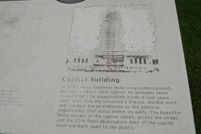
In 1931, when Governor Huey Long commissioned America's tallest state capitol, he probably never guessed he'd be assassinated inside it four years later. Note how the structure's friezes, marble-work and statuary are as elaborate as the political . . . — — Map (db m88738) HM
On North 8th Street 0.2 miles north of North Street, on the right when traveling north.
Castro Carazo, hand-picked by Huey P. Long to head LSU's marching band, lived here where he operated a private music studio. A native of Costa Rica, Carazo wrote the music for Long's campaign song "Every Man a King" as well as the State's official . . . — — Map (db m179069) HM
Near Capitol Lake Drive west of Capitol Access Road (Louisiana Highway 3045), on the left when traveling west.
One of a group of mounds probably constructed about A.D. 1000 during the Cole Creek culture period. Surrounded by a large village area, such mounds served as foundations for sacred buildings and as platforms for the chief to address the tribesmen. . . . — — Map (db m87446) HM
On North 5th Street south of Laurel Street, on the right when traveling north.
This site was purchased by the organizers of what is today Congregation B'Nai Israel, one of the oldest Reform Jewish congregations in America. The earliest records of the congregation date to 1858. The original charter stated the Congregation's . . . — — Map (db m98268) HM
Near State Capitol Drive at Capitol Access Road, on the left when traveling east.
This reproduction of the Liberty Bell was presented to the people of
Louisiana
by direction of The Honorable John W. Snyder Secretary of the Treasury
As the inspirational symbol of the United States Savings Bonds Independence Drive . . . — — Map (db m113863) HM
On State Capitol Drive east of River Road (Business U.S. 61), on the left when traveling east.
The first official air mail flight between cities in the United States landed on the LSU athletic field April 10, 1912. After taking off from the City Park Race Course in New Orleans, aviator George Mestache flew a monoplane with a 32-pound pouch of . . . — — Map (db m87473) HM
On River Road (Business U.S. 190) north of North Street, on the right when traveling north.
Fort Baton Rouge was located across the River Road from this marker. The fort was established in 1764 by Lt. Colonel Alexander Dickson, British Army commander. On September 21, 1779. General Bernardo de Gálvez, then the governor of Spanish . . . — — Map (db m306010) HM
Near North 3rd Street at Spanish Town Road, on the right when traveling south.
Here on a bluff of the river stood the old star-shaped Spanish fort from which the West Florida parishes were governed in Spanish colonial days 1779-1810. It was captured by the forces of the West Florida Republic led by Philemon Thomas, Sept 23, . . . — — Map (db m87822) HM
Near North 3rd Street at Spanish Town Road, on the left when traveling north.
Boom, boom, boom! Cannon fired all day across these grounds on September 21st, 1779, until the British flag finally came down. The Spanish victor's troops included African-Americans, Native-Americans, and French-Acadian refugees, in this, the . . . — — Map (db m138445) HM
On North 3rd Street at Laurel Street, on the left when traveling north on North 3rd Street.
According to local tradition, Charles Weick named his newly purchased saloon the day after Fort Sumter was fired on, 1861, and put the cannon out front for atmosphere. It was one of the city's most popular saloons until prohibition. — — Map (db m88273) HM
On Main Street at North Fourth Street, on the right when traveling east on Main Street.
These four corners were dedicated for public use in 1809 by Antonio Gras and Edith and Richard Devall. A market was to be in the center, and the corners were used for hitching horses and wagons. — — Map (db m87869) HM
On Third Street near Florida Street, on the right when traveling north.
One of 200 Historic Hotels of America, the Hilton Baton Rouge Capitol Center was first built in 1927 as the Hotel Heidelberg, the city's first luxury hotel and site of noteworthy social and political events. Governor Huey P. Long kept an unofficial . . . — — Map (db m104254) HM
Near State Capitol Drive west of North 5th Street, on the right when traveling east. Reported missing.
Public service commissioner, then governor, finally U.S. senator, Huey Pierce Long went from obscure upstate lawyer to flamboyant national figure. Along the way, he built a political dynasty—as well as roads, bridges, hospitals and schools. . . . — — Map (db m87430) HM
Near State Capitol Drive at Capitol Access Road, on the left when traveling east.
Unanimously elected
Commander in Chief of the Continental Army (1775-1783)
President of the Constitutional Convention (1787)
President of the United States of America (1789-1797)
A gift to the people of Louisiana by
The Louisiana . . . — — Map (db m113864) HM
On Lafayette Street south of Laurel Street, on the left when traveling south.
One of the earliest remaining architecturally significant buildings in the city. Originally the residence of Judge Charles Tessier, first Probate Judge of East Baton Rouge Parish, who acquired the property in the early 1800's through the claim of . . . — — Map (db m88281) HM
The Louisiana Gold Star Families Memorial Monument pays
tribute to Families who lost a Loved One in the service of the
United States Armed Forces.
The Homeland panel represents the state of Louisiana.
The state seal features a pelican tearing . . . — — Map (db m126714) WM
Near State Capitol Drive near North Fifth Street, on the left when traveling north.
Since 1636, the Minuteman has kept vigilant watch over our Nation and represents the men and women of the Louisiana National Guard who proudly serve and bravely answer the call of duty. Honored here are those who made the ultimate sacrifice to . . . — — Map (db m145225) HM WM
On Spanish Town Rd. near N. 4th Street, on the right when traveling east.
In 1885, Louisiana State University moved from Mid-State city of Alexandria to this site, taking over the decommissioned Baton Rouge Arsenal. Nicknamed the "Old War Skule" on these grounds LSU saw its first intercollegiate football game, regular . . . — — Map (db m87429) HM
On North 4th Street north of Florida Street (Business U.S. 190), on the right when traveling north.
On this site stood the home of Sarah Morgan Dawson (1842-1909) who wrote A Confederate Girl's Diary, which has become a Civil War classic. The diary depicts the occupation of Baton Rouge by Union forces. — — Map (db m92412) HM
Near State Capitol Drive at Capitol Access Road, on the left when traveling east.
This 1835 building's 4½ foot thick walls were designed to protect gunpowder stored inside—and help contain the explosion if that protection failed. It was part of an army post that covered these grounds from 1810 to 1885. The Civil War . . . — — Map (db m113861) HM
On North Fourth Street 0.1 miles north of North Street, on the left when traveling north.
From 1810 to 1888, the area around the State Capitol was an extensive U.S. Army arsenal and supply depot. Today, the last remaining arsenal is a museum that features replicas of powder-filled casks, as well as interpretive information about 19th . . . — — Map (db m98054) HM
On North Fourth Street north of Laurel Street, on the right when traveling north.
Named for company member, John O. Bradford, Old Brad, the first service horse in the Baton Rouge Fire Department, is buried in front of his beloved Washington No. 1 Firehouse. He served 28 years, actively for 15. After retiring, he was allowed to . . . — — Map (db m158615) HM
On North 3rd Street south of State Capitol Drive, on the left when traveling south.
Site of the
Louisiana State University
1886 - 1925
This marker
erected by the last generation
of the
Cadets of the 'Ole War Skule'
To honor the men and women
who attended or served
Louisiana State University
while on these . . . — — Map (db m85698) HM
On North 4th Street at Laurel Street, on the right when traveling north on North 4th Street.
Incorporated January 25, 1834, the church was built on this site in 1836, Charles K. Marshall, Pastor. Enlarged under the leadership of the Reverend William E. M. Linfield in 1860, it was used until March 28, 1926, when the congregation moved to a . . . — — Map (db m88303) HM
On Florida Street (Business U.S. 61/190) at North 4th Street, on the right when traveling east on Florida Street.
Organized May 27, 1827, after twelve years of missionary work by the Presbytery of Mississippi, John Dorrance first minister. Sanctuary dedicated in 1829. Rebuilt in 1854 on the same site and used until 1926 when new building was erected on the . . . — — Map (db m85342) HM
On North 3rd Street north of State Capitol Drive, on the right when traveling north.
In 1825, four military barracks were built to support the U.S. Army arsenal that occupied much of today's Capitol Park. A fifth barrack that completed the pentagon arrangement was built so poorly it was demolished shortly after construction. . . . — — Map (db m96740) HM
On North 3rd Street at Spanish Town Road, on the right when traveling south on North 3rd Street.
Begun in 1819, construction dragged on for five years because of epidemic yellow fever. Its fifth building (hence the name "pentagon") soon collapsed into a pile of bricks. But the remaining structures survived both Civil War bombardment and nearly . . . — — Map (db m87472) HM
Near North 3rd Street south of State Capitol Drive, on the right when traveling south.
Constructed 1819-1822 to house U.S. troops. Used as a garrison from 1822-1877 except from 1861-1862 when held by Confederates. From 1886-1925 these buildings and grounds were the site of Louisiana State University. — — Map (db m85704) HM
On North Street at Lucilla Lane, on the right when traveling west on North Street.
Little cottage typical of the wood frame residences of early Spanish Town. Originally, the house was one room deep with galleries, front and rear. The original lot, 160 feet wide and extending from North Street to Spanish Town Road was purchased by . . . — — Map (db m87282) HM
On North Street at North 9th Street, on the right when traveling west on North Street.
Built in the Classic Revival Style between 1846 and 1850 by Nelson Potts, Master Brick Mason, as an example of his craft as well as his home. Potts was one of the major builders of Baton Rouge during the mid-19th century. — — Map (db m87278) HM
Near North Third Street near Spanish Town Road, on the left when traveling south.
En este lugar fué creada la fraternidad Sigma Iota en el año de nuestro Señor de 1904 Convencion de 1929. English translation: Here in this place was created the Sigma Iota Fraternity in the Year of Our Lord 1904 . . . — — Map (db m137720) HM
On this site stood the Spanish Fort captured by the forces of the Republic of West Florida September 23, 1810. Erected by the Historical Society of East & West Baton Rouge January 16, 1917 in celebration of the centennial of the City — — Map (db m242219) HM
On Spanish Town Road at North Seventh Street, on the left when traveling east on Spanish Town Road.
On July 7, 1872, Rev. George Bird and the congregation of Shiloh Church dedicated the cornerstone of their new frame church on this site. For more than forty years the Church occupied a prominent place in the life of Spanish Town. In March 1918 this . . . — — Map (db m87371) HM
On Spanish Town Road at 7th Street, on the left when traveling east on Spanish Town Road.
On July 7, 1872, Rev. George
Bird and the congregation of
Shiloh Church dedicated the
cornerstone of their new frame
church on this site. For more
than forty years the Church
occupied a prominent place in
the life of Spanish Town. In
March . . . — — Map (db m259368) HM
On Lakeland Drive west of North 6th Street, on the right when traveling west.
On September 8, 1935, Dr. Carl Austin Weiss was living here with his family in a small frame cottage. About 9:30 that evening, U.S.Senator Huey P. Long was shot in the corridor just off the house chamber of the State Capitol. Weiss, the alleged . . . — — Map (db m88591) HM
On North 5th Street at Spanish Town Road, on the right when traveling north on North 5th Street.
East of this point was Spanish Town, laid out in 1805 by Carlos GrandPré, Governor of Spanish West Florida for the Canary Islanders from Galvez Town that they might continue to live on Spanish soil and help defend the forts. Spanish Town Road is now . . . — — Map (db m88592) HM
On North Sixth Street north of North Street, on the left when traveling south.
Founded in 1805, Spanish Town is Baton Rouge's oldest neighborhood having the oldest architectural history in the area. The surviving buildings represent popular styles from a period of Louisiana's history.
Spanish settlers from the Canary . . . — — Map (db m97968) HM
On Main Street at Norrth Fourth Street, on the left when traveling east on Main Street.
Built in 1853 to 1856 on the site of two earlier churches. The first erected about 1790 under Spanish rule was called "Our Lady of Sorrows." The first marriage recorded was that of Don Antonio Gras, an early Spanish resident who donated the land. . . . — — Map (db m87854) HM
On North Street at North 4th Street, on the right when traveling west on North Street.
The Brothers of the Sacred Heart founded St. Vincent's Academy on this site in 1894. In 1929 the school for boys was replaced by a larger facility and renamed Catholic High School. In 1957 the school was moved to its present location on Hearthstone . . . — — Map (db m87444) HM
On North Street at Lucillia Lane, on the left when traveling east on North Street. Reported missing.
Built about 1850 by Nathan King Knox and first occupied by the Stewart-Dougherty families, this house was used as a hospital by Union soldiers during the Civil War. It is an excellent example of Classical Revival architecture. — — Map (db m72959) HM
Planted In Loving Memory Of
Influential Louisiana Creole Singer, Songwriter and Accordionist
Amédé Ardoin
March 11, 1898-November 3, 1942
Born near Basile in Evangeline Parish
Amédé Ardoin created the framework for Cajun, Creole and . . . — — Map (db m242218) HM
Near Main Street west of North 4th Street, on the left when traveling west.
The former Baptismal fount from St. Joseph Cathedral. The first baptism recorded here was Juan Josef Trahan, son of Juan Marie Trahan of Morlaix, Britanny, France and Adelaida Tulier of Cherbourg, Normandy, France. He was born June 19, 1793 and . . . — — Map (db m93354) HM
On Capitol Lake Drive near Capitol Access Road, on the right when traveling east.
This monument honors the brave service and sacrifices of all African-American Veterans
and their families from Louisiana and nationwide. It begins with the 1863 Siege at
Port Hudson, Louisiana, the first time Black soldiers had the opportunity to . . . — — Map (db m232815) HM WM
On River Road (Business U.S. 61/190) 0.2 miles north of North Street, on the right when traveling north.
Look over the water and across time. Do you hear the paddling of Native American dug-outs? Thunderous volleys from the Civil War gunboat pictured above? Perhaps Mark Twain piloting a paddle-wheeler or P.T. Barnum beckoning with his showboat's . . . — — Map (db m88295) HM
On North Third Street 0.1 miles north of Capitol Access Road, on the left when traveling north.
The stately Old Governor's Mansion was commissioned in 1929 by Governor Huey P. Long in a style that deliberately mimicked the White House. It replaced a simple frame structure on roughly the same property and served as official residence until . . . — — Map (db m98053) HM
On North 3rd Street north of State Capitol Drive, on the right when traveling north.
Dedicated in 1932, the Louisiana State Capitol was commissioned by Governor Huey P. Long and was meant to symbolize the state's progress and modernity. At 34 stories, it is the highest state capitol in America and its Art Deco-inspired lines, . . . — — Map (db m96604) HM
On North 3rd Street at Spanish Town Road, on the left when traveling south on North 3rd Street.
To honor
Zachary Taylor
U.S. Army General and twelfth President
of the United States
Known to Americans as
"Old Rough and Ready"
and who lived for a time some 200 yards
southwest of this spot
This marker placed in 1951 by . . . — — Map (db m87482) HM WM
On Lafayette Street west of North 3rd Street, on the right when traveling south.
"Old Rough and Ready," America's 12th president, lived on this site in the home pictured above. He called the cottage Buena Vista after his famous 1847 victory in the Mexican War. The pale horse pictured was Taylor's favorite, "Whitey." It would . . . — — Map (db m87824) HM
On Park Boulevard at Wisteria Street, in the median on Park Boulevard.
Colonel Henry Watkins Allen, later governor of Confederate Louisiana, was severely wounded near here in the Battle Of Baton Rouge, August 5, 1862. He fell while leading his Louisiana brigade against the Indiana battery in position on Government near . . . — — Map (db m86585) HM
Near Oxford Avenue near Amherst Avenue, on the right when traveling west.
The Highland Ridge which borders Bayou Fountain and extends to Ward's Creek was settled as early as 1784 by predominantly German and Acadian folk through Spanish land grants. Be it recorded here that the names of early settlers to "The Highlands" . . . — — Map (db m143779) HM
Near Essen Lane (State Road 3064) south of Interstate 10, on the right when traveling south.
This building is a representation of a small eighteenth century sugar house employing the open-kettle process developed in the West Indies. It was built to show the style of old sugar houses pre-1820 when they were replaced by sugar factories. This . . . — — Map (db m112083) HM
On West Stadium Drive north of South Stadium Drive, on the left when traveling north.
Overall Record:9-2 | SEC Record: 5-0 Head Coach Bernie Moore LSU great Abe Mickal and freshman sensation Gaynell "Gus" Tinsley led the 1935 Tigers to an undefeated SEC record. LSU fell to Rice in the season opener but did not lose again in the . . . — — Map (db m98765) HM
On West Stadium Drive north of South Stadium Drive, on the left when traveling north.
Overall Record: 9-1-1| SEC Record; 6-0 Head Coach Bernie Moore After going 1-1 to open the season, Bernie Moore's Tigers did not lose again for the remainder of the regular season. LSU's high powered offense, led by Gaynell "Gus" Tinsley and . . . — — Map (db m98763) HM
On West Stadium Drive north of South Stadium Drive, on the right when traveling north.
Overall Record: 11-0 | SEC Record 6-0 Head Coach Paul Dietzel The legendary 1958 team compiled LSU's first perfect season since 1908 and became the first squad in school history to win the national title. Looking to build on a previous season . . . — — Map (db m98288) HM
On West Stadium Drive north of South Stadium Drive, on the left when traveling north.
Overall Record: 11-0 | SEC Record: 6-0 Head Coach Paul Dietzel The legendary 1958 team compiled LSU's first perfect season since 1908 and became the first squad in school history to win the national title. Looking to build on a previous season . . . — — Map (db m99199) HM
On West Stadium Drive north of South Stadium Drive, on the left when traveling north.
Overall Record: 10-1 | SEC Record: 6-0 Head Coach Paul Dietzel LSU did not let a season opening loss to Rice spoil a tremendous year for the Tigers on the gridiron. Over the final nine games, LSU allowed a measly 30 points, with 14 of those . . . — — Map (db m99196) HM
On West Stadium Road north of South Stadium Drive, on the left when traveling north.
Overall Record: 9-3 | SEC Record: 5-0 Head Coach Charles Mcclendon LSU won seven of its first eight games including a victory at Auburn over future Heisman Trophy winner Pat Sullivan, and a win in Birmingham over Alabama, the Tigers' second . . . — — Map (db m99249) HM
On West Stadium Road north of South Stadium Drive, on the left when traveling north.
Overall Record: 9-3 | SEC Record: 5-1 Head Coach Bill Arnsparger The 1986 season got off to a flying start for LSU with an upset of Texas A&M before a shocking loss to Miami of Ohio. After that temporary setback, LSU began to roll behind . . . — — Map (db m99231) HM
On West Stadium Road north of South Stadium Drive, on the left when traveling north.
Overall Record: 8-4 | SEC Record: 6-1 Head Coach Mike Archer The Tigers looked like champions early by thrashing Texas A&M then taking LSU's first win ever in Knoxville with a rout of Tennessee. After setbacks in road games at Ohio State and . . . — — Map (db m99327) HM
On Gourrier Avenue 0.3 miles west of Nicholson Drive (Louisiana Highway 30), on the right when traveling west.
LSU captured their first national championship in 1991 with a record-setting performance at the College World Series. The Tigers, who defeated Wichita State, 6-3, in the title game, established CWS marks for home runs (nine), runs per game (12), . . . — — Map (db m97632) HM
On Gourrier Avenue 0.3 miles west of Nicholson Drive (Louisiana Highway 30), on the right when traveling west.
LSU won its second NCAA title in three years with an 8-0 victory over Wichita State in the College World Series final. Freshman right-hander Brett Laxton established a CWS championship-game record with 16 strikeouts in the contest.
The 1993 . . . — — Map (db m97730) HM
On Gourrier Avenue 0.3 miles west of Nicholson Drive (Louisiana Highway 30), on the right when traveling west.
Second baseman Warren Morris belted a two-run homer in the bottom of the ninth inning to lift the Tigers to a thrilling 9-8 College World Series title game win over Miami (Fla). Morris' dramatic dinger was his only home run of the season, as he had . . . — — Map (db m97772) HM
On Gourrier Avenue 0.3 miles west of Nicholson Drive (Louisiana Highway 30), on the right when traveling west.
LSU claimed its fourth NCAA title as the Tigers overwhelmed Alabama,13-6, in the College World Series final. LSU became the first school to win back-to-back national championships since Stanford in 1987-88. The Tigers completed the year with a 57-13 . . . — — Map (db m97855) HM
On Gourrier Avenue 0.3 miles west of Nicholson Drive (Louisiana Highway 30), on the right when traveling west.
The 2000 Tigers recorded a 52-17 mark, including a perfect 13-0 post-season record. LSU won the SEC tournament with four straight wins, and the Tigers raced to a 9-0 mark in the NCAA Tournament.
The Tigers captured the national title with a . . . — — Map (db m97871) HM
On West Stadium Road north of South Stadium Drive, on the left when traveling north.
Overall Record: 10-3 | SEC Record: 5-3 Head Coach Nick Saban The Tigers got off to a flying start in 2001 with home victories over Tulane and Utah State before the terrorist attacks of September 11 postponed LSU's SEC opener against Auburn. . . . — — Map (db m99355) HM
On West Stadium Drive north of South Stadium Drive, on the right when traveling north.
Overall Record:13-1 | SEC Record: 7-1 Head Coach Nick Saban LSU entered the 2003 football season with a potent offense and the potential for a dominant defense. The Tigers ranked 15th in pre-season polls, but question marks were aplenty . . . — — Map (db m98403) HM
On West Stadium Road north of South Stadium Drive, on the left when traveling north.
Overall Record: 13-1 | SEC Record: 7-1 Head Coach Nick Saban LSU entered the 2003 football season with a potent offense and the potential for a dominant defense and the Tigers started quickly as LSU opened the season with a 5-0 record . . . — — Map (db m99360) HM
On West Stadium Drive north of South Stadium Drive, on the right when traveling north.
Overall Record: 12-2 | SEC Record: 6-2 Head Coach Les Miles Third-year coach Les Miles and the 2007 LSU Tigers looked to build on the momentum from the two previous seasons, each of which produced 11 wins. The Tigers posted a 6-2 SEC record, . . . — — Map (db m98525) HM
On West Stadium Road north of South Stadium Drive, on the left when traveling north.
Overall Record: 12-2 | SEC Record; 6-2 Head Coach Les Miles The 2007 LSU Tigers built on the momentum of the two previous seasons, each of which produced at least 11 wins, by posting a 6-2 league record en route to the SEC title. Led by three . . . — — Map (db m99356) HM
On Gourrier Avenue 0.3 miles west of Nicholson Drive (Louisiana Highway 30), on the right when traveling west.
The 2009 Tigers claimed LSU's sixth College world Series title, posting a 56-17 overall record, including a 10-1 mark in NCAA Tournament competition. The '09 season was a magnificent year that began with LSU ranked No. 1 in the polls and ended . . . — — Map (db m98049) HM
On West Stadium Road north of South Stadium Drive, on the left when traveling north.
Overall Record: 13-1 | SEC Record: 8-0 Head Coach Les Miles LSU produced perhaps the greatest regular season in school history and one of the finest in all of the annals of college football as the Tigers blitzed to a 13-0 mark, a perfect 8-0 . . . — — Map (db m99358) HM
On West Stadium Road north of South Stadium Drive, on the right when traveling north.
LSU's 2019 season finished as perhaps the greatest in college
football history. With a record seven wins over top-10 opponents,
four wins over top-five opponents, and victories over the previous
two national champions and the champions of the . . . — — Map (db m152231) HM
On South Stadium Drive west of Nicholson Drive (State Highway 30), on the left when traveling north.
As a prelude to the 2019 National Championship, top-ranked LSU
won its 12th league title with an emphatic 37-10 victory over No. 4
Georgia in the SEC Championship Game. The Tigers represented the
SEC Western Division after finishing a daunting . . . — — Map (db m152239) HM
On Gourrier Avenue west of Nicholson Drive (Louisiana Highway 30), on the right when traveling west.
LSU won its seventh NCAA National
Championship in 2023 with a resounding 18-4
win over Florida in Game 3 of the College World
Series Finals. LSU was the nation's consensus
No. 1 team for the first 12 weeks of the regular
season, and the Tigers . . . — — Map (db m244860) HM
For the second time in three seasons and for
the eighth time in school history, LSU claimed
the College World Series title, as the Tigers
capped their championship season on June 22
with a 5-3 win over Coastal Carolina.
The LSU pitching staff . . . — — Map (db m306634) HM
On Thomas H. Delpit Drive at Louise Street, on the right when traveling south on Thomas H. Delpit Drive.
There is no place you or I can go, to think about or not think about, to summon the presences of, or recollect the absences of slaves; nothing that reminds us of the ones who made the journey and of those who did not make it. There is no . . . — — Map (db m117112) HM
The Acadian House was constructed on museum property in 1975. It was built from cypress lumber that was originally part of an old mule barn dismantled at Rapidan Plantation in St. James Parish.The frame was built in the mortise-and-tenon . . . — — Map (db m134472) HM
On West Stadium Drive north of South Stadium Road, on the right when traveling north.
A dominating blocker, he was LSU's first Outland Trophy finalist and won the Jacobs Trophy as the SEC's best blocker. A 1997 All-American, he anchored an offensive line that led LSU to two SEC rushing titles. After his junior year he was picked by . . . — — Map (db m106079) HM
LSU, 1994-97
Pittsburgh Steelers, 1998-2007
New York Jets, 2008-09
Arizona Cardinals, 2010
An All-America offensive lineman and the winner of the Jacobs Trophy as the top
blocker in the SEC in 1997, Alan Faneca was inducted into the Pro . . . — — Map (db m291182) HM
Near Oxford Avenue north of Amherst Avenue, on the right when traveling north.
Confederate soldier, Bynum's Co., 9th La. Batt. Survived the rigors of siege of Port Hudson, returned to his Highland Road Home, only to be killed by a stray bullet while asleep on his bed. Gravesite lost. — — Map (db m143692) HM
On West Stadium Road north of South Stadium Drive, on the right when traveling north.
A leader on one of the most suffocating defensive units in school history in 1982, he was a big-play maker from his inside linebacker position. He once recorded 21 tackles in a single game. By the time he left LSU, he held school records for most . . . — — Map (db m105879) HM
On West Stadium Street north of South Stadium Drive, on the right when traveling north.
A three year starter, he earned All-American and All-SEC honors his senior season.He played a key role for an LSU defense that ranked among the top 10 in the nation in three categories and he was twice a Butkus Award semifinalist. In his senior . . . — — Map (db m107492) HM
On West Stadium Street north of South Stadium Drive, on the right when traveling north.
One of LSU's most outstanding and colorful linemen, he was named All-American and All-SEC as a senior in 1998. A four-year starter, he finished his career among LSU's career leaders in quarterback sacks with 17. A first round NFL draft pick by . . . — — Map (db m106142) HM
Near Oxford Avenue west of Amherst Avenue, on the right when traveling west.
From New Orleans newspaper, ARGUS, on 8-14-1826: Baton Rouge, Aug. 9, 1826, 4 P.M. We stop the press to announce the death of MR. ANTHONY PENISTON who died this moment, his death occasioned by a stab of a poignard. He survived the blow but ten . . . — — Map (db m143868) HM
Near Essen Lane (State Road 3064) south of Interstate 10, on the right when traveling south.
The kitchen was built c. 1840 on Bagatelle Plantation near Union, Louisiana. It served as a kitchen originally but was later converted to a schoolhouse that was run by 3 of the Tureaud sisters. The building was changed back to a kitchen upon being . . . — — Map (db m112095) HM
On May Street east of Dalrymple Drive, on the right when traveling west.
The idea to create lakes from the old Perkins Swamp originated in a Chamber of Commerce meeting in 1933, when thousands of men needed work and the relocation of the LSU campus had created momentum for growth of the city southward.The Baton . . . — — Map (db m111270) HM
On South Stadium Drive west of Fieldhouse Drive, on the right when traveling west.
Matt Flynn tied a school-record with four TD
passes as LSU overcame an early 10-0 deficit
to post a 38-24 win over top-ranked Ohio
State in the BCS National Championship
Game in New Orleans. The victory capped-a
12-2 season for the Tigers as . . . — — Map (db m144708) HM
Near Gourrier Avenue 0.3 miles west of Nicholson Drive (Louisiana Highway 30), on the right when traveling west.
A right-handed pitcher from Denham Springs, LA., Ben McDonald capped a magnificent 1989 season by receiving the Golden Spikes Award, given by the United States Baseball Federation to the nation's most outstanding amateur player. McDonald, the . . . — — Map (db m97773) HM