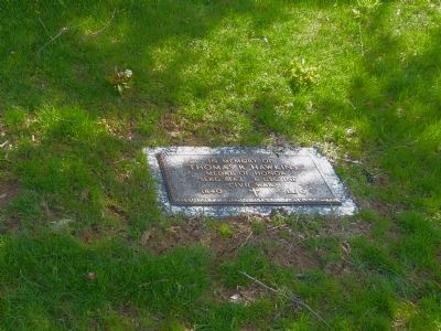
Near West Braddock Road 0.1 miles east of North Howard Street, on the left when traveling east.
Clara Shorts Adams and Robert Adams conveyed a quarter-acre to the Falls Church School District of Fairfax County in 1898 for the purpose of educating African American children. The one-room "Colored School Building at Seminary" was the first . . . — — Map (db m296270) HM
On Cemetery Road 0.1 miles north of Given Hill Road, on the right when traveling west.
Many former bondsmen and free black men enlisted when the
United States Colored Troops was formed in 1863. By war's end,
over 220,000 black soldiers and sailors had served in Union forces.
About 40 percent of the burials at Vicksburg National . . . — — Map (db m109473) HM
Near Kingsland Road 0.3 miles west of Deep Bottom Road, on the right when traveling west.
"The prize sought is either Richmond or Petersburg, or a position that will secure the fall of the latter." — Gen. Ulysses S. Grant, US Army
By the fall of 1864, Union armies under General Ulysses S. Grant were locked in a brutal . . . — — Map (db m257626) HM
On Vine Street Northwest at Sycamore Street Northwest, on the right when traveling north on Vine Street Northwest.
The Vine Street Business District, located in Old Town, once played a vital part of the city's history. After the Civil War, the neighborhood emerged politically, economically and educationally. Many prominent African American citizens resided . . . — — Map (db m154243) HM
On Beach Boulevard at Carmichael Avenue, on the right when traveling west on Beach Boulevard.
St. Nicholas Cemetery is one of the oldest and largest cemeteries associated with the historic African American communities of St. Nicholas, Philips, and Larsen/Pine Forest of South Jacksonville. Other associated community names include Spring Glen, . . . — — Map (db m220557) HM
Near Piney Narrows Road, on the right when traveling north. Reported permanently removed.
Although isolated from Maryland's largest population centers, the Eastern Shore was important to the state's role in the Civil War and exemplified the citizens' divided loyalties. In the years before the war, enslaved African-Americans here began . . . — — Map (db m8329) HM
On North Lorimier Street just north of Themis Street, on the right when traveling north.
In 1911, Cape Girardeau members of the Missouri Chapter of the Woman's Relief Corps, an auxiliary to the Grand Army of the Republic, commissioned a memorial to the fallen soldiers of the City and County. Dedicated on May 30, 1911, the memorial . . . — — Map (db m236269) HM
On Lincoln Lane, on the right when traveling west.
By the Sons of Goodwill, a society of black men for the burial of the colored citizens of Gettysburg.
-
Interred in this burial ground are 30 "United States Colored Troops" (USCT), Veterans of the Civil War, who were denied burial in the . . . — — Map (db m69156) HM WM
On Newcastle Street south of Duke Street, on the right when traveling south.
This building was built ca. 1896 by the David Hunter Post No. 9, Grand Army of the Republic (G.A.R.) The G.A.R., founded in 1866, was a fraternal society for veterans of the Union army and navy, with white and black posts. David Hunter Post was . . . — — Map (db m133383) HM
On Fort Negley Boulevard north of Chestnut Street, on the right when traveling north.
Throughout the occupation of Nashville, Federal gunboats dominated the Cumberland River. This made an overland attack from the south the Confederate States Army's most viable option. Late in 1862, the U.S. Army began constructing a complicated . . . — — Map (db m246961) HM
On Franklin Pike (Tennessee Route 6) at Lambert Drive, on the right when traveling north on Franklin Pike.
Peach Orchard Hill, also called Overton Hill, was the site of significant fighting during the second day of the Battle of Nashville on December 16, 1864. The majority of soldiers were from the 12th, 13th and 100th United States Colored Troops . . . — — Map (db m267710) HM
On South Highland Avenue (U.S. 45) at East Main Street, on the right when traveling north on South Highland Avenue.
In June 1862 the Union Army established a headquarters in Jackson. The provost marshal's office located at the court house was the recruiting station for the Union Army. In May 1863, during the Civil War, over 100 African American men from Madison . . . — — Map (db m194031) HM
On Old Nashville Highway, on the right when traveling north.
A tombstone can only tell so much about the life of a man. From the shape and standard design of the markers you see ahead, you can tell that two veterans of the United States military lie here in graves just outside of the wall of the Hazen Brigade . . . — — Map (db m82570) HM
A. Waterproof, Louisiana
Mile 381.0 AHP
This small community was moved four times due to floods and the towns caving banks. The original location is now said to lie in the Mississippi River. During its third washout, a newspaper reported . . . — — Map (db m115163) HM
On Cemetery Road at Church Street, on the right when traveling south on Cemetery Road.
After the Union victory at Fort Donelson, slaves escaping from nearby farms and iron foundries flocked to the area seeking freedom and protection. By March 1863 some 300 refugees lived here at the freedmen's camp that came to be known as "Free . . . — — Map (db m82948) HM
Born in Devonshire, England, on December 4, 1842, to William and Hannah Downing, James Downing immigrated to Boston, Massachusetts, in about 1850 with his family. On March 6, 1862, James enlisted for three years in the First Massachusetts Heavy . . . — — Map (db m201979) HM
On Old Courthouse Road. Reported permanently removed.
Before and during the Civil War, educational opportunities in Rural Virginia were often limited. The wealthier families employed a tutor or sent their children to boarding academies such as the nearby Union Academy. In such schools students . . . — — Map (db m169313) HM
On South Scott Street north of 9th Street South, on the right when traveling north.
From 1863-1865, the property southeast of Columbia Pike and Courthouse Road was the stie of Camp Casey, a key training location for Black United States Army soldiers during the Civil War. The camp included five barracks, a hospital, stables, a . . . — — Map (db m314412) HM
On Brandy Road (Virginia Route 762) north of Alanthus Road ( Route 663), on the right when traveling north.
On 5 May 1864, thousands of United States Colored Troops entered Culpeper County at Kelly's Ford, six miles southeast of here, marking the first time Black troops served alongside the Army of the Potomac. These men, including some who had escaped . . . — — Map (db m280444) HM
Near Battlefield Park Road 0.3 miles north of Mill Road.
"It was a most mad enterprise, but it was ordered...It was the hottest musketry fire I was ever in. Our regiment melted under it. And we fell back sullenly-we were too exhausted and too proud to run!" Elliott Grabill, 5th United States . . . — — Map (db m32934) HM
On Deep Bottom Road, on the left. Reported permanently removed.
After the Battle of Cold Harbor in June 1864, Grant and Lee shifted their armies to Petersburg; but Grant did not wish to abandon the Richmond front entirely. He had Gen. Benjamin Butler position a small force from his Army of the James here at . . . — — Map (db m193868) HM
On Oaklawn Boulevard (Virginia Route 36) at U.S. 295, on the right on Oaklawn Boulevard.
Ordered to take Petersburg, Gen. William F. “Baldy” Smith directed Gen. Edward W. Hinks’ division of African American soldiers to move from City Point toward the Cockade City. Hinks encountered unexpected Confederate resistance at Baylor’s Farm in . . . — — Map (db m86247) HM
Successful cotton plantation owners like the Daniells relied heavily on enslaved laborers. The Daniells were one of the largest slave owners in the state with
approximately 300 enslaved people at Windsor and over 800 enslaved people within the . . . — — Map (db m291115) HM
On Alabama Route 225 at Upper Shay Branch Road, on the right when traveling south on Alabama Route 225.
Incorporated in 1814 by the legislature of the Mississippi Territory, prior to Alabama's statehood, the town of Blakeley was envisioned by the founder Josiah Blakeley as a premier trading canter and a rival to Mobile as a port owing to its deep . . . — — Map (db m280482) HM
On Missouri Street east of Natchez Street, on the left when traveling east.
Thousands of refugee slaves came with the Union army into Helena and they continued to come. Helena became an island of freedom in a slave state.
The Union Army Recruits Freedmen
In the . . . — — Map (db m107912) HM
The African Union Church once stood on this site adjacent to the cemetery. The church was a branch of the original "Spencer Churches," founded by Wilmington's Peter Spencer in 1813. In 1835, five trustees of the church - Perry Reynolds, Noah . . . — — Map (db m244731) HM
On Scott Avenue at East 2nd Street, on the left when traveling south on Scott Avenue.
Soldiers returned to the area during the Civil War. The Fort Scott served as a supply depot and an army hospital - the largest and most well-staffed hospital in the state of Kansas. Food, ammunition, and other supplies were sent in and out of the . . . — — Map (db m313436) HM
On North 2nd Street at Gay Street, on the right when traveling north on North 2nd Street. Reported permanently removed.
Although isolated from Maryland's largest population centers, the Eastern Shore was important to the state's role in the Civil War and exemplified the citizens' divided loyalties.
In the years before the war, enslaved African-Americans here . . . — — Map (db m113505) HM
On Brandywine Road at Woolyard Road (Maryland Highway 223) on Brandywine Road.
Divided loyalties and ironies tore at Marylanders’ hearts throughout the Civil War: enslaved African-Americans and free United States Colored Troops; spies and smugglers; civilians imprisoned without trial to protect freedom; neighbors and families . . . — — Map (db m60164) HM
Near Park Entrance Road 1.7 miles north of Croom Airport Road, on the right when traveling east.
This hand-hewn log cabin was built in Aquasco, Maryland, around 1880 as a farm tenant house. This "one-up-and-one-down" design with one room and a loft was typically used for slave cabins during the early 1800s. By the late 1800s, it was the . . . — — Map (db m183969) HM
On Welcome Center Drive at Hayden Road, in the median on Welcome Center Drive. Reported permanently removed.
Although isolated from Maryland's largest population centers, the Eastern Shore was important to the state's role in the Civil War and exemplified the citizens' divided loyalties.
In the years before the war, enslaved African-Americans here . . . — — Map (db m21455) HM
Near Point Lookout Road (Maryland Route 5) south of Scotland Beach Road (Route 2.2), on the right when traveling south. Reported permanently removed.
Here you see a partial reconstruction of Camp Hoffman, the largest Union prison camp for Confederate soldiers. Built after the Battle of Gettysburg, it was planned to hold 10,000 prisoners. However, more than five times that number—52,000 in . . . — — Map (db m128950) HM
On Branch Street at Flower Street, on the right when traveling east on Branch Street. Reported permanently removed.
Isaiah "Uncle Zear" Fassett was born into slavery southeast of here in Sinepuxent in 1844. His owner, Sarah A. Bruff, released him from bondage at age nineteen on November 11, 1863, when the U.S. Army paid her $300 in compensation. That same day, . . . — — Map (db m15695) HM
Near Ocean Highway (U.S. 13) when traveling north. Reported permanently removed.
Although isolated from Maryland's largest population centers, the Eastern Shore was important to the state's role in the Civil War and exemplified the citizens' divided loyalties.
In the years before the war, enslaved African-Americans here . . . — — Map (db m51130) HM
Near Market Street (Business U.S. 17) just east of North 20th Street, on the left when traveling east.
Civil War Wilmington Wilmington was a minor Atlantic port when the Civil War started and the U.S. Navy did little to secure it. In fall 1862, the Confederate Ordnance Bureau designated it as the port of entry for its blockade runners. At night . . . — — Map (db m223962) HM
Near Cleves Warsaw Pike 0.2 miles west of Glenway Avenue (Ohio Route 264), on the left when traveling west.
Powhatan Beaty. Born in Richmond, Virginia. Powhatan Beaty moved to Cincinnati in 1849, where he spent the majority of his life. Beaty enlisted as a private in the Union Army in June 1863, and two days later was promoted to first sergeant, . . . — — Map (db m87543) HM
Near Charmian Road near Buchanan Trail East/Waynesboro Road, on the right when traveling west.
The Underground Railroad was a network of secret routes used by African American slaves during the early to mid 1800’s, to escape to the free states and Canada. One of the routes used by African-American slaves was South Mountain, where they . . . — — Map (db m202068) HM
Near Pinckney Boulevard 0.1 miles east of Ribaut Road (U.S. 21), on the left when traveling east.
Camp Saxton was established in 1862 near here as the recruiting and training depot for the 1st South Carolina Volunteers. Later re-designated the 33rd United States Colored Troops, these were the first Black men to formally enlist in the United . . . — — Map (db m301271) HM
Near Kings Highway (U.S. 17) east of Yemassee Road, on the right when traveling east.
The black regiments that participated in the battle of Honey Hill were the 32nd (raised in Pennsylvania), the 35th (raised in North Carolina) and the roand (raised in Michigan), United States Colored Troops (USCT) and the 54th and 55th . . . — — Map (db m301326) HM
On West Braddock Road 0.2 miles west of Marlboro Drive, on the right when traveling west.
The Civil War (1861-1865) opened the door for opportunity and civil rights for African American Virginians, about 90 percent of whom were enslaved in 1860. The upheaval from battles and the federal presence in Alexandria and eastern Fairfax . . . — — Map (db m149734) HM
On Old Courthouse Road (Virginia Route 24) 0.2 miles east of Gordon Drive, on the right when traveling east.
The first school for African Americans in Appomattox County began near here. Before the Civil War's end, educational opportunities in rural Virginia were often limited for White residents and practically nonexistent for African Americans, . . . — — Map (db m181152) HM
Near 251 Henricus Park Road 1.3 miles east of Coxendale Road, on the right when traveling east.
The earthen mound you see here is the Civil War remains of an 1864 mortar position built under fire by the 1st New York Engineers in September 1864. Men of the 1st Connecticut Heavy Artillery brought 8-inch mortars here to engage Confederate . . . — — Map (db m288508) HM
Near Henricus Park Road 1.3 miles east of Coxendale Road, on the right when traveling north.
The Union Army of the James under General Benjamin Butler came to "Dutch Gap" in the summer of 1864 to begin digging a military canal. The first regiment, the 169th NY Infantry and the 1st NY Engineers immediately took casualties from Confederate . . . — — Map (db m278809) HM
On Lee Highway (U.S. 211) at Richmond Road ( Route 729), on the right when traveling east on Lee Highway. Reported permanently removed.
The three brick cabins in the field before you are tangible connections to the enslaved people of Rappahannock County before and during the Civil War. Many slaves escaped to Union lines here and elsewhere, and some former bondsmen served in the U.S. . . . — — Map (db m49451) HM
On Natural Bridge Road 6 miles east of Woodville Highway (State Highway 363), on the left when traveling east.
(south)In Loving Memory 1861-1865 Defenders of Natural Bridge Lest We Forget (east) This monument erected under authority of an act of the legislature of Florida of 1921 as a just tribute of the people of Florida to commemorate the . . . — — Map (db m157200) HM WM
Near Grant Road 0.4 miles north of Gravois Road (Missouri Route 30), on the right when traveling north.
(left panel)
Outbuildings
Operating an 850-acre slave plantation required numerous outbuildings. Col. Frederick Dent's enslaved African-Americans labored in these outbuildings and kept the farm self-sufficient prior to the Civil . . . — — Map (db m124991) HM
Dedicated to the memory of
The Tuskegee Airmen
761st Tank Battalion
The Buffalo Soldiers
In grateful tribute to all those
Black servicemen and women who
served so honorably and valiantly
in all of America's wars
from the . . . — — Map (db m106465) WM
On South Payne Street south of Prince Street, on the right when traveling south.
During the Civil War, 217 was the headquarters of the L'Overture Hospital. It was named after Tousaint L'Overture — Hispaniola's (Haiti) slave revolt leader. Patients were African American Union Soldiers & “contrabands” (escaped . . . — — Map (db m74279) HM WM
On Forsyth Street at Thompson Street, on the right when traveling north on Forsyth Street.
The Thompson House
This antebellum home, constructed ca. 1847 by Benjamin Woodson Thompson (1809 - 1876), partner in the Forsyth and Simpson sawmill enterprise in Bagdad, is the best remaining Florida Panhandle example of a symmetrical Greek . . . — — Map (db m63182) HM
On Burnt Hickory Road NW at Old Mountain Road NW, on the right when traveling east on Burnt Hickory Road NW.
On June 27, 1864, Austin Gilmore of Tennessee fell, mortally wounded, in ferocious fighting near this wide field. But Gilmore held no military rank and no rifle. He held only a stretcher bearing a wounded soldier. An American of African descent, . . . — — Map (db m243772) HM
In March 1864, a regiment of United States Colored Troops (USCT) camping in Annapolis inspired William Evans, who was enslaved on this land, to self-liberate by fleeing Sandy Point to enlist in the 30th USCT. Evans was among 800 USCTs . . . — — Map (db m282041) HM
Near South Beach Road 0.8 miles south of Oceanic Drive. Reported permanently removed.
Divided loyalties and ironies tore at Marylander's hearts throughout the Civil War: enslaved African-Americans and free United States Colored Troops; spies and smugglers; civilians imprisoned without trial to protect freedom; neighbors and families . . . — — Map (db m72089) HM
Near South Beach Road 0.8 miles south of Oceanic Drive when traveling south. Reported permanently removed.
William Evans, a slave of Capt. Thomas Mezick, the owner of Sandy Point Farm here, enlisted in the 30th Regiment, United States Colored Troops, in March 1864. The 22-year-old, thereby, gained his freedom. He joined 122 other area slaves who had been . . . — — Map (db m72087) HM
Near Crain Highway (U.S. 301) 0.7 miles south of Rock Point Road (Maryland Route 257). Reported permanently removed.
Divided loyalties and ironies tore at Marylander’s hearts throughout the Civil War: enslaved African-Americans and free United States Colored Troops; spies and smugglers; civilians imprisoned without trial to protect freedom; neighbors and . . . — — Map (db m24540) HM
Near Crain Highway (U.S. 301) south of Venus Road, on the right when traveling north.
Divided loyalties and ironies tore at Marylanders' hearts throughout the Civil War: enslaved African Americans and free United States Colored Troops; spies and smugglers; civilians imprisoned without trial to protect freedom; neighbors and . . . — — Map (db m186732) HM
On Rose Hill Place at Radiance Drive, on the right when traveling north on Rose Hill Place. Reported permanently removed.
Although isolated from Maryland's largest population centers, the Eastern Shore was important to the state's role in the Civil War and exemplified the citizens' divided loyalties.
In the years before the war, enslaved African-Americans here . . . — — Map (db m8331) HM
On Main Street at Rogers Avenue, on the left when traveling west on Main Street.
Howard County native Decatur Dorsey was one of only sixteen African American soldiers to received the Medal of Honor for courage under fire during the Civil War. Sgt. Dorsey, of Company B, 39th United States Colored Troops, earned his medal at . . . — — Map (db m5756) HM
On South Queen Street just south of Cannon Street, on the right when traveling south. Reported permanently removed.
African American Civil War veterans constructed this meeting hall for Charles Sumner Post No. 25, Grand Army of the Republic (G.A.R.) in 1908. The hall is one of only two known to survive that were built for soldiers who served in . . . — — Map (db m156672) HM
On Croom Airport Road 3.7 miles east of Croom Road (Maryland Route 382). Reported permanently removed.
This hand hewn log cabin was built in Aquasco, Maryland around 1880 as a farm tenant house. This one up and one down design with one room and a loft was typically used for slave cabins during the early 1800s. By the late 1800s, it was the . . . — — Map (db m6096) HM
On Maryland Route 18 at Del Rhodes Avenue, on the left when traveling south on Maryland Route 18.
Queenstown, like most of the Eastern Shore in 1861, was a slaveholding community, and the impending conflict was regarded with concern and fear. When war erupted, families were torn apart because of their conflicting loyalities. It was not uncommon . . . — — Map (db m3113) HM
On Point Lookout Road (Maryland Route 5) 2.6 miles south of 3rd Way, on the right when traveling north. Reported permanently removed.
Divided loyalties and ironies tore at Marylanders’ hearts throughout the Civil War: enslaved African-Americans and free United States Colored Troops; spies and smugglers; civilians imprisoned without trial to protect freedom; neighbors and . . . — — Map (db m1000) HM
Near South Potomac Street (Maryland Route 65) at Memorial Boulevard West, on the right when traveling north.
Private Shedrick Campbell Co. M. 2nd United States
Colored Cavalry Regiment
Post Commander
Once let the black man get upon his person the brass letters U.S. let him get an eagle on his button, and a musket on his shoulder . . . — — Map (db m194808) WM
On Branch Street west of Flower Street, on the left when traveling west.
Isaiah Fassett was born into slavery south of here in Sinepuxent in 1844. On November 11, 1863, when he was nineteen, his owner, Sara A. Bruff, released him from bondage to enlist in Co. D, 9th United States Colored Troops. Bruff, who was loyal . . . — — Map (db m206342) HM
On Edwards Street near Hawthorne Street, on the right when traveling south.
Side A: Oscar D. Boggess Homestead
Oscar D. Boggess (1832-1907) was born in Virginia, the son of a slave and her master. He and his family were granted freedom in the will of his father and master. The will was contested up to the United . . . — — Map (db m43861) HM
On South Washington Street at Breckenridge Street, on the right when traveling south on South Washington Street.
St. Paul's A.M.E. Zion Church, erected in 1917, is the third church to be used by Gettysburg's oldest African American congregation—founded ca. 1838 in a small frame building on nearby Franklin Street. Members of this congregation have long been . . . — — Map (db m130259) HM
On Walnut Street, on the right when traveling south.
There is no place you or I can go, to think about or not think about, to summon the presences of, or recollect the absences of slaves; nothing that reminds us of the ones who made the journey and of those who did not make it. There is . . . — — Map (db m213138) HM
Near Gallatin Pike South (U.S. 31E) 0.2 miles north of Walton Lane, on the left when traveling north.
In memory
of the 20,133 who served as
United States Colored Troops
in the Union Army
Dedicated 2003
Sculptor: Roy W. Butler • Model: William C. Radcliffe
Presented by: The African American Cultural Alliance • United Association . . . — — Map (db m198942) WM
Near Fort Negley Boulevard north of Chestnut Street, on the right when traveling north.
Between 1861 and 1865 the Civil War claimed the lives of over 625,000 Americans. Few communities, North or South, were left untouched by the conflict's hardship and loss, including Nashville. Tentatively pro-Union before the war, the city was the . . . — — Map (db m178383) HM
On Eastern Flank Circle 0.4 miles south of Lewisburg Pike (Business U.S. 431), on the left when traveling west.
In 1860, African-Americans — both enslaved and free — made up more than half of Franklin's residents, as well as half of Williamson County's population. When the Federal army arrived late in 1862, many slaves freed themselves by . . . — — Map (db m120385) HM
Near Eddy Lane south of Fort Granger Drive, on the right when traveling south.
On March 24, 1863, President Abraham Lincoln told Tennessee Military Governor Andrew Johnson, “The colored population is the great available, and yet unavailed of, force for restoring the Union.” In September 1863, Johnson gave permission to Maj. . . . — — Map (db m189735) HM
On South Washington Street (Virginia Route 400) north of Capital Beltway Inner Loop (Interstate 95), on the left when traveling north.
During the Civil War, Alexandria's population swelled with more than 20,000 enslaved African Americans fleeing Confederate territory for safety behind Union lines. Initially called Contrabands because they were considered "property" taken during . . . — — Map (db m127734) HM
On Maddens Tavern Road at Youngs Lane, on the left when traveling north on Maddens Tavern Road.
On May 8, 1864, following the Battle of the Wilderness, troopers of the 9th Virginia Cavalry scouted through this region and captured several United States Colored Troops (USCTs) near Madden's Tavern. Private Byrd C. Willis of the 9th recalled, . . . — — Map (db m185516) HM
On Deep Bottom Road east of James Street, on the left.
As you watch boats being launched here today, imagine the challenge faced by Union engineers tasked with constructing a pontoon bridge at this site on June 20th, 1864. Under the cover of night, and without alerting nearby Confederate pickets, . . . — — Map (db m216519) HM
"The busiest place in Dixie" City Point, Virginia, played a significant role in the final year of the Civil War. General-in-Chief of the Union Army Ulysses S. Grant established his headquarters here on June 15, 1864. Union ships sailed . . . — — Map (db m131786) HM WM
Near Siege Road 0.4 miles east of South Crater Road (U.S. 301), on the right when traveling south.
"…they went forward with undaunted bravery!"
- Sgt. J. Payne 27th USCT
By 8:30 am, over the now wooded ground before you, nearly 4,000 black Union soldiers (known then as United States Colored Troops or USCT) . . . — — Map (db m184826) HM
Near Halsema Road North 0.4 miles north of Old Plank Road, on the right when traveling north.
The Third Union invasion was significant because it was the first deployment of African American troops in Florida by the federal government. The 33rd USCT (United States Colored Troops), formerly known as the 1st South Carolina Colored Infantry . . . — — Map (db m143682) WM
On East 10th Street at Rosedale Avenue, on the left when traveling west on East 10th Street.
Side 1
Beginning in 1909, Union Civil War veterans from all over the United States began to move to St. Cloud, many drawn by promotions in Northern newspapers. The first veteran to die in St. Cloud, Lucius L. Mitchell, passed away in December . . . — — Map (db m172100) HM
On Fort Hill Terrace east of Fort Hill Circle, on the left when traveling north.
The Confederate "Army of Tennessee" that defended Dalton from November 1863 to May 1864 briefly returned here the following October. It was much depleted in both size and spirit. Their unsuccessful defense of Atlanta ended with its fall on September . . . — — Map (db m86563) HM
On North 7th Street at Broadway Street, on the right when traveling north on North 7th Street.
( Upper Left Section )
Welcome to the Knox County Veterans’ Memorial Park. The monuments that stand before you are dedicated to the memory of all the military veterans from Knox County. Most prominent is the “Soldiers and . . . — — Map (db m23581) HM
On Broadway Street at 6th Street, on the right when traveling west on Broadway Street.
During February 1864, the Adjutant General of the U.S. Army, Lorenzo Thomas, under the direction of the Secretary of War, Edwin L. Stanton, authorized the recruitment of African Americans by the Union Army in Kentucky. The 8th United States Heavy . . . — — Map (db m48462) HM
Near Wilmott Drive, on the left when traveling south. Reported missing.
Nearby stood Camp Stanton, a Civil War-era recruiting and training post for African American Union soldiers. Named for Secretary of War Edwin Stanton, the camp was established in August 1863. Although black soldiers had served in the nation’s armed . . . — — Map (db m195735) HM
In June 1917, Judge James A. Pearce commemorated the Civil War soldiers of Kent County by erecting a monument to honor the patriotism and valor of a once divided, but now reunited country. The rough-cut and polished granite monument behind you . . . — — Map (db m186803) HM
On Quincy Avenue at East 66th Street, on the right when traveling east on Quincy Avenue.
Dedicated
In grateful memory
United States Colored Troops
"Once let the Black man get upon his person the brass letter, U.S., let him get an eagle on his button, and a musket on his shoulder and bullets in his pocket, there . . . — — Map (db m297141) WM
On North Main Street (Route 16), on the left when traveling north.
Eighty-eight African Americans from Mercersburg volunteered to defend the Union during the Civil War. At least 36 of those veterans lie in Mercersburg Zion Union Cemetery, established in 1876 by local Black citizens.
By 1850 Mercersburg had 26 . . . — — Map (db m44650) HM
Near North 5th Street at Chickies Hill Road, on the right when traveling north.
Opened at a time when blacks and whites legally could not be buried next to one another, this cemetery is the final resting place for generations of African-American wives, mothers, daughters, husbands, and sons—including valiant soldiers. In 1863 . . . — — Map (db m215521) HM
Near Pinckney Boulevard 0.1 miles east of Ribaut Road (U.S. 21), on the left when traveling east.
"...I don't intend to lay down my gun till the war is done, and our brethren all get their freedom..."
-Sergeant Prince Rivers, First South Carolina Infantry
On August 25, 1862, General Rufus Saxton was authorized by the US War . . . — — Map (db m301270) HM
On Outer Drive at Michigan Avenue, on the right when traveling south on Outer Drive.
Across the road lies the grave of Elijah Wood, who served in the United States Colored Troops during the Civil War and became a community leader after the guns fell silent.
Born into slavery in 1834 in Robertsville (now Oak Ridge), Tennessee, . . . — — Map (db m293575) HM
Near Old Dunbar Cave Road at Dunbar Cave Road, on the right when traveling north.
“A little distance from these barracks is a Negro village [Affricanna Town]. Those that are able to procure their own lumber are permitted to put up their own houses with little garden lots. The best class of negroes do this. Most of . . . — — Map (db m205379) HM
Near Courthouse Road (Virginia Route 24) 0.5 miles west of Gordon Drive, on the right when traveling east.
Companies A and F of the 41st United States Colored Troops (USCT) deployed as skirmishers (an expanded formation where soldiers are posted ahead of the main battle line to feel out enemy positions). On April 9, 1865, they crossed the field in . . . — — Map (db m292013) HM
Near Weyanoke Road 2 miles south of John Tyler Memorial Highway ( Route 5), on the left when traveling south.
Part of Gen. Ulysses S. Grant's Army of the Potomac occupied North Bend on June 14, 1864, en route to Weyanoke Point. Two days earlier, Union forces had disengaged from the Cold Harbor battlefield so stealthily that it escaped Gen. Robert E. Lee's . . . — — Map (db m267268) HM
Near Relay Road at Ballahack Road, on the left when traveling south.
Nearby were the homes of three Afro-Virginians who served in the United States Colored Troops (USCT) during the Civil War. Sgt. March Corprew, Co. I, 2nd USCT Cavalry, and his brother Pvt. Daniel Corprew, Co. D, 1st USCT Cavalry, lived on a . . . — — Map (db m282379) HM
Near Henricus Park Road 1.3 miles east of Coxendale Road.
(preface) Early in 1864, Union Gen. Ulysses S. Grant, commander of all Federal armies, ordered advances throughout the Confederacy in the spring. On May 5, Union Gen. Benjamin F. Butler landed his Army of the James on Bermuda Hundred . . . — — Map (db m164324) HM
Near Enon Church Road (Virginia Route 746) at Point of Rocks Road, on the left when traveling west.
Shortly after the Army of the James landed in Bermuda Hundred, a field hospital was established here at Point of Rocks. The hospital originally consisted of tents set up in the orchard around the Strachan House. The tents were 50 feet long and . . . — — Map (db m109377) HM
Near Enon Church Road (Virginia Route 746) at Point of Rocks Road, on the left when traveling west.
"Petersburg at that hour was clearly at the mercy of the Federal Commander who had all but captured it"
Confederate General P.G.T. Beauregard on the June 15th attack at Petersburg.
On June 9, 1864, as Grant prepared to shift his army . . . — — Map (db m180819) HM
Near Annandale Road south of Hillwood Avenue, on the right when traveling south.
In 1867, African Americans built Galloway United Methodist Church and established the historic cemetery you are facing. According to local tradition, before and during the Civil War enslaved people on the Dulany plantation secretly worshiped in the . . . — — Map (db m72029) HM
On East Fairfax Street at Douglass Avenue, on the right when traveling east on East Fairfax Street.
You are standing across the street from land that Harriet Brice, a “free woman of color,” purchased in 1864. Together with her husband, George Brice, she struggled to farm the property during the Civil War. Although she had gained her freedom . . . — — Map (db m206332) HM
On Pecan Avenue 0.1 miles east of Prince Henry Avenue, on the left when traveling south.
The 4th, 5th, 6th, and 22nd regiments of United States Colored Troops (USCT) seized this point on May 5, 1864, in advance of Union Gen. Benjamin Butler's force sailing up the James River. As the USCTs landed here, . . . — — Map (db m149551) HM
On Cedar Lane at Maplewood Avenue, on the right when traveling south on Cedar Lane. Reported permanently removed.
During the Civil War this church served as a signal station for both the Confederacy and the Union. On May 5, 1864 Col. Samuel A. Duncan’s brigade of United States Colored Troops (4th, 5th, and 6th U.S.C.T.) occupied City Point and the signal . . . — — Map (db m19604) HM