361 entries match your criteria. Entries 301 through 361 are listed.⊲ Previous 100
Maryland Civil War Trails Historical Markers
By Craig Swain, June 3, 2007
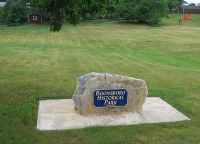
Boonsboro Historical Park.
301 ► Maryland, Washington County, Boonsboro — Washington Monument — Signal Station — Antietam Campaign 1862 —  |
| On North Main Street / Old National Road (Alternate U.S. 40), on the right when traveling south. | |||
| 302 ► Maryland, Washington County, Boonsboro — Washington Monument — Signal Station — Antietam Campaign 1862 — |
| On Washington Monument Road, on the right. | |||
| 303 ► Maryland, Washington County, Brownsville — Battle of Maryland Heights — Maryland's First Civil War Battle — Antietam Campaign 1862 — |
| On Rohrersville Road (State Highway 67), on the right when traveling north. | |||
| 304 ► Maryland, Washington County, Cearfoss — Crossing the Mason and Dixon — Pennsylvania, at Last! — Gettysburg Campaign — |
| On Fairview Road (County Route 494) at Greencastle Pike (Maryland Route 63), on the right when traveling east on Fairview Road. | |||
| 305 ► Maryland, Washington County, Cearfoss — Gettysburg Campaign — Invasion & Retreat — |
| On Fairview Road (County Route 494) at Greencastle Pike (Maryland Route 63), on the right when traveling east on Fairview Road. | |||
| 306 ► Maryland, Washington County, Clear Spring — Gettysburg Campaign — Invasion & Retreat |
| On Cumberland Street (U.S. 40) at Mill Street (Maryland Route 68), on the right when traveling west on Cumberland Street. Reported permanently removed. | |||
| 307 ► Maryland, Washington County, Clear Spring — Gettysburg Campaign — Invasion & Retreat |
| On National Pike (U.S. 40). Reported permanently removed. | |||
| 308 ► Maryland, Washington County, Clear Spring — Gettysburg Campaign — Invasion & Retreat — |
| On National Pike (U.S. 40) east of Spickler Road, on the right when traveling west. | |||
| 309 ► Maryland, Washington County, Clear Spring — Vital Crossroads — Clear Spring in the Civil War — |
| On Cumberland Street (U.S. 40) at North Mill Street (Maryland Route 68), on the right when traveling west on Cumberland Street. | |||
| 310 ► Maryland, Washington County, Conococheague — Gettysburg Campaign — Invasion & Retreat — |
| On Rufus Wilson Road, on the right when traveling west. | |||
| 311 ► Maryland, Washington County, Dargan — Confederate Invasion — Five Years Later … — Early's 1864 Attack on Washington — |
| On Chestnut Grove Road 0.3 miles east of McCoy Road, on the left when traveling east. | |||
| 312 ► Maryland, Washington County, Dargan — Kennedy Farm — Staging and Planning John Brown's Harpers Ferry Raid — |
| On Chestnut Grove Road, on the right when traveling south. | |||
| 313 ► Maryland, Washington County, Fairplay — Jones’s Crossroads — Forts Facing Forts — |
| On Shepherdstown Pike (Maryland Route 65) at Lappans Road (Route 68), on the right when traveling south on Shepherdstown Pike. | |||
| 314 ► Maryland, Washington County, Falling Waters — Battle of Falling Waters — Union Cavalry Charges Confederate Rear Guard — Gettysburg Campaign — |
| On Falling Waters Road west of Beagle Club Road, on the right when traveling west. | |||
| 315 ► Maryland, Washington County, Funkstown — Battle of Funkstown — At Bay another Day — Gettysburg Campaign |
| On Old National Pike (Alternate U.S. 40) 0.3 miles south of Lagoon Road, on the right when traveling south. Reported missing. | |||
| 316 ► Maryland, Washington County, Funkstown — Battle of Funkstown — Keeping the Federals at bay — Gettysburg Campaign — |
| On Old National Pike (Alternate U.S. 40) 0.3 miles south of Lagoon Road, on the right when traveling south. | |||
| 317 ► Maryland, Washington County, Hagerstown — First Battle of Hagerstown — Vicious Fighting in the Streets — Gettysburg Campaign — |
| On North Potomac Street (Maryland Route 65) south of West Franklin Street (U.S. 40), on the right when traveling south. | |||
| 318 ► Maryland, Washington County, Hagerstown — Gettysburg Campaign — Invasion & Retreat — |
| On North Potomac Street (Maryland Route 65). | |||
| 319 ► Maryland, Washington County, Hagerstown — Second Battle of Hagerstown — Custer Captures the Town — Gettysburg Campaign — |
| On North Potomac Street (Maryland Route 65) south of West Franklin Street (U.S. 40), on the right when traveling south. | |||
| 320 ► Maryland, Washington County, Hancock — Explore Maryland Civil War Trails — Adventure Waits — |
| On Sideling Hill Rest Area, Eastbound (Interstate 68) 3 miles east of Exit 74, on the right when traveling east. | |||
| 321 ► Maryland, Washington County, Hancock — Gettysburg Campaign — Invasion & Retreat |
| On the eastbound Sideling Hill Rest Area (Interstate 68 at milepost 75), 1.5 miles east of Exit 74, on the right when traveling east. Reported permanently removed. | |||
| 322 ► Maryland, Washington County, Hancock — Gettysburg Campaign — Invasion & Retreat |
| On the westbound Sideling Hill Visitors Center (Interstate 68 at milepost 75), 2.7 miles west of Exit 77 ( Route 144), on the right when traveling west. Reported permanently removed. | |||
| 323 ► Maryland, Washington County, Hancock — Gettysburg Campaign — Invasion & Retreat — |
| On Church Street south of Main Street ( Route 144), on the left when traveling south. | |||
| 324 ► Maryland, Washington County, Hancock — Major James Breathed — "Hardest artillery fighter the war produced" — |
| On West Main Street (Maryland Route 144), on the left when traveling west. | |||
| 325 ► Maryland, Washington County, Hancock — St. Thomas Episcopal Church — Unintended Target |
| On Church Street south of Main Street ( Route 144), on the left when traveling south. Reported permanently removed. | |||
| 326 ► Maryland, Washington County, Hancock — St. Thomas Episcopal Church — Witness to War — |
| On North Church Street at Western Maryland Rail Trail, on the left when traveling south on North Church Street. | |||
| 327 ► Maryland, Washington County, Highfield-Cascade — War Returns to South Mountain — Battle of Monterey Pass — Gettysburg Campaign — |
| Near Pen Mar High Rock Road, on the right when traveling south. | |||
| 328 ► Maryland, Washington County, Keedysville — Early's Washington Raid — Diverting Federal Forces, July 1864 |
| On Shepherdstown Pike (State Highway 34), on the right when traveling west. Reported permanently removed. | |||
| 329 ► Maryland, Washington County, Keedysville — Explore Maryland Civil War Trails — Adventure Awaits — |
| On Shepherdstown Pike (Maryland Route 34) 0.6 miles east of Richardson Avenue, on the right when traveling west. | |||
| 330 ► Maryland, Washington County, Keedysville — Gettysburg Campaign — Invasion & Retreat |
| On Boonesboro Pike (Maryland Route 34), on the left when traveling east. Reported permanently removed. | |||
| 331 ► Maryland, Washington County, Keedysville — Keedysville — Headquarters and Hospital Town — Antietam Campaign 1862 — |
| On Taylor Drive at North Main Street ( Route 845), in the median on Taylor Drive. | |||
| 332 ► Maryland, Washington County, Knoxville — Fort Duncan — Invasion Stalled — Early's 1864 Attack on Washington — |
| On Pleasantville Road 0.3 miles west of Pleasantville Road, on the left when traveling west. | |||
| 333 ► Maryland, Washington County, Lappans Crossroads — Council of War — Should We Attack? — Gettysburg Campaign — |
| Near Lappans Road (Maryland Route 68) at Printz Road, on the right when traveling west. | |||
| 334 ► Maryland, Washington County, Leitersburg — Gettysburg Campaign — Invasion & Retreat — |
| On Ringold Street at Ringold Pike (County Route 418) on Ringold Street. | |||
| 335 ► Maryland, Washington County, Leitersburg — Retreat into Maryland — "Asleep and at the same time walking" — |
| On Ringold Street at Ringold Pike (County Route 418), on the right when traveling south on Ringold Street. | |||
| 336 ► Maryland, Washington County, Sharpsburg — 1862 Antietam Campaign — Lee Invades Maryland — |
| On Shepherdstown Pike (Maryland Route 34), on the left when traveling north. | |||
| 337 ► Maryland, Washington County, Sharpsburg — 1862 Antietam Campaign — Lee Invades Maryland — |
| On Shepherdstown Pike (Maryland Route 34). | |||
| 338 ► Maryland, Washington County, Sharpsburg — Antietam Station — Railroad to Reunion — Antietam Campaign 1862 |
| On Shepherdstown Pike (Maryland Route 34), on the left when traveling north. Reported permanently removed. | |||
| 339 ► Maryland, Washington County, Sharpsburg — Antietam Station — Railroad to Reunion — Antietam Campaign 1862 — |
| On Shepherdstown Pike (Maryland Route 34) 0.3 miles west of Ranch Lane, on the right when traveling west. | |||
| 340 ► Maryland, Washington County, Sharpsburg — Collateral Damage — War Destroys Beloved Church — Antietam Campaign 1862 — |
| Near East Main Street (Maryland Route 34) east of South Church Street, on the right when traveling east. | |||
| 341 ► Maryland, Washington County, Sharpsburg — Grove Farm — A Visit from the President — Antietam Campaign 1862 |
| On Shepherdstown Pike (Maryland Route 34), on the right when traveling north. Reported permanently removed. | |||
| 342 ► Maryland, Washington County, Sharpsburg — Grove Farm — A Visit from Abe Lincoln — Antietam Campaign 1862 — |
| On Shepherdstown Pike (Maryland Route 34) 0.6 miles south of Ranch Lane, on the right when traveling north. | |||
| 343 ► Maryland, Washington County, Sharpsburg — Sharpsburg and the Battle — "We had to live on fear " — Antietam Campaign 1862 — |
| Near East Main Street (Maryland Route 34) at South Church Street, on the right when traveling east. | |||
| 344 ► Maryland, Washington County, Sharpsburg — Witness to History — |
| Near Old Burnside Bridge Road. | |||
| 345 ► Maryland, Washington County, Smithsburg — Gettysburg Campaign — Invasion & Retreat — |
| Near West Water Street (Maryland Route 66), on the left when traveling east. | |||
| 346 ► Maryland, Washington County, Smithsburg — Respite at Smithsburg — “An Oasis in the Desert” — |
| Near West Water Street (Maryland Route 66), on the left when traveling east. | |||
| 347 ► Maryland, Washington County, St. James — St. Mark's Episcopal Church — Refuge for the "sick and wounded" — |
| Near Lappans Road (Maryland Route 68) east of Sharpsburg Pike ( Route 65), on the right when traveling east. | |||
| 348 ► Maryland, Washington County, Williamsport — C & O Canal Aqueduct — Stonewall Changes Course — Antietam Campaign 1862 — |
| Near West Potomac Street. | |||
| 349 ► Maryland, Washington County, Williamsport — Falling Waters — "Just charge it to Jeff Davis" — Gettysburg Campaign — |
| Near U.S. Bicycle Route 50. | |||
| 350 ► Maryland, Washington County, Williamsport — Gettysburg Campaign — Invasion & Retreat — |
| Near Potomac Street (U.S. 11) when traveling west. | |||
| 351 ► Maryland, Washington County, Williamsport — Shielding the Army — Where are the Confederates? — Gettysburg Campaign |
| On Greencastle Pike (Route 63), on the right when traveling north. Reported missing. | |||
| 352 ► Maryland, Washington County, Williamsport — The Wagoners’ Fight — Teamsters Help Save the Army — Gettysburg Campaugn — |
| Near Lappans Road (Maryland Route 68), on the left. | |||
| 353 ► Maryland, Washington County, Williamsport — Williamsport — The Beginning and the End — Gettysburg Campaign — |
| Near West Potomac Street. | |||
| 354 ► Maryland, Worcester County, Berlin — Corp. Isaiah Fassett — "Uncle Zear" |
| On Branch Street at Flower Street, on the right when traveling east on Branch Street. Reported permanently removed. | |||
| 355 ► Maryland, Worcester County, Berlin — Corp. Isaiah Fassett — From Slavery to Honored Veteran — |
| On Branch Street west of Flower Street, on the left when traveling west. | |||
| 356 ► Maryland, Worcester County, Pocomoke City — Maryland's Eastern Shore — Hundreds of Enslaved and Free Black Men Enlisted |
| Near Ocean Highway (U.S. 13) when traveling north. Reported permanently removed. | |||
| 357 ► Maryland, Worcester County, Pocomoke City — War Along the Chesapeake — A Divided Region — |
| Near Ocean Highway (U.S. 13) north of Marva Road, on the right when traveling north. | |||
| 358 ► Maryland, Worcester County, Snow Hill — Worcester County Courthouse — Staging Ground — |
| On West Market Street (Business U.S. 113) just east of Franklin Street, on the right when traveling east. | |||
| 359 ► Pennsylvania, Adams County, Gettysburg — Gettysburg Campaign — Invasion & Retreat — |
| On Seminary Ridge 0.2 miles south of Lincoln Highway (U.S. 30), on the right when traveling south. | |||
| 360 ► Virginia, Caroline County, Port Royal — Port Royal — Booth Turned Away — John Wilkes Booth – Escape of an Assassin — |
| On King Street at Caroline Street, on the left when traveling north on King Street. | |||
| 361 ► Virginia, Loudoun County, Leesburg — 1862 Antietam Campaign — Lee Invades Maryland |
| On Tutt Lane (Route 740) west of Victory Lane, on the left when traveling west. Reported permanently removed. | |||
361 entries matched your criteria. Entries 301 through 361 are listed above. ⊲ Previous 100