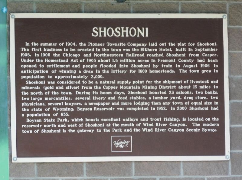
In the summer of 1904, the Pioneer Townsite Company laid out the plat for Shoshoni. The first business to be erected in the town was the Elkhorn Hotel, built in September 1905. In 1906 the Chicago and Northwestern Railroad reached Shoshoni from . . . — — Map (db m288706) HM
Mule teams hauled the materials for the original Boysen Dam, built here in the early 1900s by Asmus Boysen to provide power for his gold and copper mining interests in this area. A few years later when the Burlington Railroad built through . . . — — Map (db m88147) HM
Boysen Dam, completed in 1951, marks the southern margin of the east-west trending Owl Creek Mountains and the Wind River Canyon. Drained by the north flowing Wind River, the canyon is 14 miles long, 1.3-2 miles wide and 2,400 feet deep where it . . . — — Map (db m70611) HM
An arrastra is a type of primitive mill used to crush ore and extract gold and silver. Water diverted from Willow Creek turned the large water wheel to provide power. A drive shaft connected to the wheel rotated a series of cogwheels that in turn . . . — — Map (db m154156) HM
Two related, side-by-side markers pay tribute to Esther Hobart Morris.
Home & office site of
Esther Hobart Morris
First woman Justice
of the Peace
in the World
Feb. 14, 1870 . . . — — Map (db m80149) HM
1869 - 1925
Site of
First Masonic Lodge in Wyoming
No. 28
under jurisdiction of Nebraska
Now
Wyoming Lodge No. Two
Lander, Wyoming — — Map (db m80150) HM
As early as 300 BC, the Greeks use the primary components of a stamp mill - drive wheel, cams, and stamps - for pounding and hauling grain. The concept was adapted to crushing ore and became widely used in America as a gold recovery process.
. . . — — Map (db m154146) HM
In 1858, this ancient path, which had been used by Indians, explorers and mountain men as a short cut to the Snake River country was developed by Frederick Lander in to an alternate route on the Oregon Trail. What is commonly called the Lander Trail . . . — — Map (db m80161) HM
With spring, the meadow grasses and broad-leafed plants, called forbs, emerge green and succulent. Antelope, mule deer, and elk wintering south and west of here return each spring to the green grass and forb meadows found in the sagebrush desert and . . . — — Map (db m96700) HM
For many emigrants, the first tangible evidence that the had crossed South Pass was Pacific Springs, "the fountain source of the Pacific streams," according to pioneer Joseph Goldsborough Bruff. The broad expanse of the pass from Pacific Springs . . . — — Map (db m96660) HM
A region rich in history. A city rich in gold. From 1812 to 1868 this open country at the end of the Wind River Mountains provided a passage - the only passage - through the Rocky Mountain barrier of the Continental Divide for some 500,000 westering . . . — — Map (db m80160) HM
Founded 1868
A Great Gold Camp
Part of Wyoming’s historical heritage. Acquired for preservation May 18, 1966, with funds raised by Wyoming;s 75th Anniversary Commission Inc., its advisers, county committees and people of . . . — — Map (db m80162) HM
Emigrant travelers on their way west likely discovered small amounts of gold in the 1840’s, but it took until 1868 for the first mining claims to be staked. Word of the new gold rush spread and the summer of 1868 brought an influx of people from . . . — — Map (db m80148) HM
Thousands rushed to the South Pass area following the find of substantial gold deposits at the Carissa Mine in 1867. As the boom gained steam, the Carissa sat at the center of mining development, serving as the primary economic force for South Pass . . . — — Map (db m80146) HM
Captain James G. Willie’s Handcart Company of Mormon emigrants on the way to Utah, greatly exhausted by the deep snow of an early winter and suffering form lack of food and clothing, had assembled here for reorganization by relief parties from Utah, . . . — — Map (db m80154) HM
After 118 years, what seems to be a ghost adit reemerges during the
150th Anniversary of South Pass City. During the fall of 2017, employees
were given a glimpse into time which has been frozen in the hillside
along the paths around Hermit . . . — — Map (db m292327) HM
Oregon-Mormon Trail
and Sixth Crossing
of Sweetwater River
Willie Handcart Company rescue site, 21 October 1856 and burial site of John Winford and eight others from that company
John Linford
Born 28 August 1808 England
Died . . . — — Map (db m95742) HM
The modern burg of Sweetwater Station is at the intersection of U.S. Highway 287 and State Route 135 in central Wyoming along the Sweetwater River. It is a place of scenic beauty and historic significance. Prehistoric groups camped along the . . . — — Map (db m95745) HM
In summer, the trilling “Kroo-oo-oo” of the sandhill crane is heard along the Sweetwater River. The endangered whooping crane has been seen in the marshy meadows immediately south of this spot. The Sweetwater’s wide floodplain, enhanced . . . — — Map (db m95747) HM
The Sweetwater Valley is the mid-section of the 2000 mile-long Oregon Trail. West of Casper, Wyoming, branches of that trail, meld into a single transportation corridor and here, paralleling the serpentine Sweetwater River, the trail approaches the . . . — — Map (db m95776) HM
Late in the year of 1856, the Willie and Martin Handcart Companies and the Hunt and Hodgetts Wagon Companies left Iowa City for their journey westward. Near this spot, these companies crossed the Sweetwater River for the sixth time, thus the name . . . — — Map (db m95743) HM
It is one of the most commonly asked questions here – and with good reason. Those who grew up watching western movies expect to see a fort with a large wooden stockade. Like many other aspects of Hollywood westerns, the walled military fort . . . — — Map (db m87076) HM
This 1889 winter scene shows buildings along the west side of the Parade Ground which housed Fort Laramie’s officer complement – hence, “Officers Row”. RIGHT TO LEFT, the “Burt” House, the “Surgeon’s” . . . — — Map (db m87031) HM
Some days since I received a messenger from [Sinte Gleska], head chief of the Brule Sioux, saying that his daughter had died on the way here and had begged her Father to have her grave made with the whites . . . Wishing to do him honor . . . . — — Map (db m87041) HM
The large structure built on this site in 1885 – pictured shortly after completion – was put to many uses. The section on the far right was used as a schoolroom for officers’ children. The central portion housed the Headquarters . . . — — Map (db m87005) HM
“French, Spanish and Indian and mixed are very common here and all languages are being jabbered in promiscuous interchange.”Charles B. Darwin, Fort Laramie, June 28, 1849 Métis (ma-tes’) – of mixed race, particularly, mixed Native . . . — — Map (db m87012) HM
High ranking officers commonly kept chickens for their own use. The consumption of chickens and eggs provided a welcome change from meals of wild game and tough army beef. Individual soldiers and cooks utilizing company funds could purchase . . . — — Map (db m87024) HM
Originally intended as housing for the commanding officer, this building was divided into a duplex when the C.O. chose to remain in another new dwelling. As such, the quarters was completed in 1870 at which time high-ranking officers and . . . — — Map (db m87009) HM
The building before you is the only surviving enlisted men's barracks at Fort Laramie. The building proper was completed in late 1874 and was designed to provide quarters and other needed support facilities for two companies of soldiers, The . . . — — Map (db m71018) HM WM
This building was completed in 1884. It was built as a commissary storage facility. As such it would have been primarily divided into two large storerooms: one for meat and one for flour, rice, and beans. Three or four smaller rooms would have been . . . — — Map (db m71017) WM
Crossed the Laramie ford this morning and passed through the fort registering our names and found that . . . 16,913 men, Women 235, Children 242, Wagons 4,672, Horses 14,974, Mules, 4,641, Oxen 7,427, Cows 465, passed, besides nearly as many . . . — — Map (db m86975) HM
As the main outpost of the U.S. Government on the Northern Plains, Fort Laramie served as an official meeting ground between the United States of America and the sovereign tribes of the Northern Plains. The first great treaty negotiation, the . . . — — Map (db m86984) HM
. . . the articles of trade consist, on the one side, almost entirely of buffalo robes; and, on the other, of blankets, calicoes, guns, powder, and lead, [and] . . . cheap ornaments such as glass beads, looking-glasses, rings, vermillion for . . . — — Map (db m86968) HM
A military post on the Oregon Trail June 16, 1849-March 2, 1890. This monument is erected by the State of Wyoming and a few interested residents — — Map (db m100065) HM
Fort Laramie was perhaps the single most important location in America’s expansion into the west. Founded in 1834 as a trading post, it became a military fort in 1849. Until it closed in 1890, Fort Laramie influenced major events in the history of . . . — — Map (db m71016) HM
The epic story of America’s western expansion played out on a grand scale at Fort Laramie, where the North Platte and Laramie Rivers meet.
Fort Laramie was first established in 1834 as a private fur trading post. By the 1840’s, it served as an . . . — — Map (db m79778) HM
In 1834, Robert Campbell and William Sublette established the first fort at the confluence of the North Platte and Laramie Rivers. Christened Fort William, the post was rectangular, measuring only 100 by 80 feet. Hewn cottonwood logs 15 feet high . . . — — Map (db m86958) HM
In the 1880’s the Surgeon General determined that the privy vault - - “That most objectionable and dangerous nuisance” - - was a threat to the soldier’s health. His concern had been prompted by the accumulated reports from disgusted . . . — — Map (db m86996) HM
The remains of the first guardhouse constructed in 1850, at Fort Laramie were discovered by workmen in 1960 during restoration of the “new” guardhouse. This site is a good example of the structural changes that occurred during the forts . . . — — Map (db m87001) HM
We cannot afford to purchase wagons and teams as in times past. I am consequently thrown back upon my old plan – to make hand-carts, and let the emigration foot it . . . Brigham Young, 1855 Between 1856 and . . . — — Map (db m86981) HM
In answer to the perpetual need for housing, construction of an enlisted men’s barracks commenced at the opposite end of these foundation ruins. The barracks were extended in this direction as more men were assigned. Kitchens, mess halls, . . . — — Map (db m87030) HM
Here on December 25, 1866
John (Portugee) Phillips
finished his 236 mile ride to obtain troops for the relief of Fort Phil Kearny after the Fetterman Massacre. — — Map (db m79773) HM
Restored here to the 1850-1862 period, the magazine is among the oldest surviving structures at Fort Laramie. It was during this early period that George Balch, 1st Lieutenant, Ordnance Corps, sent the following report to the Assistant Adjutant . . . — — Map (db m168269) HM
Mary Elizabeth Homsley was born near Lexington, Kentucky, July 20, 1824. She move with her parents, Jacob and Sarah Oden, to Truxton, Missouri, where she was married to Benjamin Franklin Homsley in 1841. In April 1852, accompanied by Mary's . . . — — Map (db m98361) HM
As long as you behaved yourself and performed your duty as a soldier, you got along alright.Sergeant Perley S. Eaton, 3rd Cavalry Few soldiers completed their enlistments without experiencing the military justice system. Minor . . . — — Map (db m87003) HM
Between the years 1847 and 1868, most of the approximate 80,000 Mormon Pioneers passed through Fort Laramie. This was the first stop for the vanguard company after leaving Winter Quarters, (near Omaha) Nebraska.
In June, 1847, after following a . . . — — Map (db m79776) HM
Before you stand the remains of a six-unit apartment building constructed in 1884. Built for the fort’s senior noncommissioned officers and their families, this new structure provided the best housing available for married enlisted men on post. . . . — — Map (db m168233) HM
This 1885 photograph shows the buildings constructed on this site in 1881. Previous adobe structures, built in 1855, were left standing as rear wings. On the far left was the Commanding Officer’s residence. Between 1881 and 1890 it was successively . . . — — Map (db m87026) HM
This bridge was a vital link between Cheyenne, Fort Laramie and the Military outposts, Indian Agencies and gold fields of the Black Hills, Dakota Region. — — Map (db m5747) HM
This graceful old structure, built in 1849, is the oldest standing building in Wyoming. It was nicknamed “Old Bedlam” because of boisterous sounds supposedly heard while it was occupied by bachelor officiers.
Shown in an 1889 photograph, “Old . . . — — Map (db m79774) HM
The parade ground was the center around which a variety of utilitarian buildings were constructed between 1849 and 1885. Though intended as a center of activities for the post with its parades and drills, Fort Laramie’s parade ground was not in . . . — — Map (db m87002) HM
The job of building, maintaining, and supplying military posts belonged to the Quartermaster’s Department. The QMD was responsible for quarters, barracks, construction, infrastructure, transportation of personnel and supplies, and the procurement . . . — — Map (db m87105) HM
I knew little about reading, spelling and arithmetic, while I was well versed in lightning, thunder, vapor and geography. Guy V. Henry Jr. on growing up at frontier military posts Wyoming’s first public school opened at Fort . . . — — Map (db m168463) HM
Fort Laramie began as a dusty, drab frontier outpost as pictured above in the 1868 photograph. However, by the 1880’s, the Army had embarked upon a major cleanup and improvement campaign. The delightful results are evident in the 1887 view – . . . — — Map (db m87020) HM
Through a succession of accidental fires, Fort Laramie’s sawmills gained a reputation of being oll-fated. The lime-grout building erected upon this site in 1887 was the last of several such structures that sheltered stream engines used for sawing . . . — — Map (db m87044) HM
The Laramie River was unpredictable and unchecked by dams. High water during the spring of the year often damaged or washed away existing bridges; therefore, from 1853 to post abandonment in 1890 the river was spanned by several successive bridges . . . — — Map (db m86986) HM
Once broad and turbulent, the North Platte River posed a formidable obstacle to 19th century travelers. High water made it nearly impossible to cross the river for several months each year. The crossing became less dangerous by 1850 when ferry . . . — — Map (db m79743) HM
“I am beginning to think the soldiers … know better how to handle pick and shovel than they do a gun …”Private George W. McAnulty, Fort Laramie, W.T., 1878 “ … nothing worries a soldier more than doing the dirty [work] . . . — — Map (db m87018) HM
The “new” guardhouse, built in 1876 and shown in this 1887 view, was the last and most comfortable of three such structures at Fort Laramie. It was constructed upon the ruins of the original guardhouse, built in 1849-1850. The . . . — — Map (db m86998) HM
Most of the four generations of cavalry stables constructed at Fort Laramie were located here, just below the rise you are standing on. Measuring as large as 310 by 28 feet, the stables were made of log or board and batten construction. Typically . . . — — Map (db m87051) HM
passed near this point between 1876 and 1887. Built to supply the Dakota gold camps, the road was constructed in violation of the Ft. Laramie treaty of 1868 which reserved the Black Hills for Sioux Indians. Stagecoaches and wagons carrying . . . — — Map (db m79780) HM
In memory of the Thoroughbred horse
ridden by
John “Portugee” Phillips
from Fort Phil Kearny Wyoming to Fort Laramie Wyoming December 24, and 25, 1866, when he's sought aid for the garrison at Fort Phil Kearny, which was surrounded by . . . — — Map (db m79746) HM
"We proceeded (westward from Fort Laramie) and encamped outside the boundaries of Uncle Sam." So wrote Dr. J.S. Shepard in 1851 as he began the second leg of his journey west. "To leave Fort Laramie was to cast off all ties with civilization. It was . . . — — Map (db m98360) HM
From April, 1860, to October, 1861, Fort Laramie was a major post on the Pony Express route between St. Joseph, Missouri and Sacramento, California. — — Map (db m49117) HM
120 celebrated riders rode 650,000 miles with only one rider killed by Indians, one schedule not completed and one mail lost.
Russell • Majors • Waddell
Founders • Owners • Operators — — Map (db m49118) HM
Four different bakeries operated successively at Fort Laramie. The remains of two bakeries stand before you. The nearer, built in 1876, was used until 1884, when it was converted into a school. A bakery built upon the far site operated from 1884 . . . — — Map (db m87100) HM
A succession of three hospitals served Fort Laramie from 1849 to 1890. The first hospital was located in the old adobe trading post (Fort John) at the south end of the parade ground. Suffering from structural failure and a serious vermin . . . — — Map (db m87085) HM
With reddened knuckles and rolled up sleeves, an obscure corps served the 19th century army. Beginning in 1802, the army enlisted women aged 13 and older to wash soldiers’ laundry. Laundresses received a wage, quarters, fuel, rations, and medical . . . — — Map (db m86993) HM
The Rustic Hotel opened in 1876. During that year it probably provided the best accommodations for travelers between Cheyenne and the Black Hills. It also served as a station for the Cheyenne-Black Hills Stage and Express Line. By 1883, when this . . . — — Map (db m71020) HM
As the nation prepared to celebrate its centennial in 1876, electrifying news of a gold rush in the Black Hills flashed across the country. A new bridge over the North Platte River guaranteed that the preferred route to the gold fields passed . . . — — Map (db m87095) HM
The Victorian-style cottage, built in 1863 and shown in this 1868 photograph, must have been a strange sight on the untamed Northern Plains. Sometime between 1875 and 1882, the cottage was replaced by a much larger lime-grout structure, used by . . . — — Map (db m87046) HM
Parts of this building date from the earliest periods at Fort Laramie. The adobe portion on the left, built in 1849, housed the Post Sutler’s Store. In 1852, the right section was added and used at various times as the Sutler’s office, the . . . — — Map (db m87035) HM
Electrical Engineering Milestone Transcontinental Telegraph Between July 4 and October 24, 1861, a telegraph line was constructed by the Western Union Telegraph Co. between St. Joseph, Missouri, and Sacramento, California, thereby completing the . . . — — Map (db m87102) HM
In remembrance of the hardy pioneer stockmen and cowboys who drove their Texas herds across this spot into central and northern Wyoming — — Map (db m98347) HM
Many emigrants journals and diaries from the 1840s to 1860s mention experiences such as; “nooning,” camping for the night, crossing over, or burying a loved one on the banks of Rawhide Creek. Of these experiences, death and disease were . . . — — Map (db m79704) HM
1336 miles - Nauvoo, Illinois to the Salt Lake Valley (Second plaque below:)
"Whether I live or whether I die all is well, all is well"
Elizabeth Rutledge 1806 - 1852 — — Map (db m98358) HM
Over this trail, from distant Texas, passed the greatest migration of men and cattle in the history of America.
(second plaque at the base:)
In Memory
of the pioneer cattlemen who passed this way on the Old Texas Trail . . . — — Map (db m98349) HM
Sioux Indians massacred
29 Soldiers with their
Officer
Brevet 2nd Lt. L. Grattan,
on Aug. 19, 1854. Site is
½ mile north-west.
An Indian killed a cow from a Mormon caravan. The detachment of soldiers was sent to receive . . . — — Map (db m79706) HM
This is an ORIGINAL HOMESTEAD SHACK built in 1909 about 28 miles south of Torrington on land which is now near the center of Hawk Spring Irrigation Reservoir. The house is 12' 7" x 12' 6" square and was home for the Trouts for 13 years. Here they . . . — — Map (db m164151) HM
Cold Springs was a popular camping ground on the Overland Trail to California, Oregon, Utah and other points in the far west. It was a stage station along the Overland Stage Route 1854 - 1862 and also a Pony Express relay stop 1860 - 1861. . . . — — Map (db m79702) HM
In the 1870s, thousands of African Americans fled the poverty and racial unrest that followed the American Civil War to homestead on the plains of Kansas. These migrants were known as the Exodusters. Some intended to create separate, . . . — — Map (db m292793) HM
Dedicated to All Veterans
whose sacrifices have contributed
to the freedom of America
Our gratitude is far deeper
than words can express
World War I • World War II • Korea
Vietnam • Persian Gulf
[Armed Services Emblems] . . . — — Map (db m314908) HM
With the faith and courage of their forefathers who made possible the freedom of these United States The Boy Scouts of America dedicate this replica of the Statue of Liberty as a pledge of everlasting fidelity and loyalty 40th Anniversary . . . — — Map (db m203177) HM
Following the Lewis and Clark Expedition, much of the interior of the western United States remained a mystery and most people traveling to the west coast went by ship. By 1811, at the height of the fur trade, John Jacob Astor, owner of the . . . — — Map (db m79700) HM
History:
Originally the Hot Springs were included in the Shoshone Indian Reservation Treaty of 1868. In the years following the Hot Springs gained the reputation as having "Health Giving Properties", and eventually the U.S. Congress . . . — — Map (db m97695) HM
The Original Bridge was built to connect the Big Spring with the Fremont Spring, the Pleasant View Hotel and Sanitarium, and the Elk pasture. Later it also provided access to the Hopewell Hospital which eventually became the first county hospital. . . . — — Map (db m97655) HM
The red cliffs seen in and around the park are called the Red Peak Formation - part of the Chugwater Group. This rock outcrop is composed of fine-grained sandstone and is up to 600 feet thick. The brick red color is caused by oxidation of iron . . . — — Map (db m97658) HM
In April of 1896 a treaty was signed whereby the Shoshone and Arapahoe Tribes gave the legendary Sacred Springs of Healing to the United States government and, subsequently, to the state of Wyoming. Upon signing the treaty, Chief Washakie . . . — — Map (db m97759) HM
The Bridger Trail crossed the Bighorn River near this location in 1864. Passing over the Bridger Mountains to the southeast, the trail came down Kirby creek, crossed the river and proceeded north to the Yellowstone River, then west to the gold . . . — — Map (db m97784) HM