Alleghany County Va. Area 458 square miles. Formed in 1822, from Bath, Botetourt and Monroe, and named for the Alleghany Mountains. At Fort Mann a battle took place between settlers and Indians led by Cornstalk, 1763.
. . . — — Map (db m84057) HM
When the first train arrived in Jackson's River Station July 10th, 1857, the western terminus of the Virginia Central consisted of little more than a refueling station for wood-burning steam engines and a station house for employees and . . . — — Map (db m107983) HM
Erected by the Clifton Forge
Fire Department
in honor and to the memory of those who rendered unfaltering service
in the World War of 1914 - 18
Alfred, A.J. •
Alley, C. •
Anderson, G.C. •
Anderson, G.K. Jr. •
Andrew, W.A. • . . . — — Map (db m298435) WM
In 1937, after the Clifton Forge chapter of the NAACP decried the lack of outdoor recreation areas for African Americans, the U.S. Forest Service agreed to open a new park here for Black patrons, who were not then welcome in nearby Douthat State . . . — — Map (db m295831) HM
Low Moor Lodge No. 166, Ancient Free and
Accepted Masons, commissioned this Neo-Classical
Revival-style opera house and lodge, erected in
1905 at a cost of about $40,000. The Masons held
meetings on the third floor from 1906 to 1921.
The . . . — — Map (db m105105) HM
The land upon which Clifton Forge is established, was granted to Robert Gallaspy, from George III, King of England, through Baron DeBotetourt, Governor of the Colony of Virginia. — — Map (db m207679) HM
R. Arliner Young, zoologist, was born in Clifton
Forge. After graduating with a B.A. from Howard
University and an M.S. from the University of
Chicago, she became the first African American
woman to earn a doctorate in zoology when she . . . — — Map (db m207670) HM
World War
II
Korea
Vietnam
Kuwait Iraq
Afghanistan
For all who served
That none be forgotten
They served with honor
We honor them — — Map (db m298427) WM
In Memory of
Sergt. Roland Albert Williams, Co. I, 9th Infantry, 2nd Div., A.E.F., Killed in Action, Soissons, France, July 13, 1918. •
Corpl. Rayburn Edison Williams, Co. I, 9th Infantry, 2nd Div., A.E.F., . . . — — Map (db m298423) WM
This park was developed by the National Park Service, Interior Department, through the Civilian Conservation Corps, in conjunction with the Virginia Conservation Commission. It covers nearly 4500 acres and was opened, June 15, 1936. It lies in a . . . — — Map (db m84039) HM
Alleghany County Virginia. 458 Square Miles. Formed in 1822 from Bath, Botetourt, and Monroe, and named for the Alleghany Mountains. At Fort Mann in this county a battle took place between settlers and Indians led by Cornstalk, . . . — — Map (db m295844) HM
In December 1863, Union Gen. William W. Averell’s 2,500 cavalrymen raided Salem, Virginia, to disrupt the Virginia and Tennessee Railroad supply line to Confederate Gen. James Longstreet, who was besieging Knoxville, Tennessee. After the raid, . . . — — Map (db m107979) HM
This monument marks the true boundary between Allegheny County, Virginia and Monroe County, West Virginia as determined by a joint commission representing the Commonwealth of Virginia and the State of West Virginia on December 2, 1958, and . . . — — Map (db m298544) HM
Just over the state line in West Virginia is the grave of physician and politician John Floyd. He was born in Jefferson County, Virginia (now Kentucky), on 24 Apr. 1783. He married Laetitia Preston in 1804 and received his medical degree from the . . . — — Map (db m295842) HM
Humpback Bridge constructed of hand hewn timbers in 1835 for the James River Kanawha Turnpike Corporation remained in public use until 1929.
In 1953, through the efforts of the Covington Business and Professional Women's Club, the Chamber of . . . — — Map (db m46388) HM
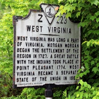
West Virginia. West Virginia was long a part of Virginia. Morgan Morgan began the settlement of the region in 1727. A great battle with the Indians took place at Point Pleasant in 1774. West Virginia became a separate state of the Union in . . . — — Map (db m46376) HM
Welcome to Falling Spring Falls in the Heart of the Alleghany Highlands.
According to the book, “Historical Sketches of the Alleghany
Highlands” by Gay Arritt, 82 acres of land including, the
Falling Spring Falls was granted by . . . — — Map (db m114706) HM
Three miles west at the mouth of Falling Spring Creek was a post garrisoned by militia under Capt. Robert Breckenridge. Washington inspected it in 1756. It survived an attack by Shawnees under Cornstalk during Pontiac's war in 1763. — — Map (db m1832) HM
Through the gap between Peters Mountain on the left and Lick Mountain lies the road to the Kanawha used by emigrants traveling west to the Mississippi basin. The road in the valley below follows the route Washington used when inspecting the forts . . . — — Map (db m77491) HM
Near this spot stood the rude hut in which "Mad Ann" Bailey spent the last years of her life as a scout and Indian fighter. She rendered valuable service to the first settlers of this section — — Map (db m256248) HM
Alleghany County. The Virginia General Assembly formed Alleghany Co. in 1822 from parts of Bath, Botetourt, and Monroe. Within its boundaries are the Towns of Clifton Forge and Iron Gate and the City of Covington, the county seat. Public . . . — — Map (db m295857) HM
Alleghany County. Formed in 1822, from Bath, Botetourt and Monroe, and named for the Alleghany Mountains. At Fort Mann a battle took place between settlers and Indians led by Cornstalk, 1763.
Botetourt County. Formed in 1769 from . . . — — Map (db m207845) HM
Australia Furnace, located just east of here, produced pig iron for the Tredegar Iron Works—“Ironmaker to the Confederacy”—during the Civil War. Ira and Edwin Jordan had begun constructing Australia Furnace in 1852; two years later, they put it in . . . — — Map (db m107981) HM
You are standing near the site of the Lucy Selina Furnace, which supplied the Confederacy with pig iron for the production of cannons, munitions, and rails during the Civil War. In 1827, two Scots-Irishmen, Col. John Jordan and John Irvine, built . . . — — Map (db m107982) HM
This furnace was built in 1827 by ironmasters John Jordan and John Irvine and was named for their wives. During the Civil War, iron produced here was used in the manufacture of Confederate Munitions. — — Map (db m46386) HM
During the Civil War, the Jackson River Depot was located here. It marked the western terminus of the Virginia Central Railroad, which extended 200 miles from Hanover Junction north of Richmond. Located just east of the Kanawha Pass of the . . . — — Map (db m107980) HM
Here stand the earliest coke ovens of the Low Moor Iron Company (organized 1873). The ovens converted coal to coke to fuel the company’s blast furnace. The company built more than a hundred such ovens in 1881. By 1923 the Low Moor Iron Company . . . — — Map (db m84051) HM
First called the Church by the Spring, Oakland Grove Church may have been organized as early as 1834, but it was officially established circa 1847 as a mission of Covington Presbyterian Church. A simple brick house of worship constructed during a . . . — — Map (db m46377) HM
In continuous use as a place of worship except for a period between 1861 and 1865 when it was used as a hospital for a contingent of General T.J. (Stonewall) Jackson's troops encamped nearby.
A monument in the churchyard marks the graves of . . . — — Map (db m46379) HM
William Henry Haynes, Sr. donated land for the Oakland Church and cemetery in 1811 to trustees James M. Montague, John P. Haynes, David Williamson and William H. Haynes, Jr. But the deed was not recorded until 1859. The original structure is said . . . — — Map (db m46378) HM
Jackson River Station
Around 1857, the Virginia Central Railroad completed the Jackson River Depot and was the terminus of the railroad for trains and travelers heading west. Travelers had to continue their travels by horseback or . . . — — Map (db m46385) HM
The Appalachian Trail crisscrosses the Blue Ridge Parkway for 100 miles in Virginia. Farther south, it winds through the Great Smoky Mountains. The trail usually follows the crest of the Appalachian chain, occasionally descending into scenic . . . — — Map (db m134499) HM
Botetourt County. Area 548 Square Miles. Formed in 1769 from Augusta, and named for Lord Botetourt, Governor of Virginia, 1768–1770. Buchanan was the western terminus of the noted James River and Kanawha Canal.
Bedford . . . — — Map (db m57734) HM
Since 1851, portions of the Buchanan Swinging Bridge have played a critical role in the Town of Buchanan’s history while providing a scenic crossing of the James River. The Buchanan Swinging Bridge you see now is 366 feet long, 57.5 feet tall at . . . — — Map (db m140270) HM
The Great Valley Road, which carried many settlers of European descent through Virginia beginning in the 1740s, crossed the James River nearby. This intersection gave rise to Pattonsburg, established north of the river in 1788 and named for early . . . — — Map (db m233096) HM
The town was established in 1811 and named for Colonel John Buchanan, pioneer and soldier. It was incorporated in 1833. Its importance consisted in its being the western terminus of the James River and Kanawha Canal, which reached the town in 1851. . . . — — Map (db m23810) HM
Buchanan, Virginia is the western terminus of the James River & Kanawha Canal. Considered one of Virginia’s most remarkable engineering feats ever attempted, the Canal’s beginnings stretch back to 1785, when George Washington appeared before the . . . — — Map (db m55794) HM
Buchanan Baptist Church
Dedicated on October 8, 1876
Has been placed on the
National Register
Of Historic Places
By the United States
Department Of The Interior — — Map (db m140259) HM
(preface)
On May 26, 1864, Union Gen. David Hunter marched south from Cedar Creek near Winchester to drive out Confederate forces, lay waste to the Shenandoah Valley, and destroy transportation facilities at Lynchburg. His raid was part of . . . — — Map (db m55777) HM
H.L. Williams House
circa 1924
Has been placed on the
National Register
Of Historic Places
By the United States
Department Of The Interior — — Map (db m140375) HM
Kemble Building
circa 1840
Has been placed on the
National Register
Of Historic Places
By the United States Department Of The Interior — — Map (db m140358) HM
Looney's Ferry, established in 1742, was the first crossing over James River in this region. On the other side of the river was Cherry Tree Bottom, home of Colonel John Buchanan, and above the mouth of this creek stood Fort Fauquier, 1758-1763. — — Map (db m23823) HM
Moelick Building
Lot 40A
has been placed on the
National Register
of Historic Places
by the United States
Department of the Interior
c. 1815 — — Map (db m189165) HM
On May 26, 1864, Union Gen, David Hunter marched south from Cedar Creek near Winchester to drive out Confederate forces, lay waste to the Shenandoah Valley, and destroy transportation facilities at Lynchburg. His raid was part of Gen. Ulysses S. . . . — — Map (db m67253) HM
(preface) On May 26, 1864, Union Gen. David Hunter marched south from Cedar Creek near Winchester to drive out Confederate forces, lay waste to the Shenandoah Valley, and destroy transportation facilities at Lynchburg. His raid was . . . — — Map (db m256765) HM
(East Face)
In Commemoration of the deeds and services of the Buchanan Company. Organized Oct. 1859, as the Mountain Rifles Virginia Volunteers. Enlisted May 1861, in the Confederate States Army, for twelve months, as Co. 1-H-28 Regiment . . . — — Map (db m23822) HM
“The new church at Buchanan deserves a word of special notice. It is chiefly the result of female enterprise. A lady well known in Virginia who occasionally visited the town, fleeing from the sultry heat of summer, determined to effect by . . . — — Map (db m140359) HM
(preface) On May 26, 1864, Union Gen. David Hunter marched south from Cedar Creek near Winchester to drive out Confederate forces, lay waste to the Shenandoah Valley, and destroy transportation facilities at Lynchburg. His raid was . . . — — Map (db m256753) HM
Robert Harvey established an agricultural and industrial complex here about 1790 that processed iron ore. The operation, known as Cloverdale Furnace, expanded in the 19th century under the ownership of John Tayloe III. About 150 enslaved African . . . — — Map (db m140513) HM
This is the old road from Pennsylvania to the Yadkin Valley, over which in early times settlers passed going south. On it were the Black Horse Tavern and the Tinker Creek Presbyterian Church. — — Map (db m62980) HM
The Carolina Road passed here on its route from Pennsylvania through the Valley of Virginia to the Carolina backcountry and beyond. Originally developed by Iroquois warriors, the road became a conduit for settlers of European descent, including . . . — — Map (db m298695) HM
Daleville College began as a private school that Church of the Brethren educator Isaac N. H. Beahm conducted for the children of Benjamin F. Nininger and George Layman in 1890. The construction of school buildings began the following year. In 1892, . . . — — Map (db m63212) HM
Half a mile west stood Greenfield, the home of Col. William Preston. According to local tradition, Stephen Rentfroe constructed a fort there in the 1740s. In 1759, Preston bought the property from Rentfroe and soon built a house that evolved into a . . . — — Map (db m62983) HM
On 15 December 1970, fire gutted the 1848 Greek
Revival-style Botetourt County courthouse.
Amid the charred wreckage, in a secure vault,
the county’s historic records fortunately
survived almost unharmed. Because of the
near-loss of the . . . — — Map (db m84188) HM
Breckinridge Mill is a rare survivor of the grain and milling industry that figured significantly in the economy of antebellum Virginia. The three-and-a-half story brick structure was erected in 1822 for James Breckinridge, and is one of the oldest . . . — — Map (db m84225) HM
Miller’s place here was selected as the county seat of Botetourt in 1770. In 1772 the town of Fincastle was established on land donated by Israel Christian and named for Lord Fincastle, eldest son of Governor Lord Dunmore. It was incorporated in . . . — — Map (db m84192) HM
Col. William Preston constructed Fort William nearby in 1755 during the French and Indian War (1754 – 1763) as one in a series of fortifications to protect Virginia’s frontier. A group of Indians paid a friendly visit in Oct. 1755, and Col. George . . . — — Map (db m62979) HM
Near here is Santillane, one of Botetourt County’s
most distinguished properties. The Greek Revival house sits on a tract of land originally
owned by Colonel George Hancock, a member
of the United States Congress from 1793-1797.
In 1808 . . . — — Map (db m84203) HM
The (Roanoke) Valley Baptist Association was organized on 7 August 1841 at nearby Zion Hill Baptist Church. Seventeen congregations constituted the original fellowship of churches; during the next century and a half membership grew to more than . . . — — Map (db m84226) HM
Norvel Lee was born in Botetourt County and grew
up two miles northeast of here. He joined the Army
Air Forces in 1943, was trained in Tuskegee, AL.
and later retired from the Air Force Reserve as a
lieutenant colonel. In 1948. Lee was arrested . . . — — Map (db m207830) HM
Cartmill’s Gap, just northwest, is named for Henry Cartmill, who acquired land nearby on Purgatory Creek. During the Seven Years’ War (1756-1763), conflicts between Indians and settlers increased in this area. In July 1757, Shawnee Indians attacked . . . — — Map (db m206612) HM
This gap, just west, is named for Henry Cartmill who acquired land nearby on Purgatory Creek. During the French and Indian War (1754-1763), conflicts between Indians and settlers increased in this area. In 1757, Indians laid waste to several nearby . . . — — Map (db m18817) HM
Nearby stood Capt. Audley Paul’s fort, built
in 1757 during the French and Indian War
(1754-1763) as one in a series of fortifications
to protect Virginia's frontier. Paul served as
a lieutenant in Maj. Gen. Edward Braddock’s
ill-fated . . . — — Map (db m43110) HM
Around 1766 Thomas Wood began the first known homestead on this property. The farm passed through several hands until John T. Johnson bought it in 1852. Johnson family descendants worked the farm continuously for nearly 90 years, during which time . . . — — Map (db m280878) HM
The Johnson Farm Apple House was a two-level structure. The upper level served as a storage/drying area for food and the lower level served as the farm's root cellar. Canned goods, as well as apples and potatoes, were stored in bins on the earthen . . . — — Map (db m280871) HM
This farmhouse was built in several sections, each at different times. When John T. Johnson bought the land in the 1850s, a four-room log cabin stood here. Over the next 70 years, the family added porches, a dining room, a kitchen, clapboard siding, . . . — — Map (db m280865) HM
Near here took place the historic meeting of John C. Moomaw and C. M. Thomas that led to the termination of the Shenandoah Valley Railroad at Big Lick (now Roanoke), April, 1881. This was the beginning of the city of Roanoke. — — Map (db m23824) HM
Botetourt County. Area 548 square miles. Formed in 1769 from Augusta, and named for Lord Botetourt, governor of Virginia, 1768-1770. Buchanan, in this county, was the western terminus of the noted James River and Kanawha . . . — — Map (db m228098) HM
(front)
To the Confederate Soldiers of Alleghany County.
(side)
"They fought for liberty, home and those they loved, their names are borne on honor's shield and their record is with God."
Erected in loving tribute by the . . . — — Map (db m108016) WM
Who served in the
Korean War 1950-1955
Vietnam Conflict 1964-1975
The Medal of Honor
awarded to
Michael Fleming Folland
Gary Lee Miller
Korean War
June 27, 1950 to Jan. 31, 1955
...
Vietnam . . . — — Map (db m108019) WM
They died, that we might live.
Marion Landes
Bedford Carlisle Lam
Roy Hedrick Bush
Wilbur McKinley Rose
Almer Roy Dew
Earl Howard Tyree
Mordiant Burnette Kelly
Roy Alexander Bazzarre
Joseph Alfred Byers
James M. Nicely . . . — — Map (db m275707) WM
C and O for Progress
Class … G-5
Type … 2-8-0
Service … Mixed
Builder … Alco
Boiler Pressure… 205 lbs.
Year Built … 1911
Richmond Va.
Cylinder H.P. … 1951
Tractive Power … 48,500 lbs.
Diameter of . . . — — Map (db m298442) HM
Covington High School
1939
is designated a
Virginia Historic Landmark
by the Virginia Department of Historic Resources
and placed on the
National Register of Historic Places
by the U.S. Department of the Interior . . . — — Map (db m298441) HM
Constructed nearby about 1756 as a wooden palisaded fort, Fort Young, originally known as Dickinson’s Fort, stood near the Jackson River. It was one in a series of forts authorized by the Virginia General Assembly to be built on the frontier to . . . — — Map (db m84052) HM
Born in Kingston, Texas, died near this site in an airplane crash. America's most decorated veteran of World War II. He served in the European Theatre-15th Infantry Regiment-3rd Infantry Division and earned 24 decorations, including the Medal of . . . — — Map (db m58308) HM
The community of Captain received its unusual name in 1888, when a post office was established in the home of Guy Dingus Huffman, who had served as the captain of Company K, 46th Virginia Infantry Regiment, C.S.A., during the Civil War. Huffman had . . . — — Map (db m84157) HM
This Federal-style house, one of Craig County's few antebellum brick buildings, was constructed for merchant Robert Wiley ca. 1832, when the style was popular in western Virginia. Construction of the house coincided with the development of a . . . — — Map (db m265635) HM
(East side)
To the Confederate Soldiers
of Craig County
1861-1865
(North side)
Invincible in life,
Immortal in death.
(West side)
Love makes
Memory eternal.
(South side)
The greatest gift . . . — — Map (db m265643) WM
After the Revolutionary War, care for people facing poverty in Virginia ceased to be the responsibility of Anglican parishes and instead was managed by county-appointed “overseers of the poor.” Craig County, formed in 1851, initially assisted the . . . — — Map (db m289050) HM
Erected in honor of those who have or shall ever serve honorably in the founding
or defense of our nation with special gratitude to those killed or missing in action and to all prisioners of war. — — Map (db m265642) WM
In memory of the men from Craig County
who gave their lives in World War II
1940-1946
James Lester Tripp •
Novel Burin Sanders •
Emmett Delbert Hutchison •
Luther Marshall Brizendine •
James Tulley Greenway •
Clyde Bertrand Brizendine . . . — — Map (db m265640) WM
To the memory of the soldiers of Craig County who made the supreme sacrifice
in the World War
Nalvin Thomas Davis •
Chap Johnston Elmore •
Lamah Martin Huffman •
Chap Lucas Huffman •
John Ashby Jones •
Frank Perkins Lipes •
Charley . . . — — Map (db m265638) WM
On August 24, 1891 the C&O Railroad made the first run of the Craig Valley Branch from Eagle Rock to New Castle, known then as Bessemer at Eagle Mountain to Craig County. The line covered a distance of 26.5 miles generally following Craig Creek. . . . — — Map (db m305330) HM
This point marks a spot along the geographical feature known as the Great Eastern Divide. From here water of Sinking Creek flows southwest into the New River. The New River, probably the oldest stream in eastern North America, becomes the Kanawha . . . — — Map (db m84180)
Like Daniel Boone who blazed the Wilderness Road, other early pioneer families such as the Holstines were commissioned by the court to survey new routes to the west. As early as 1754 the family was farming on Craig's Creek and was one of the . . . — — Map (db m265636) HM
368 entries matched your criteria. The first 100 are listed above. Next 100 ⊳