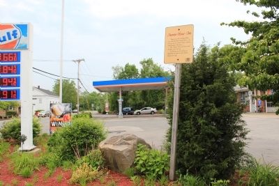
Former site of the Anawan House, once called the Lewis Tavern built ca. 1835 as a rest stop for travelers between Taunton and Providence Plantations.
The Anawan House and inn served the public until July 1970. In February 1971 the building was . . . — — Map (db m55683) HM
Site of capture of the Wamponoag Indian Chief Anawan by Captain Benjamin Church on August 28th 1676, thus ending King Philip's war — — Map (db m44921) HM
The name "Bad Luck" (origin unknown) has been associated with this area since the early 1700's. The Beverly and Kelton families operated a water powered saw mill for many years on the North side of the pond beginning in the 18th century.
Bad Luck . . . — — Map (db m56246) HM
In 1720, Jonathan Bliss moved here from South Rehoboth and established a sawmill on the East Branch of the Palmer River with a homestead nearby. This homestead was one of the first in the area, and Bliss called it " my farm in the woods" the mill . . . — — Map (db m56247) HM
Block House No. 2. From 1675 - as seen in 1782. On the rise behind this sign was a fortified house surrounded by a palisade during the King Philip's War. This enclosure was a place of safety against Indian attack for the settlers in the Palmer's . . . — — Map (db m299476) HM WM
The ruins of the old dam are all that remain of the once busy Perry Turning Mill. This mill originally operated as a saw mill in a joint venture by Aaron Cole and Ezra Perry. Perry bought out Cole's share in he early 1800's, and raised the dam, and . . . — — Map (db m56249) HM
Plain St. now crosses what was once sawmill pond.
On a cold New Years day in 1830, 14 new converts to the nearby Oak Swamp Baptist Church were baptized by being immersed in the pond through a hole cut in 14" of ice — — Map (db m55905) HM
This one room school built in the 1840's and used by the town of Rehoboth until 1937. An extension of 14 feet at the rear was made in the 1920's. During Rehoboth's 325 anniversary in 1968 the school was restored and donated to the preservation of . . . — — Map (db m44925) HM
When the British occupied Newport, RI. during the Revolution they often threatened the surrounding towns with raids or "alarums" as they were called. When a raid began a system of beacon fires were lit to warn the militia in neighboring towns to . . . — — Map (db m55911) HM
About 200 feet south of this spot is a natural oven shaped hole in a rock. According to local tradition, Indians used this as a bake oven and to parch their corn. — — Map (db m55684) HM
Nearby runs Mine Brook named after an iron mine established here in 1696 by the Leonards, a famous iron monger family from Norton and Taunton.
The ore dug at this site called bog iron, was found in the swamp and brook. The Leonards hauled the ore . . . — — Map (db m55679) HM
During the American Revolution, a large white oak called "the Liberty Tree" stood near this place, which was then near the edge of a field. Beacons warning of trouble in Rhode Island could be seen by watchers at nearby Horton's Signal. After . . . — — Map (db m55918) HM
Rehoboth's second Meeting House,built in 1773,was located in the present cemetery. It replaced the Lake St Meeting House, and was used for town meetings and church services. The site included a stable, a cemetery west of the meeting house, a militia . . . — — Map (db m55656) HM
in 1810 a group of Rehoboth Citizens established Palmer River Manufacturing Company. A cotton spinning mill on the site of the old Joshua Smith grist and saw mill the mill was enlarged about 1826 and began manufacturing fine cotton cloth, as the . . . — — Map (db m44924) HM
This town pound maintained by Col. Frederick Drown for many years. Stray cattle were kept here until retrieved by their owners.
The Wheeler family ran a pot ash business nearby. — — Map (db m55912) HM
It was known as Butterworth Falls in the colonial days. Deacon Thomas Carpenter and later the Perry family maintained the saw-gristmill-turning shop here for almost 200 years — — Map (db m55686) HM
Redway Plain is named after James Redway, who settled here in the early 1700's. Originally the plain included this field, The Faxon Farm Field,and the Village Cemetery. Neither Winthrop Street or Pond Street existed before 1828.
From colonial . . . — — Map (db m56243) HM
Founded by Josiah Millerd in 1731. For over 140 years neighborhood farmers had their corn ground into meal and their logs sawn into lumber at this mill. — — Map (db m55917) HM
Framing for this church had begun at Peckham Street, when disgruntled Oak Swamp people took away the timbers in the night and raised the church here. — — Map (db m55913) HM
Site of "The Palmer's River Meeting House" The first meeting house in the second precinct of Rehoboth. Construction started in 1717 and completed November 29th 1721, with Reverend David Turner as pastor. Fifty pounds was donated towards the cost of . . . — — Map (db m55662) HM
First liquid propellant rocket launched in Auburn Mass. Mar. 16, 1926 by R.H. Goddard
This park dedicated to his memory by the Rotary Club of Auburn 1970 — — Map (db m18099) HM
On March 16 1926 Dr. Robert H. Goddard launched the world’s first liquid propellant rocket from a point 100 feet south-southeast of this tablet on the property of the Asa M. Ward family. Erected by The American Rocket Society July 13, 1960 in . . . — — Map (db m155448) HM
Roll of Honor
This tablet was erected by
the Town of Blackstone to
Commemorate the Men who placed
Their Lives in the hands of
Their Country in the World War
1917 — 1918
Archambeault, Joseph · Babu, Tasi S. · Bagley. Edward J. · . . . — — Map (db m197601) WM
In Honor
of the
Men and Women
of
Blackstone
Who Served Their Country
In World War II
and the
Korean Conflict
Vietnam
Desert Storm — — Map (db m197575) WM
Residents of the Town of Blackstone
who Died in the Service of their Country
in World War II
Thomas P. Carroll · Edward M. Chorzempa · Alphonse J. Cote · Gerald Dumais · Raymond Guiducci · Everett G. Hanson · Carl O. Johnson · George F. . . . — — Map (db m197574) WM
Duty, Honor, Country
This memorial is a testament to the spirit of patriotism and sacrifice of all who have answered the call to boldly defend, uphold, and preserve the freedoms of this great nation through their service in the armed forces of the . . . — — Map (db m197579) HM
The United States Air Force is the aerial and space warfare branch of the United States Armed Forces. The Air Force is the youngest branch of the United States Military and was officially established under the National Security Act of 1947 but was . . . — — Map (db m197589) HM
The United States Army is the land warfare branch of the United States Armed Forces. Established on June 14th, 1775, it is the oldest branch of the united states military whose sole purpose is preserving the peace and security and providing for . . . — — Map (db m197581) HM
The United States Marine Corps is responsible for conducting expeditionary and amphibious operations in conjunction with the other branches of the United States Armed Forces. The Marine Corps is a subdivision of the United States Navy and was . . . — — Map (db m197585) HM
The United States Navy is the naval warfare branch of the United States Armed Forces. It was established on October 13th, 1775, just 4 months after the United States Army. The mission of the United States Navy is to train and equip combat ready . . . — — Map (db m197588) HM
Veteran's Memorial Corner
Dedicated To:
The Men and Women Past and Present, Who Answered the Call of Duty
To This Great Nation
"Freedom Is Not Free'
Thank You for Your Service to Our Country
God Bless You and God Bless the United States . . . — — Map (db m197576) WM
Old Boston and Hartford Turnpike
Douglas Center
Cemetery
Erected in Memory of
Forty Six Soldiers
of the
American Revolution
who are buried here
They endured hardship and death
for freedom and independence
Erected by
Capt. Job . . . — — Map (db m195642) WM
In Memory of the Men of Douglas
Who Enlisted in the Civil War.
1861 — 1865
( west side )
Samuel Sibley · Lebright Brown · John B. Johnson · John Richards · Thomas Take · Thomas Wolf · John Shriver · Horace Belding · Lorin B. Chase · . . . — — Map (db m195646) WM
( right plaque )
This building has been erected from a fund left to the Town of Douglas by the will of Moses Wallis dated 1841, to be maintained forever as a town hall for the Citizens of Douglas
( left plaque )
This . . . — — Map (db m195652) HM
John Eliot established here in 1651 a village of Christian Indians called Hassanamesit - "at a place of small stones." It was the home of James the Printer who helped Eliot to print the Indian Bible. — — Map (db m295848) HM
These four and one-half acres have never belonged to the white man, having been set aside in 1728 as an Indian Reservation by the forty proprietors who purchased the Praying Indian town of Hassanamesit. — — Map (db m93038) HM
Crossing the highway at this point is the Indian trail followed by the Reverend Thomas Hooker in 1636 when, with his invalid wife borne on a litter, he led a company of Massachusetts settlers to found Hartford, Connecticut. — — Map (db m93035) HM
Adin Ballou — Preacher, Author, Reformer, Philanthropist, Apostle of Christian Socialism, and Founder of the Hopedale Community. 1803–1890.
“Blessed are the Peacemakers.”
“Not disobedient to the heavenly . . . — — Map (db m1618) HM
Here stood Mendon's first meetinghouse, built in 1668 and destroyed by Indians in 1676. Joseph Emerson, the minister, was an ancestor of Ralph Waldo Emerson. — — Map (db m48762) HM
In memory of the honored founders of Mendon 'the old mother town.' Settled 1663. Incorporated 1667. Eight towns are now located on her original territory. Near this spot Mendon's first three meeting houses were built."
Founders 1668: . . . — — Map (db m91558) HM
Mother Mendon
Mendon began as an eight-mile square tract purchased for twenty-four pounds from several Native American tribes in 1662. In 1663, fifteen families, mostly from Braintree and Weymouth, undertook the arduous task of creating this new . . . — — Map (db m195663) HM
Built in 1840, this Greek Revival Style three-story building named in honor of President William Henry Harrison was constructed in partnership between the townspeople and Gentleman Farmer Silas Dudley who donated the land and design for the . . . — — Map (db m195701) HM
Who fought in the French-Indian Wars 1755 - 1763 and its Minute Men who responded so quickly to the Lexington Alarm April 19, 1775 and its Revolutionary Soldiers who did their part in winning the war that gave us our freedom and independence 1775 - . . . — — Map (db m63959) HM
The Roll of Martyrs
Presented by
Austin Wood
John B. Rockwood Died at Newbern N.C. Nov. 24, 1863.
Patrick Wallace Died at Newbern N.C. Oct. 24, 1862.
Martin S. Howe Died at Morris Island S.C. Nov. 23, 1863.
Robert . . . — — Map (db m195655) WM
Mendon Historical Society
1896 - 1996
Dedicated to the Collection and Curatorship
of Historic Data and Artifacts Relating to
"Mothertown" Mendon and Daughters
May 18, 1996 — — Map (db m195664) HM
In Honor of those of Mendon who Served in
Korean Era Vietnam Era
( left plaque )
Barnes Daniel N. · Butler William W. · Carmody James · Closson Alfred · Coburn Donald E. · Cram Habner O. · Delana Rudolph L. · Devoll Robert B. · . . . — — Map (db m195696) WM
Mendon
In Honor of Those Who Served in
1917 The World War 1919
George M. Aldrich · George M. Barrows · Harold C. Barrows · Leslie M. Burr · Edmund Cedarholm · Albert S. Coleman · Moses M. Coleman · Albert I. Cromb · John J. Curley · William . . . — — Map (db m195698) HM
In Honor of Those Who Served in
1941 World War II 1945
Allegrezza, Aldo O. · Allegrezza, Nello A. · Anthony, Lewis L. · Barrows, Harold C., Jr. · Bell, Robert E. · ★Bessette, Raymond · Beyer, Edward D. · Blanchard, Alphonse · Bonetta, . . . — — Map (db m195699) WM
Mendon’s First Meeting House
— Built 1668 —
Destroyed by King Philip’s warriors
at the burning of the town in 1676
Rev. Joseph Emerson — its only minister
ancestor of Ralph Waldo Emerson
this tablet erected in the name of
the Mendon . . . — — Map (db m195660) HM
First Burial Ground in Millville
is owned by the Chestnut Street Meeting House
Most markers have disappeared through the
ravages of weather and time.
Few names of our first settlers buried here are known,
however, The memory of their . . . — — Map (db m192543) HM
Longfellow School
1850
Has been placed on the
National Register
of Historic Places
by the United States
Department of the Interior
Millville Historical
Commission — — Map (db m192459) HM
Main Street, once lined with stately elm trees, was drastically changed in the 1930s when the Elm Blight decimated hundreds of trees across the state. The tree-lined image of Millville was lost.
The south side, along the railroad, was once . . . — — Map (db m192456) HM
Standing at this point the visitor will view the sites of mills dating from 1727 through 1977, when the last mill was lost to fire. The Island in the Blackstone River was the site of the earliest mills in 1727. Here the first bridge crossing . . . — — Map (db m192461) HM
In Memory of
Veterans
Of All Wars
Town of
Millville
( back )
World War I
World War II
Korean Conflict
Vietnam
Desert storm
Iraq
Afghanistan — — Map (db m192458) WM
In 1916 the Village of Millville seperated from Blackstone and was incorporated as the Town of Millville. The new town successfully faced the challenge of self-governing itself for just a few years. Following the Great Depression of 1929 . . . — — Map (db m192539) HM
Samuel Thompson’s Gristmill Stone 1727
Discovered in the Year 1937
by
A. Frederick Anderson
Town Antiquary
Presented to Longfellow School
by
Robert A. Mcglaughlin
Agent
Milleville Municipal Finance Commission
( small plaque . . . — — Map (db m192463) HM
The Raceway crosses under Central Street on the southerly side of the Longfellow Municipal Center. The water moved through it from a west-to-east direction from the Blackstone River and discharged back into the river on its northeast bank. . . . — — Map (db m192540) HM
The tower is nine-feet four inches in diameter and approximately thirty feet high, with walls at the base twenty inches thick. It is constructed of fairly thin stones which appear to be the same or similar to the material in the bedrock on which it . . . — — Map (db m192460) HM
The mill complex known as the Rockdale Mill dates from 1857 with the construction of the stone cotton mill by Paul Whitin & Sons. That building, along with several brick additions, produced much of the cotton cloth manufactured in Northbridge in the . . . — — Map (db m260370) HM
Site of Sutton's first town meeting in 1718, many working mills once dotted this landscape. The district was originally comprised of eight 40-acre farm settlements. The Eight Lots school was built circa 1800 and officially closed in 1918. Ruth . . . — — Map (db m260294) HM
In 1679, 8 miles of land was transferred by the
Native American Wampus to the English owners. By
1718, 4,960 acres of virgin land had been laid out
and established by 30 settlers. Within sight from
this common were house lots, a gristmill, . . . — — Map (db m260334) HM
The first town meeting
was held near this site
December 3, 1718
Elected were selectmen Elisha Johnson • Samuel Stearns • John Stockwell — — Map (db m260295) HM
1776 — 1976
We dedicate this testimonial plaque
to our contemporary fellowmen
and to our forebears, who, in armed
conflict and civil strife, sacrificed
their lives or domestic tranquility
to establish and preserve the most
enduring . . . — — Map (db m260332) WM
In 1672, King Charles II decreed a mail system to aid communication between the colonies. Once a month, a rider on horseback delivered saddlebags marked for each town along the route from New York to Boston. Fees for delivering mail were assessed . . . — — Map (db m260339) HM
This Spot is Sacred to
The Memory of
2nd Lt. Arnold Moholt
2nd Lt. John T. Goodwin
SSgt. Thomas L. Cater
Sgt. Merle V. Massar
Sgt. Anthony j. pitzulo
They Died When Their
US Army Airplane
Crashed Here May 18, 1944
They Gave Their . . . — — Map (db m191298) WM
Private Sullivan
U.S. Marine Corps, U.S.S. Marblehead
For heroism and gallantry under enemy fire
Received Congressional Medal of Honor
Cutting cables Cienfuegos Cuba
May 11, 1898 — — Map (db m191716) WM
Garside Square
in Memory of
Corp. Andrew W. Garside
Co.H, 15th Mass. Infantry
Captured at the Battle of
The Wilderness, VA May 6, 1864
Died Nov. 15, 1864, Millen, GA
A prisoner of war
he could do no more for his country.
Dedicated . . . — — Map (db m195654) WM
This house was built in 1768
by
Simeon Wheelock 1st Lieut.,
in the Revolutionary War
and
Deborah his wife
Presented to the
Deborah Wheelock Chapter
Daughters of the American Revolution
In 1910 by
Mr. & Mrs. William E. Hayward. . . . — — Map (db m191715) HM
James Albee · Salathiel Albee · Samuel Adams · Saint Adam · Abel Aldrich · Amariah Aldrich · Amasa Aldrich · Benjamin Aldrich · Ezekiel Aldrich · Peter Aldrich · John Alguer · Samuel Amedon · Alford Arnold · David Bacon · Elijah Bacon · Jonathan · . . . — — Map (db m191673) WM
In Memory of the Soldiers of
Uxbridge
Who served in the War for the Union
1861 — 1865
( south face )
G.W. Aldrich · J. Andy · W.O.F. Aldrich · E.C.Arnold · J.A. Aldrich · S. Anthony · H. Anson · Lieut. M.A. Aldrich · J.M. Bacon · . . . — — Map (db m191669) WM
Dedicated
Memorial Day
2009
By The
Grateful Citizens
of Uxbridge
To Those
Who Honorably
Served Their
Country During
Time of conflict
Lebanon · Grenada · Panama · Gulf War · Somalia · Bosnia · Afghanistan · Iraq
Seely, . . . — — Map (db m191670) WM
In Memoriam
Charles F. Bain · Herbert E. Blair · Ralph Coppola · John J. Creighton · Edward Horton · Edward F. Maroney · William P. Monahan · Carl Mulrain · Charles A. Rice · Theodorea A. Southwick · Harold B. Taft · William J. Wall . . . — — Map (db m191613) WM
Sgt. Walter F. Wesgan
32nd Field Artillery — 1st Div.
First
Uxbridge Polish—American
Killed in World War II
Died in the
Battle of Kasserine Pass
North Africa
March 21, 1943
Erected by
Walter F. Wesgan
Veterans Post . . . — — Map (db m191718) WM
Northbridge, MA
Canal Route & Lock Location
This property
has been listed in the
National Register
of Historic Places
by the United States
Department of the Interior — — Map (db m117520) HM
To the men of
Northbridge
who gave their lives
for their country
Andrew Addison • Henry W Ainsworth • James Allen
Arthur J Andrus • Alfred A Batcheller
Elbridge Bodwell • Dexter Brown • Edwin R Brown
Joseph E Brown • Jeremiah H . . . — — Map (db m117472) WM
Corporal John M. Dawson, lifelong resident of Whitinsville, was killed in action while on a patrol in Jalalabad, Afghanistan on April 8, 2015. He served as a combat medic assigned to Headquarters and Headquarters Troop, 1st Squadron, 33rd Cavalry . . . — — Map (db m117449) WM
In 1836 Israel Plummer built a store beside a boat basin and dock here—the mid-point of the canal journey between Worcester, Massachusetts and Providence, Rhode Island. Retail products sold at Plummer's store included stove parts, tools and . . . — — Map (db m117521) HM
World War II
[Honored Dead]
Oliver Ashton • Frank Berkowicz • Francis Bonoyer
Floyd Convent • Francis Deveau • Alvin Dillaber
Harvey Duquette • William Girard • Edward H Haringa
Philip Hathaway • Douglas Henderson • Bouwe . . . — — Map (db m117474) WM
The Mumford Riverwalk
is dedicated to
Thomas J. Melia, Jr.
1926-1998
who dedicated his life to us in war and in
peace: as a U.S. Marine and as an Officer
and Chief of our police department.
His life was an inspiration to us . . . — — Map (db m117450) WM
Dedicated to the men and women
from the town of Northbridge who
served during the Vietnam War
"Ours was an honorable cause"
In memory of
Joseph E. Fitzgerald
SSgt. United States Army
November 25, 1948 - May 31, 1967
LLRP, 3rd . . . — — Map (db m117481) WM
"The hardest working river, the most thoroughly harnessed to the mill wheels of labor in the United States, probably the world, is the Blackstone."
Winthrop Packard, 1909
The Massachusetts Department of Environmental Management (DEM) created . . . — — Map (db m117522) HM
Edward Whitin and
Arthur Fletcher Whitin
have erected this building
to be maintained forever
as a
free library
for the use of the
Citizens of Northbridge . . . — — Map (db m117469) HM
Head Track Coach at Holy Cross 1912-1964 and first Athletic Trainer. Placed third in 1900 Boston Marathon. Coached over 3000 Crusaders, including three Olympians. In 1918 coached baseball and football. His track squads won 70% of dual meets, also . . . — — Map (db m122514) HM
"We've been looking for the enemy for some time now. We've finally found him. We're surrounded. That simplifies things." — Colonel Lewis B. "Chesty" Puller
The United Nations Offensive had been a story of . . . — — Map (db m151869) HM
In honor of those
who served in the Spanish-American War
Company A, 2nd Mass. Inf., U. S. V.
The Worcester City Guards
Mustered into the United States
service May 3, 1898
Mustered out Nov. 3, 1898. . . . — — Map (db m151820) WM
In honor of those
who served in the Spanish-American War
Company C, 2nd Mass. Inf. U. S. V.
The Worcester Light Infantry
Mustered into the United States
Service May 3, 1898
Mustered out Nov. 3, 1898 . . . — — Map (db m151816) WM
260 entries matched your criteria. The first 100 are listed above. Next 100 ⊳