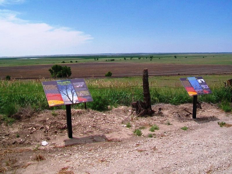
For thousands of years, Native Americans relied on this region's wildlife for sustenance. Early settlers, too, depended on bison, deer, and birds drawn to the region's reliable water and forage.
As settlements expanded, unregulated hunting . . . — — Map (db m95699) HM
Near midnight, on October 12, 1806, Lieutenant Zebulon Pike and his exploring party, headed to the Rockies, reached the Arkansas River just south of here. The explorers camped by the river for two weeks to rest their animals and lay in a . . . — — Map (db m95732) HM
When you think of Kansas, what pops into your mind? Prairie? Wheat? Dorothy? The Wetlands & Wildlife National Scenic Byway will forever reshape your image of this part of the "Sunflower State." This 77-mile Byway connects two of the world's . . . — — Map (db m95731) HM
"The stork in the heavens knoweth her appointed time; and the turtle dove, and the crane, and the swallow, observed the time of their coming" —Jeremiah (8:7)
For thousands of years, we have marveled at bird migration. How could . . . — — Map (db m95728) HM
Great Bend Army Air Field
April 1944 to December 1944
North Field Guam
December 1944 to September 1945
187 Missions
Kadena Okinawa
June 1950 to September 1953
251 Missions — — Map (db m66299) WM
Activated April 1, 1941
Deactivated October 22, 1946
Served with Distinction From Bases In
—————————
Puerto Rico • Panama • Guatamala • Ecuador • Pratt, Kansas • Chakulia, India • . . . — — Map (db m66881) WM
Donated to the City of Great Bend this 18th day of Sept., 1956 by the Atchison, Topeka and Santa Fe Railway Company.
History
Purchased in July 1919 from Baldwin Locomotive Works at Eddystone, Pennsylvania at a cost of $69,000. Used in . . . — — Map (db m59846) HM
Vernon Chandler • James Stevens
Wayne Christensen • George Lane
Neil Allen • Frank Hermes
Richard Ackerman • Harold Galbreath
Douglas Snook • Rutger Kindberg
Roy Kurre • Robert Tannehill
Andrew Kerzner — — Map (db m66300) WM
Jim Hall • Francis Thompson
Eugene Victor • Gerson Lacoff
John Segal • Don Leeper
Ernest Vick • John Keogh
Don Comer • Marv Beattie
John Tyrrell • Cecil Corley — — Map (db m66270) WM
Erected and dedicated by
Ira D. Brougher
Department Commander
to
Pap Thomas Post No. 52
Grand Army of the Republic
Department of Kansas
Veterans of the War of
1861 - 1865
[Honor Roll of Post No. 52 Members]
[Honor Roll . . . — — Map (db m59159) WM
Robert Brett • Vonley R Bucklin
Thomas Cantwell • Roger Denis
Burmon Hoyle • Clarence Rarick
William Schomburg • Fred Sobaski
Richard Solt • David Sussman
Burdette Young — — Map (db m64279) WM
Charles "Deacon" Miller • Raymond Geiger
Ted Morrill • Ernest Keller
Carson Eckmann • Edward Hassig
Robert Foor • John Murray
A.L. Tilley • Archie Moore
Delmar Pfeiffer • Elmer (mascot) — — Map (db m66265) WM
In 1825 the Federal government surveyed the Santa Fe trail, great trade route from western Missouri to Santa Fe. Treaties with Kansas and Osage Indians safeguarded the eastern end of the road but Plains Tribes continued to make raids. Fort Zarah, at . . . — — Map (db m55315) HM
Tribute to Jack Kilby
There was a time when engineers who improved our daily lives and spawned global industries achieved enormous prominence and public attention. Henry Ford and his tin lizzie were recognized everywhere. Alexander . . . — — Map (db m66174) HM
Bernard Kiley Jr • Morris Schuurmans
Patrick Conaghan Jr • Henry Harper
Arthur Richards • Edward Tis
Cecil Saul • Gilbert Dunning
Milton Diley • James Husted
John Herring — — Map (db m66245) WM
World War II • Korea • Vietnam
Enlisted in USAAF - 1943
Native of Great Bend
Distinguished Service Medal - Legion of Merit
Distinguished Flying Cross - Air Medal
Meritorious Service Medal
Air Force Accommendation Medal
Army . . . — — Map (db m64275) WM
In 1803 the United States purchased the Louisiana Territory from France, although secretly still claimed by Spain. On July 15, 1806, Lt. Zebulon Pike, US Army, left St. Louis, Missouri, with 22 troops and 51 Indians. He was to make treaties with . . . — — Map (db m302511) HM
K.D. Thompson • Thomas F. Randle, Jr.
Thurman W. Sallade • Thomas L. Price
Vaughn A. Plevan* • S. Clay Sandhofer
Louis N. Decory • Charles O. Trabold
B. Keith Baldwin • Gordon K. Golden
Leroy J. Arents — — Map (db m64304) WM
Of the 12 original pilots chosen
for the B-29 program
the following were stationed
at Great Bend Army Air Field
——————————
Marshall (Moe) Brown • Jack Doran
Archie Lewis • . . . — — Map (db m66877) WM
Roy H. Bruns • Roy B. Brown
Harold T. Bohham • Victor W. Bailey
Laurence A. Dryden • Richard H. Beardsley
Richard J. Rodrick • Victor E. Repp
C. "Mike" Williams • Herbert C. Dunn
Earle M. Bayne — — Map (db m64284) WM
Arapaho. Apache. Osage. Kiowa. Cheyenne. Comanche. Pawnee. Quivira. Wichita. All of these tribes lived in this region before Euro-American settlement, drawn to the land's bountiful wildlife, wild fruits, greens, and tubers (such as the prairie . . . — — Map (db m302600) HM
Imagine it's 1880, and you've just driven your family hundreds of wearying miles by wagon here to central Kansas. You’re anxious to build a house, but you're surrounded by unbroken prairie — not a stick of construction-grade wood in sight. With . . . — — Map (db m302598) HM
For thousands of years, Native Americans relied on this region's wildlife for sustenance. Early settlers, too, depended on bison, deer, and birds drawn to the region's reliable water and forage. As settlements expanded, unregulated hunting took . . . — — Map (db m302597) HM
Edmund G Smith POW • James Edward POW
Ray "Hap" Halloran POW • Robert Grace*
William Franz* • Guy H Knobel POW
John P Nicholson POW • Anthony Lukasiewicz*
Vito C Barbieri* • Robert Holladay*
Cecil T Laird* — — Map (db m64285) WM
Mexico won its independence from Spain in 1821, allowing the road to Santa Fe to open. This trail of commerce between Missouri and Mexico was a major international trade route. Economies were influenced from Mexico City to England. William Becknell . . . — — Map (db m302596) HM
"Lucky Irish" Gunner
73rd BW 497th BG 870th SQ
30 combat missions from Saipan.
Enroute home in the famous 52-mission
"Dauntless Dottie" which led the first
Saipan-Tokoyo [sic] Raid, the plane crashed
on Kwajalein, June 7, 1945
In . . . — — Map (db m66365) WM
In the history of most successful communities, there have been defining moments. Streetscape served as such a moment for this community. In the wake of the financial adversity of the preceding decade, this community united in common effort to . . . — — Map (db m59161) HM
Paul J Burnor • Kenneth W Fisher
John R Brown • Harold L Hadden
John M Williams • Raymond E Nelson
Frank O'Neil • Ellis W Conrad
Frank W Steed • Burrel S Lewis
James R McFayden — — Map (db m66878) WM
"The Chief" Hay • John Froehlich
Frank Pettibone • John Pearson
James Hunter • "Hap" Owens
Robert Beals • Robert Thill
Charles Burton • Bill Bostick
Al Ruester — — Map (db m66368) WM
The Arkansas River is one of America's iconic rivers, coursing 1,469 miles before merging with the Mississippi River. Here in central Kansas, its steady east-southeast flow is interrupted by a wide northward sweep called the “great bend.” The city . . . — — Map (db m302599) HM
[Panel] 1 The B-29 Memorial
Honoring the Past...
Educating the Future
The B-29 Memorial was built to honor the sacrifices made by people in the past to ensure freedom for future generations. Until the 1990s, the Great Bend Army Air . . . — — Map (db m69240) HM WM
John A Dunn* • Arwin C Hook*
John J Buckley III* • Rufus E. S. Henry*
Edward C. Johnston • John T Juracek Jr*
James E O'Donnell • Philip Wolk
Loney G Boggess • Ralph L Heffernan
Lloyd G McNamee — — Map (db m66269) WM
Nicolas Van Wingerden
William C Jennings* • Wendell F Geiwitz*
Albert E Woltz* • Uline C Miller
Thomas J Maxham* • Samuel E Davis*
Kenneth C Carlson* • Rex T Phelps*
Martin T Warner • Scott C Baker* — — Map (db m64300) WM
(east side)Dedicated to the Veterans of All Wars May 26, 1935 (west side)Erected by Morrison-McFadden Post № 3111 Great Bend, Kansas — — Map (db m156307) WM
Thomas Welch • James Johnson
Robert McKay • George Glover
Charles Vail • Robert McInerny
Allan Hanson • James Jones
Walter Grouten • James Vasbinder
Bob Kilburn • Hugh Polson
Am Reinhard — — Map (db m64286) WM
In the 1800s, the Santa Fe Trail was the Interstate-70 of the American West, and Conestoga wagons were its freight-hauling tractor trailers. Between 1822 and 1879, the trail was a commercial thoroughfare between Missouri and Santa Fe, guiding . . . — — Map (db m302743) HM
Dedicated to the memory of a man who was the "all american" citizen - total committment and devotion to his country, community and family above himself. He was a most active Chamber member and freely gave us his time, expertise and handy-man . . . — — Map (db m59845) HM
A mile northeast is Pawnee Rock, a famous landmark on the Santa Fe Trail. Considered the mid-point of the long road between Missouri and New Mexico. Pawnee Rock was a symbol of challenges overcome. Many early travelers mentioned it in their . . . — — Map (db m55303) HM
"We first rode nearly north about a mile to a remarkable Rocky Point . . .We rode upon the top which is probably 50 feet above the plain below, and from whence there is a charming view of the country in every direction."
—George Sibley, . . . — — Map (db m64191) HM
We set out at the ushal time and at 8 miles West We passed point of Red Rocks about 600 yds from the river and at Eleven miles crossed the paney River….Some Cottenwood on the Banks and Some Bushis. the Red Rock is evidently a volcanic production . . . — — Map (db m64249) HM
No one actually knows how Pawnee Rock was named. Josiah Gregg, who had been over the Santa Fe Trail eight times beginning in 1831, wrote: the attention of the traveller is directed to the ‘Pawnee Rock' so called, it is said, on account of a . . . — — Map (db m64243) HM
From 1821 until late in the 1800s Pawnee Rock was a noted landmark along the Santa Fe Trail. Thousands of wagons lumbered and creaked by here carrying goods to or from the great American Southwest. Many travelers recorded their impressions of . . . — — Map (db m64245) HM
Slowly along came the line of wagons, and the prairie breeze brought us, in sound, faint and far between, the driver’s invocations to their mules.
Matthew C. Field, journalist
1839
From 1821 until the late 1860s the Santa Fe Trail ran . . . — — Map (db m64241) HM
Standing here 175 years ago Santa Fe Trail travelers looked out over a sea of grass. About three miles to the south a line of timber marked the Arkansas River which meandered across the prairie. A few plum thickets dotted the landscape, and an . . . — — Map (db m64203) HM
Standing here 175 years ago Santa Fe Trail travelers looked out over a sea of grass. About three miles to the south a line of timber marked the Arkansas River which meandered across the prairie. A few plum thickets dotted the landscape, and an . . . — — Map (db m64205) HM
Pawnee Rock changed very little for ten thousand years. The hill was grass-covered with a fifty-foot-high face on the southeast side in front of you. Wind, water, and vegetation slowly eroded the stone.
But Pawnee Rock has changed. The top of . . . — — Map (db m64242) HM
Private
Company G 1st Regiment
Missouri Mounted Infantry
Mexican War
Pvt Carson died of some unknown illness
at this point on July 13, 1846
and was buried on the following day — — Map (db m64202) WM
In honor of the brave men and women
who passing over the old Santa Fe Trail,
endured the hardships of frontier life,
and blazed the path of civilization for posterity
Pawnee Rock, given to the State of Kansas
by Benj. P. Unruh,
in . . . — — Map (db m64248) HM
This building is the
gift of Andrew Carnegie
to the People of Halstead
A.D. 1917
———————————
In honor of all the volunteers
who helped during the
1993 Floods in . . . — — Map (db m81283) HM
Dedicated
to the Soldiers
who so bravely offered
their all to preserve
the Union of States,
1861 to 1865
Decorated
in memory of our comrades
who sleep in the
Unknown,
peacefully awaiting the
call to the Parade . . . — — Map (db m77110) WM
Trees and plaque donated by World War II Buddies of 310th Inf. 78th (Lightning) Div. Co. I, the Steele Family, and Many Friends. — — Map (db m81270) WM
Originally owned by the Halstead Town Company, Block 28 was officially designated a city park by the City of Halstead in 1891.
The Scout Cabin was built for the Halstead scout groups in 1941 by the Halstead Lions Club with the generous support . . . — — Map (db m76937) HM
Site of the first public building in Halstead, Kansas
Erected in March 1873 by G. W. Sweezy
It was a two story frame building 32 feet by 42 feet used as a commercial hotel and known as
The Sweezy Hotel
After fifty nine years of use, the . . . — — Map (db m81281) HM
"The Great American Home is that institution in which it is possible for the child to grow to maturity under conditions created and maintained for the good of the child."
Dr. Arthur E. Hertzler
Dr. Arthur E. Hertzler
1870 - . . . — — Map (db m81267) HM
This stone building was erected in 1879 after a disastrous fire wiped out many frame buildings on Main Street. Bergtholdt had a farm implement agency in the south section until 1885. That year Henry Riesen and David Dyck opened a hardware store. . . . — — Map (db m81279) HM
In Memoriam
World War II
Carl F. Dill • Claude H. Beaty • Marlin N. Wilson
Wilbur D. Robuck • Charles C. Spore • Vernon H. Buller
Marvin E. Lohmeyer • Leland F. Wendling
Elmer E. Rodenberg • William Hoffman Jr.
Orville D. Bansemer • . . . — — Map (db m81268) WM
Beaten hard by the hoofs of millions of Longhorns coming from as far as southern Texas between the years of 1867 to 1871 this trail wound northward approximately one half mile east of here. In one year alone over 600,000 cattle were herded north . . . — — Map (db m61102) HM
In the 1870s this area was settled by people with diverse backgrounds who shared the promise of the land. With an influx of those of Mennonite faith and the railroad's birth in the 1880s, success of the town was very likely. Hesston's name honors . . . — — Map (db m170407) HM
Plaque on front of building at 100 N. Main St. This is the oldest building still standing in the business row on Main Street. It was built in 1887 just after the town was officially organized. This building housed the first post office in . . . — — Map (db m170410) HM
Santa Fe engineers were surveying and platting the Newton town site on Section 17 in March 1871. Captain David L. Payne, state legislator from this district, and other early settlers saw the urgent need for domestic drinking water. Captain Payne . . . — — Map (db m56891) HM
Five generations of the Anderson family have operated Newton's oldest retail business for over 100 years on Main Street. Founder Phillip Murray Anderson began his business in 1892 selling newspapers on Santa Fe trains. In 1894 he opened a newsstand . . . — — Map (db m166282) HM
This Victorian house was built for Bernhard and Wilhelmina Warkentin in 1886-87. Bernhard was born in 1847 in the Mennonite village of Altonau, Ukraine. His father was a prominent miller. In 1872 he came to the U.S. to find new land. His letters . . . — — Map (db m56848) HM
This cannon used in coastal defense during the Civil War was secured through the efforts of Judson Kilpatrick st No. 36, G.A.R. and Congressman Chester I. Long. Presented to Mayor George W. Young for City of Newton by Hon. J. G. Wood, Topeka, on . . . — — Map (db m56919) HM WM
Twenty persons met in a vacant store on the east side of Main, midway between Sixth and Broadway, on July 7, 1872 to hear a sermon and to organize one of Newton's oldest Protestant churches. On March 25, 1875 the cornerstone was laid for a new . . . — — Map (db m166220) HM
In 1879 John Jacob Krehbiel (1838-1921), his wife Anna Leisy Krehbiel (1845-1923) and their children came to Newton from Denmark, Iowa. With George L. Epps, he purchased the Angood Blacksmith Shop at 128 E. 6th. In 1883 Krehbiel bought the business . . . — — Map (db m166406) HM
The "Mennonite Settler," designed and sculpted by artist Max Nixon (1915-2000), was dedicated by the City of Newton September 10, 1942. Funding came from citizens of Newton, the Junior Chamber of Commerce, and the U.S. Works Progress Administration . . . — — Map (db m53494) HM
Midland National Bank opened March 3, 1893 in a building located on the northeast corner of Fifth and Main. Grant Hornaday was the bank's president, J.H. McNair, vice-president and Don Kinney, cashier. The bank purchased this site in 1896 for $6000 . . . — — Map (db m166216) HM
On April 15, 1903 construction began on this site. The Cottonwood stone, red brick facade and Ionic columns combined to provide a striking addition to Main Street Newton. The two story building was designed by W.W. Rose, and constructed by Reikowski . . . — — Map (db m56851) HM
By the summer of 1871, men laying track for the Santa Fe railroad
established a railhead at the new boomtown of Newton. It became the
loading point for Texas longhorns coming north on the Chisholm Trail,
replacing Abilene, Kansas. Newton's . . . — — Map (db m250171) HM
The Ragsdale Opera House served as Newton's main center of entertainment for nearly 30 years. The grand opening was held on December 8, 1885, featuring Barney McCauley in the comedy Uncle Dan. Under constructions since May 29, 1884, it was completed . . . — — Map (db m166215) HM
Donated to the City of Newton by the Santa Fe Nov. 18, 1955. Engine 1880 and 86 other Prairie type engines built in 1906-1907 by the Baldwin Locomotive Works. They were used in various types of service for 46 years which was a longer period of . . . — — Map (db m56922) HM
The first Harvey County Courthouse on this site was a three story red brick structure in the modified Romanesque Revival style dominated by a tall clock tower. Bedford stone highlighted the exterior with marble lining the interior hallways. J.C. . . . — — Map (db m166218) HM
Masonic Lodge No. 142 was organized in 1873 with Samuel Saylor appointed master. The first meeting was held in the new schoolhouse using boxes for the altar and jewels made of tin. Early members included Muse, Peters, Munger, Spivey, Lynch, Neal, . . . — — Map (db m166283) HM
On 13 May 2003, Kansas Governor Kathleen Sebelius, proclaimed the Eisenhower Interstate Highway System in Kansas, as the "Purple Heart Trail." This trail memorializes those heroic service members who have had the Purple Heart medal bestowed on them . . . — — Map (db m56916) HM WM
Children in Russia hand-picked the first seeds of this famous winter wheat for Kansas. They belonged to Mennonite Colonies preparing to emigrate from the steppes to the America prairies. A peace-loving sect, originally from Holland, the . . . — — Map (db m53056) HM
301 entries matched your criteria. The first 100 are listed above. Next 100 ⊳