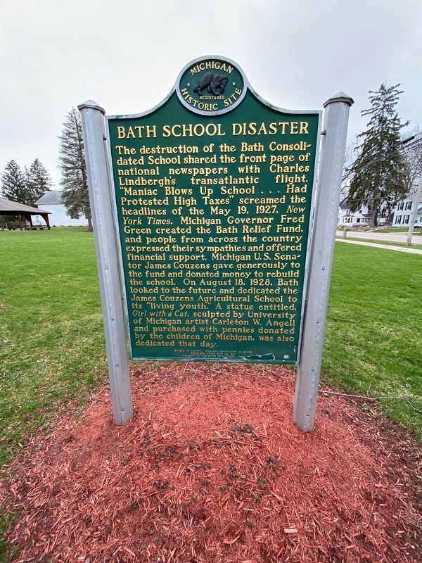
On May 18, 1927, a dynamite blast rocked the Bath Consolidated School, shattering one wing of the building and resulting in the deaths of thirty-nine children and teachers; dozens more were injured. An inquest concluded that dynamite had been . . . — — Map (db m196788) HM
This Memorial Is Dedicated
To All Veterans Who Gave
Their Lives And To Those Who
Proudly Served Our Great
Nation During The Many Wars
And Conflicts. — — Map (db m210794) WM
In 1873 there was built on this site a two story school constructed of
brick and wood. It was erected approximately 100 feet east of this
sign. The school consisted of 10 grades; a giant step toward higher
education in the Bath area.
In . . . — — Map (db m210790) HM
This small frame house
was likely built in the 1850's
by Phillip Peck. George W.
Anderson, for whom DeWitt's
Grand Army of the Republic
Post is dedicated, lived here
prior to the Civil War
in which he lost his life. — — Map (db m239641) HM
Constructed in the 1850's
for Joab and Olivia Baker.
Mr. Baker was one of the
first attorneys in Clinton
County. This house was
greatly remodeled in
the early 1900's by Levi
and Mabel Sibley. — — Map (db m239709) HM
Originally the private burial grounds for the Scott family, this Cemetery was made public by the Scotts in 1841. As one of the oldest burial grounds in the country, it is the resting place of many veterans from the War of 1812, Civil war and the . . . — — Map (db m239640) HM
Jerome and Estella Dills built
this large frame house about 1905
as a retirement home. It's
built in a style widely popular in
DeWitt at that time due the
many farmers retiring and settling
in the small village of DeWitt
during the first . . . — — Map (db m233934) HM
This Greek Revival style
house was constructed in
1855 by DeWitt merchant
Horatio Hunter. It originally
stood at 121 East Jefferson
Street. This portion of the
original house was moved
to this site by the
Shafley family in 1927. — — Map (db m233595) HM
This Greek revival style
house was built in the early
1850's by Riley J. Woodruff.
Mr. Woodruff was an early
DeWitt settler and cabinetmaker.
It was later owned by
Milton F. White, a general
merchant in DeWitt. — — Map (db m233966) HM
Herbert (Bert) Moon
retiree of REO, built this
house in 1913. It was one of
the first bungalow style
homes to be built in DeWitt.
Its low streamline appearance
was a sharp contrast to the
tall narrow house previously
popular in DeWitt. — — Map (db m239645) HM
riginally an Indian Path, this
road connected DeWitt with
the Capitol at Detroit and
Grand Haven on Lake Michigan.
It was opened as a military road
by the government in the late
1830's and at that time provided
settlers with the only access . . . — — Map (db m239677) HM
German Immigrant
Theodore Schavey who came
to America in 1854, built this
two story brick house in 1883.
This house is the high style
Italianate and features
bracketed eaves and a two
story five sided bay window. — — Map (db m239646) HM
David and Nancy Scott built
this home in the 1860's. The
house rests on the only
known uniform cobblestone
foundation that survives in
the DeWitt area. A sawmill
once stood behind the house
during the late 1800's. — — Map (db m239642) HM
Charles Scott built this upright and
wing farm home in the mid-1840's
after living in a log cabin on the
river bank. This house is by far
one of the finest and best preserved
examples of Greek revival style
architecture in Clinton County.
The . . . — — Map (db m239676) HM
Dr. Richard Simmons had
this one and a half story
frame house built in the late
1890's. It featured detailed
oak woodwork on the
interior. Dr. Simmons'
office was located in the
building now housing the
Family Barber shop. — — Map (db m233937) HM
Site of the First Jail and Sheriff's
residence in Clinton County. The
cells were located in the basement. Built by Wm. Utley for the
County in 1837 for $1078. The jail
was discontinued in 1857 when
the County Seat was moved to St.
Johns. — — Map (db m239708) HM
Built in the early 1850s, this
saltbox home was originally
located at 206 W. Main. Dr.
George Topping purchased it in
1856 and used it as an office and
drugstore. It was moved to its
present location about 1913. — — Map (db m233936) HM
This large two story house
was built about 1910 by
Knight and Harriet Van Fleet.
Mr. Van Fleet and other
members of his family were
noted quality builders early in
the twentieth century. — — Map (db m233967) HM
James Whitney is believed
to have built this upright
and wing home in the
early 1870's. It originally
stood at 403 W. Main and
was moved to its present
location in 1912 or 1913
by Earl Scott. — — Map (db m239644) HM
This two story brick house was
built in the 1870's by Addison
Woodruff to replace an earlier
home that sat on the site. Mr.
Woodruff was an early DeWitt
merchant. This house is
believed to have been the first
brick house built in
the Village . . . — — Map (db m233965) HM
This large two story house was built about 1910 for
Clayton and Clara Woodruff.
Mr. Woodruff and his
brother Mark Woodruff were
co-founders of Woodruff
Brothers Bank located in DeWitt. — — Map (db m239643) HM
Joshua Simmons II, Revolutionary War veteran, is buried in this cemetery. He was born on a Massachusetts farm in the early 1760's. In 1778 he volunteered to fight the British and served with various units in Massachusetts for about two years. In . . . — — Map (db m215373) HM
America's First "Batman" Clement Sohn "There are pioneer souls that blaze their paths where highways never ran" Sam Walter Foss — — Map (db m289527) HM
Ahead lies Lansing, capital of Michigan. In 1835, when the state was organized, Detroit was the capital, as it had been when Michigan was a territory. The capital, after much debate, was moved to its present, more centally located site in 1847. The . . . — — Map (db m94905) HM
Sleepy Hollow has three picnic areas with shelters, 1/8 mile of swim beach and a 181 site modern campground. The 11 miles of hiking trails and six miles of bridle trails pass through forested and open land. The park offers examples of "forest . . . — — Map (db m119568) HM
Purchasing one hundred sixty acres of farmland from the government, Elihu Gunnison, first settled this site, originally known as Gunnison, in 1835. This settlement, which its inhabitants often called “four corners,” had a general store owned and . . . — — Map (db m196655) HM
Side 1
Philip Orin Parmelee, noted early aviator, lived a tragically brief but venturesome life. Born in 1887 in Matherton, Michigan, Parmelee grew up in nearby St. Johns, Clinton County, where he developed a keen interest in . . . — — Map (db m233545) HM
In 1996, the Ovid Historical Society with the financial aid of the Downtown Development Association purchased a carriage that had been manufactured at the Ovid Carriage Works, later known as the Scofield Buggy Company in Ovid. The members of the . . . — — Map (db m119805) HM
Built in 1869-70 for George D. and Carrie Sowers, this house is an excellent example of Italianate architecture. Sowers, the first of several prominent local businessmen to live here, owned a planing mill located across the street with his partner, . . . — — Map (db m119389) HM
Village of Ovid
In 1836, inhabitants of Ovid, Seneca Falls County, New York, began to settle this fertile farm area. Among them were Samuel Barker, who built his log cabin in "Section 6;" Jabez Denison, noted for his prowess in killing . . . — — Map (db m119352) HM
Anthony (2002-2016) was the youngest of 11 children and
his family restored many Ovid buildings. He spoke
Spanish, made 6 missionary trips to Central America and was
the joyful greeter at Henry and Ida's Gospel Barn in Ovid.
Building occupants . . . — — Map (db m216355) HM
Home to the horse-drawn carriage industry, a video store,
church, tavern, recreation center, hardware store, dancehall
and medical office where Emily Kelley (1988-2013)
was the first infant patient.
In her lifetime Emily helped restore 4 Ovid . . . — — Map (db m216356) HM
In recognition of
Old Kent Bank
successor to State Savings Bank of Ovid
founded in 1897
for more than 100 years of
continuous operation in service
to the people of Michigan
and for contributing to the
economic growth and vitality
of our . . . — — Map (db m216357) HM
Here on this 18th day of July, A. D. 1956, the people of St. Johns, Michigan, dedicate this tree and monument to the courage and sacrifice of our forebears, who founded this city 100 years ago. ————————————— Beneath this monument is buried a metal . . . — — Map (db m213099) HM
Blue Star Mothers Chapter 88 wish to pay tribute to all from Clinton County who served in Korea and Vietnam when our country needed them ————————————— To those who gave their lives we will never forget the sacrifice you made bless you as you rest . . . — — Map (db m213100) WM
Lured by the railroad, John W. Paine (1821-1870) moved from the nearby Rochester Colony to St. Johns. In 1860 he built the town's first brick store and this house. The office was later added to this site. Dr. Samuel Gillam (1845-1908) remodeled . . . — — Map (db m215902) HM
In lasting memory of
the Clinton County
men and women
who serve in the
armed forces,
past, present
and future
Civil War
James Abbottu •
George Albert •
Edwin Ammerman •
George Anderson •
Ira Armstrong •
Abijah Arnett • . . . — — Map (db m217876) WM
In 1858 twelve persons
organized St. John’s Church.
During the Civil War the
membership dispersed; the
congregation reorganized in
1864. They built their first
church in 1867. Shortly
after the close of
of Easter
evening services in . . . — — Map (db m253703) HM
This tablet is dedicated to the settlers who came from Rochester, N.Y., and marks the first organized settlement in Clinton County, Mich. - 1836 — — Map (db m217495) HM
In 1836 a Rochester, New York, association purchased land here and by winter several families were settled in newly built log homes. Methodist circuit riders in 1837 organized a class which became center of the three-county Mapleton circuit. In 1841 . . . — — Map (db m217494) HM
The Reverend William Benson organized a Methodist class for this area in 1849. The class, which had seven members, held its first worship service in a log school south of Eureka. Later it met in the Sherwood School and the Keystone Grange Hall. . . . — — Map (db m217225) HM
In the field south of this site on
July 4th, 1895 the Michigan Rushers,
a local team, played the first professional football game in Michigan, and possibly in the U.S.
This marker was placed by citizens
of Clinton County, Michigan after
a . . . — — Map (db m254370) HM
Westphalia Settlement
In October 1836 the Reverend Anton Kopp and five other men from Westphalia, Germany, arrived in New York. They traveled to Detroit by way of the Erie Canal. Advised to settle in the Grand River Valley, the Reverend Kopp . . . — — Map (db m215916) HM
Dedicated to the memory of
Westphalia area military personnel
who sacrificed their lives for our
home and country.
Civil War
Franklin Fish · Henry Rocholl · Andrew Seckinger · Peter Sontag · Ulrich Thoma
World War I
Edward W. . . . — — Map (db m215915) WM
Front Side
Horatio Hall built this mill for Manlius Mann in 1854. Powered by water from the Battle Creek, a three-town overshot waterwheel in the basement turned three pairs of millstones that ground grain from local farmers into flour. . . . — — Map (db m166296) HM
This building served as Eaton County's courthouse from 1846 to 1872. The first courthouse was built in Bellevue in the 1830s. In 1840, Charlotte became the county seat, and in 1844 the county supervisors voted to erect a new courthouse on the . . . — — Map (db m216458) HM
Dedicated in memory of those who
sacrificed their lives to preserve
our American heritage
"that we may live in peace."
In memory of S.S.G. David W. Barrus
Many shores,
many battles,
served without malice
In memory of Frederick A. Young . . . — — Map (db m217362) WM
On November 30, 1878, the local Methodist class purchased land for a church from Benjamin and Catherine Spotts for $25.00. Church men cut and hewed the logs for the building. The Reverend B. E. Paddock dedicated the church on November 10, 1881. . . . — — Map (db m126010) HM
The citizens of Charlotte proudly dedicate this monument to the memory of our two heroes who were awarded the Medal of Honor
The Medal of Honor is America's highest military decoration for valor in combat. It is awarded to individuals whose . . . — — Map (db m216503) HM WM
Developed originally as a helicopter gunship for use in Vietnam, the Cobra demonstrated remarkable versatility and power.
Built 1968 Retired 1999
Service: Germany, South Korea, U.S.A.
Specifications
Made by Bell Helicopter Textron, Inc. . . . — — Map (db m216508) HM
Eaton County
Eaton County was organized in 1837 and named for President Andrew Jackson's war secretary, John H. Eaton. Pioneers had come to Bellevue, the first county seat, in 1833. The county was settled chiefly by New Englanders who . . . — — Map (db m121314) HM
Presented to A. S. Williams Post No. 40 Dept. of Mich. G. A. R. by U.S. Govt. in service of Civil War from 1861 to 1865.
This Post dedicated them to the memory of Soldiers and Sailors of Eaton County 1898. — — Map (db m216559) WM
This amazing oak tree is
approximately 250 years old.
It has stood as the Sentinel
on these grounds since the
American Revolution.
Courthouse Square Association
honors and celebrates its
life and history.
Eaton County's Museum
at . . . — — Map (db m216506) HM
Completed in 1846 for $1,000, the building was originally located on town
square, the current location of the 1885 Courthouse Museum. It served as
Eaton County's Courthouse until 1872, at which time it was sold and used as
the Episcopal Chapel. . . . — — Map (db m216457) HM
This handsome brick church was completed in 1881. Seven persons organized the congregation in 1851 in nearby Carmel Township. Moving to Charlotte the next year, they held services in the wooden courthouse and in 1856 built the city's first place of . . . — — Map (db m121366) HM
Members of the Gresham United Methodist Church first worshipped in a school and in homes. In 1879 Palmer and Rebecca McDonald gave this site on which to build a church. In order to erect the church, people in the community donated logs, which were . . . — — Map (db m191522) HM
The dam at Bennett Park was built around 1907 to provide cooling water for a stream generated water works facility. Additionally, it served as a local recreational attraction for many members of the community who would swim and fish here. The . . . — — Map (db m126182) HM
Local builder Nathan Johnson built this house around 1845 for Charlotte's first physician, Joseph P. Hall, and his wife, Mary. The house was moved from the business district to this site in 1868. Many professionals lived here, including . . . — — Map (db m126029) HM
Side 1
Served for many years by circuit riding ministers, the Methodist congregation dates from 1838, making it Charlotte's oldest religious society. People worshipped at the home of Jonathan Searles, in a temporary courtroom in the Eagle . . . — — Map (db m121387) HM
Luren D. Dickinson
Michigan's thirty-seventh governor, Luren D. Dickinson (1859-1943), prided himself on being a frugal farmer. As a young man he taught school and served as principal of Potterville High School before becoming . . . — — Map (db m125995) HM
"And the leaves of the trees were for the healing of the nations" Rev. 22-2
This Grove is dedicated to the memory of the Timberland Grange pioneers of Eaton County.
To the boys who answered their country's call.
To the study of trees . . . — — Map (db m216459) WM
In 1837, Methodists in Delta Township began meeting in a log schoolhouse. Served by circuit riders, they organized as a Methodist class in 1842 with two families. The class grew, and in 1865 the Reverend J. Gulic became its first appointed minister. . . . — — Map (db m182783) HM
On this site in 1839, residents of Delta Township built their first school. A one-room woodframe structure, it could seat sixty-five. In 1940 the building was remodeled and a second classroom was added. Although the township district was annexed to . . . — — Map (db m182785) HM
Delta Township Musgrove Evans platted this area in 1827. The first settlers, Erastus and Sally Ingersoll and their twelve children, did not arrive until 1835. The township was organized in 1842. At the first township meeting, citizens chose . . . — — Map (db m182784) HM
The Grand River, twisting and turning for 260 miles, is the longest river and the second largest watershed in Michigan. It begins near Jackson, flowing north through Eaton Rapids, past Woldumar and downtown Lansing. There the river turns west, . . . — — Map (db m252696) HM
"The door of the past swings open, I willingly draw near; I step inside the portals, Amid the scenes so dear."
- Fanny J. Moon, 1891
Arrival in Delta Township
In 1854, David Sands Moon and Mary (Wiltse) Moon moved to Delta . . . — — Map (db m252401) HM
"I feel the gentle hand-clasp, I hear the loving voice, I meet the tender glances. That made my heart rejoice."
- Fanny J. Moon, 1891
From Surveyors to Tycoons
Musgrove Evans, a surveyor instrumental in settling families . . . — — Map (db m252403) HM
"But present duties call me I cannot, must not stay. I go, but carry with me The thought of a summer day."
- Fanny J. Moon, 1891
Opportunity for Everyone
Woldumar Nature Center welcomes all learners. Some . . . — — Map (db m252406) HM
Known as 'Clay Hill', this was home to Dimondale's High School. Originally built in 1879, the two-story brick structure grew along with the community. It was demolished in 1965 after the school district annexed with Holt. — — Map (db m192589) HM
In memory of those who gave their lives in World War II
Alfred Merchant · Roy W. Bleisch · Alan F. Smith · Major E. Foerch · Woodrow O. Corson · Roger Keast · Lester H. Rhoades· Robert E. Hetrick · Oscar P. Kretschman · Delbert F. Meyers · . . . — — Map (db m192357) WM
It wasn't quite the Chicago Fire but a blaze in 1888 nearly wiped out Dimondale's
downtown, which at that time was located south of the river. The downtown was then
rebuilt on the north side of the bridge. — — Map (db m192591) HM
In 1846 Congregational services were conducted by the Reverend Joseph Smith in the home of one of Windsor Township's earliest residents, Nathan Pray. In 1875, nineteen years after the town of Dimondale was platted around the mill of Isaac Dimond, . . . — — Map (db m192247) HM
This bell first called the people of Dimondale to worship in 1882
It was removed from the church tower and displayed here in 1977
In memory of
Clara and Ray Burnett — — Map (db m192493) HM
Opening as a bakery, this building moved here in 1917 from where the hardware stands today. Hines Harness Repair operated here, as well as a general store. Lyle King opened a barber shop in the 1960's. Rick has served Dimondale since 1990. — — Map (db m192592) HM
This home, built in 1848
by Isaac Dimond, was sold
just after the Civil War.
In 1886 a fire burned the
house to the ground.
Owner O.H. Olmstead
rebuilt the Olmstead
House Hotel and stage-
coach stop on the original
stone foundation. — — Map (db m199011) HM
Eaton Rapids became a popular health resort when mineral water was discovered in 1869. Attracted by advertisements boasting of its curative powers, thousands came for treatment. The water was also bottled and shipped across the country. In 1874 . . . — — Map (db m171848) HM
Civil War governor Austin Blair (1818-1894) came to Jackson, Michigan, from New York in 1841. In 1842 he moved his law practice to Eaton Rapids. At that time the area was made up mostly of farmers, and Blair was paid for his legal services with . . . — — Map (db m171841) HM
We Dedicate This Plaque
"To The Ones Who Served"
In The
Spanish-American War
1898
World War I
1914-1918
World War II
1941-1945
The Korean Conflict . . . — — Map (db m171845) WM
In 1853 Warren and Sophia Ford deeded land for a school to Eaton Rapids School District No. 15. In 1869 the land became part of Hamlin Township. This one-room school, erected in 1884 with decorative Eastlake details, replaced one built in 1873. The . . . — — Map (db m171840) HM
This island, owned and operated by J. D. McAuliffe from 1872, was hailed as “a shady retreat for pleasure seekers...(with) a fine collection of animals and a museum of rare specimens”. In 1897 Eaton Rapids bought it for a city park. From . . . — — Map (db m171678) HM
In 1896 dairy farmers Dennis and Mary Miller produced ice cream for the first time on this site, using a hand-crank freezer. The 111-acre farm grew into a business with 14 farms, 1,300 acres, 500 Holstein cows, and modern equipment. In 1936 Miller . . . — — Map (db m171851) HM
In 1839 New York natives
Deodatus and Sarena Wright
settled in Parma Township
along the Territorial Road
(present-day Comdon Road).
In 1870 the Wrights sold a
parcel of their farmland,
which included this site, to
School District No. 7 . . . — — Map (db m257059) HM
The Eaton Rapids Reform Club, under the leadership of Isaac N. Reynolds, built this temperance hall in 1878. Affiliated with the national Red Ribbon movement, over a thousand local men knotted red ribbons in their lapels after pledging to abstain . . . — — Map (db m171843) HM
In 1923 the Veterans of Foreign Wars (VFW) initiated a plan to build a national home for the families of deceased and disabled American veterans. The following year a Jackson, Michigan, cattleman made his Ingham County ranch available for the site . . . — — Map (db m171836) HM
407 entries matched your criteria. The first 100 are listed above. Next 100 ⊳