By Brandon Fletcher, June 18, 2013
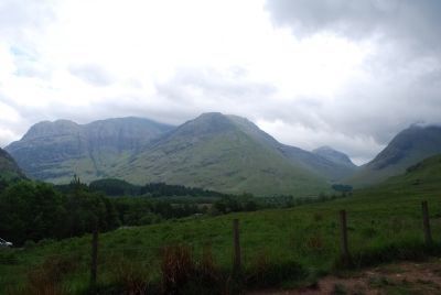
Mountains of Glencoe
| On Upper Carnoch, on the left. |
| On Scotland Route A9 at at the end of the road, on the right when traveling north on State Route A9. |
| On Marine Terrace at Bank Street, on the right when traveling north on Marine Terrace. |
| On High Street at Church Street, on the right when traveling east on High Street. |
| On High Street at Achany Road, on the right when traveling east on High Street. |
| On High Street at Park Street, on the left when traveling east on High Street. |
| On Station Road at High Street, on the right when traveling south on Station Road. |
| On Station Road at High Street, on the right when traveling south on Station Road. |
| On Station Road at Leanaig Road, on the left when traveling south on Station Road. |
| On Castle Street, on the right when traveling east. |
| On A832, 1 kilometer north of Route A835, on the right when traveling north. |
| On Scotland Route A82 at unamed road at the River Oich, on the right when traveling south on State Route A82. |
| Near Route A82, 3.7 kilometers south of River Enrick (Route A831), on the left when traveling south. |
| Near Scotland Route A82, 3.7 kilometers south of River Enrick (Route A831), on the left when traveling south. |
| On Scotland Route A82, 10.1 kilometers south of General Booth Road, on the left when traveling south. |
| On Station Road (Scotland Route B9006) at School Place, on the left when traveling north on Station Road. |
| On Chapel Street at Friar’s Lane, on the right when traveling west on Chapel Street. |
| Near Scotland Route A82 at River Enrick (Route A831), on the left when traveling south. |
| Near Scotland Route A82, 3.7 kilometers south of River Enrick (Route A831), on the left when traveling south. |
| On Castle Road at View Place, on the left when traveling south on Castle Road. |
| Near Scotland Route A82, 3.7 kilometers south of River Enrick (Scotland Route A831), on the left when traveling south. |
| On Scotland Route A82 at Scotland Route A831, on the left when traveling south on State Route A82. |
| On Castle Road at View Place, on the left when traveling south on Castle Road. |
| Near Castle Road at View Place, on the left when traveling south. |
| On Scotland Route A82, 5.5 kilometers south of River Enrick (Route A831), on the right when traveling south. |
| On Scotland Route A82, 5.5 kilometers south of River Enrick (Route A831), on the right when traveling south. |
| Near Scotland Route A82, 3.7 kilometers south of River Enrick (Route A831), on the left when traveling south. |
| On Route A82, 10.1 kilometers south of General Booth Road, on the left when traveling south. |
| Near Scotland Route A82, 3.7 kilometers south of River Enrick (Route A831), on the left when traveling south. |
| Near Route A82, 3.7 kilometers south of River Enrick (Route A831), on the left when traveling south. |
| Near Scotland Route A82, 3.7 kilometers south of River Enrick (Route A831), on the left when traveling south. |
| Near Scotland Route A82, 3.7 kilometers south of River Enrick (Route A831), on the left when traveling south. |
| Near Scotland Route A82 at River Enrick (Scotland Route A831), on the left when traveling south. |
| Near Scotland Route A82, 3.7 kilometers south of River Enrick (Route A831), on the left when traveling south. |
| On Shore Street at Innes Street, on the right when traveling north on Shore Street. |
| On Scotland Route A82, 10.1 kilometers south of General Booth Road, on the left when traveling south. |
| On Route A82, 10.1 kilometers south of General Booth Road, on the left when traveling south. |
| Near Scotland Route A82, 3.7 kilometers south of River Enrick (Route A831), on the left when traveling south. |
| Near Scotland Route A82, 3.7 kilometers south of River Enrick (Route A831), on the left when traveling south. |
| Near Scotland Route A82, 3.7 kilometers south of River Enrick (Scotland Route A831), on the left when traveling south. |
| Near Scotland Route A82, 3.7 kilometers south of River Enrick (Route A831), on the left when traveling south. |
| Near Scotland Route A82, 3.7 kilometers south of River Enrick (Route A831), on the left when traveling south. |
| Near Scotland Route A82, 3.7 kilometers south of River Enrick (Route A831), on the left when traveling south. |
| On Castle Road at View Place, on the left when traveling south on Castle Road. |
| Near Scotland Route A82, 3.7 kilometers south of River Enrick (Route A831), on the left when traveling south. |
| On Scotland Route A894, 2.4 kilometers south of the Kylesku Bridge, on the left when traveling south. |
| On Route A838, 25.3 kilometers south of the village of Durness, on the left when traveling south. |
| On Scotland Route A837, 1.3 kilometers south of Scotland Route A894, on the right when traveling south. |
| On Route A837, 2.1 kilometers south of Route A894, on the right when traveling south. |
| On Scotland Route A838, 3.2 kilometers west of Scotland Route A836 when traveling west. |
| On Scotland Route A838, 43.4 kilometers west of Scotland Route A836, on the left when traveling west. |
| On Scotland Route A838, 45.1 kilometers west of Scotland Route A836, on the right when traveling west. |
| On Scotland Route A838, 45.1 kilometers west of Scotland Route A836, on the right when traveling west. |
| On Scotland Route A837, 1.3 kilometers south of Scotland Route A894, on the right when traveling south. |
| On Scotland Route A838 at where A838 turns left toward Rhiconich, on the left when traveling west on State Route A838. |
| On Scotland Route A838 at where A838 turns left toward Rhiconich, on the left when traveling west on State Route A838. |
| On Scotland Route A837, 5 kilometers south of Scotland Route A894, on the right when traveling south. |
| On Scotland Route A835, 4.8 kilometers south of Scotland Route A837, on the right when traveling south. |
| On Route A838 at Unnamed Road to Keoldale, on the right when traveling south on Route A838. |
| On Scotland Route A838, 3.2 kilometers west of Scotland Route A836, on the left when traveling west. |
| On Scotland Route A894 at the Kylesku Bridge, on the right when traveling south on State Route A894. |
| On Scotland Route A838, 13.8 kilometers south of the village of Durness, on the right when traveling south. |
| On Scotland Route A838 at Unnamed Road to Keoldale, on the right when traveling south on State Route A838. |
| On Route A894 at the Kylesku Bridge, on the right when traveling south on Route A894. |
| On Quatre Bras (Scotland Route A99) at Village Road, on the left when traveling west on Quatre Bras. |
| On Quatre Bras (Scotland Route A99) at Village Road, on the left when traveling east on Quatre Bras. |
| On Geat N Road (Scotland Route A862) at Black Isle Road, on the left when traveling south on Geat N Road. |
| On Scotland Route B9161, 1.8 kilometers south of unnamed road (Scotland Route A832), on the right when traveling south. |
| On Harbour Street at the River Nairn, on the left when traveling east on Harbour Street. |
| On A82 just south of B8004, on the left when traveling north. |
| On Scotland Route A835 at Scotland Route A834, on the left when traveling south on State Route A835. |
| Near Scotland Route A9, 3.2 kilometers north of Moss Road, on the right when traveling north. |
| On Scotland Route A836, 2.6 kilometers east of Scotland Route B855, on the right when traveling east. |
| Near Aird Road, 4 kilometers north of Route A836, on the right when traveling north. |
| On A836 at Unnamed Road, on the left when traveling west on A836. |
| On Princes Street (Scotland Route B874) at Sir John’s Square, on the right when traveling north on Princes Street. |
| On Sinclair Street (Scotland Route A9) at Sir George’s Street, on the left when traveling north on Sinclair Street. |
| On Sinclair Street (Scotland Route A9) at Sir George’s Street, on the left when traveling north on Sinclair Street. |
| On unnamed road, 22.5 kilometers A835. |
| On A835, 14.5 kilometers south of Scotland Route A837, on the right when traveling south. |
| On Scotland Route A835 at A893, on the left when traveling south on State Route A835. |
| On unnamed road, 2.9 kilometers east of Scotland Route A99, on the left when traveling east. |
| On Main Street (Scotland Route A99) at High Street, on the left when traveling east on Main Street. |
| On Route A99, 15.6 kilometers north of the Wick River, on the left when traveling north. |
| Near Braes of Harrow, 1.6 kilometers north of Scotland Route A836, on the right when traveling east. |
| Near Braes of Harrow, 1.6 kilometers north of Route A836, on the right when traveling east. |
| On Scotland Route A99, 3.2 kilometers south of of the village of John o' Groats, on the right when traveling south. |
| On Cliff Road at River Street, on the left when traveling east on Cliff Road. |