Near New Brunswick Route 127, 9 kilometers south of New Brunswick Route 1, on the right when traveling south.
English:
In 1984, the United States Congress designated Saint Croix Island an international historic site in recognition of the historical significance of the Island to the United States and Canada.
The majestic Saint Croix . . . — — Map (db m144503) HM
Near New Brunswick Route 127, 9 kilometers south of New Brunswick Route 1, on the right when traveling south.
English:”Having found no place more suitable than this island... Sieur de Monts… allowed me to draw up the plan of our settlement."
Seventy-nine men, including noblemen, artisans, labourers, Catholic and . . . — — Map (db m144499) HM
Near New Brunswick Route 127, 9 kilometers south of New Brunswick Route 1, on the right when traveling south.
English:
Sieur de Monts named the island Saint Croix Island, and Champlain recorded that: "The island is covered with fir, birch, maple, and oak. It is naturally well located... and is easy to fortify... We considered this the . . . — — Map (db m144498) HM
Near New Brunswick Route 127, 9 kilometers south of New Brunswick Route 1, on the right when traveling south.
English:”It was difficult to know the country without having wintered there... Winter came upon us sooner than we had expected..."
Could you survive a winter on Saint Croix Island if...
• dangerous ice cut you . . . — — Map (db m144501) HM
Near New Brunswick Route 127, 9 kilometers south of New Brunswick Route 1, on the right when traveling south.
English:
The precise mapping of Acadie in the 17th century was the work of one individual — Samuel de Champlain.
Between May 1604 and August 1605, travelling by barque, pinnace, canoe or on foot, Champlain surveyed and . . . — — Map (db m144500) HM
Near New Brunswick Route 127, 9 kilometers south of New Brunswick Route 1, on the right when traveling south.
English:"In order to escape the cold and dreadful winter we experienced on Saint Croix Island, Sieur de Monts decided to move the settlement to another location. Having… found no port that was acceptable to us... we outfitted . . . — — Map (db m144502) HM
Near New Brunswick Route 127, 9 kilometers south of New Brunswick Route 1, on the right when traveling south.
English:
Welcome On Saint Croix Island in 1604, French nobleman-courtier Pierre Dugua Sieur de Monts established a settlement. This outpost was the first attempt by the French at year-round colonization in the territory they . . . — — Map (db m144495) HM
Near New Brunswick Route 127, 9 kilometers south of New Brunswick Route 1, on the right when traveling south.
English: Samuel de Champlain, explorer and geographer on Sieur de Monts' expedition, recorded in late June 1604 that:
”...we entered a river... wherein...we found two islands — one very small and near the western . . . — — Map (db m144496) HM
Near New Brunswick Route 127, 9 kilometers south of New Brunswick Route 1, on the right when traveling south.
English:
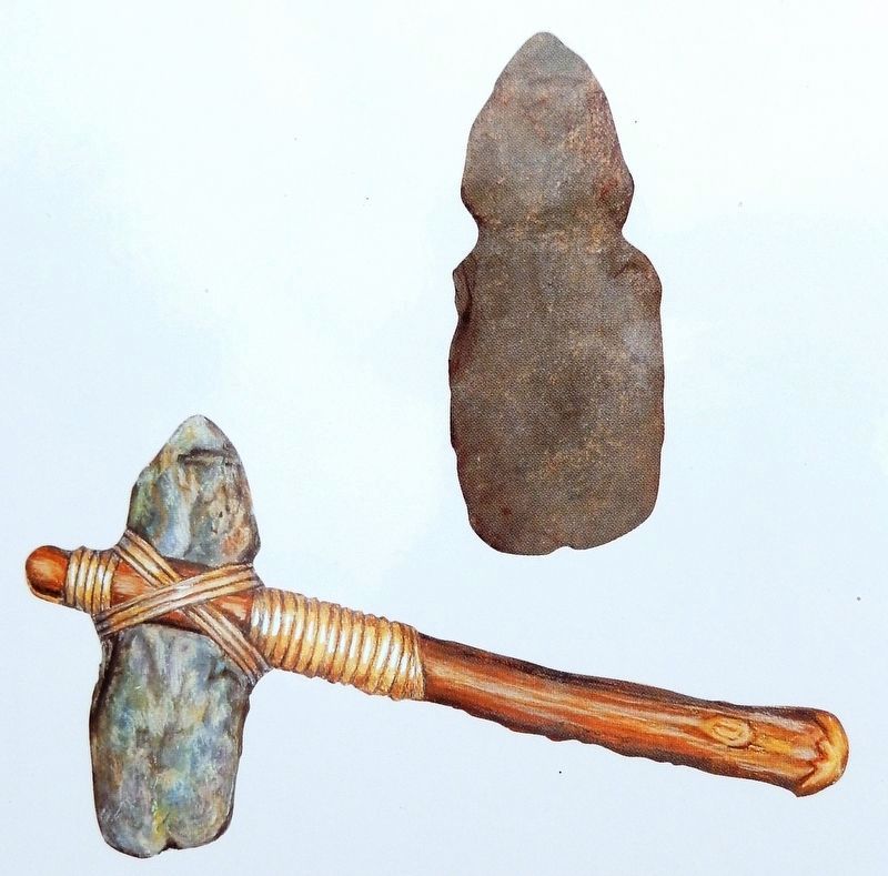
The Micmac, Maliseet, and Passamaquoddy hunters and traders provided a commercial lifeline for Sieur de Monts' colony. Their first-hand knowledge of the territory allowed these entrepreneurs to control the supply of furs. . . . — — Map (db m144497) HM
In 1881, a group of American businessmen (called themselves the Campobello Company) purchased most of Campobello Island. In an era of summer-long vacations and great summer resorts, the company hoped, by promoting Campobello's charms, to attract, . . . — — Map (db m25467) HM
On this site, in 1885, James Roosevelt, businessman and country gentleman of Hyde Park, New york, built the cottage shown below. The Cottage was intended to be a summer retreat for his wife, Sara Delano, and their son Franklin Delano Roosevelt. . . . — — Map (db m25456) HM
The Campobello hotels welcomed socializing between their guests and the summer cottage owners. Summer colonists and hotel guests exchanged visits and participated in hotel activities such as excursions aboard the company's small steamboats, field . . . — — Map (db m25462) HM
Owners of the Campobello Company hoped to enhance their one million-dollar investment by subdividing their land and selling the smaller lots to hotel guests, island residents, and others. Only a few of the lots were actually sold and built upon. . . . — — Map (db m25471) HM
On Joes Point Road close to Harriet Street, on the right when traveling east.
English on left
What kind of house?
A blockhouse is a modest fortified building with a distinctive overhanging upper level. In 18th- and 19th-century North America, both Britain and the United States built many blockhouses for . . . — — Map (db m77366) HM
On Montague Street at Edward Street, on the right when traveling west on Montague Street.
English: This elegant church marks the growth of Presbyterianism and the Kirk of Scotland in New Brunswick. Built in 1821-1824, the structure successfully combines the American meeting house form with the British Palladian style. The . . . — — Map (db m137515) HM
Near Water Street close to King Street, on the right when traveling east.
W.W.I
Anning, William • Bartlett, George Leonard • Boone, George • Cork, Alfred • Crichton, Clarence M. • Greenlaw, Ernest • Grimmer, Harold Mackie • Jack, Edward • Key, William James • Markee, Percy • McMullin, Herbert • MacQuoid, Charles Loren . . . — — Map (db m77394) WM
On Joes Point Road close to Harriet Street, on the right when traveling east.
This marker consists of two side-by-side plaques, one in English and the other in French. English:
The West Point Blockhouse and a battery were erected by the townspeople of St. Andrews at the outbreak of the War of 1812-14 in anticipation . . . — — Map (db m77240) HM
On Water Street close to King Street, on the right when traveling east.
English
Founded by Loyalists in 1783, St. Andrews is a fine and rare surviving example of a Canadian town whose plan and character clearly reflect its 18th-century origins. The town retains the four key elements of a British colonial . . . — — Map (db m77398) HM
Near Water Street close to King Street, on the right when traveling east.
English
From the Chiputneticook Lakes, the waters of the St. Croix River tumble through rolling Appalachian scenery to one of the most historic estuaries in Canada, at Passamaquoddy Bay. Here, French colonization in North America began . . . — — Map (db m77395) HM
To commemorate the men and women serving in the Canadian Arms Forces and to honour those who made the ultimate sacrifice while serving Canada and the people of Afghanistan. — — Map (db m77433) WM
Kingsbrae Garden welcomes on of the world’s oldest and rarest trees, Wollemia nobilis; the only one in Canada. An epic journey for a historic little tree, across 90 million years and 10,000 miles. from Wollemi National Park’s Blue Mountains . . . — — Map (db m77397) HM
On Joes Point Road close to Harriet Street, on the right when traveling east.
English on left
Against the odds
Many blockhouses were built in North America, but few have survived. Why is this one still here? Throughout the 19th century the St. Andrews Blockhouse was used for storage and occasionally as a . . . — — Map (db m77241) HM
On Joes Point Road close to Harriet Street, on the right when traveling east.
English on left
No hard feelings
Have a look across the St. Croix River to the land on the other side of Navy Island; that’s the United States you can see! When the War of 1812 broke out, the citizen of St. Andrews had little to . . . — — Map (db m77363) HM
On Joes Point Road close to Harriet Street, on the right when traveling east.
English on left
St. Andrews’ citizens step up
In 1812, St. Andrews was a young town, founded not long before by Loyalists from New England fleeing the American Revolution. A modest fortification - Fort Tipperary - had been built in . . . — — Map (db m77362) HM
On Joes Point Road close to Harriet Street, on the right when traveling east.
English on left
Welcome to St. Andrews Blockhouse National Historic Site, part of Parks Canada’s diverse and ever-growing system of national park, national historic sites and national marine conservation area.
Wartime building . . . — — Map (db m77361) HM
On St. Stephen Drive (County Route 3) at New Brunswick Route 170, on the left when traveling south on St. Stephen Drive.
In the waters off New Brunswick you'll find magnificent creatures of the deep - among them, North Atlantic right whales, humpback whales and finback whales
In New Brunswick, we're proud to live along the beautiful shores of the Bay of Fundy, . . . — — Map (db m106917) HM
On Milltown Boulevard (New Brunswick Route 170) close to King Street, on the right when traveling east.
English
Built in 1885-1887, this building was constructed to house the post office, customs and internal revenue. Designed under federal chief architect Thomas Fuller, the structure is one of a series of building erected to establish a . . . — — Map (db m77238) HM
On Milltown Boulevard (New Brunswick Route 170) close to Centre Street, on the right when traveling north.
English on left
They came from homes still standing in Milltown and St. Stephens. They were joined by experienced textile workers from England, Scotland, America and French Canada. They included young women, recruited from small towns and . . . — — Map (db m77234) HM
Although visitors had been coming to the island since 1855, Campobello's summer trade did not really prosper until the 1880s - years of long summer vacations and great resorts. A group of Boston and New York businessmen bought most of the . . . — — Map (db m63639) HM
Friar's Head takes its name from the stone pillar or stack (photo 1) that rises from the beach directly below the observation deck. While occupying Eastport, the British navy was said to have used the stone pillar for target practice, . . . — — Map (db m63629) HM
About 1840, a canal connecting Johnson and South Bays was dug in North Lubec and a dam constructed there to harness tidal energy to power plaster mills. Gypsum (the raw product used to make plaster) and grindstones from the Maritimes were important . . . — — Map (db m54995) HM
Lubec's known history began at a Passamaquoddy Indian encampment at Mill Creek in what came to be called Seward's Neck (now North Lubec). French settlers later came to those shores in the early 1700s, but shortly afterward were driven away by the . . . — — Map (db m55023) HM
[English version]
Built in 1885, the Mulholland Point Lighthouse guided many small coasters and freighters taking the shorter and foul weather-protected route through the narrow passage between Campobello and Lubec. Steamships, carrying freight . . . — — Map (db m54894) HM
Built in 1885, the Mulholland Point Lighthouse (photo 1) served as a guide for the many small coasters and freighters taking the shorter and more foul weather-protected route through the Lubec Narrows. Steamships, such as the . . . — — Map (db m63593) HM
Two of the Campobello Company's founders, Alex S. Porter and Samuel Wells, and several of the luxury hotel visitors, including James Roosevelt and families by the name of Sturgis, Cochrane, Prince, and Pell purchased land and refurbished or . . . — — Map (db m63641) HM
During the years FDR summered on Campobello, the daughter of one of Campobello's summer colonists married Dexter P. Cooper, an eminent American engineer. Cooper studied the tremendous rise and fall of Passamaquoddy Bay's tides and became . . . — — Map (db m63611) HM
Passamaquoddy Bay takes its name from the Native American Passamaquoddy Tribe. The word means People of the Pollock-Spearing Place. The Passamaquoddy have a rich heritage, once occupying much of what is now eastern Maine and western New . . . — — Map (db m63617) HM
The Great Depression 1929-1941
The depression was world-wide. In the U.S., the banking system collapsed and 12.8 million people were unemployed. Hardest hit were youth, minorities, the elderly, and workers in the consumer durables industries. . . . — — Map (db m54783) HM
The Roosevelt Campobello International Park is a unique example of international cooperation - jointly administered, staffed, and funded by the peoples of Canada and the United States. Established by international treaty in 1964, the . . . — — Map (db m63591) HM
Mrs. Lyndon B. Johnson and Mrs. Lester B. Pearson Together opened the Roosevelt Campobello Park on the twenthieth day of August 1964 Lyndon Baines Johnson President of the United States of America and Lester Bowles Pearson Prime Minister of Canada . . . — — Map (db m25394) HM
This house of God has welcomed worshippers for one hundred years or more. In commemoration of this fact this plaque has been presented in 1967
Canada's Centennial
of Confederation Year
1867 - 1967 — — Map (db m54939) HM
On New Brunswick Route 774, on the right when traveling north.
To the Glory of God
and the memory of our
Immortal Dead
Howard Mallock • Lawson Searles
Those who served our King and Country
Alison Alexander • Ronald Anthony • Wesley Anthony • George Babcock • Lydie Brown • Manning Brown • Raye . . . — — Map (db m54938) HM