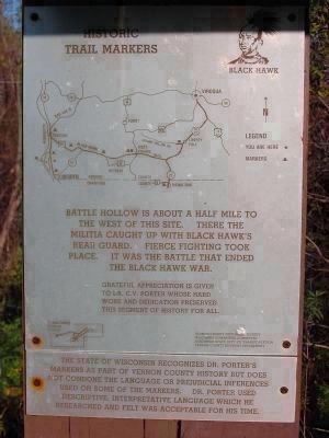
Battle Bluff ↑ Elv 1139ft
Battle Hollow →
Severe fighting 1 mile east between Gen. Henry's 300 Ill. militia and 300 Sac Indians Aug. 2 1832.
← Battle Island
Hard fighting opposite. 1200 white soldiers . . . — — Map (db m24501) HM
The Battle of Hastings and Battle Abbey
The Battle of Hastings was fought here on 14 October 1066. It is the most famous battle on English soil and its outcome had a profound impact on the history of England.
William the Conqueror's . . . — — Map (db m128713) HM
(obverse)
Before The Battle
All day that Easter Sunday the Confederate forces commanded by Col. Leon von Zinken awaited the Union Army they knew was on the way from Tuskegee. Lacking the men needed to hold it, they were forced to . . . — — Map (db m69058) HM
Here was fought on February 20, 1864
the Battle of Ocean Pond
under the immediate command of
General Alfred Holt Colquitt
"Hero of Olustee"
This decisive engagement prevented a
Sherman-like invasion of Georgia from
the south. . . . — — Map (db m54361) HM
Anxious to avoid a fight, McCook left the 8th Indiana to contend with the
Confederates at the depot while the rest of his command detoured south on the East Newnan Road. Upon reaching Land Lot 38, near Turkey Creek, the column veered to the . . . — — Map (db m94662) HM
(Front):1st Battle of CynthianaDuring CSA Col. John H. Morgan’s 1st KY Raid, on July 17, 1862, 875 CSA hit town via the Georgetown Pike. 350 US troops & Home Guard defended town from houses. Morgan attacked across Licking River and . . . — — Map (db m35858) HM
From this point the line extended about 400 yards Northeast, thence East about a mile. It extended about a half mile South from here. — — Map (db m105293) HM
Confederate General Martin Green had posted his brigade near magnolia church with at outpost at the A.K. Shaifer House. Shortly after midnight, Green rode forward to check on his pickets. The General found Mrs. Shaffer and the ladies frantically . . . — — Map (db m105844) HM
Welcome to the Mississippi's Final Stands Interpretive Center. After visiting our museum gallery, we hope that you will tour the Brice's Crossroads and Tupelo battlefields for yourself, with the help of our audio tour and roadside signage.
. . . — — Map (db m91147) HM
Jewell Hall was used as a hospital and barracks and this hill was fortified by Federal troops under Col. John Scott after their defeat at the Battle of Blue Mills Ferry, Sept. 17, 1861. A line of rifle pits was thrown up from the present location of . . . — — Map (db m45555) HM
The undulations in the ground behind this plaque mark the site of the mass burial of 17 men killed at the Battle of Liberty on September 17, 1861. These Federal soldiers came to Liberty to prevent Confederates from joining General Price at the seige . . . — — Map (db m45569) HM
Price's Raid
Confederate General Sterling Price brought three mounted divisions from Arkansas into Missouri, September 19, 1864. Fighting several small battles he marched slowly north toward St. Louis, then struck westward to Jefferson City. . . . — — Map (db m20868) HM
"Finding no great effect from our fire, and confusion beginning to
spread from the great number of men who were falling in all quarters, it
became necessary to try what could be done with the bayonet."
--Major General Arthur St. . . . — — Map (db m137502) HM
Navy Carrier launched airstrike Battle Of Midway 1942
Marine Corps raising the flag Battle of Iwo Jima 1945
Uncommon Valor was a Common Virtue
Distinguished Service Cross
Medal of Honor
Navy Cross
Air Force Cross
Distinguished . . . — — Map (db m204250) WM
Prelude to Battle
Union troops in West Tennessee and north Mississippi depended on the railroad. The Confederate high command ordered General Nathan Bedford Forrest to cut that supply line. Forrest left Columbia on December 11, 1862, . . . — — Map (db m174205) HM
Utah’s largest-ever Indian Battle took place just north of Bulldog Boulevard (1200 North) and east of 500 West near what is now Riverside Plaza. It was fought in the cold and snow in February of 1850, less than a year after the Mormon colonizers had . . . — — Map (db m301644) HM
By March 1865 Confederate General Robert E. Lee had suffered through nearly nine months of fighting, had repulsed seven Union offensives, and had his men spread along a 37-mile-long front. Knowing that it was only a matter of time before his lines . . . — — Map (db m85861) HM
This marble marks the spot where fell George T. Stovall of the Rome Light Guards, 8th Regt. Georgia Volunteers in the battle of July 21, 1861. Born at Augusta, GA, April 25, 1835.
His life he devoted to his God and sacrificed in his country's . . . — — Map (db m1996) HM
Center:
WW II
December 7, 1941 — September 2, 1945
In Memory of the Greatest Generation
Who Served for Freedom
Left:
Attack on Pearl Harbor • Battle of Wake Island • Battle of Bataan • Doolittle . . . — — Map (db m247755) WM
Read Me First The following maps and text illustrate the battle at Belmont, Missouri. The battle is broken into sections that explain the components of the overall battle. To understand the progression of the battle, match the number above each . . . — — Map (db m37089) HM
This monument is dedicated to the memory of the 40,000 troops of the 37th and 91st Divisions together with the 53rd Artillery Brigade of the American Expeditionary Forces, who fought in this region between 30 October and 11 November of 1918. It was . . . — — Map (db m87345) HM WM
This monument commemorates the achievements of the 27th and 30th Divisions which fought in the Ypres-Lys offensive with the British Army from 18 August to 4 September 1918. It was designed by the architect George Howe of Philadelphia, . . . — — Map (db m87339) HM WM
Torpedoed on 12 November 1942 by the German submarine U-163 and beached on this very site at Piscadera Curacao to save the ship and to prevent further loss of life.
In honor of all who served aboard the USS Erie, this World War II . . . — — Map (db m267049) HM WM
In early June 1918 the 42D American Division entered the battle lines with the 13th and 170th French Divisions near Souain. There it gallantly assisted in repelling the last German major offensive of the War.
When the Allies began their great . . . — — Map (db m87323) HM WM
(Panel #1)
The Montfaucon Monument commemorates the Meuse-Argonne offensive. During 47 days of fighting between September 26 and November 11, 1918, the American First Army forced a general retreat on this front. The crest of this hill . . . — — Map (db m87055) HM WM
(Main Panel:) This Monument has been erected by the United States of America to commemorate the capture of the St. Mihiel Salient by the troops of her First Army and to record the services of the American Expeditionary Forces on the battle . . . — — Map (db m87043) HM WM
Somme American Cemetery
Somme American Cemetery lies among the fields where American soldiers conducted
repeated assaults while advancing to attack the Hindenburg Line in front of Bony. 1,844
war dead of the United States of . . . — — Map (db m250767) HM WM
This Monument has been erected by the United States of America to commemorate the services of her troops and those of France who fought in this region during the World War. It stands as a lasting symbol of the friendship and cooperation between . . . — — Map (db m86789) HM WM
Erected
by the
United States
of America
to commemorate
the first attack
by an
American Division
in the
World War
Reverse
The First Division United States Army operating under the X French Corps captured the . . . — — Map (db m85933) HM WM
Italian:
Il sottotenente di vascello
Riccardo Grazioli Lante
de la Rovere
Caduto ad Homes il 28 ottobre 1911 emolando avite gesta fra cli eroi rivive ne la storia la federazione nazionale reduci patrie battaglie e militari . . . — — Map (db m266257) WM
Italian:
8 marzo 1867, da questa casa Garibaldi salutava il popolo, giurando “Roma o morte”.
I Reduci delle patrie battaglie col concorso dei cittadini posero il 21 ottobre 1888.
English . . . — — Map (db m289701) HM
On 6 June 1944, preceded by airborne units and covered by naval and air bombardment, United States and British Commonwealth forces landed on the coast of Normandy. Pushing southward they established a beachhead some 20 miles in depth. On 25 July, in . . . — — Map (db m92185) WM
[west face:]
[Portrait of General Wainwright]
General Jonathan M. Wainwright
1883 to 1953
HERO OF BATAAN
Medal of Honor Citation
“General Jonathan M. Wainwright, 02131, commanding United States
Army Forces in . . . — — Map (db m63575) WM
Manila American Cemetery, the largest of 24 cemeteries built and administered by the American Battle Monuments Commission, both in area and number of graves. 16,636 military dead of the United States of America from World War II rest here, . . . — — Map (db m73079) HM WM
The Christopher Foxley-Norris
Memorial Wall
Is Dedicated To The Aircrew
Who Flew During
The Battle of Britain
10th July 1940 — 31st October 1940
“Never in the field of human conflict
was so much owed by so many to so . . . — — Map (db m123862) WM
(preface)
"Damn the Torpedoes!" is a familiar battle cry, but there's more to the story! The Mobile Civil War Trail is your guide to military movements and the way of life on and around Mobile Bay in the closing two years of the Civil . . . — — Map (db m87247) HM
After the surrender of Fort Gaines, U.S. General Gordon Granger prepared to besiege Fort Morgan. On August 9, 1864, he moved by transport to Navy Cove and debarked 2,000 men and his siege equipment at the Pilot Town wharf. By 2:00 p.m. he had . . . — — Map (db m87246) HM
On April 30, 1865, C.S. General Richard Taylor, by then back in Meridian, received a wire from U. S. General Edward Canby. The truce negotiated at Magee Farm, Canby informed him, must end in 48 hours, because Washington had rejected the . . . — — Map (db m126690) HM
The Confederates built Fort Powell on Tower Island, an oyster shell bank fifty feet north of Grant's Pass. The Pass provided an easy route from Mobile Bay to New Orleans through Mississippi Sound. C.S. Lieutenant Colonel James M. Williams, only . . . — — Map (db m87239) HM
Once Farragut was in the Bay, capture of Fort Gaines and Powell would prevent his isolation there. So at 4:00 pm, August 3, 1864, 1,500 soldiers commanded by U.S. General Edward Canby (but under the operational direction of General Gordon . . . — — Map (db m87219) HM
At 7:25 a.m., August 5, 1864, Admiral Farragut’s lead monitor Tecumseh steered into the torpedo field at the mouth of Mobile Bay. The admiral had ordered Commander Tunis Craven, the Tecumseh’s captain, to engage the ram . . . — — Map (db m87234) HM
To Wait and Watch
In late August 1864 the Federals controlled Mobile Bay but could not attack Mobile. Admiral Farragut could not reach the City even with his light draft vessels, because the channels in the upper Bay had been obstructed. . . . — — Map (db m87243) HM
"Damn the Torpedoes!" is a familiar battle cry, but there's more to the story! The Mobile Civil War Trail is your guide to military movements and the way of life on and around Mobile Bay in the closing two years of the Civil War. . . . — — Map (db m87288) HM
This memorial's central sculpture, A Soldier's Journey, depicts scenes based on the archetypal myth of "the hero's journey," in which the hero embarks on a quest, wins victory in an epic struggle, and comes home changed by his passage . . . — — Map (db m171290) HM
All segments of American society contributed to the war effort during World War I. Despite racism at home and in the military, more than 350,000 African Americans served in uniform. Black soldiers were segregated into separate units, and and . . . — — Map (db m174084) HM
As American troops moved through the Meuse-Argonne, it became apparent that Germany had lost the war. An armistice was signed on November 11, 1918, effective at 11:00 a.m. — the eleventh hour of the eleventh day of the eleventh month.
In . . . — — Map (db m171289) HM
The American Expeditionary Forces were the soldiers and marines who fought on the Western Front in France and Belgium. But many other Americans served in the war.
While the United States initially remained neural, thousands of Americans . . . — — Map (db m171283) HM
General John J. Pershing died in 1948. The troops he led to victory 30 years before in World War I wanted a memorial. Of the potential locations, the block that you are standing on was the most appealing. It was available and it was next to the . . . — — Map (db m179904) HM
When the United States declared war in April 1917, the U.S. Army had fewer than 130,000 men. By the end of the war, 4.7 million Americans would serve in the military, two million of them in Europe.
While many Americans volunteered or were . . . — — Map (db m171287) HM
The first elements of the American Expeditionary Forces, under the command of General John J. Pershing, arrived in France in June 1917, but they lacked the numbers and training to the committed to combat. There was also debate over how the . . . — — Map (db m174083) HM
Whether our lives and our deaths were for peace and a new hope or for nothing we cannot say; it is you who must say this. They say: We leave you our deaths. Give them their meaning. We were young, they say. We have died. Remember us. . . . — — Map (db m171293) WM
You are standing in the National World War I Memorial. Before you is the American Expeditionary Forces Memorial, dedicated in 1981 to honor the American forces who served in Europe during the war and their commander, General John J. Pershing. In . . . — — Map (db m171275) HM
When "the Great War" ended in 1918, the United States did not have a tradition of national war memorials. Most memorials honored veterans from the local community, such as the District of Columbia War Memorial on the National Mall. An exception . . . — — Map (db m171292) HM
In the summer of 1914, the assassination of Archduke Franz Ferdinand, heir to the Austro-Hungarian Empire, ignited a continental war between the Central Powers of Germany, Austria-Hungary, and the Ottoman Empire and the Allies of France, Great . . . — — Map (db m171277) HM
[Inscription: Panel 1]:
Our nation honors her sons and daughters who answered the call to defend a country they never knew and a people they never met.
1950 * Korea * 1953
[Panel 2]:
Freedom Is Not Free . . . — — Map (db m8829) WM
Here in the presence of Washington and Lincoln, one the Eighteenth Century father and the other the Nineteenth Century preserver of our nation, we honor those Twentieth Century Americans who took up the struggle during the Second World War and made . . . — — Map (db m4392) HM
Dedicated to the gallant and victorious men and women who participated in the Battle of the Bulge, World War II, 16 December 1944 thru 25 January 1945 in Belgium and Luxembourg. The greatest battle ever fought by the United States Army. The veterans . . . — — Map (db m195406) WM
In memory of the soldiers and Army nurses from the Golden Triangle Area who participated in the Battle of the Bulge, 16 December 1944 through 25 January 1945 in Belgium and Luxembourg. This major conflict with the German armies is regarded as the . . . — — Map (db m166537) HM WM
Dedicated to the gallant men and women who participated in the Battle of the Bulge, World War II, 16 December 1944 thru 25 January 1945 in Belgium and Luxembourg, the greatest battle ever fought by the United States Army. The Veterans of the Battle . . . — — Map (db m7450) HM
Established in 1808 by Tecumseh and the Prophet as the capital of their pan-Indian confederacy. Led by Tecumseh, representatives of many midwestern Indian nations met and lived here in an attempt to build the greatest Indian resistance movement in . . . — — Map (db m36237) HM
Dedicated to all WWII veterans
lest we forget their generation.
Honoring the men and women who have served
but let us be glad that such heroes have lived and mourn those who gave the ultimate sacrifice
"Battle of the Bulge"
December 16, . . . — — Map (db m251747) WM
The unlucky L&N Railroad trestle over Bacon Creek received harsh treatment at the hands of Confederate raider John Hunt Morgan not once, but twice during the Civil War. The first destruction, in August 1861, was the first of many attacks Morgan . . . — — Map (db m39938) HM
Thomas Woodson received this farm as a land grant from Thomas Jefferson for service in the Revolutionary War. His son Anthony made his home on this site and developed a prosperous farmstead, considered one of the finest in the county. From his . . . — — Map (db m250225) HM
An “unauthorized and injudicious” attack …
General James R. Chalmers was sent by General Bragg as a vanguard to Cave City. There, Chalmers learned from Col. John Scott of a weak Union garrison at Munfordville. Eager for glory—and without . . . — — Map (db m250220) HM
When Braxton Bragg arrived at Green River, Cyrus Dunham had taken command of the Union garrison. The 15th had been spent clearing casualties from the field, but by the next day, gunfire erupted from Bragg’s advance guard, starting a day-long . . . — — Map (db m250219) HM
The mound on the hilltop before you is Fort Craig, a five-pointed earthen “star fort” that saw the fiercest fighting of the Civil War Battle and Siege of Munfordville, September 14-17, 1862. Forces of the 7th, 9th, and 29th Mississippi Infantry, . . . — — Map (db m250218) HM
Other than by navigating the Mississippi River, the only way for armies west of the Appalachians to move from north to south was through Kentucky. Kentucky's rivers and railroads tempted commanders from both sides in spite of the state's declared . . . — — Map (db m250223) HM
By 1857, the Louisville & Nashville Railroad lacked only one connection for through trains to travel between the two cities—a bridge over Green River. Irish stonecutters John W. Key and sons were hired for two years to construct the piers that . . . — — Map (db m250226) HM
The small, unassuming county-seat village of Munfordville, founded on an old buffalo crossing and home to a well-known tavern, could claim pride of place in 1860 as the spot where the L&N Railroad crossed the Green River, over what whas then the . . . — — Map (db m39984) HM
As useful as Munfordville's small ferry was, it couldn't meet the needs of whole armies. As soon as General Alexander McDowell McCook's army arrived at Green River in the fall of 1861, soldiers immediately began building flat-bottomed boats to . . . — — Map (db m40019) HM
The arrival of Federal troops into Lexington, Kentucky in fall 1861 prompted Lexington native John Hunt Morgan to assemble a band of 17 armed men on horseback to support the Southern cause. The "Lexington Rifle" then rode into south central . . . — — Map (db m250222) HM
Coming to America from Scotland in the year 1884, Mr. James Smith, brother of Col. Robert A. Smith, visited the battlefield at Munfordville and purchased land on which he contracted to have erected a massive and costly monument in honor of his . . . — — Map (db m250227) HM
Organized in Houston in 1861 by Kentucky-born Texas sugar planter Benjamin Franklin Terry, the 8th Texas Cavalry would be better know throughout the Civil War as “Terry’s Texas Rangers”—though Terry was himself among the first casualties in the . . . — — Map (db m250221) HM
Anthony Woodson's fields and woods felt the ravages of war. Yet before and after, and even during the strife, the daily life of a central Kentucky farmstead carried on. As you wander the paths of the Woodson farm and visit the house, keep your . . . — — Map (db m250224) HM
Son of an Influential Kentucky Family
The Nelson family counted among its friends some of the most important families in Kentucky. William Nelson, born in 1824, near Maysville, Kentucky, grew up in an atmosphere of influence and wealth. . . . — — Map (db m70658) HM
Front
On this 4 square miles in around the village of Pleasant Hill, approx. 15,000 Confederates under Maj. Gen. Richard Taylor attacked approx. 25,000 Union troops under Maj. Gen. N. P. Banks on April 9, 1864. That was the 3rd day of . . . — — Map (db m105670) HM
Front
The Village of Pleasant Hill was founded at this location just inside the DeSoto Parish in 1846. Pleasant Hill was a major road intersection with roads radiating to Mansfield, Natchitoches, Grand Ecore, Ft. Jessup, Many, Red River . . . — — Map (db m105673) HM
Front
Brig. Gen. Andrew J. Smith
Third Division Sixteen Army Corps
Second Brigade
14th Iowa - Lieut. Col. Joseph Newbold
27th Iowa - Col. James I. Gilbert
32nd Iowa - Col. John Scott
24th Missouri - Maj. Robert W. Fyan . . . — — Map (db m105357) HM WM
In Memory
Dec. 16, 1944 - Jan. 25, 1945
Dedicated to Those
Men and Women Who
Fought in the Historic
World War II
Battle of the Bulge
In the Ardennes, Belgium
Cape Cod Islands Chapter 58
Veterans of the
Battle of the . . . — — Map (db m157863) WM
Dedicated to the gallant and victorious men and women who participated in the Battle of the Bulge. The greatest battle ever fought by the United Stated Army in Belgium and Luxembourg during World War II, 16 December 1944 thru 25 January . . . — — Map (db m142706) WM
In Memory
Dec. 16, 1944 - Jan. 25, 1945
Dedicated to those
men and women who
fought in the historic
World War II
Battle of the Bulge
in the Ardennes, Belgium
Cape Cod & Islands Chapter 58
Veterans Of The Battle Of . . . — — Map (db m140414) WM
Dedicated to the recipients of this nation's oldest military decoration The "Purple Heart"
My stone is red for
the blood they shed.
The medal I bear
is my country's way
to show they care.
If I could be seen
by all mankind
maybe peace . . . — — Map (db m189342) WM
To honor
those who fought by land or sea
for the
American Republic.
In grateful and tender remembrance
of their love of country,
courage, and self-sacrifice,
the
citizens of Battle Creek
place this monument.
The national . . . — — Map (db m272754) WM
The Battle Lake area endured a tenuous time in the winter of 2008. School enrollment was down, retail and tourism economics were difficult, businesses were closing, storefronts on Lake Avenue were in disrepair, city infrastructure needed . . . — — Map (db m262096) HM
18455 entries matched your criteria. The first 100 are listed above. Next 100 ⊳
* Inflectional forms of words are their plurals, singulars, and possessives as well as gramatical tenses and similar variations.