246 entries match your criteria. Entries 101 through 200 are listed.⊲ Previous 100 — The final 46 ⊳
Erie Canal Historical Markers
By Yugoboy, July 9, 2012
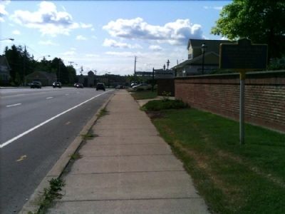
Spring House - 1822 Marker as seen facing East on Monroe Ave.
| 101 ► New York, Monroe County, Pittsford — Spring House - 1822 — |
| On Monroe Avenue (New York State Route 31) 0.1 miles east of Clover Street (New York State Route 65), on the right when traveling east. | |||
| 102 ► New York, Monroe County, Pittsford — The Great American Canal — The Canal System — |
| Near Colver Street (New York State Route 65) 0.2 miles south of Framingham Lane. | |||
| 103 ► New York, Monroe County, Rochester, Cobbs Hill — Widewaters Field — |
| On Culver Road, 0.1 miles north of Norris Drive. | |||
| 104 ► New York, Monroe County, Rochester, Downtown — Erie Canal — |
| On Main Street, 0.2 miles west of South Avenue, on the right when traveling east. | |||
| 105 ► New York, Monroe County, Rochester, Downtown — Erie Canal — National Historic Civil Engineering Landmark — |
| On East Broad Street (New York State Route 31) 0.1 miles east of Exchange Blvd (Route 383), on the left when traveling east. | |||
| 106 ► New York, Monroe County, Rochester, Downtown — Second Erie Canal Aqueduct — |
| On East Broad Street (New York State Route 31) 0.1 miles east of Exchange Blvd (New York State Route 383). | |||
| 107 ► New York, Monroe County, Rochester, Downtown — Transportation and Commerce — |
| Near Broad Street (New York State Route 31) 0.2 miles east of Exchange Street (New York State Route 383). | |||
| 108 ► New York, Monroe County, Rochester, Highland — Curtis Point — |
| Near Moore Road. | |||
| 109 ► New York, Monroe County, Rochester, Highland — Erie Lackawanna Railroad Bridge — Over the Genesee River — |
| Near Wilson Boulevard at Towers Road, on the left when traveling east. | |||
| 110 ► New York, Monroe County, Rochester, Strong — Is this the Erie Canal? — |
| On Kendrick Road, on the right when traveling west. | |||
| 111 ► New York, Monroe County, Rochester, Strong — The Canalway Trail — |
| On Kendrick Road, on the left when traveling west. | |||
| 112 ► New York, Monroe County, Rochester, Susan B. Anthony — Crossroads of Transportation — Rochester transitions from horse & wagon to canals, railroads, subway, buses and automobiles — |
| On West Main Street (New York State Route 33) at Broad Street (New York State Route 31), on the left when traveling east on West Main Street. | |||
| 113 ► New York, Monroe County, Scottsville — Genesee Valley — Historic New York — |
| Near Governor Thomas E. Dewey Thruway (Interstate 90 at milepost 366), 12.6 miles Interstate 490, on the right when traveling east. | |||
| 114 ► New York, Montgomery County, Amsterdam — Sweet Canal Store — |
| On Bridge Street, on the right when traveling south. | |||
| 115 ► New York, Montgomery County, Canajoharie — Canajoharie/Canalway Trail/Pathway Through Mountains — |
| On Montgomery Street at Church Street, on the right when traveling east on Montgomery Street. | |||
| 116 ► New York, Montgomery County, Canajoharie — The Canalway Trail: Canajoharie/ To Market, to Market — |
| On Old Fort Plain Road, on the right when traveling west. | |||
| 117 ► New York, Montgomery County, Fonda — The Erie Canal — A 19th-Century World Wonder — |
| Near NY Thruway (Interstate 90) when traveling west. | |||
| 118 ► New York, Montgomery County, Fonda — The Erie Canal — Welcoming the World — |
| Near NY Thruway (Interstate 90) when traveling west. | |||
| 119 ► New York, Montgomery County, Fonda — The Erie Canal — The Canal That Changed America — |
| Near NY Thruway (Interstate 90) when traveling west. | |||
| 120 ► New York, Montgomery County, Fonda — The Erie Canal — Not Just Big. New York State Big — |
| Near NY Thruway (Interstate 90), on the right when traveling west. | |||
| 121 ► New York, Montgomery County, Fonda — The Erie Canal — Build a Canal, Build a Nation — |
| Near NY Thruway (Interstate 90), on the right when traveling west. | |||
| 122 ► New York, Montgomery County, Fort Hunter — Building Block of the Erie Canal — |
| On Schoharie Street, on the right when traveling north. | |||
| 123 ► New York, Montgomery County, Fort Hunter — Lock 30 — |
| Near Schoharie Street at Main Street. | |||
| 124 ► New York, Montgomery County, Fort Hunter — Putman's Lock Grocery — |
| Near Queen Anne Street. | |||
| 125 ► New York, Montgomery County, Fort Hunter — Site of Queen Anne Chapel — |
| On Schoharie Street, on the right when traveling north. | |||
| 126 ► New York, Montgomery County, Fultonville — The Erie Canal — An Engineering Marvel — |
| Near NY Thruway (Interstate 90) when traveling west. | |||
| 127 ► New York, Montgomery County, Root — Dam. That's Not a Bridge? — |
| Near Interstate 90 at milepost 187 at Lock 13 Living History Rest Area. | |||
| 128 ► New York, Montgomery County, Root — Then and Now — |
| Near Interstate 90 at milepost 187 at Lock 13 Living History Rest Area. | |||
| 129 ► New York, Montgomery County, Root — Transportation is King / Modernization — |
| Near Interstate 90 at milepost 187 at Lock 13 Living History Rest Area. | |||
| 130 ► New York, Montgomery County, Sprakers — The Canalway Trail: Sprakers / Competition / Anything & Everything — |
| On Sprakers Hill Road at Sprakers Hill Road on Sprakers Hill Road. | |||
| 131 ► New York, New York County, Manhattan, Hudson Yards — Canals and Railroads — Hudson River Pk — |
| Near Pier 76 west of Hudson River Greenway. | |||
| 132 ► New York, New York County, Manhattan, Seaport — America's Emporium — South Street Seaport Museum — Where New York Begins. — |
| On East River Greenway east of John Street, on the right when traveling east. | |||
| 133 ► New York, New York County, Manhattan, Washington Heights — The Story of a Lighthouse — |
| Near Riverside Drive, on the left when traveling north. | |||
| 134 ► New York, Niagara County, Lockport — 4 — “Lockport Flight of Five” — |
| On Main Street near Cottage Street. | |||
| 135 ► New York, Niagara County, Lockport — 13 — Barge Tie Ups & lock view looking west — |
| Near Canal Street. | |||
| 136 ► New York, Niagara County, Lockport — Big Bridge — |
| On Main Street at Church Street, on the left when traveling east on Main Street. | |||
| 137 ► New York, Niagara County, Lockport — Bulkhead — |
| Near Canal Street near Ontario Street. | |||
| 138 ► New York, Niagara County, Lockport — Canal Bridge No. E-224 — Canal Road — |
| On Canal Road (County Route 77) 0.1 miles south of Harrington Road, on the right when traveling south. | |||
| 139 ► New York, Niagara County, Lockport — Canal Bridge No. E-225 — Day Road — |
| On Day Road at Groff Road, on the left when traveling north on Day Road. | |||
| 140 ► New York, Niagara County, Lockport — 3 — Canal Comparisons — |
| On Main Street near Cottage Street, on the right when traveling west. | |||
| 141 ► New York, Niagara County, Lockport — 6 — Electric Building — |
| Near Pine Street at Main Street. | |||
| 142 ► New York, Niagara County, Lockport — Historic Fittings — |
| Near Canal Street near Ontario Street. | |||
| 143 ► New York, Niagara County, Lockport — 12 — Life on the Barges — |
| Near Pine Street. | |||
| 144 ► New York, Niagara County, Lockport — Lock 71 Forebay — |
| Near Canal Street near Ontario Street. | |||
| 145 ► New York, Niagara County, Lockport — 7 — Lock Construction — |
| On Pine Street. | |||
| 146 ► New York, Niagara County, Lockport — 16 — Lock Tenders Tribute — |
| Near Canal Street near Ontario Street. | |||
| 147 ► New York, Niagara County, Lockport — Lockport — The Canalway Trail — |
| Near North Canal Road, 0.2 miles east of Old Niagara Road. | |||
| 148 ► New York, Niagara County, Lockport — Lockport Locks — Erected August 16, 1975 — |
| On W. Genesee Street, on the left. | |||
| 149 ► New York, Niagara County, Lockport — 1 — Lockport Municipal Building — |
| On Cottage Street near Niagara Street. | |||
| 150 ► New York, Niagara County, Lockport — 10 — Lower Lock Construction — |
| On Canal Street near Pine Street. | |||
| 151 ► New York, Niagara County, Lockport — Oak Wood Lock Flooring — |
| Near Canal Street near Ontario Street. | |||
| 152 ► New York, Niagara County, Lockport — 5 — Old City Hall — |
| On Pine Street near Main Street (New York State Route 31), on the right when traveling north. | |||
| 153 ► New York, Niagara County, Lockport — 11 — Old Locks West — |
| Near Pine Street. | |||
| 154 ► New York, Niagara County, Lockport — Rope Marks in Iron Railings — |
| Near Canal Street near Ontario Street. | |||
| 155 ► New York, Niagara County, Lockport — The "Deep Cut" at Lockport — |
| On State Road south of Amelia Street, on the right when traveling west. | |||
| 156 ► New York, Niagara County, Lockport — 2 — The “Big Bridge” — |
| On Canal Street at Cottage Street, on the right when traveling west on Canal Street. | |||
| 157 ► New York, Niagara County, Lockport — The Erie Barge Canal at Lockport — |
| On Market Street at Exchange Street, on the right when traveling west on Market Street. | |||
| 158 ► New York, Niagara County, Lockport — The Great American Canal — The Canal System — |
| On Pine Street. | |||
| 159 ► New York, Niagara County, Lockport — The Sluice and Hall Spillway — |
| On Market Street, 0.1 miles west of Exchange Street, on the left when traveling east. | |||
| 160 ► New York, Niagara County, Lockport — 9 — Tour Boat Then & Now — |
| On Canal Street near Pine Street. | |||
| 161 ► New York, Niagara County, Lockport — 8 — Upper Locks View — |
| Near Pine Street. | |||
| 162 ► New York, Niagara County, Lockport — 14 — Upson Park — |
| On Canal Street near Pine Street. | |||
| 163 ► New York, Niagara County, Pendleton — Controlling Water in the Erie Canal — Erie Canalway Trail — |
| On East Canal Road, 0.1 miles south of Robinson Road, on the right when traveling south. | |||
| 164 ► New York, Niagara County, Pendleton — Grand Erie Canal — |
| On North Tonawanda Creek Road at Irish Road, on the right when traveling north on North Tonawanda Creek Road. | |||
| 165 ► New York, Niagara County, Pendleton — Pendleton — |
| On Washington Street near East Canal Road, on the left when traveling west. | |||
| 166 ► New York, Niagara County, Royalton — 150th Anniversary — May 23, 1976 — |
| On State Street at Main Street (County Route 10), on the right when traveling west on State Street. | |||
| 167 ► New York, Niagara County, Royalton — Gasport — The Canalway Trail — |
| On Hartland Road (County Route 103) north of State Street, on the right when traveling south. | |||
| 168 ► New York, Oneida County, Durhamville — The Erie Canal - The Long Level — Historic New York — |
| On New York State Route 46, 0.1 miles south of Mills Road, on the left when traveling south. | |||
| 169 ► New York, Oneida County, Rome — Clinton's Ditch — (Old Erie Canal) — |
| On Fort Bull Road south of Rome-New London Road, on the left when traveling south. | |||
| 170 ► New York, Oneida County, Rome — Erie Canal — |
| On Rome New London Road (New York State Route 46 & 49), on the right when traveling east. | |||
| 171 ► New York, Oneida County, Rome — Erie Canal Enlargement — |
| On Fort Bull Road south of Rome-New London Road, on the left when traveling north. | |||
| 172 ► New York, Oneida County, Rome — The Erie Canal - July 4, 1817 — Historic New York |
| Near Fort Bull Road. Reported missing. | |||
| 173 ► New York, Oneida County, Stacy Basin — A Segment of the Old Erie Canal — |
| On State Highway 46 at Senn Road (County Route 52), on the right when traveling north on State Highway 46. | |||
| 174 ► New York, Oneida County, Westmoreland — Utica Area — Historic New York — |
| On New York State Thruway - East (Interstate 90) west of New York State Route 233, on the right when traveling east. | |||
| 175 ► New York, Onondaga County, Camillus — 9 Mile Creek Aqueduct — |
| 176 ► New York, Onondaga County, Elbridge — Jordan Lock 51 — |
| On New York State Route 31, on the right when traveling west. | |||
| 177 ► New York, Onondaga County, Jordan — Erie Canal — |
| On North Main Street (New York State Route 317), on the right when traveling north. | |||
| 178 ► New York, Onondaga County, Jordan — 7 — Locktender’s House — |
| On North Chappell Street, on the left when traveling east. | |||
| 179 ► New York, Onondaga County, Jordan — The Canalway Trail: Jordan/Jordan Aqueduct and Summit — |
| Near North Main Street (New York State Route 317). | |||
| 180 ► New York, Onondaga County, Jordan — The Canalway Trail:Elbridge/Lock 51 — |
| On New York State Route 31, 1 mile west of North Main Street, on the left when traveling east. | |||
| 181 ► New York, Onondaga County, Kirkville — 208 — Pool's Brook — |
| On North Poolsbrook Road, on the right when traveling south. | |||
| 182 ► New York, Onondaga County, Manlius — First Steamboat — |
| On Cazenovia Road (New York State Route 92) 0.7 miles south of Enders Road, on the right when traveling south. | |||
| 183 ► New York, Onondaga County, Manlius — The Erie Canal - Canvass White — Historic New York — |
| On Minoa Road at Manlius Center Road (New York State Route 290), on the left when traveling south on Minoa Road. | |||
| 184 ► New York, Onondaga County, Memphis — 487 — Old Erie Canal — |
| On Bennetts Corners Road (County Route 66). | |||
| 185 ► New York, Onondaga County, Syracuse — Syracuse Area — Historic New York — |
| Near NYS Thruway - Warners Rest Area. | |||
| 186 ► New York, Onondaga County, Syracuse — Syracuse Area — Historic New York — |
| On Interstate 90, 1 mile west of New York State Route 233, on the right when traveling east. | |||
| 187 ► New York, Onondaga County, Syracuse, Eastside — James Geddes — |
| 188 ► New York, Ontario County, Geneva — Cayuga-Seneca Canal Entrance — |
| Near Lake Front Drive (U.S. 20) just south of Lake Street. | |||
| 189 ► New York, Ontario County, Victor — Rochester Area — Historic New York — |
| On NYS Thruway - Seneca Rest Area. | |||
| 190 ► New York, Orleans County, Albion — Calamity Sept. 28, 1859 — |
| On South Main Street (New York State Route 98), on the left when traveling north. | |||
| 191 ► New York, Orleans County, Albion — Erie Canal 1825 — |
| On South Main Street (New York State Route 98), on the right when traveling north. | |||
| 192 ► New York, Orleans County, Albion — Erie Canal Spurs Albion's Growth and Prosperity — |
| On North Platt Street, 0.1 miles north of East Bank Street, on the right when traveling north. | |||
| 193 ► New York, Orleans County, Albion — 29 — Lafayette's Tour — Mapping the Farewell Tour™ — The Lafayette Trail — |
| On North Platt Street, 0.1 miles north of East Bank Street, on the right when traveling north. | |||
| 194 ► New York, Orleans County, Holley — 1823 Canal Bed — |
| On Geddes Street, 0.1 miles east of Holley Square, on the right when traveling west. | |||
| 195 ► New York, Orleans County, Holley — The Holley Loop — The Canalway Trail — |
| On East Avenue, on the right when traveling east. | |||
| 196 ► New York, Orleans County, Kendall — Norway Colony — |
| On Norway Road at Bald Eagle Drive, on the left when traveling north on Norway Road. | |||
| 197 ► New York, Orleans County, Medina — John Ryan 1801-96 / Medina Sandstone — |
| On North Gravel Road (New York State Route 63) at Ryan Street, on the left when traveling south on North Gravel Road. | |||
| 198 ► New York, Orleans County, Ridgeway — 1833 Servoss-Hagood House — National Register of Historic Places — |
| On Fruit Avenue (County Route 41) at Dublin Road, on the left when traveling south on Fruit Avenue. | |||
| 199 ► New York, Orleans County, Ridgeway — The Culvert Road — |
| On Culvert Road (County Route 35) 0.2 miles south of Portage Road, on the right when traveling south. | |||
| 200 ► New York, Orleans County, Ridgeway — The Medina Culvert — |
| On Culvert Road (County Route 35) 0.2 miles south of Portage Road when traveling south. | |||
246 entries matched your criteria. Entries 101 through 200 are listed above. ⊲ Previous 100 — The final 46 ⊳