2008 entries match your criteria. Entries 301 through 400 are listed.⊲ Previous 100 — Next 100 ⊳
Georgia Historical Society Historical Markers
The Georgia Historical Society has administered GA's historical marker program since 1998, erecting hundreds of new markers. GA's historical marker program was begun by the GA Historical Commission in 1953 and continued by the GA Department of Natural Resources. Their markers are now maintained by the Society. With over 3,000 markers, it is 2nd to Texas in state markers.
By Mike Stroud, 2008
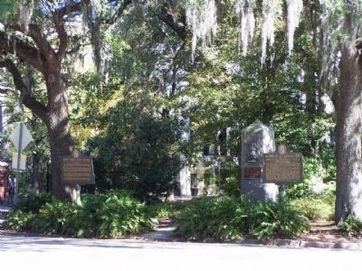
Birthplace of Juliette Low Marker, at right at Oglethorpe Avenue and Bull Street
On East Oglethorpe Avenue at Bull Street, in the median on East Oglethorpe Avenue.
In the house that stands opposite this marker, Juliette Gordon Low, founder of the Girl Scouts of the United States of America, was born, October 31, 1860. It was her girlhood home until her marriage there in 1886 to William Low, an Englishman, . . . — — Map (db m5581) HM
On East Bay Street near Drayton Street, on the right when traveling west.
Directly across Bay Street from this marker formerly stood the brick building, built in late colonial days and known as the “Coffee House,” in which the Legislature of Georgia met in 1785. Owned by Thomas Stone, it was described in a . . . — — Map (db m6668) HM
On Abercorn Street, on the right when traveling north.
This grave links Savannah with one of history's greatest naval dramas - the epic fight in 1779 between the "Bon Homme Richard" and "Serapis" in which John Paul Jones immortalized himself.
Denis Nicolas Cottineau de Kerloguen received a commission . . . — — Map (db m5339) HM
On East Harris Street near Abercorn Street, on the right when traveling north.
The congregation of St. John the Baptist formed in the late eighteenth century when French émigrés fleeing revolutions in France and Haiti found refuge in Savannah. The Church of St. John the Baptist became a cathedral in 1850 when the Diocese of . . . — — Map (db m6021) HM
These bronze cannon were presented to the Chatham Artillery by President Washington after his visit to Savannah in 1791. Of English and French make, respectively, they are excellent examples of the art of ordnance manufacture in the 18th century. . . . — — Map (db m5519) HM
These cannon, which were captured when Lord Cornwallis surrendered at Yorktown in the American Revolution, were a gift to the Chatham Artillery by President George Washington - a mark of his appreciation for the part the local military company . . . — — Map (db m5517) HM
This Episcopal Church was the first house of
worship established with the founding of Georgia in 1733. Early rectors included the Rev. John Wesley (1736-37), who began the earliest form of Sunday school and published the first English hymnal in . . . — — Map (db m5304) HM
On Abercorn Street, on the right when traveling north.
James S. McIntosh achieved an immortal record of gallantry in the War of 1812 and in the War with Mexico. In 1814 he saw considerable action on the Canadian border, he was severely wounded at Buffalo. In the Mexican War, Col. McIntosh was . . . — — Map (db m81621) HM
This cemetery, the second in colonial Savannah, was the burying ground for the city from about 1750 until it was closed against burials in 1853. Among the distinguished dead who rest here are Archibald Bulloch, first President of Georgia; James . . . — — Map (db m5313) HM
On E. State Street near Habersham, on the left when traveling west.
In 1757, during the administration of royal Governor Henry Ellis, a line of earthwork defenses, including a palisade, was erected around Savannah. Immediately west of this marker was located Bethesda Gate, one of the six entrances into the town. . . . — — Map (db m5356) HM
On Hull Street at Bull Street, on the left when traveling west on Hull Street.
One block west of this marker -- at the northwest corner of Hull and Whitaker Streets -- stood,
formerly, the residence of William Alexander Caruthers, Virginia's earliest significant novelist. He resided in Savannah for several years before his . . . — — Map (db m5920) HM
The epitaph to James Wilde on the nearby tomb is a melancholy reminder of the days of duelling and, particularly, of a tragic affair of honor fought January 16, 1815, on the Carolina side of the river near Savannah. Lieutenant Wilde was shot through . . . — — Map (db m5376) HM
Beneath this modest slab rest the remains of America's foremost painter of miniatures. Malbone, a native of Rhode Island, began his career in Providence at the age of seventeen. He pursued his calling in Boston, New York, Philadelphia, Charleston . . . — — Map (db m5369) HM
On West Bay Street near Jefferson Street, on the right when traveling west.
On Dec. 14, 1864, Fort McAllister (CS) having fallen the day before, opening the Great Ogeechee River to Union shipping and rendering Savannah untenable, Lt. Gen. W. J. Hardee, CSA, decided to evacuate the city to save it from a destructive . . . — — Map (db m5574) HM
On West Bryan Street at Montgomery Street, on the left when traveling west on West Bryan Street.
First African Baptist Church (FABC) traces its roots to 1773 and the organization of a congregation at nearby Brampton Plantation by Rev. George Leile. Under the leadership of Rev. Andrew C. Marshall (3rd pastor), the congregation obtained this . . . — — Map (db m133007) HM
On Bull St. near W. McDonough St., on the right when traveling south.
First Baptist Church, Savannah’s oldest standing house of worship, was designed by Elias Carter and completed in 1833. The congregation dates to 1800. In 1922 the front of the building was extended, a cupola removed, and the edifice covered with . . . — — Map (db m13608) HM
On East Macon Street, on the right when traveling east.
The house adjacent to this building was the home of Juliette Gordon Low at the time she founded Girl Scouting in the United States, March 12, 1912. Formerly the carriage-house and stable of the Low mansion, this building became that year the first . . . — — Map (db m5583) HM
Samuel Elbert, who became brigadier general in the Continental Army and governor of Georgia, migrated to this province from South Carolina as an orphan youth during the Colonial period. He prospered in mercantile pursuits and as an Indian trader; . . . — — Map (db m5340) HM
On Abercorn St, on the right when traveling north.
Lachlan McIntosh, Georgia's ranking Continental officer in the American Revolution, was the son of John Mor Mackintosh who settled with a group of Highlanders on the Altamaha in 1736. Lachlan served as a cadet in Oglethorpe’s Regiment and received . . . — — Map (db m5400) HM
On Bull Street at Harris Street, on the left when traveling south on Bull Street.
On January 12, 1865, U.S. Secretary of War Edwin Stanton and General Wm. T. Sherman met here at the home of Charles Green with 20 leaders from Savannah’s African-American churches, including Garrison Frazier, Ulysses L. Houston, and William . . . — — Map (db m40696) HM
Hugh McCall who is buried here was the author of the first history of Georgia.
Forced by ill health into retirement, McCall, who was a Brevet Major, U.S. Infantry, became interested in the history of his adopted State. In spite of severe . . . — — Map (db m5372) HM
On Bull Street near Oglethorpe Avenue, on the left.
The Independent Presbyterian Church was organized in 1755. The first meeting house stood facing Market Square in Savannah, between what are now St. Julian and Bryan Streets, on property granted by King George II for the use and benefit of those . . . — — Map (db m5515) HM
On Bull Street at East Hull Street, on the left when traveling north on Bull Street.
The monument in this Square to James Edward Oglethorpe - the great soldier-philanthropist who founded the colony of Georgia - was erected by the State of Georgia, the City of Savannah and various Patriotic Societies. Impressive ceremonies marked . . . — — Map (db m5308) HM
Here rests James Habersham -- associate of George Whitefield and a leading merchant, planter, and public servant during Georgia's colonial era. Mr. Habersham came to the colony in 1738 as a youthful follower of the Rev. Whitefield and collaborated . . . — — Map (db m5357) HM
Here repose the remains of James Johnston (1738-1808) - - editor of Georgia's first newspaper. A native of Scotland, Johnston settled at Savannah in 1761. "Recommended as a person regularly bred and well skilled in the Art and mystery of . . . — — Map (db m5388) HM
On East Oglethorpe Ave. near Bull Street, in the median.
The residence opposite this site, known as the Gordon House, was built between 1819-1821. A fine example of Regency architecture, it was designed by the eminent architect, William Jay. The third story and side porch were later added.
The house . . . — — Map (db m5575) HM
On W. Bay Street near Whitaker St., on the right when traveling west.
Joel Chandler Harris (1845-1908), New South journalist and author of Uncle Remus tales,
Free Joe, and many other works, was associate editor of the Savannah Morning News
from 1870 until 1876, under William Tappan Thompson, an . . . — — Map (db m25357) HM
On the "trust lot" south of President Street and immediately west of this square stood in 1736- 37 the parsonage in which John Wesley resided. In the adjoining garden he read, prayed and meditated. Weekly meetings of members of his Christ Church . . . — — Map (db m5275) HM
Johnson Square is named for Governor Robert Johnson of South Carolina who befriended the colonists when Georgia was first settled. It was laid out by Oglethorpe and by Colonel William Bull in 1733, and was the first of Savannah's squares. In early . . . — — Map (db m5494) HM
On Montgomery Street near W. Bryan Street, on the left when traveling north.
Born in Pocotaligo, SC, Jonathan Bryan accompanied James Oglethorpe on his initial visit to Yamacraw Bluff in 1733. One of Georgia’s largest landholders, Bryan was a supporter of evangelist George Whitefield and encouraged religious services for his . . . — — Map (db m41816) HM
A native of Yorkshire, Joseph Clay (1741-1804) settled at Savannah at the age of nineteen. His uncle, James Habersham, declared that his "industry" was "highly commendable" and "his Abilities for Trade unquestionable." Fulfilling his early promise, . . . — — Map (db m5364) HM
The three Habersham brothers - who here rest beside their distinguished father, James Habersham - were prominent patriots in the American Revolution and outstanding public men during the early years of the republic. JOSEPH . . . — — Map (db m5361) HM
There was "None, No None!" reads the epitaph on this tomb.
"Against Whose Name the Recording Angel Would More Reluctantly Have Written Down Condemnation."
Born at Dublin, Ireland. Son of a Georgia planter, Joseph V. Bevan attended the Univ. of . . . — — Map (db m5551) HM
On Bay St at Bull St., on the right when traveling west on Bay St.
James Edward Oglethorpe, the founder of Georgia, landed with the original colonists, about 114 in number, at the foot of this bluff on February 1 (February 12, new style), 1733. The site where he pitched his tent is marked by the stone bench . . . — — Map (db m5263) HM
On Bull Street near Oglerthorpe Street, on the right.
Lowell Mason, noted composer of sacred music, was organist of the Independent Presbyterian Church (1820- 1827), and Superintendent of its Sunday School (1815- 1827). A native of New England, Mason moved to Savannah at the age of twenty. He resided . . . — — Map (db m5635) HM
On Bull Street near President Street, on the left when traveling north.
On April 14, 1741, John Martin Bolzius, who as Pastor of the Salzburgers at Ebenezer was in charge of Lutheran work in the colony of Georgia, founded the congregation now known as the Lutheran Church of the Ascension. In 1756 members of the . . . — — Map (db m6601) HM
Madison Square was laid out in 1839 and is named for the fourth President of the United States. Around the Square stand notable examples of Greek Revival, Gothic, and Romanesque architecture characteristic of nineteenth century Savannah.
To the . . . — — Map (db m6377) HM
In 1775 John Berrien of New Jersey came to the province of Georgia, where one of his mother's kin had previously settled. His father, John Berrien (1711-1772), was a judge of the supreme court of New Jersey and a trustee of Princeton College. From . . . — — Map (db m5341) HM
Beneath the monument in this Square repose the remains of Maj. Gen. Nathanael Greene, of Rhode Island, who died near Savannah on June 19, 1786, at Mulberry Grove Plantation which had been granted to him by this State in appreciation of his services . . . — — Map (db m5442) HM
This tomb, known as the Graham vault, possesses the distinction of having been the burial place of two heroes of the Revolutionary War, one American and the other British.
Lt. Col. John Maitland of Lauder, Scotland, son of the 6th Earl of . . . — — Map (db m5342) HM
On Bay St at Drayton St, on the right when traveling north on Bay St.
This bell, which is believed to be the oldest in Georgia, bears the date 1802. Imported from Amsterdam, it hung in the cupola of the City Exchange from 1804 until a short time before that building was razed to make way for the present City Hall. . . . — — Map (db m4913) HM
On East Bay Street., on the right when traveling west.
This beacon light was erected by the Federal government in 1858 as an aid to navigation of the Savannah River. Standing 77 feet above the river level and illuminated by gas, it served for several years as a guide to vessels passing over the hulls . . . — — Map (db m5476) HM
On Bay Street (State Highway 25) near Drayton Street, on the left when traveling south.
The Savannah Cotton Exchange building was completed in 1887 during the era when Savannah ranked first as a cotton seaport on the Atlantic and second in the world. In its heyday as a cotton port over two million bales a year moved through Savannah. . . . — — Map (db m4904) HM
A fine example of Greek Revival style, this building (completed in 1840 from the plans of Charles B. Cluskey, a well-known Georgia architect) shows the distinguished trend of Savannah architecture during the first half of the 19th century. The . . . — — Map (db m5628) HM
On Abercorn Street at President St, on the right when traveling north on Abercorn Street.
This residence is the outstanding monument to the architectural genius of William Jay who completed his designs for its construction prior to his twenty-first birthday. Supervision of the work brought Jay to America in 1817. Its period is English . . . — — Map (db m5772) HM
On East Bay Street near Drayton Street, on the right when traveling west.
City Hall is the first building constructed by the citizens of Savannah expressly and exclusively to serve as the seat of municipal government. Opened on January 2, 1906 it has served continuously in this role since that date. City Hall was . . . — — Map (db m5569) HM
On River Street near Bull Street, on the left when traveling south.
The colony of Georgia began on Savannah's waterfront in 1733. The riverfront has always played an important role in Georgia, whether as a colonial port, exporter of cotton, or tourist destination. The first commercial house below the bluff opened in . . . — — Map (db m4900) HM
On E. Congress St. at Abercorn St. when traveling east on E. Congress St..
In March 1750, the Georgia Trustees in London resolved to allow colonists to elect a representative assembly to meet in Savannah, Georgia's colonial capitol. Sixteen delegates met on January 15,1751, for a twenty-four day session. Representative . . . — — Map (db m5794) HM
On East Bay Street at Habersham Street, on the right when traveling west on East Bay Street.
Once known as the Strand and later as Irish Green because of its proximity to the Irish residents of Savannah's Old Fort neighborhood, this park was renamed in 1902 for the Irish patriot Robert Emmet (1778-1803) to commemorate the centennial of his . . . — — Map (db m6321) HM
On River Street near N Barnard Street, on the left when traveling south.
The first steamship to cross the Atlantic Ocean, the SS SAVANNAH, sailed from this harbor on May 22, 1819 and reached Liverpool 27 days later. The anniversary of her sailing, May 22, is celebrated as National Maritime Day. Captain Moses Rogers was . . . — — Map (db m4934) HM
On East Liberty Street at Abercorn Street,, on the right when traveling east on East Liberty Street.
The Convent and Academy of Saint Vincent dePaul was opened in June, 1845. Sisters of Mercy from Charleston, S.C., under the leadership of Mother Vincent Mahoney, began a boarding school, orphanage, day school and free school. St. Vincent's Convent . . . — — Map (db m5757) HM
On Barnard Street near President Street, on the right when traveling south.
Open to the Public ~~~ Created under the Will of Miss Mary Telfair (c. 1789-1875), the Telfair Academy of Arts & Sciences opened as the first public art museum in the Southeast with a preliminary private showing February 12, 1885. After . . . — — Map (db m5523) HM
On Barnard Street at President Street, on the right when traveling south on Barnard Street.
This building is one of the City's outstanding examples of Regency architecture. The main floor and basement kitchens are maintained as a historic house museum. The rotunda and west wing are later additions. It was left by Savannah's outstanding . . . — — Map (db m5524) HM
On Habersham Street at East Broughton Street, on the right when traveling south on Habersham Street.
Major John Berrien (1760-1815) was a Revolutionary War officer who served at Valley Forge and fought at the Battle of Monmouth. Berrien, a New Jersey native who moved to Georgia in 1775, was an original member of the Society of the Cincinnati in . . . — — Map (db m133218) HM
On East Broughton Street east of Abercorn Street, on the left when traveling west.
On March 16, 1960, black students led by the NAACP Youth Council staged sit-ins at white-only lunch counters in eight downtown stores. Three students, Carolyn Quilloin, Ernest Robinson, and Joan Tyson, were arrested in the Azalea Room here at . . . — — Map (db m132898) HM
On Bull Street near East Presidents Street, on the left when traveling north.
Tomo-Chi-Chi, Mico of the Yamacraws, a tribe of the Creek Indian Nation, is buried in this Square. He has been called a co-founder, with Oglethorpe, of Georgia. He was a good friend to the English, a friendship indispensable to the establishment of . . . — — Map (db m5406) HM
On Barnard Street near Presidents Street, on the right when traveling south.
Mother Church of Savannah Methodism
Trinity Church is the oldest Methodist Church in a city whose intimate association with John Wesley and George Whitefield gives it a unique place in the history of Methodism. The cornerstone of the . . . — — Map (db m5478) HM
On Bay Street at Bull Street, on the right when traveling east on Bay Street.
The United States Customhouse stands on historic ground. In a house on this site, James Edward Oglethorpe, founder of the colony of Georgia, lived for a time, and in 1736 John Wesley preached his first sermon at Savannah in a building which stood on . . . — — Map (db m5441) HM
Near Bull Street near East Congress Street, on the left when traveling north.
During his Southern tour of 1791, President George Washington attended services at the original Christ Church on Sunday, May 15. While in Savannah from May 12-15, Washington lodged at a house on the corner of Barnard and State streets on St. James . . . — — Map (db m5696) HM
William Scarbrough (1776-1838) was the moving force among the enterprising business men of Savannah who in 1819 sent the first steamship across the Atlantic Ocean. The corporate charter which Scarbrough and his associates obtained from the Georgia . . . — — Map (db m5385) HM
On Bull Street at President's Street, on the right when traveling north on Bull Street.
This Square, which was laid out in 1733, was originally named for John Percival, Earl of Egmont, who played a large part in founding the Colony of Georgia. Its name was changed around 1763 to Wright Square in honor of James Wright, Royal Governor of . . . — — Map (db m6378) HM
On East Harris Street at Price Street, on the right when traveling west on East Harris Street.
The Beach Institute began in 1867 as
the first school in Savannah erected
specifically for the education of African
Americans. It was named for Alfred Ely
Beach, benefactor and editor of
Scientific American. Following the
Civil War, . . . — — Map (db m15681) HM
On West Hall Street at Barnard Street, on the right when traveling west on West Hall Street.
During the last years of Reconstruction, Maj. William Royall established the Royall Undertaking Company to serve African Americans denied mortuary services by Savannah's White-owned funeral homes. As a formal mortuary education was not available in . . . — — Map (db m200259) HM
Near Bull Street near Wayne Street, on the left when traveling north.
The great Polish patriot to whose memory this monument is erected was mortally wounded approximately one-half mile northwest of this spot during the assault by the French and American forces on the British lines around Savannah, October 9, 1779. . . . — — Map (db m5483) HM
Near Bull Street at Taylor Street, on the left when traveling north.
Jefferson Davis, former President of the Confederate States of America, was a guest in 1886 in the house on the northeast corner of Bull and Taylor Streets. The residence (built about 1880) was at that time the home of Hugh M. Comer, President of . . . — — Map (db m5983) HM
On Bull Street at East Taylor Street, on the right when traveling north on Bull Street.
The oldest Congregation now practicing Reform Judiasm in the United States. Mickve Israel was founded by a group of Jews, mainly of Spanish-Portuguese extraction, which landed at Savannah, July 11, 1733, five months after the establishment of the . . . — — Map (db m5298) HM
On East Charlton Street at Abercorn Street, on the right when traveling east on East Charlton Street.
Mary Flannery O'Connor, novelist and short story writer, was born in Savannah March 25, 1925. She grew up in this house and in later years she referred to it simply as "the house I was raised in." She lived here until 1938, attending church at the . . . — — Map (db m9490) HM
On Bull Street near Gaston Street., on the right when traveling north.
This building, now the quarters of a private Club, was erected in 1857 for Edmund Molyneux, British consul at Savannah, and served as his residence and as the Consulate until Molyneux's return to England in 1863. In 1865 the Molyneux house was . . . — — Map (db m5625) HM
In the 1840s, William Brown Hodgson (1801-1871) conceived the idea of setting aside ten acres of wooded land at this site for development of Savannah's first recreational park. It was named for former Georgia Governor John Forsyth (1780-1841). . . . — — Map (db m6092) HM
On Whitaker Street at Gaston Street, on the right when traveling south on Whitaker Street.
The Georgia Historical Society, founded May 24, 1839, is one of the oldest historical societies in the country. Among it founders were L.K. Tefft, the noted autograph collector; William Bacon Stevens, historian, physician and prelate, and Dr. . . . — — Map (db m6139) HM
World-renowned songwriter John Herndon Mercer was born in Savannah and spent much of his youth in this house at 226 East Gwinnett Street. His lyrics reflected the sounds of Southern conversation, influenced by the African-American music and the . . . — — Map (db m8702) HM
Near Barnard Street at West Taylor Street, on the left when traveling north.
Louis Burke Toomer, African-American leader, local bank founder, and realtor, was born in Savannah in 1897. Raised and educated locally, Toomer established the Georgia Savings and Realty Corporation on February 23, 1927, in the historic black . . . — — Map (db m127134) HM
On Abercorn Street south of East Macon Street, on the left when traveling south.
Mary Musgrove was the daughter of an English trader and a Creek Indian mother. In 1717 she and her husband, John, established Cowpens trading post near the Savannah River which became a center of 18th century English-Indian trade for deer hides. . . . — — Map (db m132897) HM
On Bull Street near Wayne Street, on the left when traveling south.
The monument erected in this Square to the memory of General Casimir Pulaski, who fell at Savannah in the cause of American Independence, was completed in 1854. The corner-stone was laid, with impressive ceremonies, October 11, 1853 - the 74th . . . — — Map (db m5482) HM
On Bull Street near Macon Street, on the right when traveling south.
Sergeant William Jasper, the famed Revolutionary hero, was mortally wounded a few hundred yards northwest of this spot on October 9, 1779, in the ill-fated attack of the American and French forces on the British defenses around Savannah. The . . . — — Map (db m5455) HM
On Bull Street at Macon Street, on the right when traveling south on Bull Street.
General William Tecumseh Sherman used this house as headquarters from Dec. 22, 1864, until Feb. 1, 1865. Charles Green offered the use of his home to General Sherman and his staff. Sherman's chaplain conducted the Christmas services in St. John's . . . — — Map (db m8881) HM
Georgia's first hospital, this institution is believed to be the second oldest general hospital in continuous operation in the United States. It was founded in 1803 as a seamen's hospital and poor house and was incorporated in 1808 under the name . . . — — Map (db m5781) HM
On East Liberty Street near Randolph Street, in the median.
When the British attacked Savannah on December 29, 1778, the defending Continental forces, numbering about 650 men under command of Maj. Gen. Robert Howe, were posted across Sea Island Road (now Wheaton street) approximately 100 yards east of . . . — — Map (db m6580) HM
At this site was located the first public agricultural experimental garden in America. From this garden was disseminated the upland cotton which later comprised the greater part of the world`s cotton commerce. Here were propagated and from this . . . — — Map (db m18761) HM
On International Drive, Hutchinson Island near Savannah River.
The N.S. Savannah, the first nuclear-powered cargo/passenger ship, built by the New York Shipbuilding Corporation,
was launched on July 21, 1959 and commenced her maiden voyage at sea on Friday March 23, 1962. Before
embarking on a . . . — — Map (db m58595) HM
S. S. James Oglethorpe launched on November 20, 1942, during World War II, the first of 88 Liberty Ships
built by Southeastern Shipbuilding (approximately two miles downriver from here). Setting sail from New York in a convoy bound for Liverpool, . . . — — Map (db m65470) HM
On West Broad Street / Martin Luther King Jr Boulevar near West Hall Lane.
The McKelvey-Powell Building was originally constructed in 1926. The building was a hub of African-American business and social life in Savannah during the era of segregation in the first half of the twentieth century. Throughout the 1930s the . . . — — Map (db m11751) HM
In this burial ground, hallowed to the "men who go down to the sea in ships and occupy their business in great waters," are interred ship captains and seamen from many lands - America, Norway, Sweden, England, Scotland, Ireland, and Germany. . . . — — Map (db m8672) HM
Mathilda Taylor was born in 1834 in New Orleans, and came to Savannah as a young woman. She taught black children in her home before the Civil War, when it was still illegal. She married Abraham Beasley, a successful black businessman, in 1869. . . . — — Map (db m6009) HM
On Waters Avenue at East 46th Street, on the right when traveling south on Waters Avenue.
On each side of Waters Avenue at this site stood the grandstands built for the famous Savannah automobile races in 1910 and 1911. The starting and finishing line was located in front of the stands.
On November 12, 1910, David Bruce-Brown won . . . — — Map (db m5953) HM
On Bull Street at Park Avenue, on the right on Bull Street.
On 28 January 1942, the Eighth Air Force, was activated in the adjacent building, a National Guard Armory at the time. Having moved to England, the Eighth was ready on 17 August to test the theory that daylight bombing raids could be made with . . . — — Map (db m4396) HM
Georgia's first hospital, Candler is the
second oldest continuously operating
hospital in the United States. Its history
began in the 1730s when Methodist
missionary George Whitfield brought
medicines to treat sick seamen and
the poor. . . . — — Map (db m15928) HM
On West 36th Street, on the right when traveling west.
This was the site of the first hospital in Savannah to train African-American doctors and nurses. Named for Doctors Cornelius and Alice McKane, it began on June 1, 1896, when a small group of African Americans received a charter to operate the . . . — — Map (db m11703) HM
On Florance St near W 35th St, on the right when traveling west.
Florance Street School was designed by the firm Levy and Clarke and built in 1929 as one of the early public schools in Savannah built specifically for African-American students. It contributed greatly to Savannah’s Cuyler-Brownville community by . . . — — Map (db m12088) HM
In 1853, the city reserved 4 acres in the new Laurel Grove Cemetery for Savannah’s African American community. This new burial ground replaced an older black cemetery located near Whitefield Square. Pastors Andrew Bryan (First Colored Baptist . . . — — Map (db m8498) HM
On Bull Street at West Anderson, on the right when traveling south on Bull Street.
This building was constructed in 1897-98 as a memorial to General Alexander R. Lawton (1818-96)and his daughter, Corinne (1844-77). It was used as a public space for cultural, educational and civic purposes until the 1930s. After serving in the . . . — — Map (db m6002) HM
On West Park Avenue near Jefferson Street, on the left when traveling west.
The first African Methodist Church in Georgia was organized by the Rev. A. L. Stanford on June 16, 1865, at Savannah, Georgia and was given the name Saint Phillip African Methodist Episcopal Church.
Two months and fifteen days later, the Sunday . . . — — Map (db m9392) HM
Savannah High School evolved as the senior division of Chatham Academy, chartered by the Georgia Legislature in 1788. In 1935, due to overcrowding in schools, the Board of Education collaborated with the Public Works Administration to erect this . . . — — Map (db m9291) HM
In her will, Mary Telfair (1791-1875) provided for the establishment of a women’s hospital and also named the first president (Louise Gilmer) and six directresses to manage it. Originally located at the southwest corner of Drayton and New Houston . . . — — Map (db m15927) HM
On Abercorn Street, on the left when traveling south.
Chartered by the Georgia General Assembly in 1832, the Infirmary was established "for the relief and protection of afflicted and aged Africans" under the provisions of the last will and testament of Savannah merchant and minister Thomas F. Williams . . . — — Map (db m6407) HM
On Liberty Street near Montgomery Street, on the right when traveling west.
African-American physician Cornelius McKane (1862-1912) was born in British Guiana and began medical practice in Savannah in 1892. Alice Woodby McKane (1865-1948) came to Georgia that same year – the only black female physician in the state at . . . — — Map (db m11727) HM
Here meets the oldest congregation following the Reformed (Calvinistic) theological tradition in continuous service in Georgia. In 1737, 160 Reformed Germans came to Savannah seeking religious freedom. After working their terms as indentured . . . — — Map (db m121852) HM
On Ogeechee Road (U.S. 17) at Silk Hope Road when traveling north on Ogeechee Road.
Dec. 1864. Beginning near this point and extending about 500 yards north along the left bank of Salt Creek, astride the old Savannah and Darien (Ogeechee) road, strong earthworks were constructed by Confederate engineers to prevent enemy forces . . . — — Map (db m10353) HM
On Dancy Avenue, 0.1 miles east of Rockwell Avenue, on the right when traveling east.
In May, 1864, the USS "Water Witch" (80 officers and men and 4 guns), Lt. Comdr. Austin Pendergrast, USN, was on patrol duty in Ossabaw Sound. On the 31st, Flag Officer Wm. W. Hunter, CSN, assigned Lt. Thos. P. Pelot, CSN, to command a boat . . . — — Map (db m5945) HM
On Drayton Street at East Bolton Street, on the right when traveling north on Drayton Street.
A pioneer in women’s education, Nina Anderson Pape completed her studies at Columbia University. She founded the Froebel Circle, which educated the poor children of Savannah’s Yamacraw Village; and Tybee Island’s Fresh Air Home for disadvantaged . . . — — Map (db m8659) HM
2008 entries matched your criteria. Entries 301 through 400 are listed above. ⊲ Previous 100 — Next 100 ⊳